AGENDA Development Assessment Panel 27/06/2018
Item: 05
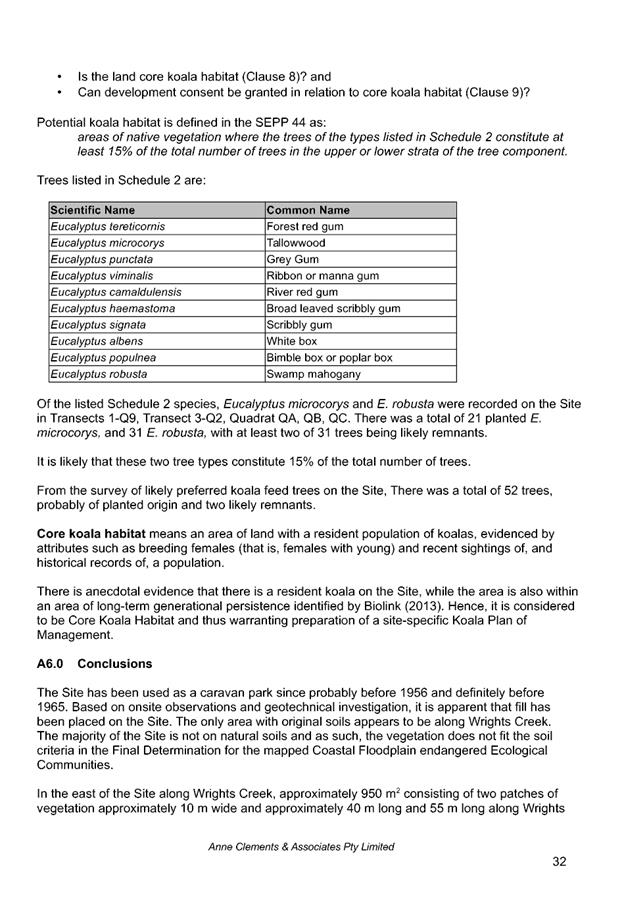
Subject: DA2018 - 130.1 Subdivison, Childcare Centre
And Managers Residence - Lots 32 & 2, DP 1100016 & 505679, Ngamba
Place & McGilvray Road Bonny Hills
Report
Author: Fiona Tierney
|
Applicant: Dataconsult
Communications & D A Smethurst
Owner: Dataconsult
Communications & D A Smethurst
Estimated Cost: $1,757,000
Alignment with Delivery
Program
4.3.1 Undertake transparent
and efficient development assessment in accordance with relevant legislation.
|
|
RECOMMENDATION
That
DA 2018 - 130 for a subdivision,
childcare centre and managers residence at
Lot 32 & 2, DP 1100016
& 505679, Ngamba Place & 3 McGilvray
Rd, Bonny HIlls, be determined by granting consent subject to the
recommended conditions.
|
Executive
Summary
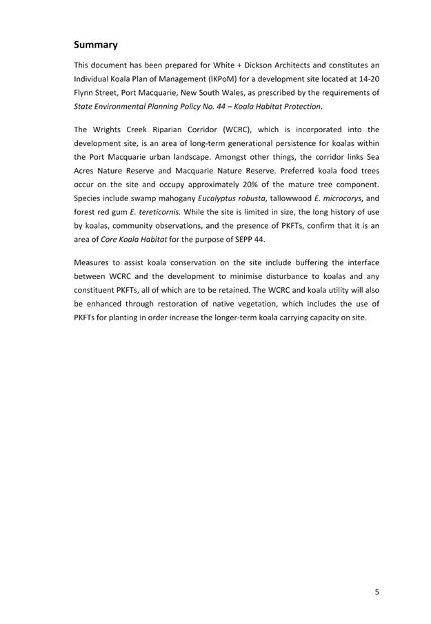
This
report considers a development application for a subdivision,
centre-based child care facility and manager’s residence at the subject site and provides an assessment of the
application in accordance with the Environmental Planning and Assessment Act
1979.
Following exhibition of the
application, 2 submissions have been received.
1. BACKGROUND
Existing sites features and Surrounding development
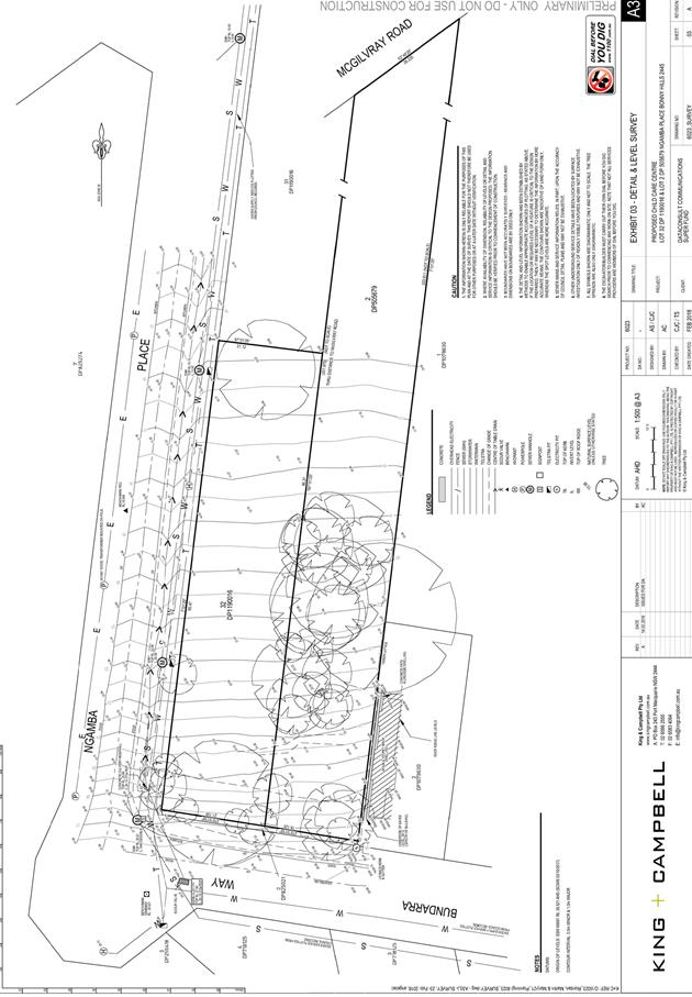
The site has an area of 6,069m2.
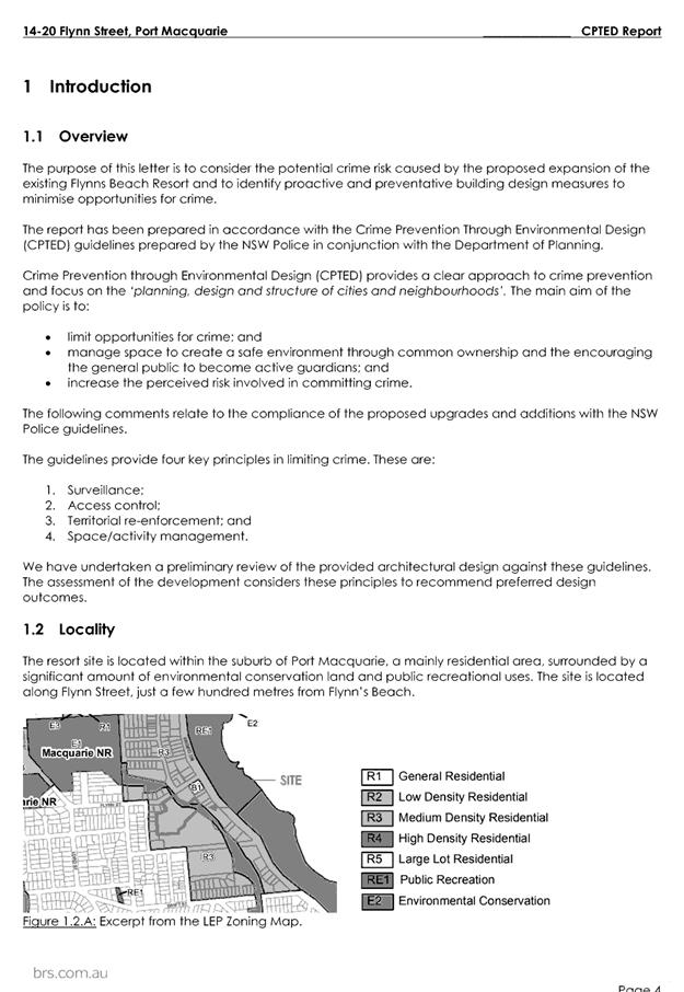
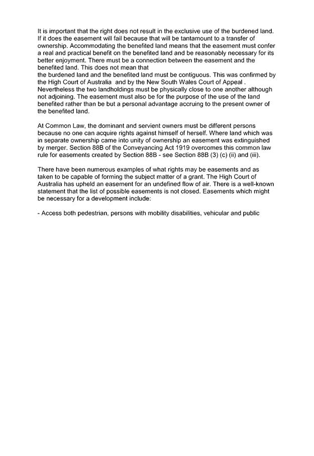
The site is zoned R1 General Residential in accordance with the Port Macquarie-Hastings Local
Environmental Plan 2011, as shown in the following zoning plan:
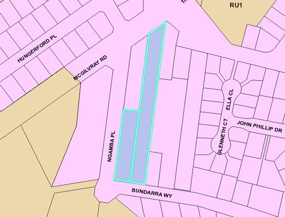
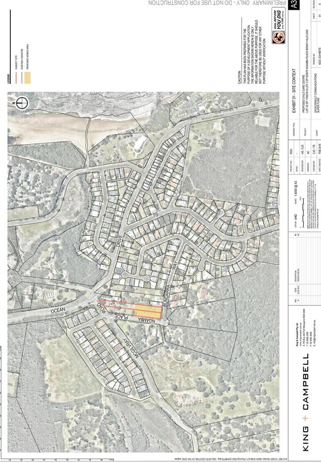
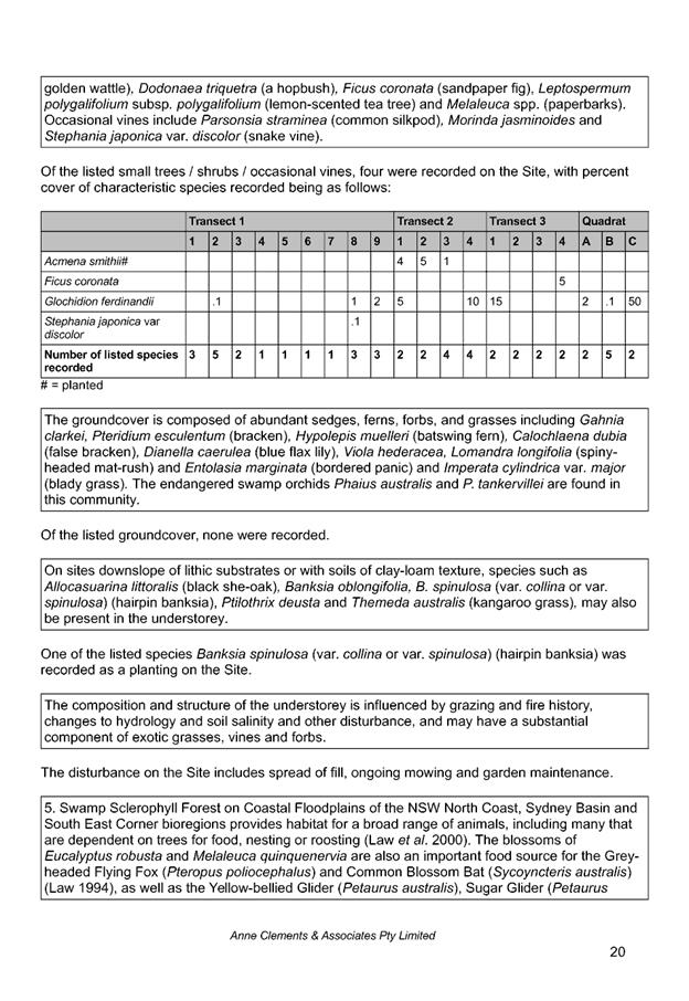
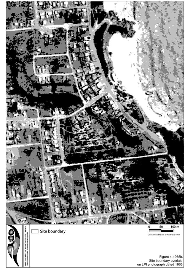
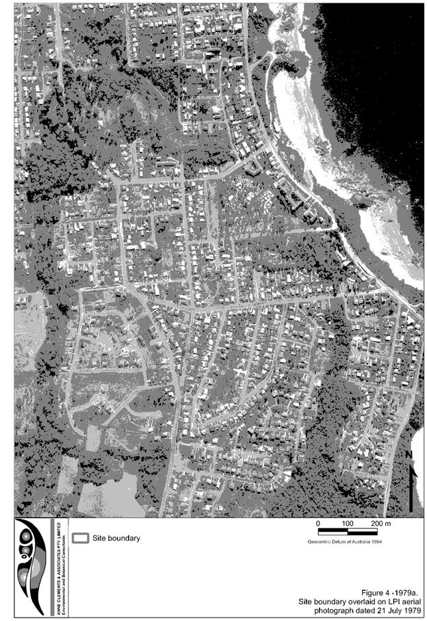
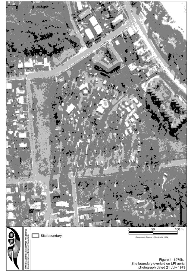
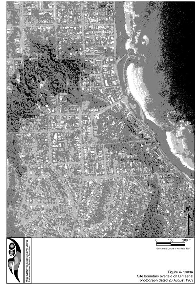
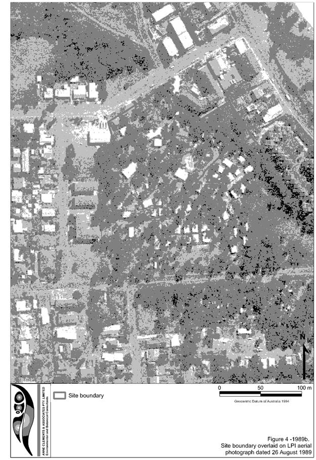
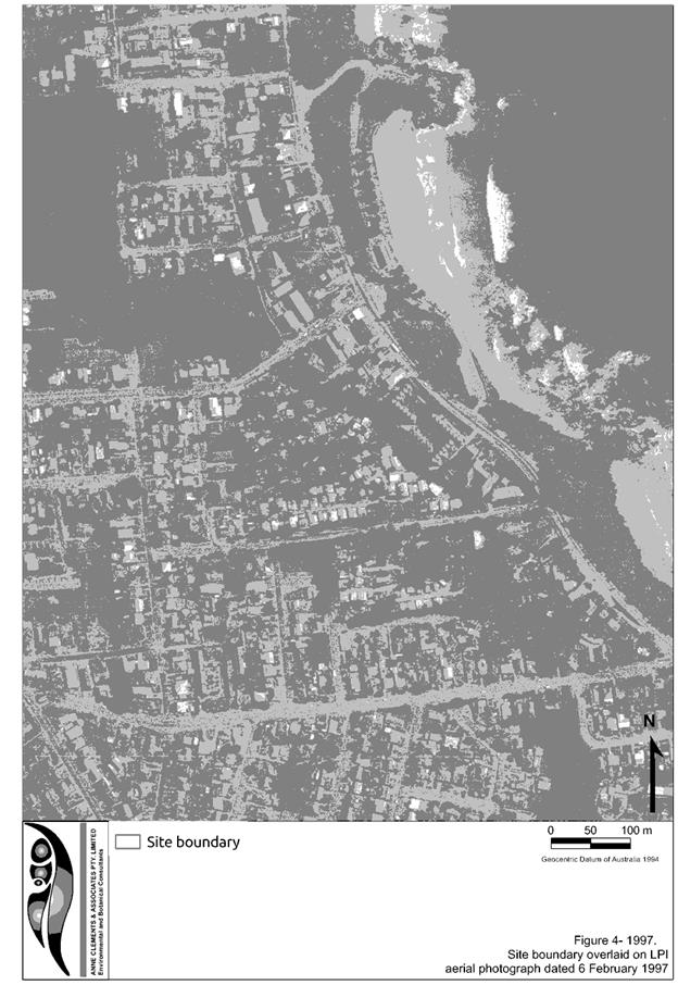
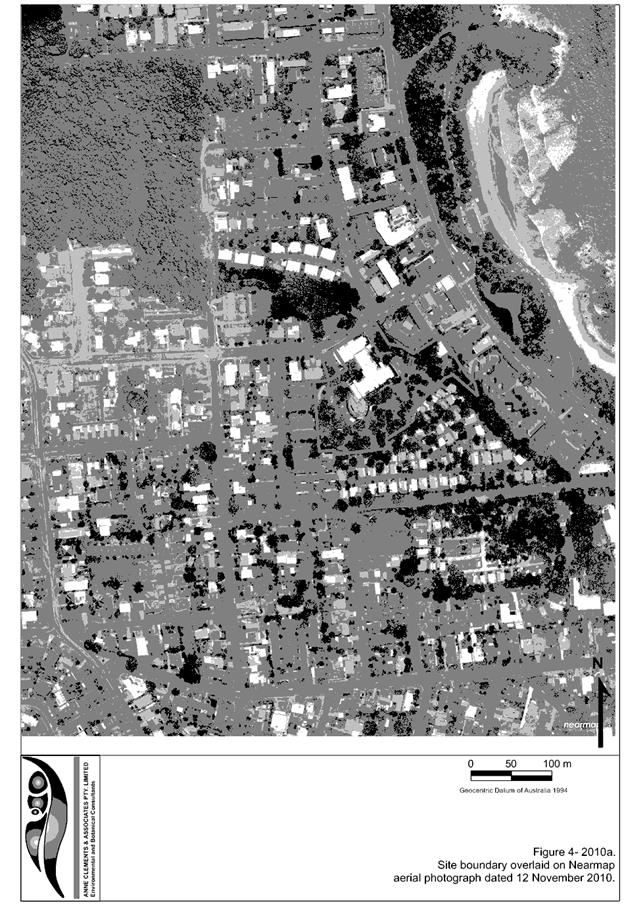
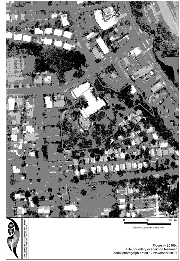
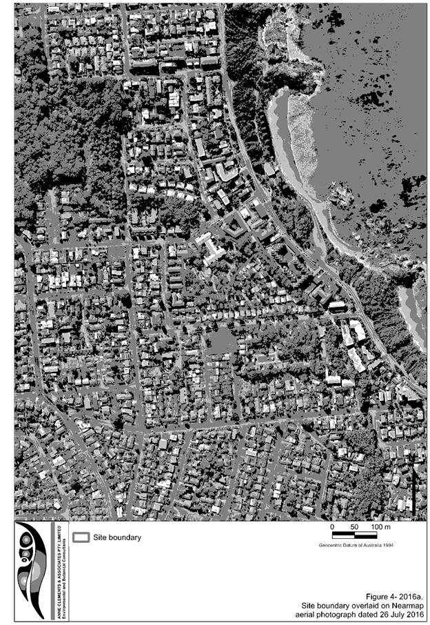
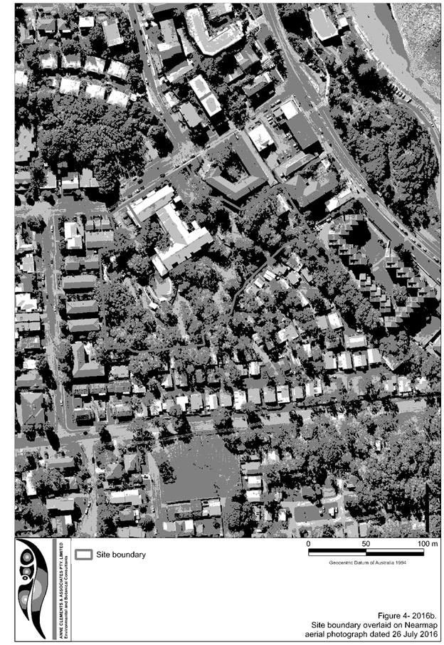
The existing subdivision pattern and location of existing
development within the locality is shown in the following aerial photograph:
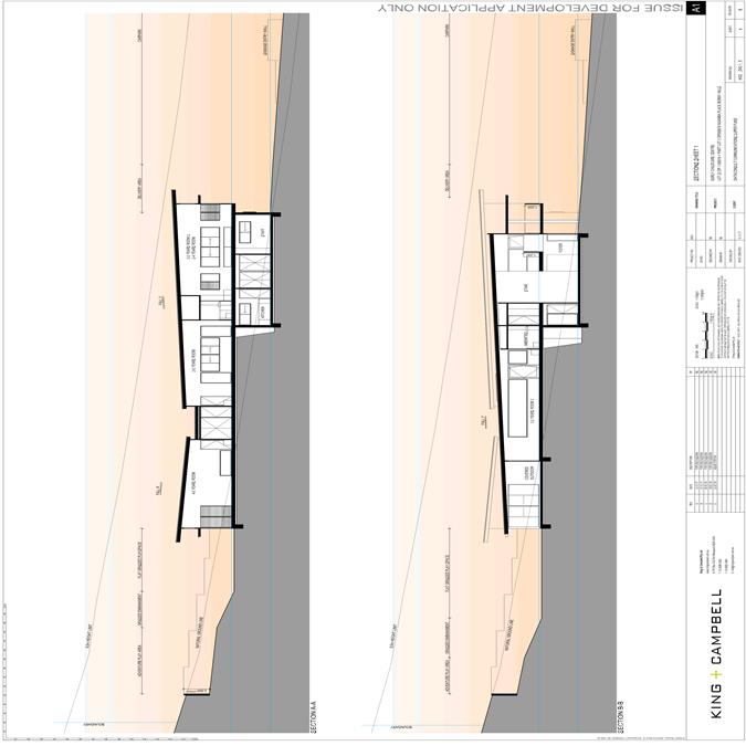
2. DESCRIPTION OF
DEVELOPMENT
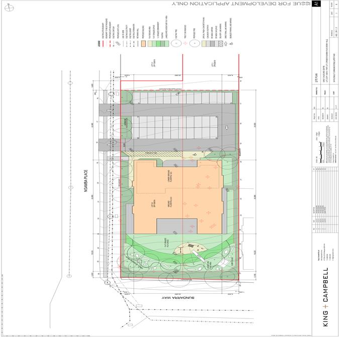
Key aspects of the proposal include the following:
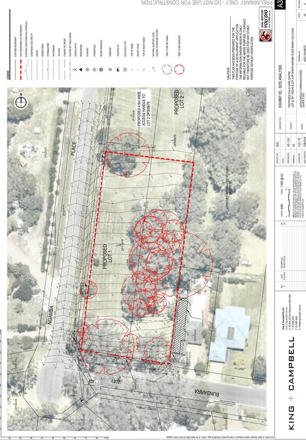
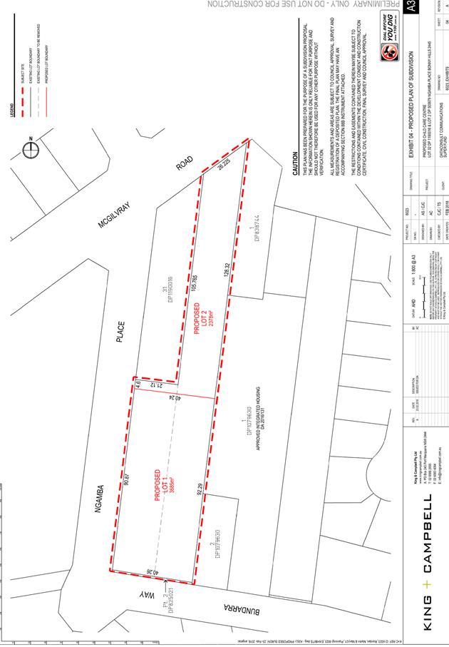
· The
subdivision (boundary adjustment) of Lot 36 and Lot 2 to create proposed Lot 1
(for the purposes of a Centre-Based Child Care Facility) and proposed Lot 2, a
residual lot with a 4.6m wide access handle to Ngamba Place Subdivision
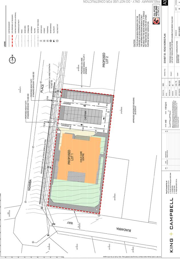
· The
construction of a Centre-Based Child Care Facility with a maximum capacity of
128 Children.
Application Chronology
· 23 February 2018 – Application lodged.
· 13 March to 26 March 2018 – Adjoining owner
notification.
· 8 March 2018 – Referral to NSW Rural Fire Service.
· 16 April 2018 – Additional information request Rural
Fire Service.
· 17 April 2018 – Bushfire Safety Authority received
from NSW Rural Fire
· 9 May 2018- Clarification kerb and guttering
3. STATUTORY ASSESSMENT
Section 4.15(1) Matters for Consideration
In determining the application, Council is required to take
into consideration the following matters as are relevant to the development
that apply to the land to which the development application relates:
(a) The
provisions (where applicable) of:
(i) any Environmental
Planning Instrument:
State
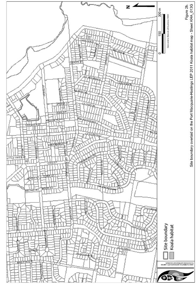
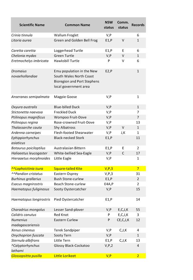
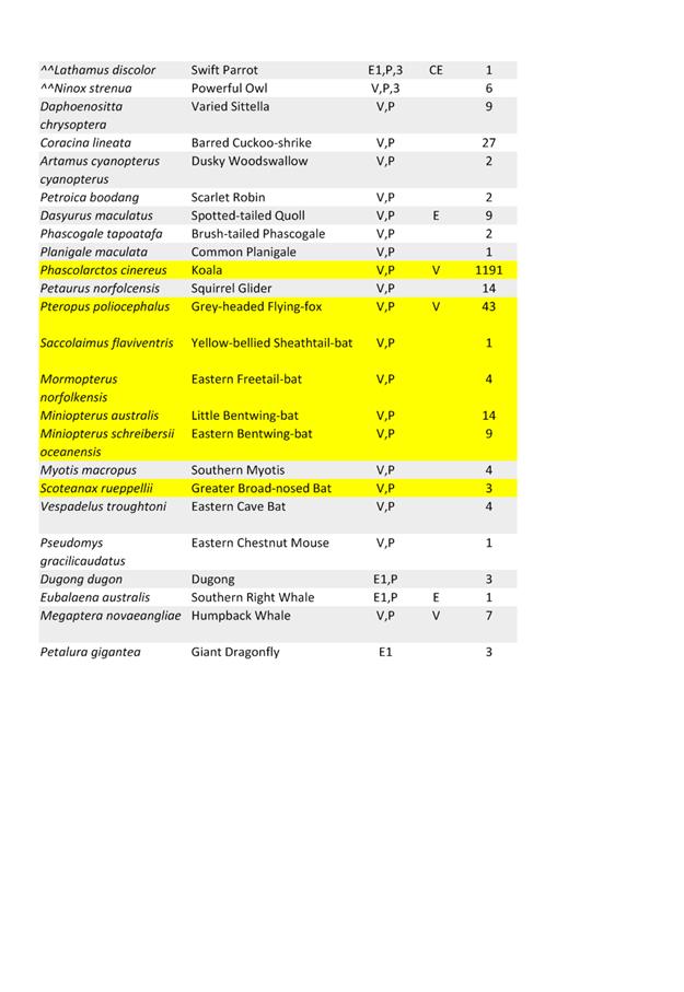
Environmental Planning Policy 44 - Koala Habitat Protection
The site has
an area of less than 1 hectare therefore the requirements for this SEPP do not
require consideration.
State Environmental
Planning Policy 55 – Remediation of Land
Following an inspection of the site and a
search of Council records, the subject land is not identified as being
potentially contaminated and is suitable for the intended use.
State
Environmental Planning Policy 62 - Sustainable Aquaculture
Given the
nature of the proposed development and proposed stormwater controls, the
proposal will be unlikely to have any adverse impact on existing aquaculture
industries within the Hastings River approximately 2 kilometres from the site.
State
Environmental Planning Policy 64 - Advertising and Signage
The
proposed development includes proposed advertising signage in the form of
business identification advertising. The signage comprises of a fixed wall
business identification sign.
In
accordance with clause 7, this SEPP prevails over the Port Macquarie-Hastings
LEP 2011 in the event of any inconsistency.
The following
assessment table provides an assessment checklist against the Schedule 1
requirements of this SEPP:
|
Applicable clauses for
consideration
|
Comments
|
Satisfactory
|
|
Clause 8(a) Consistent with objectives of the policy as
set out in Clause 3(1)(a).
|
The signage is consistent with
the objectives of this policy.
|
Yes
|
Schedule 1(1) Character of
the area.
|
The entrance wall and signage
to be incorporated will not be out of character of the area.
|
Yes
|
|
Schedule 1(2) Special areas.
|
The entrance signage will not
adversely impact on any special areas.
|
Yes
|
|
Schedule 1(3) Views and vistas.
|
The entrance signage will not
adversely impact on any views or vistas.
|
Yes
|
|
Schedule 1(4) Streetscape, setting or landscape.
|
The entrance works and signage
will not adversely detract from the streetscape.
|
Yes
|
|
Schedule 1(5) Site and building.
|
This signage is compatible with
the entrance wall to which it is to be located.
|
Yes
|
|
Schedule 1(6) Associated devices and logos with
advertisements and advertising structures.
|
None proposed.
|
Yes
|
|
Schedule 1(7) Illumination.
|
No illumination of the entrance
signage is proposed
|
Yes
|
|
Schedule 1(7) Safety.
|
The signage will not adversely
impact on public safety matters.
|
Yes
|
State Environmental Planning
Policy No. 71 – Coastal Protection and Clause 5.5 of Port
Macquarie-Hastings Local Environmental Plan 2011
The site is located within a
coastal zone noting clause 4 of the SEPP.
Subdivision of land within
residential or rural residential zone if part or all of the land is within a
Sensitive Coastal Location requires one of the following:
In accordance with clause 5, this
SEPP prevails over the Port Macquarie-Hastings LEP 2011 in the event of any
inconsistency.
Having regard for clauses 2, 8 and
12 to 16 of the SEPP and clause 5.5 of the PMH LEP 2011, the proposed
development will not result in any of the following:
a) any
restricted access (or opportunities for access) to the foreshore
b) any
adverse amenity impacts along the foreshore and on the scenic qualities of the
coast;
c) any adverse
impacts on flora and fauna;
d) the
development being subject to any adverse coastal processes or hazards;
e) any
significant conflict between water and land based users of the area;
f) any
adverse impacts on any items of archaeological/heritage;
g) reduction
in the quality of the natural water bodies in the locality (due to effluent
& stormwater disposal, construction impacts, landuse conflicts);
h) adverse
cumulative impacts on the environment;
i) a
form of development that is unsustainable in water and energy demands;
j) development
relying on flexible zone provisions. (refer to clause 5.3 of LEP 2011 -
Development near zone boundaries unable to be undertaken when SEPP 71 applies).
The site is predominately cleared
and located within a residential zone.
State
Environmental Planning Policy (Infrastructure) 2007
Vehicle
access is proposed off Ngamba Place rather than the Ocean Drive. The safety,
efficiency and ongoing operation of the adjoining Ocean Drive will not be
adversely affected by the development as a result of the anticipated volume and
frequency of vehicles anticipated.
The occupants
of the childcare centre could be sensitive to potential traffic noise from the
Ocean Drive. In this regard, the applicant has proposed to install
air-conditioning so as to enable the windows and doors to be closed during operating hours.
SEPP (Educational Establishments
and Child Care Facilities) 2017
The SEPP (EE&CCF) 2017
commenced on 1 September 2017, prior to the lodgement of this application
(lodged 11 October 2017). Therefore the provisions of the SEPP and Child Care
Planning Guideline apply are required to be addressed in the application.
A statement that the applicant has
prepared the policies and procedures referred to in Regulation 168 must be
submitted with the application for a Service Approval. Council can seek a DA to
demonstrate that the centre is capable of complying with the Regulation. In
this case, it is an existing centre. A request for a copy of the Plan of
Management was made to the applicant. A POM has not been submitted and would be
required as part of any approval, prior to commencement of the extended service
or any modification to the current service.
|
Part 3 Early Education and care facilities
– specific development controls
|
|
Provision
|
Proposal
|
|
5 Interpretation
centre-based child care facility means:
(a) a building or place used for the
education and care of children that provides any one or more of the
following:
(i) long day care,
(ii) occasional child care,
(iii) out-of-school-hours care (including
vacation care),
(iv) preschool care, or
(b) an approved family day care venue
(within the meaning of the Children (Education and Care Services) National Law
(NSW)),
but does not include:
(c) a building or place used for
home-based child care or school-based child care, or
(d) an office of a family day care service
(within the meanings of the Children (Education and Care Services) National Law
(NSW)), or
(e) a babysitting, playgroup or
child-minding service that is organised informally by the parents of the
children concerned, or
(f) a child-minding service that is
provided in connection with a recreational or commercial facility (such as a
gymnasium) to care for children while the children’s parents are using
the facility, or
(g) a service that is concerned primarily
with providing lessons or coaching in, or providing for participation in, a
cultural, recreational, religious or sporting activity, or providing private
tutoring, or
(h) a child-minding service that is
provided by or in a health services facility, but only if the service is
established, registered or licensed as part of the institution operating in
the facility.
Note: All unencumbered indoor spaces must be provided as a
secure area for children. The design of these spaces should consider the safe
supervision of children.
|
The proposal is a centre-based child care
facility in terms of the adopted definitions.
|
|
22 Centre-based child care
facility—concurrence of Regulatory Authority required for certain
development
(1) This clause applies to development for the
purpose of a centre-based child care facility if:
(a) the floor area of the building or place
does not comply with regulation 107 (indoor unencumbered space requirements)
of the Education and Care Services National Regulations, or
< ie 3.25sqm per child>
(b) the outdoor space requirements for the
building or place do not comply with regulation 108 (outdoor unencumbered
space requirements) of those Regulations.
< ie 7sqm per child>
(4) In determining whether to
grant or refuse concurrence, the Regulatory Authority is to consider any
requirements applicable to the proposed development under the Children (Education and Care
Services) National Law (NSW).
|
Centre satisfies the requirements and therefore does
not require referral/concurrence.
|
|
23 Centre-based child care
facility—matters for consideration by consent authorities
Before determining a development application for
development for the purpose of a centre-based child care facility, the
consent authority must take into consideration any applicable provisions of
the Child Care Planning Guideline, in relation to the proposed development.
|
Considered- see below
|
|
24 Centre-based child care facility in
Zone IN1 or IN2—additional matters for consideration by consent
authorities
|
Not within an IN1 or IN2 zone
|
|
25 Centre-based child care
facility—non-discretionary development standards
(1) The object of this clause is to identify development
standards for particular matters relating to a centre-based child care
facility that, if complied with, prevent the consent authority from requiring
more onerous standards for those matters.
(2) The following are non-discretionary
development standards for the purposes of section 79C (2) and (3) of the Act
in relation to the carrying out of development for the purposes of a
centre-based child care facility:
(a) location—the development may be
located at any distance from an existing or proposed early education and care
facility,
(b) indoor or outdoor space
(i) for development to which regulation 107
(indoor unencumbered space requirements) or 108 (outdoor unencumbered space
requirements) of the Education and Care Services National Regulations
applies—the unencumbered area of indoor space and the unencumbered area
of outdoor space for the development complies with the requirements of those
regulations, or
(ii) for development to which clause 28
(unencumbered indoor space and useable outdoor play space) of the Children
(Education and Care Services) Supplementary Provisions Regulation 2012
applies—the development complies with the indoor space requirements or
the useable outdoor play space requirements in that clause,
(c) site area and site dimensions—the
development may be located on a site of any size and have any length of
street frontage or any allotment depth,
(d) colour of building materials or shade
structures—the development may be of any colour or colour scheme unless
it is a State or local heritage item or in a heritage conservation area.
(3) To remove doubt, this clause does not
prevent a consent authority from:
(a) refusing a development application in
relation to a matter not specified in subclause (2), or
(b) granting development consent even though
any standard specified in subclause (2) is not complied with.
|
(a)
The site is considered appropriate for a child care facility with respect to
the growing Bonny Hills and Lake Cathie (Area 14) land release area and
immediately surrounding residential catchment;
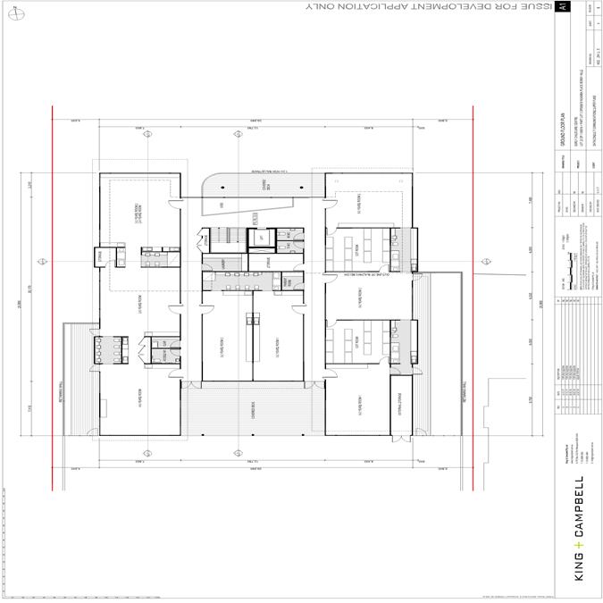
(b)(i)
Clause 107 requires a minimum of 3.25 square metres of unencumbered indoor
space for each child being educated or cared for. The proposal includes
unencumbered indoor floor space (rooms excluding hallways, toilets, kitchens,
storage, cot rooms) of 480m2, equating
to
a maximum child population of 147 children (Note: the outdoor unencumbered
space, see below, limits the centre to a maximum of 128 children).
Clause
108 requires a minimum of 7 square metres of unencumbered outdoor space for
each child being educated and/or cared for. The proposal includes
unencumbered outdoor floor space exceeding the minimum required for 128
children, that being 896m2. The proposed unencumbered outdoor space is 900m2
(excluding car parking, storage sheds, laundry and other spaces not suitable
for children).
(b)(ii)
The unencumbered indoor space does not include passage ways, thoroughfares,
door swing areas, kitchens, cot rooms, toilets or showers.
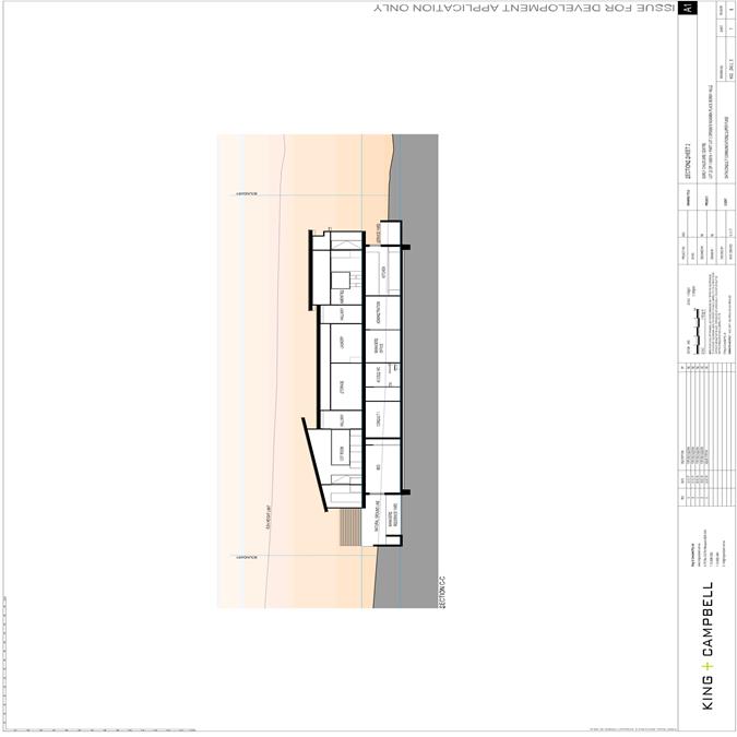
The
proposed centre also includes the following features:
-
A dedicated administration section as
well as three private
consultation rooms
for
meetings between staff and parents;
-
A
dedicated staff room; and
-
A cot room for the use of children under
2
years of age;
The
final landscaping design has not been
undertaken
as a part of this development
application.
It is considered however, that
compliance
with The Shade Handbook can be achieved.
(c)
The site is considered to contain appropriate dimensions for a centre of the
proposed size and scale;
(d)
The subject site is not mapped as being within a state or local heritage
conservation area.
|
Child Care Planning Guideline (August 2017)
|
|
Matter
for Consideration/ Requirement
|
Proposal
|
|
Chapter 2
DESIGN QUALITY PRINCIPLES
|
|
Principle
1 – Context
Good
design responds and contributes to its context, including the key natural and
built features of an area, their relationship and the character they create
when combined. It also includes social, economic, health and environmental
conditions.
Well-designed
child care facilities respond to and enhance the qualities and identity of
the area including adjacent sites, streetscapes and neighbourhood.
Well-designed
child care facilities take advantage of its context by optimising nearby
transport, public facilities and centres, respecting local heritage, and
being responsive to the demographic, cultural and socio-economic makeup of
the facility users and surrounding communities.
|
The
proposed development is appropriately located to be readily accessible by the
community. The design responds to the context and will promote
additional employment and services for the community of Bonny Hills.
The
design and landscaping will positively contribute to the identity and sense
of place of the area.
The
site is well located to provide for a number of transport options.
|
|
Principle 2 – Built Form
Good
design achieves a scale, bulk and height appropriate to the existing or
desired future character of the surrounding area.
Good
design achieves an appropriate built form for a site and the building’s
purpose in terms of building alignments, proportions, building type,
articulation and the manipulation of building elements. Good design also uses
a variety of materials, colours and textures.
Appropriate
built form defines the public domain, contributes to the character of
streetscapes and parks, including their views and vistas, and provides
internal amenity and outlook.
Contemporary
facility design can be distinctive and unique to support innovative approaches
to teaching and learning, while still achieving a visual
appearance that is aesthetically pleasing, complements the surrounding areas,
and contributes positively to the public realm.
|
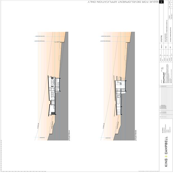
The
design is well set back from adjoining boundaries and responds well to the
slope of the site and is set in to reduce impact on adjoining properties.
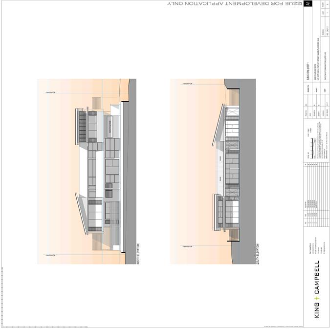
A
variety of building elements, colours and textures is proposed.
The
structure will help define and the corner allotment and provide a high
quality identifiable entry to the main part of Bonny Hills.
A
contemporary design with a coastal feel is proposed and will positively
contribute to the streetscape.
|
|
Principle
3 – Adaptive Learning Spaces
Good
facility design delivers high quality learning spaces and achieves a high
level of amenity for children and staff, resulting in buildings and
associated infrastructure that are fit-for-purpose, enjoyable and easy to
use. This is achieved through site layout, building design, and learning
spaces fit-out.
Good
design achieves a mix of inclusive learning spaces to cater for all students
and different modes of learning. This includes appropriately designed
physical spaces offering a variety of settings, technology and opportunities
for interaction.
|
Adaptive
learning spaces are provided that allow for access between rooms and
interface with outdoor play areas and covered decks.
|
|
Principle 4 – Sustainability
Sustainable
design combines positive environmental, social and economic outcomes.
This
includes use of natural cross ventilation, sunlight and passive thermal
design for ventilation, heating and cooling reducing reliance on technology
and operation costs. Other elements include recycling and re-use of materials
and waste, use of sustainable materials and deep soil zones for groundwater
recharge and vegetation.
Well-designed
facilities are durable and embed resource efficiency into building and site
design, resulting in less energy and water consumption, less generation of
waste and air
emissions
and reduced operational costs.
|
Good
cross flow opportunities provided.
Application
to comply with Section J BASIX with suitable areas for deep soil zones and
vegetation.
|
|
Principle
5 – Landscape
Landscape
and buildings should operate as an integrated and sustainable system,
resulting in attractive developments with good amenity. A contextual fit of
well-designed developments is achieved by contributing to the landscape
character of the streetscape and neighbourhood.
Well-designed
landscapes make outdoor spaces assets for learning. This includes designing
for diversity in function and use, age-appropriateness and amenity.
Good
landscape design enhances the development’s environmental performance
by retaining positive natural features which contribute to the local context,
co-ordinating water and soil management, solar access, micro-climate, tree
canopy, habitat values and preserving green networks.
|
Suitable
high quality landscaping has been provided.
|
|
Principle
6 – Amenity
Good
design positively influences internal and external amenity for children,
staff and neighbours. Achieving good amenity contributes to positive learning
environments and the well-being of students and staff.
Good
amenity combines appropriate and efficient indoor and outdoor learning spaces,
access to sunlight, natural ventilation, outlook, visual and acoustic
privacy, storage, service areas and ease of access for all age groups and
degrees of mobility.
Well-designed
child care facilities provide comfortable, diverse and attractive spaces to
learn, play and socialise.
|
Attractive
and appropriate amenity has been provided to allow for suitable break out
areas suitable for staff and children to work, learn and play.
|
|
Principle
7 – Safety
Well-designed
child care facilities optimise the use of the built and natural environment
for learning and play, while utilising equipment, vegetation and landscaping
that has a low health and safety risk, and can be checked and maintained
efficiently and appropriately.
Good
child care facility design balances safety and security with the need to
create a welcoming and accessible environment. It provides for quality public
and private spaces
that
are inviting, clearly defined and allow controlled access for members of the
community. Well-designed child care facilities incorporate passive
surveillance and Crime Prevention Through Environmental Design (CPTED).
|
Appropriate
safety deign feature shave been incorporated within the design
|
CHAPTER 3 Matters for Consideration
|
|
Provision
|
Proposal
|
|
3.1
Site selection and location p9-10
|
|
C1
Zone Objectives
For
proposed developments in or adjacent to a residential zone, consider:
· the acoustic and privacy impacts of the proposed
development on the residential properties
· the setbacks and siting of buildings within the
residential context
· traffic and parking impacts of the proposal on
residential amenity.
For
proposed developments in public or private recreation zones, consider:
· the compatibly of the proposal with the operations
and nature of the community or private recreational facilities
· if the existing premises is licensed for alcohol or
gambling
· if the use requires permanent or casual occupation
of the premises or site
· the availability of on site parking
· compatibility of proposed hours of operation with
surrounding uses, particularly residential uses
· the availability of appropriate and dedicated
sanitation facilities for the development.
|
The
site is zoned R1 General Residential.
The
objectives of the zone are:
· To provide for the housing needs of the community.
· To provide for a variety of housing types and
densities.
· To enable other land uses that provide facilities or
services to meet the day to day needs of residents.
The
development of a centre-based child care centre in the R1 zone is not
antipathetic to the objectives of the zone.
In
terms of the three environmental impacts listed:
· the acoustic and privacy impacts of the proposed
development on the residential properties. The site is set into the site and consideration has been made to
reduce the impact on adjoining residences- it is recommended acoustic fencing
be provided adjoining the carpark
· the setbacks and siting of buildings within the
residential context. Considered acceptable
· traffic and parking impacts of the proposal on
residential amenity.
Traffic assessment has been conducted and the entry
is located away from the main adjoining residential development and is
considered acceptable.
|
|
C2
Site Selection
When
selecting a site, ensure that:
· the location and surrounding uses are compatible
with the proposed development or use
· the site is environmentally safe including risks
such as flooding, land slip, bushfires, coastal hazards
· there are no potential environmental contaminants on
the land, in the building or the general proximity, and whether hazardous
materials remediation is needed
· the characteristics of the site are suitable for the
scale and type of development proposed having regard to:
- size
of street frontage, lot configuration, dimensions and overall size
- number
of shared boundaries with residential properties
- the
development will not have adverse environmental impacts on the surrounding
area, particularly in sensitive environmental or cultural areas
· where the proposal is to occupy or retrofit an
existing premise, the interior and exterior spaces are suitable for the
proposed use
· there are suitable drop off and pick up areas, and
off and on street parking
· the type of adjoining road (for example classified,
arterial, local road, cul-de-sac) is appropriate and safe for the proposed
use
· it is not located closely to incompatible social
activities and uses such as restricted premises, injecting rooms, drug
clinics and the like, premises licensed for alcohol or gambling such as
hotels, clubs, cellar door premises and sex services premises.
|
The
site is considered suitable for the childcare centre with reduced adjoining
residential property boundaries.
Centrally
located.
No
listed contaminants.
Appropriate
scale and configuration.
Suitable
separation from incompatible premises.
|
|
C3
Site Location
A
child care facility should be located:
· near compatible social uses such as schools and
other educational establishments, parks and other public open space,
community facilities, places of public worship
· near or within employment areas, town centres,
business centres, shops
· with access to public transport including rail,
buses, ferries
· in areas with pedestrian connectivity to the local
community, businesses, shops, services and the like.
|
The
site is located in close proximity to services, community facilities, open
space and small community shops.
|
|
C4
Environmental Risks
A
child care facility should be located to avoid risks to children, staff or
visitors and adverse environmental conditions arising from:
· proximity to:
- heavy
or hazardous industry, waste transfer depots or landfill sites
- LPG
tanks or service stations
- water
cooling and water warming systems - odour (and other air pollutant)
generating uses and sources or sites which, due to prevailing land use
zoning, may in future accommodate noise or odour generating uses
- extractive
industries, intensive agriculture, agricultural spraying activities
· any other identified environmental hazard or risk
relevant to the site and/ or existing buildings within the site.
|
The
site is not located in proximity to any industrial or known hazardous
location.
|
|
3.2
Local Character, streetscape and the public domain interface p11-12
|
|
C5
Local character and streetscape
The
proposed development should:
· contribute to the local area by being designed in
character with the locality and existing streetscape
· reflect the predominant form of surrounding land
uses, particularly in low density residential areas
· recognise predominant streetscape qualities, such as
building form, scale, materials and colours
· include design and architectural treatments that
respond to and integrate with the existing streetscape
· use landscaping to positively contribute to the
streetscape and neighbouring amenity
· integrate car parking into the building and site
landscaping design in residential areas.
|
The
proposal will provide for a positive contribution to the streetscape with
landscaping and fencing and visually appealing view from the public domain.
|
|
C6
Separation/transition with public spaces
Create
a threshold with a clear transition between public and private realms,
including:
· fencing to ensure safety for children entering and
leaving the facility
· windows facing from the facility towards the public
domain to provide passive surveillance to the street as a safety measure and
connection between the facility and the community
· integrating existing and proposed landscaping with
fencing.
|
Pool
type fencing and landscaping will provide for adequate and attractive
separation between the private and public realm.
|
|
C7
Legibility of Site
On
sites with multiple buildings and/or entries, pedestrian entries and spaces
associated with the child care facility should be differentiated to improve
legibility for visitors and children by changes in materials, plant species
and colours.
|
The
legibility of the access, car park and entry point into the centre re
considered acceptable. The proposed shared zone, painted and delineated
design will assist. New fencing and landscaping will provide the opportunity
to design improvements into the site.
|
|
C8
Adjoining public parks, open space or bushland
Where
development adjoins public parks, open space or bushland, the facility should
provide an appealing streetscape frontage by adopting some of the following
design solutions:
· clearly defined street access, pedestrian paths and
building entries
· low fences and planting which delineate communal/
private open space from adjoining public open space
· minimal use of blank walls and high fences.
|
N/A
|
|
C9
Fronts and retaining – character of the area
Front
fences and walls within the front setback should be constructed of visually
permeable materials and treatments. Where the site is listed as a heritage
item, adjacent to a heritage item or within a conservation area front fencing
should be designed in accordance with local heritage provisions.
|
A
mixture of pool fencing and landscaping will provide suitable visual
permeability.
|
|
C10
Fencing – Noisy or Classified Roads
|
N/A
|
|
|
|
C11
Orientation of development
Orient
a development on a site and design the building layout to:
· ensure visual privacy and minimise potential noise
and overlooking impacts on neighbours by:
- facing
doors and windows away from private open space, living rooms and bedrooms in
adjoining residential properties
- placing
play equipment away from common boundaries with residential properties
- locating
outdoor play areas away from residential dwellings and other sensitive uses
· optimise solar access to internal and external play
areas
· avoid overshadowing of adjoining residential
properties
· minimise cut and fill
· ensure buildings along the street frontage define
the street by facing it
· ensure that where a child care facility is located
above ground level, outdoor play areas are protected from wind and other
climatic conditions.
|
Large
play areas are generally located adjoining the street areas and are set into
the site dropping the areas below residential boundary and open space areas.
Mixed
location and orientation of areas available which also allow for shelter
under various climatic conditions.
|
|
C12
Scale of development – local context
The
following matters may be considered to minimise the impacts of the proposal
on local character:
· building height should be consistent with other
buildings in the locality
· building height should respond to the scale and
character of the street
· setbacks should allow for adequate privacy for
neighbours and children at the proposed child care facility
· setbacks should provide adequate access for building
maintenance
· setbacks to the street should be consistent with the
existing character.
|
Consistent.
|
|
C13
Street Setbacks
Where
there are no prevailing setback controls minimum setback to a classified road
should be 10 metres. On other road frontages where there are existing
buildings within 50 metres, the setback should be the average of the two
closest buildings. Where there are no buildings within 50 metres, the same
setback is required for the predominant adjoining land use.
|
N/A
|
|
C14
Side and Rear Boundary Setbacks
On
land in a residential zone, side and rear boundary setbacks should observe
the prevailing setbacks required for a dwelling house.
|
Acceptable.
|
|
C15
Built Form - Local Area Character
The
built form of the development should contribute to the character of the local
area, including how it:
· respects and responds to its physical context such
as adjacent built form, neighbourhood character, streetscape quality and
heritage
· contributes to the identity of the place
· retains and reinforces existing built form and
vegetation where significant
· considers heritage within the local neighbourhood
including identified heritage items and conservation areas
· responds to its natural environment including local
landscape setting and climate
· contributes to the identity of place.
|
Discussion
on built form and local area character addressed previously –
considered acceptable.
|
|
C16
Safe Environments
Entry
to the facility should be limited to one secure point which is:
· located to allow ease of access, particularly for
pedestrians
· directly accessible from the street where possible
• directly visible from the street frontage
· easily monitored through natural or camera
surveillance
· not accessed through an outdoor play area.
· in a mixed-use development, clearly defined and
separate from entrances to other uses in the building.
|
|
|
C17
Accessibility
Accessible
design can be achieved by:
· providing accessibility to and within the building
in accordance with all relevant legislation
· linking all key areas of the site by level or ramped
pathways that are accessible to prams and wheelchairs, including between all
car parking areas and the main building entry
· providing a continuous path of travel to and within
the building, including access between the street entry and car parking and
main building entrance. Platform lifts should be avoided where possible
· minimising ramping by ensuring building entries and
ground floors are well located relative to the level of the footpath. NOTE:
The National Construction Code, the Discrimination Disability Act 1992 and
the Disability (Access to Premises – Buildings) Standards 2010 set out
the requirements for access to buildings for people with disabilities.
|
Cut
and fill to the site ensures accessibility viable and compliance with the NCC
is required.
Achievable.
|
|
3.4
Landscaping p15
|
|
C18
Landscape Design
Appropriate
planting should be provided along the boundary integrated with fencing.
Screen planting should not be included in calculations of unencumbered
outdoor space. Use the existing landscape where feasible to provide a high
quality landscaped area by:
· reflecting and reinforcing the local context
· incorporating natural features of the site, such as
trees, rocky outcrops and vegetation communities into landscaping.
|
Landscape
plan provided and considered acceptable.
|
|
C19
Landscaping – car parking
Incorporate
car parking into the landscape design of the site by:
· planting shade trees in large car parking areas to
create a cool outdoor environment and reduce summer heat radiating into
buildings
· taking into account streetscape, local character and
context when siting car parking areas within the front setback
· using low level landscaping to soften and screen
parking areas.
|
Adequate
trees proposed.
|
|
3.5
Visual and Acoustic Privacy p15-16
|
|
C20
Privacy and Security of children
Open
balconies in mixed use developments should not overlook facilities nor
overhang outdoor play spaces.
|
|
|
C21
Privacy - Indoor and Outdoor Areas
Minimise
direct overlooking of indoor rooms and outdoor play spaces from public areas
through:
· appropriate site and building layout
· suitably locating pathways, windows and doors
· permanent screening and landscape design.
|
Set
into site no significant impacts anticipated
|
|
C22
Visual Privacy
Minimise
direct overlooking of main internal living areas and private open spaces in
adjoining developments through:
· appropriate site and building layout
· suitable location of pathways, windows and doors
· landscape design and screening.
|
Set
into site no significant impacts anticipated.
|
|
C23
Acoustic Privacy
A
new development, or development that includes alterations to more than 50 per
cent of the existing floor area, and is located adjacent to residential
accommodation should:
· provide an acoustic fence along any boundary where
the adjoining property contains a residential use. (An acoustic fence is one
that is a solid, gap free fence).
· ensure that mechanical plant or equipment is
screened by solid, gap free material and constructed to reduce noise levels
e.g. acoustic fence, building, or enclosure.
|
Solid
fencing proposed and acoustic treatment conditioned.
|
|
C24
Acoustic Assessment
A
suitably qualified acoustic professional should prepare an acoustic report
which will cover the following matters:
· identify an appropriate noise level for a child care
facility located in residential and other zones
· determine an appropriate background noise level for
outdoor play areas during times they are proposed to be in use
· determine the appropriate height of any acoustic
fence to enable the noise criteria to be met.
|
Not
considered necessary given the solid gap free fencing and acoustic treatment
adjoining the residential boundaries.
Building
set into site with significant cut and larger play areas located adjoining
roads.
Significant
setbacks and sleeping areas proposed adjoining residential boundaries.
|
|
3.6
Noise and air pollution p17
|
|
C25
Outside Noise Levels
Adopt
design solutions to minimise the impacts of noise, such as:
· creating physical separation between buildings and
the noise source
· orienting the facility perpendicular to the noise
source and where possible buffered by other uses
· using landscaping to reduce the perception of noise
· limiting the number and size of openings facing
noise sources
· using double or acoustic glazing, acoustic louvres
or enclosed balconies (wintergardens)
· using materials with mass and/or sound insulation or
absorption properties, such as solid balcony balustrades, external screens
and soffits
· locating cot rooms, sleeping areas and play areas
away from external noise sources.
|
N/A
|
|
C26
Noise Levels – Sleeping Areas
An
acoustic report should identify appropriate noise levels for sleeping areas
and other non play areas and examine impacts and noise attenuation measures
where a child care facility is proposed in any of the following locations:
- on
industrial zoned land
- where
the ANEF contour is between 20 and 25, consistent with AS 2021 – 2000
- along
a railway or mass transit corridor, as defined by State Environmental
Planning Policy (Infrastructure) 2007
- on
a major or busy road
- other
land that is impacted by substantial external noise.
|
N/A
|
|
C27
Noise Impacts – External Sources
Locate
child care facilities on sites which avoid or minimise the potential impact
of external sources of air pollution such as major roads and industrial
development
|
N/A
|
|
C28
Air Quality Assessment
A
suitably qualified air quality professional should prepare an air quality
assessment report to demonstrate that proposed child care facilities close to
major roads or industrial developments can meet air quality standards in
accordance with relevant legislation and guidelines.
|
N/A
|
|
3.7
Hours of operation p18
|
|
C29
Amenity of Neighbouring Residential Developments
Hours
of operation within areas where the predominant land use is residential
should be confined to the core hours of 7.00am to 7.00pm weekdays. The hours
of operation of the proposed child care facility may be extended if it
adjoins or is adjacent to non-residential land uses.
|
Complies
|
|
C30
Mixed use and Commercial Areas
|
N/A
|
|
3.8
Traffic, parking and pedestrian circulation p18-19
|
|
C31
Off-street Car Parking
Off
street car parking should be provided at the rates for child care facilities
specified in a Development Control Plan that applies to the land.
Where
a Development Control Plan does not specify car parking rates, off street car
parking should be provided at the following rates:
Within
400 metres of a metropolitan train station:
· 1 space per 10 children
· 1 space per 2 staff. Staff parking may be stack or
tandem parking with no more than 2 spaces in each tandem space.
In
other areas:
· 1 space per 4 children.
A
reduction in car parking rates may be considered where:
· the proposal is an adaptive re-use of a heritage
item
· the site is in a B8 Metropolitan Zone or other high
density business or residential zone
· the site is in proximity to high frequency and well
connected public transport
· the site is co-located or in proximity to other uses
where parking is appropriately provided (for example business centres,
schools, public open space, car parks)
· there is sufficient on street parking available at
appropriate times within proximity of the site.
|
Complies
and Suitable parking provided in accordance with Council’s DCP.
|
|
C32
Commercial, Industrial, Mixed Use Zones
|
N/A
|
|
C33
Traffic and Parking Assessment
A
Traffic and Parking Study should be prepared to support the proposal to
quantify potential impacts on the surrounding land uses and demonstrate how
impacts on amenity will be minimised. The study should also address any
proposed variations to parking rates and demonstrate that:
· the amenity of the surrounding area will not be
affected
· there will be no impacts on the safe operation of
the surrounding road network.
|
Considered
and assessed by Council’s engineers- acceptable.
|
|
C34
Access to site - Vehicles
Alternate
vehicular access should be provided where child care facilities are on sites
fronting:
· a classified road
· roads which carry freight traffic or transport
dangerous goods or hazardous materials. The alternate access must have regard
to:
· the prevailing traffic conditions
· pedestrian and vehicle safety including bicycle
movements
· the likely impact of the development on traffic.
|
N/A
|
|
C35 Narrows Road and Cul-de-sac
Child
care facilities proposed within cul-de-sacs or narrow lanes or roads should
ensure that safe access can be provided to and from the site, and to and from
the wider locality in times of emergency.
|
N/A
|
|
C36
Access to the site – Pedestrians
The
following design solutions may be incorporated
into a development to help provide a safe pedestrian environment:
· separate pedestrian access from the car park to the
facility
· defined pedestrian crossings included within large
car parking areas
· separate pedestrian and vehicle entries from the
street for parents, children and visitors
· pedestrian paths that enable two prams to pass each
other
· delivery and loading areas located away from the
main pedestrian access to the building and in clearly designated, separate
facilities
· in commercial or industrial zones and mixed use
developments, the path of travel from the car parking to the centre entrance
physically separated from any truck circulation or parking areas
· vehicles can enter and leave the site in a forward
direction.
|
Acceptable
|
|
C37
Access to the site – Mixed Use Developments
|
N/A
|
|
C38 Car Parking Design
Car
parking design should:
· include a child safe fence to separate car parking
areas from the building entrance and play areas
· provide clearly marked accessible parking as close
as possible to the primary entrance to the building in accordance with
appropriate Australian Standards
· include wheelchair and pram accessible parking.
|
Play
areas are separated from the carpark areas. Condition to be applied provide a
pool style gated fenced area along the front entry way to prevent children
entering carpark areas direct from the foyer.
Accessible
access proposed.
|
Port
Macquarie-Hastings Local Environmental Plan 2011
The
proposal is consistent with the LEP having regard to the following:
Clause
2.2, the subject site is zoned R1 General Residential. In accordance with
clause 2.3(1) and the R1 zone landuse table, the proposed development for a
childcare centre is a permissible landuse with consent.
The
objectives of the R1 zone are as follows:
o To provide for the housing needs of the community within a
low density residential environment.
o To enable other land uses that provide facilities or
services to meet the day to day needs of residents.
o To provide for low density housing that does not compromise
the environmental, scenic or landscape qualities of land.
In accordance with Clause 2.3(2), the proposal
is consistent with the zone objectives having regard to the following:
o the proposal is a permissible
landuse;
· Clause 4.3, the maximum overall height of the building
above ground level (existing) is 8.2m which complies with the standard height
limit of 8.5m applying to the site.
· Clause 4.4, the floor space ratio of the proposal is
0.36:1.0. Which complies with the maximum FSR of 0.65:1 applying to the site
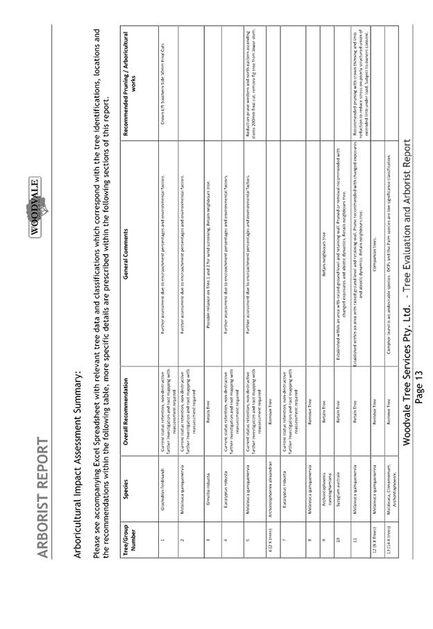
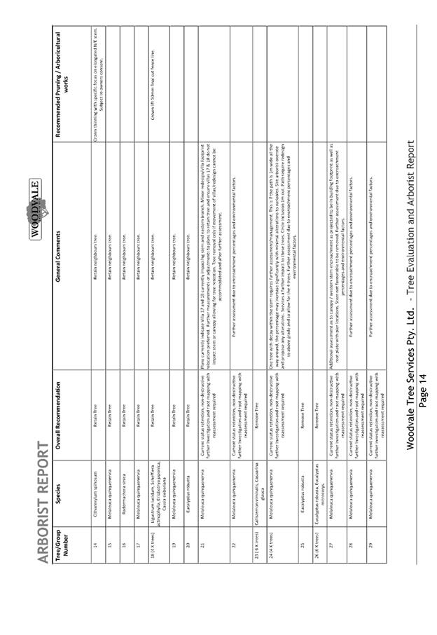
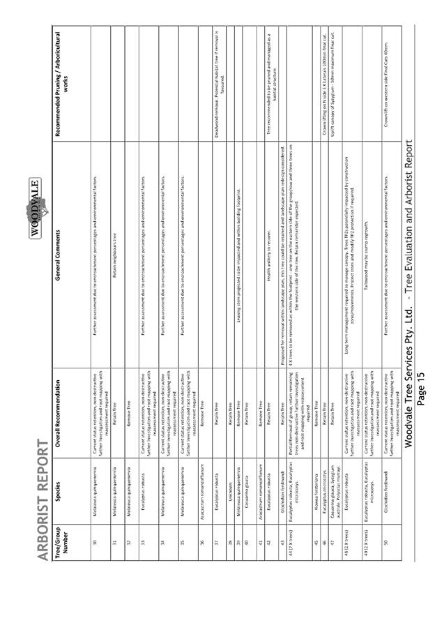
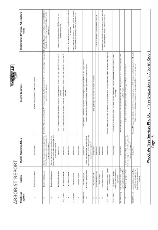
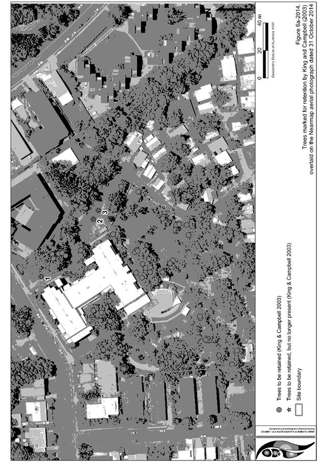
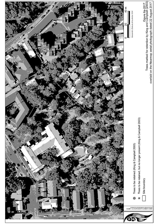
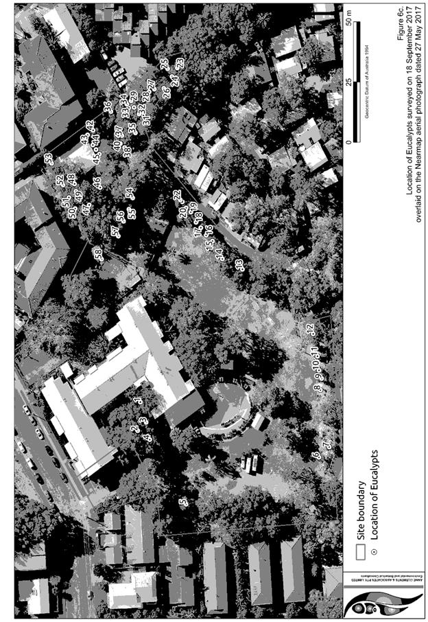
· Clause 5.9 - The proposed development proposes to remove
all trees on the site including 3 Tallowwoods during the construction of the
development. Compensatory planting at a rate of 2 per tree is proposed
· Clause 5.10 – Heritage. The site does not contain or
adjoin any known heritage items or sites of significance.
· Clause
7.13, satisfactory arrangements are in place for provision of essential
services including water supply, electricity supply, sewer infrastructure,
stormwater drainage and suitable road access to service the development.
Any draft instruments
that apply to the site or are on exhibition:
None
applicable.
(iii) any
Development Control Plan in force:
Port
Macquarie-Hastings Development Control Plan 2013
|
Requirement
|
Proposed
|
Complies
|
|
2.2
Advertising and signage
|
The
signage is primarily intended to identify the business. The signage does not
project above or the side of building facades.
No illumination of signage is
proposed.
|
Yes
|
|
2.3
Environmental Management
|
Cut
and fill. The development will require cut and fill to level the
building site and create a level building foundation for construction. The
development will implement the appropriate erosion and sedimentary control
measures during the construction phase.
Hollow
bearing trees – The development will not involve the removal of hollow
bearing trees.
It is recommend that a
condition be imposed to require offset planting.
|
Yes
|
|
2.5
Transport, Traffic Management, Access and Carparking
|
Parking
is specified at 1 space per 4 children plus set down and pick up area. The
proposed development will have a maximum of 128 child places and will require
32 spaces plus 1 space to support the manager.
36
off-street parking spaces are proposed.
There
is also opportunity to provide for an informal set down pick up area within
the driveway egress.
Satisfactory
landscaping is proposed to soften the impact of the at-grade carparking area
and building on the site.
Refer to further comments
later in report addressing traffic and access.
|
Yes
|
|
2.7
Social Impact Assessment and Crime Prevention
|
The
DCP requires a social impact assessment to be submitted in accordance with
the Council’s Social Impact Assessment Policy. For a child care centre
catering for greater than 20 children and within a residential area should
provide a social impact comment. Satisfactory information has been submitted
in this regard.
No adverse crime risk potential
identified with design layout of the centre. Adequate boundary fencing is
provided and the centre has been designed to provide surveillance of outdoor
areas.
|
Yes
|
With
respect to the 1-bedroom manager’s residence component of the
development, an appropriate level of amenity is considered to be provided. The
dwelling has a private courtyard with northern orientation and is capable of
supporting outdoor recreation and utilities.
(iiia) any
planning agreement that has been entered into under section 7.4, or any draft
planning agreement that a developer has offered to enter into under section
7.4:
Nil
iv) any matters prescribed by the
Regulations:
New South Wales Coastal Policy:
The proposal
is not at odds with the Coastal Policy. Relevant matters are considered under
SEPP 71 comments.
(b) The
likely impacts of that development, including environmental impacts on both the
natural and built environments, social and economic impacts in the locality:
Context and Setting
The
site has a general westerly street frontage orientation to Ngamba Place and is
located on the corner of Ngamba Place and Bundarra Way.
The site is
located centrally within the Bonny Hills area. The site is located in an area
that is predominately residential dwellings to the east, west to the north on
the opposite side of the Ocean Drive.
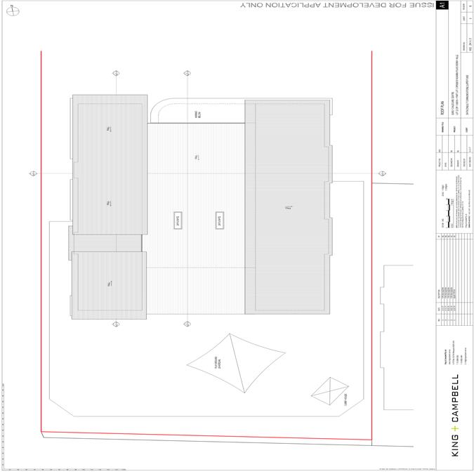
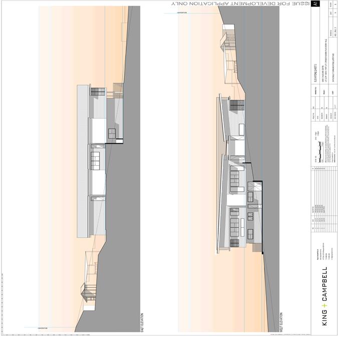
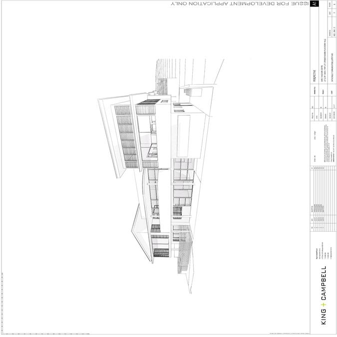
The
proposed building is single and two storey adopting appropriate front building
setbacks .The building form is well articulated with a clear entrance defined
from the proposed at grade carpark.
The
proposal will be unlikely to have any adverse impacts to existing adjoining
properties and satisfactorily addresses the public domain.
The
proposal is considered to be compatible with existing residential development
in the locality and adequately addresses planning controls for the area.
The
proposal does not have a significant adverse impact on existing view sharing.
The
proposal does not have significant adverse lighting impacts.
There
are no significant adverse privacy impacts. Adequate building separation is
proposed.
There are no
adverse overshadowing impacts. The proposal does not prevent adjoining
properties from receiving 3 hours of sunlight to private open space and primary
living areas on 21 June.
Roads
The site has road frontage to the West on Ngamba Place and a
strip of land (lot 2 DP 825021) between the development lot and Bundarra Way to
the South. Consolidation of these two lots are not a requirement of this
application.
Ngamba Place is currently a sealed
road consisting of approximately 6m sealed pavement with 1m gravel shoulders on
each side, inside a reserve of 20m and is considered a local access street.
Bundarra Way is a sealed road
consisting of approximately 7m sealed pavement inside a 19m reserve with lay
back kerb either side of the road formation and is considered a local street.
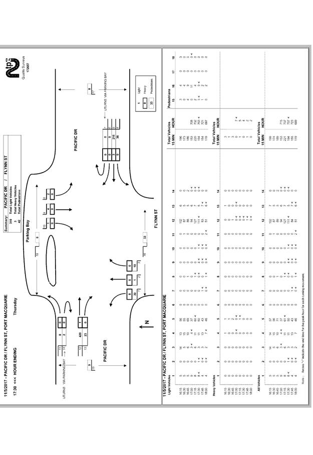
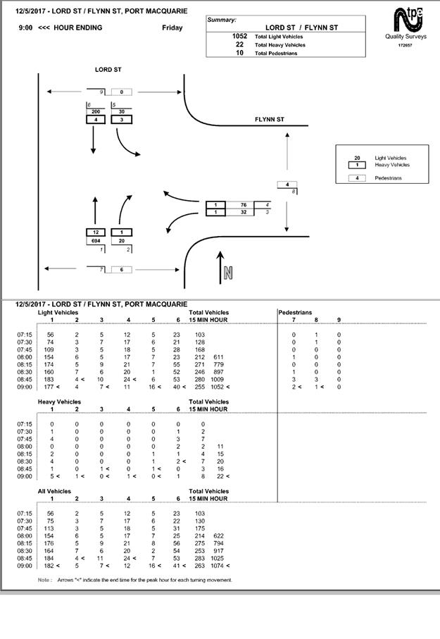
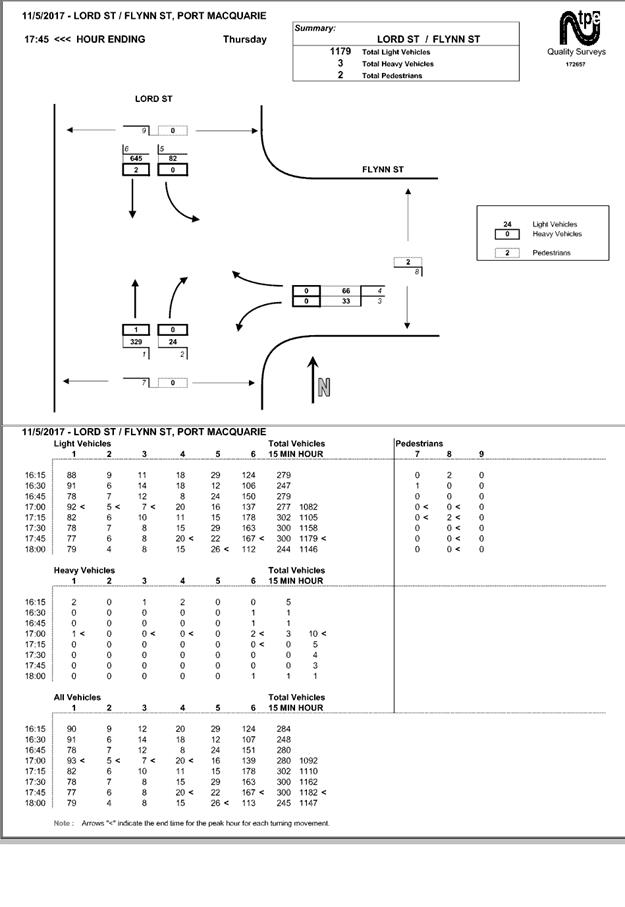
Traffic and Transport
The application includes Traffic Impact Assessment prepared
by King and Campbell, February 2018.
For the purposes of this
development it is assumed that the proposed 128 space child care centre will be
a long-day care centre. It is estimated that 100% of the attendees will arrive
between the morning peak of 7am and 9am with 30% leaving between 2:30pm and 4pm
with the remaining 70% of attendees leaving between 4pm and 6pm.
The proposal is therefore
considered to generate peak vehicle trips based on the RMS’s Guide for
mean peak generation rates as follows:
· 7am
to 9am – (0.8 of 128) 103 trips;
· 2:30pm
to 4pm – (0.3 of 128) 39 trips; and
· 4pm
to 6pm – (0.7 of 128) 90 trips.
From the above information it was
determined that the AM peak would have the greatest impact on the road network
and as such was adopted as the basis for the intersection modelling.
Trip generation calculations were
undertaken as part of the Traffic Impact Assessment based on the above
assumptions and information from the RMS guide which determined that the
development is expected to generate 103 peak hour trips during the morning
peak. The 103 Peak hour trips were split evenly between inward and outward
bound trips to accommodate the expected traffic flows of a childcare facility.
Calculations were undertaken as
part of the traffic impact assessment to determine the capacity of the road
network to cater for the proposal. The assessment found that for Ngamba Place,
the existing peak hour traffic is around
· AM
peak hour (7:30-8:30am), 6 southbound trips per hour, and 55 northbound trips.
These numbers are consistent with
Council data.
In line with Table D1.5
Characteristics of Roads in Residential Subdivision Road Networks the addition
in traffic associated with the development is unlikely to have any adverse
impacts to the existing road network within the immediate locality.
However Council staff consider that intersection improvement works are required
at the intersection of Ngamba Place & McGilvray Road to accommodate the safe
access of vehicles due to the increase in traffic associated with the proposed
development. Refer to recommended conditions of consent.
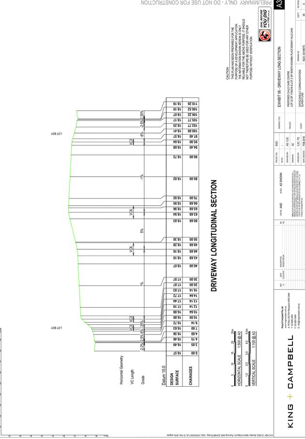
Site Frontage and Access
Vehicular access to the site is proposed through one access
driveway to Ngamba Place. The access can comply with Council AUS-SPEC and
Australian Standards, and conditions have been imposed to reflect these
requirements. The detailed design will need to be lodged with and approved by
Council prior to the issue of the Construction Certificate for the building,
and works completed and accepted by Council prior to Occupation Certificate.
During the exhibition period,
public submissions raised concern regarding safe pedestrian and vehicular
access to the facility in regards to the current condition of the intersection
at Ngamba Place and Bundarra Way. Conditions have been imposed to allow
provision lay back kerb and gutter along the full frontage of Ngamba Place and
Bundarra Way connecting to existing kerb and gutter adjacent to lot 2 DP1079630
(6 Bundarra Way). The kerb is to be positioned 4.5m from the centre line of
Ngamba Place with road widening adjacent to the kerb in accordance with Council
AUS-SPEC standards allowing for on street parking on Ngamba Place. The
proposed footpath invert radius (4m) has been designed to accommodate the
existing manhole.
Concrete footpath paving (minimum
1.5m wide) along the full frontage of Ngamba Place is required due to the size
and nature of the facility allowing for safe pedestrian access.
Parking and Manoeuvring
Table 2.5.1 of the DCP requires parking to be provided at a
rate of 1 space per 4 children. The proposed Centre Based Child Care Facility
seeks to accommodate a total of 128 children in total and therefore generates a
total parking demand of 36 spaces. The architectural plans submitted as a part
of this application demonstrates the sites ability to accommodate a total of 36
spaces on-site including 1 disability compliant space and loading/set down
area.
Parking and driveway widths on site
can comply with relevant Australian Standards (AS 2890) and conditions have
been imposed to reflect these requirements.
Due to the type of development, car
park circulation is required to enable vehicles to enter and exit the site in a
forward manner without reversing or exiting the car parking facility whilst
looking for a parking space internally. In addition, AS 2890 provides that this
facility is Class 3 (a high-turnover facility) requiring larger aisles and
parking spaces.
Surplus parking demands can be
accommodated on Ngamba Place, within walking distance with footpath provisions
and layback kerb for access.
Utilities
Telecommunication
and electricity services are available to the site. The developer will need to
contact the utilities providers to determine their requirements before the site
can be serviced.
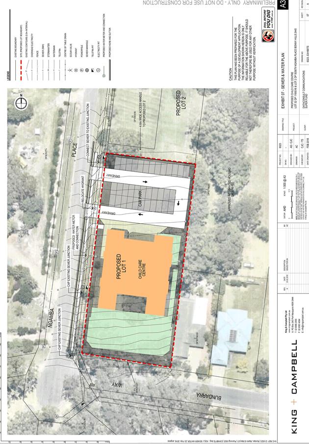
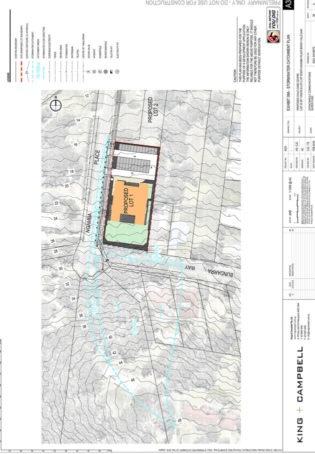
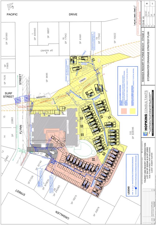
Stormwater
The site naturally grades towards the Ngamba Place street
frontage and is currently un-serviced. The legal point of discharge for the
proposed development is defined as direct
connection into the proposed 375mm pipe along Ngamba Place.
A detailed site stormwater
management plan will be required to be submitted for assessment with the Local
Government Act (s68) and Roads Act (s138) applications prior to the issue of a
CC.
In accordance with Council’s
AUS-SPEC requirements, the following must be incorporated into the stormwater
drainage plan:
· On
site stormwater detention facilities to conform to AUS-SPEC D5
· Water
quality controls to comply with AUS-SPEC D7
Refer to recommended conditions of
consent.
Water
Supply Connection
Council records indicate that proposed Lot 1 does not
currently have a metered water service. Final water service sizing will need to
be determined by a hydraulic consultant to suit the domestic and commercial
components of the development, as well as fire service and backflow protection
requirements in accordance with AS3500.
The existing water hydrant must be
relocated clear of the proposed driveway at no cost to Council.
Water
cycle
The proposed
development will be unlikely to have any adverse impacts on water resources and
the water cycle.
Soils
The
proposed development will be unlikely to have any adverse impacts on soils in
terms of quality, erosion, stability and/or productivity subject to a standard
condition requiring erosion and sediment controls to be in place prior to and
during construction.
Air
and microclimate
The
construction and/or operations of the proposed development will be unlikely to
result in any adverse impacts on the existing air quality or result in any
pollution. Standard precautionary site management condition recommended.
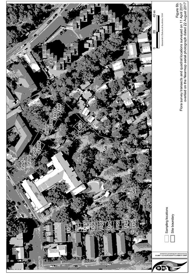
Flora and
fauna
The majority of trees located on
site are proposed to be removed. The trees proposed to be removed have been
marked on the landscape plan. The removal of these trees has been considered by
JB Enviro as a part of the Statutory Ecological Impact Assessment which has
been referred to Council’s ecologist who has concurred with the proposal
and applied conditions of consent. Compensatory tree planting is proposed to be
provided.
Waste
Satisfactory
arrangements are in place for proposed storage and collection of waste and
recyclables. A private waste collection service is recommended. An appropriate
condition is recommended in this regard. No adverse impacts anticipated.
Standard precautionary site management condition recommended.
Energy
The
proposal includes measures to address energy efficiency and will be required to
comply with the requirements of Section J of the Building Code of Australia. No
adverse impacts anticipated.
Noise
and vibration
Noise
during the operation of the child care centre will come from children, parents
and staff during the operating hours. Noise emitted would be sporadic depending
on time of day and particularly whether children are using the outdoor play areas.
Noise at the boundary of adjoining properties is likely to be acceptable having
regard for the residential uses, the typical hours of operation (no weekend
operations), the site being adjacent to a busy road – Ocean Drive and the
wider general acceptance of co-existence of child care centres, schools and the
like within a residential neighbourhood. No recommended conditions are
considered necessary to restrict the hours of outdoor play.
A
condition is recommended to restrict construction to standard construction
hours.
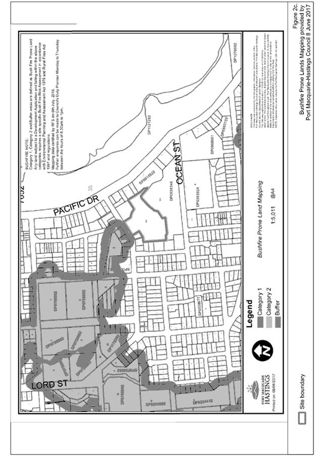
Bushfire
The
site is identified as being bushfire prone and the application has been
referred to the Rural Fire Service who have issued a bushfire authority with
conditions.
Safety,
security and crime prevention
The
proposed development will be unlikely to create any concealment/entrapment
areas or crime spots that would result in any identifiable loss of safety or
reduction of security in the immediate area. An on-site manager will further
assist in managing this issue.
Social
impacts in the locality
Given
the nature of the proposed development and its’ location, the proposal is
unlikely to result in any adverse social impacts.
Economic
impact in the locality
No adverse
impacts. A likely positive impact is that the development will maintain
employment in the construction industry, which will lead to flow impacts such
as expenditure in the area.
Site
design and internal design
The
proposed development design satisfactorily responds to the site attributes and
will fit into the locality. No adverse impacts likely.
Construction
No potential
adverse impacts identified to neighbouring properties with the construction of
the proposal.
Cumulative Impacts
The proposed
development is not expected to have any adverse cumulative impacts on the
natural or built environment or the social and economic attributes of the
locality.
(c) The suitability of the site for
the development:
The proposal
will fit into the locality and the site attributes are conducive to the
proposed development.
(d) Any submissions made in
accordance with this Act or the Regulations:
Two (2) written submissions have been received following public
exhibition of the application.
Key issues raised in the submissions received and comments
in response to these issues are provided as follows:
|
Submission
Issue/Summary
|
Planning
Comment/Response
|
|
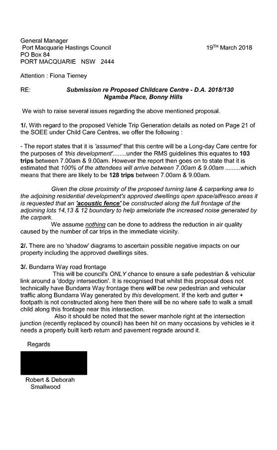
Traffic numbers and air
quality and noise generated by the carpark
|
Traffic numbers and movements
have been assessed by Council’s engineers and considered that the road network
has the capability of supporting the proposed development.
It is not considered that
traffic emissions will be excessive so as to require pollution treatment.
Given the relatively short
window of peak traffic movements and operating hours not commencing until
7am, the anticipated noise generated by the development is not considered
likely to create undue noise nuisance to adjoining properties. Impacts are
considered to be balanced by the site not being in use on weekends. The
cutting in of the development into the site, setbacks and room placement also
assists in ameliorating impacts form both traffic and general use of the
site.
|
|
Overshadowing- negative impacts
|
It is considered that that with the orientation of the
development to the west of the adjoining approved multi dwelling residential
development, building setbacks of 5.3 m and building height less than 8. 5m,
there will not be significant adverse overshadowing impacts. A detailed
overshadowing analysis is not considered to be justified noting the
development/site attributes.
|
|
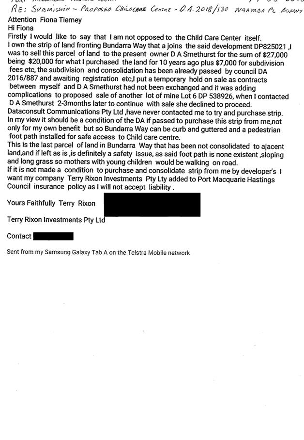
Safe kerb and gutter should be constructed on Bundara Way
|
The site is unusual in that there is a thin piece of land
that cannot be developed. The site has been examined by Council’s
engineers and it is considered reasonable that the kerb and gutter be
completed to close off the final piece of road/stormwater network. See
engineering comments above and recommended conditions of consent.
|
(e) The Public Interest:
The proposed
development satisfies relevant planning controls and is unlikely to impact on
the wider public interest. The provision of child care centres are considered
to be an important element in a growing community such as Bonny Hills
4. DEVELOPMENT
CONTRIBUTIONS APPLICABLE
· Development contributions will be required towards
augmentation of town water supply and sewerage system head works under Section
64 of the Local Government Act 1993.
· Development contributions will be required under Section
7.11 and 7.12 of the Environmental Planning and Assessment Act 1979 towards
roads, open space, community cultural services, emergency services and
administration buildings.
5. CONCLUSION
The application has been assessed in accordance with
Section 4.15 of the Environmental Planning and Assessment Act 1979.
Issues raised during assessment and public exhibition of
the application have been considered in the assessment of the application.
Where relevant, conditions have been recommended to manage the impacts
attributed to these issues.
The site is suitable for the proposed development, is not
contrary to the public's interest and will not have a significant adverse
social, environmental or economic impact. It is recommended that the
application be approved, subject to the recommended conditions of consent
provided in the attachment section of this report.
|
Attachments
1View. DA2018
- 130.1 Plans
2View. DA2018
- 130.1 Recommended Conditions
3View. DA2018
- 130.1 Submission - Rixon
4View. DA2018
- 130.1 Submission - Smallwood
|
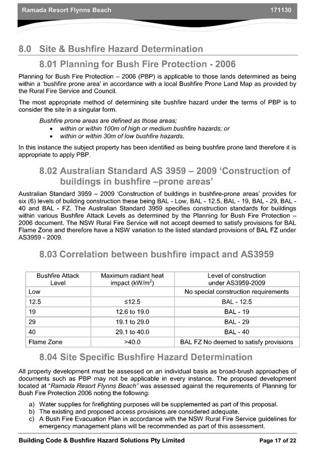
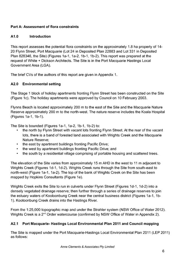
AGENDA Development Assessment Panel 27/06/2018
Item: 06
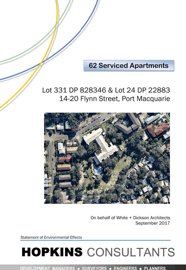
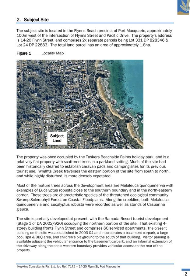
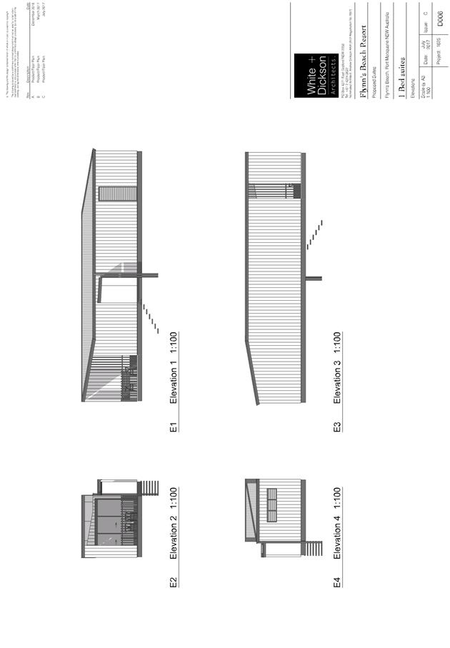
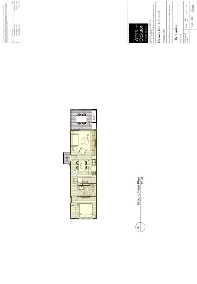
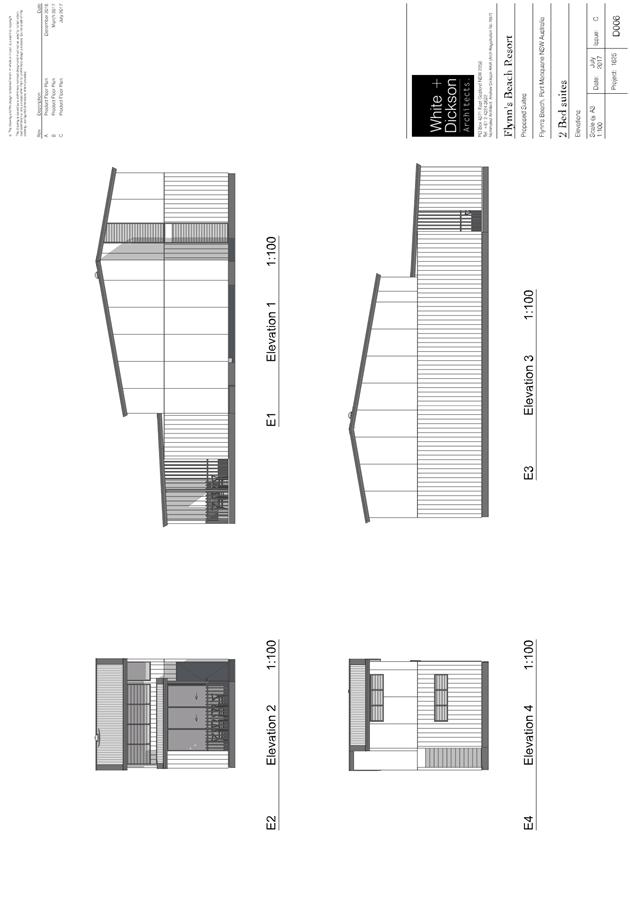
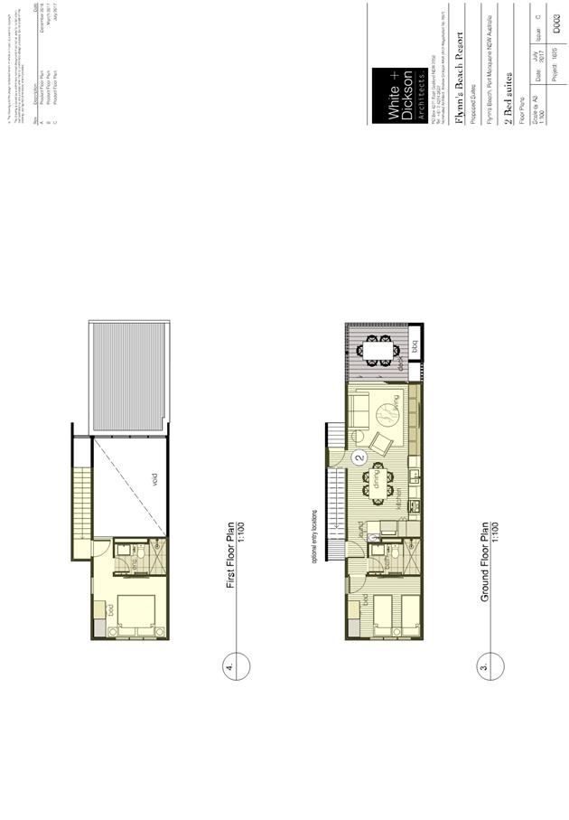
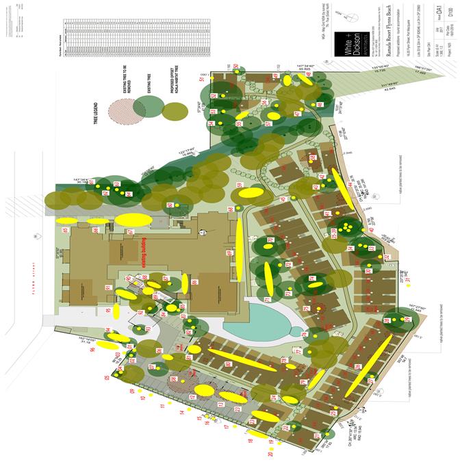
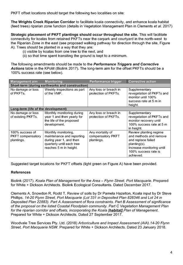
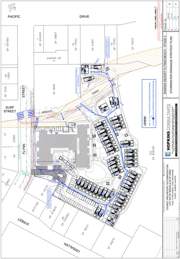
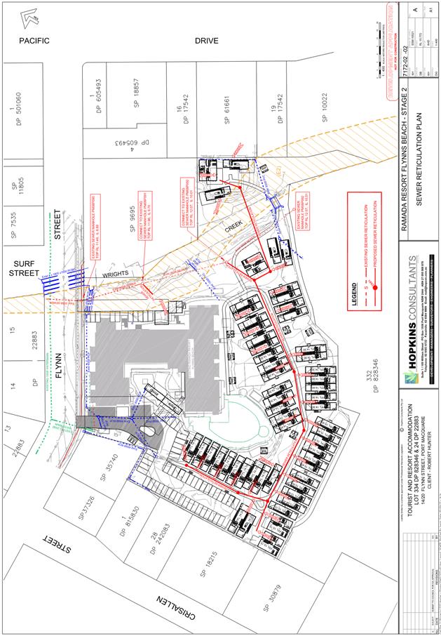
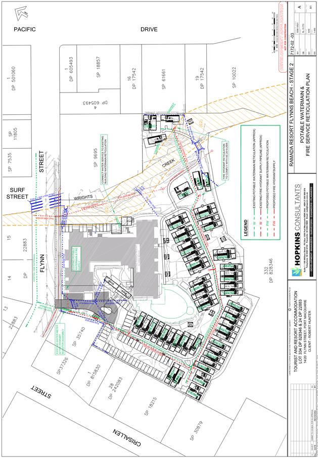
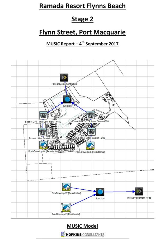
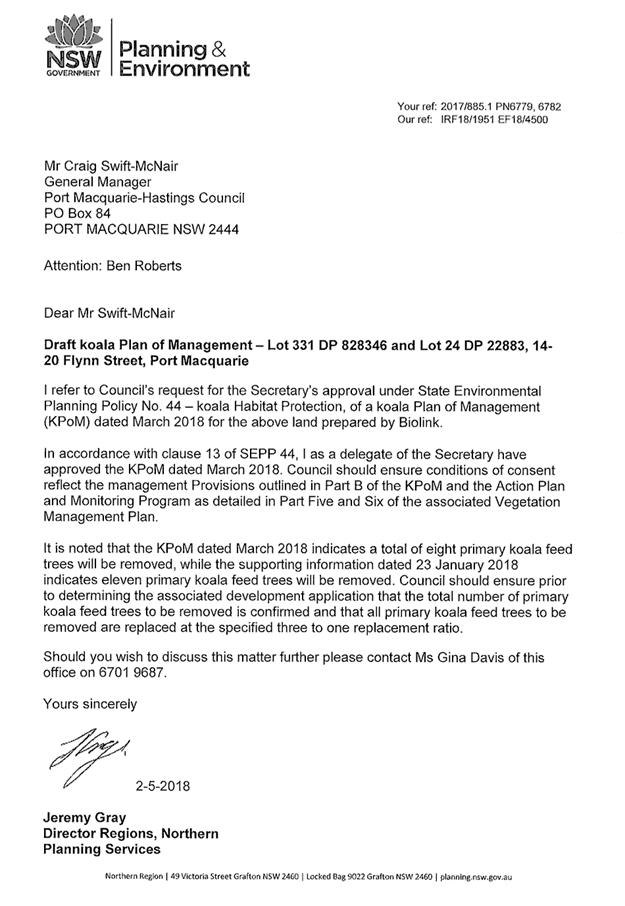
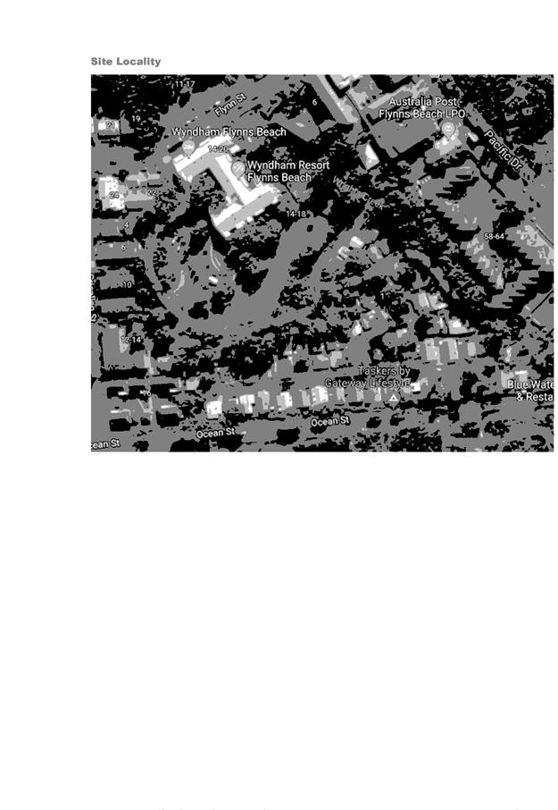
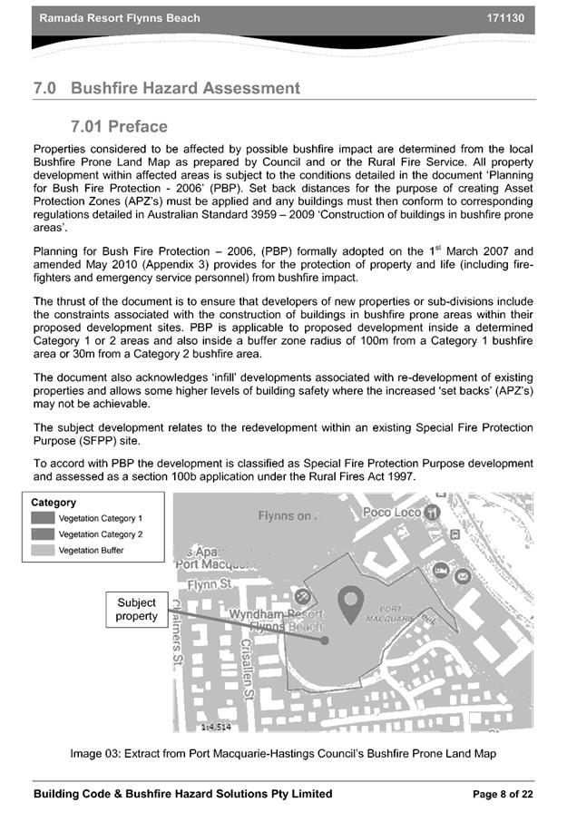
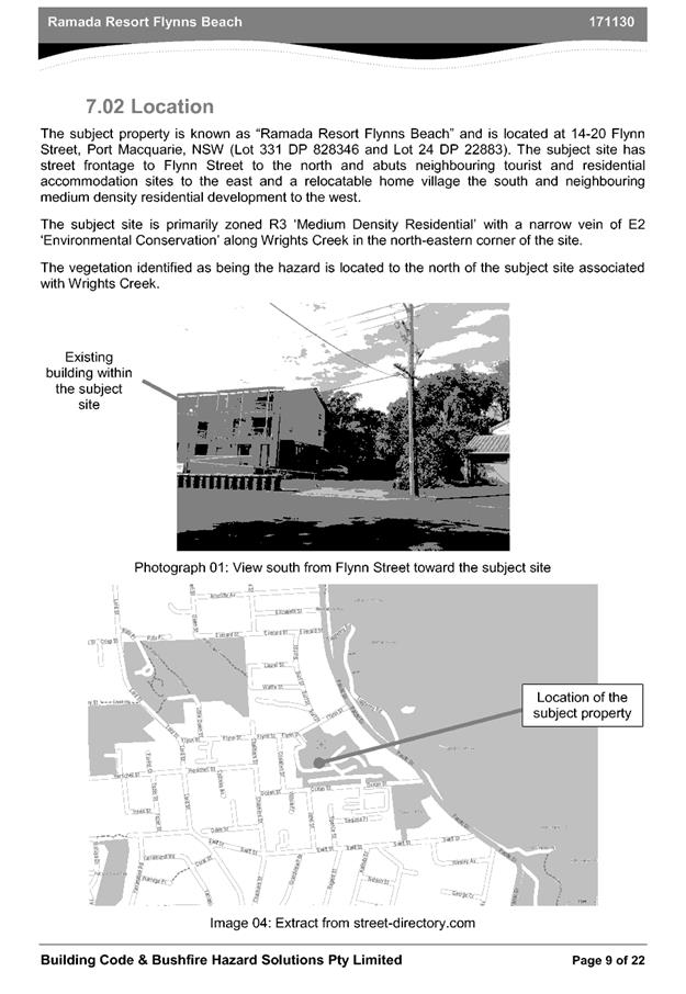
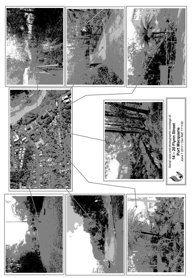
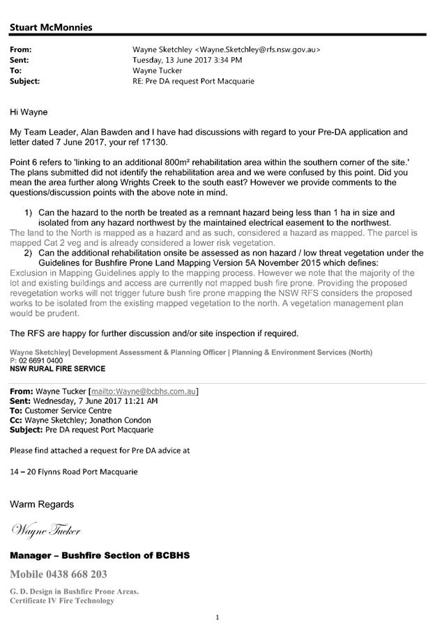
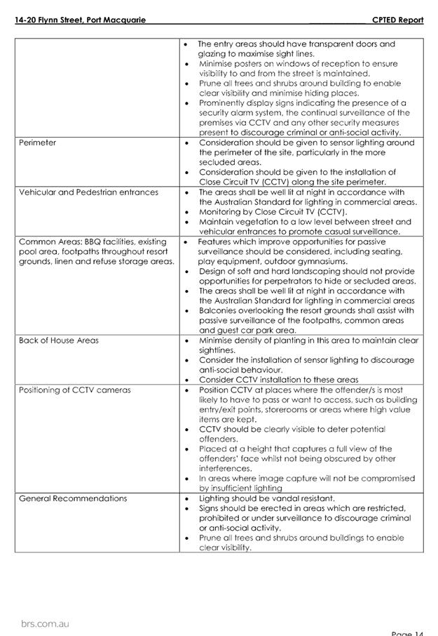
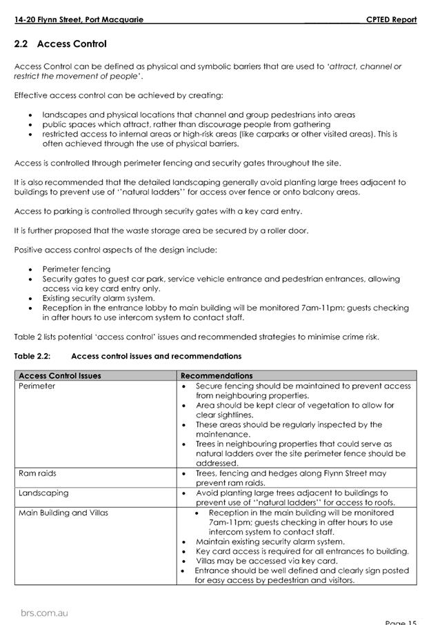
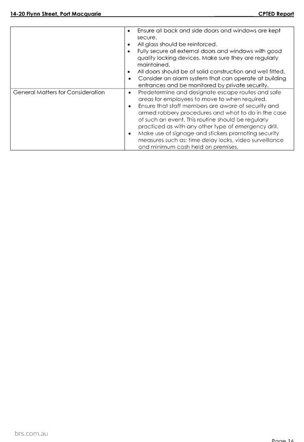
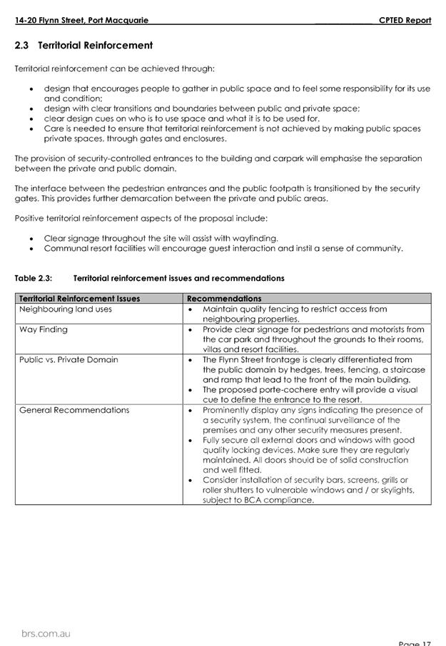
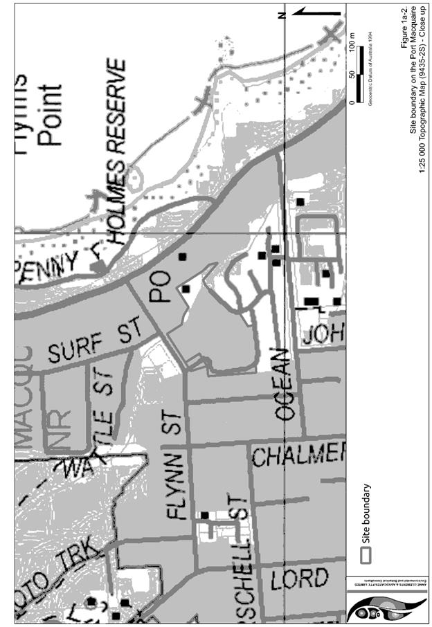
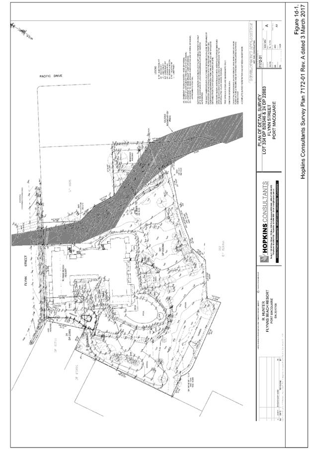
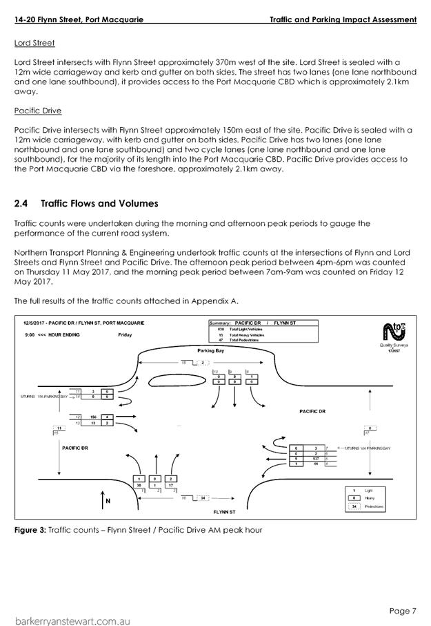
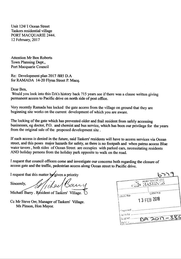
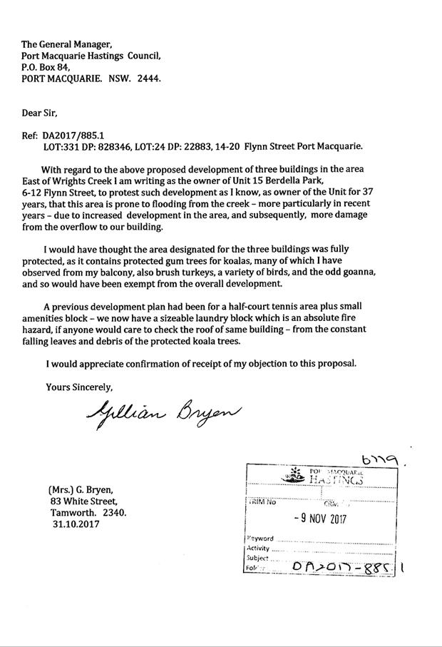
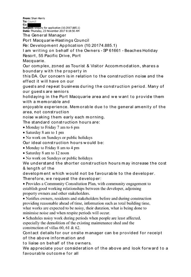
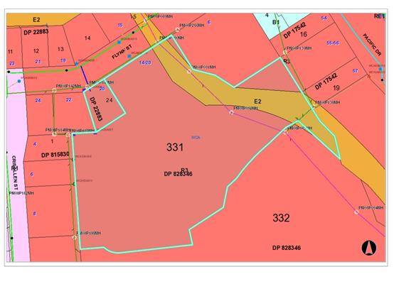
Subject: DA2017 - 885.1 Tourist And Visitor
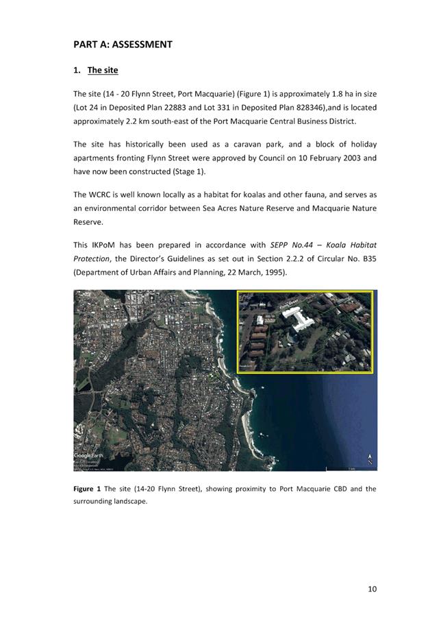
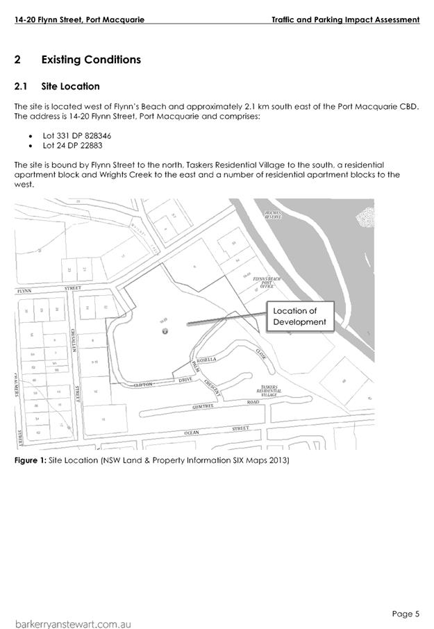
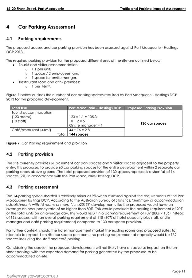
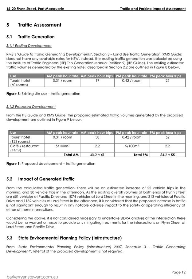
Accommodation - Lot 331 DP828346, Lot 24 DP 22883, 14-20 Flynn Street, Port
Macquarie
Report
Author: Benjamin Roberts
|
Applicant: Builtsmart
Group Pty Ltd
Owner: Permanent
Trustee Australia Ltd
Estimated Cost: $10,942,792
Alignment with Delivery
Program
4.3.1 Undertake transparent
and efficient development assessment in accordance with relevant legislation.
|
|
RECOMMENDATION
1. That
DA2017 – 885.1 for tourist and visitor accommodation at Lot 331, DP
828346 and Lot 24, DP 22883, No. 14-20 Flynn Street, Port Macquarie, be
determined by granting consent subject to the recommended conditions.
2. That
the Koala Plan of Management be approved in granting consent to the
development application.
|
Executive
Summary
This
report considers a development application for tourist and visitor
accommodation at the subject site and provides
an assessment of the application in accordance with the Environmental Planning
and Assessment Act 1979.
Following exhibition of the
application, five (5) submissions have been
received.
The application was considered at Council’s
development assessment panel on 13 June 201, where it was resolved:
“That DA2017 –
885.1 for tourist and visitor accommodation at Lot 331, DP 828346 and Lot 24,
DP 22883, No. 14-20 Flynn Street, Port Macquarie, be deferred to enable the
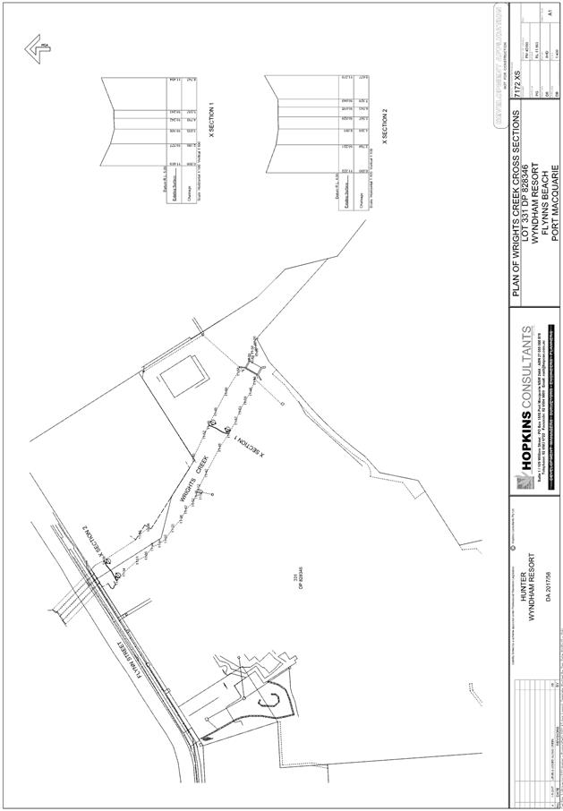
applicant to address the following:
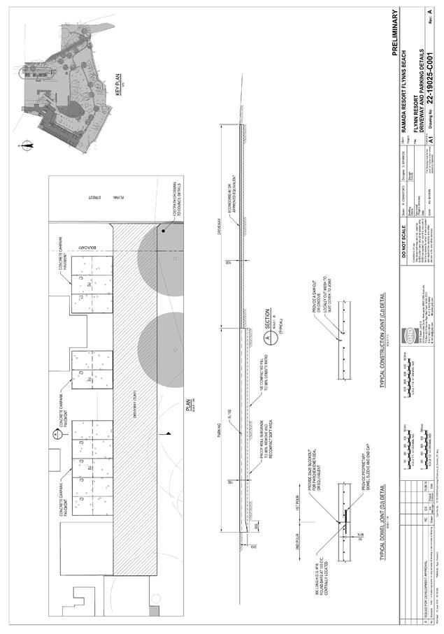
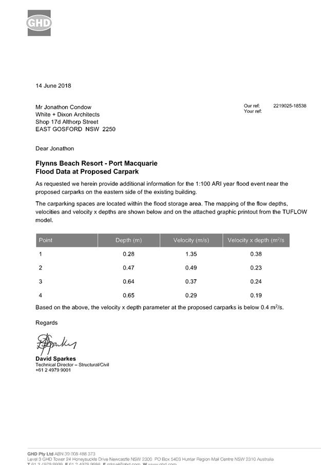
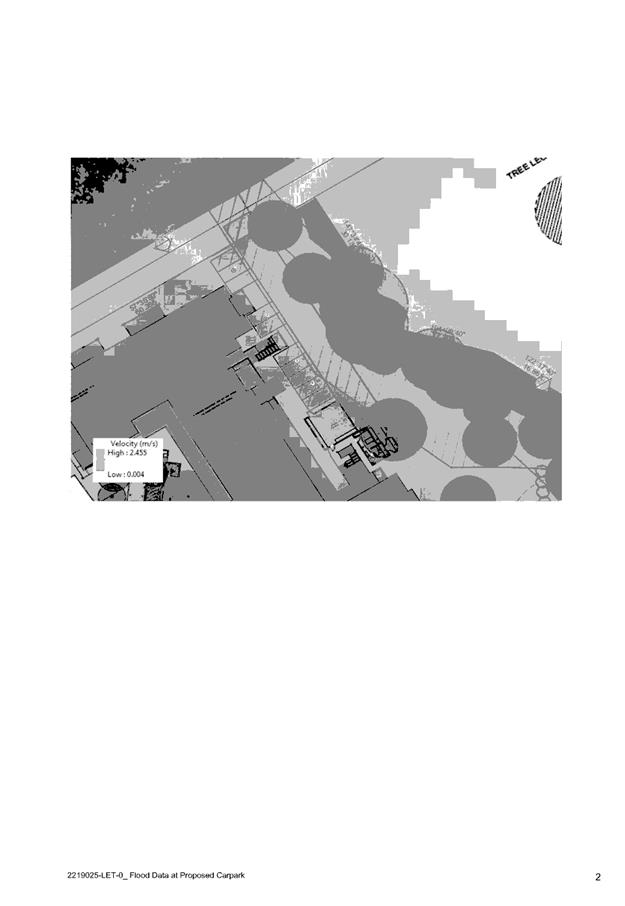
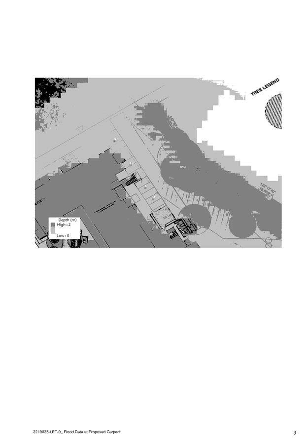
1. To
review the proposed pathways and parking areas adjacent to the Wrights Creek
environs to determine the level of risk to persons and property is acceptable.
This includes the access/pathways to villas 56, 57 and 58.
·
2. To
provide details satisfying the proposed draft conditions of consent B25, B26,
and B27.
The applicant has submitted additional information and
revised plans in response to the reasons for deferral. The additional
information and revised plans are attached to this report. Council technical
staff have reviewed the additional information and provided further comment
under clause 7.3 heading of Port Macquarie-Hastings Local Environmental Plan
2011 within this report.
1. BACKGROUND
Existing sites features and surrounding and existing
development
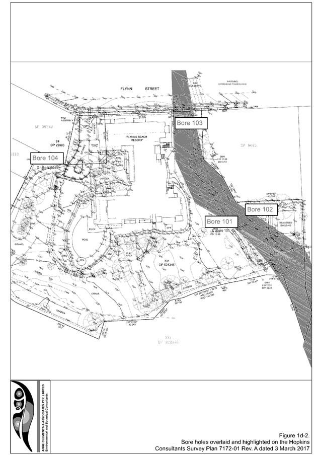
The site comprises two separate parcels being; Lot 331 DP 828346 and
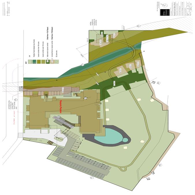
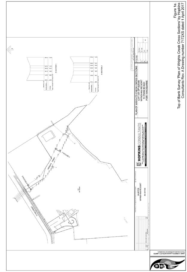
Lot 24 DP 22883 with a combined land area of 18,053.87m2. The property is relatively flat with Wrights Creek
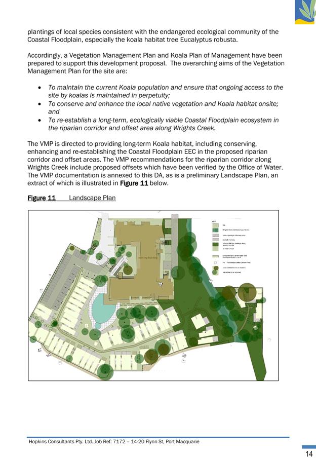
traversing its eastern portion.
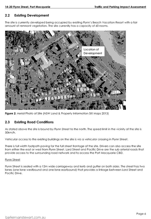
The site currently comprises a
four (4) storey serviced apartment building fronting Flynn Street, comprising
sixty (60) serviced apartments in three blocks with basement parking, swimming
pool and children’s playground area.
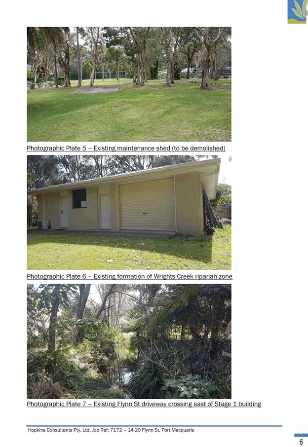
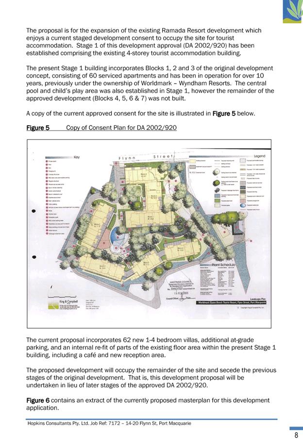
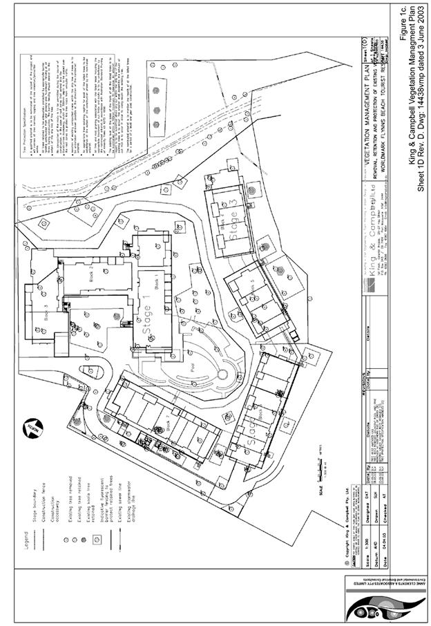
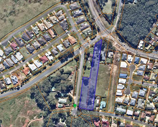
These existing buildings and amenities
were constructed as part of the first stage of a development consent issued by
Council on 19 February 2003 for a tourist accommodation complex (DA2002/920).
This consent provides for a further 4 detached buildings (4 storeys in height))
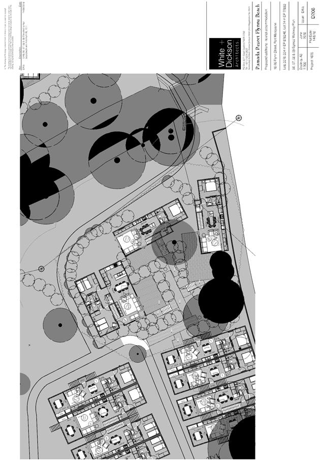
which have not yet commenced. A copy of the approved site plan is reproduced
below for reference:
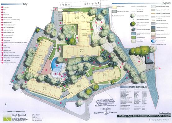
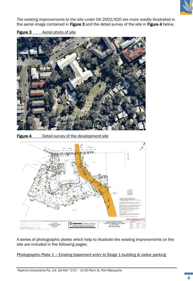
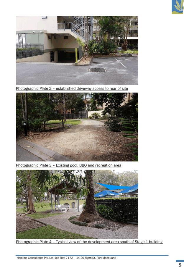
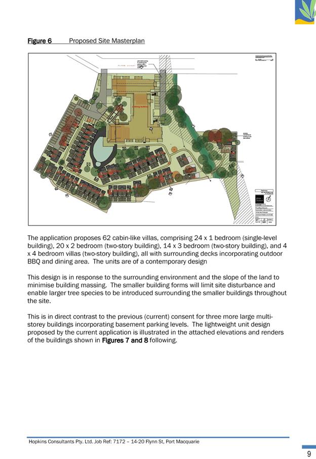
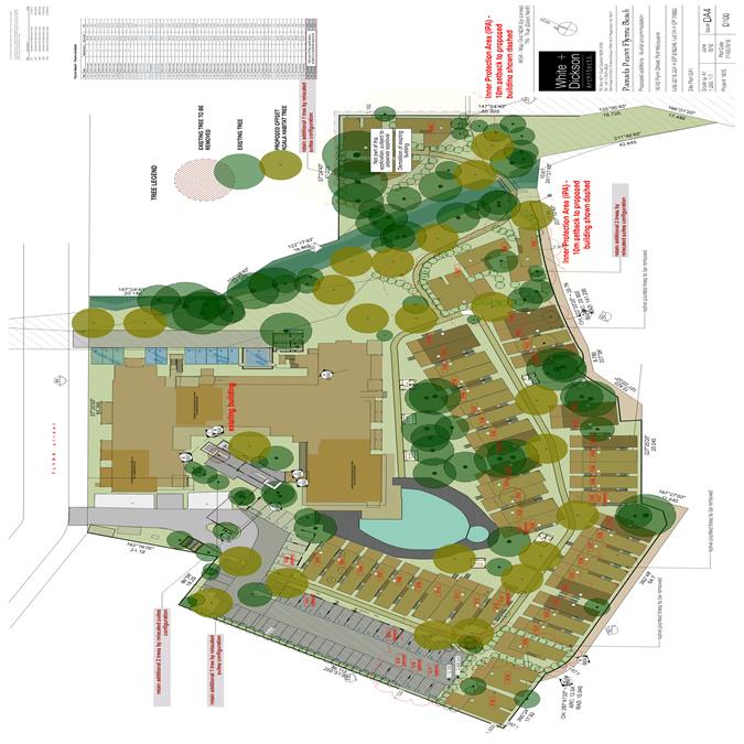
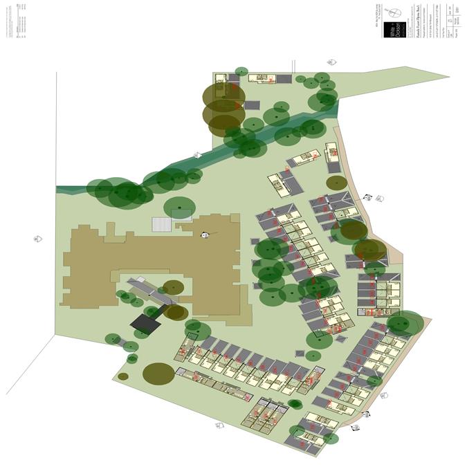
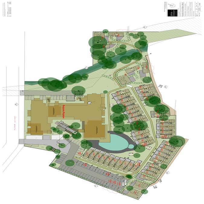
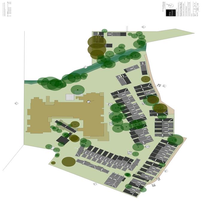
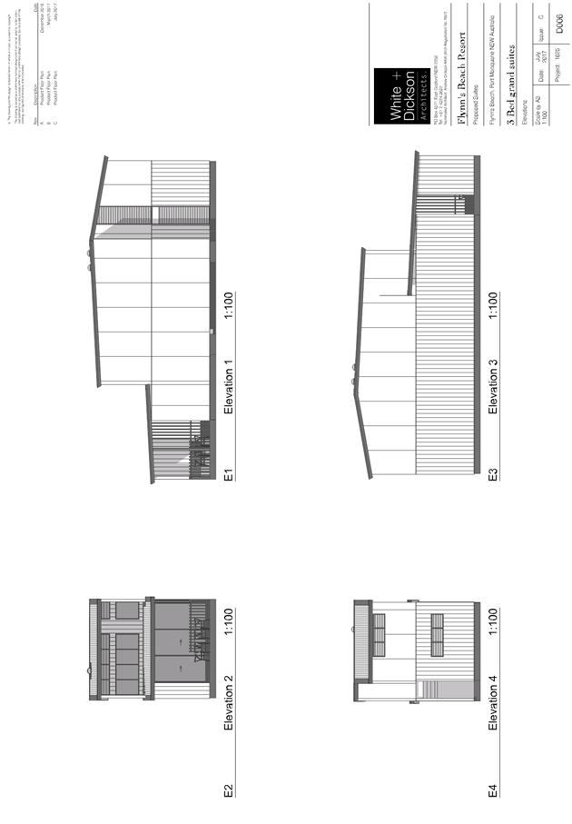
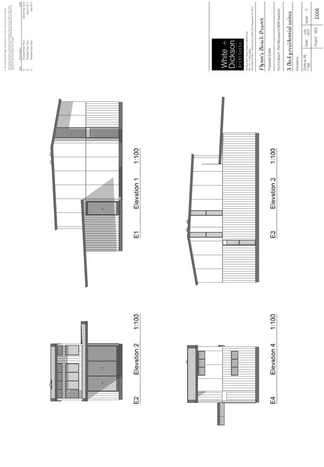
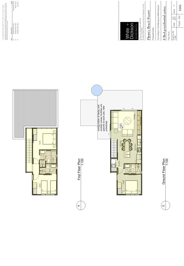
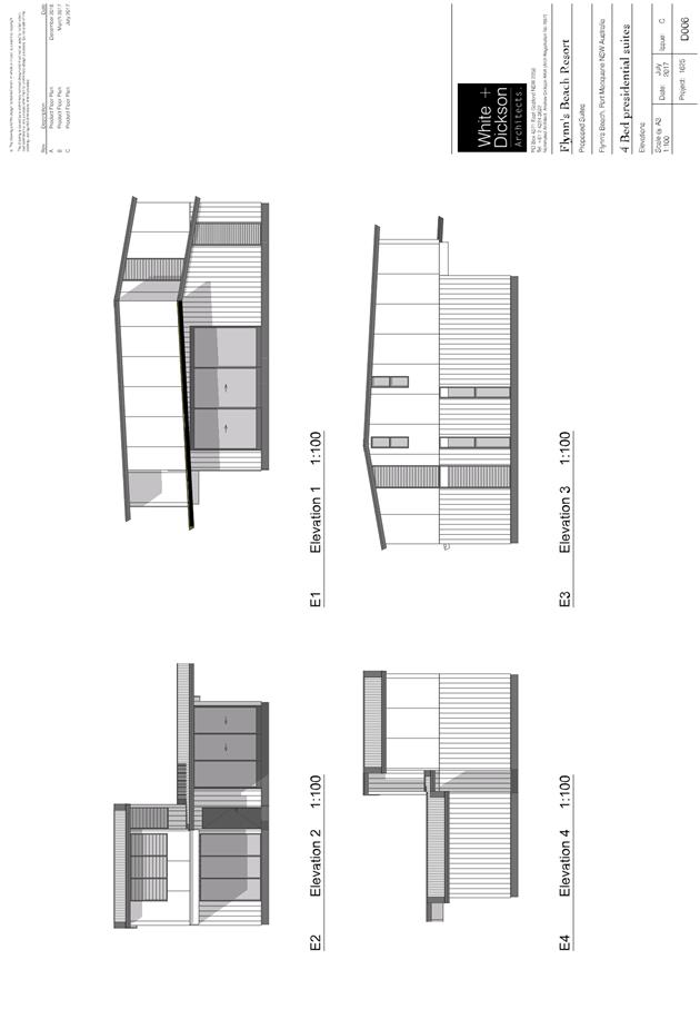
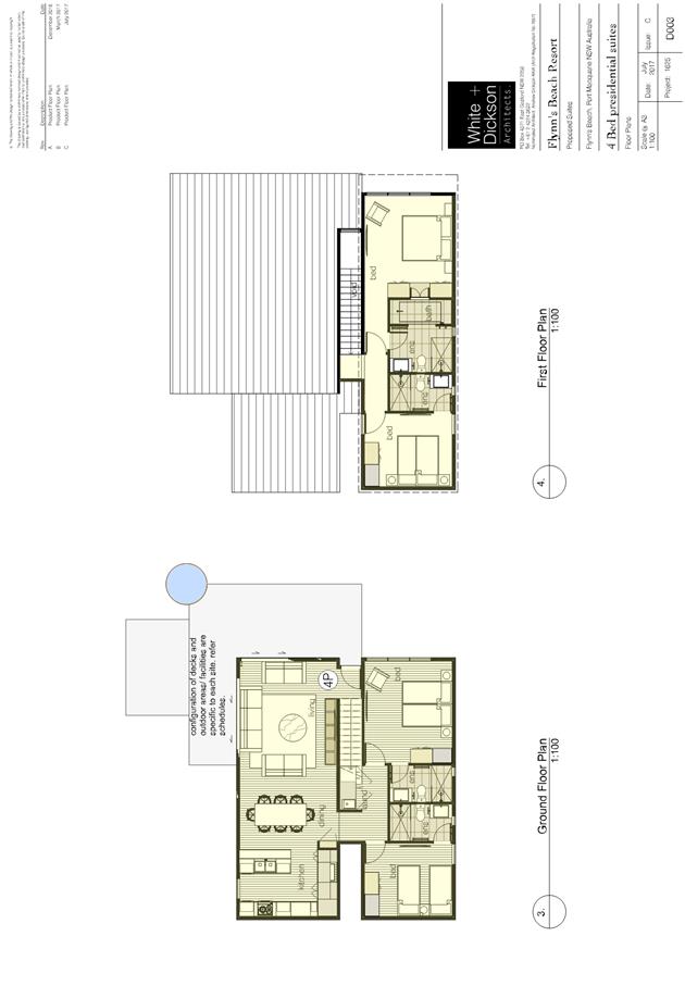
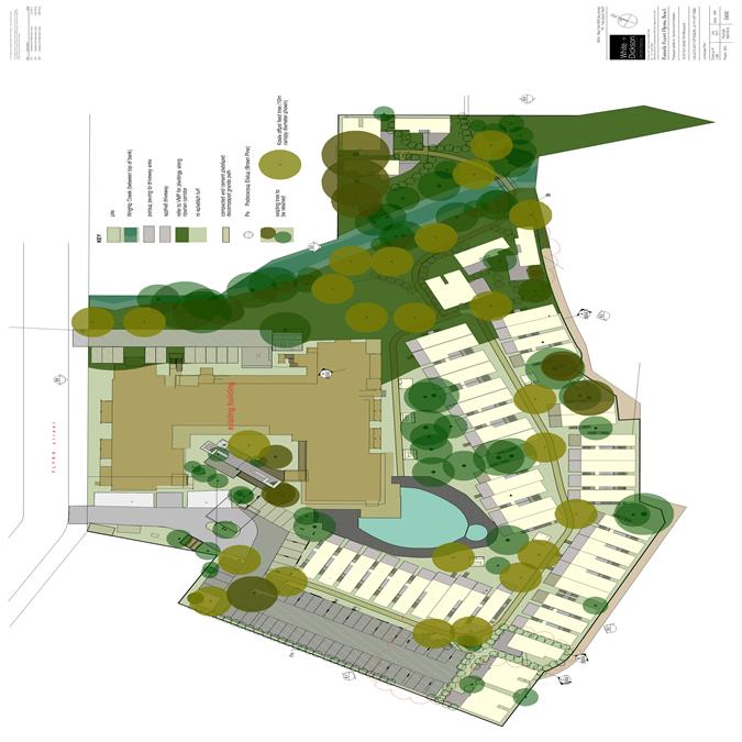
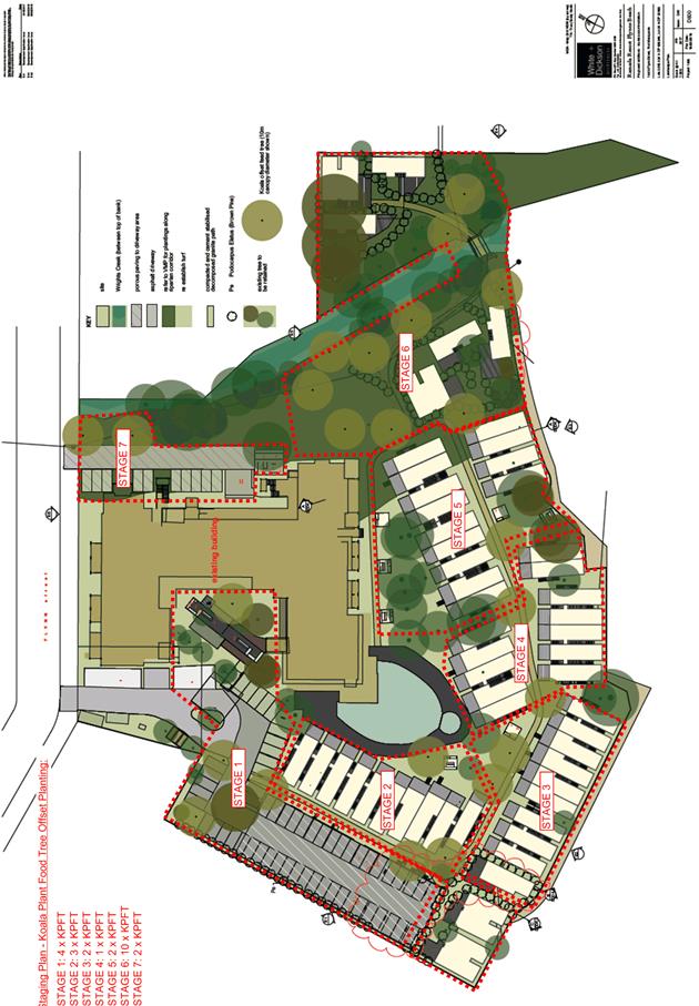
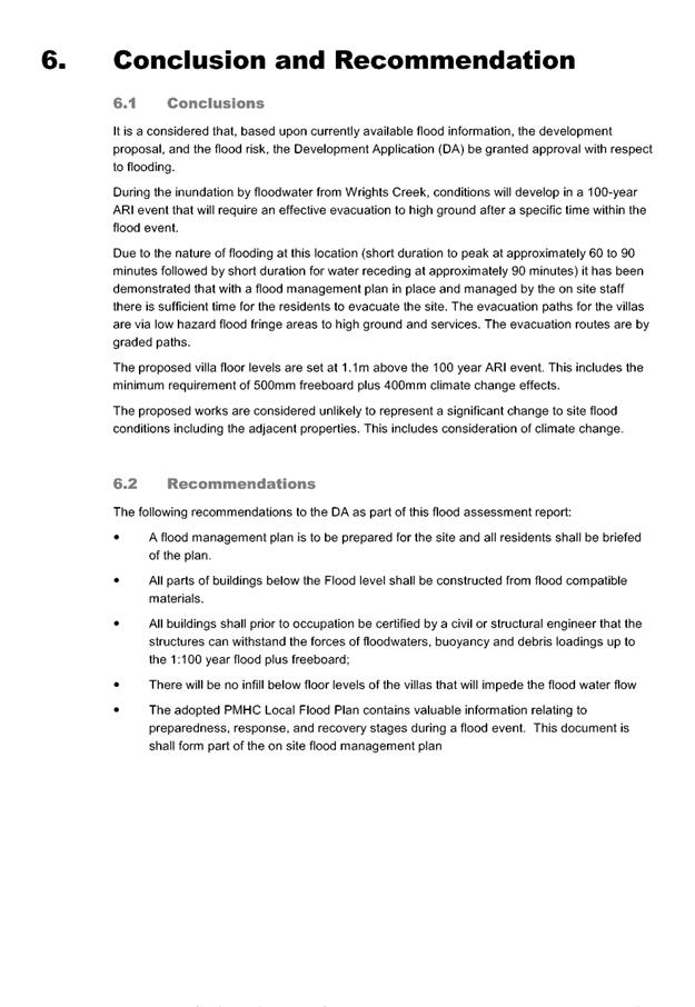
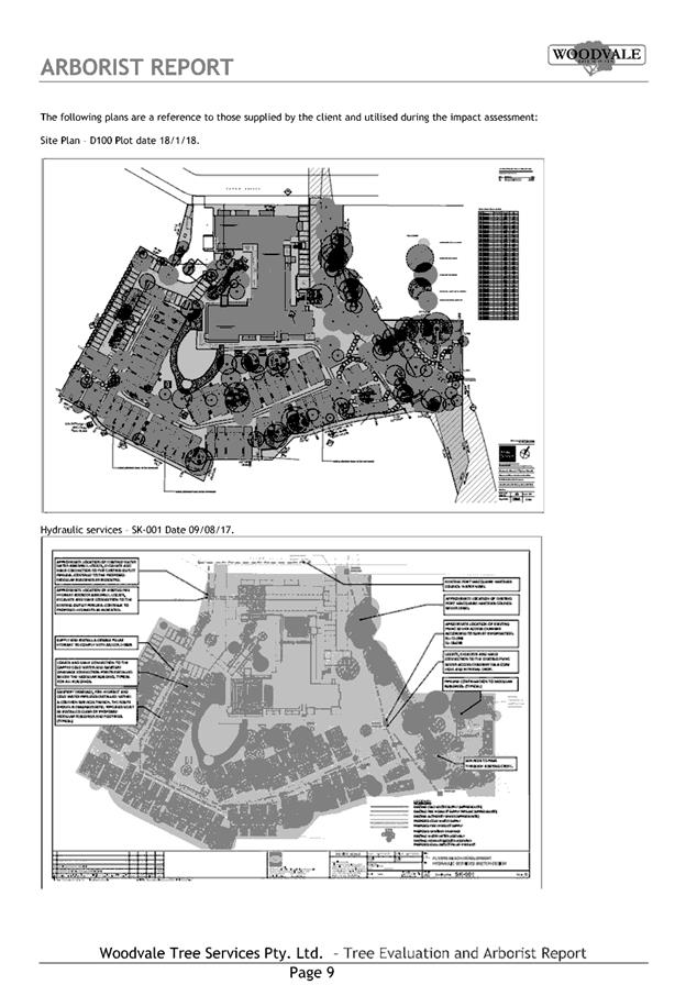
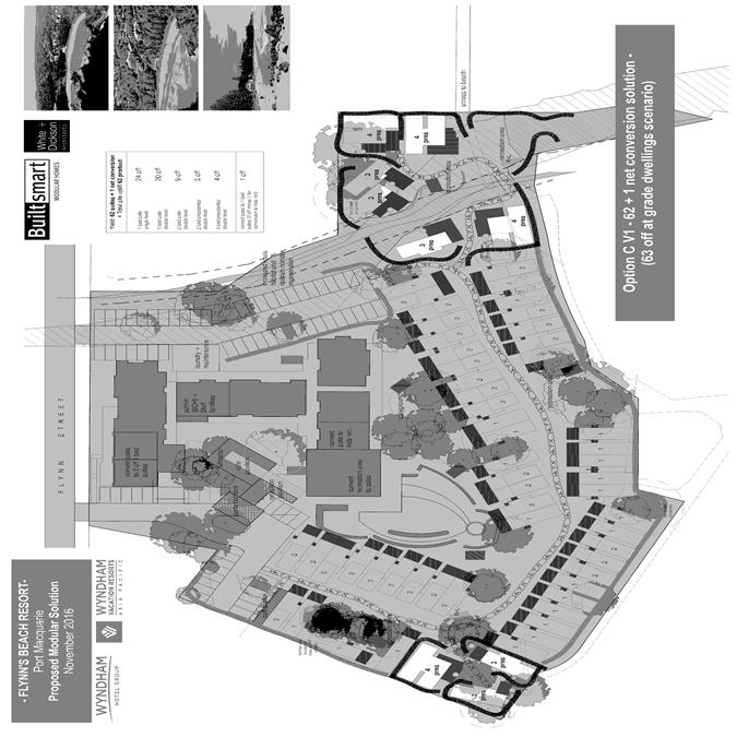
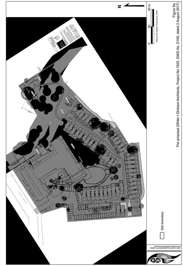
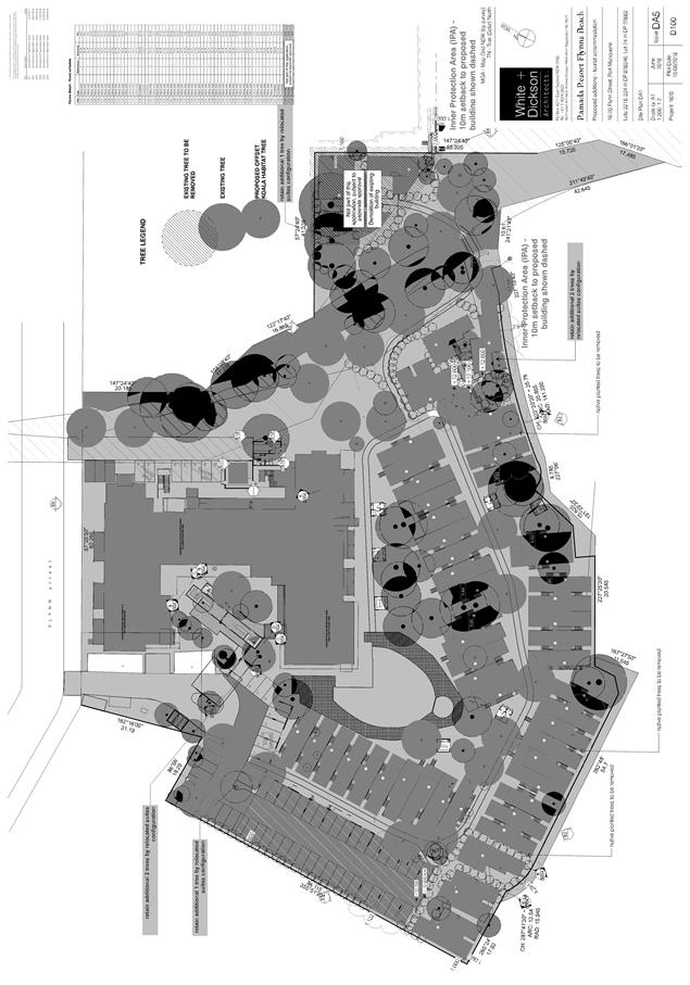
The subject development
application seeks to modify the remaining development approval by incorporating
59 new villa style apartment buildings with at-grade parking in lieu of the
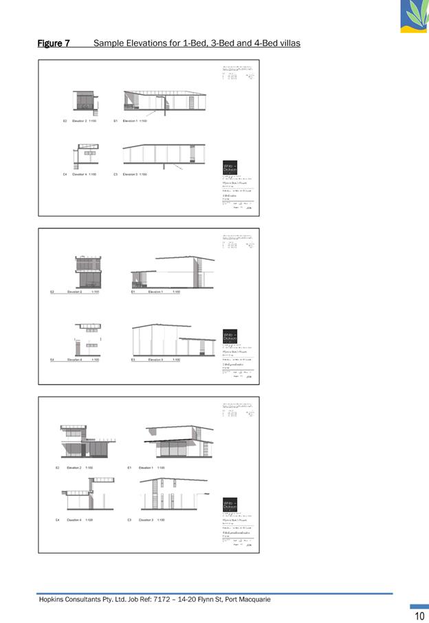
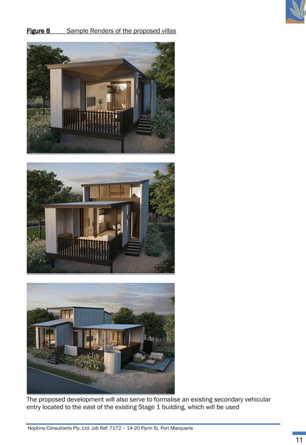
remaining stages of the commenced development consent.
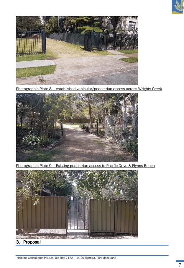
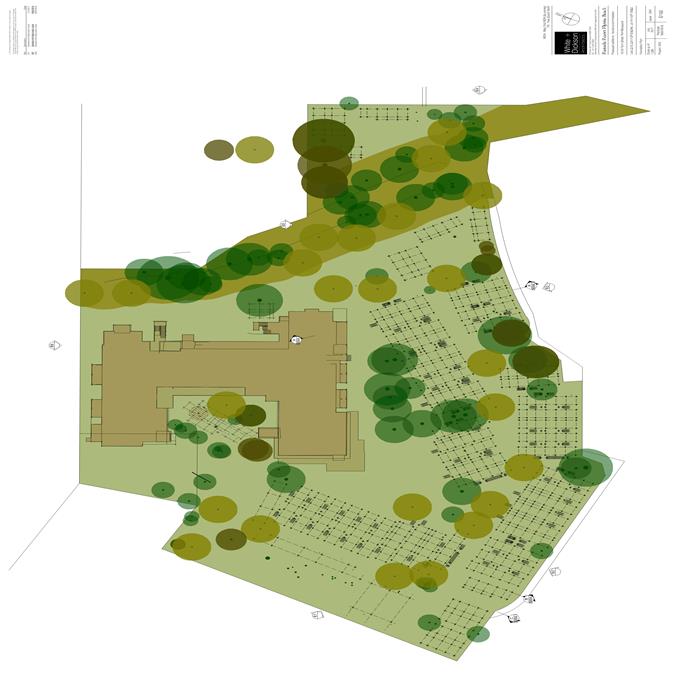
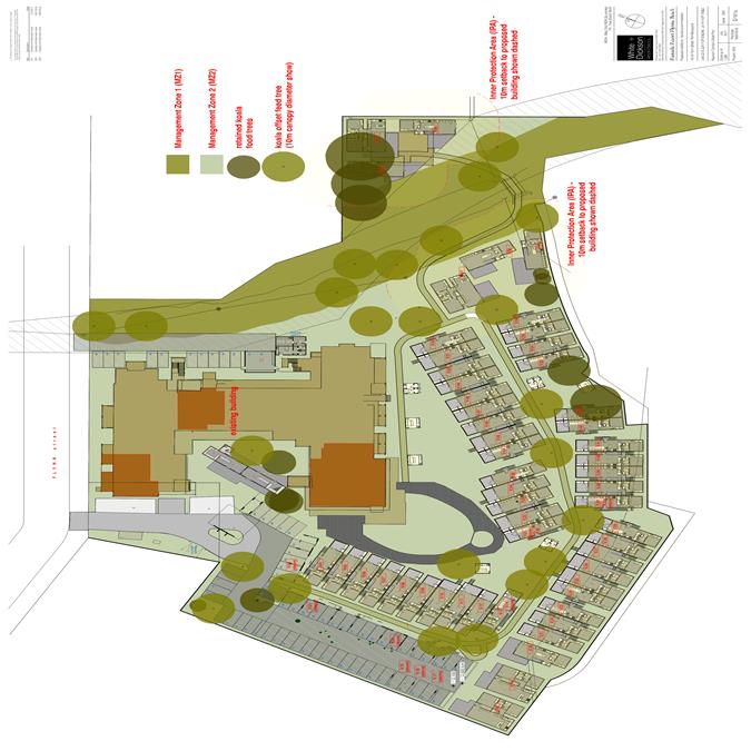
The site is highly modified in
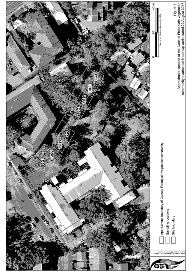
terms of vegetation however scattered trees exist throughout with evidence of
remnant riparian vegetation adjoining Wrights Creek.
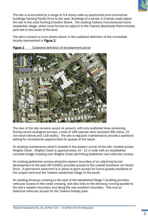
Adjoining the site to the east is
a mixture of both 3 and 4 storey walk up style apartment and commercial
buildings fronting Pacific Drive and Flynn Street. Adjoining the site
immediately to the north is Council owned land containing the Wrights Creek riparian
corridor. Adjoining development to the northeast comprises a mixture of 3 to 4
storey unit buildings. Adjoining development to the northwest is 3 storey unit
complex with single storey dwellings further along the northern side of Flynn
Street. Adjoining the site to the west is a combination of both 2 and 3 storey
unit complexes. Adjoining the site to the south is a manufactured home estate
often referred to as “Taskers Village” comprising single storey
cabin style manufactured homes.
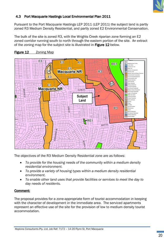
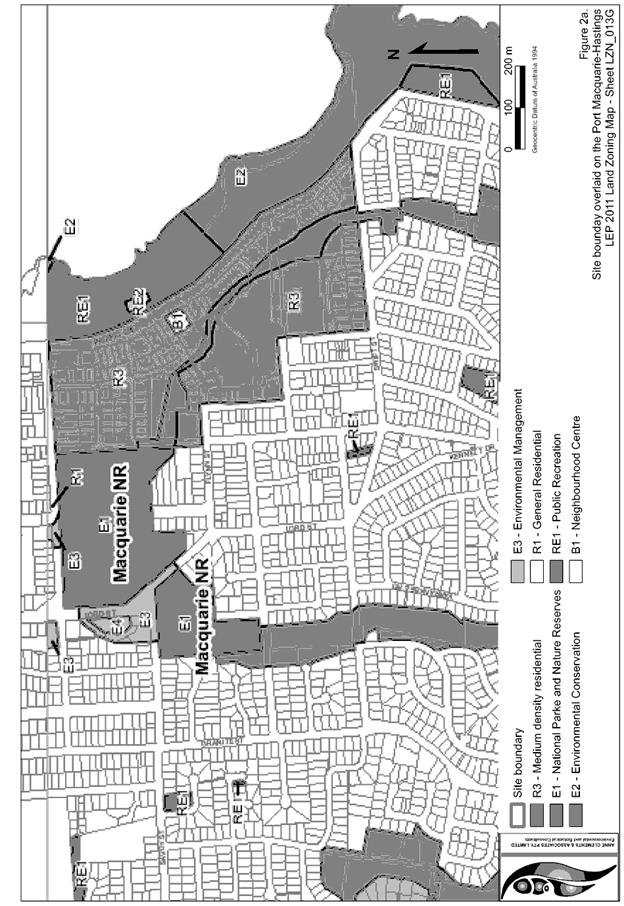
The site is zoned R3 Medium Density and E2
Environmental Conservation in accordance with the
Port Macquarie-Hastings Local Environmental Plan 2011, as shown in the
following zoning plan:
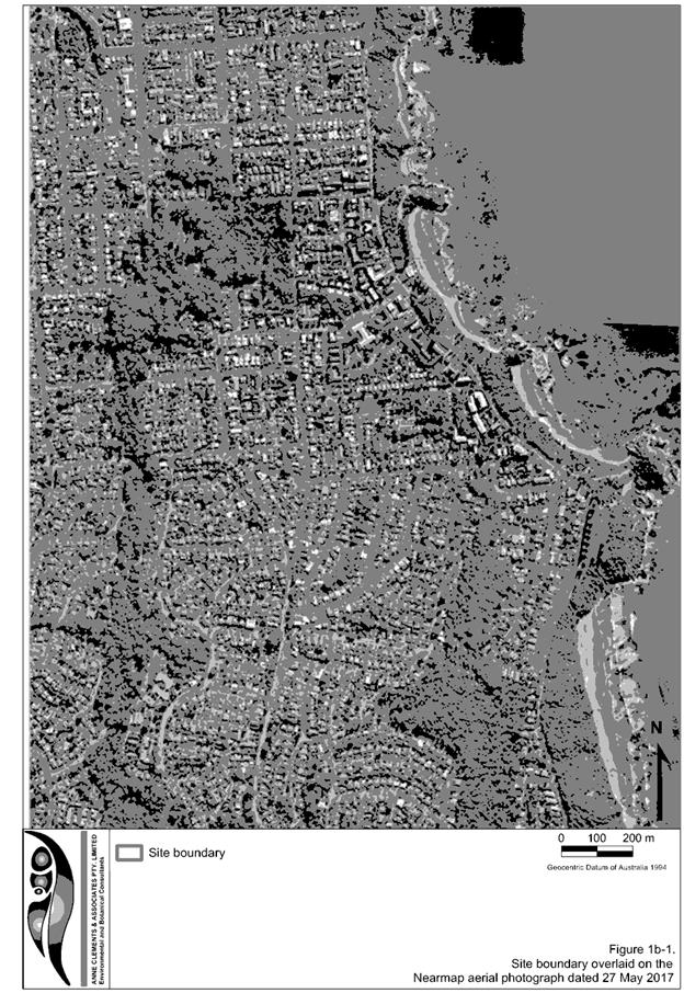
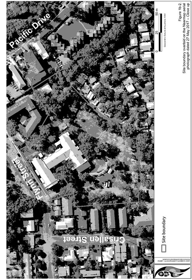
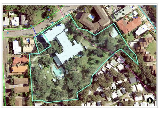
The existing subdivision pattern and location of existing
development within the locality is shown in the following aerial photograph:
2. DESCRIPTION OF
DEVELOPMENT
Key aspects of the proposal include the following:
· Selective
tree removal, including 8 Koala feed trees.
· Construction
of fifty-nine (59) cabin style villas for tourist accommodation use.
· Construction
of at-grade parking.
· Internal
alterations to existing building to convert existing sales area into two
1xbedroom units, convert existing reception area to administration area and
convert existing recreation area and a unit into a sales area.
· Construction
of ancillary café, reception and office building.
· Construction
of ancillary recreational facilities including BBQ and utility pavilions.
· Construction
of ancillary maintenance and staff amenities.
· Retention
and enhancement of riparian corridor adjoining Wrights Creek.
Refer
to attachments at the end of this report.
Application
Chronology
· 4 October 2017 – Application lodged.
· 26 October to 24 November 2017 – Public exhibition.
· 12 October 2017 – Referral to NSW Rural Fire Service.
· 12 October 2017 – Referral to NSW Office of Water.
· 20 October 2017 – Applicant advised that flood impact
assessment deficient. Additional information required.
· 17 November 2017 – Revised flood impact assessment
lodged.
· 21 November 2017 – Additional information request to
applicant.
· 28 November 2017 – Bushfire Safety Authority received
from NSW Rural Fire Service.
· 11 December 2017 – Applicant advised that revised
flood impact assessment still deficient. Additional information required.
· 19 January 2018 – Additional information request.
Stormwater concept modelling and onsite detention facility details.
· 23 January 2018 – Revised flood impact assessment,
cost breakdown, Arborist report, Koala Plan of Management, revised plans
lodged.
· 1 February 2018 – Additional information request.
Traffic, parking, compensatory plantings and Asset Protection Zone conflicts.
· 6 February 2018 – Revised stormwater management plan
with details.
· 13 February 2018 – Additional information request.
Ecological assessment deficient, Asset Protection Zone requirements conflict
with compensatory replanting proposed under Koala Plan of Management,
Vegetation Management Plan deficient.
· 14 February 2018 – Traffic movement data provided.
· 6 March 2018 – Traffic and parking response with
revised plans provided.
· 8 March 2018 – Revised ecological assessment
provided.
· 14 March 2018 – Revised Koala Plan of Management
provided.
· 16 March 2018 – Koala Plan of Management referred to
NSW Planning.
· 16 March 2018 – Bushfire advice provided surrounding
compensatory replanting.
· 19 April 2018 – Further flooding advice lodged.
· 30 April 2018 – Applicant advised that revised flood
impact assessment is still deficient and fails to address previous concerns.
· 2 May 2018 – Advice from NSW Department of Planning
advising Koala Plan of Management approved.
· 14 May 2018 – Advice from NSW Office of Water with
General Terms of Approval.
· 15 May 2018 – Additional flood information lodged.
· 16 May 2018 – Applicant advised information still
deficient and that additional data and information to be incorporated into a
revised flood impact assessment.
· 21 May 2018 – Revised flood impact assessment lodged.
· 22 May 2018 – Applicant advised flooding impacts
still not adequately addressed.
· 1 June
2018 – Advice from applicant and revised plans received with villas (V60,
V61 and V62) on the eastern side of Wrights Creek removed from application.
· 13
June 2018 – Development Assessment Panel meeting. Application deferred.
· 15
June 2018 – Additional information submitted addressing reasons for
deferral.
3. STATUTORY
ASSESSMENT
Section
4.15(1) Matters for Consideration
In
determining the application, Council is required to take into consideration the
following matters as are relevant to the development that apply to the land to
which the development application relates:
(a) The
provisions (where applicable) of:
(i) any
Environmental Planning Instrument:
State Environmental Planning Policy No. 44 - Koala Habitat
Protection
The land is greater than one
hectare in size and this policy applies.
The policy outlines a three step
process for determining a development application, as follows:
· Is the land
potential koala habitat (Clause 7)?
· Is the land core
koala habitat (Clause 8)?
· Can development
consent be granted in relation to core koala habitat (Clause 9)?
Consistent with clause 7 of this
policy and before Council may grant consent to an application for consent to
carry out development on land to which this Part applies, it must satisfy
itself whether or not the land is potential koala habitat.
Potential koala habitat is
defined as:
“potential
koala habitat means areas of native vegetation where the trees of the types
listed in Schedule 2 constitute at least 15% of the total number of trees in
the upper or lower strata of the tree component”.
Trees listed in Schedule 2 are:
|
Scientific Name
|
Common Name
|
|
Eucalyptus tereticornis
|
Forest red gum
|
|
Eucalyptus microcorys
|
Tallowwood
|
|
Eucalyptus punctata
|
Grey Gum
|
|
Eucalyptus viminalis
|
Ribbon or manna gum
|
|
Eucalyptus camaldulensis
|
River red gum
|
|
Eucalyptus haemastoma
|
Broad leaved scribbly gum
|
|
Eucalyptus signata
|
Scribbly gum
|
|
Eucalyptus albens
|
White box
|
|
Eucalyptus populnea
|
Bimble box or poplar box
|
|
Eucalyptus robusta
|
Swamp mahogany
|
Of the schedule 2 species both
Tallowwood and Swamp mahogany were recorded on the site. There were 21
Tallowwoods and 31 Swamp Mahogany trees recorded to which the ecologist
concluded they were likely to constitute 15% of the total number of trees and
therefore qualify as potential koala habitat.
Consistent with clause 8 of this
policy and before a Council may grant consent to an application to carry out
development on land to which this Part applies, to which it is satisfied is a
potential koala habitat, it must satisfy itself whether or not the land is core
koala habitat. A council may satisfy itself as to whether or not land is core
koala habitat only on information obtained by it, or by the applicant, from a
person with appropriate qualifications and experience in biological science and
fauna survey and management.
Core koala habitat is defined as
follows:
“core
koala habitat means an area of land with a resident population of koalas,
evidenced by attributes such as breeding females (that is, females with young)
and recent sightings of and historical records of a population”.
Based on historical information
and information provided by an appropriately qualified person engaged by the
applicant, there is anecdotal evidence that there is a resident koala on the
site and Council is satisfied that the land is core koala habitat.
If the Council is satisfied that
the land is core koala habitat, it must comply with clause 9. This clause
provides that before Council may grant consent to a development application for
consent to carry out development on land to which this part applies, there must
be a plan of management prepared and the Council’s determination of the
development application must not be inconsistent with the plan of management.
The application was supported by
a Koala Plan of Management (KPOM) prepared by Biolink Ecological Consultants
which has been prepared in accordance with the published guidelines. The KPOM
lodged was revised following a request by Council to address concerns
surrounding proposed offset replanting’s and conflict with required Asset
Protection Zones (APZ). Consistent with clause 13, the revised KPOM, dated
March 2018, was referred to and approved by the Director of NSW Department of
Planning. The Departments letter advises Council to ensure conditions of
consent reflect the management provisions outlined in the Part B of the KPOM
and the action plan and monitoring program as detailed in parts five and six of
the associated Vegetation Management Plan (VMP). Suitable conditions have been
recommended reinforcing that these provisions form part of any consent issued.
The Department’s letter
also pointed out that the KPOM indicates a total of eight primary koala feed
trees will be removed, while supporting information dated 23 January 2018
indicates eleven primary koala feed trees will be removed. The Department
advised Council to ensure that prior to determining the development
application, the total number of primary koala feed trees to be removed be
confirmed and that all primary koala feed trees to be removed are replaced at
the specified three to one replacement ratio.
A review of the information
provided and referenced has confirmed that eight (8) koala feed trees are
proposed to be removed consistent with that stipulated in the KPOM and the tree
removal/retention plan. Specifically koala trees to be removed are those
numbered 25, 26 (comprising a clump of 6 trees) and 44 as indicated in the
tree/removal retention plan. The supporting information prepared by Ann
Clements and dated 23 January 2018, referenced by the Department, is outdated.
Specifically the proposal was revised to incorporate a change to footing and
pier design of cabins enabling retention of additional koala food trees.
Consistent with clause 9 and
subject to the imposition of conditions, Council staff are satisfied that the
development proposal is not inconsistent with the koala plan of
management.
Council staff do not have
delegation to approve a KPOM and hence the recommendation for DAP to approve
this aspect (ie DAP has delegation to approve KPOMs).
State Environmental Planning Policy No.55 –
Remediation of Land
Following an inspection of the
site and a search of Council records, the subject land is not identified as
being potentially contaminated and is suitable for the intended use.
State Environmental Planning Policy No.64 –
Advertising and Signage
No signage or advertising is proposed. Internal signage
conditioned to be installed for environmental/educational awareness will not be
visible from the public domain and is considered consistent with the aims and
objectives of this policy.
State Environmental Planning Policy No. 71 – Coastal
Protection
State Environmental Planning Policy No. 71 – Coastal
Protection and Clause 5.5 of Port Macquarie-Hastings Local Environmental Plan
2011. The site is located within a coastal zone as defined in accordance with
clause 4 of SEPP 71.
In accordance with clause 7, this SEPP prevails over the Port
Macquarie-Hastings LEP 2011 in the event of any inconsistency.
Having regard to clauses 8 and 12 to 16 of SEPP 71 and clause
5.5 of Hastings LEP 2011 inclusive the proposed development will not result in
any of the following:
a) any restricted access (or
opportunities for access) to the coastal foreshore;
b) any identifiable adverse amenity
impacts along the coastal foreshore and on the scenic qualities of the coast;
c) any identifiable adverse impacts on
any known flora and fauna (or their natural environment);
d) subject to any identifiable adverse
coastal processes or hazards;
e) any identifiable conflict between
water and land based users of the area;
f) any identifiable adverse impacts on
any items of archaeological/heritage; and
g) reduce the quality of the natural
water bodies in the locality.
In particular, the site is located within an area zoned for
medium density residential purposes and the riparian corridor is zoned for
environmental conservation and shall be protected and enhanced. The
requirements of this SEPP are therefore satisfied.
State Environmental Planning Policy (Building
Sustainability Index: BASIX) 2004
The proposal does not contain
any dwellings and is not BASIX affected development.
State Environmental Planning Policy (Infrastructure)
2007
Consistent with clause 45 the
site contains no easements for electricity or electricity supply
infrastructure.
Consistent with clause 104 the
proposal is not traffic generating development for the purpose of this policy.
State Environmental Planning Policy (State and Regional
Development) 2011
Consistent with clause 20 the
proposal is not regionally significant development.
Port
Macquarie-Hastings Local Environmental Plan 2011 (LEP 2011)
The proposal is consistent with the LEP having regard to the
following:
· Clause 2.2, the
subject site is zoned R3 Medium Density Residential and E2 Environmental
Conservation. The proposed building development is contained to the R3 zoned
land. In accordance with clause 2.3(1) and the R3 zone landuse table, tourist
and visitor accommodation is a permissible landuse with consent. The proposed
café, recreational facilities, reception space and sales room are all
ancillary to the primary tourist and visitor accommodation use.
Adjoining the existing building to
the east there is an existing driveway and access partly within the E2 zoned
land. This driveway is proposed to be formalised by providing a porous paving
with access to staff and visitor parking. The existing driveway and access
serving the tourist and visitor accommodation is considered to be an existing
use under division 4.11 of the Environmental Planning and Assessment Act, 1979.
Consistent with Part 5, clause 43 of the Environmental Planning and Assessment
Regulation, 2000, a consent may be sought for the alteration and
intensification of an existing use. It is considered that providing porous
paving to the existing driveway and provision of access to staff and visitor
parking is an alteration and intensification to the existing use and is
permissible with consent.
The objectives of the R3 zone are as
follows:
o To provide for the housing
needs of the community within a medium density residential environment.
o To provide a variety of
housing types within a medium density residential environment.
o To enable other land uses
that provide facilities or services to meet the day to day needs of residents.
In accordance with Clause 2.3(2), the
proposal is consistent with the R3 zone objectives as it is a permissible
landuse and is compatible with the character of the surrounding medium density
residential environment.
The objectives of the E2 zone are as
follows:
o To protect, manage and
restore areas of high ecological, scientific, cultural or aesthetic values.
o To prevent development that
could destroy, damage or otherwise have an adverse effect on those values.
o To protect coastal wetlands
and littoral rainforests.
o To protect land affected by
coastal processes and environmentally sensitive land.
o To prevent development that
adversely affects, or would be adversely affected by, coastal processes.
o To enable development of
public works and environmental facilities where such development would not have
an overall detrimental impact on ecological, scientific, cultural or aesthetic
values.
In accordance with clause 2.3(2), the
proposal is consistent with the E2 zone objectives in that protection and
rehabilitation of the Wright Creek riparian zone is proposed. No buildings are
proposed in the E2 zone. The alteration and intensification of the existing
driveway and access is limited to the area to which the existing access and
driveway is located. Only a very small part of the visitor and staff parking
spaces are located in the E2 zone along on the western side of the access
driveway. Consistent with the findings of the flora and fauna impact assessment
these works will result in no adverse environmental impact to the Wrights Creek
riparian corridor.
· Clause 2.7, the
part demolition of the existing building for internal alterations forms part of
this development application seeking consent.
· Clause 4.1, no
subdivision is proposed. A condition of consent is recommended requiring lot
consolidation. The minimum lot size provision applicable to the land is 1000m2.
The consolidated lot would exceed the minimum lot size standard.
· Clause 4.3, the
maximum overall height of all buildings proposed above ground level (existing)
comply with the maximum building height limit of 11.5m applying to the land.
·
· Clause 4.4, the
floor space ratio of the proposal (inclusive of the existing apartment
building) is 0.49:1.0, which complies with the maximum 1:1 floor space ratio
applying to the site.
· Clause 5.10, the
site does not contain or adjoin any known heritage items or sites of
significance.
·
· Clause 7.3, the
site is mapped as within the “Flood planning area” on the Flood
Planning Map as illustrated below:
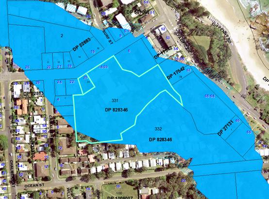
Consistent with this clause,
development consent must not be granted to development on land to which this
clause applies unless the consent authority is satisfied that the development:
(a) is
compatible with the flood hazard of the land, and
(b) is
not likely to significantly adversely affect flood behaviour resulting in
detrimental increases in the potential flood affectation of other development
or properties, and
(c) incorporates
appropriate measures to manage risk to life from flood, and
(d) is
not likely to significantly adversely affect the environment or cause avoidable
erosion, siltation, destruction of riparian vegetation or a reduction in the
stability of river banks or watercourses, and
(e) is
not likely to result in unsustainable social and economic costs to the
community as a consequence of flooding.
The application was supported by
a flooding assessment report prepared by GHD dated September 2017. Numerous
additional information requests were made to the applicant in an attempt to
quantify flood risk and flood impact of the proposed development consistent
with Councils adopted flood policy. The most recent flood assessment report
prepared by GHD dated May 2018 supports the application.
The site is impacted by localised
flooding stemming from the Wrights Creek catchment. The flood characteristics
applicable to this site are detailed under the Wrights Creek Flood Study
(2007). This flood study and model has been used as the basis of assessment of
the development from a floodplain management perspective. The 2007 flood study
and model has been used by the consultant to generate a localised TUFLOW model
to assess both the impacts of the additional cabins within flood prone areas
and evacuation of the site. The TUFLOW model has been updated by incorporating
additional feature survey and localised floodplain details.
The development is required to
meet the provisions of the Port Macquarie-Hastings Flood Policy (2015). The
Flood Policy contains the relevant flood related planning controls applicable
to the proposed development. In this regard the development must meet the
following prescriptive controls:
· Floor Level
· Flood Proofing
· Flood Impact on
Other Properties
· Site Access and
Flood Evacuation Requirements
Noting that the three villas
(V60, V61 and V62) on the eastern side of Wrights Creek no longer form part of
this development application it is considered that:
· The proposal is
compatible with the flood hazard of the land.
· The proposal will
not result in a significant adverse effect on flood behaviour that would result
in detrimental increases in the potential flood affectation of other
development or properties.
· The proposal
incorporates measures to manage risk to life from flood.
· The proposal is
not likely to significantly adversely affect the environment or cause avoidable
erosion, siltation, destruction of riparian vegetation or a reduction in the
stability of river banks or watercourses.
· The proposal is
not likely to result in unsustainable social and economic costs to the
community as a consequence of flooding.
· The impacts of the
development on the floodplain are manageable and that no adverse impacts will
be experienced both on the subject site and on adjoining land.
Specific conditions have been
recommended to ensure flooding impacts are managed in an appropriate fashion.
Matters that are capable of being demonstrated to Council prior to the issue of
any construction certificate and are recommended as consent conditions include:
· Finished floor
level confirmation on numerous ancillary structures including the café
building and laundry/staffroom building.
· Specifications and
details of the porous pavement material for the driveway and parking located on
the eastern side of the existing resort structure to ensure it is appropriate
given its located partially within designated floodway.
· Confirmation that
no obstructions or land reshaping will occur for the proposed driveway located
on the eastern side of the existing resort structure.
· Submission of a
detailed flood evacuation plan.
The above requirements are
considered achievable with minimal to little change to the design. In
particular, the majority of the development meets the necessary floor levels or
requires minimal change to meet the floor levels (ie floor levels on some
buildings located closer to the creek will need to be raised approx. 1m) -
refer to conditions of consent on required floor levels and site survey plan
for context.
Council staff have reviewed the
additional information and revised plans. Staff are of the view that the flood
depth and velocity data confirms that the driveway and parking spaces are
acceptable. However, the remaining information only partly addresses the
matters stipulated in previously recommended conditions B25, B26 and B27.
With regard to recommended
condition B25 the additional information confirms that the driveway and parking
spaces are acceptable however it does not confirm that the ground levels are to
remain unaltered. This still needs to be stipulated given that the works will
be within floodway. Recommended condition B25 has been reworded as follows:
(B25) Detailed plans must be
submitted to Council for approval for the driveway on the eastern side of the
existing resort building. The detailed plans shall confirm the construction
materials that are to be used to ensure that they are capable of withstanding
flood forces. The detailed plans must also confirm that ground
levels are not altered (i.e. raised) as part of the driveway works. No kerbing
or other obstructions to flood flows are permitted to service the driveway
areas.
With regard to recommended
condition B26 no detail has been provided which confirms where the
‘downstream control’ trigger will be located and it is not clear as
to how a level of 11.5m AHD has been adopted as the critical level. Given that
in any given flood the floodwaters over the site can vary by approx. 650/750mm
(i.e. the flood surface at the upstream boundary can be 750mm higher than the
same flood surface at the downstream boundary) it is difficult to determine how
a flood trigger located at the downstream boundary will provide for a reliable
and failsafe trigger, especially at the upstream boundary. Technical staff have
also advised of other minor issues with the submitted flood evacuation report
and therefore recommended condition B26 is to remain unchanged.
With regard to recommended
condition B27 technical staff have advised that a long section demonstrating that
the 1:20 year flood level is achieved for the egress route is specifically
required. A boardwalk is shown at 12.10m AHD, however there is no confirmation
that the connecting footpath (assumed to be gravel or asphalt) is at or above
12.10m AHD. Therefore recommended condition B27 is to remain unchanged.
Staff are still of the opinion
that the details required via these conditions is capable of being demonstrated
to Council prior to the issue of any construction certificate.
· Clause 7.4,
consistent with subclause 2 this provision does not apply as the land is below
the flood planning level. Refer to comments above under clause 7.3.
·
· Clause 7.5, the
site is not mapped as a “Koala habitat area” on the Koala Habitat
Map. This clause is not applicable. Refer to comments under State Environmental
Planning Policy 44 – koala habitat protection heading.
· Clause 7.13,
provides that development consent must not be granted to development unless the
consent authority is satisfied that any of the following services that are
essential for the proposed development are available or that adequate
arrangements have been made to make them available when required:
(a) The supply of water,
Comments: Reticulated water
supply is existing and available. Council’s water supply section are
satisfied that adequate arrangements will be made for the supply of water
expected to be generated from the development. Specifically consent conditions
have been recommended requiring final water service sizing to be determined by
a hydraulic consultant consistent with the requirements of Australian Standard
3500: Plumbing and Drainage with details to be provided as part of the
infrastructure construction certificate.
(b) The supply of
electricity,
Comments: Electricity supply is
existing and available. Council is satisfied that satisfactory arrangements
will be made with the electricity service provider to accommodate the proposed
development.
(c) The disposal and
management of sewage,
Comments: Reticulated sewer
supply is existing and available. Council’s sewer supply section are
satisfied that adequate capacity is available and arrangements will be made for
connection and disposal of sewage expected to be generated from the
development. Specifically consent conditions have been recommended requiring
sewer reticulation details to be provided as part of the infrastructure
construction certificate application.
(d) Stormwater drainage or
on-site conservation,
Comments: A stormwater management
plan has been submitted demonstrating how the site is proposed to be drained to
Wrights Creek. The proposal includes the provision of a number of proprietary
gross pollution traps which have been sized to treat stormwater runoff such
that the site meets the discharge parameters of AUSPEC D7. Conceptual modelling
has been submitted to demonstrate compliance in this regard.
The stormwater management plan
also demonstrated how on-site stormwater detention facilities can be
incorporated into the proposed development, providing two options. In
particular, the plan indicates that the required onsite detention volume can be
accommodated within either a large end of line basin beneath the common
driveway area or within numerous individual tanks located within the deck area
of each proposed holiday unit. Either solution is acceptable from an AUSPEC
compliance perspective.
Council’s stormwater
engineer is satisfied that adequate arrangements will be made for stormwater
drainage and onsite detention for the proposed development. Specifically
consent conditions have been recommended requiring a detailed site stormwater
management plan to be submitted for assessment with the S.68 application and
prior to the issue of a Construction Certificate.
(e) Suitable road access.
Comments: Suitable road access is
existing via Flynns Street.
·
Council staff are satisfied that satisfactory arrangements are in
place for the provision of essential services.
(ii) Any
draft instruments that apply to the site or are on exhibition:
State
Environmental Planning Policy (Coastal Management) 2018
This policy
commenced on 3 April 2018. The development application was lodged 4 October
2017. Consistent with the savings and transitional provisions the former
planning provisions continue to apply (and this policy does not apply) to a
development application lodged, but not finally determined, immediately before
the commencement of this Policy in relation to the land to which this Policy
applies. Refer to comments under SEPP 71 – Coastal Protection heading of
this report
(iii) Any
Development Control Plan in force:
Port
Macquarie-Hastings Development Control Plan 2013
|
DCP 2013: Residential Flat Development, Tourist and
Visitor Accommodation and Mixed Use Development
|
|
DCP Objective
|
Development Provisions
|
Proposed
|
Complies
|
|
3.3.2.2
|
Satisfactory site analysis plan submitted.
|
Site analysis plan provided.
|
Yes
|
|
3.3.2.3
|
Statement addressing site attributes and constraints
submitted.
|
Suitable statement of environmental effects provided.
|
Yes
|
|
3.3.2.4
|
Streetscape and front setback:
· Within 20% of the average setback
of the adjoining buildings.
· 3m setback to all frontages if no
adjoining development.
· 2m setback to secondary frontages.
· Max. 9m setback for tourist
development to allow for swimming pool.
|
The proposed buildings are located behind the existing
building and setback approximately 50m from the front boundary.
|
Yes
|
|
3.3.2.5
|
Balconies and building extrusions can encroach up to 600mm
into setback.
|
No balconies proposed in front setback.
|
N/A
|
|
Buildings generally aligned to street boundary.
|
Buildings proposed behind existing building line.
|
N/A
|
|
Primary openings aligned to street boundary or rear of
site.
|
Openings of each villa building front pathway
|
|
|
3.3.2.6
|
Side setbacks comply with Figure 3.3-1:
· Min. Side setback 1.5m for 75% of
building depth.
· Windows on side walls min. 3m from
side boundary.
· 3m minimum where adjacent to
existing strata titled building.
|
Side setback to villas along the western side boundary are
1m to villa 18 and 1.133m to villas 15, 16 and 17.
Eastern side setback is approximately 40m to villa 59.
|
No but considered acceptable noting the intent of the side
setback requirement being applicable to residential flat buildings. The
proposed villas are of a scale and nature (ie similar to dwellings that only
need a 900mm setback) that allows adequate natural light and ventilation
between buildings and private open space areas.
|
|
Side walls adjacent to existing strata-titled buildings
should be articulated and modulated to respond to the existing buildings.
|
No extended wall lengths proposed along side boundaries.
|
N/A
|
|
Min. 6m rear setback (including sub basements)
|
Rear setback varies from minimum 1.095m out to 4.394m.
Refer to site plan.
|
No but considered acceptable. Larger setbacks have been
provided to other boundaries and no adverse overshadowing or privacy impacts
to adjoining dwellings/units have been identified that would warrant refusal
of the application.
|
|
3.3.2.7
|
A party wall development may be required if site
amalgamation is not possible and higher density development is envisaged by
these controls.
|
No zero side setbacks proposed. No party walls proposed or
required.
|
N/A
|
|
3.3.2.8
|
Party wall development can occur only with the agreement
and consent of the adjoining property owner. Exposed party walls should be
finished in a quality comparable to front facade finishes.
|
No party walls proposed.
|
N/A
|
|
3.3.2.9
|
Corner sites consolidated with adjacent land where
possible.
|
The site is not a corner site.
|
N/A
|
|
Where consolidation not possible a minimum setback of 6m
should extend to secondary street (see Fig 3.3-2 and 3.3-3).
|
The site is not a corner site.
|
N/A
|
|
3.3.2.10
|
Where sites adjacent to open space are to be developed the
edge of the open space should be defined with a public road and buildings
address the open space.
|
The site does not adjoin any areas of public open space.
|
N/A
|
|
3.3.2.11
|
Deep soil zones:
· Extend the width of the site and
have minimum depth of 6m.
· Are contiguous across sites and
within sites (see Fig 3.3-4).
|
The proposal does not include any residential flat
buildings but rather individual villa type buildings at grade providing for
greater retention of trees and landscaping. The landscaping treatment and
specifically retention and enhancement of the Wrights Creek riparian corridor
will provide a better outcome than a 6m wide deep soil zone.
|
Yes
|
|
3.3.2.12
|
Deep soil zones accommodate existing advanced trees, and
allow for advanced tree planting.
|
The proposal has been designed to accommodate retention of
advanced Koala trees. Where not possible advanced compensatory re-planting is
proposed.
|
Yes
|
|
3.3.2.13
|
Deep soil zones integrated with stormwater management
measures.
|
Stormwater to be directed to Wrights Creek, the site of
replanting and enhancement of the riparian corridor.
|
Yes
|
|
3.3.2.14
|
Sunlight to the principal area of ground-level private
open space of adjacent properties should not be reduced to less than 3 hours
between 9.00am and 3.00pm on June 22.
|
The single and double storey design of villa buildings
combined with setbacks to boundaries and buildings on adjoining properties
will not reduce sunlight to principal areas of ground level private space to
less than 3 hours between 9am to 3pm on June 22.
|
Yes
|
|
Where existing overshadowing by buildings and fences is
greater than this, sunlight should not be reduced by more than 20%.
|
No change to existing buildings or fences that would
result in more than 20% further overshadowing impacts.
|
N/A
|
|
Buildings should not reduce the sunlight available to the
windows of living areas that face north in existing adjacent dwellings to
less than the above specification.
|
The single and double storey design of the villa buildings
combined with setbacks to boundaries and buildings on adjoining properties
will not reduce sunlight available to windows of living areas that face north
in adjacent dwellings to less than 3 hours between 9am to 3pm on June
22.
|
Yes
|
|
3.3.2.15
|
Internal clothes drying space provided (not mechanical).
|
Sufficient area available within villas to provide for
clothes drying.
|
Yes
|
|
Ceiling fans provided in preference to air conditioning.
|
Details not provided but given the tourist accommodation
use assessment has assumed air conditioning.
|
Yes
|
|
Solar hot water systems (or equivalent technology)
provided.
|
None proposed. However the proposal is not BASIX affected
development.
|
Yes
|
|
Photovoltaic arrays installed where practical.
|
None proposed. However the proposal is not BASIX affected
development.
|
Yes
|
|
3.3.2.16
|
Landscape plan provided including:
· 35% soft landscaping with minimum
width of 3m.
· Existing vegetation and proposed
treatment.
· Details of hard landscaping.
· Location of communal recreational
facilities.
· Species not to obscure doors,
paths, etc.
· Street trees in accordance with
Council’s list.
|
Landscaping strategy and Vegetation Management Plan (VMP)
provides for enhancement of the Wrights Creek riparian corridor and offset
plantings for koala food trees.
|
Yes
|
|
3.3.2.17
|
Existing vegetation to be retained and nutrient-rich water
prevented from entering native gardens.
|
Retention of koala food trees proposed where practical
with enhancement of riparian corridor proposed.
|
Yes
|
|
3.3.2.18
|
Landscape plan to demonstrate how trees and vegetation
contribute to energy efficiency and prevent winter shading on neighbouring
properties.
|
Landscaping plan provided is acceptable.
|
Yes
|
|
3.3.2.20
|
Street trees in accordance with Council’s list.
|
Having regard to the location of services within the
street, street tree planting not considered appropriate. Existing landscaping
within the frontage of the site considered acceptable. A condition has been
recommended requiring this landscaping to be extended in front of the new
visitor parking.
|
N/A
|
|
3.3.2.20
|
All dwellings at ground floor level have minimum 35m2
of private open space, including one area 4m x 4m at maximum grade of 5% and
directly accessible from living area.
|
The villas/apartments are for tourist accommodation use
and not permanent dwellings.
Adequate communal recreation facilities and areas are
proposed.
|
Yes
|
|
Separate private open space for any resident manager or
permanent occupant of a tourist facility.
|
No change to existing onsite manager arrangements.
|
N/A
|
|
3.3.2.21
|
Dwellings on or above first floor to have balconies as
follows:
· Studio - 4m2
· 1 bedroom - 8m2,
minimum 2m wide
· 2 bedroom - 10m2,
minimum 2m wide
· 3 bedroom - 12m2,
minimum 2.4m wide
|
No first floor unit balconies proposed. However, it is
noted that each villa/apartment is provided with the following:
• 1 bedroom – 10.8m2
• 2 bedroom – 10.8m2
• 3 bedroom – 16.5m2
• 4 bedroom – 45m2
With minimum widths provided.
|
Yes
|
|
3.3.2.22
|
Fencing or landscaping defines public/communal and private
open space.
|
All villas/apartments orientated toward communal open
space areas including pool and play areas. Private open space contained to
deck areas of villas/apartments.
|
Yes
|
|
3.3.2.23
|
Solid fences should be:
· Max. 1.2m high,
· Setback 1m,
· Suitably landscaped,
· Provide 3m x 3m splay.
|
Front fencing is existing. No change proposed.
|
N/A
|
|
Where front fences higher than 1.2m:
· Max. 1.8m high,
· Landscaped recesses for 50% of
frontage, or length of fence not more than 6m or 50% of street frontage.
· Min. 25% transparent,
· 3m x 3m splay for corner sites.
· 900mm x 900mm splay at vehicle
driveways.
|
Front fencing is existing. No change proposed.
|
N/A
|
|
3.3.2.24
|
Fencing materials consistent with or complimentary to
existing fencing in the street.
|
Front fencing is existing. No change proposed.
|
N/A
|
|
3.3.2.25
|
Fences constructed of chain wire, solid timber or masonry
and solid street not permitted, even if consistent with existing fencing in
the locality.
|
Front fencing is existing. No change proposed.
|
N/A
|
|
3.3.2.26
|
Building to be designed so that:
· Busy, noisy areas face the street.
· Quiet areas face the side or rear
of the lot.
· Bedrooms have line of site
separation of at least 3m from parking areas, streets and shared driveways.
|
Buildings are adequately setback from Flynn Street.
|
Yes
|
|
Openings of adjacent dwellings separated by at least 3m.
|
Adequate building separation proposed. Window placement in
villas have retained privacy between dwellings/units on adjoining properties.
|
Yes
|
|
3.3.2.27
|
Building designed so noise transmission between apartments
is minimised.
|
The design of the villa layouts and specifically the
deck/open space areas has been orientated toward the centre of the site
containing the recreation facilities.
|
Yes
|
|
Uses are to be coupled internally and between apartments
i.e. noisy internal and noisy external spaces should be placed together. (See
Figure 3.3-6).
|
As per above.
|
Yes
|
|
3.3.2.28
|
Development complies with AS/NZS2107:2000 Acoustic
– Recommended design sound levels and reverberation times for building
interiors for residential development.
|
There are no noise generating developments within
proximity of this site. Further Flynn Street does not experience traffic
volumes that would warrant any noise attenuation measures.
|
Yes
|
|
3.3.2.29
|
Impact of noise from key public places to be considered.
|
The site does not adjoin any areas of public open space
where noise generating activities or events take place.
|
N/A
|
|
3.3.2.30
|
Direct views between living room windows to be screened
where:
· Ground floor windows are within 9m
of windows in an adjoining dwelling.
· Other floors are within a 12m
radius.
· Living room windows are within 12m
radius of the principal area of private open space of other dwellings.
|
The villas/apartments will not result in any adverse
privacy impacts to adjoining dwellings. Specifically the following is noted:
- Each
villas open space, livings areas and decking is orientated toward the central
recreational facilities of the site.
- Windows
facing side or rear boundaries are to utility, bathrooms or bedrooms
only.
|
Yes
|
|
Direct views may be screened with either a 1.8m high fence
or wall, or screening that has maximum 25% openings.
|
No window screening required having regard to rooms in
which the windows serve.
|
Yes
|
|
Windows in habitable rooms screened if >1m above ground
level and wall set back <3m.
|
No window screening required having regard to rooms in
which the windows serve.
|
Yes
|
|
Balconies, decks, etc screened if <3m from boundary and
floor area >3m2 and floor level >1m above ground level.
|
No first floor elevated decks/balconies proposed. No
screening required. Each villas open space, livings areas and decking is
orientated toward the central recreational facilities of the site away from
side or rear boundary.
|
Yes
|
|
3.3.2.31
|
Developments to be designed in accordance with AS 1428.
|
Capable of being disabled access compliant. Details to be
provided for compliance with Building Code of Australia at construction
certificate stage.
|
Yes
|
|
3.3.2.32
|
Barrier free access to at least 20% of dwellings provided.
|
Barrier free access provided to at least 20% of
villas/apartments.
|
Yes
|
|
3.3.2.33
|
Developments located close to open space, recreation,
entertainment and employment.
|
The development site is located less than 100m from
retail/café spaces located on the corner of Flynn Street & Pacific
Drive. Flynns Beach and associated open space area is within 200m.
|
Yes
|
|
Where LEP permits FSR > 1:1, FSR not less than 1:1
should be achieved.
|
FSR of 0.49:1 proposed.
|
No but having regard to environmental constraints on the
site, the proposed FSR is considered acceptable.
|
|
3.3.2.34
|
Variety of types - studio, 1, 2, 3 and 3+ bedroom
apartments
|
The proposal incorporates a range of unit types, featuring
1, 2, 3 and 4 bedroom configurations.
|
Yes
|
|
Studio and 1 bedroom apartments not > 20% of total
number of apartments.
|
1 bedroom apartments comprise 38% of the total number of
apartments
|
No but considered acceptable given the tourist/short stay
use.
|
|
Mix of 1 and 3 bedroom apartments at ground level.
|
A mixture of 1, 2 and bedroom apartments accessible at
ground level.
|
Yes
|
|
3.3.2.35
|
Council’s Affordable Housing Strategy to be
considered for residential flat buildings.
|
Residential flat building not proposed.
|
N/A
|
|
3.3.2.36
|
Lift over-runs and plant integrated within roof
structures.
|
Residential flat building not proposed.
|
N/A
|
|
Outdoor recreation areas on roof tops to be landscaped and
incorporate shade structures and wind screens.
|
Residential flat building not proposed.
|
N/A
|
|
Outdoor roof areas oriented to the street.
|
Residential flat building not proposed.
|
N/A
|
|
Roof design to generate interesting skyline.
|
Residential flat building not proposed.
|
N/A
|
|
3.3.2.37
|
Facade composition should:
· Have balance of horizontal and
vertical elements.
· Respond to environmental and
energy needs.
· Incorporate wind mitigation.
· Reflect uses within the buildings.
· Include combination of building
elements.
|
The façade composition of the villas/apartment is
acceptable.
|
Yes
|
|
3.3.2.38
|
Building elements, materials and colours consistent or
complimentary to those existing in the street.
|
Contemporary building elements, materials and colours
consistent with existing and within the street.
|
Yes
|
|
3.3.2.39
|
Entrances clearly identifiable from street level.
|
No change to exiting entry to the site and main building
fronting the site.
|
N/A
|
|
Entries provide clear transition between public street and
shared private circulation spaces/apartments.
|
Each villa/apartment provided with clearly defined entry
point.
|
Yes
|
|
Entries provide clear line of sight between one
circulation space and the next.
|
Each villa/apartment provided with clearly defined entry
point.
|
Yes
|
|
Entries avoid ambiguous and publicly accessible small
spaces in entry areas.
|
Each villa/apartment provided with clearly defined entry
point.
|
Yes
|
|
Entries sheltered and well lit.
|
Each villa/apartment provided with clearly defined entry point.
|
Yes
|
|
Entries and circulation spaces sized for movement of
furniture.
|
Each villa/apartment provided with clearly defined entry
point.
|
Yes
|
|
Corridors minimum 2.5m wide and 3.0m high.
|
No residential flat building proposed.
|
N/A
|
|
Corridor lengths minimised and avoid tight corners.
|
No residential flat building proposed.
|
N/A
|
|
Longer corridors articulated by:
· Changing direction and width.
· Utilising series of foyers.
· Incorporating windows.
|
No residential flat building proposed.
|
N/A
|
|
3.3.2.40
|
Minimum 1 balcony per apartment.
|
Suitable private open space areas compliant with deck
requirements provided to each villa/apartment.
|
Yes
|
|
Main balcony accessible from living area.
|
Private open space accessible from main living area.
|
Yes
|
|
Balconies take advantage of favourable climatic
conditions.
|
Decking open space suitably orientated.
|
Yes
|
|
Balconies and balustrades balance privacy and views.
|
Decking open space orientated toward the centre of the
site containing recreational facilities. Not orientated to side or rear
boundaries.
|
Yes
|
|
3.3.2.42
|
Secure open air clothes drying facilities that are:
· easily accessible,
· screened from public domain and
communal spaces,
· located with high degree of solar
access.
|
While no permanent dwellings are proposed, sufficient area
exists to provide open air clothes drying facilities.
|
Yes
|
|
3.3.2.43
|
Mailboxes integrated into building design and sighted to
ensure accessibility and security.
|
No mailboxes required. Tourist accommodation only.
|
N/A
|
|
3.3.2.44
|
Public and private space clearly defined.
|
Public and private space areas clearly defined by existing
fencing.
|
Yes
|
|
Entrances:
· oriented to public street,
· provide direct and well lit access
between car parks, lift lobbies and unit entrances,
· optimise security by grouping
clusters (max. 8) around a common lobby
|
No change to the existing clearly defined entrances to the
site.
|
Yes
|
|
Surveillance facilitated by:
· views over public space from
living areas,
· casual views of common internal
areas,
· provision of windows and
balconies,
· separate entries to ground level
apartments.
|
Villas/apartments orientated toward the centre of the site
containing recreational facilities, which provides suitable casual
surveillance.
|
Yes
|
|
Concealment avoided by:
· preventing dark or blind alcoves,
· providing lighting in all common
areas,
· providing graded car parking
illumination (greater at entrances).
|
A Crime Prevention Through Environmental Design assessment
was undertaken and supported the application. The recommendations of the
assessment have been considered in the design of the development proposal.
|
Yes
|
|
Access to all parts of the building to be controlled.
|
No residential flat building proposed.
|
N/A
|
|
3.3.2.45
|
Accessible storage provided for tenants in basement car
park or garages.
|
No residential flat building proposed.
|
N/A
|
|
One bike storage space per dwelling provided.
|
No residential flat building proposed.
|
N/A
|
|
3.3.2.46
|
For developments of < 6 dwellings individual waste
management permitted. Designated area to be provided for storage of bins:
· not visible from street,
· easily accessible,
· not adjoining private or communal
space, windows or clothes drying areas,
· on hard stand area,
· close to street and a tap for
washing,
· maintained free of pests.
|
Private waste collection service to be provided. Suitable
areas onsite to accommodate service and bin storage. Condition recommended to
require service to be in place prior to issue of any occupation certificate.
|
Yes
|
|
Communal bulk waste required where:
· > 6 dwellings, or
· Number of bins wouldn’t fit
in street frontage, or
· Topography would make street
collection difficult.
|
See above comments.
|
Yes
|
|
Communal bulk waste facilities integrated into development
and located at ground or sub-basement level.
· Not visible from street,
· Easily accessible,
· Can be serviced by collection
vehicles,
· Not adjoining private or communal
space, windows or clothes drying areas,
· Has water and drainage facilities
for cleaning,
· Maintained free of pests.
|
See above comments.
|
Yes
|
|
Evidence provided that site can be serviced by waste
collection service.
|
See above comments.
|
Yes
|
|
3.3.2.47
|
Common trenching of utility services where possible.
|
A preliminary servicing plan supported the application
which is considered acceptable in principle. Details will be provided with
infrastructure construction certificate.
|
Yes
|
|
Above ground utility infrastructure integrated with
building design.
|
No above ground utilities on the site.
|
N/A
|
|
Site and individual units numbered.
|
Apartment/villas will be numbered.
|
Yes
|
|
Common aerials and satellite dishes provided.
|
No residential flat building proposed.
|
N/A
|
|
DCP 2013: General Provisions
|
|
DCP Objective
|
Development Provisions
|
Proposed
|
Complies
|
|
2.7.2.2
|
Design addresses generic principles of Crime Prevention
Through Environmental Design guideline:
· Casual surveillance and sightlines
· Land use mix and activity
generators
· Definition of use and ownership
· Lighting
· Way finding
· Predictable routes and entrapment
locations
|
A Crime Prevention Through Environmental Design assessment
was undertaken by Barker Ryan Stewart – Total Project Solutions dated
September 2017. The recommended strategies are summarised as follows:
• Access to the site shall be restricted by
perimeter fencing and security gates.
• Low level planting shall be maintained in
appropriate locations to provide good visibility of the site from surrounding
streets, and clear sight lines across the grounds of the resort.
• Surveillance of pathways, and concealed areas
should be maximised through a combination of CCTV, proper lighting and
passive surveillance.
• The car park should be well lit at night and
covered by CCTV.
• Public spaces and private areas will be clearly
delineated.
• An on-going maintenance plan shall be implemented.
It is considered that the recommendations have been
incorporated into the design of the development proposal and there is scope
for the ongoing management measures to be implemented.
|
Yes
|
|
2.3.3.1
|
Cut and fill 1.0m max. 1m outside the perimeter of the
external building walls
|
No cut or fill >1m proposed outside perimeter of
external walls.
|
Yes
|
|
2.3.3.2
|
1m max. height retaining walls along road frontages
|
No retaining walls proposed.
|
N/A
|
|
Any retaining wall >1.0 in height to be certified by
structural engineer
|
No retaining walls proposed.
|
N/A
|
|
Combination of retaining wall and front fence height
|
No retaining walls proposed. Front fence existing.
|
N/A
|
|
2.3.3.4
|
For coastal flood plan endangered ecological communities a
minimum, fully vegetated buffer of 35m must be provided.
|
The Wrights Creek riparian corridor was recognised as an
Endangered Ecological Community – Swamp Sclerophyll Forest on Coastal
Floodplains. It is proposed to retain the EEC with a buffer of 20m each side
of the water course as per the recommended 2nd order creek
provisions of the Water Management Act, 2000.
|
No. However the reduction to the 35m buffer standard is accepted
because of the Water Management Act standard and the highly modified nature
of the site at present. The active development consent also only provides for
a 5m wide corridor on each side of the creek. The ecological impact
assessments have concluded that the proposal inclusive of the reduced buffer
will not have a significant adverse environmental impact.
|
|
Stormwater management facilities may be considered in
buffer area where justified on practical engineering grounds but still
consistent with objectives.
|
The existing stormwater discharges to the Wrights Creek
catchment within the buffer area. The preliminary stormwater plans adopt a
similar approach.
|
Having regard to the site constraints, disposal of
stormwater in the buffer is accepted as there are no other feasible options
available. It is noted that onsite detention forms part of the preliminary
stormwater analysis. The ecological impact assessments have concluded that
the proposal, inclusive of the stormwater facilities, will not have a
significant adverse environmental impact.
|
|
Fully vegetated buffers cannot contain road infrastructure
or an asset protection zone.
|
No roads are proposed. The driveway, visitor and staff
parking and part APZ is proposed within the buffer.
|
Having regard to the highly modified nature of the site at
present and proposed retention and enhancement measures allowing these components
of the development within in the buffer area is considered reasonable. The
ecological impact assessment have concluded that these components, being
located within the buffer area, will not have a significant adverse
environmental impact.
|
|
2.3.3.5
|
Habitat/vegetation to be lost is to be offset.
|
Koala food trees to be removed within the development
footprint are to be offset with compensatory plantings in suitable locations
within the site. Riparian corridor to be retained and enhanced.
|
Yes
|
|
Improvement and maintenance of existing habitat and
corridors first preference.
|
Riparian corridor to be retained and enhanced.
|
Yes
|
|
Vegetation Management Plan (VMP) for environmental land to
be retained or used to offset.
|
Vegetation Management Plan (VMP) provided for protection
and enhancement of Wrights Creek riparian corridor.
|
Yes
|
|
2.3.3.6
|
Minimum fully vegetated buffers from top of bank to both
sides of a water course as follows:
· 10m for 1st order streams that
flow intermittently.
· 30m for 1st order streams that
flow permanently.
· 40m for 2nd order streams.
· 50m for 3rd order streams.
· 65m for 4th order streams.
|
20m buffer proposed to each side of Wrights Creek which is
a 2nd order stream.
|
No. However the reduction to the 40m buffer standard is accepted
because of the Water Management Act standard and the highly modified nature
of the site at present. The active development consent also only provides for
a 5m wide corridor on each side of the creek. The ecological impact
assessments have concluded that the proposal, inclusive of the reduced
buffer, will not have a significant adverse environmental impact.
|
|
2.3.3.8 onwards
|
Removal of hollow bearing trees
|
A hollow bearing tree assessment was undertaken by a
qualified ecologist. Two trees were identified as having hollow bearing
potential. Both are to be retained.
|
Yes
|
|
2.4.3.4
|
Asset Protection Zones to be located outside of
environmental protection zones and within private land.
|
The NSW Rural Fire Service (NSW RFS) have required the
whole site, apart from the Wrights Creek corridor, to be managed as an APZ
(inner protection area). Part of the Asset Protection Zone will be within the
E2 zone.
|
No however the 10m riparian corridor either side of the
creek to be protected and enhanced does not contain any APZ obligation.
|
|
2.4.3.5
|
Development must comply with Council’s Floodplain
Management Plan and Flood Policies.
|
Refer to comments under clause 7.3 of the LEP heading
within this report.
|
Yes
|
|
2.4.3.6
|
All stormwater infrastructure to be designed in accordance
with AUSPEC.
|
Concept stormwater management plan provided.
Council’s stormwater engineering has reviewed the plan and advised that
the design is suitable and capable of compliance with AUSPEC standards. The
specific detailed design is to be provided as part of application for
construction certificate.
|
Yes
|
|
2.6.3.1
|
Tree removal (3m or higher with 100m diameter trunk and 3m
outside dwelling footprint
|
Trees identified in the plan are proposed to be removed.
Refer to detailed comments under SEPP 44 and the flora and flora headings of
this report for impacts and offset measures.
|
Yes
|
|
2.4.3
|
Bushfire risk, Acid sulphate soils, Flooding,
Contamination, Airspace protection, Noise and Stormwater
|
Refer to main body of report.
|
Yes
|
|
2.5.3.2
|
New accesses not permitted from arterial or distributor
roads. Existing accesses rationalised or removed where practical
|
No new access permitted from and arterial or distributor
road.
|
N/A
|
|
Driveway crossing/s minimal in number and width including
maximising street parking
|
No new crossovers proposed. Confined to two existing
crossovers to Flynn Street.
|
Yes
|
|
2.5.3.3
|
Off-street parking in accordance with Table 2.5.1:
· 1.1 per unit + 1 per 2 employees
(onsite at any one time) + 1 for on-site manager.
|
Existing 60 units + 59 new villas = 119 units x 1.1 =
130.9 spaces.
Addition of two new units to existing apartment building =
2.2 spaces.
Conversion of 1 unit to sales area within existing
building = -1.1 spaces.
10 staff = 5 spaces
1 onsite manager = 1 space
A total of 138 spaces required.
It is noted that the proposed café is only
accessible and available for staying guests. No additional parking demand
would be generated from this component.
|
Yes. There are 61 existing basement parks under the
apartment building and 9 existing visitor spaces along the entrance driveway.
70 new parking spaces at grade. A total of 140 spaces are proposed.
|
|
2.5.3.5
|
On-street parking permitted subject to justification
|
The proposal is not reliant on on-street parking.
|
N/A
|
|
2.5.3.7
|
Visitor parking to be easily accessible
|
Visitor parking easily identified and accessible form the
Flynn Street.
|
Yes
|
|
Stacked parking permitted for medium density where visitor
parking and 5.5m length achieved
|
No stacked parking proposed.
|
N/A
|
|
Parking in accordance with AS 2890.1
|
Plans indicate parking generally in accordance with
AS2890. Suitable condition recommended requiring certification prior to issue
of construction certificate.
|
Yes
|
|
2.5.3.9
|
Bicycle and motorcycle parking considered and designed
generally in accordance with the principles of AS2890.3
|
Suitable areas available to accommodate bicycle and motor
cycle parking consistent with AS2890.
|
Yes
|
|
2.5.3.10
|
Parking concessions possible for conservation of heritage
items
|
Not a heritage listed site and no parking concession proposed.
|
N/A
|
|
2.5.3.11
|
Section 94 contributions
|
Refer to main body of report.
|
Yes
|
|
2.5.3.12 and 2.5.3.13
|
Landscaping of parking areas
|
Suitable landscaping proposed.
|
Yes
|
|
2.5.3.14
|
Sealed driveway surfaces unless justified
|
Driveways to be sealed to a suitable standard.
|
Yes
|
|
2.5.3.15
|
Driveway grades for first 6m of ‘parking area’
shall be 5% grade
(Note AS/NZS 2890.1 permits steeper grades)
|
Driveways existing.
|
N/A
|
|
2.5.3.16
|
Transitional grades min. 2m length
|
Driveways existing.
|
N/A
|
|
2.5.3.17
|
Parking areas to be designed to avoid concentrations of
water runoff on the surface.
|
Parking and hardstand areas accommodated in preliminary
stormwater management plans.
|
Yes
|
(iiia) Any planning agreement that has
been entered into under section 7.4, or any draft planning agreement that a
developer has offered to enter into under section 7.4:
No planning agreement has been
offered or entered into.
iv) Any
matters prescribed by the Regulations:
New
South Wales Coastal Policy:
The proposed development is
consistent with the objectives and strategic actions of this policy.
Demolition
of buildings AS 2601:
Part demolition of the existing
building is capable of compliance with AS 2601. Condition of consent has been
recommended to reinforce.
v) Any coastal
zone management plan (within the meaning of the Coastal Protection Act 1979),
that apply to the land to which the development application relates:
No Coastal Zone Management Plan
applies to the subject site.
(b) The likely
impacts of that development, including environmental impacts on both the
natural and built environments, social and economic impacts in the locality:
Context and setting
The site comprises an area of 18,053.87m2. The property is relatively flat with Wrights Creek
traversing its eastern portion.
The
site currently comprises a four (4) storey serviced apartment building fronting
Flynn Street, with sixty (60) serviced apartments in three blocks with basement
parking, swimming pool and children’s playground area.
Adjoining
the site to the east is a mixture of both 3 and 4 storey walk up style
apartment and commercial buildings fronting Pacific Drive and Flynn Street.
Adjoining the site immediately to the north is Council owned land containing
the Wrights Creek riparian corridor. Adjoining development to the northeast
comprises a mixture of 3 to 4 storey unit buildings. Adjoining development to the
northwest is 3 storey unit complex with single storey dwellings further along
the northern side of Flynn Street. Adjoining the site to the west is a
combination of both 2 and 3 storey unit complexes. Adjoining the site to the
south is a manufactured home estate often referred to as “Taskers
Village” comprising single storey cabin style manufactured homes.
Having regard to existing
development with the locality and adopted building height and floor space ratio
controls, the proposal is considered to be consistent with the locality and
adequately addresses planning controls for the area.
The proposal will be unlikely to
have any adverse impacts to existing adjoining properties and satisfactorily
addresses the public domain.
There are no adverse impacts on
existing view sharing and there are no adverse privacy impacts. Refer to
comment within Development Control Plan compliance table.
There are no adverse
overshadowing impacts. The proposal does not prevent adjoining properties from
receiving 3 hours of sunlight to private open space and primary living areas on
21 June.
Roads
The site has road frontage to Flynn Street, a Council-owned
and maintained urban collector road with a carriageway width of approximately
12.5m within a 20.1m wide road reserve. The road is bordered by upright (SA)
type kerb and gutter on both sides. There is a local sag point within Flynn
Street in front of the site where the road crosses the creek.
An existing 1.2m wide concrete footpath fronting the site
within Flynn Street provides continuous access for pedestrians, wheelchairs and
so on to Flynns Beach and the shopping precinct to the east of the site.
Traffic
and Transport
The site currently operates as a 60-unit four storey visitor
accommodation building and resort. The original proposal was to create an
additional 63 self-contained visitor accommodation cabins comprising a
combination of 1, 2 and 3 bedroom units. The application has been revised since
the original traffic impact assessment was undertaken. Specifically 59
self-contained cabins are now proposed.
The traffic and parking impact assessment dated September
2017 prepared by Barker Ryan Stewart supported the development application for
63 cabins. The assessment included counts of existing traffic at the nearby
intersections of Flynn and Lord Streets, and Flynn Street with Pacific Drive.
The traffic assessment adopts a trip generation rate of 0.31
trips and 0.42 trips per accommodation unit during the AM and PM daily peak
periods respectively, which it has sourced from the Institute of Transportation
Engineers (ITE) Trip Generation Handbook 9th Edition.
While a reputable source, this data has been obtained in the
US context and may not reflect user mode preferences and low public transport
use typical in a region such as Port Macquarie. As each accommodation unit will
have more than one bedroom, this rate appears to be low. For a peak factor of
0.1 (typical), the rate implies each unit may generate 4.2 trips per day, which
is not considered to represent tourist arrival, trips to local attractions,
procuring supplies, return for meal times and departure.
The RMS Guide to Traffic Generating Developments 2002 does
not provide rates for visitor accommodation but in comparison with dwellings of
similar numbers of bedrooms, Council has adopted a worst case likely trip rate
of 7 per day per accommodation unit, or 0.7 during the daily AM and PM peak
hours.
The proposed increase in local traffic is therefore expected
to be approximately 62 x 7 = 434 trips per day, or 44 trips during each of the
peak hours. To determine likely impacts on local roads, trip distribution
factors assumed by Council staff are illustrated below, having regard to likely
desire lines to nearby attractions. These are indicative only but help to
identify where key constraints may be present.
· During the AM peak
90% of trips are outbound from the site and 10% are inbound to the site. During
the PM peak 10% are outbound and 90% are inbound.
· An 80%-20% split
distribution of trips via Lord St versus Pacific Dr respectively, during the
daily peaks.
· At the
intersection of Lord/Flynn Streets, trips are distributed 80% to/from the north
(CBD) and 20% to/from the south.
· At the
intersection of Pacific Dr/Flynn St, trips are distributed evenly north and
south.
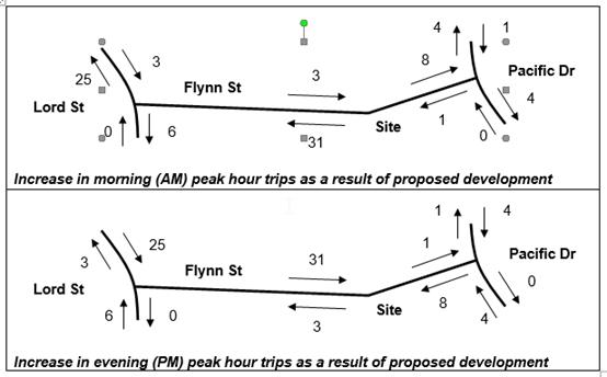
The intersection of Lord and Flynn Streets is considered to
be the main concern. Existing traffic counts by the consultant indicate that
this intersection experiences 1,100 trips during the AM peak hour (to 09:00)
and 1,200 trips during the PM peak hour (to 17:45).
The applicant has provided SIDRA analysis to show that the
current operation of this intersection has an acceptable level of service and
that the proposed development will not significantly increase delays for users,
particularly during the morning peak hour when the greatest number of users
would attempt to turn right out of Flynn Street towards Port Macquarie CBD.
However, analysis of the PM peak turning volumes raises
concern, with 87 southbound vehicles turning left into Flynn Street and 26
northbound vehicles turning right into Flynn Street. With reference to the
AUSTROADS Guide to Traffic Management Part 6: Intersections, Interchanges and
Crossings (2017), the warrants for upgrading the intersection to safer
channelised turn treatments are already considered triggered as a result of
existing traffic. The proposal would further increase the numbers of turning movements
by 29% on existing trips for the southbound left turn (CHL) and 23% for the
northbound right turn (CHR), which represents a significant increase in risk of
safety incidents.
It is therefore recommended that the intersection be
upgraded to CHL and CHR turn treatments prior to occupation certificate being
issued for the development. This upgrade will ensure that the proposed increase
in traffic will be safely and efficiently catered for within the local road
network. The line marking required to achieve this is likely to fit within the
existing wide carriageway of Lord Street without realigning kerb and gutter or
widening the pavement. Suitable consent conditions have been recommended.
Site
Frontage and Access
Vehicle access to the site is proposed through two
driveways. The existing resident access driveway and existing driveway to the
east for staff and visitor vehicle parking. Access shall comply with Council
AUSPEC and Australian Standards and conditions have been imposed to reflect
these requirements.
Parking
and Manoeuvring
Existing and proposed parking requirements are provided in
the table to the DCP heading earlier within this report. In summary a total of
seventy (70) new parking spaces are indicated on the site plan, which satisfies
the minimum parking provision.
Parking and driveway widths on site can comply with relevant
Australian Standards (AS 2890) and conditions have been imposed to reflect
these requirements.
Due to the type of development, car park circulation is
required to enable vehicles to enter and exit the site in a forward manner.
Site plans show adequate area is available. A dedicated turning bay has been
made available at the end of the blind aisle, which is not open to the public.
Water Supply Connection
Reticulated water supply is existing and available.
Council’s water supply section are satisfied that adequate arrangements
will be made for the supply of water expected to be generated from the
development. Specifically consent conditions have been recommended requiring final
water service sizing to be determined by a hydraulic consultant consistent with
the requirements of Australian Standard 3500: Plumbing and Drainage with
details to be provided as part of the infrastructure construction certificate.
Sewer Connection
Reticulated sewer supply is existing and available.
Council’s sewer supply section are satisfied (via conditions of consent)
that adequate arrangements will be made for the supply of sewer expected to be
generated from the development.
Stormwater
The site grades to Wrights Creek, located within the eastern
portion of the site.
The legal point of discharge for the proposed development is
defined as a new outlet to Wrights Creek, subject to the provision of a
suitable outlet design to protect against erosion. The applicant’s
stormwater concept plan is consistent with this requirement.
A stormwater management plan has been submitted
demonstrating how the site is proposed to be drained to Wrights Creek. The
proposal includes the provision of a number of proprietary gross pollution
traps, which have been sized to treat stormwater runoff such that the site
meets the discharge parameters of AUSPEC D7. Conceptual modelling has been
submitted to demonstrate compliance in this regard.
The stormwater management plan also demonstrated how on-site
stormwater detention facilities can be incorporated into the proposed
development, providing two options. In particular, the plan indicates that the
required onsite detention volume can be accommodated within either a large end
of line basin beneath the common driveway area or within numerous individual
tanks located within the deck area of each proposed holiday unit. Either
solution is acceptable from an AUSPEC compliance perspective.
The site is also affected by the flooding of Wrights Creek.
Assessment of the associated risks have been made by a flooding engineer. From
a stormwater drainage perspective, the provision of on-site stormwater
detention facilities which have been designed to limit site stormwater
discharge to pre-development rates mean that the development will have no
impacts on the extent of downstream flooding as a consequence of an increase in
stormwater runoff from the site.
The detailed design submission will need to demonstrate that
the proposed detention facilities continue to function during a flood event. A
detailed site stormwater management plan will be required to be submitted for
assessment with the S.68 application and prior to the issue of a Construction
Certificate.
Other
Utilities
Telecommunication and electricity services are available to
the site. Any substation required to provide for the additional load is to be
contained within private property unless accepted in writing by Council.
Other land resources
No adverse impacts anticipated.
The site is within an established urban context and will not sterilise any
significant mineral or agricultural resource.
Water cycle
The proposed development will be
unlikely to have any adverse impacts on water resources and the water cycle.
Soils
The
proposed development will be unlikely to have any adverse impacts on soils in
terms of quality, erosion, stability and/or productivity subject to a standard
condition requiring erosion and sediment controls to be in place prior to and
during construction.
Air and microclimate
The construction and/or
operations of the proposed development will be unlikely to result in any
adverse impacts on the existing air quality or result in any pollution.
Standard precautionary site management condition recommended.
Flora and fauna
Construction of the proposed development will require
removal of scatter trees throughout the site in order to accommodate buildings,
services and bushfire protection measures. The protection and enhancement of the
Wright Creek riparian corridor also forms part of the proposal.
It is noted that the application
was lodged on 4 October 2017. The Biodiversity Conservation (Savings and
Transitional) Amendment Regulation 2017 released on 24 November 2017 extended
the application of the former planning provisions of the Environmental Planning
and Assessment Act to the biodiversity assessment of Part 4 development
applications to 25 February 2018.
Having regard to the tree removal
proposed to accommodate the development (inclusive of buildings, services and
bushfire protection measures), the application was supported by a three part
report prepared by Anne Clements and Associates Pty Ltd, dated 29 September
2017. The three part report provided the following:
· Part A – Assessment
of flora constraints.
· Part B –
Assessment of significance of the proposal on the listed Coastal Floodplain
community.
· Part C –
Vegetation Management Plan (VMP) for the riparian corridors and offsets,
incorporating the Koala Plan of Management (KPOM).
The flora assessment concluded that
there were 58 Eucalypt trees on the site. Of these 54 were identified as
preferred koala feed trees. Refer to detailed comments under SEPP 44 heading
for koala impacts.
The flora assessment also concluded
that an area of vegetation comprising 950m2 in two patches
approximately 10m wide and approximately 40m and 55m long within the Wrights
Creek riparian corridor represents a coastal flood plain Endangered Ecological
Community (EEC).
The assessment gave consideration
to the impact of the proposal on the identified EEC. The assessment concluded
that the proposal will result in no direct clearing of the EEC but rather
indirectly modify approximately 145m2 (within 10m of the proposal)
of the 950m2 of mapped EEC. The assessment concludes that the
proposal is not likely to result in a significant impact on the EEC and that a
Species Impact Statement is not required.
The flora assessment recommends the
following key ameliorative measures:
· That a 20m buffer
be provided to either side of Wrights Creek consistent with a 2nd
order stream consistent with the guidelines for riparian corridors on
waterfront land provided under the Water Management Act.
· A VMP
incorporating a KPOM be prepared to establish a fully structured vegetated
riparian corridor consistent with the NSW Office of Water guidelines.
· This riparian
corridor is to provide a conservation link along Wrights Creek. It is to be
conserved and enhanced through careful bush regeneration with plantings of only
local provenance species consistent with the Coastal Floodplain, especially the
preferred koala feed tree Eucalyptus robusta.
· Any landscaping on
the site should also consider the use of preferred koala feed tree, Eucalyptus
robusta.
Consistent with the above, the
proposal incorporates a 20m buffer either side of Wrights Creek. A VMP has been
provided which aims to conserve and enhance the riparian corridor noting its
importance as a conservation link along Wrights Creek. The VMP and KPOM provide
for compensatory replanting of preferred koala feed trees within the riparian
corridor and site at a ratio of 3:1.
A separate fauna impact assessment
supported the application. The assessment was prepared by JB Enviro, dated 7
March 2018 and addresses the requirements of the ‘7 part test’
under section 5A of the Act. The report
concluded that the proposal is unlikely to have a significant impact on any
threatened species and that a Species Impact Statement is not required.
Both the flora and fauna impact
assessments conclude that the proposal is unlikely to have any significant
adverse impacts on any threatened flora and fauna species and that Species
Impact Statements are not required.
Conditions of consent have been
recommended specifying that the commitments and obligations provided in both
the VMP and KPOM form part of any consent issued and shall be implemented at
their respective stages throughout the development if consent is granted.
In addition to the above, an
Arboriculture impact assessment report was undertaken by Woodvale Tree
services. In summary it was demonstrated that the koala feed trees nominated
from retention can be retained long term. However it was recommended that
further canopy impact assessments and pre-non-destructive below grade
examination of areas within chosen tree protection zones may be necessary to
determine the final location of piers.
Waste
Satisfactory arrangements are in place for proposed storage
and collection of waste and recyclables via a private waste collection service.
No adverse impacts anticipated. Standard precautionary site management
condition recommended.
Energy
The proposal is not BASIX
affected development. However, the development will be required to comply with
section J of the Building Code of Australia (BCA).
Noise and vibration
Having regard to the location of
the site and nature of the development, there will be anticipated short term
noise impacts during construction activities. Consent condition has been
recommended to restrict construction to standard construction hours.
In terms of the visitor
accommodation use, it is noted that the existing onsite manager is to remain. A
condition of consent has been recommended to require a complaints register to
be established by management and this be made available upon request to
Council. The condition also requires that a telephone number be provided on the
sign located on the front fence for any complaints.
Bushfire
The site is identified as being bushfire prone. In
accordance with Section 100B of the Rural Fires Act, 1997, the application
proposes development for a Special Fire Protection Purpose. The application was
supported by a bushfire assessment report prepared by a Certified Consultant.
The application and supporting bushfire assessment report
were referred to the NSW Rural Fire Service. The Commissioner has assessed the
application and issued a Bushfire Safety Authority consisting of a series of
conditions which are recommended to form part of the consent conditions.
Safety, security and crime
prevention
The proposed development will be
unlikely to create any concealment/entrapment areas or crime spots that would
result in any identifiable loss of safety or reduction of security in the
immediate area.
A suitable level of surveillance
of the area will be retained by the design.
Social impacts in the
locality
Given the nature of the proposed
development and its’ location, the proposal is unlikely to result in any
adverse social impacts.
Economic
impact in the locality
No
adverse impacts. Likely positive impacts can be attributed to the construction
of the development and associated flow on effects (ie maintained employment and
expenditure in the area).
Site design and internal
design
The proposed development design
satisfactorily responds to the site attributes and will fit into the locality.
No adverse impacts likely.
Construction
No significant adverse impacts
identified to neighbouring properties with the construction of the proposal.
Standard conditions will be imposed to control construction, demolition,
erosion, noise etc.
Cumulative Impacts
The proposed development is not
expected to have any adverse cumulative impacts on the natural or built
environment or the social and economic attributes of the locality.
(c) The
suitability of the site for the development:
The proposal will fit into the
locality. Site constraints have been adequately addressed and appropriate
conditions of consent recommended.
(d) Any
submissions made in accordance with this Act or the Regulations:
Five (5) written submissions have been received following public exhibition of
the application.
Key
issues raised in the submissions received and comments in response to these
issues are provided as follows:
|
Submission
Issue/Summary
|
Planning
Comment/Response
|
|
The residents of the gateway
lifestyle village have lost their right of pedestrian access through the site
to Pacific Drive via the right of footway over SP61661 being 55-56 Pacific
Drive.
|
A title search of SP61661
reveals a reference to dealing 5040496 - Right of Footway 1.5m wide burdening
the property. The land burdened being Lot 18 DP17542 (being the land prior to
strata subdivision). Land benefited is Lot 331 DP828346. The land containing
the gateway lifestyle village (Lot 332 DP828346) does not benefit from use of
the footway. There is also no right of footway over Lot 331 DP828346 to this
pathway.
|
|
If no pedestrian access is permitted through the site the
developer should provide a footpath connection along Ocean Street to Pacific
Drive.
|
There is no nexus between the proposed development and
suggested footpath. Council could not impose such a requirement. Full
frontage footpath paving already exists along the Flynns Street
frontage.
|
|
The adopted occupancy rate in the supporting parking
assessment is not appropriate. Parking proposed is insufficient noting the
peak seasonal demand likely to be experienced from this and surrounding
developments. Limited on-street parking exists.
|
Refer to parking calculations in Development Control Plan
(DCP) table of this report. The application has been revised to provide
additional parking consistent with DCP provisions.
|
|
Occasional queues are experienced at the existing
entrance driveway waiting for the automatic gate to open. The proposal will
exacerbate this problem creating a traffic and pedestrian safety
problem.
|
Refer to comments under roads, traffic and transport
heading of this report. Council’s development engineering section are
comfortable the additional traffic likely to be generate from the proposal
can be safely accommodated via the existing entrance arrangement.
|
|
The doubling of tourist accommodation will increase night
time noise levels experienced by adjoining residents. The sliding gate and
intercom are loud. No consideration of this has been given.
|
Management of guests within the site will be the
responsibility of centre management. An onsite manger already exists and is
to be retained. A Condition of consent has been recommended requiring a
complaints register to be developed with contact number made available to the
public.
|
|
The site is subject to flooding and impacts need to be
considered.
|
Refer to comments under Port Macquarie-Hastings Local
Environmental Plan 2011 heading of this report, specifically clause 7.3.
|
|
The application should have regard to the shire wide KPoM
to be considered by Council at its December 2017 meeting.
|
This site is subject to its own Koala Plan of Management.
Refer to comments under State Environmental Planning Policy 44 heading of
this report.
|
|
Construction noise will impact on adjoining residents
within the locality. It is suggested that standard construction hours be
reduced to minimise impacts.
|
Standard building construction hours are considered appropriate.
|
|
In terms of planned noisy construction activities the
developer undertake community consultation with adjoining property owners and
residents.
|
A condition has been recommended requiring a construction
management plan. The plan shall provide a contact number for the site
supervisor/manager, works schedule and notification procedure to adjoining
land owners for noisy works.
|
|
The area on the eastern side of the creek is subject to
high flooding and contains Koala trees and fauna and is not suitable for
development.
|
The application has been revised since lodgement and the
villas/units originally proposed on the eastern side of the creek do not form
part of this application.
|
|
The roof of the existing amenities block on the eastern
side of the creek catches leaves and is a fire hazard.
|
Noted, however the building is existing and there is no
change proposed.
|
(e) The Public Interest:
The proposed development
satisfies relevant planning controls and is unlikely to impact on the wider
public interest.
4. DEVELOPMENT
CONTRIBUTIONS APPLICABLE
· Development contributions will be required towards
augmentation of town water supply and sewerage system head works under Section
64 of the Local Government Act 1993.
· Development contributions will be required under Section 94
of the Environmental Planning and Assessment Act 1979 towards roads, open
space, community cultural services, emergency services and administration
buildings.
5. CONCLUSION
The
application has been assessed in accordance with Section 4.15 of the
Environmental Planning and Assessment Act 1979.
Issues
raised during assessment and public exhibition of the application have been
considered in the assessment of the application. Where relevant, conditions
have been recommended to manage the impacts attributed to these issues.
The
site is suitable for the proposed development, is not contrary to the public's
interest and will not have a significant adverse social, environmental or
economic impact. It is recommended that the application be approved, subject to
the recommended conditions of consent provided in the attachment section of
this report.
|
Attachments
1View. DA2017
- 855.1 Recommended Consent Conditions
2View. DA2017
- 885.1 Site Survey Plan
3View. DA2017
- 885.1 Wrights Creek survey
4View. DA2017
- 885.1 SoEE
5View. DA2017
- 885.1 Site Plan
6View. DA2017
- 885.1 Floor Plans
7View. DA2017
- 885.1 Roof Plan
8View. DA2017
- 885.1 Foundation Plan
9View. DA2017
- 885.1 Elevation Plans
10View. DA2017
- 885.1 Sections
11View. DA2017
- 885.1 Existing Building Alterations Ground Floor Plan
12View. DA2017
- 885.1 Reception and Cafe Plan
13View. DA2017
- 885.1 BBQ and Utilities Pavilions Plans
14View. DA2017
- 885.1 Utilities Pavilions Elevations
15View. DA2017
- 885.1 Maintenance and Staff Amenities Plan
16View. DA2017
- 885.1 Villa Suite Plans
17View. DA2017
- 885.1 Riparian Corridor and Offset Plan
18View. DA2017
- 885.1 Riparian Corridor Plan showing encroachments
19View. DA2017
- 885.1 Landscape Plan
20View. DA2017
- 885.1 Tree Removal Retention Plan
21View. DA2017
- 885.1 Tree removal & proposed offset planting - Anne Clements
22View. DA2017
- 885.1 Services Plan - StormwaterWaterSewer
23View. DA2017
- 885.1 Stormwater Drainage Strategy Plan & Modelling
24View. DA2017
- 885.1 Koala Plan of Management and Vegetation Management Plan
25View. DA2017
- 885.1 NSW Planning Department letter advising of KPoM approval
26View. DA2017
- 855.1 Revised Flood Impact Assessment
27View. DA2017
- 885.1 Arboricultural Impact Assessment
28View. DA2017
- 885.1 Bushfire Assessment Report
29View. DA2017
- 885.1 Confirmation of APZ compliance with proposed offset plantings
30View. DA2017
- 885.1 NSW Rural Fire Service - Bushfire Safety Authority conditions
31View. DA2017
- 885.1 NSW Office of Water General Terms of Approval
32View. DA2017
- 885.1 CPTED Assessment Report
33View. DA2017
- 885.1 Ecology Report Parts 1-4
34View. DA2017
- 885.1 Seven Part Test ecological assessment
35View. DA2017
- 885.1 Traffic and Parking Impact Assessment Report
36View. DA2017
- 885.1 Carpark detail GHD
37View. DA2017
- 885.1 Email from applicant with response to reasons for deferral - Jonathon
Condon
38View. DA2017
- 885.1 Flood Data at Proposed Carpark GHD
39View. DA2017
- 885.1 Flood Evacuation Plan GHD
40View. DA2017
- 885.1 Flooding Egress Walkway Plan Villas 56, 57, 58 and 59
41View. DA2017
- 885.1 Revised Site Plan
42View. DA2017
- 885.1 Survey Plan
43View. DA2017
- 885.1 Submission - Barry
44View. DA2017
- 885.1 Submission - Bryen
45View. DA2017
- 885.1 Submission - Harris for Owners SP61661 6779
46View. DA2017
- 885.1 Submission - Lyons
47View. DA2017
- 885.1 Submission - Wells
|