Business
Paper
|
date of meeting:
|
|
Wednesday 28
February 2018
|
|
location:
|
|
Function Room
Port
Macquarie-Hastings Council
17 Burrawan Street
Port Macquarie
|
|
time:
|
|
2:00pm
|
Development
Assessment Panel
CHARTER
1.0 OBJECTIVES
To assist in managing Council's development assessment
function by providing independent and expert determinations of development
applications that fall outside of staff delegations.
2.0 KEY FUNCTIONS
·
To review development application reports and conditions;
·
To determine development
applications outside of staff delegations;
·
To refer development applications
to Council for determination where necessary;
·
To provide a forum for objectors and applicants
to make submissions on applications
before the Development Assessment Panel
(DAP);
·
To maintain transparency in the determination of development
applications.
Delegated Authority of Panel
Pursuant to
Section 377 of the Local Government Act, 1993 delegation to:
·
Determine development applications under Part 4
of the Environmental Planning and Assessment
Act 1979 having
regard to the relevant environmental planning instruments,
development control plans and Council policies.
·
Vary, modify or release restrictions as to use
and/or covenants created by Section 88B instruments under the Conveyancing Act
1919 in relation to development applications for subdivisions being considered
by the panel.
·
Determine Koala Plans of Management under State
Environmental Planning Policy 44 - Koala Habitat Protection associated with
development applications being considered by the Panel.
Noting the trigger to escalate
decision making to Council as highlighted in section 5.2.
3.0
MEMBERSHIP
3.1
Voting
Members
·
Two independent external members. One of the
independent external members to be the Chairperson.
·
Group Manager Development Assessment (alternate
- Director Development & Environment or Development Assessment Planner)
The independent external members shall have expertise in
one or more of the following areas: planning, architecture, heritage, the
environment, urban design, economics, traffic and transport, law, engineering,
government and public administration.
3.2
Non-Voting Members
·
Not applicable
3.3 Obligations
of members
·
Members must act faithfully and diligently and
in accordance with this Charter.
·
Members must comply with Council's Code of Conduct.
·
Except as required to properly perform their
duties, DAP members must not
disclose any confidential information (as advised by Council) obtained in connection with the DAP functions.
·
Members will have read and be familiar with the
documents and information provided by Council prior
to attending a DAP meeting.
·
Members must act in accordance with Council's
Workplace Health and Safety Policies and Procedures
·
External members of the Panel are not authorised
to speak to the media on behalf of Council. Council officers that are members
of the Committee are bound by the
existing operational delegations in relation to speaking to the media.
·
Staff members shall not vote on matters before
the Panel if they have been the principle author of the development assessment report.
3.4
Member Tenure
·
The independent external members will be
appointed for the term of four (4) years
maximum in which the end of the tenure of these members would occur in a
cascading arrangement.
3.5 Appointment
of members
·
The independent external members (including the
Chair) shall be appointed by the General Manager following an external
Expression of Interest process.
·
Staff members of the Panel are in accordance
with this Charter.
4.0 TIMETABLE
OF MEETINGS
·
The Development Assessment Panel will generally
meet on the 1st and 3rd Wednesday each month at 2.00pm at the Port Macquarie
offices of Council.
·
Special Meetings of the Panel may be convened by
the Director Development & Environment Services with three (3) days notice.
5.0
MEETING PRACTICES
5.1
Meeting
Format
·
At all Meetings of the Panel the Chairperson
shall occupy the Chair and preside. The Chair will be responsible for keeping
of order at meetings.
·
Meetings shall be open to the public.
·
The Panel will hear from applicants
and objectors or their r e p r e s e n t a t i v e s .
·
Where considered necessary, the Panel will
conduct site inspections which will
be open to the public.
5.2
Decision Making
·
Decisions are to be made by consensus. Where
consensus is not possible on any item, that item is to be referred to Council
for a decision.
·
All development applications involving a
proposed variation to a development standard
greater than 10% under Clause
4.6 of the Local Environmental Plan will be
considered by the Panel and recommendation made to the Council for a decision.
5.3
Quorum
·
All members (2 independent external members and
1 staff member) must be present at a
meeting to form a quorum.
5.4
Chairperson and Deputy Chairperson
·
Independent Chair (alternate, second independent member)
5.5
Secretariat
·
The Director Development &n Environment is
to be responsible for ensuring that the Panel has adequate secretariat support.
The secretariat will ensure that the business paper and supporting papers are
circulated at least three (3) days prior to
each meeting. Minutes shall be appropriately approved and circulated to each
member within three (3) weeks of a meeting being held.
·
The format of and the preparation and publishing
of the Business Paper and Minutes shall be similar to the format for Ordinary
Council Meetings.
5.6
Recording of decisions
·
Minutes will record decisions and how each
member votes for each item before the Panel.
6.0 CONVENING
OF “OUTCOME SPECIFIC” WORKING GROUPS
Not applicable.
7.0 CONFIDENTIALITY
AND CONFLICT OF INTEREST
·
Members of the Panel must comply with the
applicable provisions of Council’s Code of Conduct. It is the personal
responsibility of members to comply with the standards in the Code of Conduct
and regularly review their personal circumstances with this in mind.
·
Panel members must declare any conflict of
interests at the start of each meeting or before discussion of a relevant item
or topic. Details of any conflicts of interest should be appropriately minuted.
Where members are deemed to have a real or perceived conflict of interest, it
may be appropriate they be excused from deliberations on the issue where the
conflict of interest may exist. A Panel meeting may be postponed where there is
no quorum.
8.0 LOBBYING
·
All members and applicants are to adhere to
Council’s Lobbying policy. Outside of
scheduled Development Assessment Panel meetings, applicants, their
representatives, Councillors, Council staff and the general public are not to
lobby Panel members via meetings, telephone conversations, correspondence and
the like. Adequate opportunity will be provided at Panel inspections or
meetings for applicants, their representatives and the general public to make
verbal submissions in relation to Business Paper items.
Development Assessment Panel
ATTENDANCE
REGISTER
|
Member
|
08/11/17
|
22/11/17
|
06/12/17
|
13/12/17
|
14/02/18
|
|
Paul Drake
|
P
|
P
|
P
|
P
|
P
|
|
Robert Hussey
|
P
|
P
|
P
|
P
|
P
|
|
David Crofts
(alternate member)
|
|
|
|
|
|
|
Dan Croft
(Acting Director
Development & Environment)
Clinton Tink
(Acting GM Development
Assessment
(alternates)
- Director Development & Environment
- Development Assessment Planner
|
P
|
P
P
|
P
P
|
P
P
|
P
P
|
Key: P = Present
A
= Absent With Apology
X
= Absent Without Apology
Development
Assessment Panel Meeting
Wednesday 28 February
2018
Items of Business
01 Acknowledgement
of Country............................................................................ 8
02 Apologies......................................................................................................... 8
03 Confirmation
of Minutes.................................................................................... 8
04 Disclosures
of Interest..................................................................................... 14
05 DA2017
- 721.1 Manufactured Housing Estate, Manager's Residence And Associated
Infrastructure - Lot 2 DP 1224314, Lot 2 DP 1172154 Thrumster Street, Thrumster 18
06 DA2017
- 871.1 Service Station And Signage - Lot 20 DP 1191370 No. 16 Sancrox Road,
Sancrox........................................................................................................ 404
07 DA2017
- 1007.1 Eight Semi-Detached Dwellings With Torrens Title Subdivision
Lots 114,115,116 And 117 DP 1229250, 43 Seaside Drive And 4-6 Waterside
Way Lake Cathie..................................................................................................................... 517
08 DA2017
- 780.1 Shop Top Housing - Lot 1 DP 536032, No. 4 Hastings River Drive, Port
Macquarie..................................................................................................... 578
09 DA2017
- 981.1 Ancillary Building (Shed) Lot 2 DP 244961, No 8 Azalea Avenue, Wauchope..................................................................................................................... 652
10 General
Business
AGENDA Development Assessment Panel 28/02/2018
Subject: ACKNOWLEDGEMENT
OF COUNTRY
"I acknowledge that we are
gathered on Birpai Land. I pay respect to the Birpai Elders both past and
present. I also extend that respect to all other Aboriginal and Torres Strait
Islander people present."
RECOMMENDATION
That the apologies received be
accepted.
Subject: CONFIRMATION
OF PREVIOUS MINUTES
Recommendation
That the Minutes of the Development
Assessment Panel Meeting held on 14 February 2018 be confirmed.
MINUTES
Development Assessment Panel Meeting
14/02/2018
PRESENT
Members:
Paul
Drake
Robert Hussey
Clinton Tink
Other Attendees:
Dan Croft
Ben
Roberts
Chris
Gardiner
Deb
McKenzie
|
The meeting opened at 2:00pm.
|
|
01 ACKNOWLEDGEMENT
OF COUNTRY
|
|
The
Acknowledgement of Country was delivered.
|
|
03 CONFIRMATION
OF MINUTES
|
|
CONSENSUS:
That
the Minutes of the Development Assessment Panel Meeting held on 13 December
2017 be confirmed.
|
|
04 DISCLOSURES OF INTEREST
|
|
Clinton Tink declared a
Non-Pecuniary – Less than Significant Interest tabled on Item 05 being
DA2017 – 355.1 and Item 06 being DA2017 – 553.. The reason
being that, as per the Development Assessment Panel Charter, Clinton Tink is
the author of both reports. As a result, Clinton Tink did not vote on
the items but remained within the meeting to answer any questions from the
Panel. Dan Croft, Acting Director of Development and Environment
replaced Clinton Tink on the Panel for Item 05 and Item 06 only.
|
|
05 DA2017 - 355.1
- Demolition Of Dwelling And Construction Of Child Care Centre - Lot 14 DP
262597, 17 Kulai Place, Port Macquarie
|
|
Clinton Tink declared a Non-Pecuniary – Less than Significant Interest in
this item, left the Panel and Dan Croft replaced him.
Dan
Croft tabled copies of submissions that were not included in the agenda. Dan
Croft confirmed that while the submissions were not included in the agenda,
they were considered in the assessment report and copies were also provided
to and reviewed by the Panel members before the meeting.
Dan
Croft also tabled a request from the applicant to have the item deferred.
Speakers:
Brad
Maggs (applicant)
CONSENSUS:
That DA2017 – 355.1 be deferred to allow the
applicant the opportunity to investigate alternate access arrangements and to
address the reasons for refusal listed within the report.
|
|
06 DA2017
- 553.1 - Multi Dwelling Housing And Strata Title Subdivision - Lot 2 DP
18127, 34 Chapman Street, Port Macquarie
|
|
Clinton
Tink declared a Non-Pecuniary – Less than
Significant Interest in this item, left the Panel and Dan Croft replaced him.
Speakers:
Krissa Wilkinson (o)
Michael Eddie (o)
David Pensini (applicant)
CONSENSUS:
That DA2017 – 553.1 for
multi dwelling housing and strata title subdivision at Lot 2, DP 18127, No.
34 Chapman Street, Port Macquarie, be determined by granting consent subject
to the recommended conditions as amended below:
Add condition B20 to state:
B20 (B199) Prior to release of any
Construction Certificate, plans are to be provided to the Principal
Certifying Authority providing for eastern, southern and western boundary
fencing to achieve a height of a minimum 1.8m above finished ground level and
be of solid construction.
Dan
Croft left the Panel and Clinton Tink returned to the Panel.
|
|
07 DA 2017 -
914.1 Additions To Dwelling - Lot 111, DP 246248, No. 14 Hibbard Drive,
Port Macquarie
|
|
Speakers:
Mark
& Belinda Patterson (o)
James
Collins (applicant)
CONSENSUS:
That DA2017 – 914.1 for additions to dwelling at
Lot 111, DP 246248, No. 14 Hibbard Drive, Port Macquarie, be determined by
granting consent subject to the recommended conditions as amended below:
Delete
condition B2.
|
|
08 DA2017
- 529.1 Alterations To Caravan Park - Lot 2 DP 598227, Bell Street, Dunbogan
|
|
CONSENSUS:
That DA2017 – 529.1 for alterations to caravan park
at Lot 2, DP 598227, Bell Street, Dunbogan, be determined by granting consent
subject to the recommended conditions.
|
|
09 DA2017 - 979.1
Construction Of A New Dwelling (Including Clause 4.6 Variation To Clause 4.3
(Height Of Buildings) Of The Port Macquarie-Hastings Local Environmental Plan
2011, Swimming Pool And Spa at Lot 143 DP 1229250, No 62 Surfers Drive, Lake
Cathie
|
|
Speakers:
Graham
& Karen Davis (o)
Chris
Jenkins (applicant)
CONSENSUS:
That
DA2017 – 979 for the construction of a new dwelling (including clause
4.6 variation to clause 4.3 (height of buildings), of the Port Macquarie-Hastings
Local Environmental Plan 2011, swimming pool and spa at Lot 143 DP 1229250,
No. 62 Surfers Street, Lake Cathie, be determined by granting consent subject
to the recommended conditions.
|
|
10 DA2017 - 632.1
Multi Dwelling Housing And Strata Subdivision - Lot 1 DP 596122, 25 Hibbard
Drive, Port Macquarie
|
|
Speakers:
Andrew
Lister (o)
Victor
Jackson (o)
Ian
Gowan (o)
James
Collins (applicant)
CONSENSUS:
That DA2017 – 632.1 for multi dwelling housing and
strata title subdivision at Lot 2, DP 596122, No. 25 Hibbard Drive, Port
Macquarie, be determined by granting consent subject to the recommended
conditions as amended below:
Add
condition B20 to state:
B20 (B034) Prior to release of the
Construction Certificate the submission of details to Council for the
disposal of any spoil gained from the site and/or details of the source of
fill, heavy construction materials and proposed routes to and from the site,
including, but not limited to:
·
The pavement condition of the route/s proposed (excluding
collector, sub-arterial and arterial roads) for the haulage of fill material
to the site and/or haulage of excess material from the site. The condition
report shall include photographs of the existing pavement and pavement
deflection test results taken in the travel lanes;
·
Recommended load limits for haulage vehicles and;
·
A procedure for monitoring the condition of the pavement during
the haulage;
·
Bond to guarantee public infrastructure is not damaged as a
result of construction activity,
and;
Council shall
determine the need for and extent of any rectification work on the haulage
route/s considered attributable by the haulage of materials to and/or from
the site.
Add
condition E21 to state:
E21 (E007) The
owner/applicant is responsible for ensuring that any imported fill is either
Virgin Excavated Natural Material (VENM) or Excavated Natural Material (ENM).
Prior to the issue of an Occupation Certificate, certification is to be
provided to Council demonstrating that the fill is either VENM or ENM.
Add condition E22 to state:
E22
(E195) Prior to release of the Occupation Certificate or occupation
(whichever occurs first), the flood evacuation process is to be displayed
within each unit and maintained at all times.
|
|
The meeting closed at 4:00pm.
|
AGENDA Development Assessment Panel 28/02/2018
Subject: DISCLOSURES
OF INTEREST
RECOMMENDATION
That Disclosures of Interest be presented
DISCLOSURE OF
INTEREST DECLARATION
Name of Meeting: ………………………………………………………………………..
Meeting Date: ………………………………………………………………………..
Item Number: ………………………………………………………………………..
Subject: ………………………………………………………………………..
…………………………………………………….……………...…..
I,
.....................................................................................
declare the following interest:
 Pecuniary:
Take
no part in the consideration and voting and be out of sight of the meeting.
Non-Pecuniary
- Significant Interest:
Take
no part in the consideration and voting and be out of sight of the meeting.
Non-Pecuniary
- Less than Significant Interest:
May
participate in consideration and voting.
For the reason that:
....................................................................................................
.......................................................................................................................................
Name:
…………………………………………………….
Signed:
.........................................................................
Date: ..................................
 (Further
explanation is provided on the next page)
(Further
explanation is provided on the next page)
Further
Explanation
(Local Government Act and Code of Conduct)
A conflict of interest exists where a reasonable and informed
person would perceive that a Council official could be influenced by a private
interest when carrying out their public duty. Interests can be of two types:
pecuniary or non-pecuniary.
All interests, whether pecuniary or non-pecuniary are required to
be fully disclosed and in writing.
Pecuniary Interest
A pecuniary interest is an interest that a Council official has in
a matter because of a reasonable likelihood or expectation of appreciable
financial gain or loss to the Council official. (section 442)
A Council official will also be taken to have a pecuniary interest
in a matter if that Council official’s spouse or de facto partner or a
relative of the Council official or a partner or employer of the Council
official, or a company or other body of which the Council official, or a
nominee, partner or employer of the Council official is a member, has a
pecuniary interest in the matter. (section 443)
The Council official must not take part in the consideration or
voting on the matter and leave and be out of sight of the meeting. The
Council official must not be present at, or in sight of, the meeting of
the Council at any time during which the matter is being considered or
discussed, or at any time during which the council is voting on any question in
relation to the matter. (section 451)
Non-Pecuniary
A non-pecuniary interest is an interest that is private or
personal that the Council official has that does not amount to a pecuniary
interest as defined in the Act.
Non-pecuniary interests commonly arise out of family, or personal
relationships, or involvement in sporting, social or other cultural groups and
associations and may include an interest of a financial nature.
The political views of a Councillor do not constitute a private
interest.
The management of a non-pecuniary interest will depend on whether
or not it is significant.
Non Pecuniary – Significant Interest
As a general rule, a non-pecuniary conflict of interest will be
significant where a matter does not raise a pecuniary interest, but it
involves:
(a)
A relationship between
a Council official and another person that is particularly close, for example,
parent, grandparent, brother, sister, uncle, aunt, nephew, niece, lineal
descendant or adopted child of the Council official or of the Council official’s
spouse, current or former spouse or partner, de facto or other person living in
the same household.
(b)
Other relationships
that are particularly close, such as friendships and business relationships.
Closeness is defined by the nature of the friendship or business relationship,
the frequency of contact and the duration of the friendship or relationship.
(c)
An affiliation between
a Council official an organisation, sporting body, club, corporation or
association that is particularly strong.
If a Council official declares a non-pecuniary significant
interest it must be managed in one of two ways:
1.
Remove the source of
the conflict, by relinquishing or divesting the interest that creates the
conflict, or reallocating the conflicting duties to another Council official.
2.
Have no involvement in
the matter, by taking no part in the consideration or voting on the matter and
leave and be out of sight of the meeting, as if the provisions in section
451(2) apply.
Non Pecuniary – Less than Significant Interest
If a Council official has declared a non-pecuniary less than
significant interest and it does not require further action, they must provide
an explanation of why they consider that the conflict does not require further
action in the circumstances.
SPECIAL
DISCLOSURE OF PECUNIARY INTEREST DECLARATION
|
By
[insert full name of councillor]
|
|
|
In the
matter of
[insert name of environmental planning instrument]
|
|
|
Which is
to be considered at a meeting of the
[insert name of meeting]
|
|
|
Held on
[insert date of meeting]
|
|
|
PECUNIARY
INTEREST
|
|
Address of land in which councillor or an
associated person, company or body has a proprietary interest (the identified
land)i
|
|
|
Relationship of identified land to councillor
[Tick or cross one box.]
|
Councillor
has interest in the land (e.g. is owner or has other interest arising out of
a mortgage, lease trust, option or contract, or otherwise).
Associated
person of councillor has interest in the land.
Associated
company or body of councillor has interest in the land.
|
|
MATTER GIVING
RISE TO PECUNIARY INTEREST
|
|
Nature of land that is subject to a change
in zone/planning control by proposed
LEP (the subject land iii
[Tick or cross one box]
|
The
identified land.
Land
that adjoins or is adjacent to or is in proximity to the identified land.
|
|
Current zone/planning control
[Insert name of current planning instrument and
identify relevant zone/planning control applying to the subject land]
|
|
|
Proposed change of zone/planning control
[Insert name of proposed LEP and identify proposed
change of zone/planning control applying to the subject land]
|
|
|
Effect of proposed change of zone/planning control
on councillor
[Tick or cross one box]
|
Appreciable
financial gain.
Appreciable
financial loss.
|
|
|
|
Councillor’s
Name: …………………………………………
Councillor’s
Signature:
……………………………….
Date: ………………..
Important Information
This information is being
collected for the purpose of making a special disclosure of pecuniary interests
under sections 451 (4) and (5) of the Local Government Act 1993.
You must not make a special disclosure that you know or ought reasonably to
know is false or misleading in a material particular. Complaints made
about contraventions of these requirements may be referred by the
Director-General to the Local Government Pecuniary Interest and Disciplinary
Tribunal.
This form must be completed by
you before the commencement of the council or council committee meeting in
respect of which the special disclosure is being made. The
completed form must be tabled at the meeting. Everyone is entitled to
inspect it. The special disclosure must be recorded in the minutes of the
meeting.
i.
Section 443 (1) of the Local Government Act 1993 provides that
you may have a pecuniary interest in a matter because of the pecuniary interest
of your spouse or your de facto partner or your relativeiv or
because your business partner or employer has a pecuniary interest. You may
also have a pecuniary interest in a matter because you, your nominee, your
business partner or your employer is a member of a company or other body that
has a pecuniary interest in the matter.
ii.
Section 442 of the Local Government Act 1993 provides that a pecuniary
interest is an interest that a person has in a matter because of a
reasonable likelihood or expectation of appreciable financial gain or loss to
the person. A person does not have a pecuniary interest in a matter if the
interest is so remote or insignificant that it could not reasonably be regarded
as likely to influence any decision the person might make in relation to the
matter or if the interest is of a kind specified in section 448 of that
Act (for example, an interest as an elector or as a ratepayer or person liable
to pay a charge).
iii.
A pecuniary interest may arise by way of a change of permissible use of land
adjoining, adjacent to or in proximity to land in which a councillor or a
person, company or body referred to in section 443 (1) (b) or (c) of the
Local Government Act 1993 has a proprietary interest..
iv.
Relative is defined by the Local Government Act 1993 as
meaning your, your spouse’s or your de facto partner’s parent,
grandparent, brother, sister, uncle, aunt, nephew, niece, lineal descendant or
adopted child and the spouse or de facto partner of any of those persons.
AGENDA Development Assessment Panel 28/02/2018
Item: 05
Subject: DA2017 - 721.1 Manufactured Housing Estate,
Manager's Residence And Associated Infrastructure - Lot 2 DP 1224314, Lot 2 DP
1172154 Thrumster Street, Thrumster
Report
Author: Benjamin Roberts
|
Applicant: GEM
Planning Projects
Owner: G
R & M P Murcott
Estimated Cost: $8,600,000
Alignment with Delivery
Program
4.3.1 Undertake transparent
and efficient development assessment in accordance with relevant legislation.
|
|
RECOMMENDATION
That
DA 2017 – 721.1 for a
Manufactured Housing Estate, Manager’s Residence and Associated
Infrastructure at Lot 2, DP 1224314 and Lot 2, DP 1172154 Thrumster Street,
Thrumster, be determined by granting consent subject to the recommended
conditions.
|
Executive
Summary
This
report considers a development application for a manufactured housing estate,
manager’s residence and associated infrastructure at the subject site and provides an assessment of the
application in accordance with the Environmental Planning and Assessment Act
1979.
Following exhibition of the
application, three (3) submissions have been
received.
1. BACKGROUND
Existing sites features and Surrounding development
The site has an area of 86,794.85m2 or 8.68 hectares.
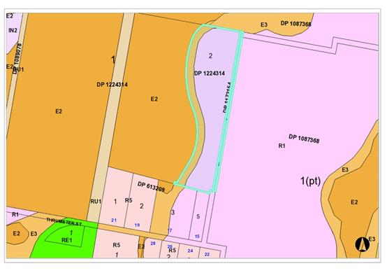
The site is zoned R1 General Residential and E3
Environmental Management in accordance with the Port
Macquarie-Hastings Local Environmental Plan 2011, as shown in the following
zoning plan:
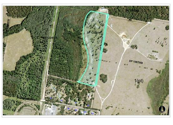
The existing subdivision pattern and location of existing
development within the locality is shown in the following aerial photograph:
2. DESCRIPTION OF
DEVELOPMENT
Key aspects of the proposal include the following:
· 151
dwelling sites accommodating a mix of 1 and 2 bedroom dwellings.
· Community
facilities comprising dining hall, recreation spaces, barbeque areas, tennis
court, lawn bowls, pool and parking.
· Manager’s
residence and sales office.
· Van
and storage area.
· Ancillary
roads and car parking.
· Landscaping
and environmental enhancements.
· Construction
of the road reserve connection to Thrumster Street.
Refer
to attachments at the end of this report.
Application Chronology
· 17
August 2017 - Application lodged.
· 24
August 2017 – Integrated development referral to NSW Rural Fire Service.
· 24
August 2017 – Integrated development referral to NSW Office of
Water.
· 31 August to 29 September 2017 – Public exhibition
neighbour notification and advertising in the local papers.
· 18 September 2017 – Social impact assessment report
lodged.
· 4 October 2017 – Referral to Essential Energy.
· 10 October 2017 – Request for additional information
from NSW Rural Fire Service.
· 16 November 2017 – Additional information request
from Council.
· 24 November 2017 – Essential Energy response.
· 5 December 2017 – Additional information response to
NSW Rural Fire Service received and forwarded to NSW Rural Fire Service.
· 20 December 2017 – Additional information response to
Council matters received with amended plans.
· 22 January 2018 – Applicant advice that E3 zoned land
to be dedicated to Council as per Voluntary Planning Agreement and intended
purchase of triangular parcel of Council land not proceeding. Amended plans
received to entrance in lieu of above.
· 29 January 2018 – Bushfire Safety Authority
conditions received.
3. STATUTORY ASSESSMENT
Section 79C(1) Matters for Consideration
In determining the application, Council is required to take
into consideration the following matters as are relevant to the development
that apply to the land to which the development application relates:
(a) The provisions (where
applicable) of:
(i) any Environmental
Planning Instrument:
State Environmental Planning Policy No. 36 - Manufactured
Home Estates
The aims of this policy and comments are provided below:
a) to facilitate
the establishment of manufactured home estates as a contemporary form of medium
density residential development that provides an alternative to traditional
housing arrangements, and
Comments: Manufactured Home Estates are considered a
contemporary form of medium density housing. The proposed development will
provide an alternative to traditional housing.
(b) to
provide immediate development opportunities for manufactured home estates on
the commencement of this Policy, and
Comments: This policy was gazetted and commenced on 16 July
1993.
(c) to
encourage the provision of affordable housing in well designed estates, and
Comments: The proposal will provide for affordable housing
in a specifically designed
estate. Adequate provision has been made for on-site
facilities, services and open space.
(d) to
ensure that manufactured home estates are situated only in suitable locations
and not on land having important resources or having landscape, scenic or
ecological qualities that should be preserved, and
Comments: Assessment of the proposal having regard to
landscape, scenic and in particular ecological qualities have concluded the
site suitable for the proposed development. Refer to detailed comments under
Flora and Fauna assessment later in this report.
(e) to
ensure that manufactured home estates are adequately serviced and have access
to essential community facilities and services; and
Comments: The proposed development will be serviced by
adequate infrastructure including reticulated water and sewer facilities. The
proposal will provide a number of community facilities within the estate and
access to social and health services will be available.
(f) to
protect the environment surrounding manufactured home estates, and
Comments: Measures have been incorporated into the design
of the estate to provide protection to the environment within and surrounding
the proposed estate. These measures have been incorporated into a Vegetation
Management Plan (VMP).
(g) to
provide measures which will facilitate security of tenure for residents of
manufactured home estates.
Comments: Tenure is largely secured through the large
upfront capital required to establish supporting infrastructure. Conditions of
consent have been recommended to require community and recreational facilities
to be provided up front and before occupation of any sites. Ongoing tenancy
agreements are the other means for tenure security.
The proposed development is considered consistent with the
aims of this policy.
Clause 6 - Where development for the purposes of a
manufactured home estate may be carried out
Clause 6 of this policy provides where development for the
purposes of a manufactured home estate maybe carried out.
The proposed development is permissible with the consent of
Council pursuant to clause 6. In particular, the subject clause allows a
manufactured home estate on land where a caravan park is permissible. The R1
residential zoning of the subject land allows caravan parks with development
consent. In addition, the proposed development is not subject to any of the
excluded areas contained in Schedule 2 of the SEPP.
Clause 7 - Development consent required for manufactured
home estates
Clause 7(1) provides that development for the purposes of a
manufactured home estate permitted to be carried out by this Policy may be
carried out only with the development consent of the council.
Comments: Noted. This development application is seeking
such development consent.
Clause 7(2) provides that a council must not consent to any
such development unless it imposes, as a condition of the consent, a
requirement that an approval to operate a manufactured home estate on the land
on which the development is to be carried out must be obtained under Part 1 of
Chapter 7 of the Local Government Act 1993.
Comments: Noted. Suitable condition recommended.
Clause 7(3) provides that nothing in this Policy requires a
separate development consent to authorise the placing of each manufactured home
within a manufactured home estate.
Comments: Noted.
Clause 8 - Subdivision of manufactured home estates
(1) Land
on which development for the purposes of a manufactured home estate may be
lawfully carried out (whether or not because of a development consent granted
pursuant to this Policy) may be subdivided:
(a) under section 289K of the Local
Government Act 1919 for lease purposes, or
(b) under the Community Land Development
Act 1989,
only with the development consent of the
council.
(2) A
council must not grant a development consent for such a subdivision if any of
the lots intended to be created by the proposed subdivision would contravene a
requirement of the Local Government (Manufactured Home Estates) Transitional
Regulation 1993.
(3) Any
prohibition or restriction on the subdivision of land imposed by any other
environmental planning instrument (whether made before or after this Policy)
does not apply to such a subdivision.
(4) This Policy does not allow the
subdivision of land within a Crown reserve.
Comments: No subdivision for lease or community title
purposes is proposed.
Clause 9 - Matters to be considered by councils
Clause 9(1) provides that Council may grant development
consent for the purposes of a manufactured home estate only if it satisfied:
(a) That each of
the sites on which a manufactured home is or will be installed within the
manufactured home is or will be installed within the manufactured home estate
is or will be adequately provided with reticulated water, a reticulated
sewerage system, drainage and electricity, and
Comments:
Each of the proposed sites within the proposed estate would be serviced by
reticulated water, reticulated sewer, drainage and electricity services.
(b) that the
manufactured home estate is or will be provided with adequate transport
services, and
Comments:
The road network provided to and within the estate is considered appropriate
for the proposed development. A private daily bus service is proposed to
provide residents with access to wider services in the Port Macquarie Central
Business District.
(c) that
sufficient community facilities and services, whether situated within or
outside the estate, are or will be available and reasonably accessible to the
residents of the manufactured home estate, and
Comments:
A range of community facilities are proposed within
the estate, which will be directly available and accessible to the residents
within the estate. The community facilities proposed include dining hall,
swimming pool, tennis court, lawn bowls, library, gym/yoga, amenities and
caravan storage area. In providing a private bus service residents within the
estate will also have access to a range of facilities and services outside the
estate and surrounds.
(d) that the
development will not have an adverse effect on any:
·
conservation area
·
heritage item
·
waterway or land having special
landscape, scenic or ecological qualities,
·
which is identified in an environmental
planning instrument applicable to the land concerned.
Comments:
The proposed development will not have an adverse impact on any of the above.
Clause 9(2) provides that Council may grant development
consent for the purposes of a manufactured home estate only after it has
considered the following:
(a) the cumulative
impact of the proposed development and other manufactured home estates in the
locality,
Comments:
An assessment of the proposed development, supporting documentation and
legislative provisions suggests that there will be no adverse cumulative impact
on the locality or other manufactured home estates in the area.
(b) any relevant
guidelines issued by the Director,
Comments: No relevant guidelines identified.
(c) the provisions
of the Local Government (Manufactured Home Estates) Transitional Regulation
1993.
Comments: The above Regulation has since been
repealed. The Local Government (Manufactured Home Estates, Caravan Parks,
Camping Grounds and Moveable Dwellings) Regulation 2005 is the current
Regulation applicable. A detailed checklist of compliance with the Local
Government (Manufactured Home Estates, Caravan Parks, Camping Grounds and
Moveable Dwellings) Regulation 2005 is attached as a table at the end of this
report.
State
Environmental Planning Policy No. 44 - Koala Habitat Protection
The Thrumster
(Area 13) Koala Plan of Management (KPoM) applies to the site. In accordance
with clause 9 of the policy Council’s determination of the application
must not be inconsistent with the adopted plan of management.
The
application is supported by an ecological impact assessment prepared by Flora
and Fauna Consulting dated 22 December 2014. This report was prepared for a previous
application for the subdivision of the land. The ecologist has reviewed the
report against the current proposal and notes the proposed manufactured home
estate is contained to the same development footprint of the residential
subdivision and that there have been no significant changes to the legislative
framework applicable since the original assessment was undertaken.
The proposed
development includes tree removal including removal of koala food trees which
is proposed to be addressed with compensatory offset plantings within the E3
zoned land to be dedicated to Council. The offset plantings are detailed in the
Vegetation Management Plan (VMP) lodged with the application. A condition has
been recommended requiring the VMP to be approved by Council prior to the issue
of any Construction Certificate.
The findings
of the Koala habitat assessment within the ecological assessment report
identified the south western corner of the R1 zoned land as core Koala habitat.
All four Koala food trees within this area are to be retained. Consent
conditions are recommended requiring title restrictions in relation to the
keeping of domestic dogs, fencing and protection of preferred koala food trees
within the identified core Koala habitat, consistent with the provisions of the
KPoM.
The proposal
is not inconsistent with the adopted Area 13 Koala Plan of Management and
clause 9 of the policy is satisfied.
State
Environmental Planning Policy No.55 – Remediation of Land
Following an
inspection of the site and a search of Council records, the subject land is not
identified as being potentially contaminated and is suitable for the intended
use.
State
Environmental Planning Policy No. 62 – Sustainable Aquaculture
Given the
nature of the proposed development and proposed stormwater controls the
proposal will be unlikely to have any adverse impact on existing aquaculture
industries.
State
Environmental Planning Policy – Advertising and Signage
The proposal
incorporates entry feature signage to the front wall at the entrance to the
proposed estate. The proposal satisfies the applicable requirements of this
policy. The assessment table provided below provides consideration of the
proposal in accordance with schedule 1 of the policy.
|
Applicable clauses for consideration
|
Comments
|
Satisfactory
|
|
Clause 8(a) Consistent with objectives of the policy as
set out in Clause 3(1)(a).
|
The signage is consistent with the objectives of this
policy.
|
Yes
|
Schedule 1(1) Character of
the area.
|
The entrance wall and signage
to be incorporated will not be out of character of the area.
|
Yes
|
|
Schedule 1(2) Special areas.
|
The entrance signage will not
adversely impact on any special areas.
|
Yes
|
|
Schedule 1(3) Views and vistas.
|
The entrance signage will not
adversely impact on any views or vistas.
|
Yes
|
|
Schedule 1(4) Streetscape,
setting or landscape.
|
The entrance works and signage
will not adversely detract from the streetscape.
|
Yes
|
|
Schedule 1(5) Site and
building.
|
This signage is compatible with
the entrance wall to which it is to be located.
|
Yes
|
|
Schedule 1(6) Associated
devices and logos with advertisements and advertising structures.
|
None proposed.
|
N/A
|
|
Schedule 1(7) Illumination.
|
No illumination of the entrance signage is proposed.
|
Yes
|
|
Schedule 1(7) Safety.
|
The signage will not adversely
impact on public safety matters.
|
Yes
|
State
Environmental Planning Policy (Infrastructure) 2007
The proposal
was not required to be referred to Roads and Maritime Services as it does not
meet the thresholds specified in Schedule 3 of this policy.
Clause 111A
of the policy provides that development for the purposes of stormwater
management system may be carried out by any person with consent on any land.
The stormwater detention basins serving this development and adjoining land to
the east are proposed in the E3 zone land are permissible with consent.
State
Environmental Planning Policy (State and Regional Development) 2011
The proposed
development does not have a capital investment value of more than $20 million
and is not considered regional development.
Port
Macquarie-Hastings Local Environmental Plan 2011
The proposal
is consistent with the LEP having regard to the following:
· Clause
2.2, the subject site is zoned R1 General Residential and E3 Environmental
Management. The proposed manufactured home estate is located on the R1
residential zoned land. In accordance with clause 2.3 the proposed development
for a manufactured home estate is a permissible land use with consent in the R1
zone.
The associated stormwater management systems (i.e.
detention basins), part of the Asset Protection Zone and environmental
enhancement works are proposed in the adjoining E3 zone. The stormwater
management systems are considered permissible under clause 111A of SEPP
(Infrastructure) 2007. The environmental enhancement works are considered to be
environmental protection works and are permissible with consent in the E3 zone.
· The part Asset Protection
Zone (APZ) while necessary to serve this development is considered to be a
result of strategic planning for a buffer between the adjoining E2 zoned land
and R1 zoned land. The Port Macquarie-Hastings Development Control Plan 2013,
Vegetation Management Plan and previous development consent for subdivision
have envisaged in this case that the APZ extending into the E3 zone consistent
with this proposal.
The
objectives of the R1 zone are as follows:
· To
provide for the housing needs of the community.
· To
provide for a variety of housing types and densities.
· To
enable other land uses that provide facilities or services to meet the day to
day needs of residents.
The
objectives of the E3 zone are as follows:
· To
protect, manage and restore areas with special ecological, scientific, cultural
or aesthetic values.
· To
provide for a limited range of development that does not have an adverse effect
on those values.
In accordance
with Clause 2.3(2), the proposal is consistent with the zone objectives having
regard to the following:
· The
development provides residential housing needs of the community.
· The
development provides opportunity for a range of housing types and densities.
· The
development includes revegetation of E3 land and future dedication to Council,
which would provide for long-term protection of ecological values.
Clause 5.9 -
A number of listed trees in Development Control Plan 2013 are proposed to be
removed. Further comments on the proposed tree removal are provided in the
flora and fauna section of this report.
Clause 5.10
– Heritage. The site does not contain or adjoin any known heritage items
or sites of significance.
Clause 6.1-
This clause requires satisfactory arrangements to be in place for designated
State public infrastructure before the subdivision of land in an urban release
area. No subdivision of land is proposed.
Clause 6.2,
satisfactory arrangements are in place for provision of essential public
utility infrastructure including stormwater, water and sewer infrastructure to
service the development within the urban release area.
Clause 6.3 -
a DCP is in place for the urban release area. See comments later in this report
for Chapter 4.5 of DCP 2013.
Clause 6.4
– Relationship between Part and remainder of Plan - this part to prevail
to the extent of any inconsistency.
Clause 7.1
– Acid sulfate soils. The site contains mapped class 2 acid sulfate soils
in the north western corner of the lot. There is minimal works proposed in this
area and more specifically it will be filled to meet the flood planning levels.
The exposure of any acid sulfate soils is unlikely.
Clause 7.3,
the site is land within a mapped “flood planning area”. In this
regard the following comments are provided which incorporate consideration of
the objectives of Clause 7.3 & Council’s current flood policy:
· The
proposal is compatible with the flood hazard of the land taking into account
projected changes as a result of climate change.
· The
proposal will not result in a significant adverse effect on flood behaviour
that would result in detrimental increases in the potential flood affectation
of other development or properties.
· The
proposal incorporates measures to minimise & manage the flood risk to life
and property associated with the use of land,
· The
proposal is not likely to significantly adversely affect the environment or
cause avoidable erosion, siltation, destruction of riparian vegetation or a
reduction in the stability of river banks or watercourses
· The
proposal is not likely to result in unsustainable social and economic costs to
the community as a consequence of flooding.
· Conditions
have been recommended requiring internal roads and finished levels of sites to
meet that of the flood policy.
Clause 7.5
– Koala Habitat. Part of the site is mapped as Koala habitat.
Specifically in the south western corner. The objective of this clause is to
ensure the development is designed to retain Koala habitat. This area of the
site is the proposed van storage area and which all four Koala food trees are
to be retained. This clause provides that development consent should not be
granted for development unless the development is consistent with the relevant
adopted Koala Plan of Management. Refer to comments under SEPP 44 heading of
which the proposal has demonstrated consistency with the adopted KPoM.
Clause 7.7
– Airspace operations. The proposed development will not penetrate the
Limitation or Operations Surface however any cranes that may work on site may
penetrate the Limitation or Operations Surface. A suitable condition has been
applied advising that a controlled activity approval may be necessary for any
crane and that applicants should check with the airport operator at the
earliest possible stage.
Clause 7.13,
satisfactory arrangements are in place for provision of essential services
including water supply, electricity supply, sewer infrastructure, stormwater
drainage and suitable road access to service the development. Provision of
electricity and other services (i.e. NBN) will be subject to obtaining
satisfactory arrangements from the service providers as recommended by a
condition of consent.
(ii) Any
draft instruments that apply to the site or are on exhibition:
None relevant to the proposal.
(iii) any
Development Control Plan in force:
Port
Macquarie-Hastings Development Control Plan 2013
The following
relevant provisions of the plan are addressed as follows:
|
DCP 2013: General
Provisions
|
|
|
Requirements
|
Proposed
|
Complies
|
|
2.2.2.1
|
Signage to be building or business identification. Be
contained to within the property. Not project above building facades.
Potential for light spill from illumination to be subject to curfew.
|
Entrance signage on front wall identifying the estate
proposed. No illumination proposed.
|
Yes
|
|
2.7.2.2
|
Design addresses generic principles of Crime Prevention
Through Environmental Design guideline
|
Adequate casual surveillance available
|
Yes
|
|
2.3.3.1
|
Cut and fill 1.0m max. 1m outside the perimeter of the
external building walls
|
Earthworks proposed up front and capable of being managed.
Suitable site management conditions recommended.
|
Yes
|
|
2.3.3.2
|
1m max. height retaining walls along road frontage
|
No retaining walls along road frontage proposed.
|
N/A
|
|
Any retaining wall >1.0 in height to be certified by
structure engineer
|
1.5m high retaining wall proposed along eastern boundary
road. Suitable condition recommended requiring engineering certification.
|
Yes
|
|
Combination of retaining wall and front fence height max
1.8m, max length 6.0m or 30% of frontage, fence component 25% transparent,
and splay at corners and adjacent to driveway
|
No combination of retaining and front fence proposed.
|
N/A
|
|
2.3.3.8
|
Removal of hollow bearing trees
|
Hollow bearing trees are proposed to be removed. Refer to
detailed comments under the flora and fauna headings of this report.
|
Yes
|
|
2.6.3.1
|
Tree removal (3m or higher with 100m diameter trunk at 1m
above ground level and 3m from external wall of
existing dwelling)
|
Tree removal is proposed, Refer to detailed comments under
flora and fauna heading of this report.
|
Yes
|
|
2.4.3
|
Bushfire risk, Acid sulphate soils, Flooding,
Contamination, Airspace protection, Noise and Stormwater
|
Refer to main body of report.
|
Yes
|
|
2.5.3.2
|
New accesses not permitted from arterial or distributor
roads
|
Access proposed via public road connection.
|
Yes
|
|
Driveway crossing/s minimal in number and width including
maximising street parking
|
Single entry and exit point proposed via public road.
|
Yes
|
|
2.5.3.3
|
Parking in accordance with Table 2.5.1.
|
Adequate off-street parking is proposed consistent with
the requirement of the Local Government (Manufactured Home Estates, Caravan
Parks, Camping Grounds and Moveable Dwellings) Regulation 2005.
|
Yes
|
|
2.5.3.11
|
Section 94 contributions
|
Refer to main body of report.
|
Yes
|
|
2.5.3.12 and 2.5.3.13
|
Landscaping of parking areas
|
Suitable landscaping proposed.
|
Yes
|
|
2.5.3.14
|
Sealed driveway surfaces unless justified
|
Internal roads to be sealed.
|
Yes
|
|
2.5.3.15 and 2.5.3.16
|
Driveway grades first 6m or ‘parking area’ shall
be 5% grade with transitions of 2m length
|
Internal roads can comply with requirements of the Local
Government (Manufactured Home Estates, Caravan Parks, Camping Grounds and
Moveable Dwellings) Regulation 2005.
|
Yes
|
|
2.5.3.17
|
Parking areas to be designed to avoid concentrations of
water runoff on the surface.
|
Parking areas will be adequately drained.
|
Yes
|
|
Vehicle washing facilities – grassed area etc
available.
|
Suitable areas available for car washing.
|
Yes
|
|
DCP 2013: Thrumster Area Based DCP provisions (note
other generic DCP subdivision requirements are not considered)
|
|
|
Requirements
|
Proposed
|
Complies
|
|
4.5.3.1
|
Aboriginal heritage and archaeology
|
No potential sites within site identified.
|
Yes
|
|
4.5.3.2
|
Vegetation management plan required
|
Vegetation Management Plan submitted.
|
Yes
|
|
4.5.3.3
|
Hollow bearing trees - Refer above table
|
Refer to detailed comments under flora and fauna heading
of this report.
|
Yes
|
|
4.5.3.4 - 4.4.3.6
|
Koala habitat
|
Area 13 KPoM addressed earlier in this report under SEPP
44 heading.
|
Yes
|
|
4.5.3.7
|
Stormwater Management Strategy required.
|
Stormwater strategy provided. See comments later in this
report under Stormwater.
|
Yes
|
|
4.5.3.8
|
Water supply - reclaimed water and rainwater tank supply
|
Water supply strategy provided. Suitable conditions
recommended.
|
Yes
|
|
4.5.3.9
|
Airspace protection
|
Refer to comments under clause 7.7 of the LEP.
|
Yes
|
|
4.5.3.10
|
Bushfire management -
May allow up to 15m of 30m buffer width within
Environmental Management Zone to be Outer Protection Area
|
15m of the proposed APZ to west is proposed within the E3
Environmental Management zone consistent with this provision.
|
Yes
|
|
4.5.3.11
|
Flooding
|
Extent of filling for sites and internal roads required at
CC stage. Specific conditions recommended.
|
Yes
|
|
4.5.3.12
|
Noise industrial
|
N/A
|
N/A
|
|
4.5.3.13
|
Road noise
|
N/A
|
N/A
|
|
4.5.3.15
|
Transport network - Partridge Creek Residential
|
Refer to engineering comments.
|
Yes
|
|
4.5.3.17
|
Pedestrians and cycleways - Development is to provide for
pedestrian and cycle ways generally in accordance with the relevant
neighbourhood maps.
|
No footpaths or shareway is proposed in the location
outlined in figure 4.5 – 54.
|
No. However given there are no public collector roads to
be created within the estate is considered unreasonable from a safety and
security perspective to enforce public footpath and share way through the
site.
|
|
4.5.3.18
|
Provide the bus stops, including bus bays, and shelters,
generally in the locations shown on Figure 4.5-57 and the relevant
neighbourhood maps and not more than 600 metres apart.
|
There is no bus route proposed within the site.
Bus stop identified at future collector road intersection
with Thrumster Street can be accommodated.
|
Yes
|
|
4.5.3.19
|
Roads and fauna management corridors
|
Consistent.
|
Yes
|
|
4.5.3.20
|
Road hierarchy - Accommodate the provision of a street
network generally in accordance with Figure 4.5-65.
|
The proposal does not propose a public collector road as
identified in figure 4.5-62
|
No. However the traffic impact assessment accompanying the
application has investigated and reviewed the need for the identified
collector on the site. The report concludes that the provision of two
collector roads to service the anticipated potential peak traffic generation
of the Partridge creek precinct is not warranted around the western edge of
this site. It is noted that the second perimeter road is proposed in the
adjoining subdivision to the east. Based on these findings it is considered
that the public collector road is not required.
|
|
4.5.3.21
|
Road design - collector, perimeter and collector roads
that are perimeter roads
|
No collector road proposed.
|
N/A
|
|
4.5.4.1
|
Development sequencing - Partridge Creek Residential.
|
Consistent and sequencing is confirmed by conditions.
|
Yes
|
|
4.5.4.2
|
Sewerage
|
Refer to comments later in report. Suitable conditions
provided.
|
Yes
|
|
4.5.4.3
|
Urban structure and lot layout - lot layout
|
Consistent.
|
Yes
|
|
4.5.4.4
|
Residential density - Partridge Creek - development
consistent with urban structure in Figure 4.5-77
|
151 sites are proposed. The residential zoned area of the
site is approximately 10 hectares.
The density is 151/10 = 15.1 dwellings per hectare, which
is in excess of the requirement of 6-10 dwellings per hectare for development
in the R1 zone.
|
Yes
|
|
4.5.4.5
|
Public open space (passive and active) - Partridge Creek
|
No local parks within this section of Partridge Creek
land.
|
N/A
|
|
4.5.4.6
|
Service infrastructure - Partridge Creek.
|
Proposal can be adequately serviced. Suitable conditions
recommended.
|
Yes
|
|
4.5.5.1-4.5.5.2
|
Design guidelines
|
N/A
|
N/A
|
(iiia) any
planning agreement that has been entered into under Section 93f or any draft
planning agreement that a developer has offered to enter into under Section
93f:
The Area 13
Environmental Land Management Planning agreement applies to the site. It was
executed between the landowner and Port Macquarie-Hastings Council on 18 June
2008. The requirements of the Area 13 Environmental Land Management Planning
Agreements shall be complied with at all applicable stages of the carrying out
of the development. Such requirements include, but are not limited to, the
required preparation and approval of a Detailed Management Plan (i.e.
Vegetation Management Plan) and dedication of Environmental Management Land to
Council in accordance with the Agreements. Appropriate conditions have been
recommended.
The Thrumster
Area 13 Murcott Planning Agreement applies to the site. It was executed between
the NSW Department of Planning and the landowner. It confirmed that
satisfactory arrangements are in place for designated State public
infrastructure with respect to the previous development application for
subdivision of the land via development application 2015/134. In summary it
requires payment of a monetary contribution for each lot prior to issue of each
relevant subdivision certificate. It is noted the proposal does not include any
subdivision of land.
iv) any matters prescribed by the
Regulations:
Local
Government (Manufactured Home Estates, Caravan Parks, Camping Grounds and
Moveable Dwellings) Regulation 2005.
It is
noted the development application was accompanied by a section 82(1) under the
Local Government Act 1993. Specifically seeking an exemption to clause 41 of
this regulation which requires manufactured homes to be constructed and
assembled onsite. This is noted however is not a matter for consideration under
the development application process.
The
relevant parts of the regulation are addressed below in the following table:
|
CLAUSE
|
REQUIREMENT
(in summary)
|
COMMENT/COMPLIANCE
|
|
Division 1 Application of
Part
|
|
Clause
1-4
|
No
specific requirements only information on the legislation in terms of
operation, definitions etc
|
Noted
|
|
5
Application of Part
|
This
part applies to both the operation of the manufactured home estate and the
installation of the home itself.
|
Noted
|
|
Division 2 Approvals and
exemptions
|
|
6
Factors for consideration before approval is granted
|
(1)
Council must be satisfied that the estate will be designed in accordance with
Division 3; and
(2)
Council must have regard to the Floodplain Development Manual.
|
(1)
The proposed development has been designed in accordance with Division 3,
refer to comments in Division 3;
(2)
Consultation has been undertaken with Council’s Flooding Engineer as
part of the site is mapped as flood prone land. Fill is proposed in low lying
section to meet required flood planning levels. Council’s Flooding
Engineer has given consideration to the proposal with regard to the
Floodplain Development Manual and provided recommended conditions to be
applied to any consent issued.
|
|
7
Matters to be specified in approval
|
Any
approval must specify the number, size and location of the dwelling sites.
|
N/A
only relevant to approval to operate.
|
|
8
Conditions of approval
|
The
approval must be conditioned to ensure the design, construction, maintenance
and operation
of
the estate is in accordance with Division 3.
|
N/A
only relevant to approval to operate.
|
|
9
Conditional exemption
|
(1)
Council approval is not required for:
(a)
the installation of a home within the estate, so long as it is designed,
constructed and installed in accordance with Division 4 and is only occupied
after certificate of completion is issued; or
(b)
the associated structure is designed, constructed and installed in accordance
with Division 4.
(2)
This exemption applies only of the installation is carried out by the
operator of the estate.
(3)
This exemption does not apply to the installation of a home on flood liable
land.
(4)
This exemption does not apply for homes or associated structures of more than
one storey.
|
N/A
only relevant to approval to operate.
|
|
10
Installation on flood liable land
|
(1)
Council must have regard to the Floodplain Development Manual.
(2)
The home must be designed, constructed and installed in accordance with
Division 4.
|
(1)
As detailed above part of the site is mapped as flood prone land. However
fill is proposed to meet the necessary flood planning levels.
(2)
Noted.
|
|
11
Installation of manufactured home or associated structure of more than one
storey
|
Council
assessment must have regard to the amenity of the adjoining occupiers.
|
N/A
only relevant to approval to operate/install. The plans provided indicate the
dwellings will be of single storey construction.
|
|
Division
3 Manufactured home estates
|
|
12
Minimum size of estate
|
Estate
must have an area of not less than 1 hectare.
|
Complies
– total proposed manufactured home estate area is approximately 6.85
hectares.
|
|
13
Community amenities
|
(1)
10% of total area of estate must be reserved for
recreation
or other communal activities.
(2)
If lesser proportion, Council must have regard to the type and range of
amenities proposed.
|
7521m2
being 10.98% of the site is available for recreational or communal
activities.
|
|
14
Size of dwelling sites
|
A
dwelling site must have an area of at least 130m².
|
Complies
– All proposed site have areas exceeding 130m². Minimum site area
is 208m2.
|
|
15
Site identification
|
(1)
Dwelling site to be numbered with clearly identified boundaries.
(2)
Site identification must be conspicuous.
|
Complies
– Each of the dwelling sites will be clearly numbered.
|
|
16 Dwelling
sites to have road frontage
|
A
dwelling site must have vehicular access to a road.
|
Complies
– all proposed dwelling sites have frontage to a road
|
|
17
Setbacks of community
buildings
|
(1)
Not to be located closer than 10m to boundary of estate and dwelling sites.
(2)
Any lesser distance to satisfy Council that building has been properly
screened, fenced,
enclosed
or otherwise treated.
(3)
Must not in any case be closer than 2m to any boundary.
|
The
community facility buildings are to be setback closer than 10m and minimum of
2m from dwelling sites 9 to 18.
Screening
via a 1.8m high fence is proposed between the community building and the
sites. Suitable consent condition recommended to reinforce.
No
dwelling sites or community buildings closer than 2m to any boundary.
|
|
18
Setbacks of dwelling sites from road frontages
|
(1)
No closer than 10m to a public road or 3m to
any
other boundary unless approved.
(2)
Any lesser distance to satisfy Council that the
dwelling
site has been properly screened, fenced,
enclosed
or otherwise treated.
|
All
dwelling sites are located greater than 10m from a public road and 3m from
any other property boundary.
|
|
19
Use of buffer zones
|
Buffer
zones can be used for:
(a)
community amenities, access roads, car
parking,
footpaths or landscaping, or
(b)
or any similar purpose.
|
Complies.
Nothing proposed in buffer zones.
|
|
20
Entrance and exit roads
|
(1)
Entrance to or exit from estate must be 8m wide.
(2)
Divided roads to have at least 5m on either
side.
(3)
Tapers between entrance and access roads to
be
in the approval.
|
Complies.
Proposed 8m width. The entrance and exit roads meet the requirements.
|
|
21
Width of roads
|
(1)
Road reserve to be:
(a)
8.5m for major access road, and
(b)
6m for minor access road.
(2)
Sealed portion of access road must be:
(a)
6m for major roads, and
(b)
4m for minor roads.
(3)
Passing bays required for minor access roads
exceeding
80m in length
(4)
Passing bays at intervals of 100m.
(5)
Sealed portion of access road with a passing
bay
to be:
(a)
8.5m for major road, and
(b)
6m for minor roads.
|
The
widths of all proposed internal roads are capable of compliance with the
requirements. Passing bays not required as no minimum road (i.e. 4m width is
proposed).
|
|
22
Speed restrictions as part of road design
|
(a)
30 km/hr for major access roads, and
(b)
15 km/hr for minor access roads.
|
To
be sign-posted accordingly and suitable condition recommended.
|
|
23
Visitor parking
|
(1)(a)
8 spaces for an estate with 35 sites.
(b)
12 spaces for 35 to 70 sites.
(c)
16 spaces for 70 to 105 sites.
(d)
20 spaces for 105, plus 1/7 sites over 140.
(2)(a)
Minimum dimensions of 5.4m x 2.5m, and
(b)
6.1m x 2.5m.
(3)
Visitor spaces to be clearly identified.
|
For
the 151 sites proposed a total of 22 visitor car parking spaces are required.
It is proposed to provide 35 visitor spaces throughout the property.
|
|
24
Visitor parking for people with disabilities
|
(1)
1 space for people with a disability.
(2)
If more than 100 sites - 1 / 100 sites of fraction
of
100 sites.
(3)
In accordance with AS/NZS 2890.1:2004.
(4)
Visitor and disabled spaces to be clearly
marked.
(5)
Visitor spaces to be counted under clause 23.
|
For
the 151 sites proposed a total of 2 disabled visitor spaces are required. 2
disabled visitor spaces proposed.
|
|
25
Road surfaces
|
Must
have all-weather sealed surface, allow for
adequate
drainage and eliminate excessive
grades.
|
All
proposed roads to and within the development will have all asphalt sealed
surface and will allow for adequate drainage.
|
|
26
Lighting
|
Roads
to be lit between sunset and sunrise.
|
All
roads proposed to be lit via fixed street lighting .
|
|
27
Water supply
|
(1)(a)
Estate must be connected to mains water,
or
(b)
provided with an alternative.
(2)(a)
Dwelling site must be connected to the
estate
water supply, and
(b)
separately metered.
(3)(a)
water supply to comply with the Plumbing
and
Drainage Code of Practice, and
(b)
Requirements of relevant statutory bodies.
(4)
Water for domestic requirements to comply
with
'Australian Drinking Water Guidelines.
|
Complies
– Estate is to be connected to mains water. Each dwelling site
is to be connected to the estate water supply.
|
|
28
Sewerage
|
(1)(a)
Estate must be connected to main sewer, or
(b)
alternative approved system.
(2)
Dwelling site to be connected to estate system.
(3)(a)
System to comply with the Plumbing and
Drainage
Code of Practice, and
(b)
Requirements of relevant statutory bodies.
|
Complies.
Estate to be connected to reticulated main sewer. Each dwelling site
will be connected to the estate system.
|
|
29
Drainage
|
(1)
Estate to comply with specified and approved
stormwater
drainage system.
(2)(a)
dwelling site to be connected with estate
system,
or
(b)
or provided with on-site drainage system.
(3)(a)
System to comply with the Plumbing and
Drainage
Code of Practice, and
(b)
Requirements of relevant statutory bodies.
|
Conceptual
stormwater management plan has been submitted and will be conditioned to
comply. Dwelling sites will be directly connected to the stormwater
drainage system.
|
|
30
Electricity supply
|
(1)
Dwelling site to be supplied with electricity and
a
separate meter.
(2)
Installation in accordance with AS/NZS
3000:2000.
(3)
Electricity charge to comply with standard for
locality.
|
Electricity
supply is capable of being supplied to each dwelling site. Recommended
condition applied requiring letter from respective electricity authority
confirming satisfactory arrangement have been made.
|
|
31
Telephone lines
|
Must
be available to each dwelling site.
|
Each
dwelling site will have telephone service available.
|
|
32
Common trenches
|
Common
trench may be used.
|
Noted.
|
|
33
Garbage removal
|
Arrangements
to be specified and must be in a clean and sanitary condition.
|
All
proposed dwelling sites will be provided with a garbage collection service
via a private waste contractor. Bin storage areas have been identified on
plans.
|
|
34
Fire hydrants
|
(1)
Dwelling site and community building to be no
more
than 90m from fire hydrant.
(2)(a)
hydrant to be a double-headed pillar-type
hydrant,
and
(b)
maintained to standard specified.
|
Fire
hydrants are proposed to meet the requirements.
|
|
35
Buildings
|
(1)
A building must not be erected in an estate unless the approval allows.
(2)
Buildings allowed within an estate include:
(a) community
building,
(b)
Brick or masonry separating walls or external
facades
to homes.
(3)
Brick or masonry external façade permitted
only
if:
(a)
the dwelling site is within a 'neighbourhood lot',
and
(b)
the owner of the lot is also the proprietor.
|
Complies.
No buildings, other than community/recreational buildings are proposed as
part of this proposal.
|
|
36
Use of manufactured home
estates
|
(1)(a)
estate must not be used for any other
commercial
purpose, or
(b)
manufacture, construction or reconstruction of
a
moveable dwelling.
(2)
Manufactured home may be used for exhibition purposes.
(3)
Renovation and maintenance permitted on
homes.
|
Noted.
|
|
37
Community map
|
Map
to be provided to Council.
|
Noted.
A community map will be provided to Council. Will be a condition of any
approval to operate the MHE.
|
|
38
Access to approval and
community
map
|
Approval,
community map and this Regulation must be available for inspection.
|
Noted.
Will be condition as part of the approval to operate the MHE.
|
v) any coastal
zone management plan (within the meaning of the Coastal Protection Act 1979),
that apply to the land to which the development application relates:
No Coastal Zone Management Plan
applies to the subject site.
(b) The
likely impacts of that development, including environmental impacts on both the
natural and built environments, social and economic impacts in the locality:
Context
and Setting
The subject
site comprises Lot 2 DP 1224314 an elongated shaped lot with an unformed road
frontage to Thrumster Street.
The total
area of the subject land is 8.685 hectares. The site is currently land
historically used for cattle grazing.
Adjoining the
site to the north is Council owned land containing a sewer pump station and
vegetation. Adjoining the site to the east is Council owned vacant residential
zoned land. A development application (DA2017/675) has been lodged for
subdivision of this adjoining land for the purpose of a 507 lot residential
subdivision. Adjoining the site to the south are two existing larger
residential lots containing existing dwelling houses. Beyond Thrumster Street
are similar sized lots on the R5 Large Lot zone containing existing dwelling
houses. Adjoining the site to the west is heavily vegetated land zoned E2
Environmental Conservation.
Having regard
to the residential zoning and conservation of the environmental values on the
site, the proposal is not considered to be incompatible with the
locality.
Roads
The site has
legal access to Thrumster Street, a Council-owned ‘Rural
Residential’ road with a general minimum pavement width of 6m. The road
will need to be upgraded in connection with ultimate development of the
precinct, using a combination of developer works and s94 contributions. An
interim condition requiring upgrade of the 90 degree bend approximately 80m
east of the site access is recommended to ensure that heavy trucks can access
the site safely if construction of the MHE commences prior to the full road
upgrade being completed.
An existing
unformed and unnamed Council-owned road reserve connects Thrumster Street to
the proposed site. A public road will need to be extended along this reserve to
‘Local Street’ standard (having regard to ultimate traffic as
discussed below), and the turning area proposed with the application is to be
dedicated to Council to provide for public truck movements including fire
trucks and garbage trucks (for example, those required to circulate in
connection with any future subdivision of adjoining land).
A minimum
1.2m wide pedestrian footpath connection from the site internal footpaths to
the Thrumster Street road reserve is also recommended to facilitate residents’
access to the local area and public foot access for visitors to the site.
Traffic
and Transport
The ultimate
traffic generation as a result of the previous approved subdivision is
considered to be 7-9 trips per new dwelling, or approximately 504 to 648 daily
trips (total for in and out), which equates to 51 to 65 movements each during
the AM and PM peak hours.
A Traffic
Impact Assessment (TIA) by Positive Traffic Pty Ltd was lodged with the current
development application. It predicts a peak hour traffic generation rate of
0.1-0.2 trips per dwelling site in the manufactured home estate, based on an
expectation that the majority of residents at these facilities will be seniors
or those with a disability. This value is provided within the RMS Guide to Traffic
Generating Developments (2002) with the note that the rate is at the lower end
of subsidised (e.g. run by religious organisations) development studies in
Sydney. It notes that trip rates for resident funded developments are often
greater.
While the application
has not been made under the Seniors Housing SEPP developments of this nature do
attract seniors. However for the purpose of this assessment Council staff have
applied a rate of approximately 4 trips per dwelling per day, which is closer
to the RMS rate for medium density flat buildings (1-2 bedrooms) and has been
provided in studies associated with other equivalent Seniors Living
developments in the Local Government Area.
Based on that
rate, the proposed 151 manufactured home sites would be expected to generate
approximately 604 trips per day, or 60 trips during the AM and PM peak periods.
Thus trip generation by this proposal is likely to be similar to the previous
approved 72 lot residential subdivision, and equivalent conditions have been
imposed in relation to road design, hierarchy and safety.
Site
Frontage & Access
Vehicle
access to the site is proposed though a gated driveway to the proposed turning
area within the future public road extension. Access shall comply with Council
AUSPEC and Australian Standards, and conditions have been recommended to
reflect these requirements.
Parking
and Manoeuvring
In addition
to future garages and parking spaces within each site, the applicant has
proposed a total of 35 parking spaces for visitors. The Local Government
Regulation (MHEs) sets out a minimum parking provision of 22 spaces for an MHE
of this size. At least 2 visitor parking spaces are required to comply with AS
2890.6 for people with a disability, and there is sufficient space in the proposed
parking areas to accommodate this. This count does not include an additional
storage area for up to 18 resident caravans / recreational vehicles.
Parking,
passing bays and circulation road widths on site can comply with relevant
standards which include AS 2890, Planning for Bushfire Protection 2006 and the
Local Government Regulation (Manufactured Home Estates). These measures are
particularly important for this development given the Special Fire Protection
Purpose (vulnerability of seniors and those with a disability), to facilitate
rapid and safe evacuation and emergency services access during a bushfire.
Conditions have been imposed to ensure these requirements are satisfied during
the detailed design and construction phases.
Due to the
type of development, forwards-only circulation is required to enable vehicles
to enter and exit the site in a forward manner. Site plans show adequate
area is available and conditions have been imposed to reflect these
requirements.
Refer to
relevant recommended conditions of consent.
Water
Supply Connection
Council
records indicate that the proposed development site does not currently have a
water service. Preliminary modelling of the potable water supply reticulation
indicates that a 300mm water main will be required to be extended from the
300mm water main in John Oxley Drive. The water main size north of Thrumster
Street is estimated to be 200mm. Preliminary modelling of the reclaimed water
supply reticulation indicates that a 250mm water main will be required to be
extended from John Oxley Drive. The water main size north of Thrumster Street
is estimated to be 200mm. Unless it is possible to connect to the proposed
reclaimed water main from Port Macquarie, or to the existing interim reclaim
water supply arrangements, a further temporary connection to service the
reclaimed reticulation from the potable supply may be required at no cost to
Council.
Final water
service sizing will need to be determined by a hydraulic consultant to suit the
domestic and commercial components of the development, as well as fire service
and backflow protection requirements in accordance with AS3500.
The
development shall be serviced for water through a master meter located at the
Thrumster Street road frontage.
Suitable
conditions of consent have been recommended.
Sewer
Connection
Council
records indicate that the proposed development site does not currently have a
connection to sewer. The internal sewer lines that service this development
shall be owned and maintained by a private entity. The sewer link mains that
are required to connect the adjoining development to sewer (Lot 1 DP1087368),
shall become owned and maintained by Council. The sewer reticulation strategy
shown on the plan by Kevin Hall Civil Engineering Designs (CwC-J3332 Drawing 3)
is acceptable for conceptual purposes. Details are to be provided with
application for a Construction Certificate. Refer to relevant recommend
conditions of consent.
Stormwater
The site
naturally grades towards the environmental zoned land to the west. The existing
approved 72-lot subdivision included dedication of downstream bio-retention
basins to Council to cater for the wider catchment. Although the perimeter road
is no longer proposed to be dedicated to the public under this proposal, the basins
serve the greater catchment including drainage of residential zoned land to the
east, and as such are to be dedicated to the public and designed to cater for
the entire catchment.
The legal
point of discharge for the proposed development is defined as a direct piped
connection to each basin and the concept stormwater plan lodged with the
application demonstrates this will be achieved.
A detailed
site stormwater management plan will be required to be submitted for assessment
with the S.68 application and prior to the issue of a CC.
In accordance
with Councils AUSPEC requirements, the following requirements are also noted
and required as conditions of consent where applicable:
· On
site stormwater detention facilities have been deemed not to be required as a
result of the previous DA 2015/134, and this proposal has relied on similar
catchment hydrology assumptions. However, the adjoining development proposal
2017/675 for a 507 lot subdivision to the east has not (at the time of
preparing this report) demonstrated that detention is not required. As the
basins serve this broader catchment, recommend consent conditions for this
application are to require the basins to cater for the above proposed
development which may require detention capacity. Cost sharing and timing of
construction is a matter for negotiation between adjacent owners given there
are substantial savings available to both developers by having combined the
stormwater treatment facilities.
· Water
quality controls for urban runoff treatment will be required as proposed in the
concept plan and calculations.
· Provision
of public drainage to allow upstream developments to drain via the site to the
receiving waters (in the environmental land)
· Importantly,
proposed basins must be located outside of the required Bushfire Asset
Protection Zones to ensure that any vegetation regrowth will not pose a hazard
to adjoining residences, or burden Council with an additional maintenance
regime.
· To
provide for orderly and efficient future development of the precinct,
construction plans and the plan of subdivision (which will be prepared to
dedicate the drainage basins and road reserve) will also need to provide all
necessary services easements and sewerage connections benefitting adjoining private
land to the south and the east which has been zoned residential.
Overall,
stormwater is capable of being managed subject to recommended conditions of
consent.
Other
Utilities
Telecommunication
and electricity services are available to the site. Evidence of satisfactory
arrangements with the relevant utility authorities for provision to each
proposed lot will be required prior to Subdivision Certificate approval.
Heritage
No known
items of Aboriginal or European heritage significance exist on the property. No
adverse impacts anticipated.
Other land
resources
The site is
within an established urban context and will not sterilise any significant
mineral or agricultural resource.
Water
cycle
Given that
works are proposed within 40m of a water course the proposal was referred to
NSW Office of Water as Integrated development. At the time of preparing this
report no response had been received from the NSW Office of Water.
In accordance
with clause 70 of the Environmental Planning and Assessment Regulation 2000 the
approval body (NSW Office of Water) have not provided a decision concerning the
general terms of approval in relation to the development application within 40
days.
In accordance
with clause 91A(5) of the Environmental Planning and Assessment Act 1979 if the
approval body fails to inform the consent authority, whether or not it will
grant the approval, or of the general terms of approval:
(a)
the consent authority may determine the development application, and
(b)
if the consent authority determines the development application by granting
consent:
(i) the approval body cannot refuse to grant approval to an
application for approval in respect of the development, and
(ii) an approval granted by the approval body must not be inconsistent
with the development consent, and
(iii) section 93 applies to an approval so granted as if it were
an approval the general terms of which had been provided to the consent
authority,
despite
any other Act or law.
The proposed
development will be unlikely to have any adverse impacts on water resources and
the water cycle subject to appropriate erosion and sedimentation control
measures being in place.
Soils
The proposed
development will be unlikely to have any adverse impacts on soils in terms of
quality, erosion, stability and/or productivity subject to a standard condition
requiring erosion and sediment controls to be in place prior to and during
construction.
Air and
microclimate
The
construction and/or operations of the proposed development will be unlikely to
result in any adverse impacts on the existing air quality or result in any
pollution. Standard precautionary site management condition recommended.
Flora and
fauna
The applicant
has submitted a flora and fauna impact assessment report prepared by Flora and
Fauna Consulting dated 22 December 2014. The report addresses the requirements
of the ‘7 part test’ under Section 5A of the Act.
The
development includes tree removal including hollow bearing trees which has been
satisfactorily addressed with offsets as refined during the assessment of the
application. A draft Vegetation Management Plan (VMP) has been prepared and
accepted by Council staff, with the detail to be approved, prior to
construction. The ecological assessment report concludes that the proposal is
unlikely to have any significant adverse impacts on flora and fauna subject to
the implementation of the recommendations within the report. The
recommendations of the report form part of the recommended consent conditions.
Construction
of the proposed development will require removal/clearing of vegetation however
having regard to the adopted Council policies, DCP, KPoM, zoning and offsets
the proposal will be unlikely to have any significant adverse impacts on
biodiversity or threatened species of flora and fauna. Section 5A of the Act is
considered to be satisfied.
Waste
Satisfactory
arrangements are in place for proposed storage and collection of waste and
recyclables. No adverse impacts anticipated. Standard precautionary site
management condition recommended.
Energy
No adverse
impacts anticipated.
Noise and
vibration
No adverse
impacts anticipated. Condition recommended to restrict construction to standard
construction hours.
Bushfire
The site is
identified as being bushfire prone. In accordance with Section 100B - Rural
Fires Act 1997 - the application proposes a development which is recognised as
a special fire protection purpose. The applicant has submitted a bushfire
report prepared by a Certified Consultant. The Commissioner of the NSW Rural
Fire Service has assessed the development and has issued a Bushfire Safety
Authority consisting of a series of conditions. The conditions are recommended
to form part of any development consent issued.
Safety,
security and crime prevention
The proposed
development will be unlikely to create any concealment/entrapment areas or
crime spots that would result in any identifiable loss of safety or reduction
of security in the immediate area.
Social
impacts in the locality
A Social
Impact Assessment (SIA) was undertaken by All About Planning dated 14 September
2017. The SIA was lodged in support of the application. The conclusion of the
SIA is provided as follows:
“The subject Partridge Creek Precinct at Thrumster, as identified
in PM-HC’s DCP 2013 is planned and primed to undergo a significant
residential transformation. The proposed 151 site MHE combined with an adjacent
503 lot residential development of the site immediately adjacent, will
undoubtedly change the area’s existing character.
A number of mitigations relevant to the subject MHE development have
been recommended to address both the ongoing needs of future MHE residents and
the existing and future needs of residents in the Thrumster precinct. Key
recommended mitigations include a requirement for provision of an on-site
manager, a community bus, additional site landscaping to improve eastern edge
effects and a pathway to connect the MHE to Thrumster Street.
Ongoing engagement is also recommended with the residents of 15 and 22
Thrumster Street and the other 6 households that expressed interest in being
involved in further discussion with the proponent regarding the proposed MHE.
Specific targeted engagement with the residents of 15 and 22 Thrumster Street is
especially recommended to assist in resolving a design response to address the
particular localised needs and issues identified by those closest residents.
Overall, positive social and economic impacts are anticipated from the
proposed development.
Whilst the traffic impacts of the proposed MHE development are not
insignificant, it is anticipated that the proponent will engage with Council
regarding requirements for an upgrade of Thrumster Street and timing for
Council’s future realignment of the northern end of Thrumster Street in
accord with Council’s DCP. Council’s DCP identified Thrumster
Street will become a Collector Road and this change in road classification and
function will necessitate an upgrade to Collector Road standard. As an interim
measure, AAP considers it likely that Council will require at least a partial
road upgrade to Thrumster Street as a condition of consent.
The proposed MHE residents will be afforded access to quality on site
recreation and social facilities and resident’s shopping, commercial,
professional, medical and other needs can be met within the capacity of
existing businesses and service providers in Port Macquarie.
All recommended mitigations to identified impacts are included at
Attachment 1 of this SIA.
The proposed development is recommended to Council subject to the
mitigations identified in this social impact assessment”.
Having regard
to the findings of the SIA and proposed recommended mitigation measures forming
part of the recommended consent conditions it is considered that the proposed
development and its’ location is unlikely to result in any adverse social
impacts that would warrant refusal of the application.
Economic
impact in the locality
No adverse
impacts. A likely positive impact is that the development will maintain
employment in the construction industry, which will lead to flow impacts such
as expenditure in the area.
Site
design and internal design
The proposed
development design satisfactorily responds to the site attributes and will fit
into the locality. No adverse impacts likely.
Construction
No potential
adverse impacts identified to neighbouring properties with the construction of
the proposal.
Cumulative Impacts
The proposed
development is not expected to have any adverse cumulative impacts on the
natural or built environment or the social and economic attributes of the
locality.
(c) The suitability of the site for
the development:
The proposal
will fit into the locality and the site attributes are conducive to the proposed
development.
(d) Any submissions made in
accordance with this Act or the Regulations:
Three (3) written submissions have been received following public
exhibition of the application.
Key issues raised in the submissions received and comments
in response to these issues are provided as follows:
|
Submission Issue/Summary
|
Planning Comment/Response
|
|
The road to be constructed to serve the development will
be of benefit for future access and development potential of the property at
15 Thrumster Street.
|
Noted. The lead in road to be constructed will be a
public road. The suitability of any further/future access proposed via any
future development application would be
assessed under subsequent applications.
|
|
As a land
owner in Thrumster unhappy that only just hearing about the application and
have heard rumours the proposal could be for housing commission, over
50’s or immigrants.
|
The proposal
was notified to adjoining land owners and advertised in the local papers. The
proposal is for a manufactured home estate targeted at seniors.
|
|
The
positioning of the lead in road is directly opposite the driveway to the
residence at 22 Thrumster Street will create adverse traffic and safety
impacts.
|
Refer to
traffic and access comment within this report. There is no adverse traffic or
safety impacts identified from the proposed construction of the lead in road.
It should be noted there has always been a road reservation in this location
(previously a Crown road reservation).
|
|
Given the
location of the road existing traffic will result in headlight shine at night
time.
|
The dwelling
located at 22 Thrumster Street will be located approximately 30 metres from
the exit point onto Thrumster Street and is not directly opposite the lead in
road. Also having regard to the comments above surrounding the road reserve
being in existence for some time it is not anticipated that headlight glare
will be of a significant impact that would warrant refusal of this
application.
|
|
The
increased noise from traffic will disrupt the lives of existing residents.
|
The increase
in traffic volumes anticipated is not consider to generate any unacceptable
noise levels. It is also noted the general area is undergoing change
consistent with planned future growth.
|
|
Thrumster
street has a large block rural feel and the proposal is out of character of
this area.
|
Having
regard to the residential zoning of the site and planned future growth of
this area, the proposal is not considered to be incompatible with the
locality.
|
|
The street
is not wide enough to cater for the anticipated level of traffic and there is
a sharp bend in Thrumster Street which will pose a traffic issue.
|
Refer to
comments under traffic and access heading within this report. Thrumster
Street is considered suitable to cater for the likely traffic to be generated
by the development. Consent conditions have been recommended requiring
upgrade works to the sharp bend referred to and to tie in with the lead in
road and intersection with Thrumster Street.
|
|
What is the
socio economic group the proposal is aimed at? We don’t want a slum
area that may increase crime in the area.
|
The proposal
is for a manufactured home estate targeted at seniors.
|
|
There is
only one single entry and exit point. What happens the residents if there is
a bushfire?
|
Refer to NSW
Rural Fire Service conditions. Noting there is also an emergency evacuation
route through the north eastern corner of the site into the adjoining land
consistent with the subdivision layout proposed.
|
|
Construction
traffic in and out of the site will impact on the residents of 22 Thrumster
Street.
|
The short
term building and construction traffic will be limited to the standard
building works hours.
|
(e) The Public Interest:
The proposed
development satisfies relevant planning controls and will be in the wider
public interest with provision of appropriate additional housing
4. DEVELOPMENT
CONTRIBUTIONS APPLICABLE
· Development contributions will be required towards
augmentation of town water supply and sewerage system head works under Section
64 of the Local Government Act 1993.
· Development contributions will be required under Section 94
of the Environmental Planning and Assessment Act 1979 towards roads, open
space, community cultural services, emergency services and administration
buildings.
5. CONCLUSION
The application has been assessed in accordance with
Section 79C of the Environmental Planning and Assessment Act 1979.
Issues raised during assessment and public exhibition of
the application have been considered in the assessment of the application.
Where relevant, conditions have been recommended to manage the impacts
attributed to these issues.
The site is suitable for the proposed development, is not
contrary to the public's interest and will not have a significant adverse
social, environmental or economic impact. It is recommended that the
application be approved, subject to the recommended conditions of consent
provided in the attachment section of this report.
|
Attachments
1View. DA2017
- 721.1 Plans
2View. DA2017
- 721.1 21.12.17 MJM Cross Boundary Murcott Negotiation Letter
3View. DA2017
- 721.1 Social Impact Assesment Report
4View. DA2017
- 721.1 SoEE
5View. DA2017
- 721.1 Bushfire Assessment
6View. DA2017
- 721.1 Ecology Reports
7View. DA2017
- 721.1 Traffic Assessment
8View. DA2017
- 721.1 Vegetation Management Plan
9View. DA2017
- 721.1 S82 Objection
10View. DA2017
- 721.1 Recommended Conditions
11View. DA2017
- 721.1 NSW RFS Bush Fire Safety Authority Conditions
12View. DA2017
- 721.1 Submission - Grounds & Hemler
13View. DA2017
- 721.1 Submission - Tiller
14View. DA2017
- 721.1 Submission - Vagg
|
|
ATTACHMENT
|
Development Assessment Panel
28/02/2018
|
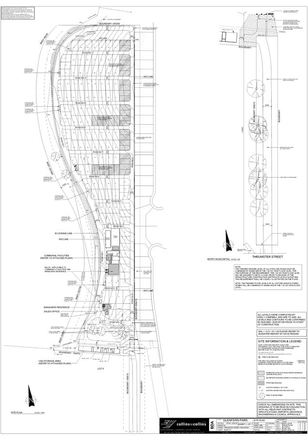
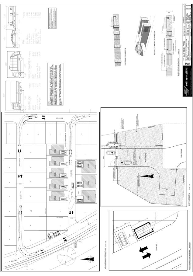
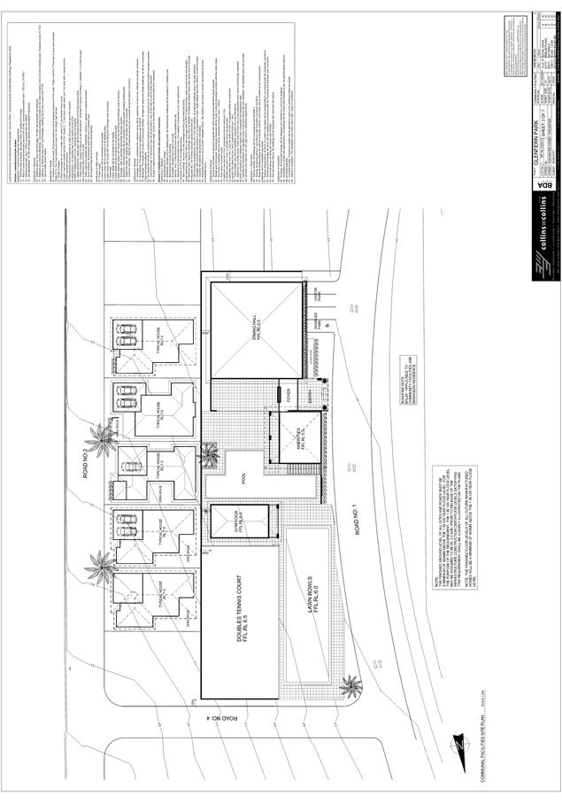
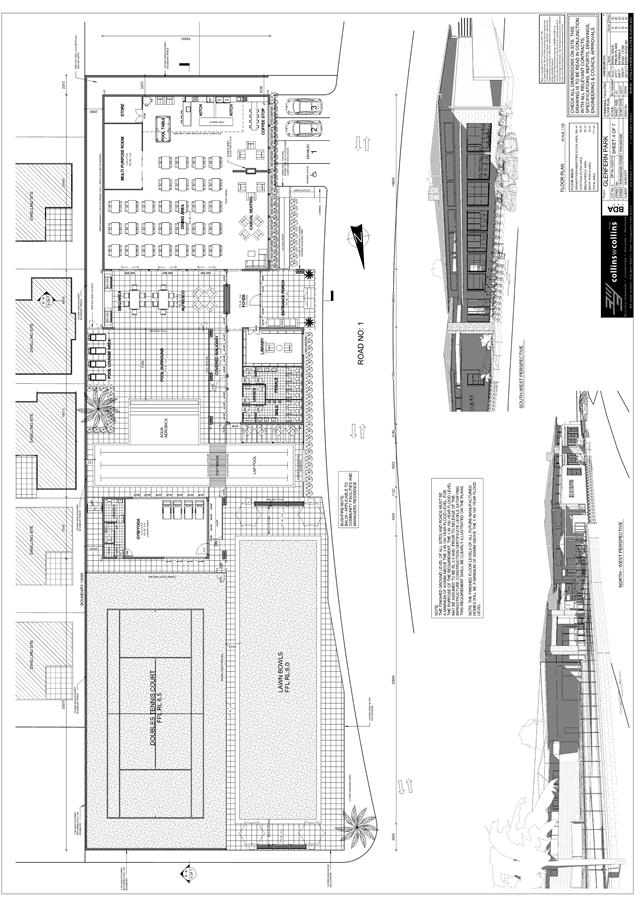
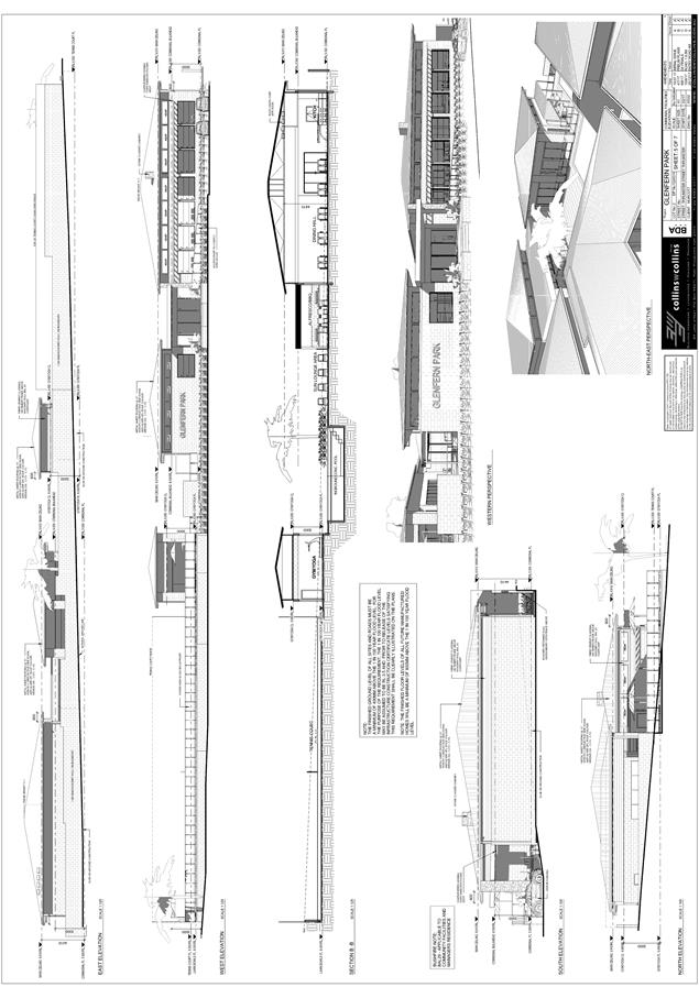


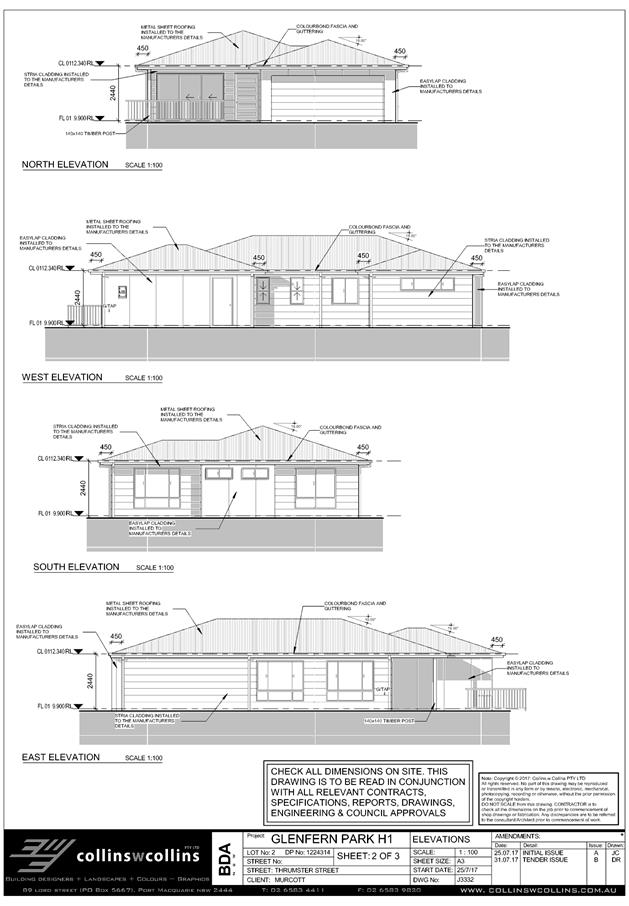
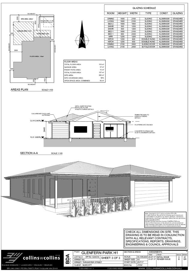
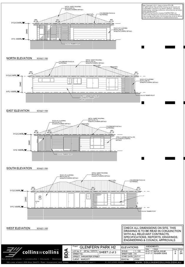
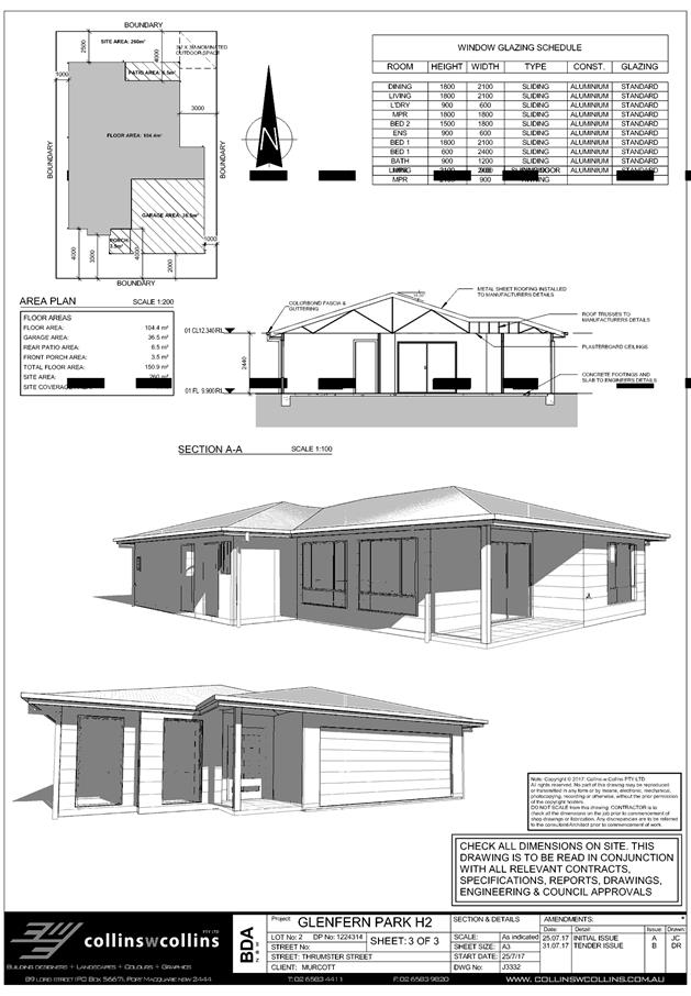
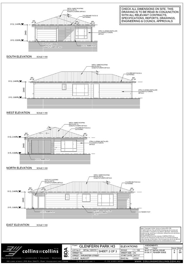
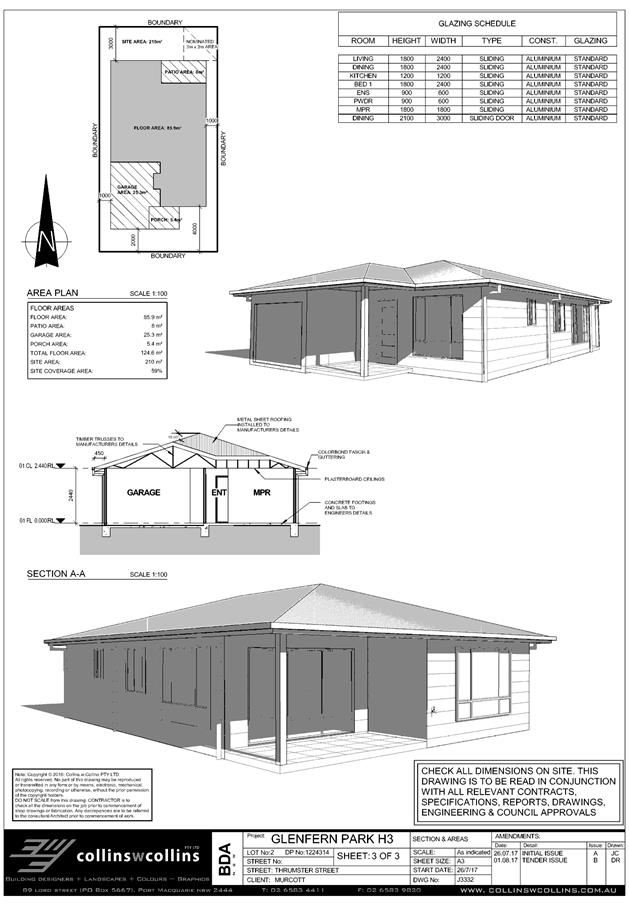

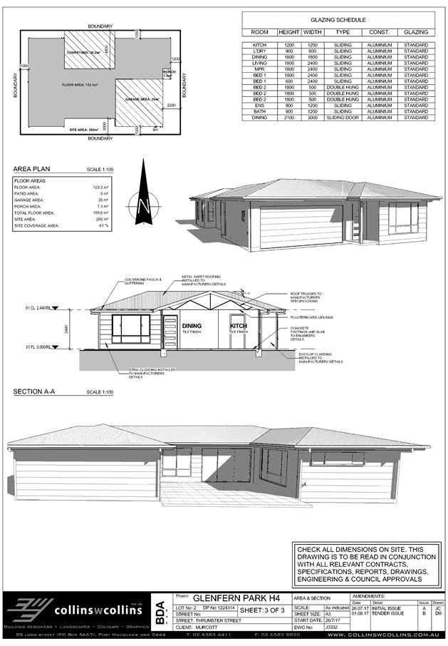
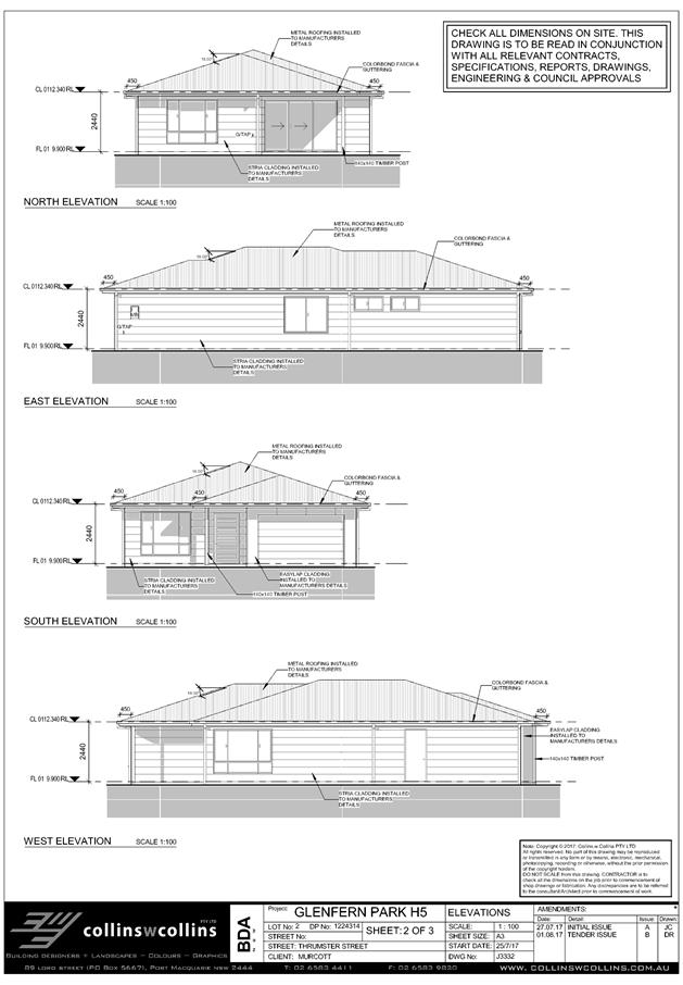
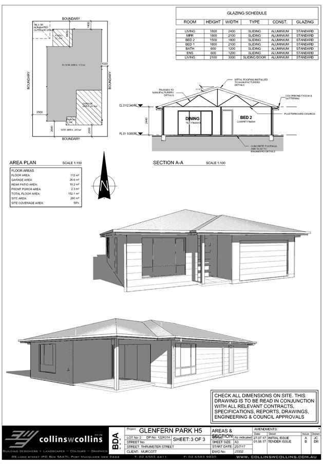
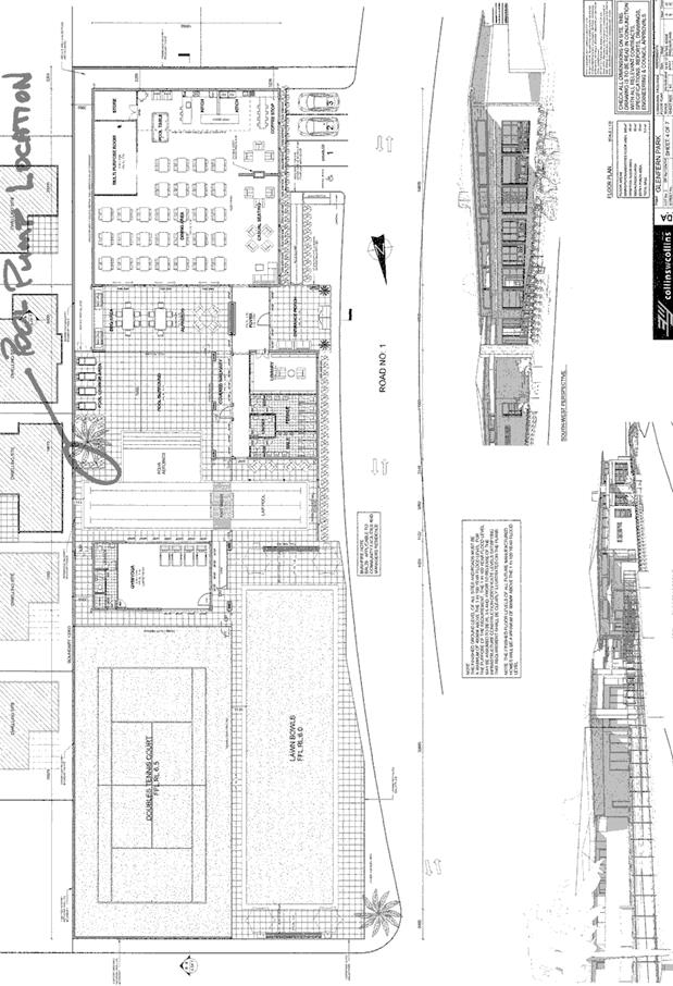
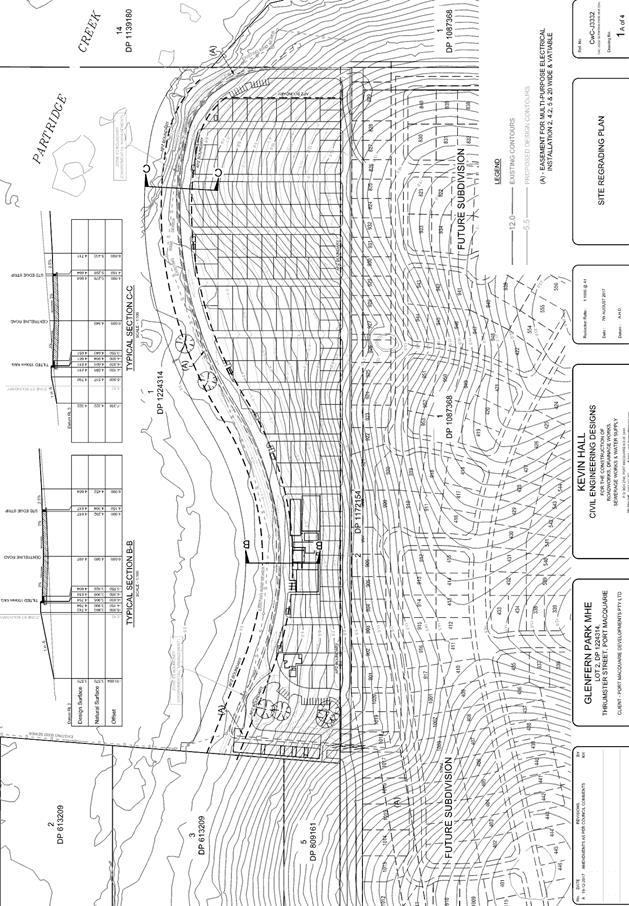
|
ATTACHMENT
|
Development Assessment Panel
28/02/2018
|
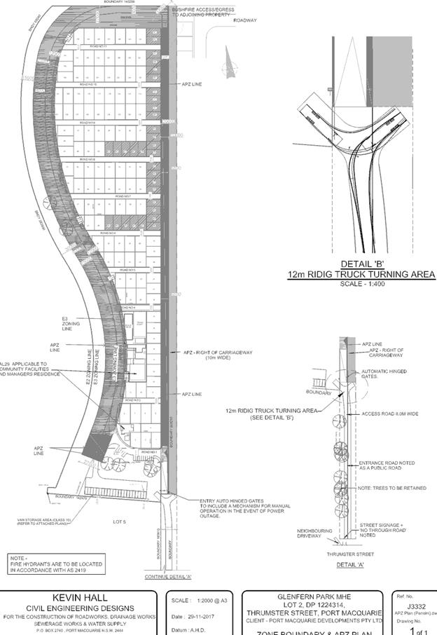
|
ATTACHMENT
|
Development Assessment Panel
28/02/2018
|
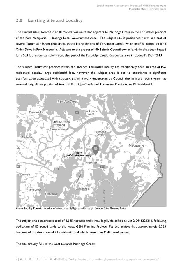
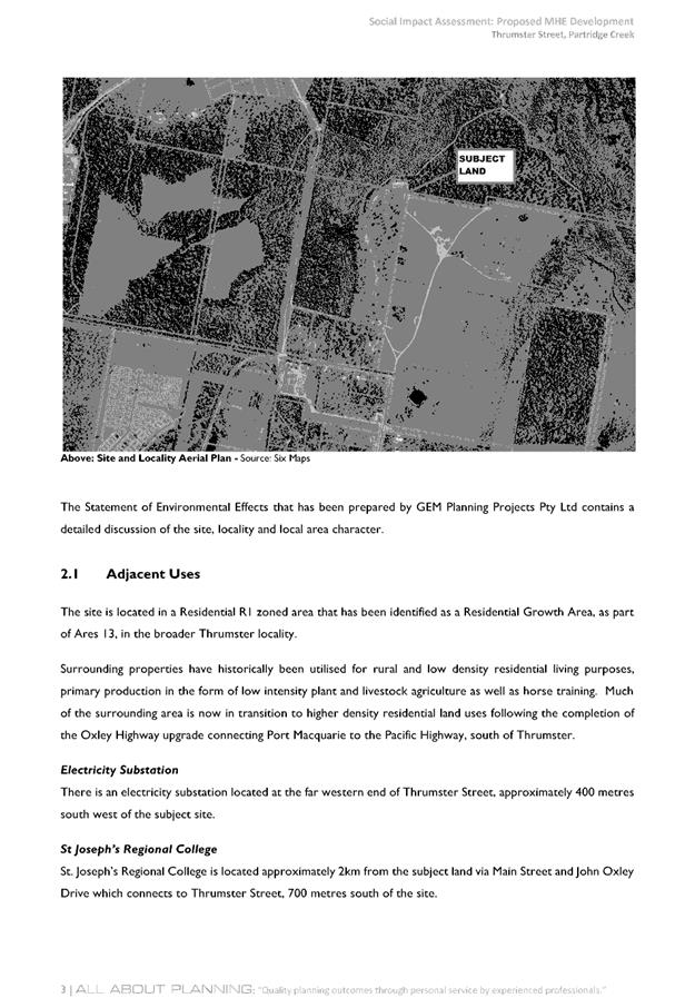
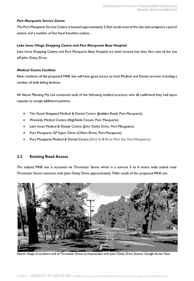
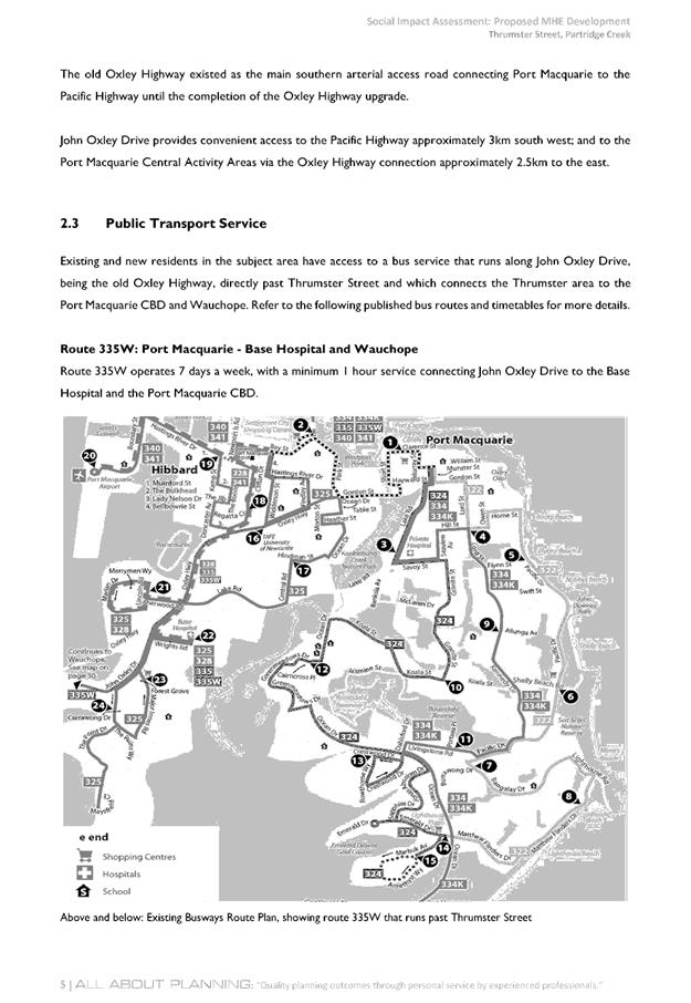
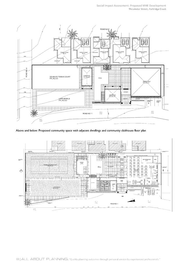
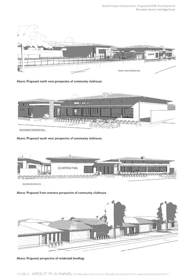
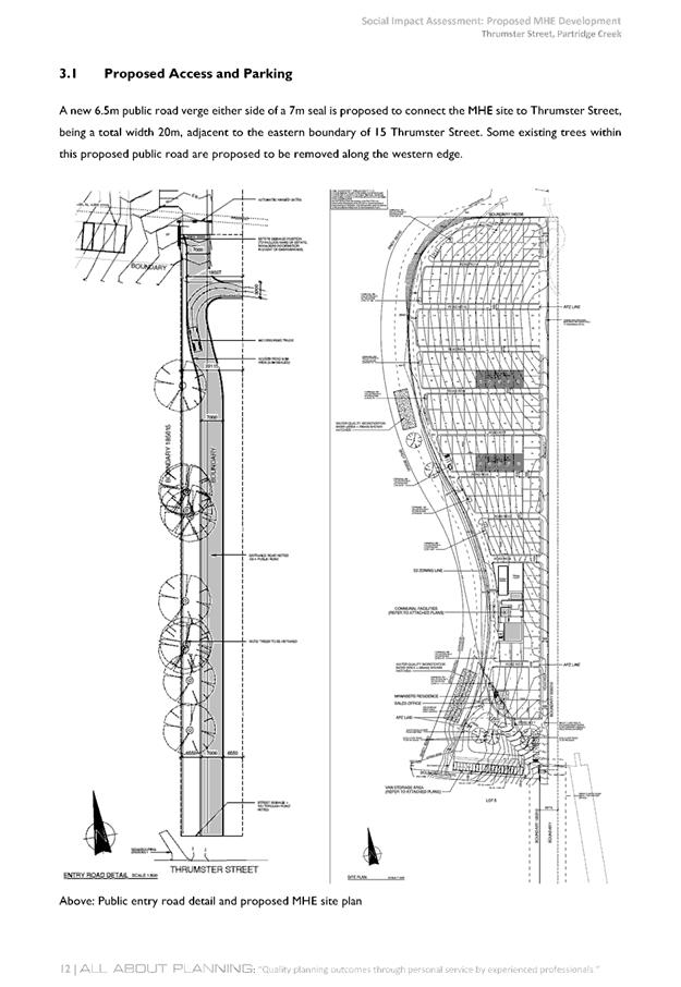
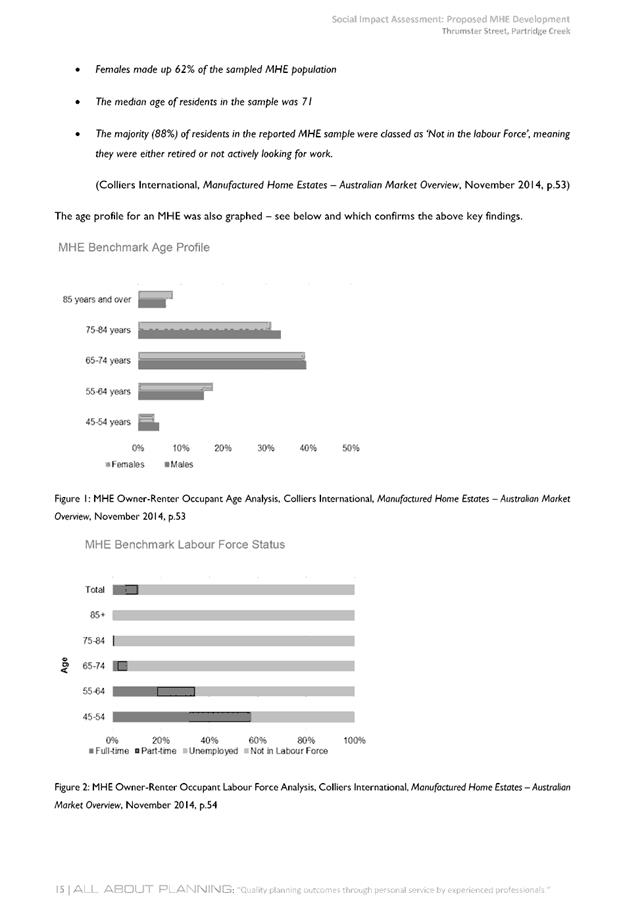
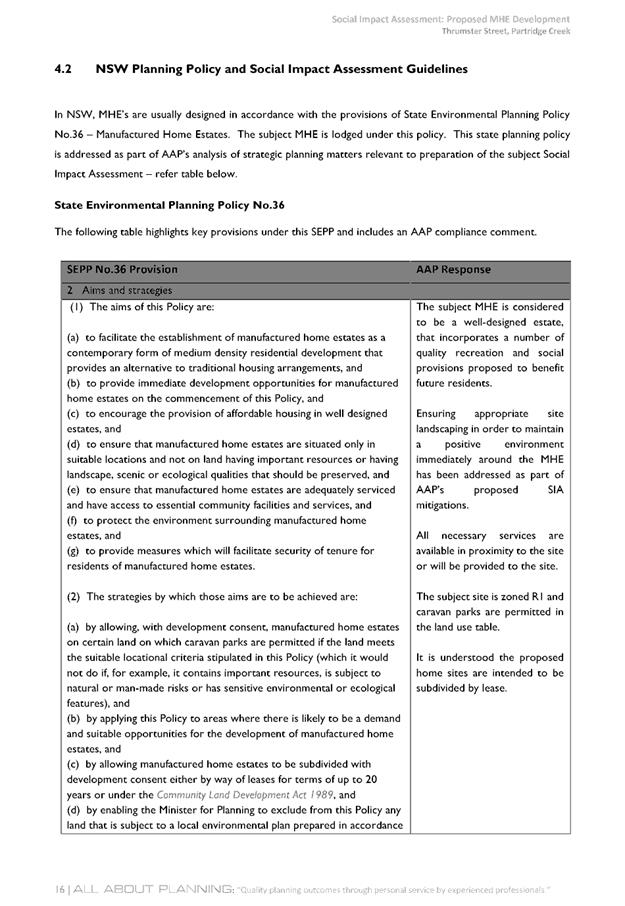
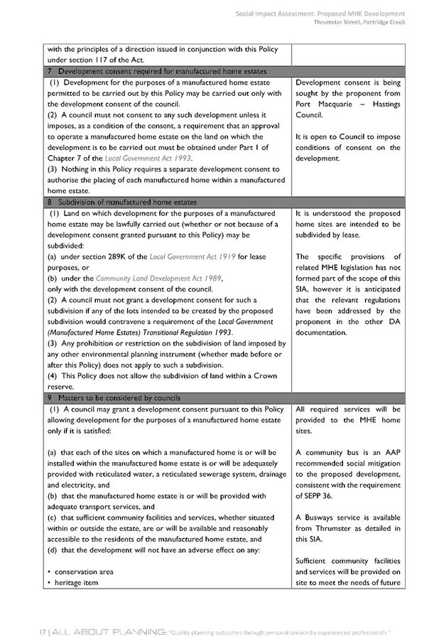

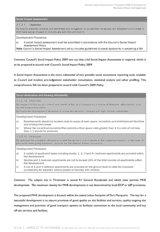
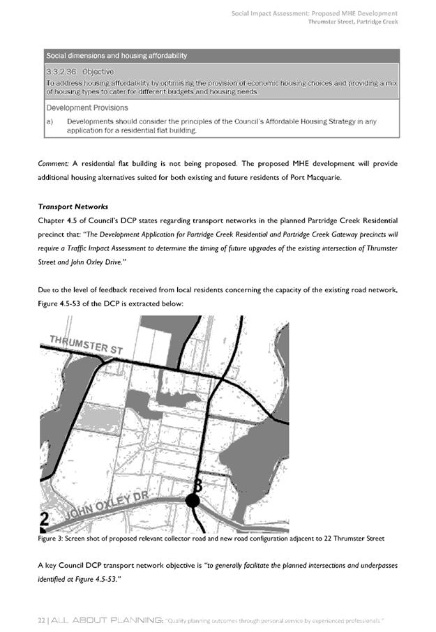
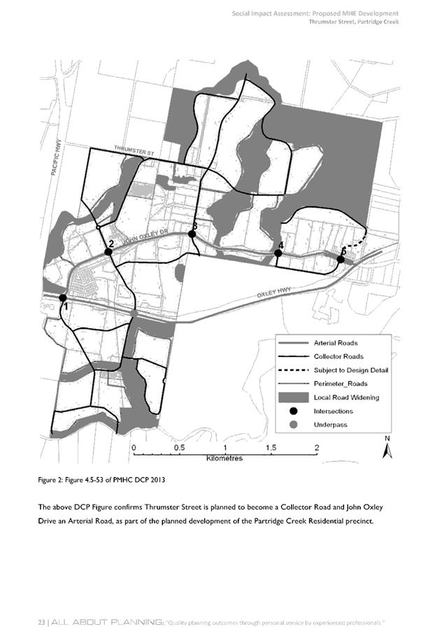
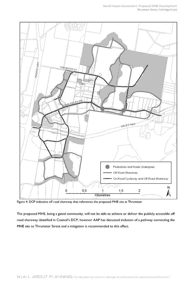
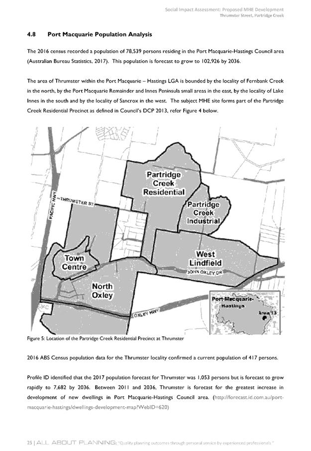
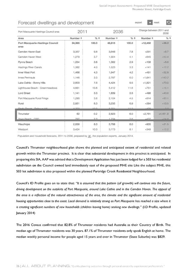
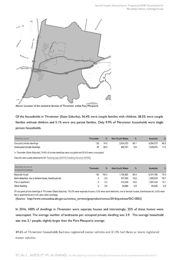
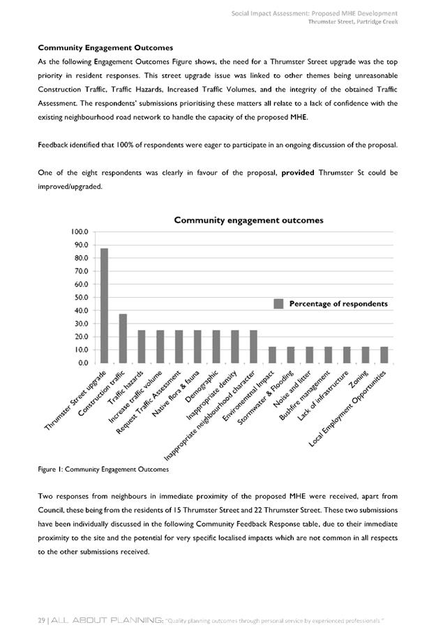
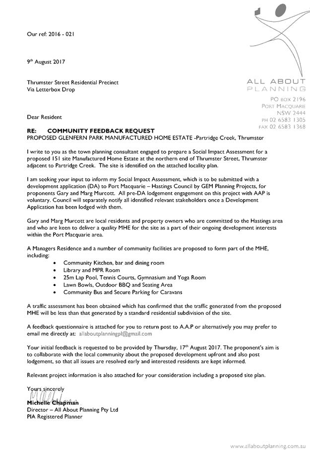
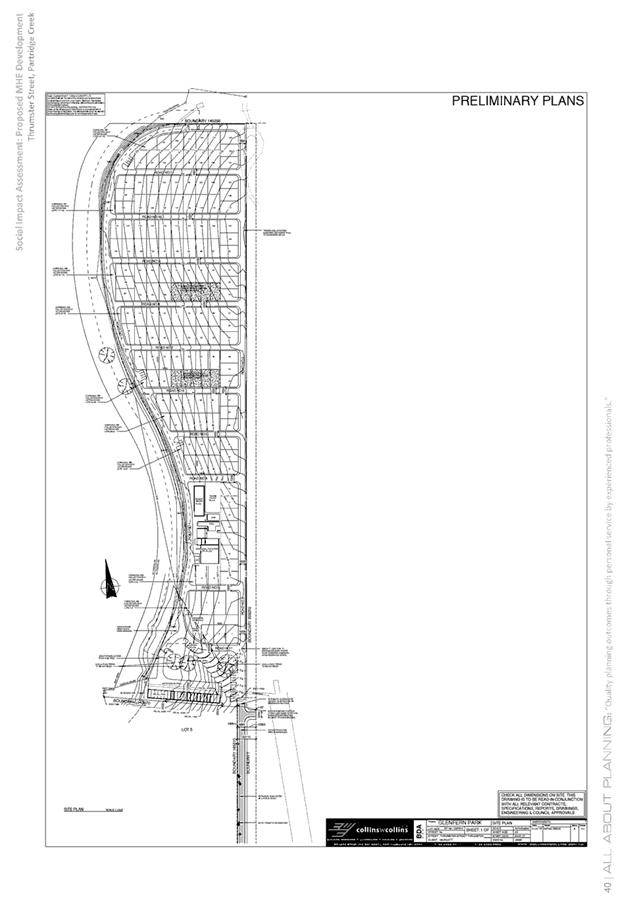
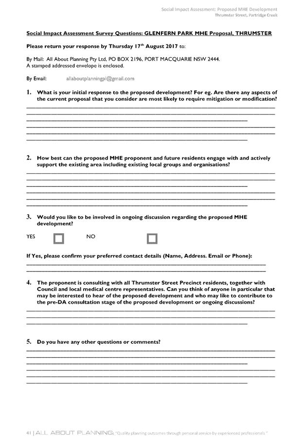
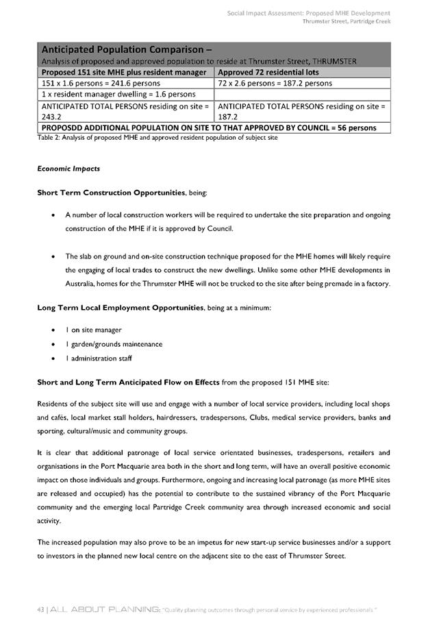
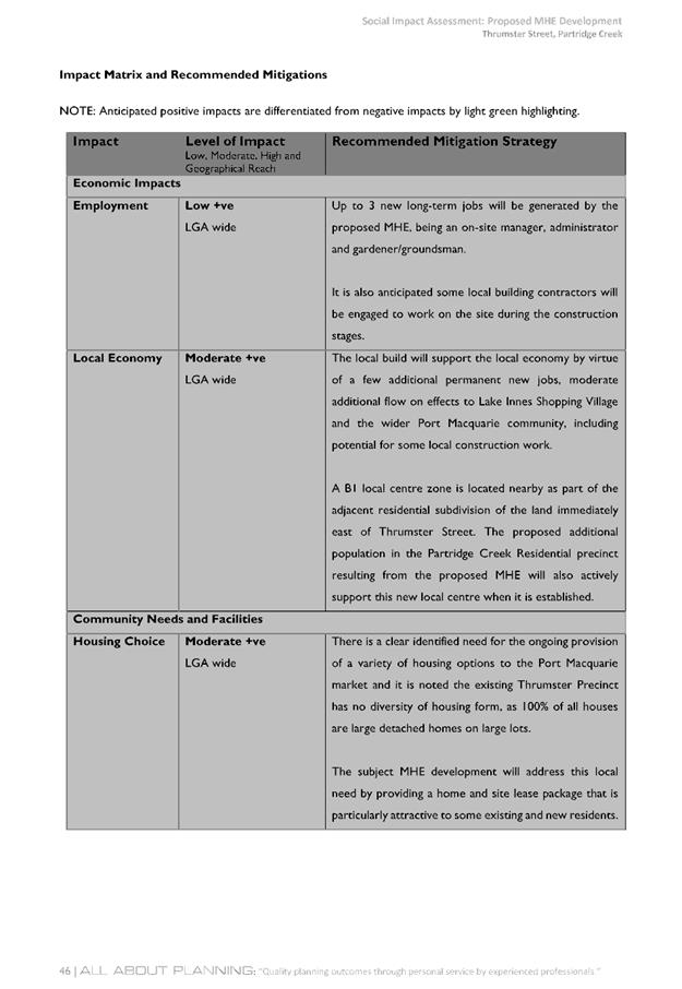
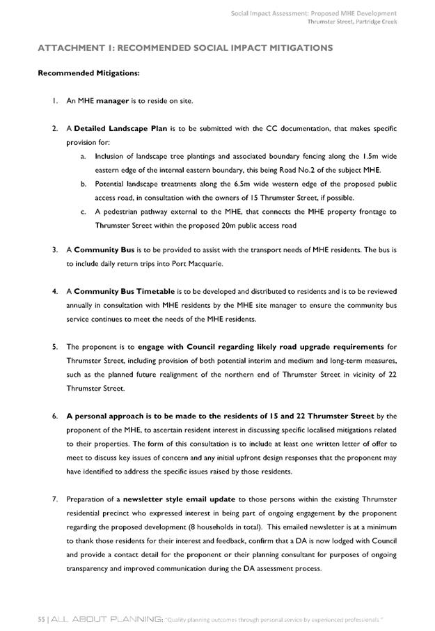
|
ATTACHMENT
|
Development Assessment Panel
28/02/2018
|
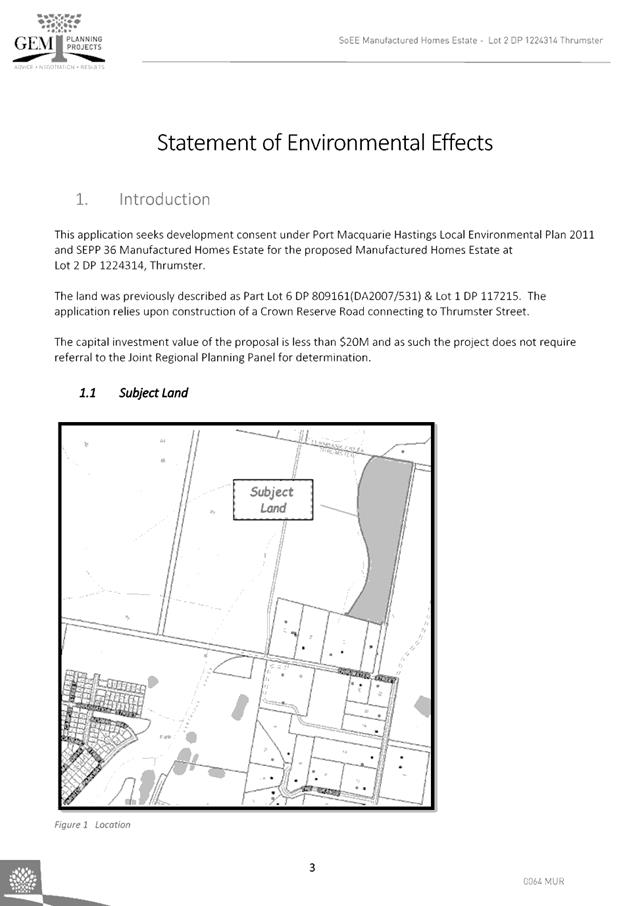
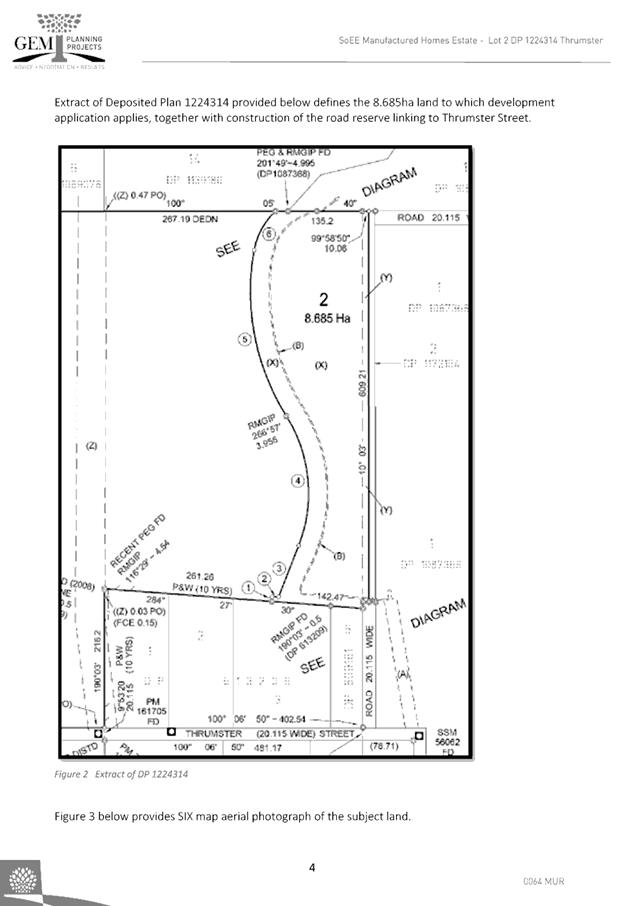
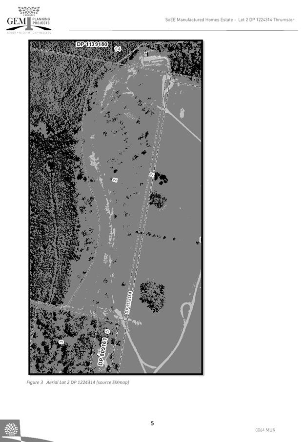
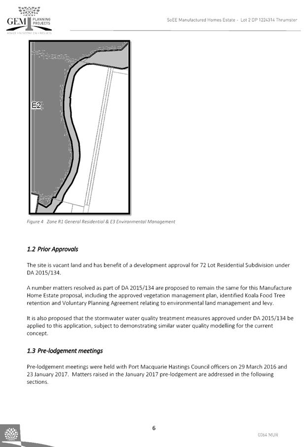
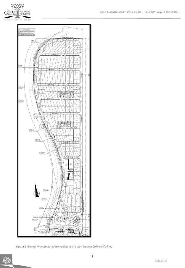
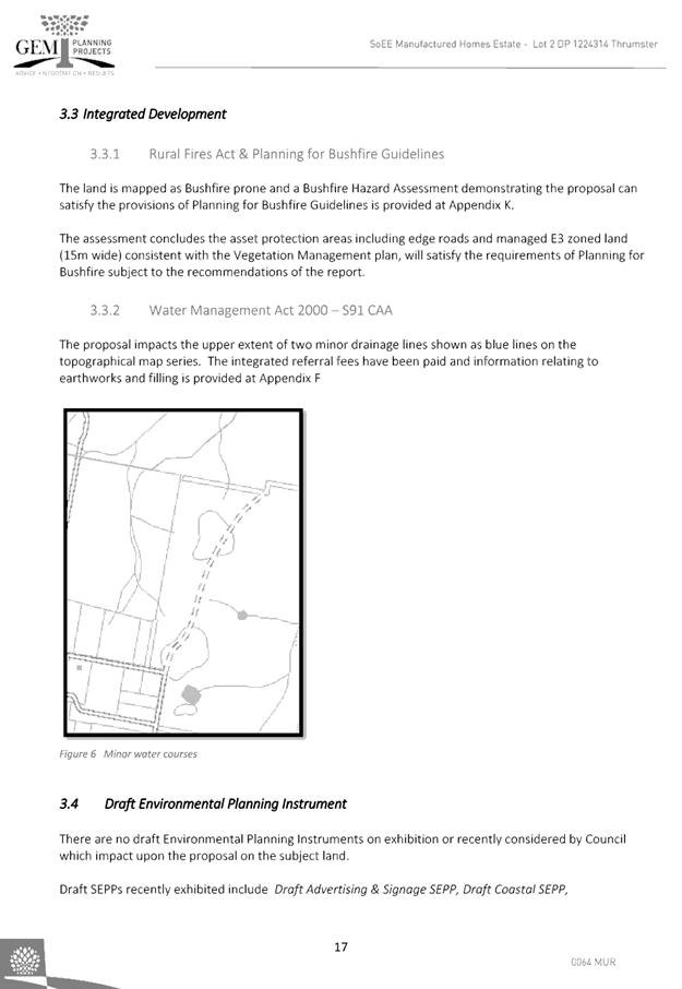
|
ATTACHMENT
|
Development Assessment Panel
28/02/2018
|

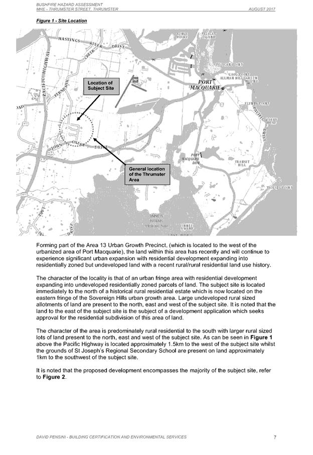
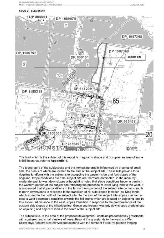
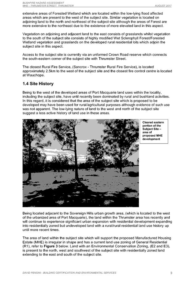
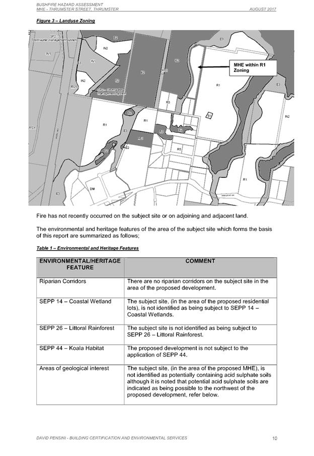
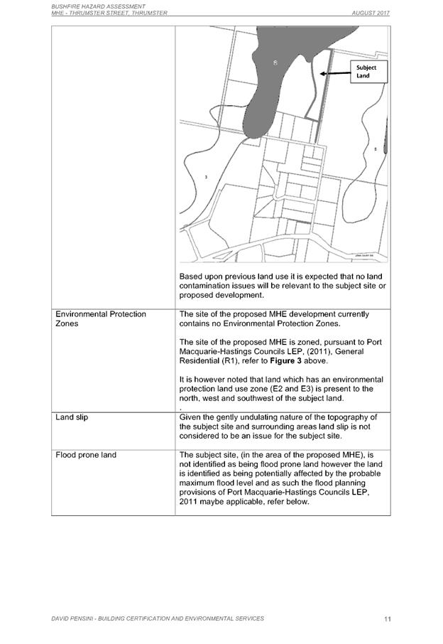
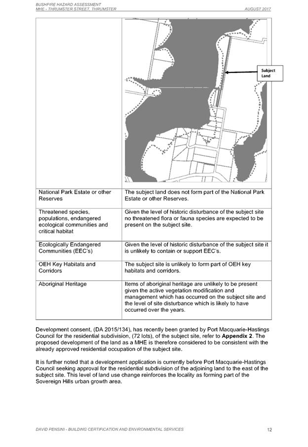
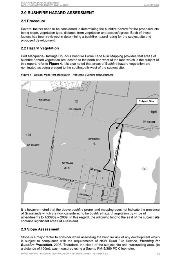
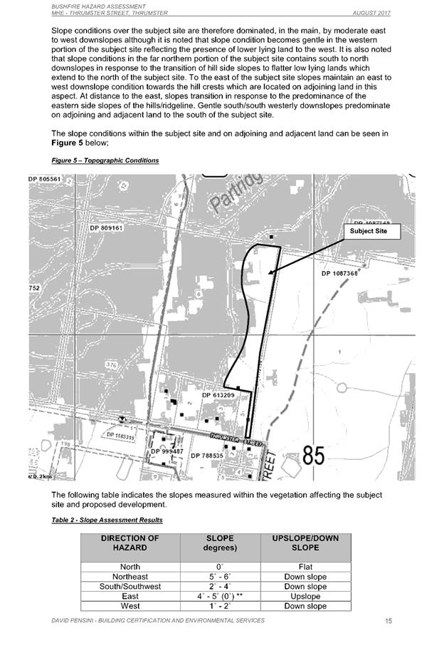
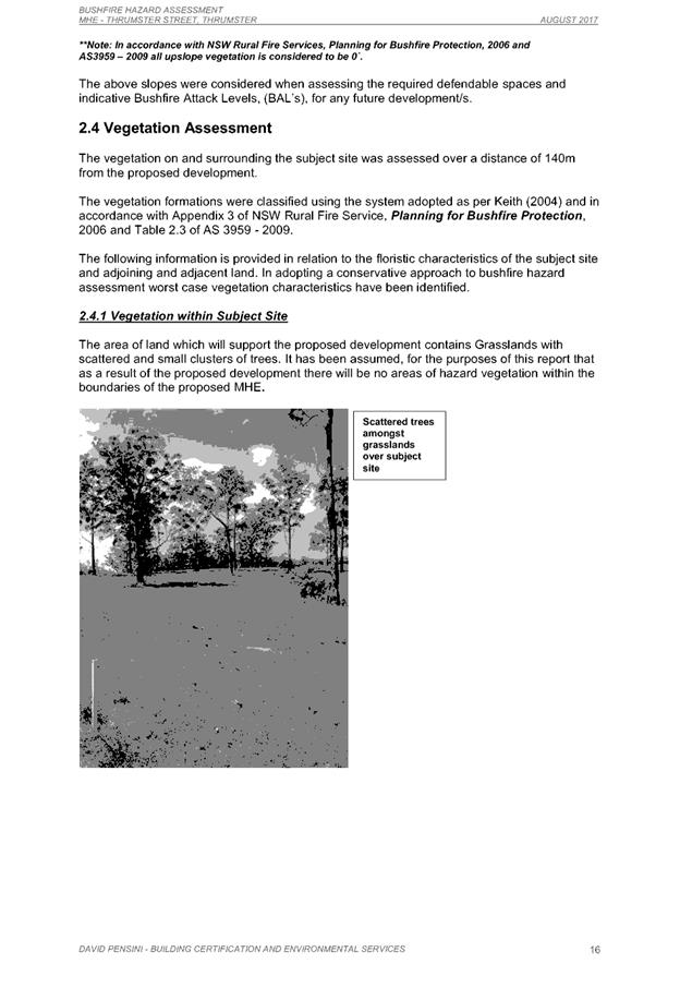
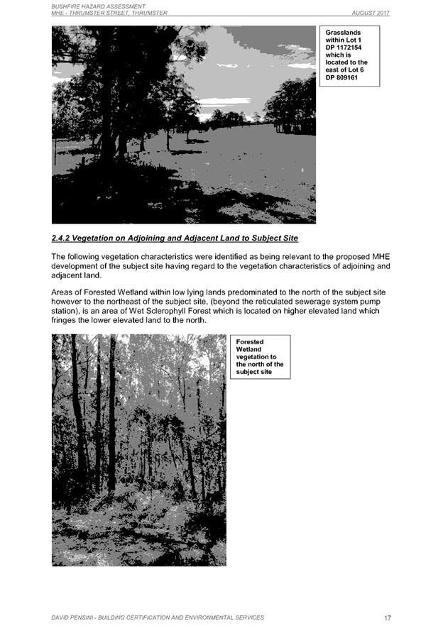
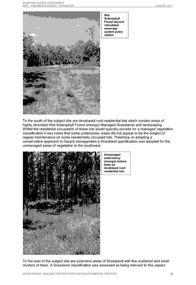
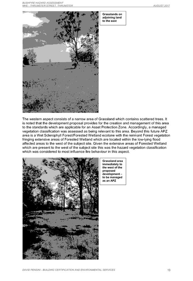
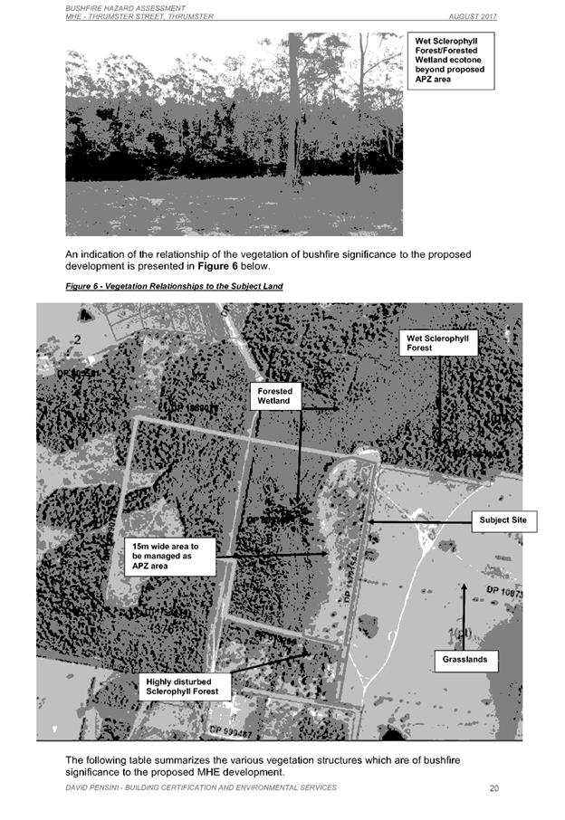
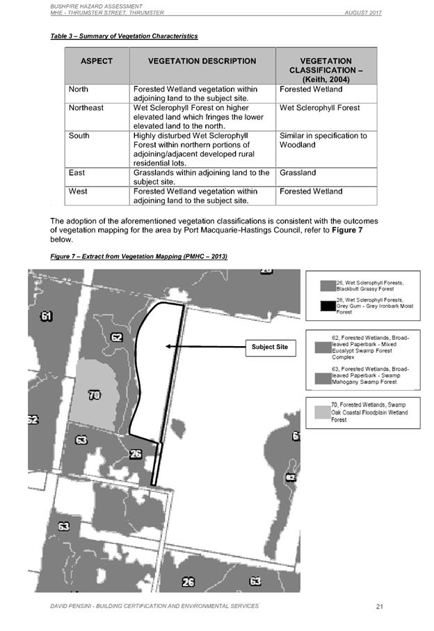
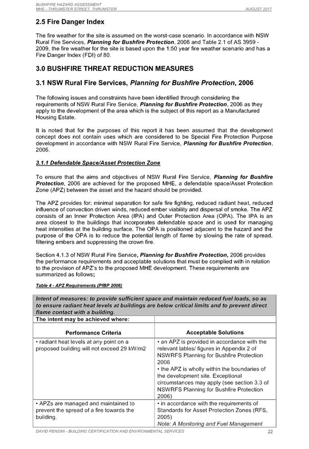
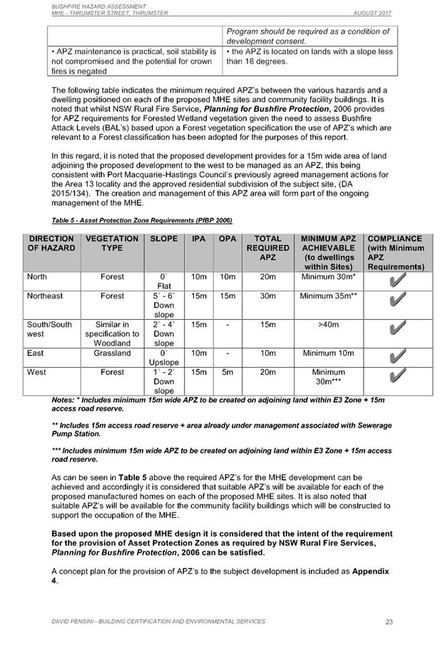
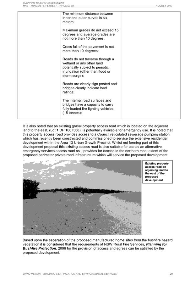
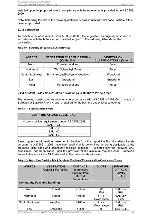
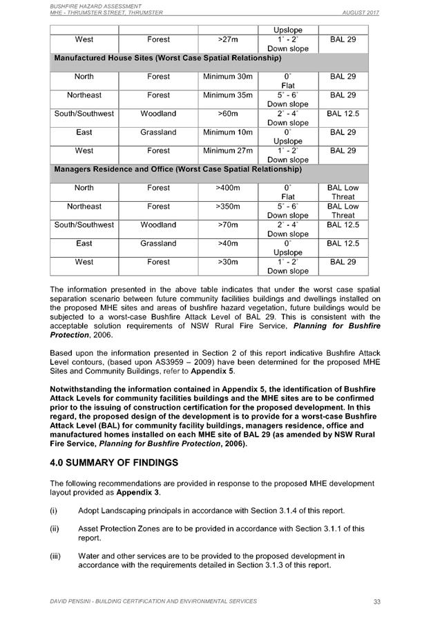
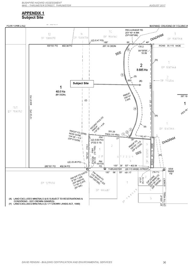
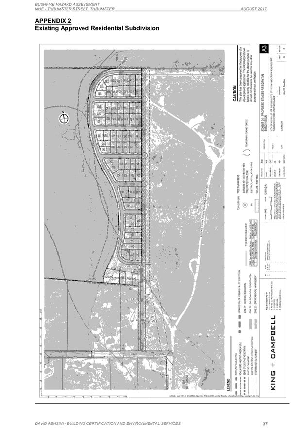
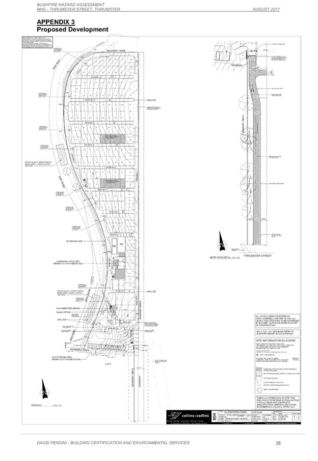
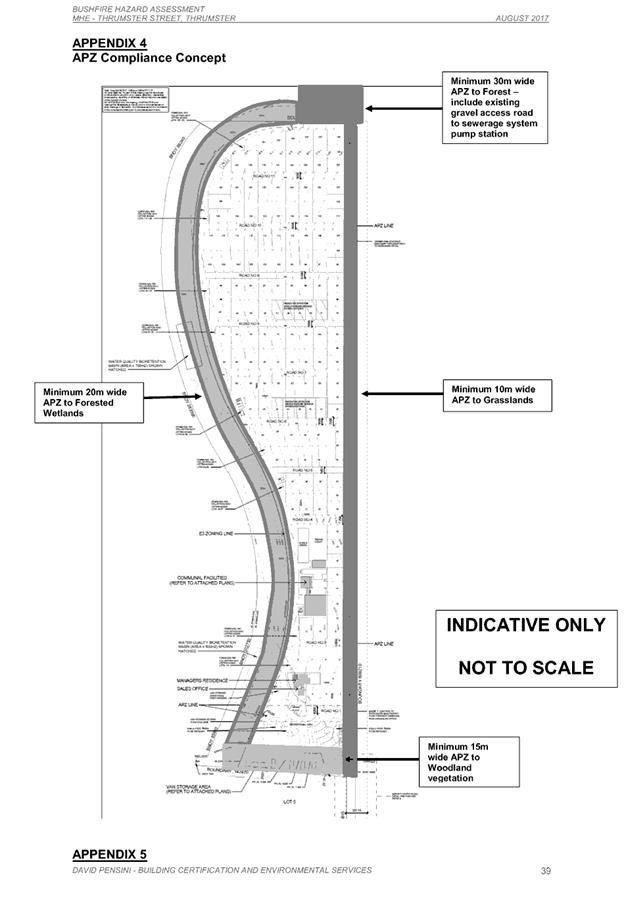
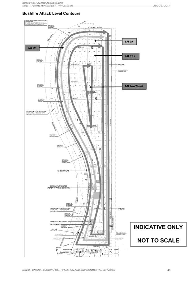
|
ATTACHMENT
|
Development Assessment Panel
28/02/2018
|

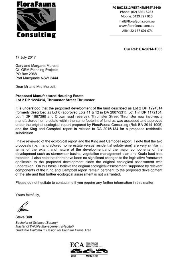
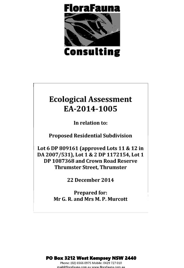
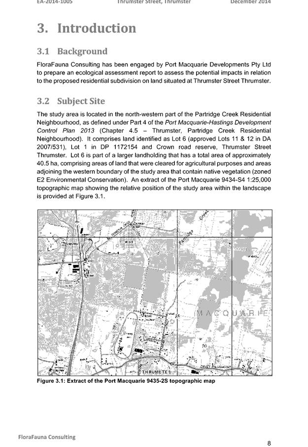
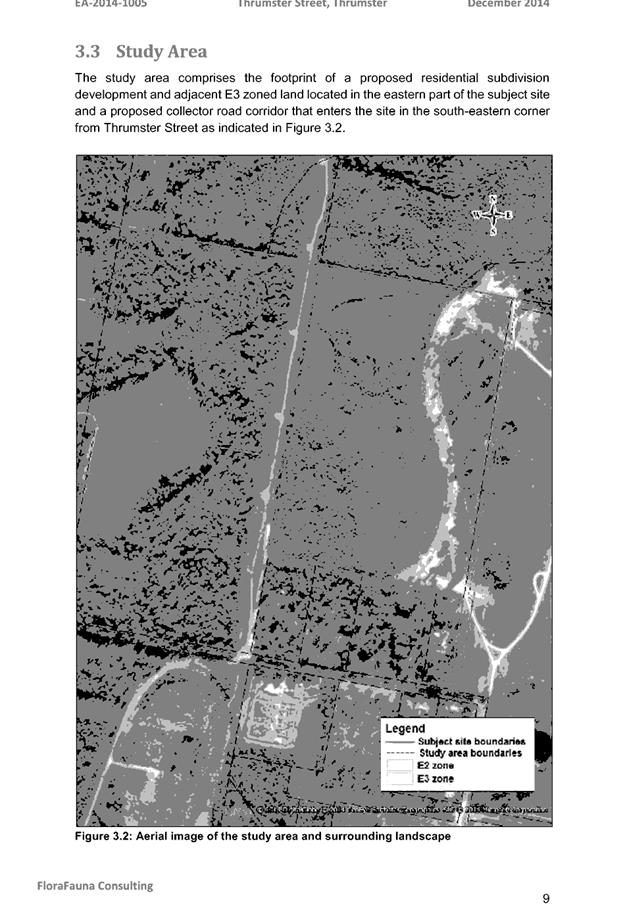
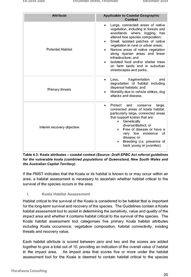
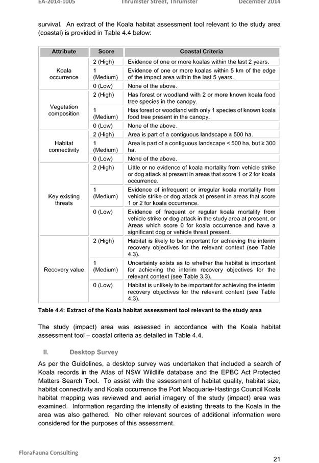
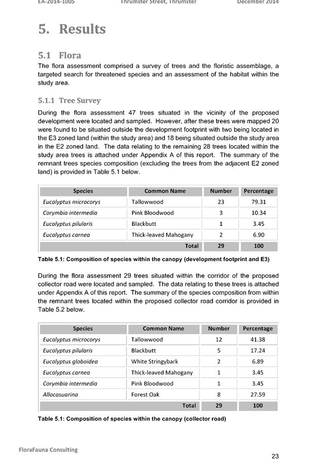
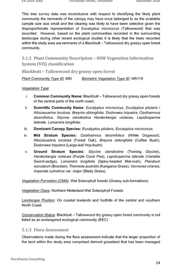
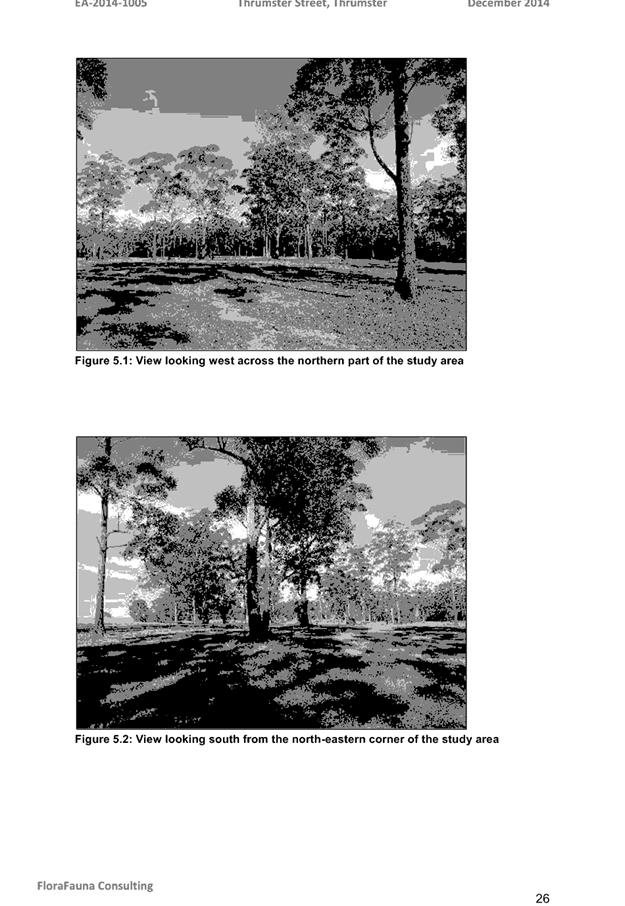
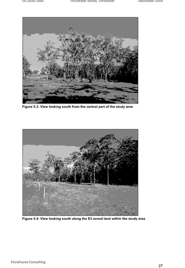
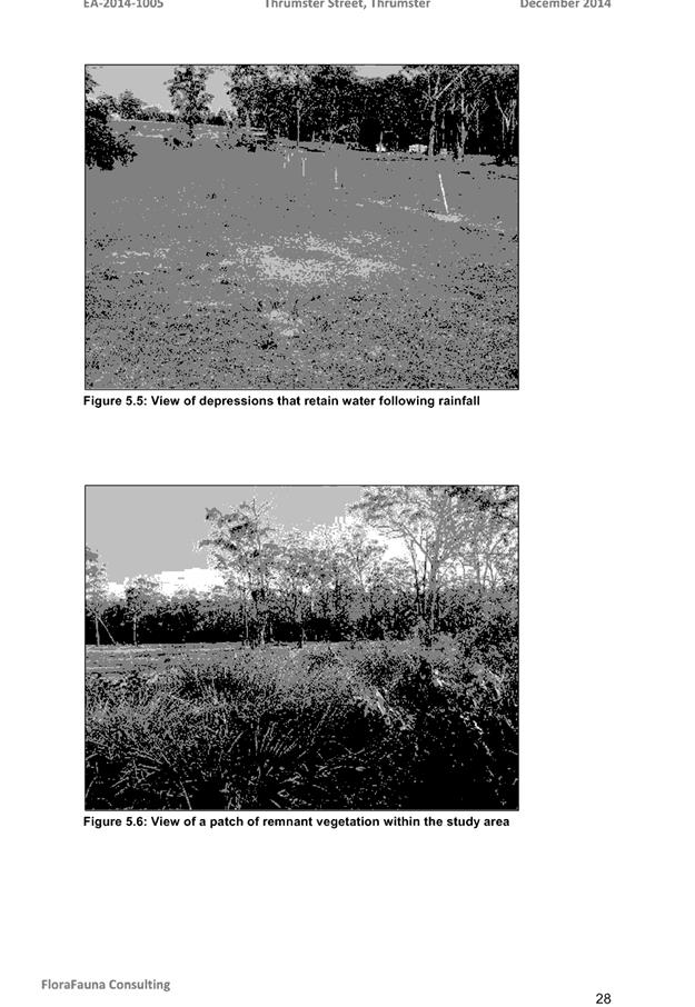
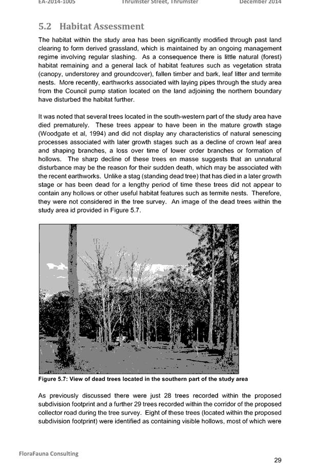
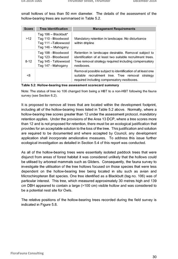
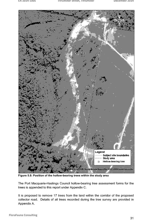
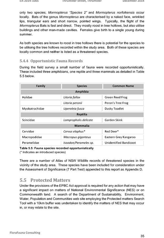
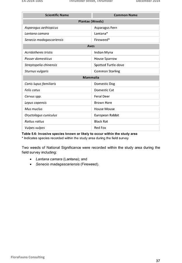
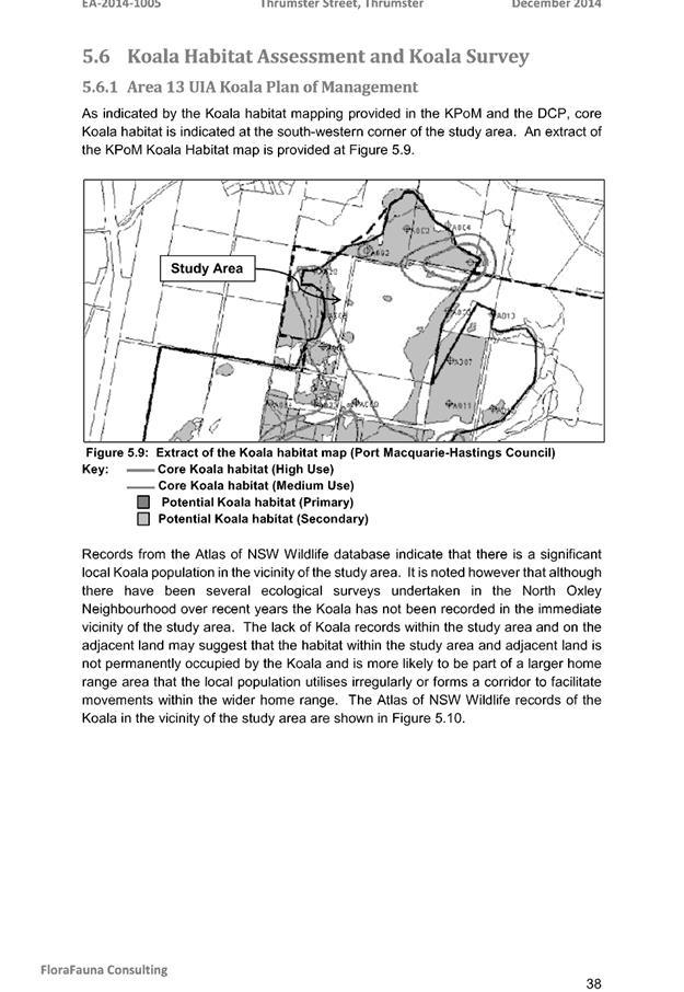
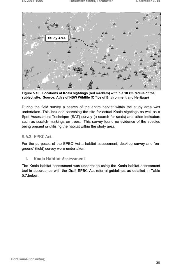
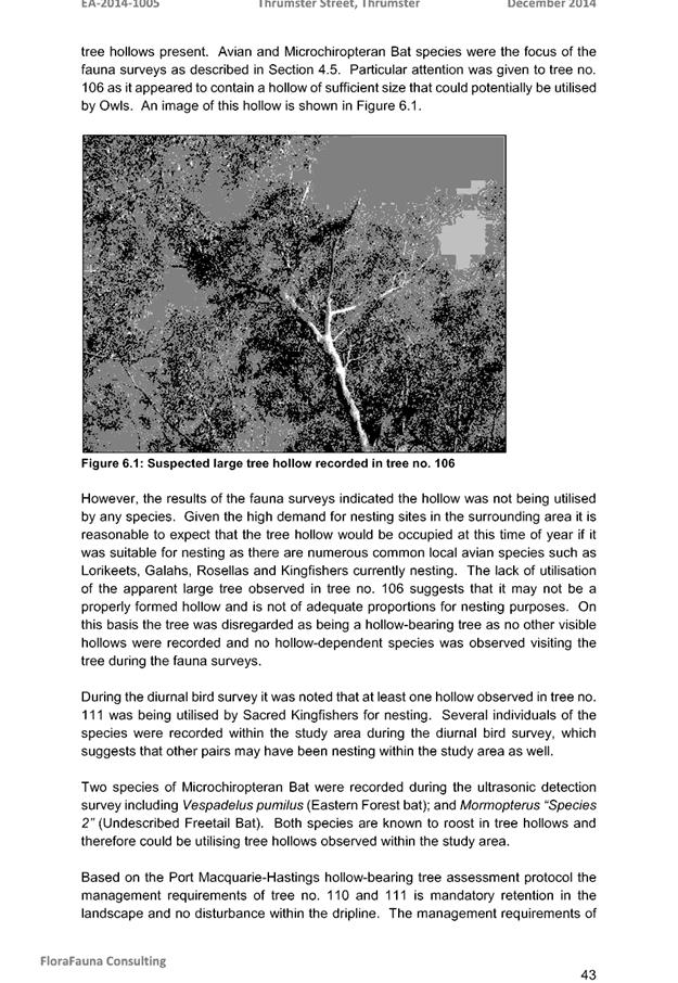
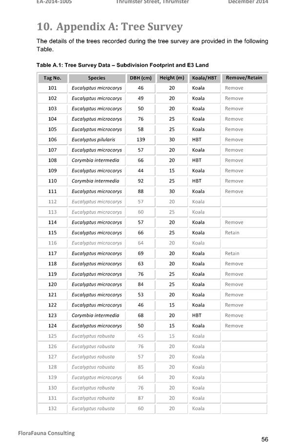
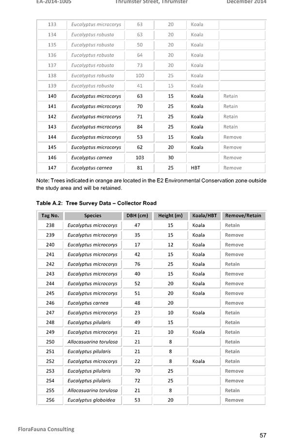
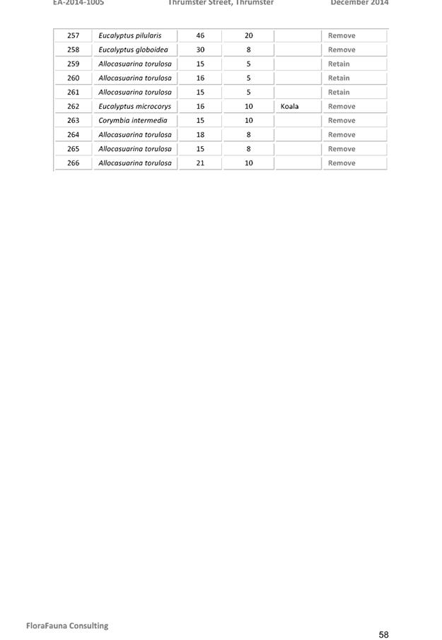
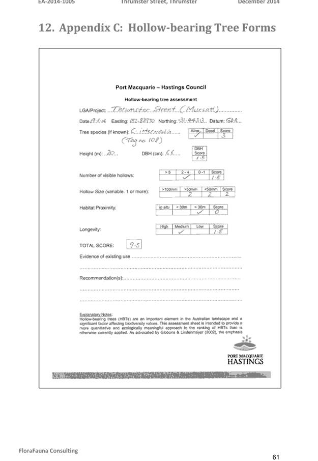

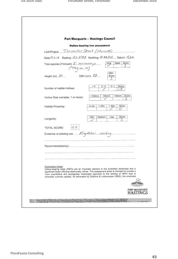

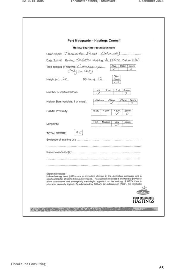
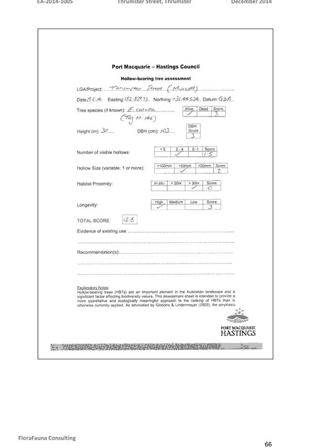
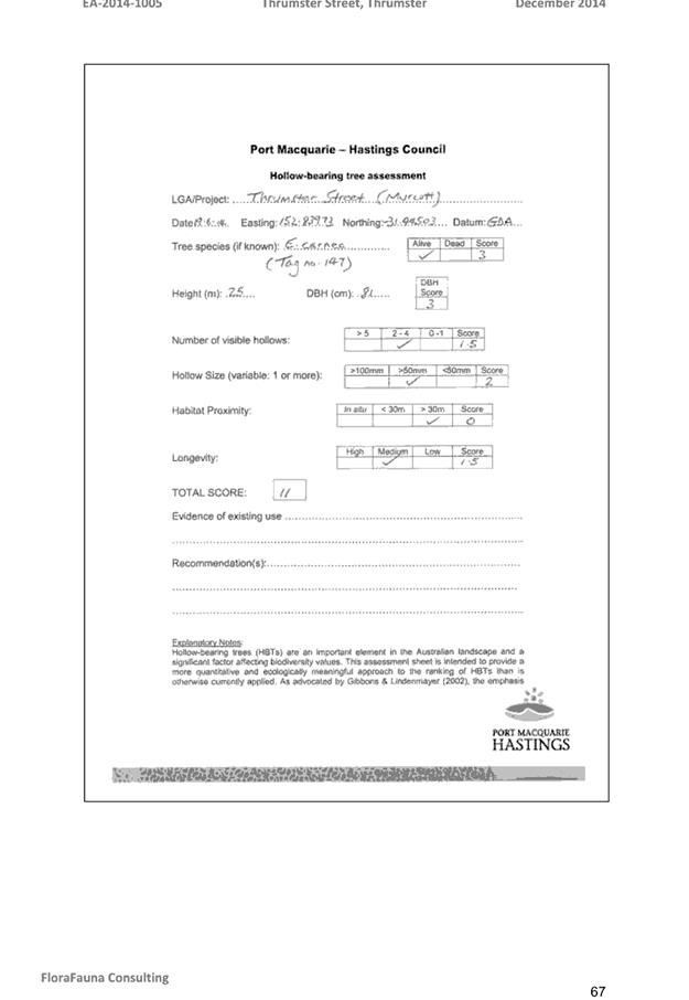
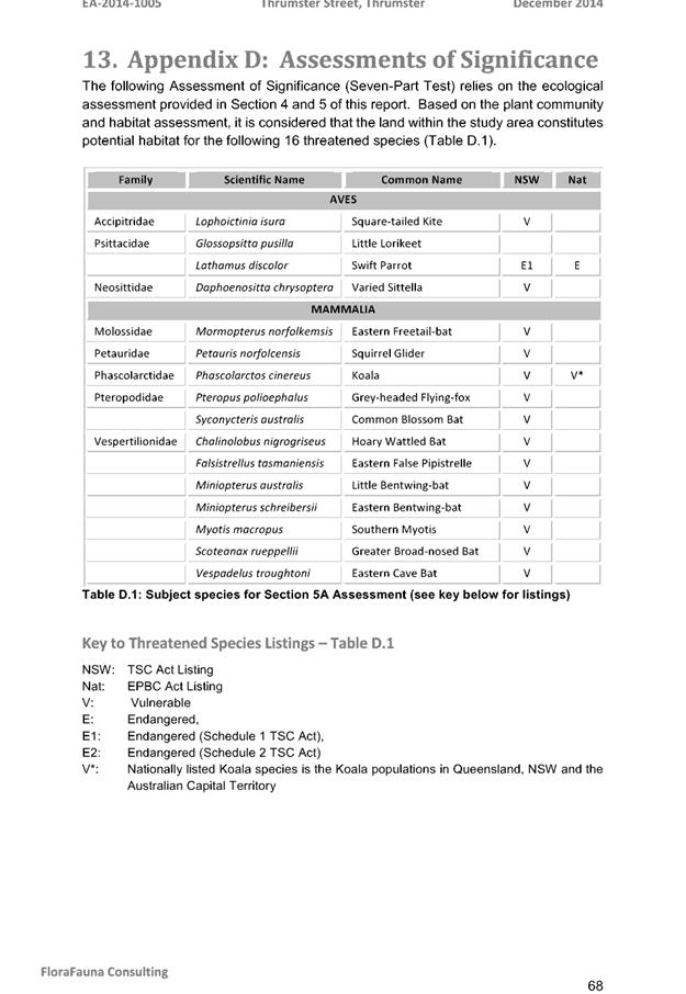
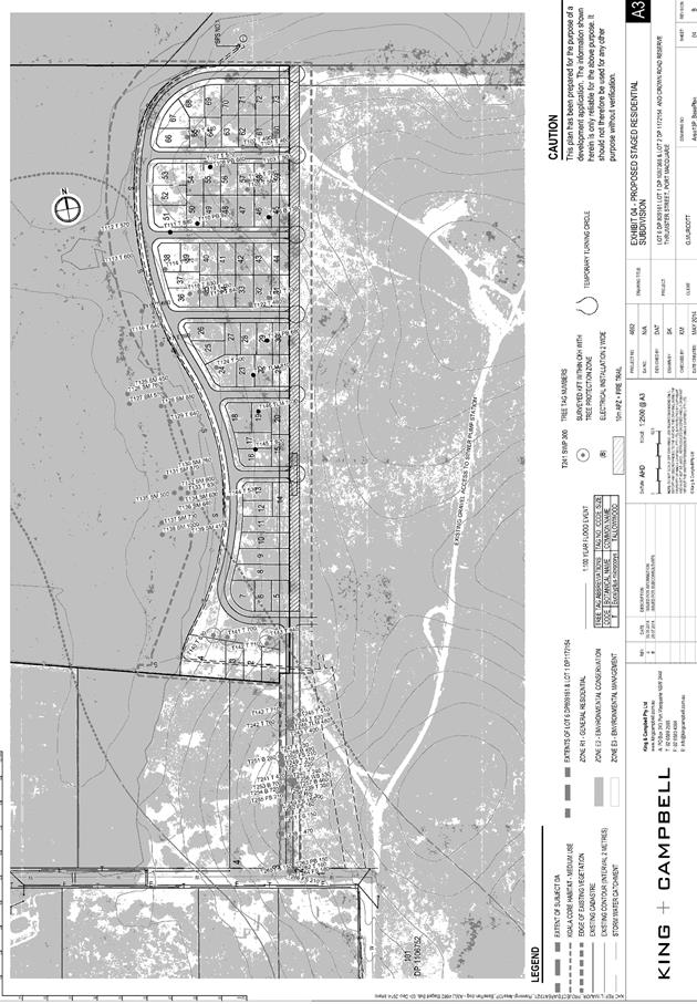
|
ATTACHMENT
|
Development Assessment Panel
28/02/2018
|

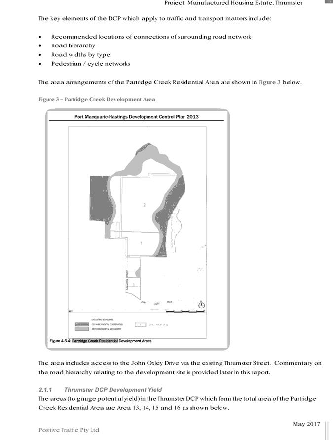
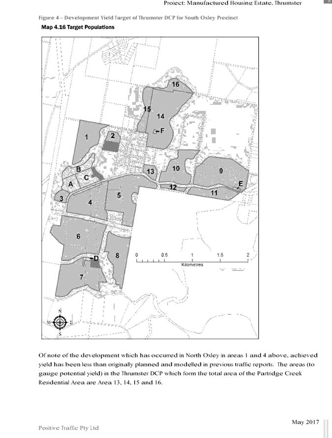
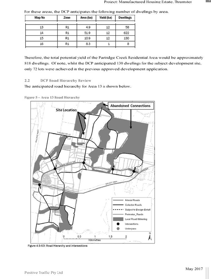
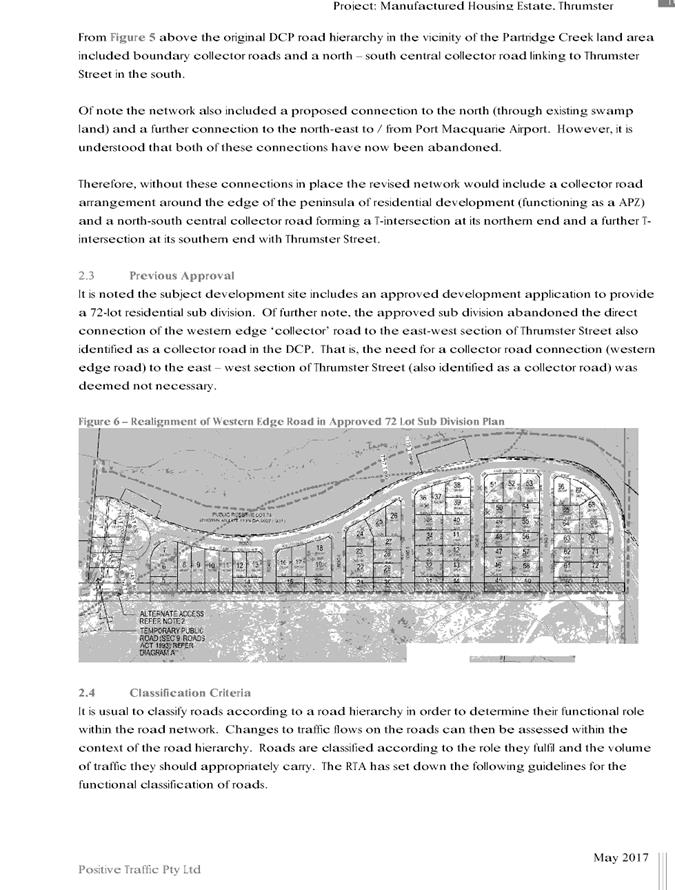
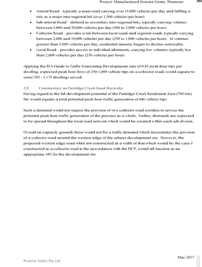
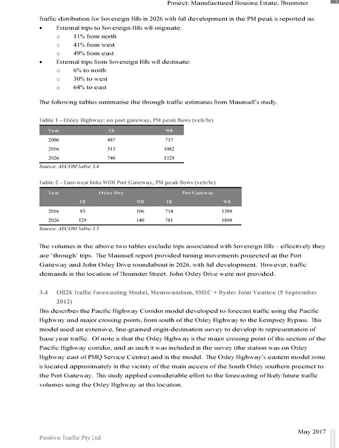
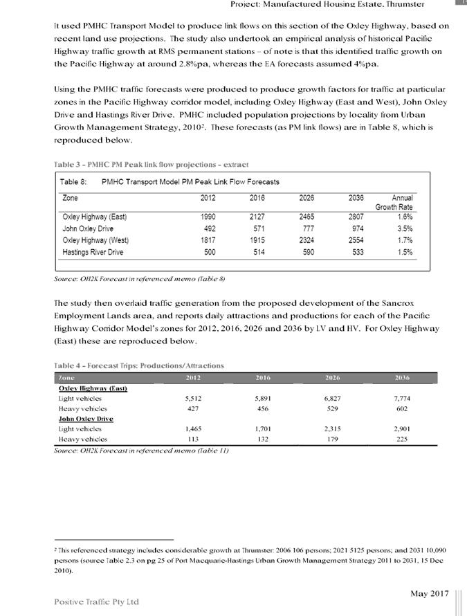
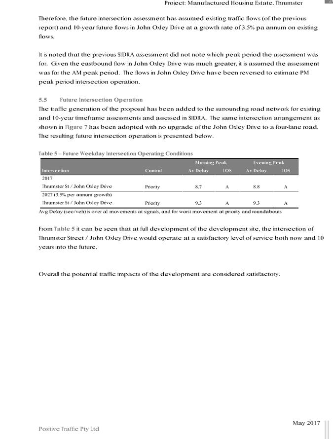
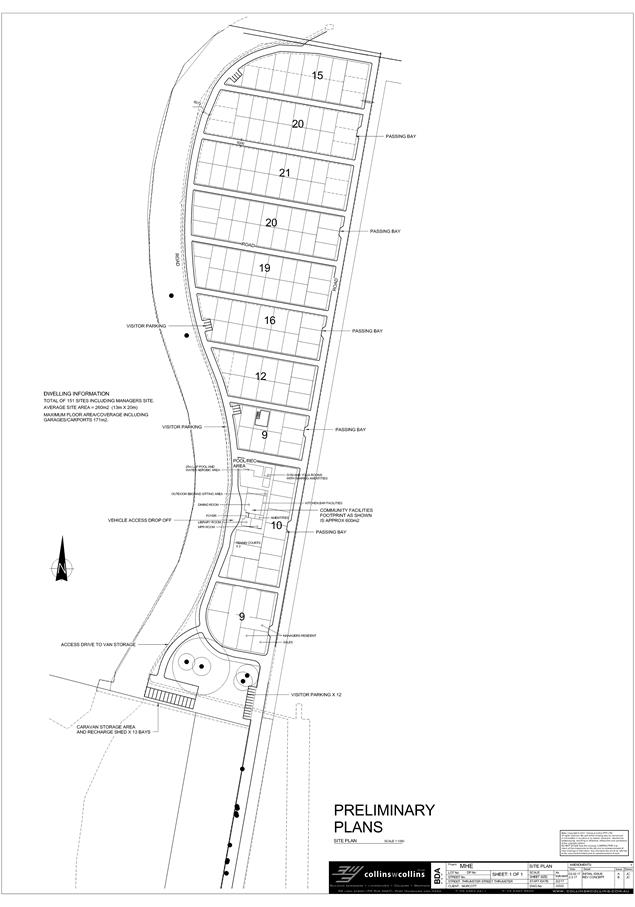
|
ATTACHMENT
|
Development Assessment Panel
28/02/2018
|


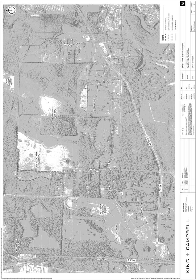
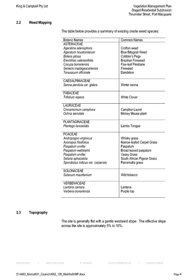
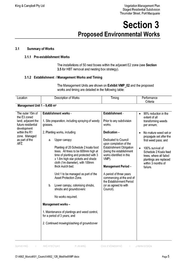
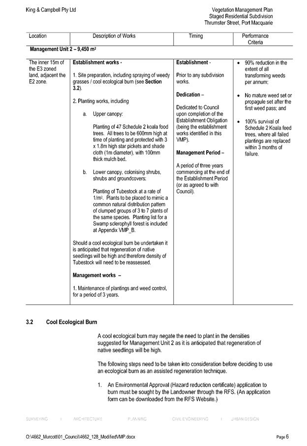
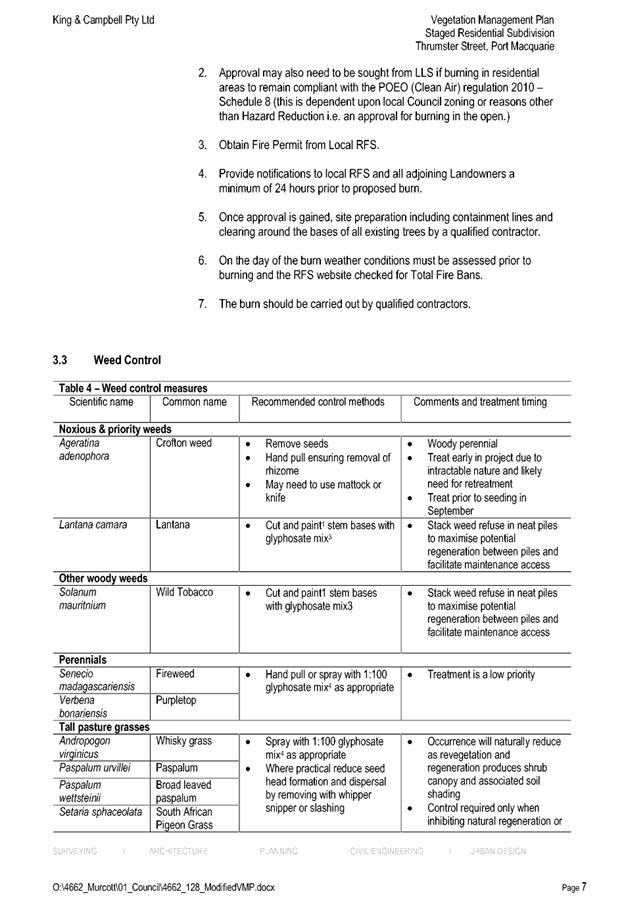
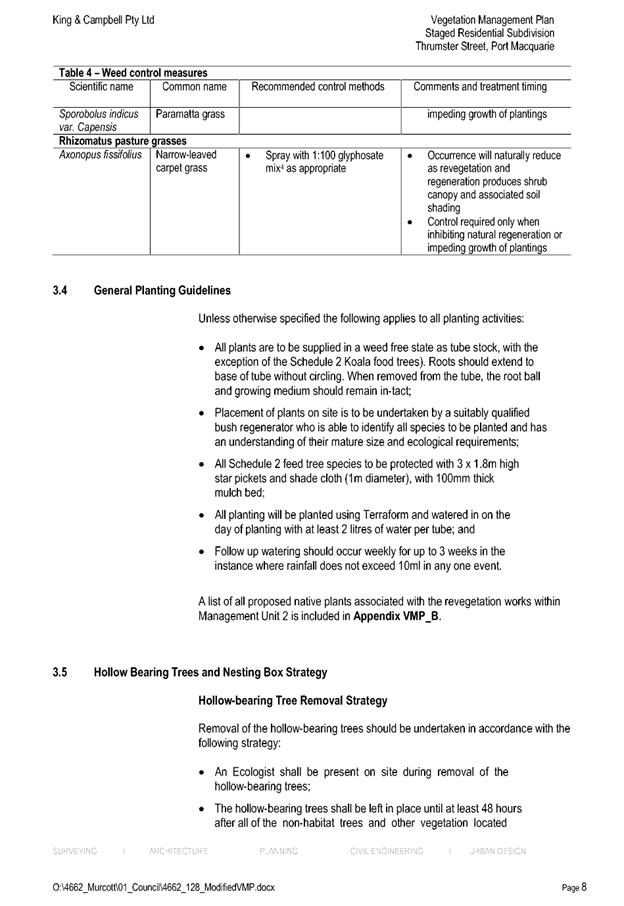
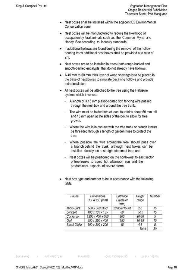
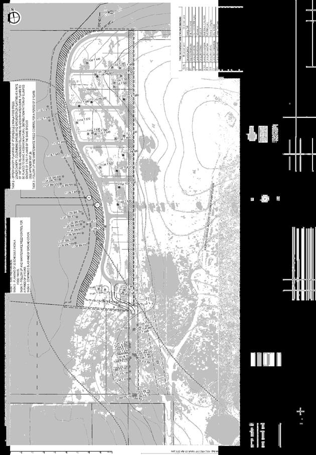

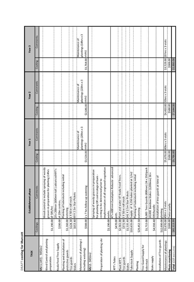

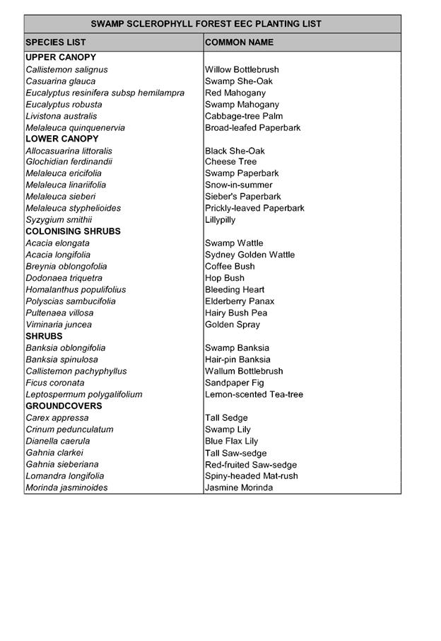

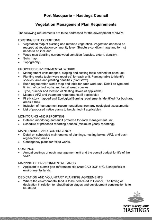
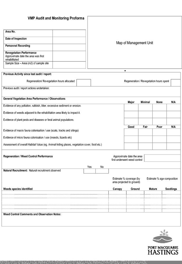
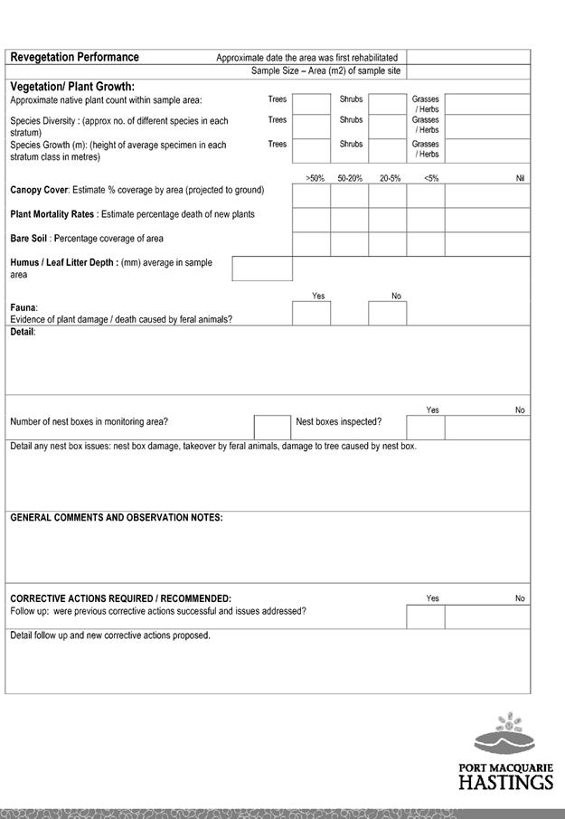

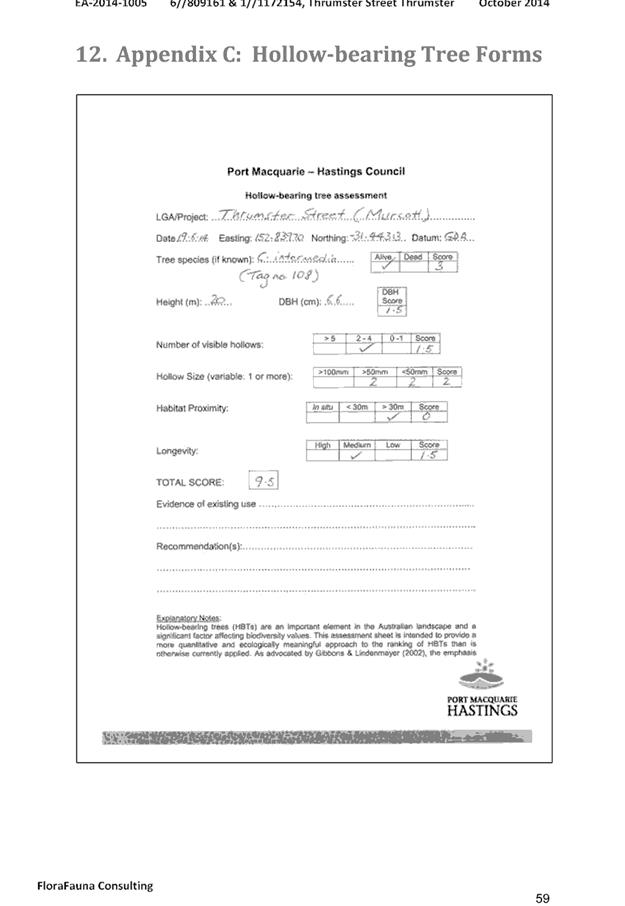
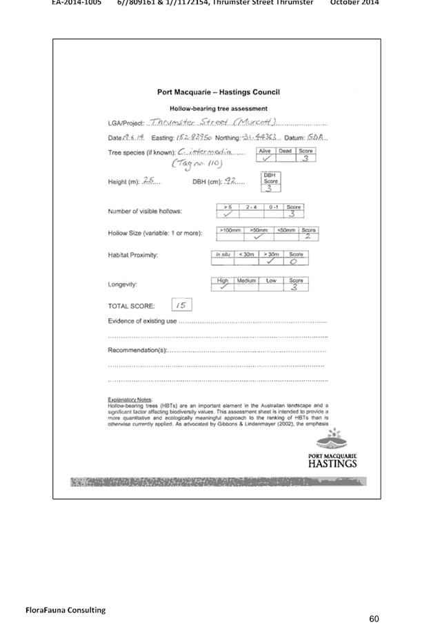
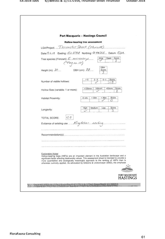

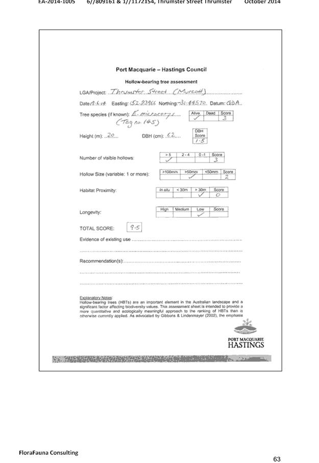
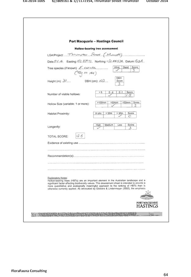
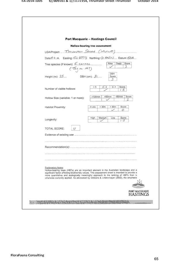
|
ATTACHMENT
|
Development Assessment Panel
28/02/2018
|

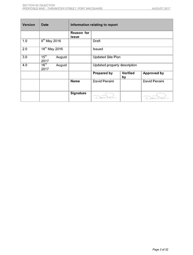
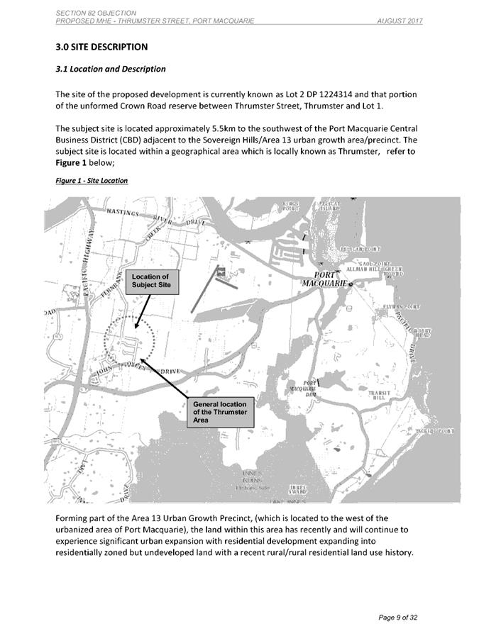
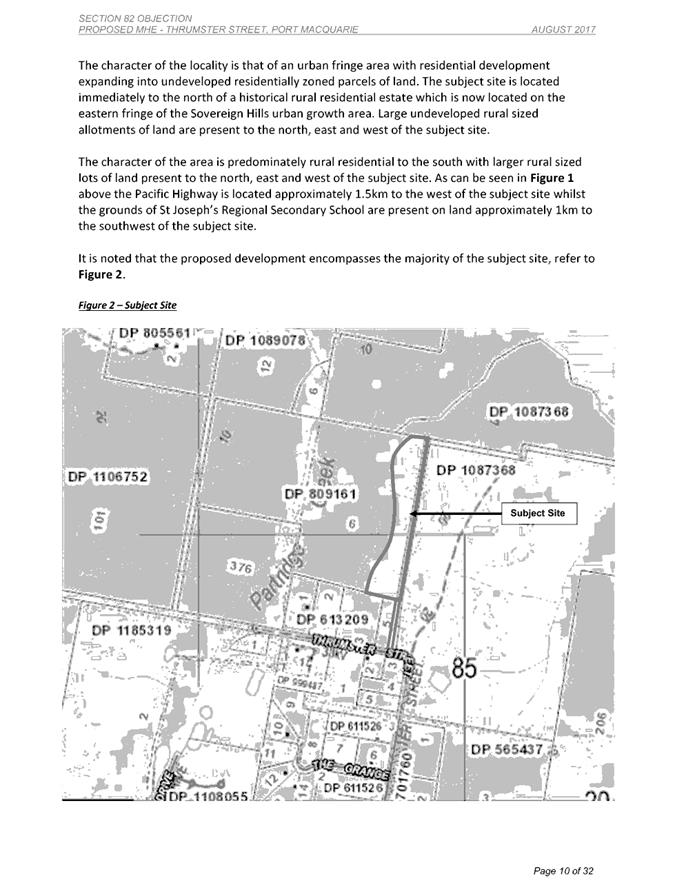
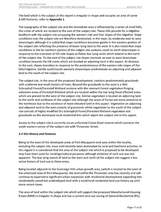
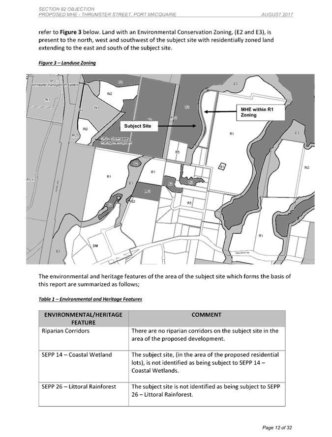
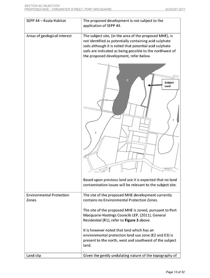
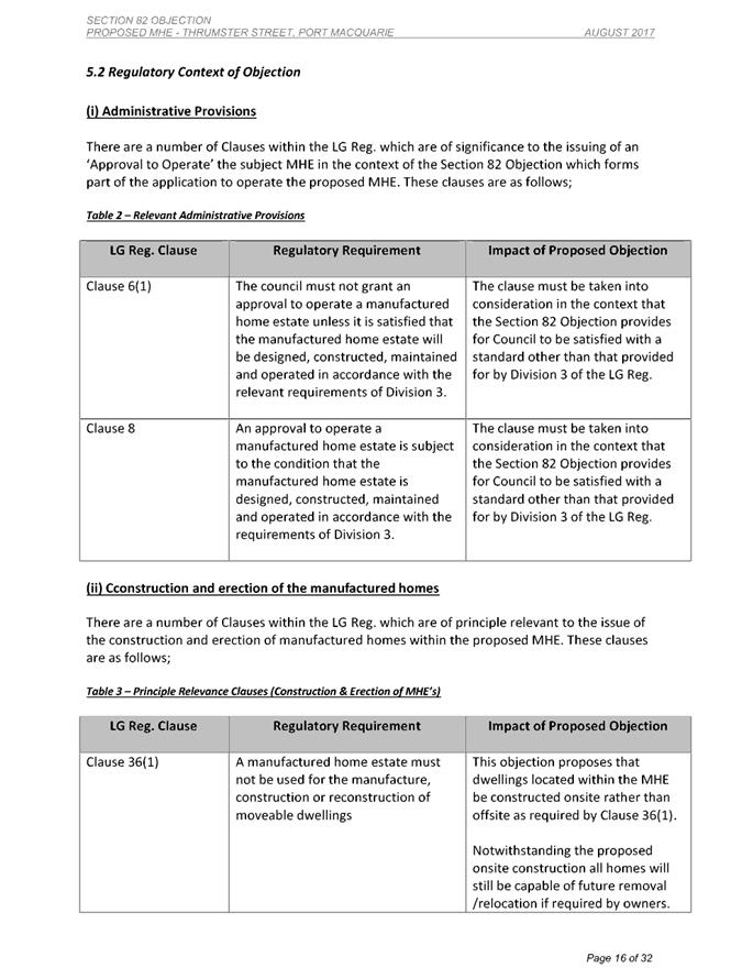
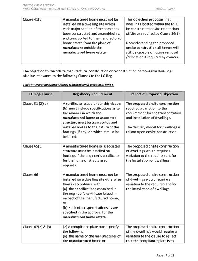
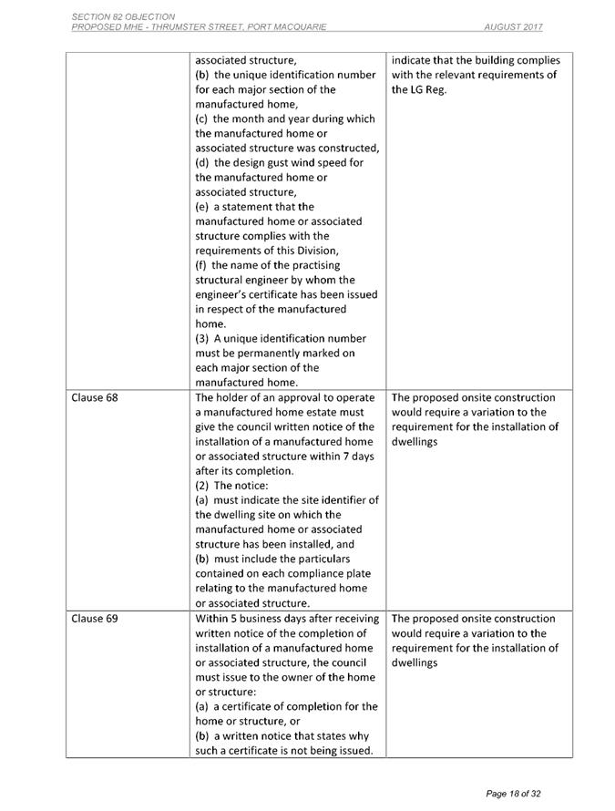
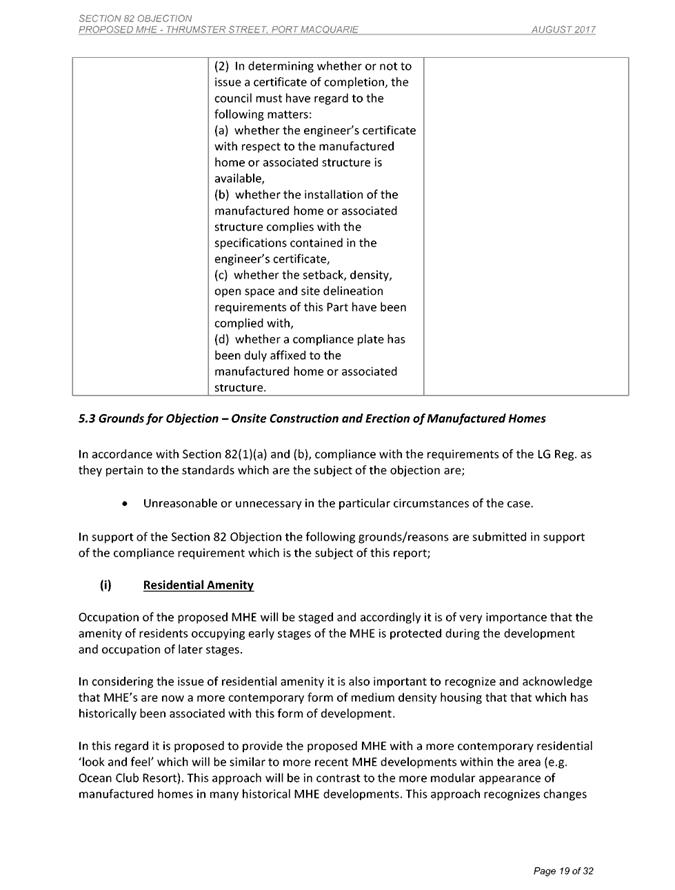

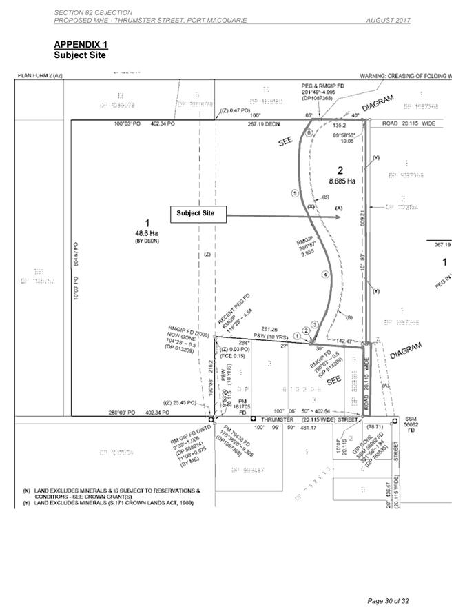
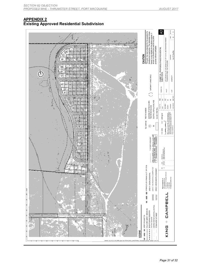
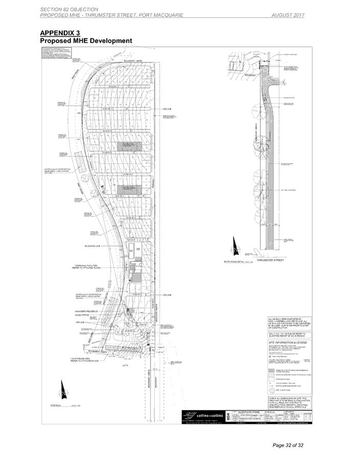
|
ATTACHMENT
|
Development Assessment Panel
28/02/2018
|
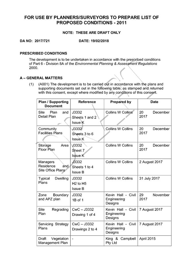

|
ATTACHMENT
|
Development Assessment Panel
28/02/2018
|
|
ATTACHMENT
|
Development Assessment Panel
28/02/2018
|
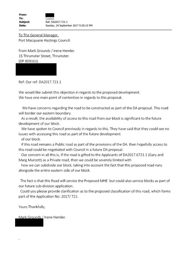
|
ATTACHMENT
|
Development Assessment Panel
28/02/2018
|
|
ATTACHMENT
|
Development Assessment Panel
28/02/2018
|
AGENDA Development Assessment Panel 28/02/2018
Item: 06
Subject: DA2017 - 871.1 Service Station And Signage -
Lot 20 DP 1191370 No. 16 Sancrox Road, Sancrox
Report
Author: Patrick Galbraith-Robertson
|
Applicant: Expressway
Spares Pty Ltd CARE King and Campbell Pty Ltd
Owner: Expressway
Spares Pty Ltd
Estimated Cost: $3.5M
Alignment with Delivery
Program
4.9.2 Undertake transparent
and efficient development assessment in accordance with relevant legislation.
|
|
RECOMMENDATION
That
DA 2017 – 871.1 for a service
station and signage at Lot 20, DP 1191370, No.
16 Sancrox Road, Sancrox, be
determined by granting consent subject to recommended conditions.
|
Executive
Summary
This
report considers a Development Application (DA) for a service station
and signage at the subject site and provides an
assessment of the DA in accordance with the Environmental Planning and
Assessment Act 1979.
Following exhibition of the
application, one (1) submission has been
received raising objections to the proposal and two (2) submissions in support.
Key assessment issues identified
in this report include landuse characterisation of the development, access and
traffic, economic impact and issues raised in the submission received.
The proposal has been amended
during the assessment of the DA.
1. BACKGROUND
Existing sites features and Surrounding development
The site has an area of 12.355
hectares.
The site has a development consent
in place for an industrial subdivision. The proposal only relates to 2 of the
approved lots within this subdivision. Proposed Lots 1 and 2 are shown in the
image extract below:
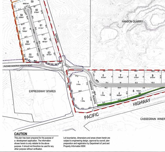
The section of the site proposed to be developed is zoned IN1
Industrial in accordance with the Port
Macquarie-Hastings Local Environmental Plan 2011, as shown in the following
zoning plan:
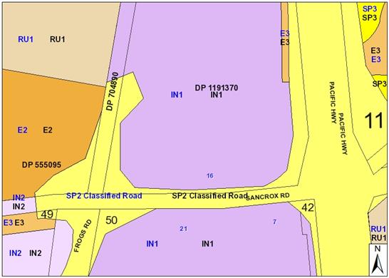
The existing subdivision pattern and location of existing
development within the locality is shown in the following aerial photograph
(source nearmap 2017):
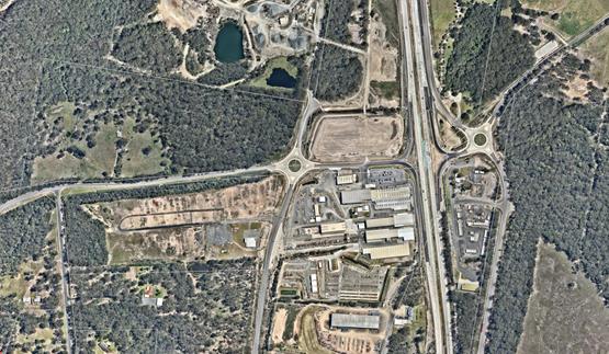
The
subject site is located in the established Sancrox Employment Lands precinct on
the western side of the Pacific Highway.
The
property itself as it currently exists has a total area of 12.38 hectares. The
proposed Lot 1 has an area of 1.04 hectares.
Lot 20 DP 1191370 has a total
land area of 12.38ha and is part of the land that has been granted development
consent under DA2012/305 (as modified) to be subdivided into 70 industrial
allotments.
The
subject site has a frontage of 192.13m along its northern boundary to a
drainage reserve; a western side boundary of 84.74m; a southern rear boundary
of 230.90m to the Sancrox Road; and an eastern side boundary to the Pacific
Highway of 73.37m.
Topographically,
the natural surface levels of the site fall in a south-west to north-east
direction towards the Pacific Highway. The overall cross fall is approximately
0.5% and the gradient can best be described as very gentle.
The
adjoining lands directly to the north and west are currently vacant. Abutting
the site to the south (on the other side of Sancrox Road) is a number of
well-established light industrial/commercial complexes including Expressway
Spares.
To the
east, on the other side of the Pacific Highway lies the Fernbank Park Employment
Lands and the Cassegrain Winery.
Approximately
2.5 kilometres to south of the subject site, further along the Pacific Highway
lies a very large well-established highway service centre (HSC) at the
intersection of the Pacific and Oxley Highways. In addition to a service
station, this HSC encompasses a number of fast food restaurants (McDonalds, KFC
and Oliver’s), food court, extensive convenience store, and day use,
picnic areas and playgrounds. This HSC is specifically designed to cater for the
everyday travelling needs of the general public utilising the Highway.
Hanson Quarry is located to the
west of the development site.
It should be noted that
Council’s Development Assessment Panel refused consent on 10 May 2017 to
a proposed Service Station (DA2016/801) on Approved Lots 1 & 2 within Lot
20 DP1191370. This Development Application was refused for the following
reasons:
1. The proposal is
characterised as a highway service centre and is a prohibited land use in the
IN1 General Industrial zone under the Port Macquarie-Hastings Local
Environmental Plan 2011;
2. The proposal is likely to
result in adverse traffic and safety impacts in the immediate locality; and
3. The proposal has potential
to result in adverse economic impacts in terms of planning highway service
centre sites within the Port Macquarie-Hastings Local Government area.
2. DESCRIPTION
OF DEVELOPMENT
Key aspects of the proposal (as detailed in the submitted
information) include the following:
· Construction
of a service station containing gross floor area of approximately 270m2 and
including store room, office, counter, male and female disabled WC and 190m2
general sales area;
· Truck
wash area;
· 12 (6
double sided) fuel bowsers for small vehicles and associated metal roof canopy;
· 6 fuel
bowsers for large vehicles and associated metal roof canopy;
· 3 Type
90 (90,000 litres nominal capacity) underground petroleum storage tanks and
associated infrastructure.
· Stormwater
drainage management system.
· Two
(2) B-Double truck parking spaces;
· Two
(2) separate driveway connections to Sancrox Road (one entry one exit); and
· 13
parking spaces including one (1) disabled space.
· Signage,
including:
- Two (2) free-standing illuminated pylon signs
measuring 5.4m high by 2m wide adjacent the access driveways;
- Business identification fascia signage above
the service station entrance
- Canopy fascia signage;
- Fuel dispenser signage; and
- General directional signage.
The existing driveway servicing
Approved Lot 2 will be replaced with the proposed driveway as a part of this
application.
The subdivision of Lot 20
DP1191370 to create Approved Lots 1 and 2 and the lot to contain the sewer pump
station is currently being carried out pursuant to Development Consent
DA2012/305.
The proposed service station is
proposed to operate between the hours of 5am to 10pm, 7 days a week.
An extract of the proposed site
plan is provided as follows:
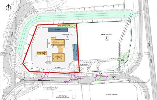
Refer
to attachments at the end of this report for more detailed plans and information.
Application Chronology
· 28
September 2017 – DA lodged with Council.
· 10 October 2017 – Referral of DA to the NSW Roads and
Maritime Service
· 13
to 26 October 2017 – Neighbour notification of proposal
· 24 October 2017 – Assessment update provided to
Applicant.
· 30 October 2017 – Meeting with Applicant to discuss
initial assessment issues
· 13 November 2017 – Advice received from the RMS
· 13 December 2017 – Additional information received
from Applicant
· 31 January 2018 – Meeting with Applicant to discuss
assessment issues particularly traffic management
· 14 February 2018 – Additional information received
from Applicant – traffic management and introduction of right of
carriageway proposed across proposed approved Lots 1 and 2.
3. STATUTORY
ASSESSMENT
Section
79C(1) Matters for Consideration
In
determining the application, Council is required to take into consideration the
following matters as are relevant to the development that apply to the land to
which the development application relates:
(a) The
provisions (where applicable) of:
(i) any
Environmental Planning Instrument:
State Environmental Planning Policy No. 33 - Hazardous
and Offensive Development
The subject SEPP was introduced to clarify the definitions
for hazardous and offensive industries and to apply guidelines for the
assessment of industries that have the potential to create hazards or an
offence.
Clause 12 of SEPP 33 requires
that a Development Application for the purposes of a potentially hazardous
industry must include a preliminary hazard analysis (PHA) in accordance with
the current circulars or guidelines published by the Department of Planning.
The Department has published Hazardous
and Offensive Development Application Guidelines – Applying to SEPP
33 (January 2011). Appendix 3 of The Guideline identifies Petrol
Stations as industries which may be potentially hazardous. The primary sources
of hazard is identified as liquid fuel leaks/spills resulting in possible
impacts such as fire and explosions.
Appendix 2 of The Guideline
includes a list of information required in
relation to
the SEPP 33 risk screening method as follows:
- Hazardous Materials involved in the Proposed
Development
- Dangerous Goods classifications for all
Dangerous Goods held on
site;
- Quantities
of dangerous goods and otherwise hazardous materials involved in the proposed
development.
- Distance
from the boundary for each hazardous substance;
- Weekly
and annual number of deliveries (and the quantities) of dangerous goods and otherwise
hazardous materials to and from the facility;
- Site
Layout plan showing proposed development and any existing development on site;
and
- Locality
Plan showing immediate neighbours and their activities and also showing the
nearest residential property.
The above information is
contained in the SEPP 33 Threshold Risk Screening Assessment included in submitted
information with the application. The proposed service station does not exceed
any of the SEPP 33 Risk Thresholds. No further consideration of the SEPP
required.
State Environmental Planning Policy No. 44 - Koala
Habitat Protection
With reference to clauses 6 and 7, the subject land is
greater than 1 hectare (including any adjoining land under same ownership) and
therefore the provisions of SEPP must be considered.
The DA has demonstrated that no habitat will be removed or
modified therefore no further investigations are required on the proposed
approved Lot to which the application relates to.
The proposal is also consistent with the Koala Plan of
Management associated with DA2012 – 305.
State Environmental Planning Policy No.55 –
Remediation of Land
Following an inspection of the site, a search of Council
records and based upon the information submitted, the subject land is not
identified as being potentially contaminated and is suitable for the intended
use.
State Environmental Planning Policy No. 62 –
Sustainable Aquaculture
Given the nature of the proposed development and proposed
stormwater controls, the proposal would be unlikely to have any adverse impact
on existing aquaculture industries.
State Environmental Planning Policy No. 64 –
Advertising and Signage
The proposed development includes proposed advertising
signage in the form of business/building identification signage. The following
signage is proposed:
- Two (2) free-standing illuminated pylon signs
measuring 5.4m high by 2m wide adjacent the access driveways;
- Business identification fascia signage above
the service station entrance;
- Canopy fascia signage;
- Fuel dispenser signage; and
- General directional signage.
In accordance with clause 7,
this SEPP prevails over the Port Macquarie-Hastings LEP 2011 in the event of
any inconsistency.
The following assessment table
provides an assessment checklist against the Schedule 1 requirements of this
SEPP:
|
Applicable clauses for consideration
|
Comments
|
Satisfactory
|
|
Clause 8(a) Consistent with objectives of the policy as
set out in Clause 3(1)(a).
|
The subject site is zoned IN1
General Industrial and the surrounding land is intended to contain a variety
of industrial land uses as the industrial estate develops.
The proposed signage is
considered compatible with the desired future character of the locality.
The signage is consistent with the objectives to not
warrant refusal on its own.
|
Yes
|
Schedule 1(1) Character of
the area.
|
The proposed signage will be compatible with the desired
character of the locality.
There is no identifiable theme for outdoor advertising in
the area.
|
Yes
|
|
Schedule 1(2) Special areas.
|
The proposed signage does not
detract from any areas of environmental or cultural importance. There are no
such areas in direct proximity to the subject land.
|
Yes
|
|
Schedule 1(3) Views and vistas.
|
The proposed site signage does not obscure or compromise
any important existing or potential views or view corridors.
The proposed service station
also includes two (2) 5.4m high x 2m wide freestanding pylon signs adjacent
to the southern boundary of the site (fronting Sancrox Road). These signs are
not considered likely to obscure any existing or proposed advertising signage
on adjoining land or within the precinct.
|
Yes
|
|
Schedule 1(4) Streetscape, setting or landscape.
|
The subject site (approved Lot
1) directly addresses a sub-arterial road (Sancrox Road) which provides the key
thoroughfare to the approved 70 lot industrial estate.
The two proposed pylon signs
are 77 metres apart and siting in such a way to relate to entry and exit
points from the service station which is not uncommon.
The proposed signage is
therefore considered appropriate for the site for the following reasons:
- The proposed signage
is considered appropriate given the scale of industrial
development anticipated within the area;
- The proposed signage is
considered likely to contribute to the visual interest of the area whilst
appropriately identifying the
occupant/business carried out
on site;
- The proposed signage is not
proposed in order to screen unsightliness as the site is currently vacant;
and
- The proposed signage will
not protrude above other signs within the locality.
|
Yes
|
|
Schedule 1(5) Site and building.
|
The subject land is primarily
flat and has been granted consent for an industrial subdivision. Service
Stations are permissible with consent in the IN1 zone and it is considered
that the proposed signage integrates with the built form of the proposed
service station and surrounding existing and future land uses.
The proposed signage is not
considered to detract from important features of the site, proposed building
or surrounding development.
The location of the proposed
signage is considered suitable for the proposed use and appropriate given the
proposed service stations position, proposed access arrangements and parking.
|
Yes
|
|
Schedule 1(6) Associated devices and logos with
advertisements and advertising structures.
|
The intended occupant of the
proposed service station is not currently known.
The proposed service station
includes signage which is intended to ultimately include logos and symbols
representing facilities and services offered.
|
Yes
|
|
Schedule 1(7) Illumination.
|
The service station signage will include a number of
illuminated signage panels including:
- Two (2) 5.4m high x 2m wide pylon signs;
- Flush wall above awning sign;
- Canopy signage; and
- Directional and accessible signage.
These signs will be required to be illuminated at
appropriate LUX levels so as to ensure that the signage will not result in
unacceptable glare.
The proposed illuminated signage is not considered likely
to provide a significant safety concern for pedestrians, vehicles or
aircraft.
|
Yes
|
|
Schedule 1(7) Safety.
|
The proposed service station
signage is not considered likely to reduce road safety for pedestrians,
cyclists or any vehicles utilising a public road. Sightlines to and from the
site are not considered likely to be affected.
|
Yes
|
State Environmental Planning
Policy (Infrastructure) 2007
· Clause 101,
refers to assessment of access, traffic and parking impacts addressed later in
this report. The development is of a type which is not sensitive to traffic
noise or vehicle emissions from the adjoining Pacific Highway and would be
unlikely to result in smoke and dust to affect the adjoining Pacific Highway.
· Clause
104(3)(b)(ii) and (iii), the DA has been referred to the NSW Roads and Maritime
Service (RMS). The RMS’ advice and other matters requiring consideration
are considered in the assessment of access, traffic and parking impacts
addressed later in this report.
Port Macquarie-Hastings Local Environmental
Plan 2011
The proposal is considered consistent with the LEP having
regard to the following:
· Clause
2.2, the subject site (proposed Lot 1) is zoned IN1 General Industrial.
· Service
stations are identified as a permissible land use with consent in the IN1 zone
The following landuses in
the LEP are relevant to determine and characterise the proposed use:
service
station means a building or place used for the sale by retail
of fuels and lubricants for motor vehicles, whether or not the building or
place is also used for any one or more of the following:
(a) the ancillary sale by retail of spare parts
and accessories for motor vehicles,
(b) the cleaning of motor vehicles,
(c) installation of accessories,
(d) inspecting, repairing and servicing of motor
vehicles (other than body building, panel beating, spray painting, or chassis
restoration),
(e) the ancillary retail selling or hiring of
general merchandise or services or both.
transport depot means
a building or place used for the parking or servicing of motor powered or motor
drawn vehicles used in connection with a business, industry, shop or passenger
or freight transport undertaking.
truck depot means
a building or place used for the servicing and parking of trucks, earthmoving
machinery and the like.
highway
service centre means a building or place used to provide refreshments
and vehicle services to highway users. It may include any one or more of the
following:
(a) a restaurant or cafe,
(b) take away food and drink premises,
(c) service stations and facilities for
emergency vehicle towing and repairs,
(d) parking for vehicles,
(e) rest areas and public amenities.
The Applicant has
submitted that the proposal is best characterised as a ‘service
station’ and not a ‘highway service centre’.
Specifically, the
Applicant has provided the following justification:
- The
proposed service station has been designed to cater primarily for traffic
generated by the Sancrox Employment Precinct traffic and passing traffic on
Sancrox Road, including heavy vehicles;
- The
scale of the proposed service station is suitable to provide fuel supply
services to the Sancrox Employment Precinct, nearby Fernbank Park Employment
Precinct and passing traffic on Sancrox Road and is typical of the scale of
this type of facility commonly found in industrial employment
precincts;
- The
proposed service station includes a small retail component for the ancillary
sale of spare parts and accessories and general merchandise; and
- The
proposal includes a self-contained truck wash facility to cater for heavy
vehicles.
- The
proposed service station does not contain any of the additional features found
within a Highway Service Centre such as a restaurant, café, take away
food and drink premises, public amenities, parking for vehicles (other than
fuel customers), or a rest area;
- The
proposed service station is to be located on Approved Lot 1 and so as not have
direct frontage to the Pacific Highway.
- The
design of the proposed service station does not provide potential for expansion
of the proposal to accommodate other elements typically found in highway
service centres;
- The
proposed hours of operation of the service station are consistent with a local
fuel supply facility rather than the 24- hour 7 days a week operations of a
highway service centre.
In accordance with clause
2.3(1) and the IN1 zone landuse table, the proposal is best characterised as a
‘service station’ based upon the submitted justification and the
nature and design of the development.
The objectives of the IN1 zone are as follows:
§ To provide a wide range of industrial and warehouse land
uses.
§ To encourage employment opportunities.
§ To minimise any adverse effect of industry on other land
uses.
§ To support and protect industrial land for industrial uses.
§ To enable other land uses that provide facilities or
services to meet the day to day needs of workers in the area.
In accordance with Clause 2.3(2) having regard to the
objectives of the IN1 zone:
- the service station will encourage employment
opportunities;
- will not have any noticeable adverse impacts on other
developments in the precinct;
- will provide services and facilities that support
industrial land and landuses; and
- will provide facilities to meet the day-to-day needs
of workers in both the Sancrox and Fernbank Park Employment Lands precincts.
The proposal is consistent with
the remainder of the LEP having regard to the following:
· Clause
4.3, the maximum overall height of the building above ground level (existing)
is approximately 7.0m which complies with the standard height limit of 14.5m
applying to the site.
· Clause
5.9 - No listed trees in Development Control Plan 2013 are proposed to be
removed.
· Clause
5.10 – Heritage. The site does not contain or adjoin any known heritage items
or sites of significance.
· Clause
7.7 – The proposal will be unlikely to result in any identifiable impact
on airspace operations.
· Clause
7.8 - This proposal will be unlikely to be impacted upon by aircraft noise
operations.
· Clause
7.13, satisfactory arrangements are in place for provision of essential
services including water supply, electricity supply, sewer infrastructure,
stormwater drainage and suitable road access to service the development.
(ii) Any draft
instruments that apply to the site or are on exhibition:
No draft
instruments apply to the site.
(iii) any Development
Control Plan in force:
Port
Macquarie-Hastings Development Control Plan 2013
|
DCP 2013: Chapter 3.5 - Industrial Development
|
|
DCP Objective
|
Development Provisions
|
Proposed
|
Complies
|
|
3.5.3.1
|
Minimum setbacks are provided as follows:
· 10m from a classified road;
· 7.6m from any other road boundary;
· 3m from any secondary road
frontage.
|
Minimum setbacks complied with and are greater than 7.6m.
|
Yes
|
|
3.5.3.2
|
Elevations of building which are visible from a public
road, reserve or adjacent or adjoining residential areas are to be
constructed using:
· brick, masonry, pre-coloured metal
cladding, or
· appropriately finished
‘tilt-slab’ concrete; or
· a combination of a number of these
materials.
|
Elevations design and finishes are acceptable.
|
Yes
|
|
Large unrelieved expanses of wall or building mass are not
favoured, and as such should be broken up by the use of suitable building
articulation, fenestration or alternative architectural enhancements.
|
The proposal does not have any large unrelieved expanses
of walls.
|
N/A
|
|
3.5.3.3
|
Material storage/work areas and volumes to be provided
with application.
|
No open storage or work areas are proposed as part of the
proposed service station.
|
N/A
|
|
Open work and storage areas to be located at rear of
premises and screen from view by landscaping and/or fencing minimum 2m high.
|
N/A
|
|
|
3.5.3.4
|
Detailed landscaping plan submitted.
|
Detailed landscaping plan submitted.
The proposal also seeks to provide plantings around the
western and
northern boundary, consisting of a variety of species, to
complement the vegetation existing within the vegetated swale and Koala
corridor to be established pursuant to DA 2012/305.
|
Yes
|
|
Landscaped strip 3m wide for 2/3 of each road frontage.
|
Landscaped strip provided
|
Yes
|
|
No fencing in front setback unless for display items. High
quality fencing and landscaping.
|
No fencing proposed
|
N/A
|
|
3.5.3.5
|
An onsite recreation area is provided for staff that:
· Includes seating, tables and
rubbish bin.
· If outside, is adequately
protected from the weather
· Is safely accessible to all staff.
· Is separate private from public
areas.
· Is located away from noisy or
odorous activities.
|
Staff area provided - office.
|
Yes
|
|
3.5.3.6
|
Provide onsite facilities for changing, showering and
secure bike storage.
|
Amenities provided.
|
Yes
|
|
3.5.3.7
|
Development complies with NSW Industrial Noise Policy.
|
No potential adverse noise issues identified.
|
Yes
|
|
Building openings located to minimise noise impacts if
within 400m of residential zone.
|
N/A
|
|
|
External plant such as generators, air conditioning plant
and the like, should be enclosed to minimise noise nuisance and located away
from residences.
|
No potential adverse noise issues identified.
|
Yes
|
|
External and security lighting should be directed and
shielded to avoid light spillage to adjoining residential areas.
|
No potential light spill issues identified.
|
Yes
|
|
Driveways should be arranged or screened to avoid
headlight glare on residential windows.
|
N/A
|
|
|
3.5.3.8
|
Office space ancillary to the industrial use is
permissible with consent, subject to satisfaction of the following matters:
· That the office component of a
proposed development is ancillary to the functions carried out in the factory,
warehouse or other industrial use.
· That the office area is not leased
to a separate company or entity.
· That parking facilities are
adequate to cater for the size of the office development.
|
Ancillary staff space proposed
|
Yes
|
|
3.5.3.9
|
The site should be serviced by reticulated water (and dual
reticulation where this is available), sewer and telecommunications.
|
Site is serviced with essential services.
|
Yes
|
|
3.5.3.10
|
Garbage storage areas are not visible from a public place.
|
Garbage storage areas at the rear of the building
|
Yes
|
|
3.5.3.11
|
Stormwater management strategy prepared.
|
Stormwater strategy submitted
|
Yes
|
|
Rainwater tank and dual reticulation for non-potable uses
on the site.
|
Refer to water supply comments later in this report.
|
Yes
|
|
DCP 2013: General Provisions
|
|
DCP Objective
|
Development Provisions
|
Proposed
|
Complies
|
|
2.2.2.1
|
Signs primarily identifying products or services are not
acceptable, even where relating to products or services available on that
site.
|
The signage proposed is intended
to relate only to the main products sold at the site characteristic of a
service station, and does not include any non-related services, unassociated
products, 3rd party promotion or additional business
merchandise advertising.
|
Yes – condition recommended
|
|
On-premise signs should not project above or to the side
of building facades
|
The signage does not project above or to the side of
building facades.
|
Yes
|
|
2.2.2.2
|
Where there is potential for light spill from signage in a
non -residential zone adjoining or adjacent to residential development,
illuminated signage is to be fitted with a time switch to dim by 50% or turn
off the light by 11pm each night, depending on the nature of the development.
|
There are no potential light spill issues to sensitive
receivers identified.
|
Yes
|
|
2.7.2.2
|
Design addresses generic principles of Crime Prevention
Through Environmental Design guideline:
· Casual surveillance and sightlines
· Land use mix and activity
generators
· Definition of use and ownership
· Lighting
· Way finding
· Predictable routes and entrapment
locations
|
The proposed development will be unlikely to create any
concealment/entrapment areas or crime spots that would result in any
identifiable loss of safety or reduction of security in the immediate area.
Appropriate external lighting can be provided.
|
Yes
|
|
2.3.3.1
|
Cut and fill 1.0m max. 1m outside the perimeter of the
external building walls
|
Cut and fill including stormwater facilities is
acceptable.
|
Yes
|
|
2.6.3.1
|
Tree removal (3m or higher with 100mm diameter trunk and
3m outside dwelling footprint
|
No tree removal proposed
|
N/A
|
|
2.4.3
|
Bushfire risk, Acid sulphate soils, Flooding,
Contamination, Airspace protection, Noise and Stormwater
|
Refer to main body of report.
|
Yes
|
|
2.5.3.2
|
New accesses not permitted from arterial or distributor
roads. Existing accesses rationalised or removed where practical
|
Refer to traffic assessment details later in this report.
The primary access points are proposed off a nominated sub-arterial road
being a section of Sancrox Road.
Driveways are limited.
|
No* Refer to traffic assessment details later in this
report.
|
|
Driveway crossing/s minimal in number and width including
maximising street parking.
|
Yes
|
|
2.5.3.3
|
Off-street parking in accordance with Table 2.5.1.
Reduction possible if supported by parking demand study.
|
Parking provision numbers comply - refer to comments later
in this report addressing parking.
|
Yes
|
|
2.5.3.5
|
On-street parking permitted subject to justification.
|
None proposed
|
N/A
|
|
2.5.3.6
|
On-street parking includes streetscape improvements.
|
None proposed
|
N/A
|
|
2.5.3.7
|
Customer parking to be easily accessible.
|
Customer parking to be easily accessible.
|
Yes
|
|
Way finding signs provided for parking areas.
|
Capable providing way finding signs
|
Yes - capable
|
|
Parking in accordance with AS 2890.1.
|
Parking design is capable of compliance with detailed
requirements of AS 2890.1.
|
Yes – condition recommended
|
|
2.5.3.8
|
Aged and disabled persons and persons wheeling prams or
trolleys are provided with suitable access and parking in accordance with AS
2890.1 and AS 2890.2.
|
Capable of compliance with access requirements
|
Yes
|
|
2.5.3.9
|
Bicycle and motorcycle parking considered and designed
generally in accordance with the principles of AS 2890.3
|
No specific parking identified.
|
N/A
|
|
2.5.3.11
|
Section 94A contributions
|
Refer to main body of report.
|
|
|
2.5.3.12 and 2.5.3.13
|
Landscaping of parking areas
|
Landscaping satisfactory
|
Yes
|
|
2.5.3.14
|
Sealed driveway surfaces unless justified
|
Sealed driveways proposed
|
Yes
|
|
2.5.3.15
|
Driveway grades for first 6m of ‘parking area’
shall be 5% grade
(Note AS/NZS 2890.1 permits steeper grades)
|
Driveway grades capable of complying with Council
standards
|
Yes
|
|
2.5.3.16
|
Transitional grades min. 2m length
|
|
2.5.3.17
|
Parking areas to be designed to avoid concentrations of
water runoff on the surface.
|
Parking areas to be designed to avoid concentrations of
water runoff on the surface with appropriate stormwater management proposed.
|
Yes
|
|
Vehicle washing facilities – grassed area etc
available.
|
N/A
|
|
|
No direct discharge to K&G or swale drain
|
Car parking areas proposed to be drained to swales, bio
retention, rain gardens and infiltration areas.
Refer to stormwater comments later in this report.
|
Yes
|
|
2.5.3.18
|
Car parking areas drained to swales, bio retention, rain
gardens and infiltration areas
|
|
2.5.3.19
|
Off street commercial vehicles
facilities are provided in accordance with AS/NZS 2890.2
|
Off street commercial vehicles
facilities are capable of being provided in accordance with AS/NZS 2890.2
|
Yes
|
|
Loading bays will be provided
in accordance with the following requirements;
• Minimum dimensions to be 3.5m wide x 6m long. (This
may increase according to the size and type of vehicle).
• Vertical clearance shall be a minimum of 5m.
• Adequate provision shall be made on-site for the
loading, unloading and manoeuvring of delivery vehicles in an area separate
from any customer car parking area.
• A limited number of ‘employee only’ car
parking spaces may be combined with loading facilities.
• Loading areas shall be designed to accommodate
appropriate turning paths for the maximum design vehicle using the site.
• Vehicles are to be capable of manoeuvring in and out
of docks without causing conflict with other street or on-site traffic.
• Vehicles are to stand wholly within the site during
such operations.
|
A loading bay is proposed at
the rear of the service station.
Fuel deliveries will be via an
articulated vehicle.
|
Yes
|
|
For external bays, one bay is required
for 500m² of floor space or 1000m² of site area.
|
|
|
Commercial development having a
floor space less than 500m² need not provide a loading bay.
|
|
|
Other commercial development
shall provide one loading bay for the first 1,000m² floor space and one
additional bay for each additional 2,000m².
|
|
|
2.5.3.20
|
The location and design of
loading bays should integrate into the overall design of the building and car
parking areas.
|
The location and design of
loading bay integrates into the overall design of the building and car
parking areas.
|
Yes
|
|
Where visible from the public
domain, loading bays are located behind the building.
|
Loading bays are located behind
the building.
|
Yes
|
|
Where loading bays are located
close to a sensitive land use, adequate visual and acoustic screening is
provided.
|
N/A
|
|
|
2.5.3.21
|
Plans to confirm vehicular
access, circulation and manoeuvring in accordance with AUSTROADS and AS 2890.
|
Refer to comments later in this
report addressing traffic and access.
|
No
|
|
Adequate area provided for
loading/unloading and manoeuvring of B-Doubles where access is available from
approved B-Double routes.
|
Refer to comments later in this
report addressing traffic and access.
|
No
|
|
Ingress and egress in a forward
direction.
|
Ingress and egress in a forward
direction.
|
Yes
|
|
Driveways >6m from tangent
point of kerb radius and >1.5m from common side boundary with another lot.
|
N/A
|
|
|
Driveways not located within
intersection or restricted areas, and adequate sight distance available.
|
Refer to comments later in this
report addressing traffic and access.
|
No
|
|
DCP 2011: Sancrox Employment Lands
|
|
DCP Objective
|
Development Provisions
|
Proposed
|
Complies
|
|
OB3
|
Landscape
plantings and street trees are to be in accordance with Council’s
Street Planting List and Aus-Spec Design Specifications.
|
Landscape plan complies
|
Yes
|
|
OB4
|
A
Stormwater Management Strategy prepared by a certified practicing engineer in
accordance with Council’s Aus-Spec Design Specifications and Martens
Concept Water Cycle Management Strategy (Apr 2010) at Appendix 3 to the
Sancrox Employment Lands LES.
|
A satisfactory stormwater strategy has been submitted.
|
Yes
|
|
OB6
|
All
industrial lots are to be provided with on-site rain gardens at a minimum
size of 2.5% of the gross lot area. Rain gardens shall be designed and
constructed as per Council’s Aus-Spec Design Specifications and Martens
Concept Water Cycle Management Strategy.
|
Car parking areas proposed to be drained to swales, bio
retention, rain gardens and infiltration areas.
Refer to stormwater comments later in this report.
|
Yes
|
|
OB6
|
All
industrial lots are to be provided with a minimum 10 KL rainwater tank. All
roof water shall be directed to the rainwater tank and tank overflows
directed to the lot rain garden.
|
Provision
of a system of downpipes from the roofed areas connecting to a 10,000L
rainwater tank. Overflows to be directed to the vegetated areas (garden)
around the edge of the site. Refer to detailed comments addressing
stormwater later in this report.
|
Yes
|
|
OB6
|
All
site discharge, including hardstand areas and outflows from the on-site rain
garden is to be directed to the on-site detention.
|
All stormwater discharging
from the operational apron/ forecourt area and fill point areas will be
treated through two large bio-filtration basins located strategically within
the site as a part of the detailed design phase. The size of the designated
areas is 2.5% of the total lot area as per the DCP requirements. These areas
satisfy the AUS-SPEC requirements for stormwater treatment. Specific
modelling of the
pollutant loads is not
required at DA stage as the bio-filtration areas as in accordance with the
modelling done by Martens.
Specific construction details
of the stormwater treatment will form part of the Construction Certificate
documentation.
Refer to stormwater comments later in this report.
|
Yes
|
|
OB19
|
Buildings
on future lots at the Pacific Highway/ Sancrox Road intersection shall be
designed by a suitably qualified architect to create a distinctive and
recognisable gateway entry to the Employment Lands. Detailed design plans,
including proposed colours for buildings and signage are to accompany the DA
for approval.
|
The proposed design has adopted a variety of use of
external materials, texture and colours to ensure.
The elevations of the proposed building have some
architectural interest.
The proposal incorporates generous (and conforming)
setbacks to Sancrox Road.
|
Yes
|
(iiia) any planning agreement that has
been entered into under Section 93f or any draft planning agreement that a
developer has offered to enter into under Section 93f:
There is a Sancrox Employment Land Road Construction
Planning Agreement in place relating to the site. The obligations of the
Planning Agreement are capable of being complied with separate to this DA.
iv) any
matters prescribed by the Regulations:
N/A
v) any coastal zone management plan
(within the meaning of the Coastal
Protection Act 1979), that apply to
the land to which the development application relates:
No Coastal
Zone Management Plan applies to the subject site.
(b) The likely
impacts of that development, including environmental impacts on both the
natural and built environments, social and economic impacts in the locality:
Context and setting
The proposal will be unlikely to have any adverse visual
impacts to existing adjoining properties or the public domain.
The proposal has adequately addressed the intent of the
planning controls for the area and is a permissible landuse.
The proposal will not have significant adverse impacts on
any existing view sharing.
The proposal will not have any identifiable significant
adverse lighting impacts.
There are no significant adverse privacy impacts.
There are no adverse overshadowing impacts.
Subdivision Context
The development is proposed on the northern side
of Sancrox Road west of the Pacific Highway, on proposed Lot 1 of an industrial
subdivision approved as part of DA 2012/305 (within former Lot 2, DP
22740). On 14 March 2017 Council approved a Construction Certificate for
subdivision works to service proposed Lots 1 & 2 and to construct sewer
(pump station) infrastructure required to service the development.
Within the area, Roads and Maritime Services (RMS)
is currently upgrading the Pacific Highway. Relevant acquisition plans
related to the land include DP 1191370 and DP 1228060. On completion, the
Pacific Highway will be under the care and control of the RMS, with Sancrox
Road and the newly formed Orleans Avenue west of the site to be under the care
and control of Council.
Roads
The site is bounded by
the Pacific Highway to the east, Sancrox Road to the south and Orleans Avenue
(a newly formed and proposed industrial access road) to the west and north.
Sancrox Road is
classified as a major local rural road in Council’s mapping system, is
Council owned and maintained, with an 11m wide formation currently within a 20m
wide road reserve to be widened with dedication of the RMS acquired lands. The
recently upgraded road formation includes barrier (SA) type kerb and gutter on
both sides.
Proposed Orleans
Avenue is currently formed along the western boundary of the site as a 12m wide
industrial road including asphalt shoulders. The road reserve has not yet been
dedicated to Council. Orleans Avenue is proposed under DA 2012/305 to be
extended to the northwest of the site to facilitate access to the industrial
subdivision lands to the north. This DA for a service station does not
currently propose direct access to or from Orleans Ave.


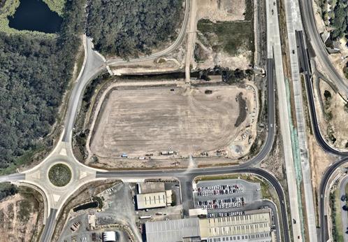
Figure: Aerial
photograph taken December 2017 showing new roads, with indicative overlay of
future approved Lots 1 and 2 (credit Nearmap).
Traffic and
Transport
A Traffic Impact
Assessment (TIA) by TPS Traffic & Parking Systems Pty Ltd was lodged with
the Development Application on 28/09/2017.
Estimates of the
number of traffic trips using the site post-development are given as follows.
· The
TIA assumes that 5% of passing trade will use the development. A previous
traffic study for the Sancrox industrial subdivision projected 880 vehicle
trips on Sancrox Road in 2029 for each peak hour period (total for both
directions). At 5% this equates to 90 trips per hour (45 in + 45 out) during
the peak hour, or approximately 800 trips per day.
· The
TIA checks this value with a rational estimate. In urban areas where there is
high competition between service stations, the TIA states that peak fuel sales
volumes are generally estimated by industry at 750,000 litres per month. For an
average car refill of 35L and truck refill of 200L assuming 10% of the visits
are trucks, an average rate of 500 customers per weekday is obtained (5 day
week, 4.33 week month). If 12.5% of that volume occurs during the PM peak hour,
this gives 125 trips per hour (63 in + 62 out) or 1000 trips per day.
· Council
has considered the RMS Guide to Traffic Generating Developments 2002.
For a site area comparable with urban sites, i.e. excluding the ancillary
manoeuvring areas and truck wash of A(S) = 3,500sqm (one third of the site) and
a convenience store area of A(F) = 190sqm, the Guide provides the below
results.
|
Description
|
Method
|
Peak Hour Result
|
Daily Result
|
|
Evening peak hour
trips
|
0.04 A(S) + 0.3 A(F)
|
197 trips (in +
out)
|
2000 trips (in +
out)
|
|
or Evening peak hour
trips
|
0.66 A(F)
|
125 trips (in +
out)
|
1250 trips (in +
out)
|
The TIA emphasises
that for typical service stations the vast proportion (90%) of trade will be
from passing traffic, as customers tend to refuel or stop when convenient en route
to other destinations rather than making a trip primarily to a service station.
As such, for this development there will be a minor increase in trips using the
roundabout to the west to circulate to the site, estimated in the TIA to be
less than 1.5%, but otherwise local roads will not have a noticeable increase.
While the magnitude of passing trade may be overstated, or magnitude of
customer visits underestimated, Council staff have tested for sensitivity and
agree with the assertion that the proposed increase in traffic will not have
significant impacts on the capacity (efficiency) of the road network, given the
projected PM peak trips using the Pacific Highway interchange (all directions)
is expected to exceed 2,200 vehicles in 2029 (TTM Consulting, 2009).
Considering the
application of Schedule 3 of the SEPP (Infrastructure) 2007, the proposal was
referred to Roads and Maritime Services and a response received dated
13/11/2017. The contents of that letter are summarised and discussed below.
1. Forwards-only
circulation on entry, internally and on exit from the site should be achieved.
Design to be in accordance with AS 2890 and Council’s specifications.
Council: The site
layout achieves those requirements.
2. Refuelling
points to be set back from the ingress driveway to allow for queuing.
Council: The proposed
layout makes available a minimum queue distance to the property boundary of 30m
for light vehicles and 35m for trucks to the closest bowser. Including
additional capacity in other bowser ‘lanes’ (12 light vehicle lanes
and 2 truck lanes) this allows for up to 84 light vehicles and 4 B-doubles to
be served or queue within the site. Considering the probabilistic distribution
of trips in the peak hour, queuing onto the road reserve is not likely.
3. Left
turn only into the site is supported. Physical right turn barriers in addition
to signage is considered necessary.
Council: Requested the
Applicant revise the plans and a 50mm trafficable median combined with hatch
line marking is now proposed in addition to the ‘no right turn’
signage. A raised hard barrier (e.g. New Jersey kerb) could not be used in this
area having regard for the existing Expressway Spares land use to the south,
which regularly transports ‘over size over mass’ heavy mining and
construction equipment by low loader trucks past the site frontage. Details of
proposed traffic devices are to be approved under a future Roads Act (s138)
application prior to issue of the CC, and any regulatory devices will require
Local Traffic Committee approval.
4. Proposed
accesses to Lots 1 & 2 are considered to have overlapping turning movements
with each other and existing driveways opposite. Consideration of access to Lot
2 is required to ensure queuing back towards the Pacific Highway does not
occur.
Council: The applicant
has submitted a revised plan, proposing a new driveway access to Lot 2 with
this application. Noting the existing lot configuration is approved. The
proposed locations of each driveway has minimised turning conflicts and the
likelihood of queuing within the public road. The ingress driveway for proposed
Lot 1 is 160m west of the Pacific Highway off ramp, while ingress to proposed
Lot 2 will be 50m west of the off ramp. It is likely that future ‘no
right turn’ traffic devices will also be required for proposed Lot 2, but
the need for this will be assessed in connection with any future development
application for that site, and noting the industrial land use traffic volumes
are expected to be comparatively low.
5. Consider
pedestrian, cyclist and public transport connectivity.
Council: Pedestrian
footpaths were not required as part of the design for the previous industrial
lands subdivision (which was approved early 2013). However, as the site is
proposed to be used as a service station, there will likely be a pedestrian
intensification as industrial employees from nearby seek to access the site on
foot for refreshments. Additionally the strategy for the industrial precinct as
well as the Traffic Impact Assessment envisaged a component of commuter travel
would be by bicycle, so safe off-road travel should be provided where
practicable to minimise interaction with the higher proportion of heavy
vehicles using local roads. It is therefore appropriate that the service
station developer construct a minimum 1.2m wide concrete footpath for the
frontage of the site along Sancrox Road to the existing pedestrian path and
refuges which have been provided by RMS at the Orleans Ave roundabout.
6. Landscaping
not to obstruct site lines between vehicles and pedestrians.
Council: the applicant
has specified frontage landscaping which satisfies this aim.
7. Pylon
signage should be a single structure located in accordance with SEPP 64 and
illumination should adjust to ambient light levels.
Council: Refer to
comments earlier in this report. Two signs are considered acceptable given the
nature of the design layout and location.
Each of the above
RMS’ comments have therefore been satisfactorily considered.
Site Frontage &
Access
Vehicle access to the
site is proposed though a dedicated entry driveway and a dedicated exit
driveway. The proposed accesses can comply with Council AUSPEC and Australian
Standards and conditions have been imposed to reflect these requirements.
The proposal also
includes relocation of the access to Lot 2, and proposes a right of way to give
access to a new Council sewer pump station. Traffic impacts associated with Lot
2 are to be assessed under any future DA. A right of way is also proposed to be
registered over Lot 1 benefitting Lot 2 to allow for future egress in a safe
location if required.
Refer to relevant
conditions of consent. Other required frontage works have been provided as part
of the parent subdivision application.
Parking
The proposed service station does
not include a work bay or restaurant/take away food and drink and is estimated
to have a maximum of two (2) employees on-site at any one time. The proposed
service station is therefore considered to require a minimum of four (4)
vehicle parking spaces.
Notwithstanding the above, TPS
states that ‘…it is industry practice to provide parking for the
sales/shop component of a service station development at a rate of 5 spaces /
100sqm (GFA), including provision for employees. This rate is widely applied by
Council’s across Australia. At that rate, the proposed 190sqm sales/shop
are should be provided with 10 parking spaces’.
The proposed service station
includes 13 parking spaces (including a disabled space) as well as two (2)
truck parking spaces. The proposal is therefore considered to provide parking
spaces sufficient for the proposed development.
Water Supply
Connection
Council records indicate that the
development site has an existing sealed water service from the 300 PVC water
main on the same side of Sancrox Road.
Final water service sizing would
need to be determined by a hydraulic consultant to suit the domestic and
commercial components of the development, as well as fire service and backflow
protection requirements. Considered capable of being complied with.
Sewer Connection
Council
records indicate that the development site does not currently have a connection
to sewer.
The proposed development must drain to an
existing or proposed sewer manhole.
All-weather access to the Sewer Pump
Station site must be made available to Council personal before, during and
after construction.
A modified Sewer Pump Station site must be
excised from this development area prior to or as part of this subdivision. In
addition a five (5) metre wide Easement for Access and
Services is to be provided from the pump station site across this development
site to a point on Sancrox Road where access is possible to and from the pump
station in both directions on Sancrox Road. Overall, the development is capable
of complying.
Stormwater
The site naturally grades towards the north (the rear) and
is currently not serviced by piped infrastructure. Due to the low-lying
position of the land within the Fernbank Creek catchment and rural history, the
parent subdivision proposal (DA 2012/305) included provision of a large swale
along the western and northern boundaries of the lots. This is defined as the
legal point of discharge for the development and a condition of consent would
need to require construction and dedication of this downstream system to
Council as part of the parent subdivision (DA 2012/305) prior to any Occupation
Certificate for the proposed service station.
Drainage outlets from the development should be limited in
number and located to minimise downstream impacts. Adequate scour protection
would be a requirement and given the high percentage of impervious area created
may need to be extensively engineered.
A detailed site stormwater management plan is required to be
submitted for assessment with the Local Government Act Section 68 application
and prior to the issue of a Construction Certificate.
In accordance with
Council’s AUSPEC requirements, the following must be incorporated into
the stormwater drainage plan:
· Special controls
are required in relation to any areas which may be contaminated by petrol or
oils due to spills, including the uncovered tank filling points, to avoid
pollution of the environment. Refer to the conditions of consent.
· A water quality
control basin will be required due to the magnitude of hard surfaces at ground
level and the risk profile for the type of development. The downstream
treatment train will need to remove contaminants, impurities, nitrate and
phosphate levels through progressive treatment devices to ensure the end of
line site outflow meets the outcomes specified by Council’s AUS-SPEC D7.
· The natural
topography drains through the southeast corner of the site, and with the
Sancrox Road upgrade the RMS have constructed a pit and pipe drainage network
in this area. Council has little information currently on these assets as
handover has not yet occurred. An easement over the line of pipes is proposed
to burden Lot 2.
· On-site detention
was demonstrated as not required for this catchment in the Stormwater
Management Plan under DA 2012/305.
Overall and through the imposition of conditions, stormwater
is capable of being managed.
Other Utilities
Telecommunication and electricity services are
available to the site. Application would need to be made to the separate
utility authorities to determine any specific requirements they may have in
connection with the development.
Heritage
Following a site inspection (and a search of Council
records), no known items of Aboriginal or European heritage significance exist
on the property. No adverse impacts anticipated.
Other land resources
The site is within a developing industrial context
and will not sterilise any significant mineral or agricultural resource.
Water cycle
At occupation stage,
land can become contaminated from fuel leaks either above or below ground. As a
result, fuel leak containment, loss monitoring, groundwater monitoring wells
and surface bunding is required as a minimum. The forecourt area must drain
(minimum 2% fall required) to dry sumps or be directed to the proposed
“Pureceptor” for treatment prior to discharge to the SW system.
Various special conditions recommended to ensure compliance if the development
was approved.
The submitted information and plans propose to install
various measures to prevent surface and ground water pollution. Compliance with
the UPSS Regulation is required besides other requirements. A minimum 2% fall
on the bunded under canopy forecourt areas is required. Conditions are
recommended to address specific requirements.
The proposed development will be unlikely to have any
adverse impacts on water resources and the water cycle.
Soils
The proposed development will be unlikely to have
any adverse impacts on soils in terms of quality, erosion, stability and/or
productivity subject to a standard condition requiring erosion and sediment
controls to be in place prior to and during construction.
Air and microclimate
The construction and/or operations of the proposed
development would be unlikely to result in any adverse impacts on the existing
air quality or result in any pollution.
A standard precautionary site management condition could be
imposed if the development was to be approved.
At Occupation stage, it is also proposed to install Stage 1
vapour recovery on the fuel lines and Stage 2 vapour recovery if required.
Flora and fauna
Construction of the proposed development will not
require any removal/clearing of any significant vegetation and therefore will
be unlikely to have any significant adverse impacts on biodiversity or
threatened species of flora and fauna.
No landscaping adjoining the proposed parking areas is
proposed. Landscaping areas are proposed around the periphery of the development
to ensure a suitable visual appearance from the public street.
Overall, the application seeks to provide 1,717m2 of
landscaped area surrounding the proposed service station hard stand area. This
equates to approximately 17% of the total site area.
Waste
Satisfactory arrangements are in place for proposed storage
and collection of waste and recyclables. No adverse impacts anticipated.
Energy
The proposal includes measures to address energy
efficiency and will be required to comply with the requirements of Section J of
the Building Code of Australia. No adverse impacts anticipated.
Noise and vibration
During construction potential exists for offensive
noise to be generated but due to proximity of nearby buildings and the
industrial use, any impact is expected to be minimal.
Noise will be generated onsite during operation of
the use but also due to the location and surrounding industrial land uses,
minimal adverse impact is expected.
Bushfire
The site is identified as being bushfire prone. In
accordance with Section 79BA - EP&A Act 1979 and having
regard to Section 1.1 of Planning for Bushfire Protection 2006, the objectives
of this Guideline are satisfied. There is adequate defendable space around the
proposed buildings and there is safe operational access and egress for
emergency vehicles if required.
Safety, security and crime prevention
The proposed development will be unlikely to
create any concealment/entrapment areas or crime spots that would result in any
identifiable loss of safety or reduction of security in the immediate
area.
Social and Economic impacts in the locality
The Sancrox Employment Precinct is designed to offer
functionality for heavy vehicle industrial usage - a core prerequisite for
occupation by employers in manufacturing, transport, warehousing and logistics
is access to suitable refuelling capability. The development of a suitable
service station within this industrial zone could be a catalyst for significant
further employment-generating commercial activity within this precinct.
Site
design and internal design
The proposed development design satisfactorily
responds to the site attributes and will satisfactorily fit into the locality.
Construction
No potential adverse impacts identified to
neighbouring properties with the construction of the proposal.
Cumulative
impacts
No adverse cumulative impacts identified within
the locality.
(c) The
suitability of the site for the development:
It is considered that based upon the assessment in this
report that the site is considered suitable for the development.
(d) Any
submissions made in accordance with this Act or the Regulations:
Key
issues raised in the submissions (for and against the proposal) received and
comments in response to these issues are provided as follows:
|
Submission
Issue/Summary
|
Planning
Comment/Response
|
|
The proposal is proposed again
as a highway service centre with its primary function of a building or place
to provide refreshments and vehicle services to users of the Pacific Highway.
|
The proposed
service station does not include a take away food and drink premises,
café or restaurant nor does it contain any of the other additional
listed features of a highway service centre being public amenities, parking
for vehicles (Other than fuel customers) or a rest area.
The proposed
development is not considered to fit the definition of a ‘highway
service centre’, particularly when a substantive part of that
definition being the provision of refreshments and vehicle services to
highway users.
Refer also
to comments provided earlier in this report addressing permissibility of the
proposal. The assessment of this proposal has had regard to the previous
refusal and it is considered to be differently characterised. In particular,
this proposal is considered to be a service station.
|
|
The development will be the first in the new Sancrox
Employment Precinct and as such the Precinct itself does not generate the
traffic to serve the local service station.
|
The proposed
service station has been designed to cater primarily for traffic generated by
the Sancrox Employment Precinct and passing traffic on Sancrox
Road.
The Sancrox
Employment Precinct contains approximately 70 hectares of industrially zoned
land and will be a major employment precinct to develop in the Port Macquarie
Hastings LGA.
A service
station is considered to be an essential service in an efficiently operating
major Employment Precinct and the proposed development is centrally located
on the corner of Sancrox Road and Orleans Avenue however does not have
immediate frontage to the Pacific Highway.
The proposed
service station is also well located to service Fernbank Park employment
precinct and the future employment precinct investigation area located to the
south of HF Hand existing operations.
|
|
Council’s first reason
for refusal still stands that the proposal is prohibited.
|
This
proposed development is more accurately characterised as a service station
which as outlined above is separately defined in the LEP and permissible in
the IN1 General Industrial zone.
|
|
Despite the increased distance to the service centre
entry, the proposal has not addressed the potential for highway sourced
traffic to queue in Sancrox Road waiting to enter the service centre due to
its decreased capacity nor the potential frequent U-turn movements at the
proposed round-about by both B-double trucks and domestic highway travellers
realizing the delays internally within the service centre.
|
The proposed
service station driveways (as amended during the assessment of the
application) have been designed to prohibit right turns into the site for
west-bound traffic. This removes potential queuing in Sancrox Road by
ensuring that traffic travelling west along Sancrox Road utilise the existing
roundabout to enter the site.
Refer to
detailed comments provided earlier in this report.
|
|
There is a nominated
highway service centre site in the Section 117 directions issued by the NSW
Department of Planning and Environment at 1179 Oxley Highway on the
north-bound side of the Pacific Highway and Oxley Highway interchange. The
proposal will have a negative economic impact on the future of this planned
facility.
|
The proposed
development is considered to not be a Highway Service Centre and is not
proposed to be located on the Pacific Highway. The proposed service station
is not in conflict with the RMS Policy or the 117 Direction.
The proposed
service station has been designed to primarily provide fuel services to the
Sancrox Employment Precinct and other local users of Sancrox Road. Given the
scale of the Sancrox Employment Precinct, a well located accessible service
station is considered to be an essential service to the existing and future
industrial uses in the locality.
|
|
The proposed commercial
use conflicts with the Roads and Maritime Services Policy on Commercial and
Retail Development along the Pacific Highway North Coast.
|
|
Support for a service station
at Sancrox as would be much more convenient to an existing business than the
options currently available.
|
Support noted.
|
|
Hastings Co-op currently supplies fuel and other goods to
Expressway Spaces and the Co-Op is looking to partner with Expressway Spares
in establishing the service station, as part of the growing Sancrox
Enterprise Zone.
|
Support noted.
|
(e) The Public Interest:
Based upon the assessment made
in this report, it is considered that the proposed development satisfies relevant
planning controls and is in the wider public interest to support.
4. DEVELOPMENT
CONTRIBUTIONS APPLICABLE
Development
contributions will be required towards augmentation of town water supply and
sewerage system head works under Section 64 of the Local Government Act 1993
and under Section 94A of the Environmental Planning and Assessment Act 1979.
There is a Sancrox Employment Land Road Construction
Planning Agreement in place relating to the site. The obligations of the
Planning Agreement are capable of being complied with in relation to
development contributions.
5. CONCLUSION
The
application has been assessed in accordance with Section 79C of the
Environmental Planning and Assessment Act 1979.
Issues
raised during assessment and public exhibition of the application have been
considered in the assessment of the DA.
The
site is considered suitable for the proposed development. It is recommended
that the application be approved subject to conditions.
|
Attachments
1View. DA2017
- 871.1 Plans
2View. DA2017
- 871.1 Recommended Conditions
3View. DA2017
- 871.1 Additional Information
4View. DA2017
- 871.1 Correspondence to SMEC - Swept Paths
5View. DA2017
- 871.1 RMS Comments
6View. DA2017
- 871.1 Traffic Report
7View. DA2017
- 871.1 Submission - Hand
8View. DA2017
- 871.1 Submission - Hastings Cooperative Ltd
9View. DA2017
- 871.1 Submission - Scott PDI
|
|
ATTACHMENT
|
Development Assessment Panel
28/02/2018
|
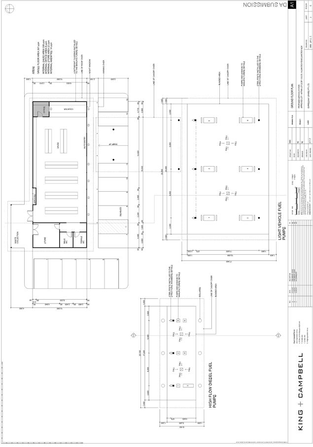
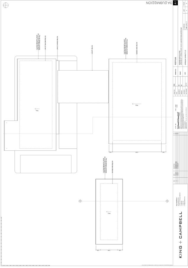
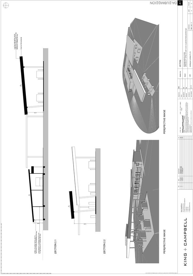
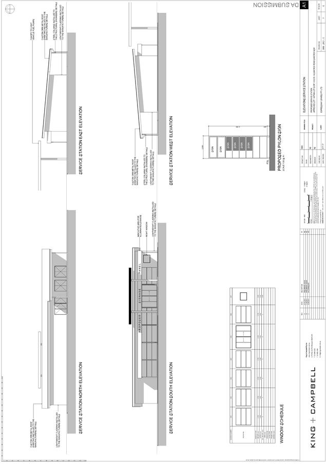
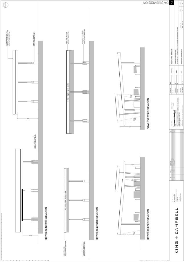
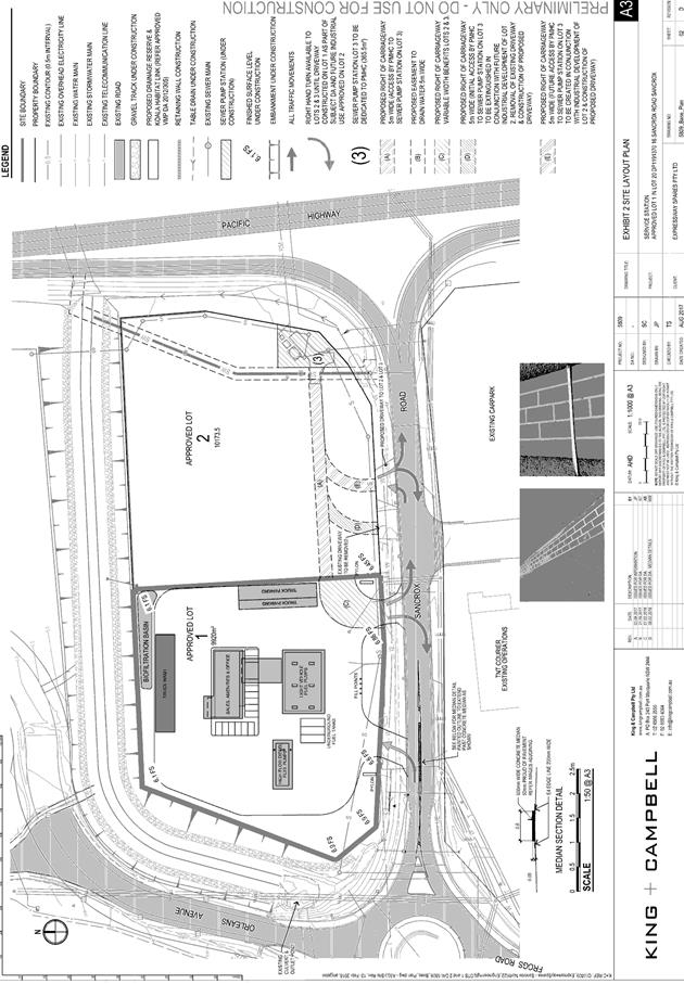
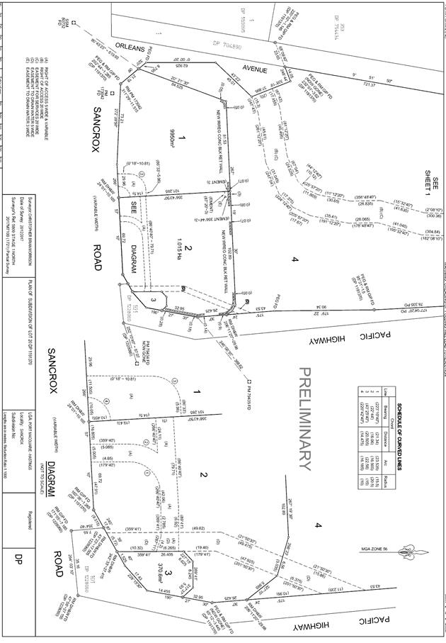
|
ATTACHMENT
|
Development Assessment Panel
28/02/2018
|

|
ATTACHMENT
|
Development Assessment Panel
28/02/2018
|

|
ATTACHMENT
|
Development Assessment Panel
28/02/2018
|
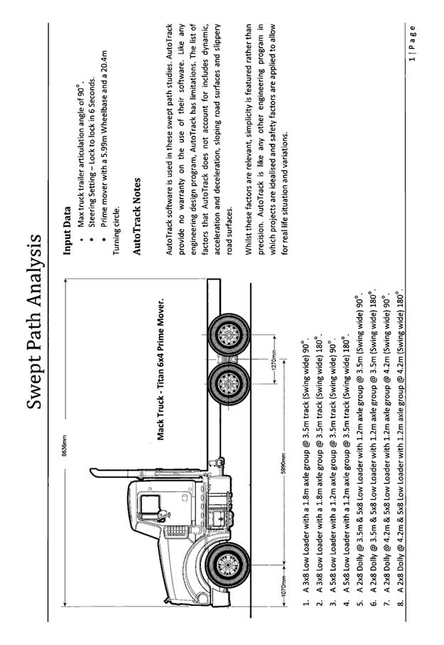
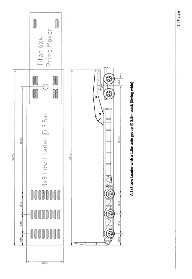
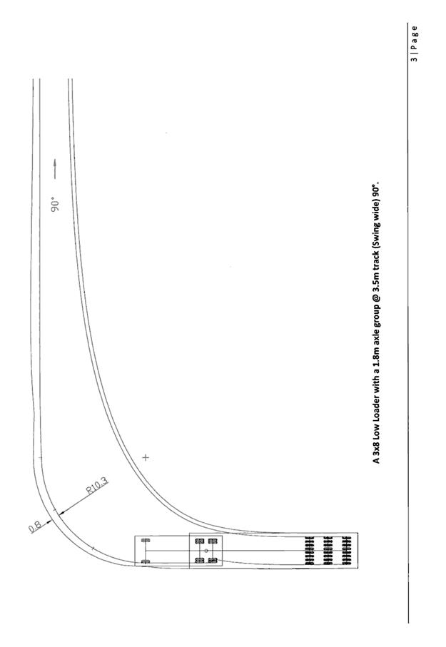
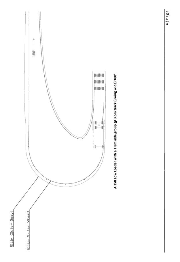
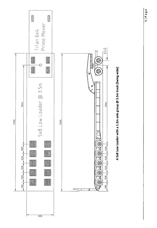
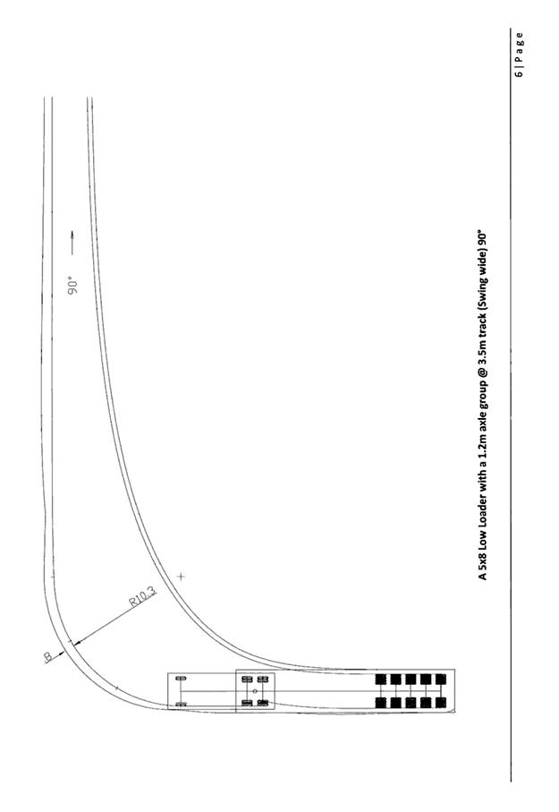
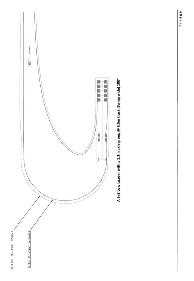
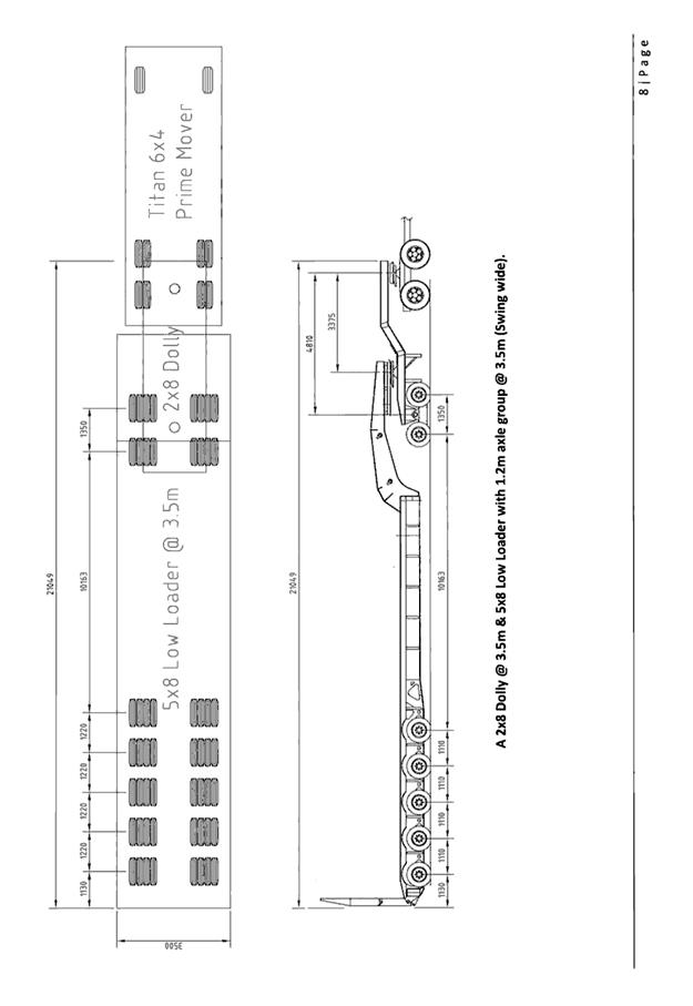
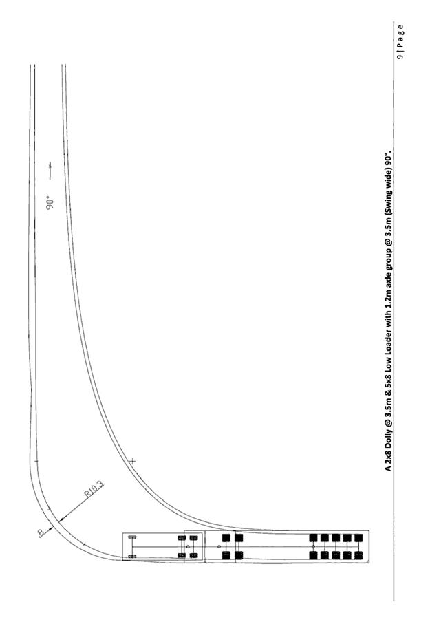
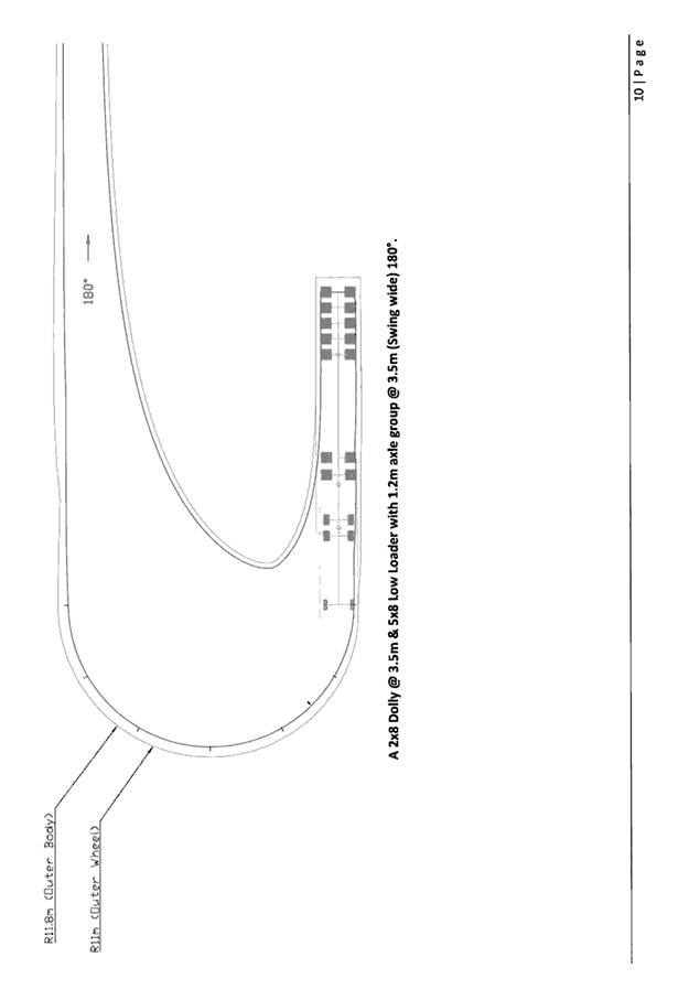
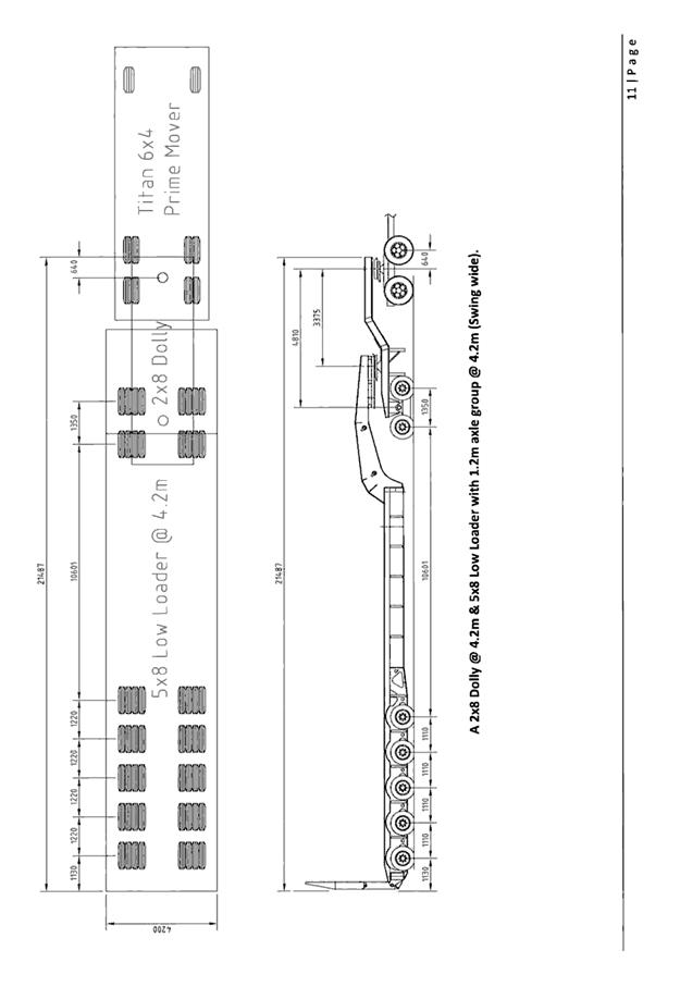
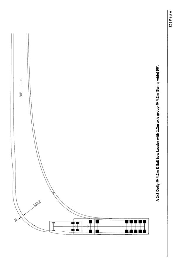
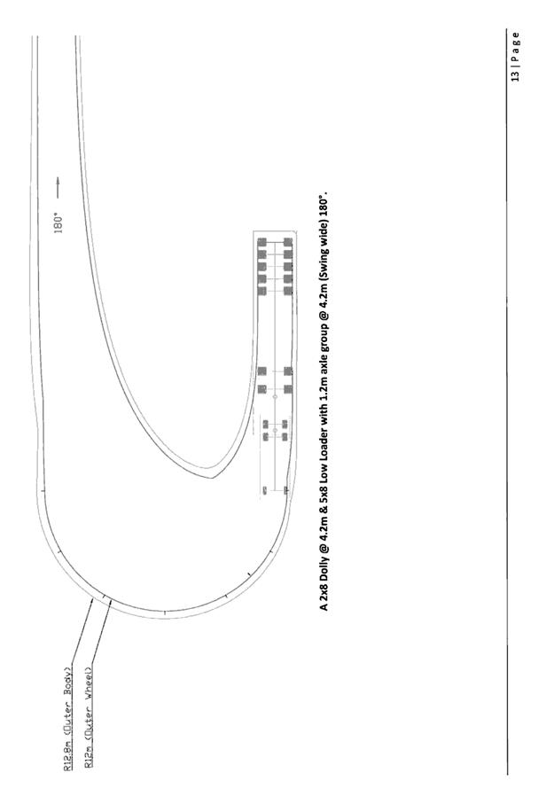
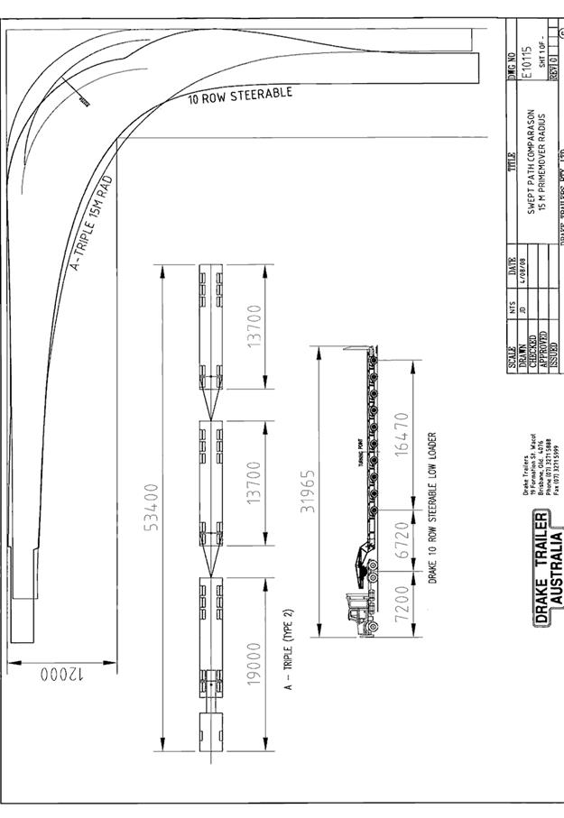
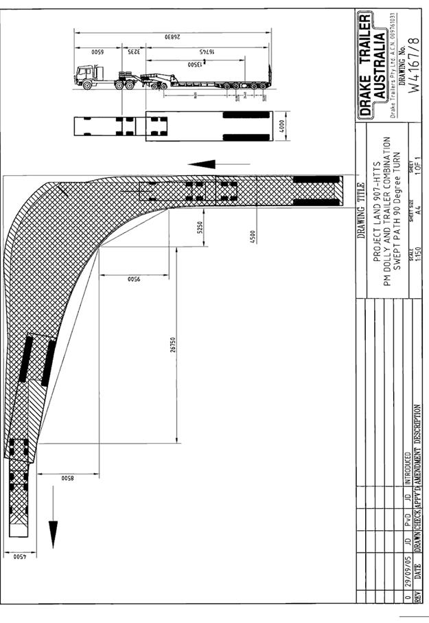
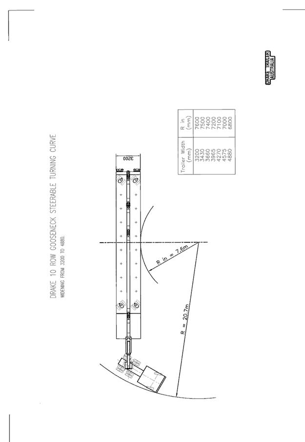
|
ATTACHMENT
|
Development Assessment Panel
28/02/2018
|
|
ATTACHMENT
|
Development Assessment Panel
28/02/2018
|
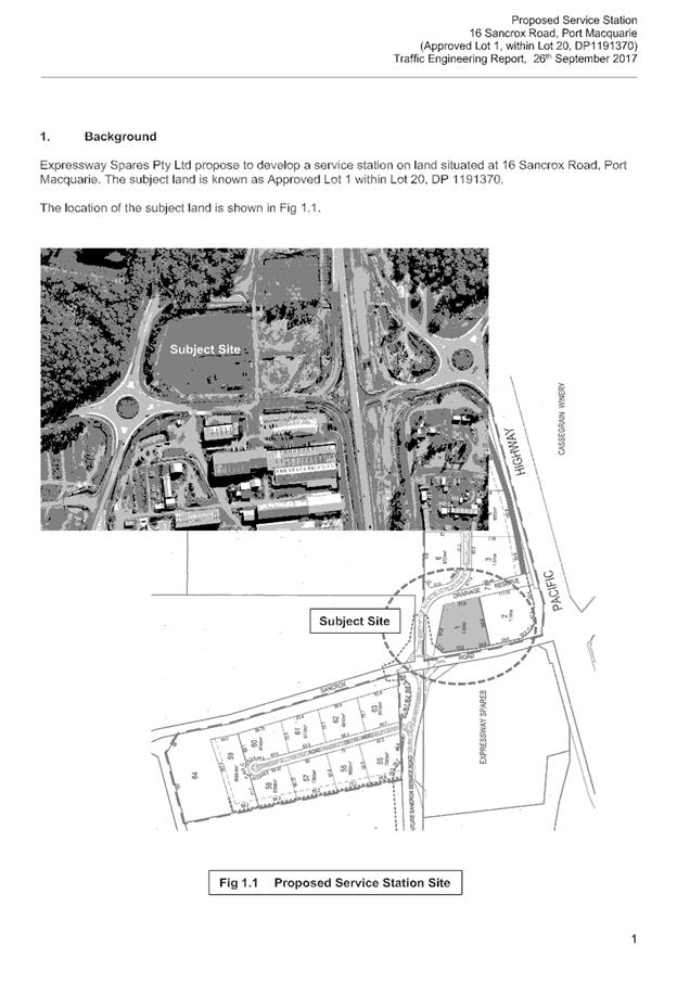
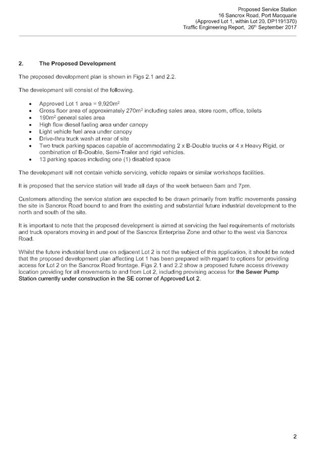
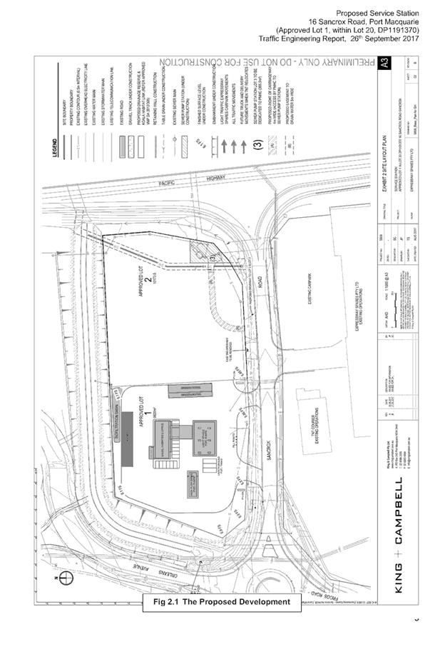
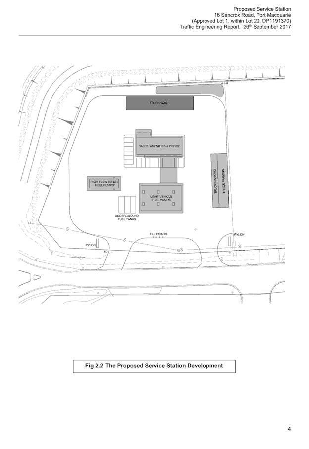
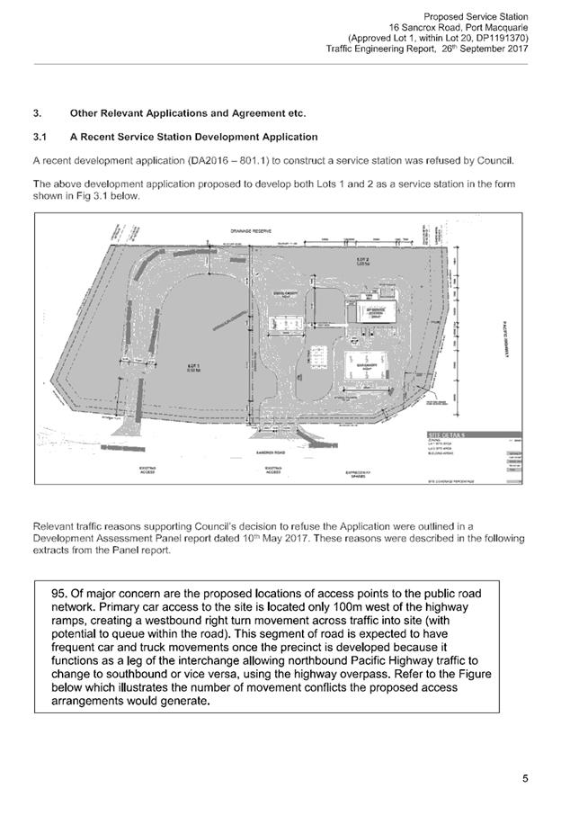
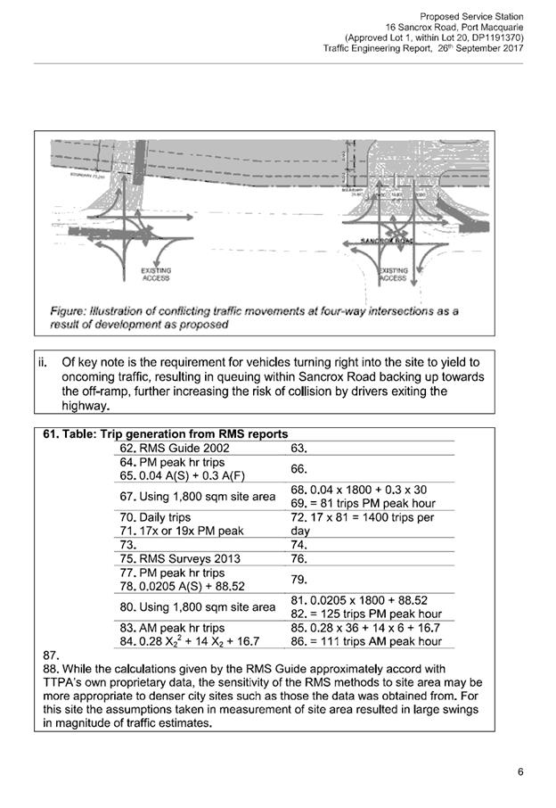
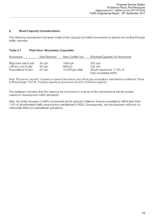

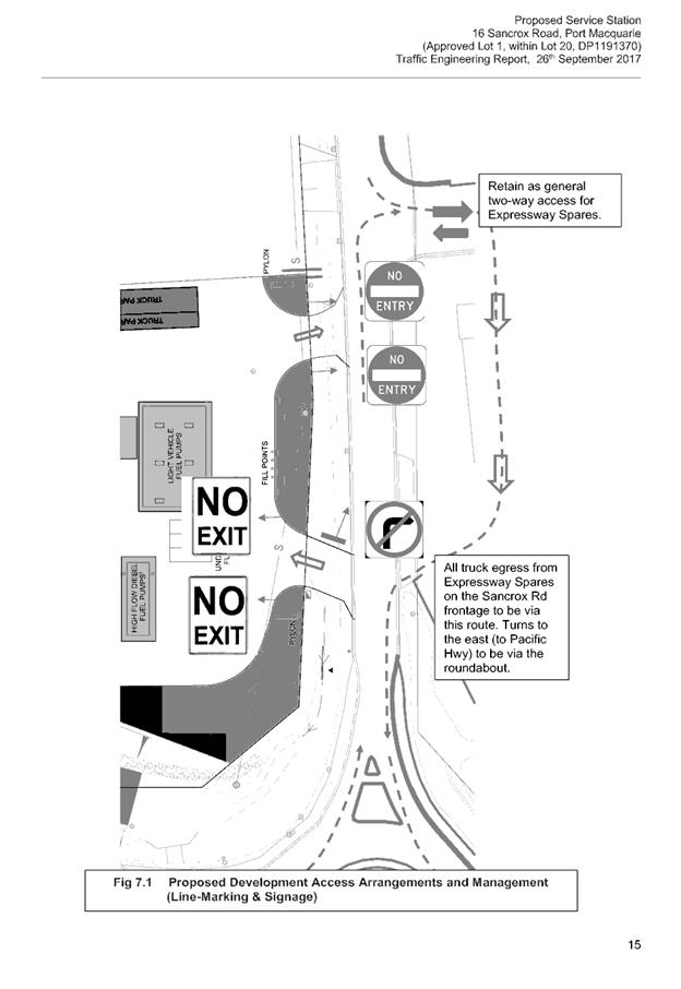
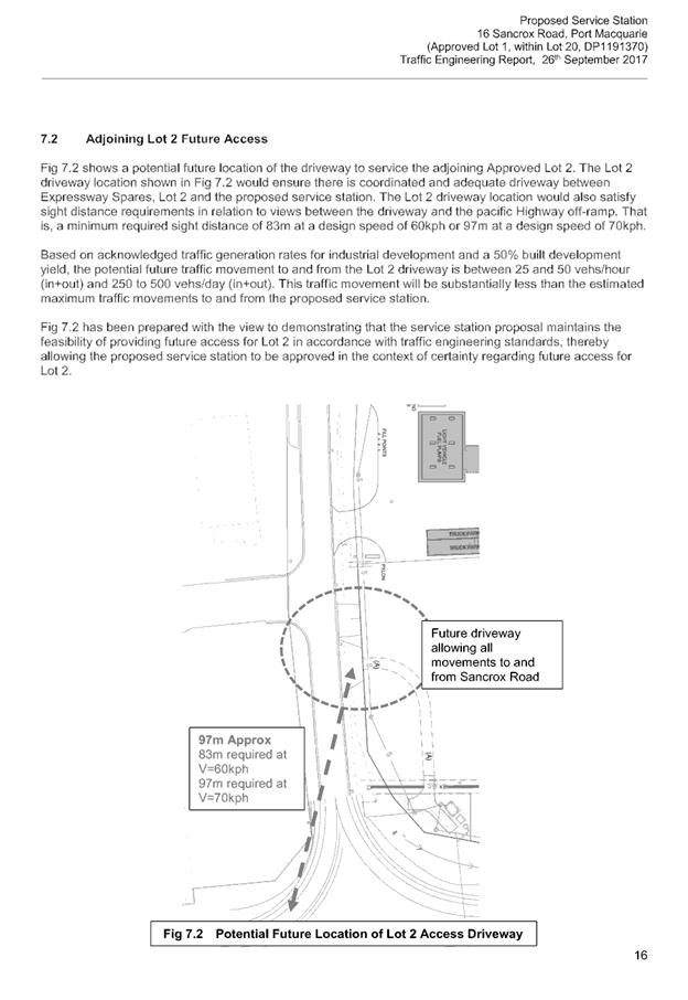
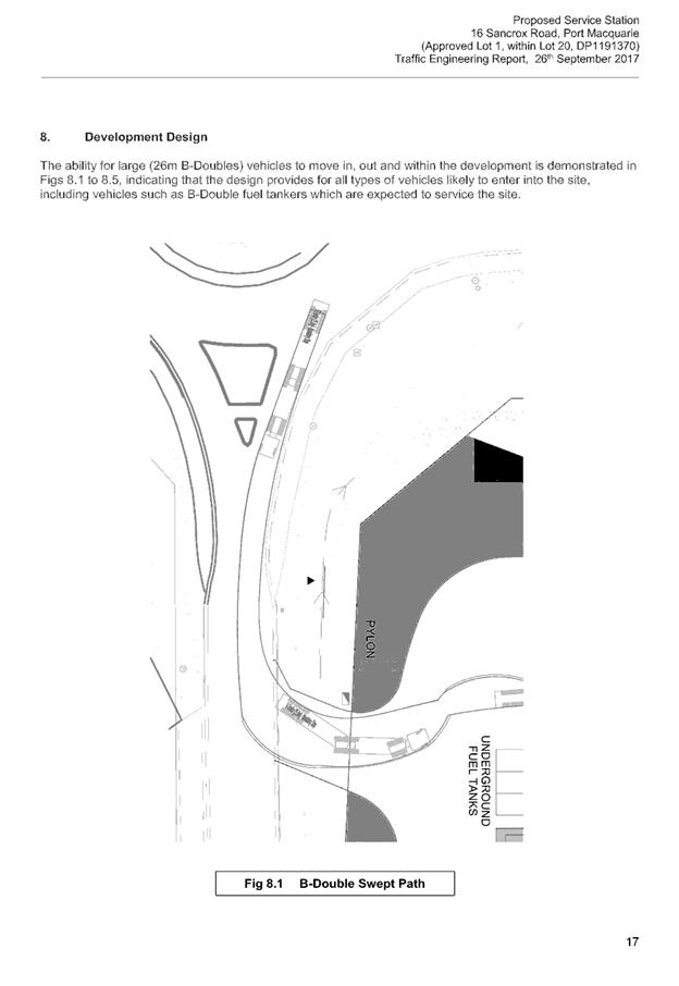
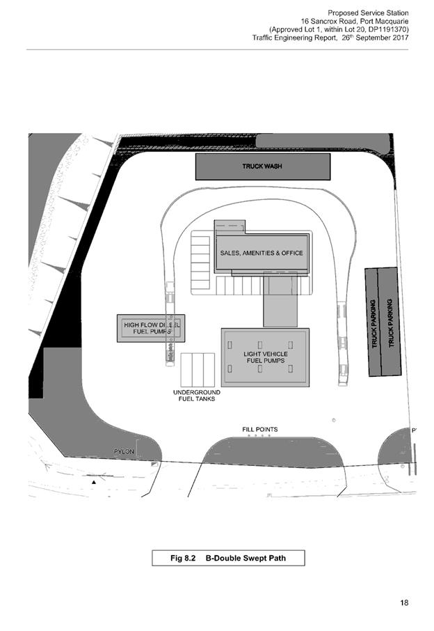
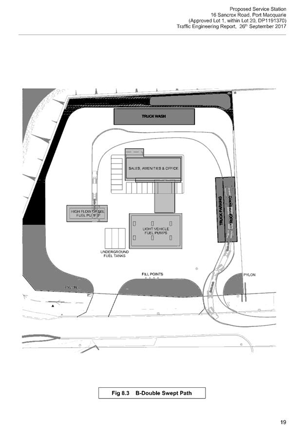
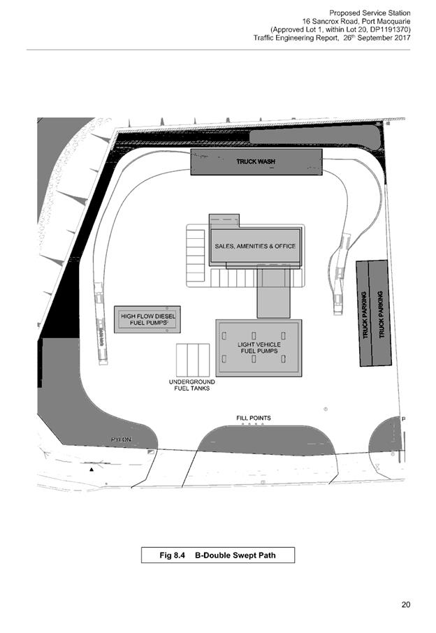
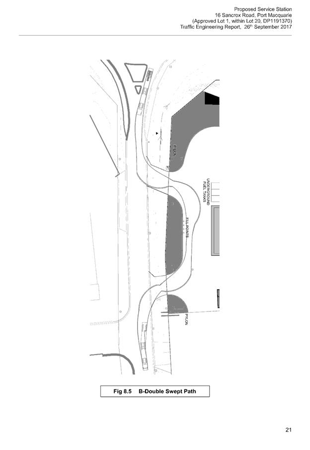
|
ATTACHMENT
|
Development Assessment Panel
28/02/2018
|
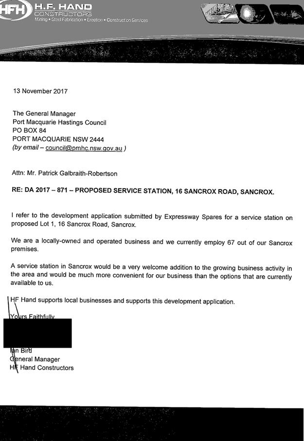
|
ATTACHMENT
|
Development Assessment Panel
28/02/2018
|
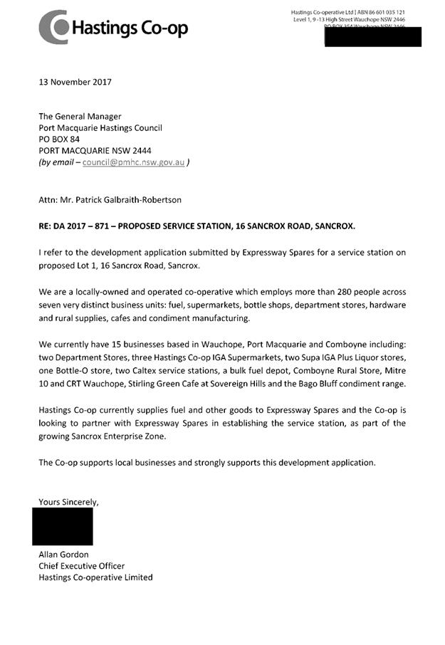
|
ATTACHMENT
|
Development Assessment Panel
28/02/2018
|
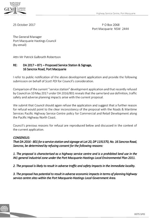
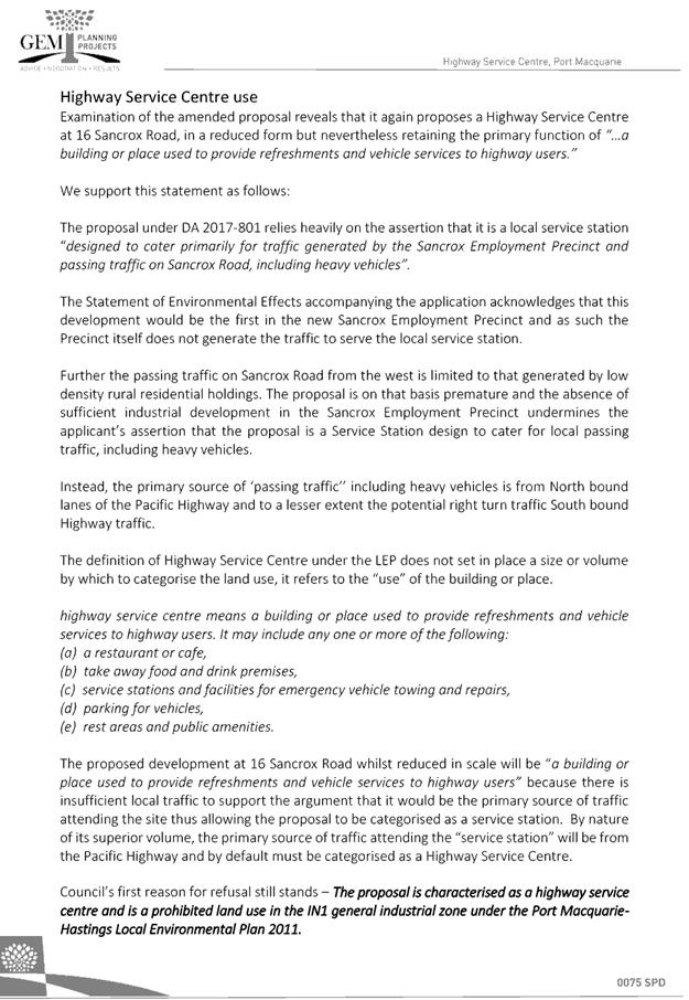
AGENDA Development Assessment Panel 28/02/2018
Item: 07
Subject: DA2017 - 1007.1 Eight Semi-Detached Dwellings With Torrens Title
Subdivision Lots 114,115,116 And 117 DP 1229250, 43 Seaside Drive
And 4-6 Waterside Way Lake Cathie
Report Author: Fiona Tierney
|
Applicant: T
Saab C/- Collins W Collins
Owner: S
& P Karabulut
Estimated Cost: $1,722,875
Parcel no: 66478,66479,66480,66481
Alignment with Delivery Program
4.3.1 Undertake transparent
and efficient development assessment in accordance with relevant legislation.
|
|
RECOMMENDATION
That
DA 2017 - 1007 for eight (8)
semi-detached dwellings with torrens title subdivision at Lot 114,115,116 & 117, DP 1229250, No. 43 Seaside Drive & 4-6
Waterside Way, Lake Cathie, be determined by granting consent subject to the
recommended conditions.
|
Executive
Summary
This
report considers a development application for eight (8) semi-detached
dwellings and torrens subdivision at the
subject site and provides an assessment of the application in accordance with
the Environmental Planning and Assessment Act 1979.
Following exhibition of the
application, two (2) submissions have been
received.
1. BACKGROUND
Existing sites features and Surrounding development
The site has an area of 2158.8m2.
The site is zoned R1- General Residential in accordance with the Port Macquarie-Hastings Local
Environmental Plan 2011, as shown in the following zoning plan:
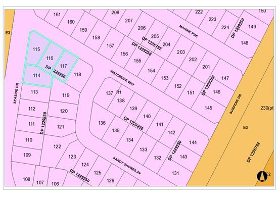
The existing subdivision pattern and location of existing
development within the locality is shown in the following aerial photograph:
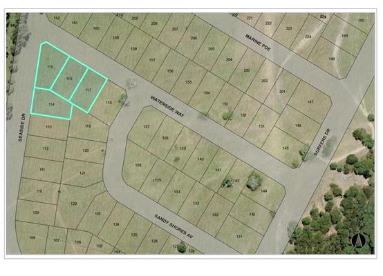
2. DESCRIPTION OF
DEVELOPMENT
Key aspects of the proposal include the following:
· Construction
8 two storey dwellings, each comprising 3 bedrooms (with additional study and
rumpus rooms)
· Construction of front fence and landscaping
· Torrens Title subdivision
· Staged construction - Stage 1 – Units 1 & 2,
Stage 2 - Units 3 & 4,Stage 3 - Units 5 & 6 & boundary Adjustment,
Stage 4 - Units 7 & 8
Refer
to attachments at the end of this report.
Application Chronology
· 10
November 2017 – DA lodged with Council.
· 20
November 2017- Additional information requested
· 23 November 2017 to 6 December 2017 – Neighbour
notification of proposal.
· 18 January 2018 – Amended plans received
façade material alterations.
3. STATUTORY ASSESSMENT
Section 79C(1) Matters for Consideration
In determining the application, Council is required to take
into consideration the following matters as are relevant to the development
that apply to the land to which the development application relates:
(a) The provisions (where
applicable) of:
(i) any Environmental
Planning Instrument:
State
Environmental Planning Policy No.55 – Remediation of Land
Following an
inspection of the site and a search of Council records, the subject land is not
identified as being potentially contaminated and is suitable for the intended
use.
State
Environmental Planning Policy No. 62 – Sustainable Aquaculture
Given the
nature of the proposed development and proposed stormwater controls, the
proposal will be unlikely to have any adverse impact on existing aquaculture
industries.
State
Environmental Planning Policy (Building Sustainability Index: BASIX) 2004
A BASIX certificate
has been submitted demonstrating that the proposal will comply with the
requirements of the SEPP. It is recommended that a condition be imposed to
ensure that the commitments are incorporated into the development and certified
at Occupation Certificate stage.
Port Macquarie-Hastings Local Environmental Plan 2011
The proposal
is consistent with the LEP having regard to the following:
· Clause
2.2, the subject site is zoned R1 General Residential. In accordance with
clause 2.3(1) and the R1 zone landuse table, the semi-detached dwellings and
subdivision is a permissible landuse with consent.
The
objectives of the R1 zone are as follows:
o To
provide for the housing needs of the community.
o To
provide for a variety of housing types and densities.
o To
enable other land uses that provide facilities or services to meet the day to
day needs of residents.
In accordance with Clause 2.3(2), the proposal is consistent with the
zone objectives as it is a permissible landuse and sufficiently consistent with
the immediate residential locality.
· Clause
4.1, the standard minimum lot size requirements do not apply to this proposal.
In this instance, Clause 4.1A is to be utilised and allows an integrated
housing type application whereby construction and subdivision are included in
the one application. When both construction and subdivision are included in the
one application, Clause 4.1A allows the minimum lot size standard to be varied/reduced.
The intent of the clause is to encourage housing diversity without
compromising residential amenity. This overall assessment shows that the
development will have limited impact on adjoining properties. The surrounding
area also contains a mixture of low and medium to high density residential
development. This proposal will be consistent with such a density.
· Clause
4.3, the maximum overall height of the buildings above ground level (existing)
is 7.643m which complies with the standard height limit of 8.5m applying to the
site.
· Clause
4.4, the floor space ratio of the proposal is 0.64:1.0 which complies with the
maximum 0.65:1 floor space ratio applying to the site.
· Clause
5.9 – no listed trees in Development Control Plan 2013 are proposed to be
removed.
· Clause
5.10 – Heritage. The site does not contain or adjoin any known heritage
items or sites of significance.
· Clause
7.13, satisfactory arrangements are in place for provision of essential
services.
(ii) Any
draft instruments that apply to the site or are on exhibition:
No draft
instruments are considered relevant to the application.
(iii) any
Development Control Plan in force:
Port
Macquarie-Hastings Development Control Plan 2013:
|
DCP 2013: Dwellings,
Dual occupancies, Dwelling houses, Multi dwelling houses & Ancillary
development
|
|
|
Requirements
|
Proposed
|
Complies
|
|
3.2.2.1
|
Ancillary development:
• 4.8m
max. height
• Single
storey
• 60m2
max. area
• 100m2
for lots >900m2
• 24
degree max. roof pitch
• Not
located in front setback
|
Water tanks are appropriately
located.
|
Yes
|
|
3.2.2.2
|
Articulation zone:
• Min.
3m front setback
• An
entry feature or portico
• A
balcony, deck, patio, pergola, terrace or verandah
• A
window box treatment
• A
bay window or similar feature
• An
awning or other feature over a window
• A
sun shading feature
|
The development contains small
covered area at the entrances to units in Waterside Way to 3.002m which do
not exceed 25% of the articulation zone.
|
Yes
|
|
Front setback (Residential not
R5 zone):
• Min.
6.0m classified road
• Min.
4.5m local road or within 20% of adjoining dwelling if on corner lot
• Min.
3.0m secondary road
• Min.
2.0m Laneway
|
Front building line setback is
compliant with the minimum 4.5m front setback requirements in Waterside Way.
The majority of the units to
Seaside Drive (Secondary Frontage) are also proposed at a minimum of 4.5m
with the exception of Unit 3/4 which has a minimum setback of 3.59m which
complies with the 3m setback.
|
Yes
|
|
3.2.2.3
|
Garage 5.5m min. and 1m behind
front façade.
Garage door recessed behind
building line or eaves/overhangs provided
|
Garage door setback
requirements are complied with.
|
Yes
|
|
6m max. width of garage door/s
and 50% max. width of building
|
Whilst the widths comply,
Units 1 & 5-8 do not technically comply with the 50% requirement. The aim
of the provision is to reduce impact of garages on the streetscape. As the
dwellings are 2 storey and the upper floor extends forward of the garage
doors this reduces the visual dominance of the garages and therefore meets
with the objectives of this clause.
|
No - however meets objectives
|
|
Driveway crossover 1/3 max. of
site frontage and max. 5.0m width
|
5.5m wide driveway crossover
(at kerb) and proportionally 16% of frontage.
|
No- however meets objectives
|
|
3.2.2.4
|
4m min. rear setback.
Variation subject to site analysis and provision of private open space
|
Min. 3.193m rear setback to
patio posts and 5.593m to main body of building
|
No- however meets objectives
|
|
3.2.2.5
|
Side setbacks:
• Ground
floor = min. 0.9m
• First
floors & above = min. 3m setback or where it can be demonstrated that
overshadowing not adverse = 0.9m min.
• Building
wall set in and out every 12m by 0.5m
|
The minimum side setback
requirements are complied with and where less than 3m shadow diagrams have
been submitted demonstrating compliance.
The wall articulation is
compliant and satisfies the objectives of the development provision.
|
Yes
|
|
3.2.2.6
|
35m2 min. private open space
area including a useable 4x4m min. area which has 5% max. grade
|
Each occupancy contains
35m² open space in one area including a useable 4m x 4m area.
|
Yes
|
|
3.2.2.7
|
Front fences:
• If
solid 1.2m max height and front setback 1.0m with landscaping
• 3x3m
min. splay for corner sites
• Fences
>1.2m to be 1.8m max. height for 50% or 6.0m max. length of street
frontage with 25% openings
• 0.9x0.9m
splays adjoining driveway entrances
• Front
fences and walls to have complimentary materials to context
|
The proposed front fence
design at a height of 1.8m with 25% transparency and landscaped recesses is
considered to meet the fencing provisions and objectives of DCP 2013. No
adverse impacts will occur.
N/A
|
Yes
|
|
3.2.2.10
|
Privacy:
• Direct
views between living areas of adjacent dwellings screened when within 9m
radius of any part of window of adjacent dwelling and within 12m of private
open space areas of adjacent dwellings. ie. 1.8m fence or privacy screening
which has 25% max. openings and is permanently fixed
• Privacy
screen required if floor level > 1m height, window side/rear setback
(other than bedroom) is less than 3m and sill height less than 1.5m
• Privacy
screens provided to balconies/verandahs etc which have <3m side/rear
setback and floor level height >1m
|
No direct views between living
areas of adjacent dwellings when within 9m radius of any part of window of
adjacent dwelling and within 12m of private open space areas of adjacent
dwellings. Standard side and rear fencing will provide screening.
|
Yes
|
|
DCP 2013: General Provisions
|
|
|
Requirements
|
Proposed
|
Complies
|
|
2.7.2.2
|
Design addresses generic
principles of Crime Prevention Through Environmental Design guideline
|
No concealment or entrapment
areas proposed. Adequate casual surveillance available.
|
Yes
|
|
2.3.3.1
|
Cut and fill 1.0m max. 1m
outside the perimeter of the external building walls
|
Cut 1-1.5m unit 1 outside the
perimeter of the external building walls
|
No- however considered
acceptable
|
|
2.3.3.2
|
1m max. height retaining walls
along road frontage
|
None proposed
|
N/A
|
|
Any retaining wall >1.0 in
height to be certified by structure engineer
|
Condition recommended to
require engineering certification for retaining walls within close proximity
to existing property boundaries.
|
Yes
|
|
Combination of retaining wall
and front fence height max 1.8m, max length 6.0m or 30% of frontage, fence
component 25% transparent, and splay at corners and adjacent to driveway
|
Retaining wall front fence
combination proposed max 2.1m including retaining wall. Retaining wall
typically 450mm and fence 1650mm. Proposed for very small portion of
development.
|
No- however meets objectives
|
|
2.3.3.8
|
Removal of hollow bearing
trees
|
No hollow bearing trees
proposed to be removed
|
N/A
|
|
2.6.3.1
|
Tree removal (3m or higher
with 100m diameter trunk at 1m above ground level and 3m from external wall
of existing dwelling)
|
None proposed.
|
N/A
|
|
2.4.3
|
Bushfire risk, Acid sulphate
soils, Flooding, Contamination, Airspace protection, Noise and Stormwater
|
Refer to main body of report.
|
Noted
|
|
2.5.3.2
|
New accesses not permitted
from arterial or distributor roads
|
No new access proposed to
arterial or distribution road.
|
N/A
|
|
Driveway crossing/s minimal in
number and width including maximising street parking
|
Considered acceptable.
|
Yes
|
|
2.5.3.3
|
Parking in accordance with Table
2.5.1.
Multi dwelling
1 space per 1 & 2 bedroom
occupancies
1.5 spaces per 3+ bedroom
occupancies
0.25 spaces per occupancy for
visitor parking.
|
Proposal involves:
8 x 3 bedroom dwellings
Therefore requirements are:
8 x 1.5 spaces rounded up) =
12 spaces +
8 x 0.25 visitor = 2 spaces
(rounded up) = 14 spaces in total
The development proposes: 16
parking spaces as part of the dwellings and sufficient room for stack parking
for visitors in front of each garage.
|
Yes
|
|
2.5.3.11
|
Section 94 contributions
|
Contributions apply.
|
Yes
|
|
2.5.3.12 and 2.5.3.13
|
Landscaping of parking areas
|
Suitable landscaping proposed
around driveway/parking locations.
|
Yes
|
|
2.5.3.14
|
Sealed driveway surfaces
unless justified
|
Sealed driveway areas
proposed.
|
Yes
|
|
2.5.3.15 and 2.5.3.16
|
Driveway grades first 6m or
‘parking area’ shall be 5% grade with transitions of 2m length
|
Driveway grades capable of
satisfying Council standard driveway crossover requirements. Condition
recommended for section 138 Roads Act permit
|
Yes
|
|
2.5.3.17
|
Parking areas to be designed
to avoid concentrations of water runoff on the surface.
|
Stormwater drainage is capable
of being managed as part of plumbing construction.
|
Yes
|
The proposal seeks to vary
Development Provision relating to the garage door width occupying more than 50%
of building width
The relevant objectives are:
· To minimise the
impact of garages and driveways on the streetscape, on street parking and
amenity.
· To
minimise the visual dominance of garages in the streetscape.
Having regard for the
development provisions and relevant objectives, the variation is considered
acceptable for the following reasons:
· The
garage doors proportional to the overall elevation to the front boundary is
significantly less than the recommended 50%.
· The
visual dominance is reduced as the upper elevation extends forward of the
garages and strategic use of landscaping assists with integration into the
overall streetscape.
The proposal seeks to vary Development
Provision relating to recommended 4m rear setback. The proposal includes
sections of the rear of the units with open patio areas within the 4m area.
The relevant objectives are:
· To allow adequate
natural light and ventilation between dwellings/buildings and to private open
space areas.
· To provide useable
yard areas and open space.
Having regard for the
development provisions and relevant objectives, the variation is considered
acceptable for the following reasons:
· The
development is part of an overall cluster of houses that allow for an
integrated consideration of the design. Design allows for increased natural
light and ventilation.
· There
are no adverse natural light and ventilation issues to the northern
neighbouring property.
· The
structures within the 4m setback other than the main buildings are only
relating to open patios with posts.
· The
subject units generally have areas well in excess of 35m2 of useable private
open space areas.
The proposal seeks to vary Development
Provision relating to maximum front fence and retaining wall height of 1.8m.
The proposal includes a section of courtyard fencing that proposes a maximum
combined height of 2.1m.
The relevant objectives are:
· To define the
edge between public and private land and to provide privacy and security.
· To ensure
adequate sight lines are provided for vehicles leaving the site.
· To ensure front
fencing does not impact on the public domain.
· To encourage
surveillance of the street and other public places.
Having regard for the
development provisions and relevant objectives, the variation is considered acceptable
for the following reasons:
· The area of
variation is for a very small proportion of the overall development and
proportional to the bulk and scale of the dwellings behind.
· The fence is well
broken up with a retaining wall, recessed panels and a 25% open transparency
design.
· The design will
allow for adequate surveillance and lines of sight for vehicles entering and
leaving the site.
The proposal seeks to vary Development
Provision relating to maximum cut of 1.0m external to the building. The
proposal proposes a cut of 1-1.5m for units 1 and 2.
The relevant objectives are:
· Minimise
the extent of site disturbance caused by excessive cut and fill to the site.
· Ensure
there is no damage or instability to adjoining properties caused by excavation
or filling.
· Ensure
there is no adverse alteration to the drainage of adjoining properties.
· Ensure
the privacy of adjoining dwellings and private open space are protected.
· Ensure
that adequate stormwater drainage is provided around the perimeter of buildings
and that overflow paths are provided.
Having regard for the
development provisions and relevant objectives, the variation is considered acceptable
for the following reasons:
· There is no
adverse impacts on privacy due to the variation being limited to cut only.
· Stormwater design
and drainage will cater for the proposed cut.
· The proposal will
allow for more efficient and appropriate use of the site for suitable outdoor
areas.
· Retaining walls
are to be designed by a structural engineer to ensure there is no instability
or damage to adjoining properties.
Based on the above assessment,
the variations proposed to the provisions of the DCP are considered acceptable
and the relevant objectives have been satisfied.
Cumulatively, the variations do
not amount to an adverse impact or a significance that would justify refusal of
the application.
(iiia) any
planning agreement that has been entered into under Section 93f or any draft
planning agreement that a developer has offered to enter into under Section
93f:
No
planning agreement has been offered or entered into relating to the site.
iv) any matters prescribed by the
Regulations:
New South Wales Coastal Policy:
Consistent
v) any coastal
zone management plan (within the meaning of the Coastal Protection Act 1979),
that apply to the land to which the development application relates:
None
applicable
(b) The
likely impacts of that development, including environmental impacts on both the
natural and built environments, social and economic impacts in the locality:
Context and setting
• The
proposal will be unlikely to have any adverse impacts to existing adjoining
properties and satisfactorily addresses the public domain.
• The proposal is considered to be consistent with other
residential development in the locality and adequately addresses planning
controls for the area.
• There
are no adverse impacts on existing view sharing.
• There are no adverse privacy impacts.
• There are no adverse overshadowing impacts. The proposal
does not prevent adjoining properties from receiving 3 hours of sunlight to
private open space and primary living areas on 21 June.
Roads
The site has road frontages to Waterside Way and Seaside
Drive both are residential streets which are sealed with kerb and gutter.
Traffic and Transport
The site is currently vacant land. This development proposes
to generate 35 additional daily trips. The addition in traffic associated with
the development is unlikely to have any adverse impacts to the existing road
network within the immediate locality.
Site Frontage & Access
Vehicle access to the site is proposed though multiple
driveways with direct frontage to either Waterside Way or Seaside Drive being a
public roads. Access shall comply with Council AUSPEC and Australian Standards,
and conditions have been imposed to reflect these requirements.
Due to the type and size of development, additional works
are required to include:
· Concrete footpath paving
(minimum 1.2m wide) along the full frontage (ie those areas of the frontage
where footpath does not exist at present).
Parking and Manoeuvring
Parking spaces have been provided on-site within garages
with additional parking provided available within the driveways. Parking
and driveway widths on site can comply with relevant Australian Standards (AS
2890) and conditions have been imposed to reflect these requirements.
Water Supply
Council records indicate that the development site has
multiple existing water services. Each propose lot requires an individual
metered water service. The engineering plans submitted with the development
application are not acceptable in their current form.
Detailed plans will be required to be submitted for
assessment with the S.68 application. Overall, the design is capable of
complying.
Sewer
Council records indicate that the development site is
connected to Sewer via several junctions. Each proposed lot requires an
individual connection to sewer. The engineering plans submitted with the
development application are acceptable for Sewer Section purposes.
Detailed plans will be required to
be submitted for assessment with the S.68 application.
Stormwater
The site naturally grades towards the street.
A detailed site stormwater
management plan will be required to be submitted for assessment with the
Section 68 application and prior to the issue of a Construction Certificate.
Overall, stormwater is capable of complying.
Other Utilities
Telecommunication and electricity services are available to
the site.
Heritage
This site does not contain or adjoin any known heritage item
or site of significance.
Other land resources
No adverse impacts anticipated. The site is within an
established urban context and will not sterilise any significant mineral or
agricultural resource.
Water cycle
The proposed development will be unlikely to have any adverse
impacts on water resources and the water cycle.
Soils
The proposed development will be unlikely to have any
adverse impacts on soils in terms of quality, erosion, stability and/or
productivity subject to a standard condition requiring erosion and sediment
controls to be in place prior to and during construction.
Air and microclimate
The construction and/or operations of the proposed
development will be unlikely to result in any adverse impacts on the existing
air quality or result in any pollution.
Flora and fauna
Construction of the proposed development will not require
removal/clearing.
The proposal will be unlikely to
have any significant adverse impacts on biodiversity or threatened species of
flora and fauna. Section 5A of the Act (the legislation in force at the
time of the application being received) is considered to be satisfied.
Waste
Satisfactory arrangements are in place for proposed storage
and collection of waste and recyclables. No adverse impacts anticipated.
Energy
The proposal includes measures to address energy efficiency
and will be required to comply with the requirements of BASIX.
Noise and vibration
No adverse impacts anticipated. Condition recommended to
restrict construction to standard construction hours.
Bushfire
The site is identified as being
bushfire prone.
The applicant has submitted a
bushfire report prepared by a Certified Consultant. The report assumes that
proposed subdivision will occur and has carried out an assessment under Section
100B requirements. The matter has been referred to the RFS who have issued a
bushfire safety authority and conditions.
Safety, security and crime prevention
The proposed development will be unlikely to create any
concealment/entrapment areas or crime spots that would result in any
identifiable loss of safety or reduction of security in the immediate area.
Social impacts in the locality
Given the nature of the proposed development and its’
location the proposal is unlikely to result in any adverse social impacts.
Economic impact in the locality
No adverse impacts. Likely positive impacts can be
attributed to the construction of the development and associated flow on
effects (ie maintained employment and expenditure in the area).
Site design and internal design
The proposed development design satisfactorily responds to
the site attributes and will fit into the locality. No adverse impacts likely.
Construction
No potential adverse impacts identified to neighbouring
properties with the construction of the proposal.
Cumulative Impacts
The proposed development is not expected to have any adverse
cumulative impacts on the natural or built environment or the social and
economic attributes of the locality.
(c) The suitability of the site for
the development:
The proposal will fit into the
locality and the site attributes are conducive to the proposed development.
(d) Any submissions made in
accordance with this Act or the Regulations:
Two (2) written submissions have been received following public
exhibition of the application.
Key issues raised in the submissions received and comments
in response to these issues are provided as follows:
|
Submission
Issue/Summary
|
Planning
Comment/Response
|
|
The proposal fails to meet the
requirements of the LEP in relation to streetscape, density and lot size.
|
The application has been
assessed above to be compliant with the requirements of the LEP in relation
to streetscape, density and lot size.
In particular the LEP permits
the development type and the floor space ratio requirements have been met. A
reduction in lot size is permissible where attached dwellings are approved as
part of the assessment process.
|
|
The development proposal fails to meet the requirements
of the Catarina Design Guidelines and what was promised to future buyers.
|
The Catarina Design Guidelines have been developed as a
private covenant agreement and are not part of Council’s assessment
process.
|
|
Out of character with free standing dwellings in the area
|
A variety of development is proposed within the precinct
with a variety of multi dwelling and dual occupancy development. Buildings have been designed to incorporate articulation, as well
as a variety in colours, materials and finishes in order to provide a high
level of visual amenity when viewed from the public domain and roadways.
The development will provide a variety of housing to
provide a multi-faceted character to the area that responds to the needs of
the differing requirements of the Lake Cathie community.
|
(e) The Public Interest:
The proposed
development satisfies relevant planning controls and is unlikely to impact on
the wider public interest.
4. DEVELOPMENT
CONTRIBUTIONS APPLICABLE
· Development contributions will be required towards
augmentation of town water supply and sewerage system head works under Section
64 of the Local Government Act 1993.
· Development contributions will be required under Section 94
of the Environmental Planning and Assessment Act 1979 towards roads, open
space, community cultural services, emergency services and administration
buildings.
5. CONCLUSION
The application has been assessed in accordance with
Section 79C of the Environmental Planning and Assessment Act 1979.
Issues raised during assessment and public exhibition of
the application have been considered in the assessment of the application.
Where relevant, conditions have been recommended to manage the impacts
attributed to these issues.
The site is suitable for the proposed development, is not
contrary to the public's interest and will not have a significant adverse
social, environmental or economic impact. It is recommended that the
application be approved, subject to the recommended conditions of consent
provided in the attachment section of this report.
|
Attachments
1View. DA2017
- 1007.1 Plans
2View. DA2017
- 1007.1 Recommended Conditions.
3View. DA2017
- 1007.1 Submission - Brown
4View. DA2017
- 1007.1 Submission - Ding
|
|
ATTACHMENT
|
Development Assessment Panel
28/02/2018
|
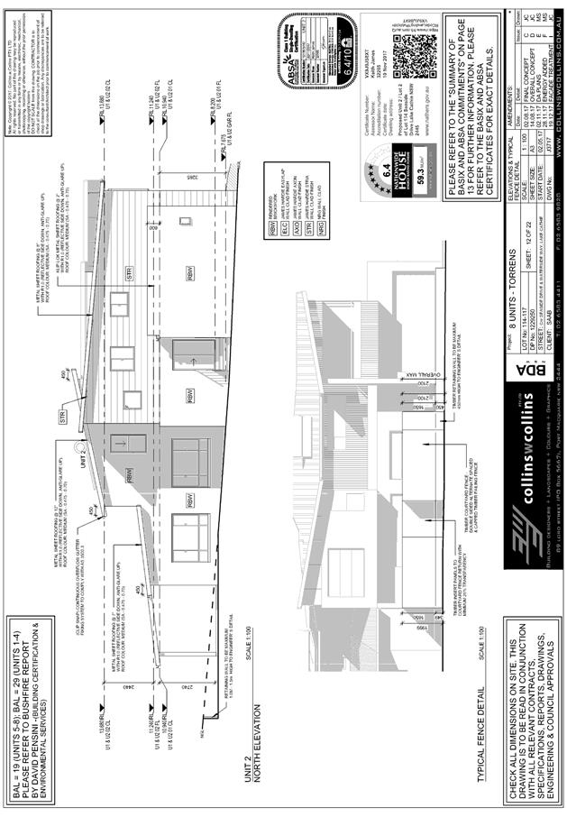

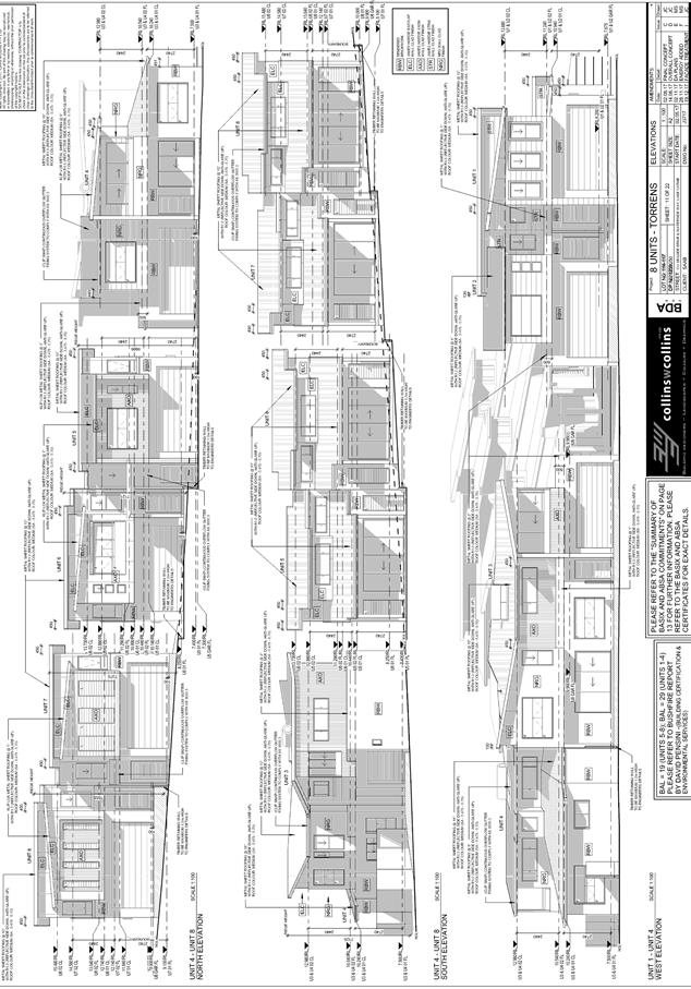
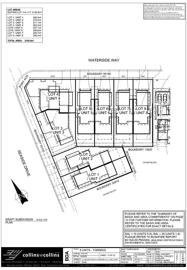
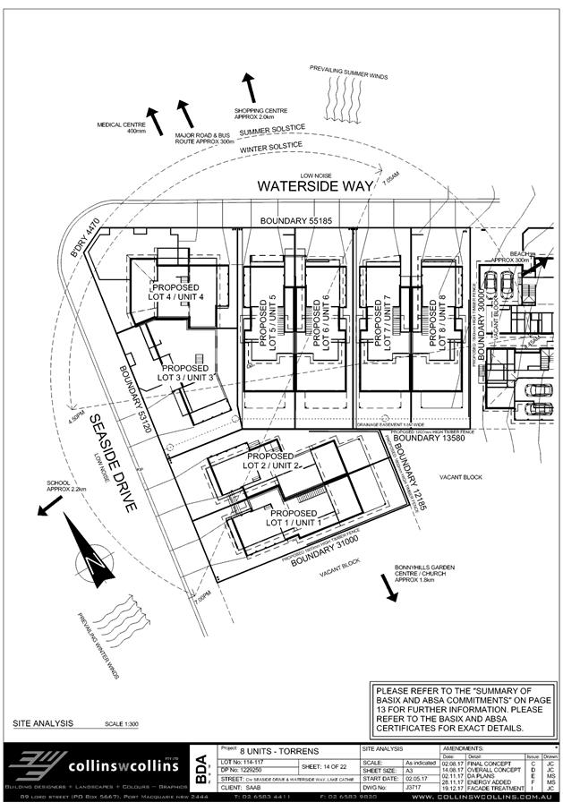
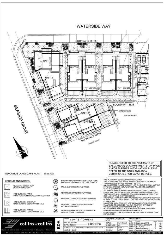
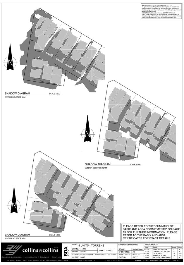
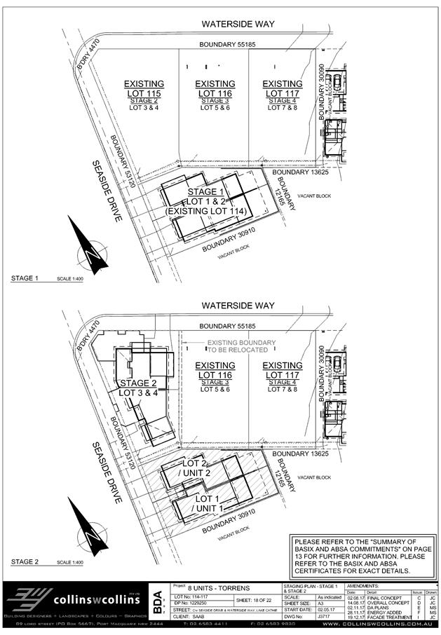
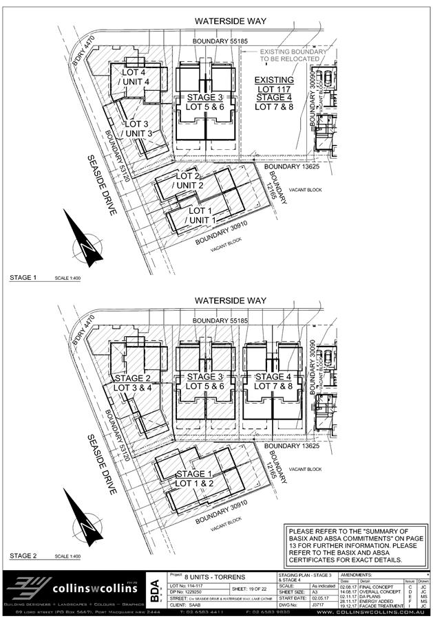
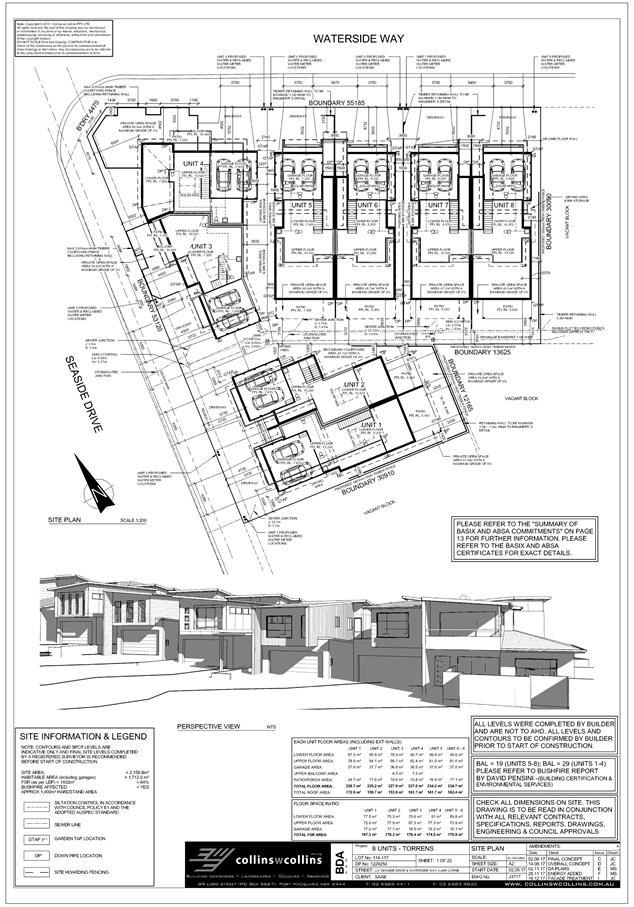
|
ATTACHMENT
|
Development Assessment Panel
28/02/2018
|
|
ATTACHMENT
|
Development Assessment Panel
28/02/2018
|
|
ATTACHMENT
|
Development Assessment Panel
28/02/2018
|
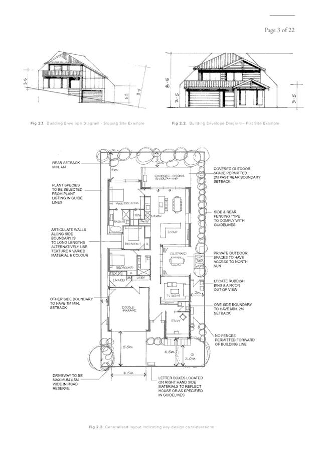
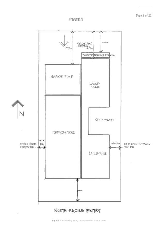
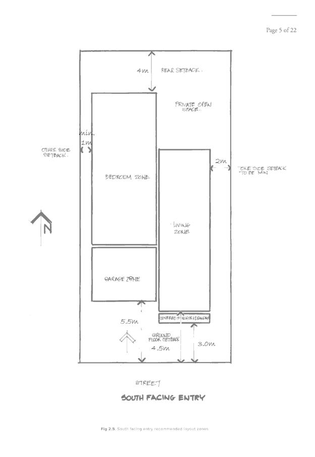
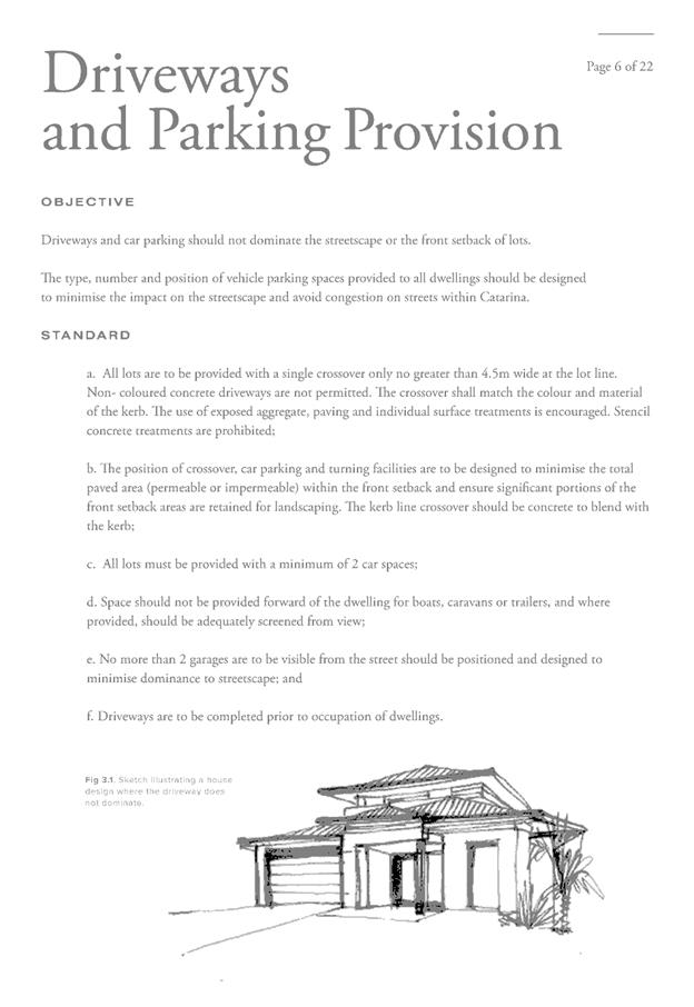
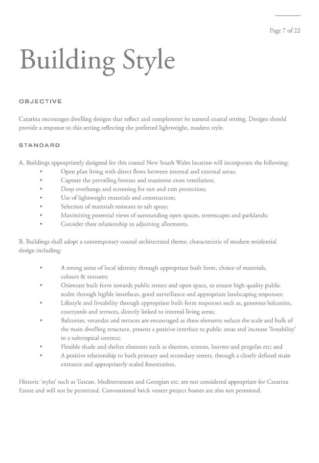
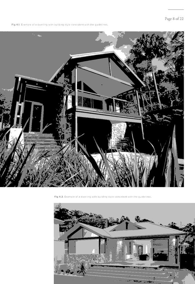
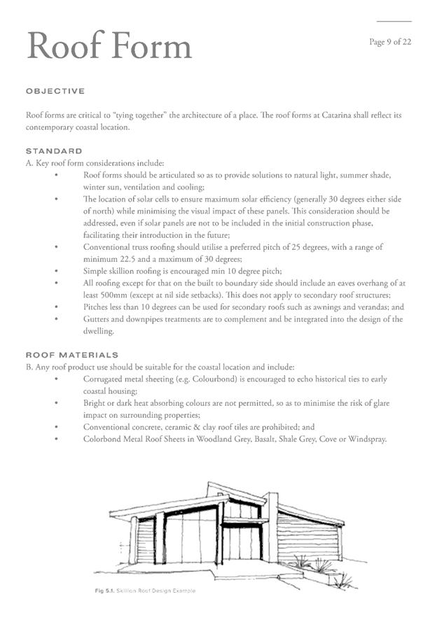
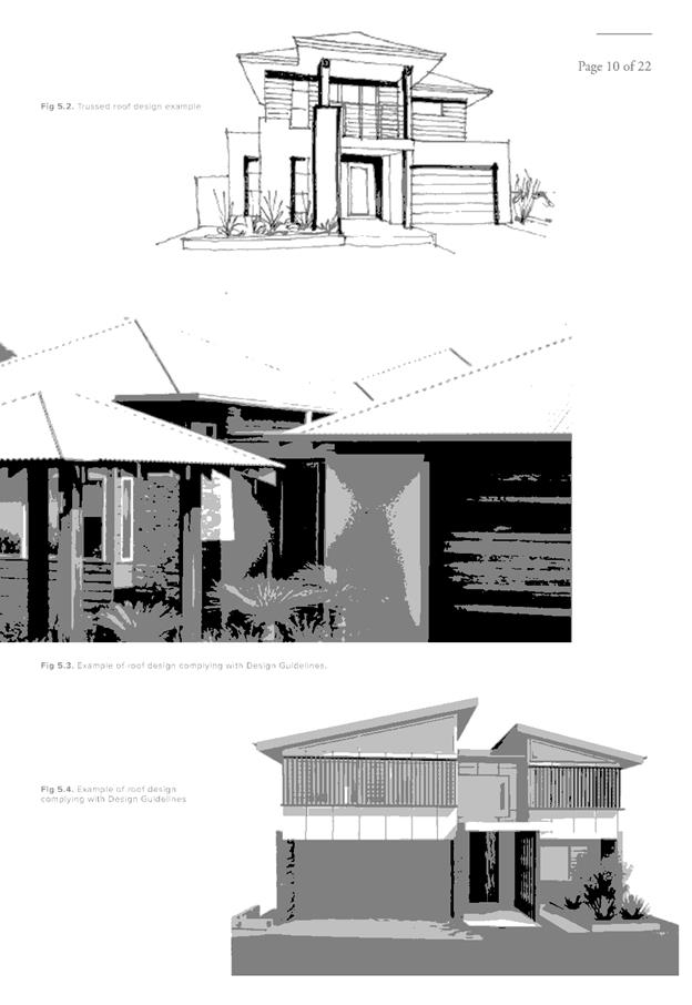
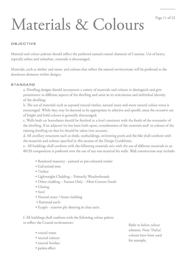
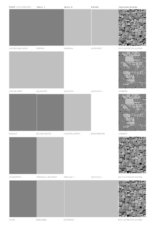
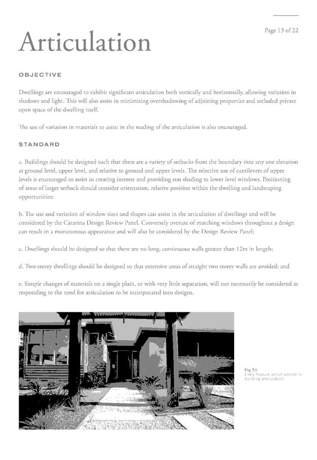
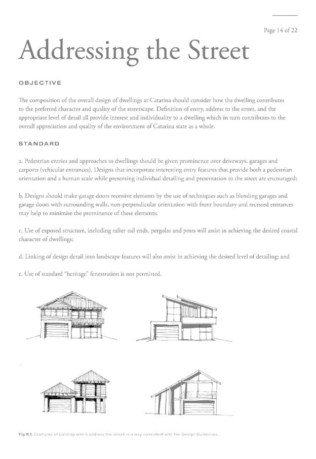
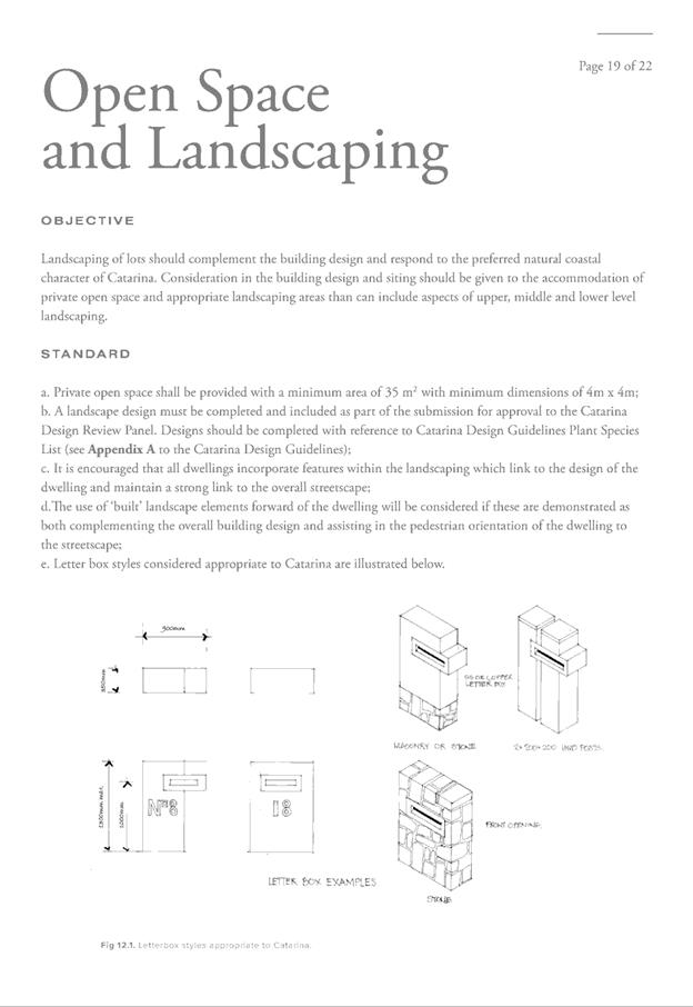


AGENDA Development Assessment Panel 28/02/2018
Item: 08
Subject: DA2017 - 780.1 Shop Top Housing - Lot 1 DP
536032, No. 4 Hastings River Drive, Port Macquarie
Report
Author: Fiona Tierney
|
Applicant: Wayne
Ellis Architect
Owner: Gerranne
Pty Ltd
Estimated Cost: $3,800,000
Alignment with Delivery
Program
4.3.1 Undertake transparent
and efficient development assessment in accordance with relevant legislation.
|
|
RECOMMENDATION
That
DA 2017 - 380 for Shop Top
Housing at Lot 1, DP 536032, No. 4 Hastings River Drive, Port Macquarie,
be determined by granting consent subject to the recommended conditions.
|
Executive
Summary
This
report considers a development application for a Shop Top Housing at the subject site and provides an assessment of the
application in accordance with the Environmental Planning and Assessment Act
1979.
Following exhibition of the
application, 2 submissions have been received.
1. BACKGROUND
Existing sites features and Surrounding development
The site has an area of 1081m².
The site is zoned B2 Local Centre in accordance with the Port Macquarie-Hastings Local
Environmental Plan 2011, as shown in the following zoning plan:
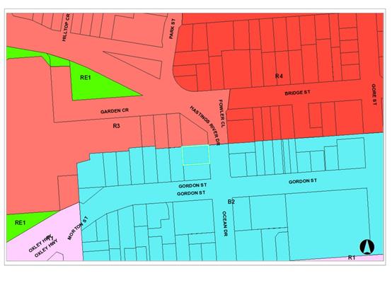
The existing subdivision pattern and location of existing
development within the locality is shown in the following aerial photograph:
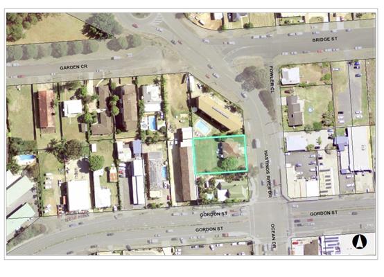
2. DESCRIPTION OF
DEVELOPMENT
Key aspects of the proposal include the following:
· Four
storey shop top housing with commercial floor space at ground level
· Ground
floor car parking
· Twelve
(12) x Two (2) bedroom units and five (5) x one (1) bedroom units
Refer
to attachments at the end of this report.
Application Chronology
· 4
April 2017- Pre-lodgement meeting
· 4
September 2017- Application Lodged
· 15 September -28 September 2017- Neighbour notification
· 15 September 2017- Heritage advisor comments
3. STATUTORY ASSESSMENT
Section 79C(1) Matters for Consideration
In determining the application, Council is required to take
into consideration the following matters as are relevant to the development
that apply to the land to which the development application relates:
(a) The provisions (where
applicable) of:
(i) any Environmental
Planning Instrument:
State
Environmental Planning Policy No.55 – Remediation of Land
Following an inspection of the site and a
search of Council records, the subject land is not identified as being
potentially contaminated and is suitable for the intended use.
State
Environmental Planning Policy No. 62 – Sustainable Aquaculture
Given the nature
of the proposed development and proposed stormwater controls the proposal will
be unlikely to have any adverse impact on existing aquaculture industries
within the Hastings River.
State
Environmental Planning Policy No. 64 – Advertising and Signage
There is no
signage proposed as part of the application. Suitable condition has been
recommended advising of consent requirements for future signage.
State
Environmental Planning Policy 65 - Design Quality of Residential Flat
Development
In accordance
with clause 4, SEPP applies to the proposal. It is noted that no Design Review
Panel has been appointed by Port Macquarie-Hastings Council following
amendments to this Policy in July 2015.
In accordance
with clause 30(2), the proposal has demonstrated satisfactory consideration
against the design quality principles contained in the Apartment Design Guide
and the following table provides an assessment against these principles:
|
Requirement
|
Proposed
|
Complies
|
|
Principle 1:Context & Neighbourhood Character
Good design responds and contributes to its context.
Context is the key natural and built features of an area, their relationship
and the character they create when combined. It also includes social,
economic, health and environmental conditions.
Health and environmental conditions.
Responding to context involves identifying the desirable
elements of an area’s existing or future character.
Well-designed buildings respond to and enhance the
qualities and identity of the area including the adjacent sites, streetscape
and neighbourhood. Consideration of local context is important for all sites,
including sites in established areas, those undergoing change or identified
for change.
|
The proposal is for a four storey shop top housing
development. The area is characterised by a mixture of commercial, tourist
and higher density developments. The area is currently undergoing rapid
redevelopment with a number of higher density flat buildings, shop top
housing and medical developments underway or proposed in the immediate area.
Encouraging higher density in areas with close proximity to the CBD or
business zones is desirable.
The proposed building design is
compatible with existing development and the desired future character of the
area as stated in the relevant planning and design policies. It is considered
the building will contribute to the identity of the area.
|
Yes
|
|
Principle
2:Built form and Scale
Good design achieves a scale,
bulk and height appropriate to the existing or desired future character of
the street and surrounding buildings. Good design also achieves an
appropriate built form for a site and the building’s purpose in terms
of building alignments, proportions, building type, articulation and the
manipulation of building elements. Appropriate built form defines the public
domain, contributes to the character of streetscapes and parks, including
their views and vistas, and provides internal amenity and outlook.
|
The height and bulk of the proposed building is
considered to be acceptable in the streetscape and future desired character
of the area.
The building is considered to achieve an appropriate
built form and incorporates interesting building elements and treatments that
will complement the streetscape.
The proposed internal unit
layouts provide for internal amenity. The orientation of the block takes
advantage of the northern outlook.
|
Yes
|
|
Principle
3:Density
Good design achieves a high
level of amenity for residents and each apartment,
resulting in a density appropriate to the site and its context. Appropriate
densities are consistent with the area’s existing or projected
population. Appropriate densities can be sustained by existing or proposed infrastructure,
public transport, access to jobs, community facilities and the environment.
|
The proposal is for a floor space
ratio (FSR) of approximately 1.21:1, which complies with
the maximum 1.8:1 FSR adopted in the LEP.
The adopted FSR for the site is consistent with the
objectives of the B2 zone and the height of buildings envisaged for the area.
The proposed density is also
considered to be sustainable having regard to availability of infrastructure,
and public transport, proximity to services and community facilities and the
environmental quality of the area.
|
Yes
|
|
Principle 4:Sustainability
Good design combines positive
environmental, social and economic outcomes. Good sustainable design includes
use of natural cross ventilation and sunlight for the amenity and liveability
of residents and passive thermal design for ventilation, heating and cooling
reducing reliance on technology and operation costs. Other elements include
recycling and reuse of materials and waste, use of sustainable materials, and
deep soil zones for groundwater recharge and vegetation.
|
Most units contain a certain level of north/north east
facing balconies/aspect and opportunities for solar access and natural
ventilation.
A BASIX certificate has been provided demonstrating that
the design satisfies acceptable energy and water efficiency measures.
|
Yes
|
|
Principle 5:Landscape
Good design recognises that
together landscape and buildings operate as an integrated and sustainable
system, resulting in attractive developments with good amenity. A positive
image and contextual fit of well-designed developments is achieved by
contributing to the landscape character of the streetscape and neighbourhood.
Good landscape design enhances the development’s environmental
performance by retaining positive natural features which contribute to the
local context, co-ordinating water and soil management, solar access,
micro-climate, tree canopy, habitat values, and preserving green networks.
Good landscape design optimises usability, privacy and opportunities for
social interaction, equitable access, respect for neighbours’ amenity,
provides for practical establishment and long term management.
|
Satisfactory landscaping. The soil depth and area
available is consistent the Apartment Design Guide and provides for a variety
of landscaping that incorporates medium sized trees and lower scale plantings
that is considered acceptable for the site.
|
Yes
|
|
Principle 6:Amenity
Good design positively influences
internal and external amenity for residents and neighbours. Achieving good
amenity contributes to positive living environments and resident well-being.
Good amenity combines appropriate room dimensions and shapes, access to
sunlight, natural ventilation, outlook, visual and acoustic privacy, storage,
indoor and outdoor space, efficient layouts and service areas, and ease of
access for all age groups and degrees of mobility.
|
Adequate storage and outdoor space provided throughout
the building.
Accessibility is possible via ramps, stairs and lifts.
The layout of the units has taken advantage of the
north/eastern orientation with an emphasis of natural sunlight and
ventilation via predominantly north facing windows and balconies and access
to external common areas.
The design and layout will provide a good level of
amenity.
All units are accessible via a lift.
Building depth is satisfactory.
All units include a sufficient amount of private open
space.
Communal open space is
satisfactory.
|
Yes
|
|
Principle 7:Safety
Good design optimises safety and
security, within the development and the public domain. It provides for
quality public and private spaces that are clearly defined and fit for the
intended purpose. Opportunities to maximise passive surveillance of public
and communal areas promote safety. A positive relationship between public and
private spaces is achieved through clearly defined secure access points and
well lit and visible areas that are easily maintained and appropriate to the
location and purpose.
|
The various array of windows, doors and balconies
throughout the building provide surveillance of the site and also the public
domain.
The proposal adequately addresses the principles of Crime
Prevention Through Environmental Design.
|
Yes
|
|
Principle 8:Housing Diversity and Social Interaction
Good design achieves a mix of
apartment sizes, providing housing choice for different demographics, living
needs and household budgets. Well-designed apartment developments respond to
social context by providing housing and facilities to suit the existing and
future social mix. Good design involves practical and flexible features,
including different types of communal spaces for a broad range of people,
providing opportunities for social interaction amongst residents.
|
The proposal provides 12 x 2 bedroom apartments and 5 x 1
bedroom. The units will suit a variety of budgets and housing needs.
The proposal adequately addresses
social dimensions and housing affordability.
|
Yes
|
|
Principle 9:Aesthetics
Good design achieves a built form
that has good proportions and a balanced composition of elements, reflecting
the internal layout and structure. Good design uses a variety of materials,
colours and textures. The visual appearance of well-designed apartment development
responds to the existing or future local context, particularly desirable
elements and repetitions of the streetscape.
|
The plans provide examples of the colours, textures and
finishes.
The colours and materials
provided on the plans indicate a contemporary high quality design and finish.
It is considered that the aesthetics of the building will respond
appropriately to the surrounding environment and context of the existing and
desired character of the locality.
|
Yes
|
Clause 28(2),
the proposal has adequately addressed the Apartment Design Guide. The following
table provides an assessment against the relevant Apartment Design Guide
criteria:
|
Requirement
|
Proposed
|
Complies
|
|
3A site
analysis
|
|
Site analysis illustrates that design decisions have been
based on opportunities and constraints of the site conditions and their
relationship to the surrounding context.
|
Suitable site analysis provided.
|
Yes
|
|
3B
orientation
|
|
Building types and layouts respond
to the streetscape and site while optimising solar access within the
development.
|
Ground floor commercial space and pedestrian and driveway
entries respond to street.
Suitable solar access is
available to the individual units throughout the year.
Overshadowing has been minimised
to southern neighbours through increased setbacks to the southern boundary.
|
Yes
|
|
Overshadowing of neighbouring properties is minimised
during mid-winter
|
Due to the orientation of the site the primary
overshadowing impacts shall occur over the southern property. The development
has been located to be sympathetic to this site with driveways located on the
southern side to increase solar access. The southern property has their
access via this northern side and is largely shaded by vegetation during the
winter months. Balconies and living areas are located to the south of the
premises which limits the overshadowing impacts to adjoining site. The
proposal achieves compliance with sunlight criteria in that these areas will
receive the minimum 3 hours direct sunlight between 9am and 3.pm mid-winter
|
Yes
|
|
3C public domain interface
|
|
Transition between private and public domain is achieved
without compromising safety and security
|
Overlooking of street available form front living areas
and entry is well lit and activated
|
Yes
|
|
Amenity of the public domain is retained and enhanced.
|
Street frontage is activated
through setback to Hastings River Drive Street with ground floor commercial
tenancies and landscaping. Landscaping has been incorporated into the design
to soften the built form.
Mailbox location acceptable.
Substations, pump rooms, garbage
storage areas and other service requirements will be located in basement car
parks or out of view.
Ramping for accessibility has been
be minimised by building entry locations and setting ground floor levels in
relation to footpath levels.
|
Yes
|
|
3D Communal and public open
space
|
|
Communal open space 25% of the
site.
|
276m² of area available for
use.
|
Yes
|
|
50% direct sunlight to useable communal open space for 2
hours mid-winter
|
>50% direct sunlight to
communal open space area.
|
Yes
|
|
Communal open space is designed to allow a range of
activities, respond to site conditions and be attractive and inviting.
|
The communal area is considered to allow for a range of
activities for both the individual and groups in a user friendly and
northerly orientated open space. More specific
landscape details will be required prior to issue of a Construction
Certificate.
|
Yes
|
|
Communal open space is designed
to maximise safety.
|
The communal open space is directly accessible from the
stairway and designed to maximise safety. Communal open space and the public
domain should be readily visible from habitable rooms and private open space
areas while maintaining visual privacy.
|
Yes
|
|
Public open space, where
provided, is responsive to the existing pattern and uses of the
neighbourhood.
|
No public open space proposed.
|
N/A
|
|
3E deep
soil zones
|
|
3m minimum dimensions required for deep soil zone and
minimum 7% of site area.
1. Deep soil zones are to meet
the following minimum requirements:
a) <
650m²,
no min dimension, 7% site area deep soil zone.
b) 650-1500m²,
3m dimension, 7% site area deep soil zone.
c) >1500m²,
6m dimension, 7% site area deep soil zone.
On some sites it may be possible
to provide larger deep soil zones, depending on the site area and context:
- 10%
of the site as deep soil on sites with an area of 650m² - 1,500m²
- 15%
of the site as deep soil on sites greater than 1,500m².
Deep soil zones should be located
to retain existing significant trees and to allow for the development of
healthy root systems, providing anchorage and stability for mature trees.
Design solutions may include:
- basement
and sub basement car park design that is consolidated beneath building
footprints
- use
of increased front and side setbacks
- adequate
clearance around trees to ensure long term health
- co-location
with other deep soil areas on adjacent sites to create larger contiguous
areas of deep soil.
Achieving the design criteria may
not be possible on some sites including where:
- the
location and building typology have limited or no space for deep soil at
ground level (e.g. central business district, constrained sites, high density
areas, or in centres)
- there
is 100% site coverage or non-residential uses at ground floor level.
Where a proposal does not achieve
deep soil requirements, acceptable stormwater management should be achieved
and alternative forms of planting provided such as on structure.
|
Site is 1081m2.
Deep soil planting proposed min 3.8m. A total of 276m2
has been nominated as deep soil- a total of 25% of the site.
|
Yes
|
|
3F visual privacy
|
|
Between habitable rooms and site boundaries:
- 6m separation up to 4 storeys
- 9m separation 5 and 6 storey
- 3m separation non habitable up to 4 storeys
- 4.5m separation non habitable
up to 4 storeys
|
Does not comply with setback
specifications but alternative walls and screens have been utilised to
maximise privacy. Considered satisfactorily addressed.
|
No, but
acceptable.
|
|
Site and building design elements increase privacy
without compromising access to light and air and balance outlook and views
from habitable rooms and private open space.
|
Natural screen wall plantings provide
visual privacy without detrimentally impacting solar access and views.
|
Yes
|
|
3G Pedestrian access and entries
|
|
Building entries and pedestrian
access connects to and addresses the public domain.
|
Multiple building entries are provided to ensure an
activated street frontage is provided. Each access is clearly defined and
articulated to the street.
|
Yes
|
|
Access, entries and pathways are accessible and easy to
identify
|
The building access areas are clearly visible from the
street and the ground floor is provided at grade in compliance with the
relevant disability standards.
|
Yes
|
|
Large sites provide pedestrian links for access to
streets and connection to destinations
|
Pedestrian connections to the
public footpath running along Hastings River Drive are proposed in accordance
with the design criteria.
|
Yes
|
|
3H
Vehicle Access
|
|
Vehicle access points are
designed and located to achieve safety, minimise conflicts between
pedestrians and vehicles and create high quality streetscapes. Car park
access should be integrated with the building’s overall facade. Design
solutions may include:
- the
materials and colour palette to minimise visibility from the street
- security
doors or gates at entries that minimise voids in the facade
- where
doors are not provided, the visible interior reflects the facade design and
the building services, pipes and ducts are concealed.
Car park entries should be
located behind the building line.
Vehicle entries should be located
at the lowest point of the site minimising ramp lengths, excavation and
impacts on the building form and layout.
Car park entry and access should
be located on secondary streets or lanes where available.
Vehicle standing areas that
increase driveway width and encroach into setbacks should be avoided.
Access point locations should
avoid headlight glare to habitable rooms.
Adequate separation distances
should be provided between vehicle entries and street intersections.
The width and number of vehicle
access points should be limited to the minimum.
Visual impact of long driveways
should be minimised through changing alignments and screen planting.
The need for large vehicles to
enter or turn around within the site should be avoided.
Garbage collection, loading and
servicing areas are screened.
Clear sight lines should be
provided at pedestrian and vehicle crossings.
Traffic calming devices such as
changes in paving material or textures should be used where appropriate.
Pedestrian and vehicle access
should be separated and distinguishable. Design solutions may include:
- changes
in surface materials
- level
changes
the use of landscaping for
separation
|
The driveway entry is located via
Hastings River Drive east of the site. Car park access satisfactorily
integrated with the building’s overall facades.
Car park entry located behind the
building line.
Vehicle entry located at the
lowest point of the site minimising ramp lengths, excavation and impacts on
the building form and layout.
Access point location avoids
headlight glare to habitable rooms.
The width of the vehicle access
point is limited.
Garbage
collection, loading and servicing areas are screened.
Considered acceptable.
|
Yes
|
|
3J Bicycle and carparking
|
|
On land within 400m of B3 or B4
mixed use or equivalent in a nominated regional centre the min. car parking
requirements set out in the Guide to Traffic Generating Developments are to
be provided. the minimum car parking requirement for residents and visitors
is set out in the Guide to Traffic Generating Developments, or the car
parking requirement prescribed by the relevant council, whichever is less
The car parking needs for a
development must be provided off street.
Where a car share scheme operates
locally, provide car share parking spaces within the development. Car share
spaces, when provided, should be on site.
Where less car parking is
provided in a development, council should not provide on street resident
parking permits
Guide to Traffic Generating
Developments
Medium density residential flat
buildings require:
- 1
space per unit +
- 1
space for every 5 x 2 bedroom unit +
- 1
space for every 2 x 3 bedroom unit +
- 1
space for 5 units (visitor parking).
High density residential flat
buildings for metropolitan sub-regional centres require:
- 0.6
spaces per 1 bedroom unit
- 0.9
spaces per 2 bedroom unit
- 1.40
spaces per 3 bedroom unit +
1 space per 5
units (visitor parking)
|
The subject
site is located in a B2 zone. Parking requirement for the site are outlined
later in this report under the Parking heading. In summary, a shortfall
exists with contributions to be levied.
|
No, but
acceptable.
|
|
Parking and facilities are provided for other modes of
transport
|
Site is centrally located within short walk of all
facilities. The basement car park allows
for vehicle spaces to be used for motorbikes etc. There are also storage
areas available for bicycles
|
Yes
|
|
Carpark design and access is safe and secure
|
Safe and secure parking proposed.
|
Yes
|
|
Visual and environmental impacts of underground car
parking are minimised
|
The proposed basement car park
shall not be visible from the street.
|
Yes
|
|
4A Solar and daylight access
|
|
Living rooms and private open space areas of at least 70%
apartments receive 3 hours of sunlight mid-winter
Max. 15% of apartments receive no direct sunlight in
mid-winter
|
Proposed
development provides suitable sunlight. All units have multiple aspects over
multiple levels with a northern aspect meaning all units will achieve 3 hours
sunlight midwinter.
|
Yes
|
|
Daylight access is maximised where sunlight is limited
|
It is considered that adequate daylight access is
available to each of the proposed units due to their orientation.
|
Yes
|
|
Design incorporates shading and glare control,
particularly for warmer months
|
Proposed
development provides suitable shading.
|
Yes
|
|
4B natural
ventilation
|
|
All habitable rooms are naturally ventilated.
The building's orientation
maximises capture and use of prevailing breezes for natural ventilation in
habitable rooms.
Depths of habitable rooms support
natural ventilation.
The area of unobstructed window
openings should be equal to at least 5% of the floor area served.
Light wells are not the primary
air source for habitable rooms.
Doors and openable windows
maximise natural ventilation opportunities by using the following design
solutions:
- adjustable
windows with large effective openable areas
- a
variety of window types that provide safety and flexibility such as awnings
and louvres
windows which the occupants can
reconfigure to funnel breezes into the apartment such as vertical louvres,
casement windows and externally opening doors
|
The depths of the proposed unit’s habitable rooms
are considered to support natural ventilation with suitable opportunities for
cross ventilation due to multiple aspects.
|
Yes
|
|
The layout and design of single aspect apartments
maximises natural ventilation.
|
No single aspect units.
|
Yes
|
|
60% of apartments are naturally cross ventilated
|
Cross ventilation provided.
|
Yes
|
|
Overall depth of crossover or cross through apartments
does not exceed 18m
|
Proposal complies with width.
Overall depth of cross-over or cross-through apartments do not exceed 18m,
measured glass line to glass line.
The building includes several
dual aspect apartments, cross through apartments and corner apartments and
limited apartment depths.
|
Yes
|
|
4C ceiling heights
|
|
2.7m habitable rooms ceiling height
|
Proposal
complies.
Units generally have minimum 2.8m
ceiling heights. Small area to rear of upper unit 17 is 2.559m due to
skillion roof slope.
|
Yes
|
|
Ceiling height increases the sense of space in apartments
and provides for well-proportioned rooms
|
Consistent.
|
Yes
|
|
Ceiling heights contribute to the flexibility of building
use over the life of the building
|
Consistent.
|
Yes
|
|
4D apartment size and layout
|
|
Apartment size minimums to be comply with:
Studio = 35m²
1 Bedroom = 50m²
2 Bedroom = 70m²
The minimum internal areas
include only one bathroom. Additional bathrooms increase the minimum internal
area by 5m²
each.
A fourth bedroom and further
additional bedrooms increase the minimum internal area by 12m² each.
2. Every habitable room must
have a window in an external wall with a total minimum glass area of not less
than 10% of the floor area of the room. Daylight and air may not be borrowed
from other rooms.
Kitchens should not be located as
part of the main circulation space in larger apartments (such as hallway or
entry space).
A window should be visible from
any point in a habitable room.
Where minimum
areas or room dimensions are not met apartments need to demonstrate that they
are well designed and demonstrate the usability and functionality of the
space with realistically scaled furniture layouts and circulation areas.
These circumstances would be assessed on their merits
|
Apartment size minimums comply.
With the exception of unit 8.
However, it is considered the northern orientation and balcony area/layout
will provide sufficient amenity and provides for a variety of housing.
Every habitable room has access
to a window with compliant glass area.
Kitchens are not part of hallways
etc.
|
No- however
considered acceptable
|
|
Windows in habitable rooms with 10% of floor area
|
Windows provided and sufficient size.
|
Yes
|
|
Environmental performance of the apartment is maximised
Design Criteria
1. Habitable room depths are
limited to a maximum of 2.5 x the ceiling height.
2. In open plan layouts (where
the living, dining and kitchen are combined) the maximum habitable room depth
is 8m from a window.
Greater than minimum ceiling heights
can allow for proportional increases in room depth up to the permitted
maximum depths.
All living areas and bedrooms
should be located on the external face of the building.
Where possible:
- bathrooms
and laundries should have an external openable window.
main living spaces should be
oriented toward the primary outlook and aspect and away from noise sources
|
Habitable room depths do not
exceed 2.5 x the ceiling height.
The open plan areas do not exceed
8m.
Living areas
and bedrooms are located on the external face of the building.
Proposed design considered compliant.
|
Yes
|
|
Apartment layouts are designed to
accommodate a variety of household activities and needs
Design Criteria
1. Master bedrooms have a
minimum area of 10m²
and other bedrooms 9m²
(excluding wardrobe space).
2. Bedrooms have a minimum
dimension of 3m (excluding wardrobe space).
3. Living rooms or combined
living/dining rooms have a minimum width of:
• 3.6m for studio and 1
bedroom apartments
• 4m for 2 and 3 bedroom
apartments
4. The width of cross-over or
cross-through apartments are at least 4m internally to avoid deep narrow
apartment layouts.
Access to bedrooms, bathrooms and
laundries is separated from living areas minimising direct openings between
living and service areas.
All bedrooms allow a minimum
length of 1.5m for robes.
The main bedroom of an apartment
or a studio apartment should be provided with a wardrobe of a minimum 1.8m
long, 0.6m deep and 2.1m high.
Apartment layouts allow
flexibility over time, design solutions may include:
- dimensions
that facilitate a variety of furniture arrangements and removal
- spaces
for a range of activities and privacy levels between different spaces within
the apartment
- dual
master apartments
- dual
key apartments Note: dual key apartments
which are separate but on the same title are regarded as two sole occupancy
units for the purposes of the Building Code of Australia and for calculating
the mix of apartments
- room
sizes and proportions or open plans (rectangular spaces (2:3) are more easily
furnished than square spaces (1:1))
efficient planning of circulation
by stairs, corridors and through rooms to maximise the amount of usable floor
space in rooms
|
Master bedrooms comply with the
10m²
minimum standard and other bedrooms comply with the 9m² standard.
Bedrooms comply with 3m minimum
dimension.
Living rooms comply with 4m
minimum dimension.
Suitable separation of rooms
exists via use of doors, walls etc
Robes in bedrooms considered
acceptable.
Layouts
contain flexibility.
The proposal for dual key apartments has been removed.
The lower door is to be removed and opening widened.
Details are to be shown on the application for the construction certificate
|
Yes
|
|
4E Private open space and balconies
|
|
2 bed min area 10m² and min
depth 2m
|
Balconies do not comply with the
minimum depth requirement of 2m. Currently 1.8m.The consent is to be
conditioned to require the plans to be amended to provide a 2m depth.
|
Yes
|
|
Ground floor min 15m² and min depth 3m
|
|
N/A
|
|
Primary private open space and balconies are
appropriately located to enhance liveability for residents.
|
The balconies for each of the
proposed units are located off a bedroom and/or living area in a manner
compliant with the design criteria.
|
Yes
|
|
Private open space and balcony
design is integrated into and contributes to the overall architectural form
and detail of the building.
|
The balcony design is considered to integrate into the
architectural form of the building whilst providing views across the site,
passive surveillance of the street and maintaining visual privacy for
occupants.
|
Yes
|
|
Private open space and balcony design maximises safety.
|
Design is considered compliant however details of
dividing screens to be detailed on plans.
Changes in ground levels or
landscaping are minimised.
Design and
detailing of balconies avoids opportunities for climbing and falls subject to
also complying with the Building Code of Australia. Specific details will be
required to be provided and addressed prior to the issue of a construction
certificate
|
Yes
|
|
4F Common circulation and spaces
|
|
Max. 8 units off a circulation core on a single level
|
Compliant
|
Yes
|
|
Common circulation spaces promote safety and provide for
social interaction between residents
|
The proposed
lift lobby will provide a short, direct entry to the lift with access to the
units.
Direct and legible access is
provided between vertical circulation points and apartment entries by
minimising corridor or gallery length to give short, straight, clear sight
lines.
Tight corners and spaces are
avoided.
Circulation spaces are capable of
being well lit at night and provided with appropriate signage.
|
Yes
|
|
4G Storage
|
|
a) Min.
storage requirements Studio apartments = 4m³.
b) 1
bedroom apartments = 6m³.
c) 2
bedroom apartments 8m³.
d) 3+
bedroom apartments = 10m³.
At least 50% of the
required storage is to be located within the apartment.
Storage is accessible from either
circulation or living areas.
|
Suitable
storage provided and additional in garage areas.
|
Yes
|
|
4H Acoustic privacy
|
|
Noise transfer is minimised through the siting of
buildings and building layout
|
The use of separation, screening
and having high use living areas face adjoining low use non habitable rooms
(i.e. bathrooms) ensures no adverse acoustic issues. Living areas are also
grouped throughout the levels of the building.
Other
acoustic provisions of ADG have been suitably implemented.
|
Yes
|
|
Noise impacts are mitigated within apartments through
layout and acoustic treatments.
|
Rooms with similar noise requirements are grouped
together both internally within the apartments and between apartments.
Internal walls between apartments shall be constructed so as to comply with
the applicable noise and acoustic standards.
|
Yes
|
|
4J Noise and pollution
|
|
In noisy or
hostile environments the impacts of external noise and pollution are
minimised through the careful siting and layout of buildings.
|
The subject site is not considered to be located within a
noisy or hostile environment.
|
N/A
|
|
Appropriate noise shielding or attenuation techniques for
the building design, construction and choice of materials are used to
mitigate noise transmission.
|
The building is to be designed using appropriate
construction materials to comply with acceptable noise criteria. Condition to
be applied to ensure compliance.
|
Yes
|
|
4K Apartment mix
|
|
A range of apartment types and sizes is provided to cater
for different household types now and into the future.
|
The proposal
is for a mixture of 1 & 2 bedroom units only. The mix is considered
appropriate for the site and its position considering the distances to public
transport, employment and education.
|
Yes
|
|
The apartment mix is distributed to suitable locations
within the building.
|
|
Yes
|
|
4L Ground floor apartments
|
|
Street frontage activity is maximised where ground floor
apartments are located
|
No ground floor units proposed.
|
N/A
|
|
Design of
ground floor apartments delivers amenity and safety for residents.
|
No ground floor units proposed.
|
N/A
|
|
4M Facades
|
|
Building facades provide visual interest along the street
while respecting the character of the local area.
|
The proposed design provides a composition of varied
building elements to ensure that the building is provided with variations in
texture, material and detail. The proposal is considered compliant with the
design criteria.
|
Yes
|
|
Building
functions are expressed by the facade
|
The building entries are clearly defined from the street
frontage via the provision of the access paths and variation of materials
surrounding the entries. The proposal is considered compliant with the design
criteria.
|
Yes
|
|
4N Roof design
|
|
Roof treatments are integrated into the building design
and positively respond to the street.
|
Although not visible from the street the proposal is
considered compliant with the design criteria.
|
Yes
|
|
Opportunities to use roof space for residential
accommodation and open space are maximised
|
None
proposed.
|
N/A
|
|
Roof design incorporates sustainability features
|
No roof space
proposed
|
Yes
|
|
4O Landscape design
|
|
Landscape design is viable and sustainable
|
Suitable landscape plan provided that allows a range of
plantings and potential for stormwater detention
|
Yes
|
|
Landscape design contributes to the streetscape and
amenity
|
Suitable landscaping plan
provided that will allow variation in species type and size conducive to the
size of the development.
|
Yes
|
|
4P
Planting on structures
|
|
Appropriate soil profiles are provided
|
The soil depth is considered capable of accommodating
trees, shrubs, ground covers and turf. The proposal is considered compliant
with the design criteria.
|
Yes
|
|
Plant growth
is optimised with appropriate selection and maintenance
|
The plant species will be chosen for their suitability
for the local environment and tolerance to the existing and proposed site
conditions. The proposal is considered compliant with the design criteria.
|
Yes
|
|
Planting on structures contributes to the quality and
amenity of communal and public open spaces
|
The proposal
is considered compliant with the design criteria.
|
Yes
|
|
4Q
Universal design
|
|
Universal design features are included in apartment
design to promote flexible housing for all community members
|
Universal design features are included in apartment
design to promote some flexible housing for all community members in
particular units.
|
Yes
|
|
A variety of apartments with adaptable designs are provided
|
The proposed apartments are considered to provide a
layout and design that caters for adaptable apartments which include a high
level of solar access.
|
Yes
|
|
Apartment layouts are flexible and accommodate a range of
lifestyle needs
|
The proposed apartments contain open plan living, kitchen
and dining areas which are considered to be suitable for a variety of
adaptable uses.
|
Yes
|
|
4S
Mixed Use
|
|
Mixed use developments are provided in appropriate
locations and provide active street frontages that encourage pedestrian
movement
|
Commercial ground floor street activation and residential
above.
|
Yes
|
|
Residential levels of the building are integrated within
the development, and safety and amenity is maximised for residents
|
Separate access and parking areas well defined.
|
Yes
|
|
4T
Awning and Signage
|
|
Awnings are well located and complement and integrate
with the building design
|
Awnings are street aligned, well integrated into the
building design and provide defined entry to commercial tenancy.
|
Yes
|
|
Signage responds to the context and desired streetscape
character
|
To be proposed dependant on tenancy.
|
Yes
|
|
4U
Energy efficiency
|
|
Development incorporates passive environmental design
|
The proposal is considered to provide adequate passive
solar design. BASIX provided.
|
Yes
|
|
Development incorporates passive solar design to optimise
heat storage in winter and reduce heat transfer in summer
|
The proposal is considered to provide adequate natural
ventilation. BASIX provided.
|
Yes
|
|
Adequate natural ventilation minimises the need for
mechanical ventilation
|
The proposal is considered to provide adequate natural
ventilation. BASIX provided.
|
Yes
|
|
4V
Water management and conservation
|
|
Potable water use is minimised
|
BASIX
certificate submitted which includes requirements for water reuse.
|
Yes
|
|
Urban stormwater is treated is treated on site before
being discharged to receiving waters
|
Refer to stormwater comments later in this report.
|
Yes
|
|
Flood
management systems are integrated into site design
|
Suitable stormwater management systems are proposed to
cater for any internal flooding of the basement parking area
|
Yes
|
|
4W
Waste management
|
|
Waste storage facilities are designed to minimise impacts
on the streetscape, building entry and amenity of residents.
|
A common
waste storage area is proposed within the ground floor parking area in a
location suitable for collection via a private contractor.
|
Yes
|
|
Domestic waste is minimised by providing safe and
convenient source separation and recycling.
|
Collection from the proposed building can occur via
private collection.
|
Yes
|
|
4X
Building maintenance
|
|
Building design detail provides protection from
weathering
|
The proposed design is considered to provide design
solutions to be weather proof.
|
Yes
|
|
Systems and access enable ease of maintenance
|
Windows are
considered to be able to be cleaned from inside.
|
Yes
|
|
Material selection reduces ongoing maintenance costs
|
The materials chosen for the proposed building are
considered to be appropriate for the locality, robust and durable.
|
Yes
|
State Environmental Planning
Policy No. 71 – Coastal Protection and Clause 5.5 of Port
Macquarie-Hastings Local Environmental Plan 2011
The site is
located within a coastal zone noting clause 4 of the SEPP.
In accordance with clause 5, this
SEPP prevails over the Port Macquarie-Hastings LEP 2011 in the event of any
inconsistency.
Having regard for clauses 2, 8 and
12 to 16 of the SEPP and clause 5.5 of the PMH LEP 2011, the proposed
development will not result in any of the following:
a) any
restricted access (or opportunities for access) to the foreshore
b) any
adverse amenity impacts along the foreshore and on the scenic qualities of the
coast;
c) any adverse
impacts on flora and fauna;
d) the
development being subject to any adverse coastal processes or hazards;
e) any
significant conflict between water and land based users of the area;
f) any
adverse impacts on any items of archaeological/heritage;
g) reduction
in the quality of the natural water bodies in the locality (due to effluent
& stormwater disposal, construction impacts, landuse conflicts);
h) adverse
cumulative impacts on the environment;
i) a
form of development that is unsustainable in water and energy demands;
j) development
relying on flexible zone provisions. (refer to clause 5.3 of LEP 2011 - Development
near zone boundaries unable to be undertaken when SEPP 71 applies).
The site is predominately cleared
and located within an area zoned and substantially built out already with
similar uses.
State Environmental Planning Policy (Building Sustainability
Index: BASIX) 2004
A BASIX/universal certification has
been submitted demonstrating that the proposal will comply with the
requirements of the SEPP. It is recommended that a condition be imposed
to ensure that the commitments are incorporated into the development and
certified at Occupation Certificate stage.
State
Environmental Planning Policy (Infrastructure) 2007
Clause 101 refers to development
with frontage to a classified road. In this case, the development has frontage
to a classified road. Hastings River Drive is identified as MR600. The development is of a type that is sensitive to
traffic noise or vehicle emissions and the applicant is to include measures to
ameliorate potential traffic noise or vehicle emissions within the site of the
development arising from the adjacent classified road. Overall, the
noise issue is capable of being complied with and conditions have been imposed
to address this issue at the construction certificate stage.
Clause 102 refers to noise and
vibration impacts from a classified road on non-road development. The clause
only applies to freeways, tollways and roads with an Annual Average Daily
Traffic (AADT) of 40,000 vehicles. In this case, Hastings River Drive does not
contain such traffic volumes and further consideration is not required.
The development does not trigger
any of the traffic generating development thresholds of Clause 104.
Based on the
above, the proposed development addresses relevant clauses in the SEPP and is
unlikely to create any conflict in terms of traffic or noise.
Port
Macquarie-Hastings Local Environmental Plan 2011
The proposal is consistent with the LEP having regard to the
following:
· In
accordance with clause 2.2, the subject site is zoned B2 Local Centre. In
accordance with clause 2.3(1) and the B2 zone landuse table, the proposed
development for a shop top housing development is a permissible landuse with
consent.
The objectives of
the B2 zone are as follows:
o To provide a range of retail,
business, entertainment and community uses that serve the needs of people who
live in, work in and visit the local area.
o To encourage employment
opportunities in accessible locations.
o To maximise public transport
patronage and encourage walking and cycling.
o To ensure that new
developments make a positive contribution to the streetscape and contribute to
a safe public environment.
In accordance with clause 2.3(2), the proposal is consistent with the zone objectives having regard to
the following:
o The proposal
is a permissible landuse.
· Clause 2.7,
the demolition requires consent as it does not fit within the provisions of
SEPP (Exempt and Complying) 2008.
· Clause 4.3,
the maximum overall height of the building above ground level (existing) is
12.925m which complies with the standard height limit of 14.5 m applying to the
site.
· Clause 5.9 -
no listed trees in Development Control Plan 2013 are proposed to be removed.
· Clause 4.4,
the floor space ratio of the proposal is 1.21:1 which complies with the maximum
1.8:1 floor space ratio applying to the site.
· Clause 5.10
– Heritage. The site does not contain but does adjoin a heritage item -
see comments under Heritage heading later in this report.
· Clause 7.7
– Airspace operations - condition proposed to cover height of crane
approval (if utilised).
· Clause 7.13,
satisfactory arrangements are in place for provision of essential services
including water supply, electricity supply, sewer infrastructure, stormwater
drainage and suitable road access to service the development. Provision of
electricity will be subject to obtaining satisfactory arrangements
certification prior to the issue of a Subdivision Certificate as recommended by
a condition of consent.
(ii) Any draft instruments that
apply to the site or are on exhibition:
No draft instruments apply to the
site.
(iii) any
Development Control Plan in force:
Port
Macquarie-Hastings Development Control Plan 2013
|
Residential Flat Development, Tourist and Visitor
Accommodation and Mixed Use Development
|
|
DCP Objective
|
Development Provisions
|
Proposed
|
Complies
|
|
3.3.2.2
|
Satisfactory site analysis plan submitted.
|
Satisfactory site analysis plan submitted.
|
Yes
|
|
3.3.2.3
|
Statement addressing site attributes and constraints
submitted.
|
Statement addressing site attributes and constraints
submitted.
|
Yes
|
|
3.3.2.4
|
Streetscape and front setback:
· Within 20% of
the average setback of the adjoining buildings.
· 3m setback to
all frontages if no adjoining development.
· 2m setback to
secondary frontages.
· Max. 9m setback
for tourist development to allow for swimming pool.
|
Minimal setback proposed and the site is zoned B2- Local
Centre. Consistent with adjoining setbacks.
|
N/A – commercial zoned site
|
|
3.3.2.5
|
Balconies and building extrusions can encroach up to 600mm
into setback.
|
N/A
|
N/A
|
|
Buildings generally aligned to street boundary.
|
Buildings generally aligned to street boundaries
|
Yes
|
|
Primary openings aligned to street boundary or rear of
site.
|
Primary openings aligned to street boundaries
|
Yes
|
|
3.3.2.6
|
Side setbacks comply with Figure 3.3-1:
· Min. Side
setback 1.5m for 75% of building depth.
· Windows on side
walls min. 3m from side boundary.
· 3m minimum where
adjacent to existing strata titled building.
|
Side setback to the south greater than 3m and 3m minimum
to adjoining strata titled building.
|
Yes
|
|
Min. 6m rear setback (including sub basements)
|
1.486m to sub-basement- site adjoins an existing motel development,
No balconies proposed in rear setback that allows for visual and acoustic
privacy
|
No, but acceptable.
|
|
3.3.2.11
|
Deep soil zones:
· Extend the width
of the site and have minimum depth of 6m.
· Are contiguous
across sites and within sites (see Fig 3.3-4).
|
276m² of deep soil zone or 25% of the site area is
proposed. While not 6m in width, the dimensions are considered acceptable to
meet the objectives of the DCP.
The location of the deep soil zone is satisfactory
|
No, but acceptable.
|
|
3.3.2.12
|
Deep soil zones accommodate existing advanced trees, and
allow for advanced tree planting.
|
Deep soil zones can accommodate advanced tree planting.
|
Yes
|
|
3.3.2.13
|
Deep soil zones integrated with stormwater management
measures.
|
Deep soil zones are capable to have integrated stormwater
management measures.
|
Yes
|
|
3.3.2.14
|
Sunlight to the principal area of ground-level private
open space of adjacent properties should not be reduced to less than 3 hours
between 9.00am and 3.00pm on June 22.
|
Shadow diagrams have been submitted demonstrating
compliance.
|
N/A
|
|
Where existing overshadowing by buildings and fences is
greater than this, sunlight should not be reduced by more
than 20%.
|
|
|
Buildings should not reduce the sunlight available to the
windows of living areas that face north in existing adjacent dwellings to
less than the above specification.
|
|
|
3.3.2.15
|
Internal clothes drying space provided (not mechanical).
|
No internal clothes drying space. Considered not
mandatory.
|
N/A
|
|
Ceiling fans provided in preference to air conditioning.
|
N/A – refer BASIX
|
N/A
|
|
Solar hot water systems (or equivalent technology)
provided.
|
N/A – refer BASIX
|
N/A
|
|
Photovoltaic arrays installed where practical.
|
|
N/A
|
|
3.3.2.16
|
Landscape plan provided including:
· 35% soft landscaping
with minimum width of 3m.
· Existing
vegetation and proposed treatment.
· Details of hard
landscaping.
· Location of
communal recreational facilities.
· Species not to
obscure doors, paths, etc.
· Street trees in
accordance with Council’s list.
|
Satisfactory concept landscape plan submitted. Condition
recommended to required detailed landscaping plan to be submitted prior to
issue of a Construction Certificate.
|
Yes
|
|
3.3.2.17
|
Existing vegetation to be retained and nutrient-rich water
prevented from entering native gardens.
|
No existing vegetation to be retained on-site.
|
N/A
|
|
3.3.2.18
|
Landscape plan to demonstrate how trees and vegetation
contribute to energy efficiency and prevent winter shading on neighbouring
properties.
|
Satisfactory concept landscaping plan submitted. Condition
recommended to submit a detailed landscaping plan prior to the issue of a
Construction Certificate.
|
Yes
|
|
3.3.2.19
|
Street trees in accordance with Council’s list.
|
A condition is recommended to require more details on landscaping
prior to issue of a Construction Certificate
|
Yes - capable
|
|
3.3.2.22
|
Fencing or landscaping defines public/communal and private
open space.
|
Fencing or landscaping defines public/communal and private
open space.
|
Yes
|
|
3.3.2.23
|
Solid fences should be:
· Max. 1.2m high,
· Setback 1m,
· Suitably
landscaped,
· Provide 3m x 3m
splay.
|
N/A
|
N/A
|
|
Where front fences higher than 1.2m:
· Max. 1.8m high,
· Landscaped
recesses for 50% of frontage, or length of fence not more than 6m or 50% of
street frontage.
· Min. 25%
transparent,
· 3m x 3m splay
for corner sites.
· 900mm x 900mm
splay at vehicle driveways.
|
None proposed.
|
N/A
|
|
3.3.2.24
|
Fencing materials consistent with or complimentary to
existing fencing in the street.
|
Older timber fencing.
|
N/A
|
|
3.3.2.25
|
Fences constructed of chain wire, solid timber or masonry
and solid street not permitted, even if consistent with existing fencing in
the locality.
|
N/A
|
N/A
|
|
3.3.2.26
|
Building to be designed so that:
· Busy, noisy
areas face the street.
· Quiet areas face
the side or rear of the lot.
· Bedrooms have
line of site separation of at least 3m from parking areas, streets and shared
driveways.
|
Building designed so that:
· Busy, noisy
areas face the street.
· Bedrooms have
line of satisfactory site separation from parking areas, streets and shared
driveways.
· Acoustic
certification will be required adjoining a classified road
|
Yes
|
|
Openings of adjacent dwellings separated by at least 6m.
|
Screen provided where appropriate
|
Yes
|
|
3.3.2.27
|
Building designed so noise transmission between apartments
is minimised.
|
Building designed so noise transmission between apartments
is minimised.
|
Yes
|
|
Uses are to be coupled internally and between apartments
i.e. noisy internal and noisy external spaces should be placed together. (See
Figure 3.3-6).
|
Uses are to be coupled internally and between apartments.
|
Yes
|
|
3.3.2.28
|
Development complies with AS/NZS2107:2000 Acoustic
– Recommended design sound levels and reverberation times for building
interiors for residential development.
|
Condition of consent to be applied - adjoining classified
road.
|
Yes – capable subject to conditions
|
|
3.3.2.29
|
Impact of noise from key public places to be considered.
|
|
3.3.2.31
|
Developments to be designed in accordance with AS 1428.
|
Development capable of compliance with the design
requirements of AS 1428. Specific details required to be submitted with the
application for Construction Certificate
|
Yes
|
|
3.3.2.32
|
Barrier free access to at least 20% of dwellings provided.
|
Barrier free access available to all level 1 units.
|
Yes
|
|
3.3.2.33
|
Developments located close to open space, recreation,
entertainment and employment.
|
The proposal is located on a site within close proximity
to town centre.
|
Yes
|
|
Where LEP permits FSR > 1:1, FSR not less than 1:1
should be achieved.
|
FSR greater than 1:1 proposed.
|
Yes
|
|
3.3.2.34
|
Variety of types - studio, 1, 2, 3 and 3+ bedroom
apartments
|
A variety of dwelling types are proposed
|
Yes
|
|
Studio and 1 bedroom apartments not > 20% of total
number of apartments.
|
12 x 2 bedroom
Units 1-4,6,7,11,12 ( media room considered capable of use
as a bedroom),13,15-17 ( 2 Bedroom) and 5 x 1 bedroom proposed- Units
5,8-10,14 ( 1 Bedroom). The 1 bedroom comprise 30% of total with a number of
1 bedroom units having media rooms that allow for flexibility in use.
Considered that the mix is appropriate given location and demand for
affordable housing/student accommodation.
|
No, but acceptable.
|
|
Mix of 1 and 3 bedroom apartments at ground level.
|
No ground level units – proposal is shop top housing,
which requires shops/commercial at ground level.
|
N/A
|
|
3.3.2.35
|
Council’s Affordable Housing Strategy to be
considered for residential flat buildings.
|
A mix of dwelling types are proposed.
|
Yes
|
|
3.3.2.36
|
Lift over-runs and plant integrated within roof
structures.
|
Lift over-runs and plant integrated within roof
structures.
|
Yes
|
|
Outdoor recreation areas on roof tops to be landscaped and
incorporate shade structures and wind screens.
|
None proposed.
|
N/A
|
|
Outdoor roof areas oriented to the street.
|
None proposed.
|
N/A
|
|
Roof design to generate interesting skyline.
|
Roof design will generate an interesting skyline.
|
Yes
|
|
3.3.2.37
|
Facade composition should:
· Have balance of
horizontal and vertical elements.
· Respond to
environmental and energy needs.
· Incorporate wind
mitigation.
· Reflect uses
within the buildings.
· Include
combination of building elements.
|
Facade composition:
· provides a
balance of horizontal and vertical elements.
· responds to
environmental and energy needs.
· incorporates
wind mitigation.
· reflect uses
within the buildings.
· includes a
combination of building elements.
|
Yes
|
|
3.3.2.38
|
Building elements, materials and colours consistent or
complimentary to those existing in the street.
|
Building elements, materials and colours consistent or
complimentary to those existing in the street.
|
Yes
|
|
3.3.2.39
|
Entrances clearly identifiable from street level.
|
Entrances clearly identifiable from street level.
|
Yes
|
|
Entries provide clear transition between public street and
shared private circulation spaces/apartments.
|
Entries provide clear transition between public street and
shared private circulation spaces/apartments.
|
Yes
|
|
Entries provide clear line of sight between one
circulation space and the next.
|
Entries provide clear line of sight between one
circulation space and the next.
|
Yes
|
|
Entries avoid ambiguous and publicly accessible small
spaces in entry areas.
|
Entries avoid ambiguous and publicly accessible small
spaces in entry areas.
|
Yes
|
|
Entries sheltered and well lit.
|
Entries sheltered and well lit.
|
Yes
|
|
Entries and circulation spaces sized for movement of
furniture.
|
Entries and circulation spaces sized for movement of
furniture.
|
Yes
|
|
Lobby width minimum 2.5m wide and 3.0m high.
|
Lobby width > minimum 2.5m width however 2.8m height
approximately. The compliant width caters for the minor variation to height.
Objectives of DCP not compromised.
|
No, but acceptable.
|
|
Corridor lengths minimised and avoid tight corners.
|
Corridor lengths minimised and avoid tight corners.
|
Yes
|
|
Longer corridors articulated by:
· Changing
direction and width.
· Utilising series
of foyers.
· Incorporating
windows.
|
Longer corridors articulated by changing direction and
windows are provided.
|
Yes
|
|
3.3.2.40
|
Minimum 1 balcony per apartment.
|
1 balcony per apartment.
|
Yes
|
|
Main balcony accessible from living area.
|
Main balcony accessible from living areas.
|
Yes
|
|
Balconies take advantage of favourable climatic
conditions.
|
Balconies take advantage of favourable climatic conditions.
|
Yes
|
|
Balconies and balustrades balance privacy and views.
|
Balconies and balustrades balance privacy and views.
|
Yes
|
|
3.3.2.41
|
Balconies include sunscreens, pergolas, shutters and
operable walls.
|
Balconies include screens, shutters and satisfactory
shading.
|
Yes
|
|
Balconies recessed to create shadowing to facade.
|
Balconies recessed to create shadowing to facade.
|
Yes
|
|
Solid balustrades discouraged.
|
Solid
balustrades are discouraged but may be considered where it is demonstrated
that outlook and privacy is achieved and that there is sufficient
articulation or visual interest in the building facade to accommodate the
solid element. Solid balconies are not proposed in tis instance.
|
yes
|
|
Air conditioning units not visible from the street.
|
No air conditioning units proposed.
|
N/A
|
|
3.3.2.42
|
Secure open air clothes drying facilities that are:
· easily
accessible,
· screened from
public domain and communal spaces,
· located with
high degree of solar access.
|
No outdoor clothes drying facilities.
|
N/A
|
|
3.3.2.43
|
Mailboxes integrated into building design and sighted to
ensure accessibility and security.
|
Mailboxes integrated into building design and sighted to
ensure accessibility and security.
|
Yes
|
|
3.3.2.44
|
Public and private space clearly defined.
|
Public and private space clearly defined subject to more
specific details on landscaping
|
Yes - capable
|
|
Entrances:
· oriented to
public street,
· provide direct
and well lit access between car parks, lift lobbies and unit entrances,
· optimise security
by grouping clusters (max. 8) around a common lobby
|
Entrances:
· oriented to
public street,
· provision of
direct and capability for well lit access between car parks, lift lobbies and
unit entrances,
· optimise
security by grouping clusters around a common lobby
|
Yes
|
|
Surveillance facilitated by:
· views over
public space from living areas,
· casual views of
common internal areas,
· provision of
windows and balconies,
· separate entries
to ground level apartments.
|
Surveillance facilitated by:
· views over
public space from living areas,
· casual views of
common internal areas,
· provision of
windows and balconies,
· separate entries
to ground level apartments.
|
Yes
|
|
Concealment avoided by:
· preventing dark
or blind alcoves,
· providing
lighting in all common areas,
· providing graded
car parking illumination (greater at entrances).
|
Concealment avoided by:
· preventing dark
or blind alcoves,
· providing
lighting in all common areas,
|
Yes
|
|
Access to all parts of the building to be controlled.
|
Access to all parts of the building to be controlled.
|
Yes
|
|
3.3.2.45
|
Accessible storage provided for tenants in basement car
park or garages.
|
Accessible storage provided for tenants in basement car
park or garages.
|
Yes
|
|
One bike stowage space per dwelling provided.
|
Bicycle storage areas proposed in basement
|
Yes
|
|
3.3.2.46
|
For developments of < 6 dwellings individual waste
management permitted. Designated area to be provided for storage of bins:
· not visible from
street,
· easily accessible,
· not adjoining
private or communal space, windows or clothes drying areas,
· on hard stand
area,
· close to street
and a tap for washing,
· maintained free
of pests.
|
Communal bulk waste facilities integrated into development
and located at basement level.
|
Yes
|
|
Communal bulk waste required where:
· > 6
dwellings, or
· Number of bins
wouldn’t fit in street frontage, or
· Topography would
make street collection difficult.
|
Communal bulk waste facilities integrated into development
and located at basement level.
|
Yes
|
|
Communal bulk waste facilities integrated into development
and located at ground or sub-basement level.
· Not visible from
street,
· Easily
accessible,
· Can be serviced
by collection vehicles,
· Not adjoining
private or communal space, windows or clothes drying areas,
· Has water and
drainage facilities for cleaning,
· Maintained free
of pests.
|
Communal bulk waste facilities integrated into development
and located at basement level.
|
Yes
|
|
Evidence provided that site can be serviced by waste
collection service.
|
Private waste collection proposed and required as a
recommended condition of consent.
|
Yes
|
|
3.3.2.47
|
Common trenching of utility services where possible.
|
Services capable of being provided to proposal all
underground
|
Yes
|
|
Above ground utility infrastructure integrated with
building design.
|
Above ground utility infrastructure required to be
integrated with building design. Substation location details are to be
provided with the application for construction certificate.
|
Yes- capable
|
|
Site and individual units numbered.
|
Site and individual units can be appropriately numbered.
|
Yes - capable
|
|
Common aerials and satellite dishes provided.
|
Common aerials and satellite dishes can be appropriately
provided.
|
Yes - capable
|
|
DCP 2013: General Provisions
|
|
DCP Objective
|
Development Provisions
|
Proposed
|
Complies
|
|
2.7.2.2
|
Design addresses generic principles of Crime Prevention
Through Environmental Design guideline:
· Casual
surveillance and sightlines
· Land use mix and
activity generators
· Definition of
use and ownership
· Lighting
· Way finding
· Predictable
routes and entrapment locations
|
The proposed development will be unlikely to create any
concealment/entrapment areas or crime spots that would result in any
identifiable loss of safety or reduction of security in the immediate area.
The increase in housing density will improve natural surveillance within the
locality and openings from each dwelling overlook common and private areas.
|
Yes
|
|
2.3.3.1
|
Cut and fill 1.0m max. 1m outside the perimeter of the
external building walls
|
Cut and fill 1.0m max. 1m outside the perimeter of the
external building walls
|
Yes
|
|
2.3.3.2
|
1m max. height retaining walls along road frontages
|
Approximate 1m max. height retaining walls along road frontages
stepped to respond to topography
|
Yes
|
|
Any retaining wall >1.0 in height to be certified by
structural engineer
|
Condition recommended to require engineering certification
for project.
|
Yes
|
|
Combination of retaining wall and front fence height
|
|
N/A
|
|
2.3.3.8 onwards
|
Removal of hollow bearing trees
|
No hollow bearing tree removal proposed.
|
N/A
|
|
2.6.3.1
|
Tree removal (3m or higher with 100mm diameter trunk and
3m outside dwelling footprint
|
One existing Black bean tree proposed to be removed.
|
Yes
|
|
2.4.3
|
Bushfire risk, Acid sulphate soils, Flooding,
Contamination, Airspace protection, Noise and Stormwater
|
Refer to main body of report.
|
Yes
|
|
2.5.3.2
|
New accesses not permitted from arterial or distributor
roads. Existing accesses rationalised or removed where practical
|
New access proposed from Hastings River Drive
|
Yes
|
|
Driveway crossing/s minimal in number and width including
maximising street parking
|
Driveway crossing from Hastings River Drive maximising
street parking
|
Yes
|
|
2.5.3.3
|
Off-street parking in accordance with Table 2.5.1:
· 1 space = single
dwelling (behind building line) and dual occupancy
· Medium density
– 1 per 1 or 2 bed dwelling or 1.5 per 3-4 bed dwelling + 1 visitor/4
dwellings
|
State Environmental Planning Policy (SEPP) No 65 Design
Quality of Residential Apartment Development provides at clause 30(1)(a)
that minimum car parking requirements are to be determined in accordance with
Section 3J of the NSW Residential Apartment Design Guide. That guide
prescribes a minimum rate equal to Council’s DCP requirements or the
requirements set out in the RMS Guide to Traffic Generating Developments
2002, whichever is less. Both requirements are tabulated below to determine
the minimum rate for the site.
|
Description
|
DCP 2013 Requirement
|
RMS Guide Requirement
|
|
First floor units
|
1 per (1 to 2 b/r)
= 6 spaces
|
1 per unit, plus 0.2 per (2
b/r), plus 0.5 per (3+ b/r)
= 6 + 0.2 x (5) + 0.5 x (0)
= 7 spaces
|
|
Second floor units
|
1 per (1 to 2 b/r)
= 6 spaces
|
As above
= 6 + 0.2 x (2) + 0.5 x (0)
= 6.4 spaces
|
|
Third floor units
|
1 per (1 to 2 b/r)
= 6 spaces
|
As above
= 6 + 0.2 x (4) + 0.5 x (0)
= 6.8 spaces
|
|
Residential visitors
|
1 per 4 units
= 18 / 4 = 4.5
|
1 per 5 units
= 18 / 5 = 3.6
|
|
Retail tenancy
|
1 per 30sqm
= 66 / 30 = 2.2
|
SEPP No 65 is not applicable to
commercial
|
|
Body Corporate (office)
|
1 per 30sqm or
1.5 per office (min)
= 22 / 30 or 1.5
= 1.5
|
SEPP No 65 is not applicable to
commercial
|
|
TOTAL PARKING
Residential
Business
|
22.5 (23)
3.7 (4)
|
23.8 (Use DCP rate)
|
The DA plan provides for 18
onsite spaces (including 17 within the gated area and 1 external space), so
using Council’s DCP there is a resulting shortfall of 9 spaces (all 4
business and all 5 visitor spaces required under the plan). The site is within
Council’s mapped CBD area in the relevant contributions plan, so a cash
contribution for each of the 9 parking spaces not provided onsite is
recommended to fund public parking projects in the surrounding area.
Refer to relevant conditions of consent.
|
No, but acceptable based on each dwelling/unit having a
space onsite (which is the key issue) and contributions being levied on the
remaining shortfall.
|
|
2.5.3.5
|
On-street parking permitted subject to justification
|
On-street parking not reliant upon for required parking
provision.
|
N/A
|
|
2.5.3.7
|
Visitor parking to be easily accessible
|
Visitor parking easily accessible in basement parking
area.
|
Yes
|
|
Parking in accordance with AS 2890.1
|
Parking and driveway widths on site can comply with
relevant Australian Standards (AS 2890) and conditions have been imposed to
reflect these requirements. Due to the type of development, car park
circulation is required to enable vehicles to enter and exit the site in a
forward manner.
|
Yes - capable
|
|
2.5.3.9
|
Bicycle and motorcycle parking considered and designed
generally in accordance with the principles of AS2890.3
|
Bicycle parking/storage is available within the basement.
Motorcycles could be parked in this space.
|
Yes
|
|
2.5.3.11
|
Section 94 contributions
|
Refer to main body of report.
|
Yes
|
|
2.5.3.12 and 2.5.3.13
|
Landscaping of parking areas
|
No specific landscaping of parking areas as basement
parking proposed.
|
N/A
|
|
2.5.3.14
|
Sealed driveway surfaces unless justified
|
Sealed driveway surfaces required
|
Yes
|
|
2.5.3.15
|
Driveway grades for first 6m of ‘parking area’
shall be 5% grade
(Note AS/NZS 2890.1 permits steeper grades)
|
Parking and driveway widths on site can comply with
relevant Australian Standards (AS 2890) and conditions have been imposed to
reflect these requirements.
|
Yes
|
|
2.5.3.16
|
Transitional grades min. 2m length
|
|
2.5.3.17
|
Parking areas to be designed to avoid concentrations of
water runoff on the surface.
|
The carparking areas are proposed within basement levels
of the building. The access driveway is partly uncovered.
|
Yes
|
|
Vehicle washing facilities – grassed area etc
available.
|
No vehicle washing facilities are proposed as only
encourage by the DCP.
|
N/A
|
|
No direct discharge to K&G or swale drain
|
No direct discharge to K&G or swale drain
|
Yes
|
|
2.5.3.18
|
Car parking areas drained to swales, bio retention, rain
gardens and infiltration areas
|
The carparking areas are proposed within basement levels
of the building
|
N/A
|
|
DCP 2013: Westport
Precinct
|
|
Development Provisions
|
Proposed
|
Complies
|
|
Residential
flat buildings to have 24m frontage.
Dual
frontages may accept an 18m frontage.
|
Frontage is 27.095m
The
development is consistent with the relevant bulk and scale provisions of the
LEP and DCP and as such the development potential is consistent with Councils
vision for the development of the locality.
|
Yes
|
|
Development
complies with:
- Building height
complies with LEP.
- Setbacks and
building alignments consistent with 4.2-4.
- Controls on
building height, commercial uses etc apply to Bridge, Gore and William
Street.
|
Building height addressed in LEP
section of this report.
Ceiling heights for residential
first floor are 2.8m. The height is acceptable given the building use is
unlikely to change in the near future.
|
Yes
|
|
Setbacks
and building alignments to be consistent with Figures 4.2-5 & 6 or 3m
where no setback shown.
Upper
level to be setback.
|
Figure 4.2-5 allows a 0m setback
to Hastings River Drive. Applicant has chosen a setback more conducive to the
area and that required by section 3.3 of the DCP. Setback provides a good
middle standard.
|
Yes
|
|
Side
and rear setbacks to be:
- 3m from side
boundaries.
- 6m from rear
boundary.
- South of Gordon
Street 10m rear setback.
- Party wall not
appropriate.
|
The development is setback 3m from side boundaries.
It should be noted the property has a reduced rear setback
but increased side setbacks provided for better acoustic outcomes for more
sensitive receivers.
|
Yes.
|
|
Side
and rear walls are to be articulated to provide privacy and separation with
balconies of adjacent buildings by the following:
- Up to 4 storeys or
12m = 6m habitable rooms/balconies and 3m non habitable.
- Between 5 & 8
storeys or 25m = 9m habitable rooms/balconies and 4.5m non habitable.
Where
separation does not exist, privacy screens or louvers may be utilised.
|
Where separation is compromised,
the development contains no windows or has nominated privacy screens.
|
Yes
|
|
Open
space areas are:
- 25% communal open
space. Where 25% not possible due to constraints, 5m² per dwelling required.
- 2 hours sunlight
for communal area between 9am and 3pm.
- Communal areas may
be reduced where development contributes to public area.
- Rooftop communal setback
from edges and not overlook.
|
Communal open space complies
with 25% requirement. The communal area receives a suitable mixture of sun and shade.
|
Yes
|
|
Deep
soil to site area provided as follows:
- <650m² =
7%
- 650m² to 1500m² = 10%
- >1500m² = 15%
Min
6m width unless a constrained site - see DCP for what constitutes
constrained. Constrained sites need to be 3m.
10%
paving allowed where tree growth can still occur.
|
Refer to comments in ADG
assessment regarding deep soil zone areas.
|
No, but acceptable.
|
|
Fences
and retaining walls to comply with the following:
- Within 1m of front
boundary be max 1.2m high.
- Variations allowed
where ground floor level is higher than ground level.
- Fences greater than
1.2m should be 50% transparent above the 1.2m height.
- Fences should step
down sloping sites.
|
None proposed.
|
N/A
|
|
|
|
|
|
Based on the above assessment, the
variations proposed to the provisions of the DCP are considered acceptable and
the relevant objectives have been satisfied.
Cumulatively, the variations do not
amount to an adverse impact or a significance that would justify refusal of the
application.
(iiia) any
planning agreement that has been entered into under Section 93f or any draft
planning agreement that a developer has offered to enter into under Section
93f:
No planning
agreement has been offered or entered into relating to the site.
iv) any matters prescribed by the
Regulations:
New South Wales Coastal Policy:
The proposed development is
consistent with the objectives and strategic actions of this policy.
Demolition
of buildings AS 2601:
Demolition of the existing building
on the site is capable of compliance with this Australian Standard and is
recommended to be conditioned.
v) any coastal
zone management plan (within the meaning of the Coastal Protection Act 1979),
that apply to the land to which the development application relates:
· No
Coastal Zone Management Plan applies to the subject site.
(b) The
likely impacts of that development, including environmental impacts on both the
natural and built environments, social and economic impacts in the locality:
The site has a general easterly
street frontage orientation to Hastings River Drive.
Adjoining the site to the north is
an existing residential development.
Adjoining the site to the east are
existing commercial development.
Adjoining the site to the south is
an existing heritage listed Backpackers Establishment.
Adjoining the site to the west is
an existing motel.
The proposal will be unlikely to
have any adverse impacts to existing adjoining properties and satisfactorily
addresses the public domain.
The proposal is considered to be
consistent with other commercial/residential development in the locality and
adequately addresses planning controls for the area.
The proposal does not have a
significant adverse impact on existing view sharing.
The proposal does not have
significant adverse lighting impacts.
There are no significant adverse
privacy impacts. Adequate building separation and tenancy is
proposed/existing.
There is no adverse overshadowing
impacts. The proposal does not prevent adjoining properties from receiving 3
hours of sunlight to private open space and primary living areas on 21 June.
Roads
The site is bordered to the east by Hastings River Drive, a
dual carriageway arterial road within a road reserve 30m wide. Hastings River
Drive is owned and maintained by Council, with the RMS having a concurrence
role as it is a regional classified road – see the RMS heading below.
An upgrade of Hastings River Drive
near the site was completed by Council in early 2016 providing a number of
improvements, including:
· The northbound
lane fronting the site now has a median island, forcing traffic access to the
site to be left in / left out only. A roundabout 120m to the north along
Hastings River Drive facilitates a safer turning movement for traffic heading
in other directions.
· Concrete footpath
was constructed along the frontage of the site. No further footpath
augmentation is considered necessary in connection with this proposal.
· A kerbside parking
lane was upgraded with new concrete pavement, upright (SA type) kerb, and a
dish drain and stormwater pit.
Traffic and Transport
The proposal has previously been presented to Council in a
similar form under pre-lodgement meetings 2016/69 and 2017/51.
Previous DA 2004/819 for a 4-storey
residential flat building also applies to the land, but as the development has
not been completed, no credit in regard to parking or traffic generation has
been assessed.
The site is currently occupied by a
dwelling with a single vehicular access driveway to the road network. An
estimate of existing vehicular trips would be in the order of 7-9 trips per day
on average.
The RMS Guide to Traffic
Generating Development (2002) provides a trip generation rate for
Residential Flat Buildings of 4-5 average trips per day, which is expected to
be appropriate for this proposal given the site’s close proximity to the
CBD. For the proposed 18 units (counting units 11b and 12b as separate
occupancies and generators), this equates to around 90 trips per day, or an
increase of 83 trips compared with the existing dwelling. 83 trips per day
would generally amount to around 9 trips during each of the AM and PM peak
(commuter) periods, assuming a peak factor of 0.1 which is typical.
Also provided in the RMS Guide is a
peak hourly rate of 10 trips per 100sqm of office GFA, which for the 22sqm of
body corporate floor area is 2.2 trips (i.e. per AM and PM commuter peak
period), noting that this office floor area may later be used by a different
type of business without the need for a change of use DA. 22 daily trips is
expected to be conservative (high).
A traffic generation estimate for
the retail floor area (66sqm) is less certain until the nature of the tenant
business is known, but a simple rate of 15 trips per 100sqm is likely to be
adequate with reference to the RMS Guide. Thus 10 trips per peak hour or 100
trips per day is expected to be a conservative (high) estimate.
The total increase in trip
generation for this development is therefore expected to be in the order of 21
during each AM and PM peak hour and 205 trips per day. The site’s
location on Hastings River Drive (a four lane arterial road) and proximity to
the Oxley Highway means the local road network will cater for the proposed
minor increase with no significant impacts.
Roads and Maritime Services (RMS)
RMS referral is not required at the DA stage as none of the
provisions of Schedule 3 of the SEPP (Infrastructure) 2007 are triggered by the
development.
Details of any works within the Hastings River Drive road
reserve will need to be referred to the RMS under s139 of the Roads Act as it
is a designated Regional Road (linking the Oxley Hwy in the west to the Port
Macquarie town centre, east). Works are expected to be minor (not affecting traffic
lanes).
Site Frontage & Access
Vehicle access to the site is proposed though one access
driveway. AS 2890.1 clause 3.2.2 stipulates that a driveway for this type of
development must be provided with 5.5m width for at least the first 6m into the
site, given the arterial road and blind corner proposed at the entrance to the
carpark. This will ensure that two cars may pass without one being forced to
wait within the road reserve, potentially impeding traffic flows, which is a
key concern as the site is so close to the major intersection of Oxley Highway
and Hastings River Drive.
Consent conditions will require the Roads Act (s138)
construction details to reflect this. Otherwise the proposed access can comply
with Council AUSPEC and Australian Standards, subject to detailed design.
Parking and Manoeuvring
While there is adequate area for two parking spaces to be
located outside the gated car park, one of these spaces is required to provide
a dedicated turnaround area (no parking) to enable vehicles which enter the
site to leave in a forwards-only direction if the gate is not opened (e.g. if
they are visiting). Forwards-only exit is a requirement of AS 2890.1 and is
particularly important for this site, given the high volume of traffic on
Hastings River Drive and proximity to the intersection, increasing the risk of
a collision if vehicles were required to reverse out of the site. A condition
of consent has been recommended to this effect.
A dedicated turning bay is not
required within the gated area as the carpark is not open to the public (as per
AS 2890). Site plans show adequate area is available for the internal access
aisles and parking bays to comply with AS 2890.1 and conditions have been
imposed to reflect these requirements.
Water Supply Connection
Council
records indicate that the existing development site has a 20mm metered water
service from the 150mm AC water main on the same side of Gordon Street. Final
water service sizing will need to be determined by a hydraulic consultant to
suit the domestic and commercial components of the development, as well as fire
service and backflow protection requirements. The dwellings and commercial
premises must be individually metered for water.
Detailed plans will be required to be submitted for
assessment with the S.68 application.
Refer to relevant conditions of consent.
Sewer Connection
If the
proposed car park extension will encompass the existing sewer manhole then the
manhole lid and surround will have to be replaced with heavy duty components.
As the dwellings are to be
Strata Titled, a private sewer system can be adopted, connected.
The hydraulic designer is to confer with Council sewer
section prior to submitting sewer design plans.
Detailed plans will be required to be submitted for assessment
with the S.68 application.
Refer to relevant conditions of consent.
Stormwater
The site naturally grades westwards towards the street and a
stormwater pit was recently constructed adjacent to the site as part of the
Hastings River Drive upgrade by Council. The legal point of discharge for the
proposed development is defined as a direct connection to Council’s
stormwater network. A detailed site stormwater management plan will be required
to be submitted for assessment with the S.68 application and prior to the issue
of a Construction Certificate.
In accordance with Councils AUSPEC requirements, on site
stormwater detention facilities must also be incorporated into the stormwater
drainage plan to ensure that post-development peak flows from the site will not
exceed pre-development flows. There is ample room within the site beneath paved
surfaces to accommodate storage volume. Refer to relevant conditions of
consent.
Other Utilities
Telecommunication and electricity services are available to
the site.
Evidence of satisfactory arrangements with the relevant
utility authorities for provision to each proposed lot will be required prior
to Occupation Certificate approval for the separate domiciles.
Heritage
The adjoining property contains a heritage listed item.
Following a site inspection Councils’ Heritage Advisor has made the
following comments:
The design, whilst simple in
overall planning adopts a complexity of form combining a number of materials
and devices that detract from the potential simplicity and cohesiveness of the
building.
A green wall is proposed over
two levels on the Northern elevation facing the adjacent multi-unit dwelling.
The southern elevation facing Elsinore is broken up by the central stairway and
its louvred treatment and the flanking stairs on the east and west with similar
external treatment.
External materials include
glass shopfronts, Designer Series bricks, rendered brick, weatherboards,
horizontal louvres and vertical louvres as well as a finish to the upper floor
which is not stipulated by appears to be terracade or similar, but is nominated
in the SOHI as dark timber. The elevations are very busy in this way with their
composite finishes especially alongside the heritage building.
The large Black Bean tree is
being lost as a result of the proposal.
The set back from the
heritage item is sufficient. The overall form of the building is considered to
be reasonably well modulated and articulated, however a level of complexity has
been introduced which is considered to be unnecessary.
It is accepted that the use
of weatherboard is referential, however there needs to be further consideration
of consistency of finish to simplify the elevational treatment.
A colour palette and finishes
is to be submitted to the PCA with the application for the Construction
Certificate that incorporates a simplified finishes proposal.
The heritage item is isolated
from other significant buildings and the precinct is a mix of 1960’s and
70s construction. The proposed development replaces a red brick dwelling and is
considered to establish a future desired character for the area. A condition of
consent is proposed to submit a colour and material palette in accordance with
the recommendations from the Heritage advisor.
Other land resources
The site is within an established urban context and will not
sterilise any significant mineral or agricultural resource.
Water cycle
The proposed development will be unlikely to have any
adverse impacts on water resources and the water cycle.
Soils
The proposed development will be unlikely to have any
adverse impacts on soils in terms of quality, erosion, stability and/or
productivity subject to a standard condition requiring erosion and sediment
controls to be in place prior to and during construction.
Air and microclimate
The construction and/or operations of the proposed
development will be unlikely to result in any adverse impacts on the existing
air quality or result in any pollution. Standard precautionary site management
condition recommended.
Flora and fauna
Construction of the proposed development will not require
any removal/clearing of any significant vegetation and therefore will be
unlikely to have any significant adverse impacts on biodiversity or threatened
species of flora and fauna. Section 5A of the Act is considered to be
satisfied
Waste
Satisfactory arrangements are in place for proposed storage
and collection of waste and recyclables. No adverse impacts anticipated.
Standard precautionary site management condition recommended.
Energy
The proposal includes measures to address energy efficiency
and will be required to comply with the requirements of BASIX or Section J of
the Building Code of Australia. No adverse impacts anticipated.
Noise and vibration
No adverse impacts anticipated. Condition recommended to
restrict construction to standard construction hours.
Dwellings will be conditioned to be design to address noise
impacts from Hastings River Drive.
Bushfire
The site is not identified as being bushfire prone.
Safety, security and crime prevention
The proposed development will be unlikely to create any
concealment/entrapment areas or crime spots that would result in any
identifiable loss of safety or reduction of security in the immediate area. The
increase in housing density will improve natural surveillance within the
locality and openings from each dwelling overlook common and private areas.
Social impacts in the locality
Given the nature of the proposed development and its’
location the proposal is unlikely to result in any adverse social impacts.
Economic impact in the locality
No adverse impacts. A likely positive impact is that the
development will maintain employment in the construction industry, which will
lead to flow impacts such as expenditure in the area.
Site design and internal design
The proposed development design satisfactorily responds to
the site attributes and will fit into the locality. No adverse impacts likely.
Construction
No potential adverse impacts identified to neighbouring properties
with the construction of the proposal.
Cumulative Impacts
The proposed development is not
expected to have any adverse cumulative impacts on the natural or built
environment or the social and economic attributes of the locality.
(c) The suitability of the site for
the development:
The proposal will fit into the
locality and the site attributes are conducive to the proposed development.
(d) Any submissions made in
accordance with this Act or the Regulations:
Two written submissions have been received following public
exhibition of the application.
Key issues raised in the submissions received and comments
in response to these issues are provided as follows:
|
Submission
Issue/Summary
|
Planning
Comment/Response
|
|
Heritage Impact on adjoining
heritage listed building and removal of significant Queensland Blackbean Tree
|
The site has been inspected by
Council’s Heritage advisor who has indicated a general acceptance of
the proposal. The tree is no longer within the curtilage of the heritage item
and so is difficult to retain.
|
|
Proposal out of scale with heritage listed building
|
The proposal has been provided with reasonable setbacks
to the heritage item with the driveway access located adjoin the building.
The proposal is considered acceptable.
|
|
Overshadowing
|
Shadow diagrams have been submitted which indicate
compliance with the required hours of solar access to the living areas. The
building has been designed to allow reasonable solar access.
|
|
Traffic impact and insufficient parking
|
See comments above from Councils’ Traffic engineer.
The applicant will be required to pay additional s94 contribution in lieu of
the 9 space shortfall.
|
|
Insufficient bin storage
|
A private bin collection service will be required
|
|
Noise and vibration during construction
|
Standard conditions of consent will be applied to manage
construction noise.
|
|
Noise and privacy due to increase in pedestrian activity
|
It is considered that the increase in activity will
provide positive benefits to enhance the area and increase safety and
security. It is not anticipated that the development will unduly create an
unacceptable noise impact.
|
|
Deep soil zone
|
The site has proposed a number of areas suitable for
planting of medium sized trees and the proposal complies with the required
setbacks.
|
|
Privacy into adjoining communal areas
|
The development has been designed to consider privacy
with provision of screens and walls to address immediate overlooking. The
lower two levels have been provided with a natural screen and planting
proposals. It is considered the upper levels will be higher and overlook the
roof areas and the pool area is exposed to general overlooking by the
multiple existing units.
|
|
Overdevelopment of the site
|
The application complies with the required Floor Space
Ratio requirements of the site and addresses the future desired character of
the precinct.
|
(e) The Public Interest:
The proposed development will be in
the wider public interest with provision of appropriate additional housing.
The proposed development satisfies relevant planning controls and is
unlikely to impact on the wider public interest.
4. DEVELOPMENT
CONTRIBUTIONS APPLICABLE
· Development contributions will be required towards
augmentation of town water supply and sewerage system head works under Section
64 of the Local Government Act 1993.
· Development contributions will be required under Section 94
of the Environmental Planning and Assessment Act 1979 towards parking, roads,
open space, community cultural services, emergency services and administration
buildings.
5. CONCLUSION
The application has been assessed in accordance with
Section 79C of the Environmental Planning and Assessment Act 1979.
Issues raised during assessment and public exhibition of
the application have been considered in the assessment of the application.
Where relevant, conditions have been recommended to manage the impacts
attributed to these issues.
The site is suitable for the proposed development, is not
contrary to the public's interest and will not have a significant adverse
social, environmental or economic impact. It is recommended that the
application be approved, subject to the recommended conditions of consent
provided in the attachment section of this report.
|
Attachments
1View. DA2017
- 780.1 Plans.
2View. DA2017
- 780.1 Recommended Conditions.
3View. DA2017
- 780.1 Submission - McVeagh
4View. DA2017
- 780.1 Submission - Vogel
|
|
ATTACHMENT
|
Development Assessment Panel
28/02/2018
|
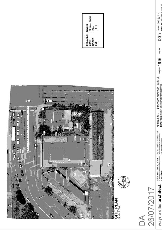
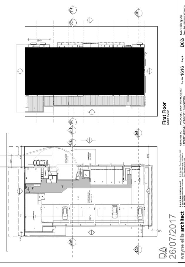
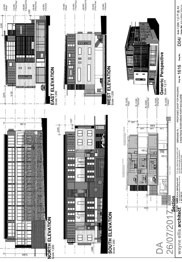
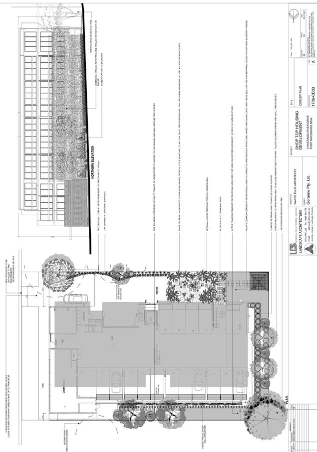
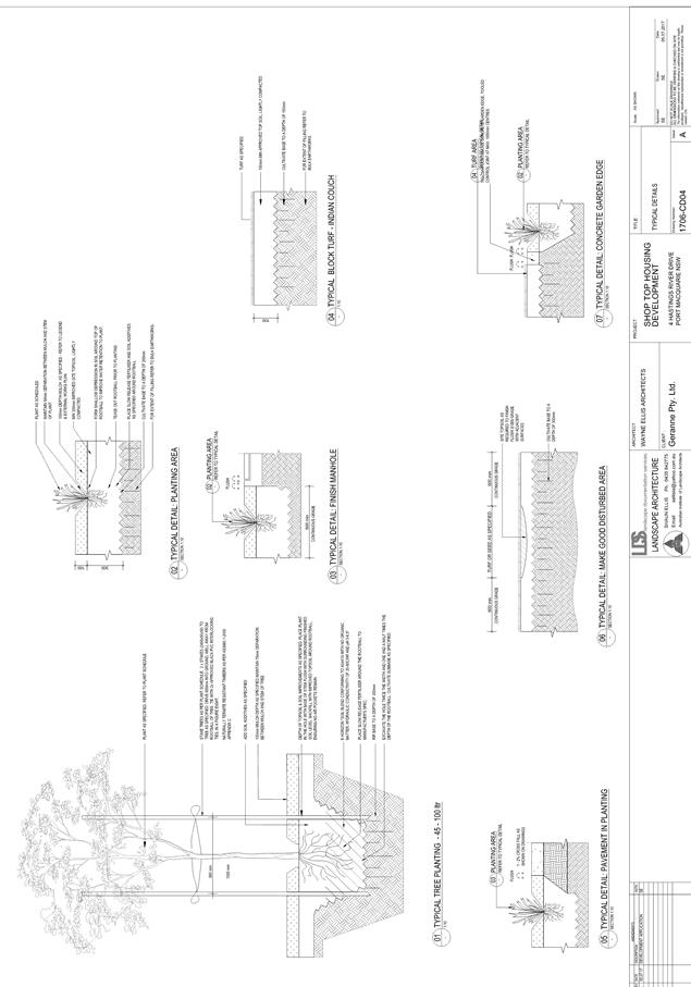
|
ATTACHMENT
|
Development Assessment Panel
28/02/2018
|
|
ATTACHMENT
|
Development Assessment Panel
28/02/2018
|
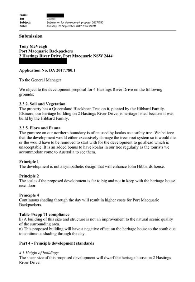
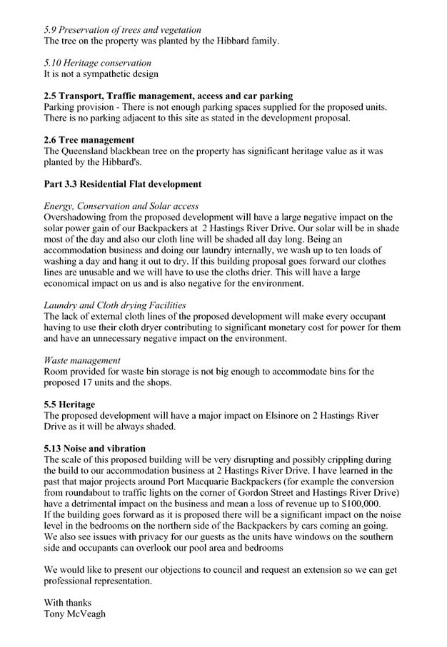

|
ATTACHMENT
|
Development Assessment Panel
28/02/2018
|
AGENDA Development Assessment Panel 28/02/2018
Item: 09
Subject: DA2017 - 981.1 Ancillary Building (Shed) Lot 2 DP 244961, No 8
Azalea Avenue, Wauchope
Report Author: Warren Wisemantel
|
Applicant: A
J Van Oirschot
Owner: A
J Van Oirschot
Estimated Cost: $12,165
Alignment with Delivery Program
4.3.1 Undertake transparent and
efficient development assessment in accordance with relevant legislation.
|
|
RECOMMENDATION
That
DA 2017 – 981.1 for an ancillary building (shed) at Lot 2, DP 244961,
No. 8 Azalea Avenue, Wauchope be determined by granting consent subject to
the recommended conditions.
|
Executive
Summary
This
report considers a development application for an ancillary building (shed) at
the subject site and provides an assessment of the application in accordance
with the Environmental Planning and Assessment Act 1979.
Following exhibition of the
application, 1 submission was received.
1. BACKGROUND
Existing sites features and Surrounding development
The site has an area of 717m2.
The site is zoned R1 General Residential in accordance with the Port Macquarie-Hastings Local
Environmental Plan 2011, as shown in the following zoning plan:
The existing subdivision pattern and location of existing
development within the locality is shown in the following aerial photograph:
2. DESCRIPTION OF
DEVELOPMENT
Key aspects of the proposal include the following:
· The
applicant proposes to erect a shed in the rear north east corner of the
allotment.
Application Chronology
· 2
November 2017 – Application lodged
· 20 November 2017 – 4 December 2017 – Exhibition
via neighbour notification
· 4 December 2017 – Objection received
· 6 December 2017 – Additional information letter sent
to applicant requesting shed size be reduced
· 8 December 2017 – Property owner requested
application be put on hold until such time he could address matters regarding
size of shed
· 11 January 2018 – Received telephone call from
objector’s daughter questioning what was going on with development.
Advised that property owner requested application be put on hold until such
time he could address matters regarding size of shed
· 9 February 2018 – Amended plans received reducing
size of shed
· 9 February 2018 – Telephoned objectors daughter
advising amended plans had been received reducing size of shed
· 12 February 2018 – Amended shed plans emailed to
objectors requesting advice if they still object to proposal with shed being
reduced in size
· 13 February 2018 – Email from objectors advising they
still object to proposed shed
· 19 February 2018 – Telephone call received from
objector requesting copy of plans attached to original neighbour notification (20/11/2017
to 4/12/2017) to compare difference in size of shed. Plans emailed to objector.
3. STATUTORY ASSESSMENT
Section 79C(1) Matters for Consideration
In determining the application, Council is required to take
into consideration the following matters as are relevant to the development
that apply to the land to which the development application relates:
(a) The provisions (where
applicable) of:
(i) any Environmental
Planning Instrument:
State Environmental Planning Policy No. 44 - Koala Habitat
Protection
There is no Koala Plan of
Management on the site. Additionally, the site is less than 1ha in area. Therefore,
no further investigations are required.
State Environmental Planning
Policy No.55 – Remediation of Land
Following an inspection of the site and a search of Council
records, the subject land is not identified as being potentially contaminated
and is suitable for the intended use.
State Environmental Planning
Policy No. 62 – Sustainable Aquaculture
Given the nature of the proposed
development and proposed stormwater controls the proposal will be unlikely to
have any adverse impact on existing aquaculture industries.
State Environmental Planning
Policy No. 71 – Coastal Protection and Clause 5.5 of Port
Macquarie-Hastings Local Environmental Plan 2011
The site is not located within a
coastal zone as defined in accordance with clause 4 of SEPP 71.
Port
Macquarie-Hastings Local Environmental Plan 2011
The proposal is consistent with the LEP having regard to the
following:
· Clause
2.2, the subject site is zoned R1 General Residential. In accordance with
clause 2.3(1) and the R1 zone landuse table, the dwelling (or ancillary
structure to a dwelling) is a permissible landuse with consent.
The objectives of
the R1 zone are as follows:
o To provide for the housing
needs of the community.
o To provide for a variety of
housing types and densities.
o To enable other land uses
that provide facilities or services to meet the day to day needs of residents.
In accordance with
Clause 2.3(2), the proposal is consistent with the zone objectives as it is a
permissible landuse and consistent with the established residential locality.
· Clause
4.3, the maximum overall height of the building above ground level (existing)
is 3.778m which complies with the standard height limit of 8.5m applying to the
site.
· Clause 5.9 -
No listed trees in Development Control Plan 2013 are proposed to be removed.
The above site photograph is not current as the trees in question are no longer
onsite having been removed some time ago.
· Clause 7.13,
satisfactory arrangements are in place for provision of essential services.
(ii) Any
draft instruments that apply to the site or are on exhibition:
No draft instruments apply to the
site.
(iii) any
Development Control Plan in force:
Port
Macquarie-Hastings Development Control Plan 2013
|
DCP 2013: Dwellings, Dual
occupancies, Dwelling houses, Multi dwelling houses & Ancillary
development
|
|
|
Requirements
|
Proposed
|
Complies
|
|
3.2.2.1
|
Ancillary development:
• 4.8m max. height
• Single storey
• 60m2 max. area
• 100m2 for lots
>900m2
• 24 degree max.
roof pitch
• Not located in
front setback
|
Proposed 77m2 storage shed with
an overall height of 3.680m located in rear yard for the garaging of
vehicles, motorbikes, tools and lawn mowers.
|
No, however the property owner
has a number of vehicles, motorbikes, lawn mowers and tools which require
storage. Due to an increase in theft in the area over recent months the
property owner has requested council consider a shed of this size. The shed
has been reduced in size from 96m2 and height of 3.778m down to 77m2 and
overall height of 3.680m to accommodate the objectors concerns. The subject
property has an overall area of 717m2. Shed size is considered acceptable and
does not compromise objectives of DCP.
|
|
3.2.2.2
|
Articulation zone:
• Min. 3m front
setback
• An entry feature
or portico
• A balcony, deck,
patio, pergola, terrace or verandah
• A window box
treatment
• A bay window or
similar feature
• An awning or
other feature over a window
• A sun shading
feature
|
No elements within the
articulation zone.
|
N/A
|
|
Front setback (Residential not R5
zone):
• Min. 6.0m
classified road
• Min. 4.5m local
road
• Min. 3.0m
secondary road
• Min. 2.0m
Laneway
|
The proposed shed is located in
the rear yard of the subject lot.
|
N/A
|
|
3.2.2.3
|
Garage 5.5m min. and 1m behind
front façade.
Garage door recessed behind building
line or eaves/overhangs provided
|
The proposed shed is located in
the rear yard of the subject lot.
|
N/A
|
|
6m max. width of garage door/s
and 50% max. width of building
|
The proposed shed is located in
the rear yard of the subject lot with one garage roller door having an
opening of 4.000m.
|
N/A
|
|
Driveway crossover 1/3 max. of
site frontage and max. 5.0m width
|
Existing driveway in position
|
Yes
|
|
3.2.2.4
|
4m min. rear setback. Variation
subject to site analysis and provision of private open space
|
The proposed shed is located in
the rear yard of the subject lot with a 1.000m setback from the north and
east boundary.
|
Yes
|
|
3.2.2.5
|
Side setbacks:
• Ground floor =
min. 0.9m
• First floors
& above = min. 3m setback or where it can be demonstrated that overshadowing
not adverse = 0.9m min.
• Building wall
set in and out every 12m by 0.5m
|
The minimum side setback
requirements are complied with.
The proposed shed is located in
the rear yard of the subject lot with a 1.000m setback from the north and
east boundary
|
Yes
|
|
3.2.2.6
|
35m2 min. private open space area
including a useable 4x4m min. area which has 5% max. grade
|
Open space will not be effected on-site with the proposed
shed.
|
Yes
|
|
3.2.2.7
|
Front fences:
• If solid 1.2m
max height and front setback 1.0m with landscaping
• 3x3m min. splay
for corner sites
• Fences >1.2m
to be 1.8m max. height for 50% or 6.0m max. length of street frontage with
25% openings
• 0.9x0.9m splays
adjoining driveway entrances
|
No fences proposed
|
N/A
|
|
3.2.2.8
|
Front fences and walls to have
complimentary materials to context
No chain wire, solid timber,
masonry or solid steel front fences
|
N/A
|
|
|
3.2.2.10
|
Privacy:
• Direct views
between living areas of adjacent dwellings screened when within 9m radius of
any part of window of adjacent dwelling and within 12m of private open space
areas of adjacent dwellings. ie. 1.8m fence or privacy screening which has
25% max. openings and is permanently fixed
• Privacy screen
required if floor level > 1m height, window side/rear setback (other than
bedroom) is less than 3m and sill height less than 1.5m
• Privacy screens
provided to balconies/verandahs etc which have <3m side/rear setback and
floor level height >1m
|
The proposal does not give rise to any privacy impacts.
|
Yes
|
|
DCP 2013: General
Provisions
|
|
|
Requirements
|
Proposed
|
Complies
|
|
2.7.2.2
|
Design addresses generic principles of Crime Prevention
Through Environmental Design guideline
|
No concealment or entrapment areas proposed. Adequate
casual surveillance available.
|
Yes
|
|
2.3.3.1
|
Cut and fill 1.0m max. 1m outside the perimeter of the
external building walls
|
Cut and fill <1.0m change 1m outside the perimeter of
the external building walls
|
Yes
|
|
2.3.3.2
|
1m max. height retaining walls along road frontage
|
None proposed
|
N/A
|
|
Any retaining wall >1.0 in height to be certified by
structure engineer
|
No retaining wall likely >1m
|
Yes
|
|
Combination of retaining wall and front fence height max
1.8m, max length 6.0m or 30% of frontage, fence component 25% transparent,
and splay at corners and adjacent to driveway
|
No retaining wall front fence combination proposed.
|
N/A
|
|
2.4.3
|
Bushfire risk, Acid sulphate soils, Flooding,
Contamination, Airspace protection, Noise and Stormwater
|
Refer to main body of report.
|
|
|
2.5.3.11
|
Section 94 contributions
|
Refer to main body of report.
|
|
(iiia) any
planning agreement that has been entered into under Section 93f or any draft
planning agreement that a developer has offered to enter into under Section
93f:
No planning
agreement has been offered or entered into relating to the site.
iv) any matters prescribed by the
Regulations:
New South Wales Coastal Policy:
N/A
Demolition
of buildings AS 2601:
N/A
v) any coastal
zone management plan (within the meaning of the Coastal Protection Act 1979),
that apply to the land to which the development application relates:
None
applicable
(b) The
likely impacts of that development, including environmental impacts on both the
natural and built environments, social and economic impacts in the locality:
Context and setting
• The
proposal will be unlikely to have any adverse impacts to existing adjoining
properties and satisfactorily addresses the public domain.
• The proposal is considered to be consistent with other
residential development in the locality and adequately addresses planning
controls for the area.
• There
are no adverse impacts on existing view sharing.
• There are no adverse privacy impacts.
• There are no adverse overshadowing impacts. The proposal
does not prevent adjoining properties from receiving 3 hours of sunlight to
private open space and primary living areas on 21 June.
Access, transport and traffic
The proposal will be unlikely to have any adverse impacts in
terms access, transport and traffic. The existing road network will
satisfactorily cater for any increase in traffic generation as a result of the
development.
Water Supply
Service available.
Sewer
Service available.
Stormwater
Service available – Stormwater being connected to
existing.
Other Utilities
Telecommunication and electricity services are available to
the site.
Heritage
This site does not contain or adjoin any known heritage item
or site of significance.
Other land resources
No adverse impacts anticipated. The site is within an
established urban context and will not sterilise any significant mineral or
agricultural resource.
Water cycle
The proposed development will be unlikely to have any
adverse impacts on water resources and the water cycle.
Soils
The proposed development will be unlikely to have any
adverse impacts on soils in terms of quality, erosion, stability and/or
productivity subject to a standard condition requiring erosion and sediment
controls to be in place prior to and during construction.
Air and microclimate
The construction and/or operations of the proposed
development will be unlikely to result in any adverse impacts on the existing
air quality or result in any pollution.
Flora and fauna
Construction of the proposed development will not require
any removal/clearing of any significant vegetation and therefore will be
unlikely to have any significant adverse impacts on biodiversity or threatened
species of flora and fauna.
Waste
Satisfactory arrangements are in place for proposed storage
and collection of waste and recyclables. No adverse impacts anticipated.
Noise and vibration
No adverse impacts anticipated. Condition recommended to
restrict construction to standard construction hours.
Bushfire
The site is not identified as being bushfire prone.
Safety, security and crime prevention
The proposed development will be unlikely to create any
concealment/entrapment areas or crime spots that would result in any
identifiable loss of safety or reduction of security in the immediate area.
Social impacts in the locality
Given the nature of the proposed development and its’
location the proposal is unlikely to result in any adverse social impacts.
Economic impact in the locality
No adverse impacts. Likely positive impacts can be
attributed to the construction of the development and associated flow on
effects (ie maintained employment and expenditure in the area).
Site design and internal design
The proposed development design satisfactorily responds to
the site attributes and will fit into the locality. No adverse impacts likely.
Construction
No potential adverse impacts identified to neighbouring
properties with the construction of the proposal.
Cumulative impacts
The proposed development is not expected to have any adverse
cumulative impacts on the natural or built environment or the social and
economic attributes of the locality.
(c) The suitability of the site for
the development:
The proposal will fit into the
locality and the site attributes are conducive to the proposed development.
Site constraints have been
adequately addressed and appropriate conditions of consent recommended.
(d) Any submissions made in
accordance with this Act or the Regulations:
Following exhibition in accordance
with DCP 2013, one submission was received.
Key issues raised in the submission and comments in
response to these issues are provided as follows:
|
Submission
Issue/Summary
|
Planning
Comment/Response
|
|
Concerns raised regarding
residential and rural views which have been enjoyed for the last 40 years
being interrupted.
Concerns raised regarding size
of shed in rear yard and the objectors living areas will be looking directly
onto the site of the proposed shed.
The size of the shed gives the
property a commercial feel affecting the objector’s property.
|
The objectors dwelling is
elevated with a rear verandah and living areas located on the second storey.
The subject shed is to be located on the lower side in the north west corner.
The construction of this shed will not affect the residential and rural views
in question as they will still be available over the top of the shed.
Proposed 77m2 storage shed with an overall height of
3.680m located in rear yard for the garaging of vehicles, motorbikes, tools
and lawn mowers. The property owner has a number of vehicles, motorbikes,
lawn mowers and tools which require storage. Due to an increase in theft in
the area over recent months the property owner has requested Council consider
a shed of this size. The shed has been reduced in size from 96m2 and height
of 3.778m down to 77m2 and overall height of 3.680m to accommodate the
objectors concerns. The subject property has an overall area of 717m2. The
subject shed will be visible from the objectors property, however as
previously stated both residential and rural views will still be available
and the variation to the DCP is minor and will create no adverse impact.
The shed has been reduced in
size from 96m2 and height of 3.778m down to 77m2 and overall height of 3.680m
to accommodate the objectors concerns. The subject property has an overall
area of 717m2. The shed has a colour scheme of ironstone for the roof and
roller door and woodland grey for the walls. The carefully selected colour
scheme allows the shed to compliment the natural surroundings and blend in with
surrounding residential developments in the area which would somewhat detract
from the commercial feel as suggested by the objector.
|
(e) The Public Interest:
The proposed
development satisfies relevant planning controls and is not expected to impact on
the wider public interest
4. DEVELOPMENT
CONTRIBUTIONS APPLICABLE
Not applicable
5. CONCLUSION
The application has been assessed in accordance with
Section 79C of the Environmental Planning and Assessment Act 1979.
Issues raised during assessment and public exhibition of
the application have been considered in the assessment of the application.
Where relevant, conditions have been recommended to manage the impacts
attributed to these issues.
The site is suitable for the proposed development, is not
contrary to the public's interest and will not have a significant adverse
social, environmental or economic impact. It is recommended that the
application be approved, subject to the recommended conditions of consent
provided in the attachment section of this report.
|
Attachments
1View. DA2017
- 981.1 Plans
2View. DA2017
- 981.1 Recommended Conditions
3View. DA2017
- 981.1 Submission - Sheringham 04122017
4View. DA2017
- 981.1 Submission - Sheringham 13022017
|
|
ATTACHMENT
|
Development Assessment Panel
28/02/2018
|
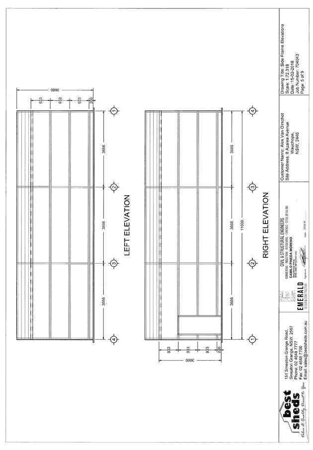
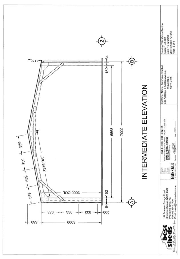
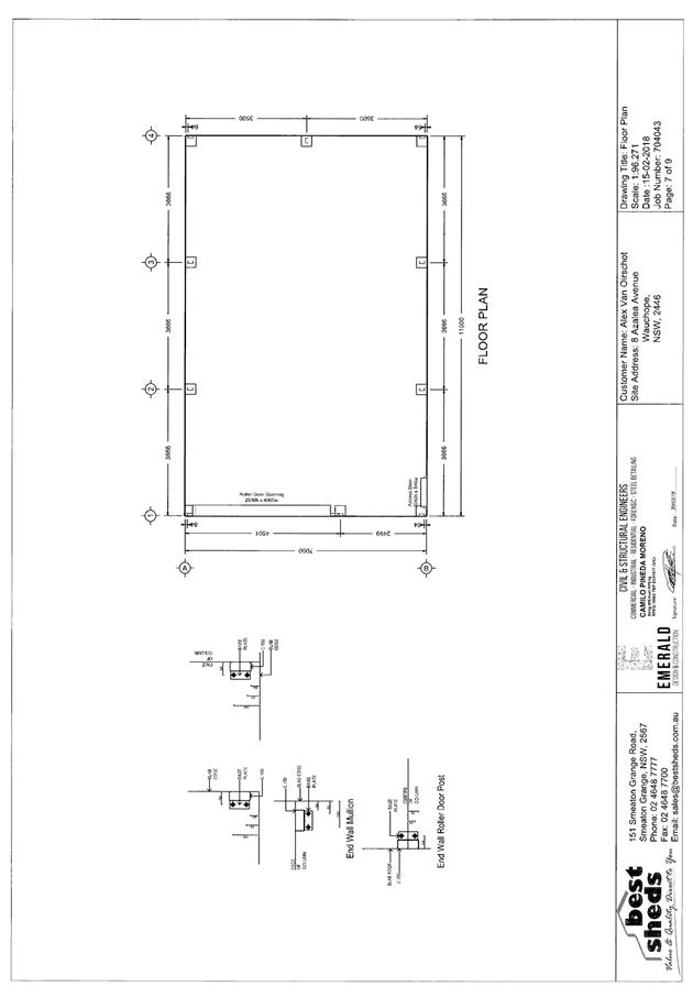
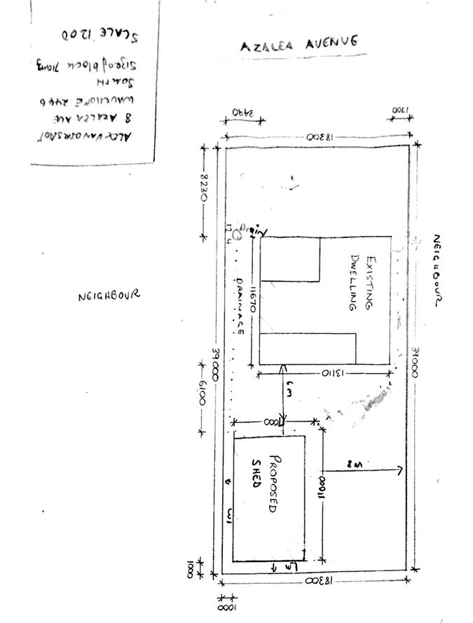
|
ATTACHMENT
|
Development Assessment Panel
28/02/2018
|
|
ATTACHMENT
|
Development Assessment Panel
28/02/2018
|
|
ATTACHMENT
|
Development Assessment Panel
28/02/2018
|