Business
Paper
|
date of meeting:
|
|
Wednesday 23 October
2019
|
|
location:
|
|
Function Room
Port
Macquarie-Hastings Council
17 Burrawan Street
Port Macquarie
|
|
time:
|
|
2:00pm
|
Development
Assessment Panel
CHARTER
1.0 OBJECTIVES
To assist in managing Council's development assessment
function by providing independent and expert determinations of development
applications that fall outside of staff delegations.
2.0 KEY FUNCTIONS
·
To review development application reports and conditions;
·
To determine development
applications outside of staff delegations;
·
To refer development applications
to Council for determination where necessary;
·
To provide a forum for objectors and applicants
to make submissions on applications
before the Development Assessment Panel
(DAP);
·
To maintain transparency in the determination of development
applications.
Delegated Authority of Panel
Pursuant to
Section 377 of the Local Government Act, 1993 delegation to:
·
Determine development applications under Part 4
of the Environmental Planning and Assessment
Act 1979 having
regard to the relevant environmental planning instruments,
development control plans and Council policies.
·
Vary, modify or release restrictions as to use
and/or covenants created by Section 88B instruments under the Conveyancing Act
1919 in relation to development applications for subdivisions being considered
by the panel.
·
Determine Koala Plans of Management under State
Environmental Planning Policy 44 - Koala Habitat Protection associated with
development applications being considered by the Panel.
Noting the trigger to escalate
decision making to Council as highlighted in section 5.2.
3.0
MEMBERSHIP
3.1
Voting
Members
·
Two independent external members. One of the
independent external members to be the Chairperson.
·
Group Manager Development Assessment (alternate
- Director Development & Environment or Development Assessment Planner)
The independent external members shall have expertise in
one or more of the following areas: planning, architecture, heritage, the
environment, urban design, economics, traffic and transport, law, engineering,
government and public administration.
3.2
Non-Voting Members
·
Not applicable
3.3 Obligations
of members
·
Members must act faithfully and diligently and
in accordance with this Charter.
·
Members must comply with Council's Code of Conduct.
·
Except as required to properly perform their
duties, DAP members must not
disclose any confidential information (as advised by Council) obtained in connection with the DAP functions.
·
Members will have read and be familiar with the
documents and information provided by Council prior
to attending a DAP meeting.
·
Members must act in accordance with Council's
Workplace Health and Safety Policies and Procedures
·
External members of the Panel are not authorised
to speak to the media on behalf of Council. Council officers that are members
of the Committee are bound by the
existing operational delegations in relation to speaking to the media.
·
Staff members shall not vote on matters before
the Panel if they have been the principle author of the development assessment report.
3.4
Member Tenure
·
The independent external members will be
appointed for the term of four (4) years
maximum in which the end of the tenure of these members would occur in a
cascading arrangement.
3.5 Appointment
of members
·
The independent external members (including the
Chair) shall be appointed by the General Manager following an external
Expression of Interest process.
·
Staff members of the Panel are in accordance
with this Charter.
4.0 TIMETABLE
OF MEETINGS
·
The Development Assessment Panel will generally
meet on the 1st and 3rd Wednesday each month at 2.00pm at the Port Macquarie
offices of Council.
·
Special Meetings of the Panel may be convened by
the Director Development & Environment Services with three (3) days notice.
5.0
MEETING PRACTICES
5.1
Meeting
Format
·
At all Meetings of the Panel the Chairperson
shall occupy the Chair and preside. The Chair will be responsible for keeping
of order at meetings.
·
Meetings shall be open to the public.
·
The Panel will hear from applicants
and objectors or their r e p r e s e n t a t i v e s .
·
Where considered necessary, the Panel will
conduct site inspections which will
be open to the public.
5.2
Decision Making
·
Decisions are to be made by consensus. Where
consensus is not possible on any item, that item is to be referred to Council
for a decision.
·
All development applications involving a
proposed variation to a development standard
greater than 10% under Clause
4.6 of the Local Environmental Plan will be
considered by the Panel and recommendation made to the Council for a decision.
5.3
Quorum
·
All members (2 independent external members and
1 staff member) must be present at a
meeting to form a quorum.
5.4
Chairperson and Deputy Chairperson
·
Independent Chair (alternate, second independent member)
5.5
Secretariat
·
The Director Development &n Environment is
to be responsible for ensuring that the Panel has adequate secretariat support.
The secretariat will ensure that the business paper and supporting papers are
circulated at least three (3) days prior to
each meeting. Minutes shall be appropriately approved and circulated to each
member within three (3) weeks of a meeting being held.
·
The format of and the preparation and publishing
of the Business Paper and Minutes shall be similar to the format for Ordinary
Council Meetings.
5.6
Recording of decisions
·
Minutes will record decisions and how each
member votes for each item before the Panel.
6.0 CONVENING
OF “OUTCOME SPECIFIC” WORKING GROUPS
Not applicable.
7.0 CONFIDENTIALITY
AND CONFLICT OF INTEREST
·
Members of the Panel must comply with the
applicable provisions of Council’s Code of Conduct. It is the personal
responsibility of members to comply with the standards in the Code of Conduct
and regularly review their personal circumstances with this in mind.
·
Panel members must declare any conflict of
interests at the start of each meeting or before discussion of a relevant item
or topic. Details of any conflicts of interest should be appropriately minuted.
Where members are deemed to have a real or perceived conflict of interest, it
may be appropriate they be excused from deliberations on the issue where the
conflict of interest may exist. A Panel meeting may be postponed where there is
no quorum.
8.0 LOBBYING
·
All members and applicants are to adhere to Council’s
Lobbying policy. Outside of
scheduled Development Assessment Panel meetings, applicants, their
representatives, Councillors, Council staff and the general public are not to
lobby Panel members via meetings, telephone conversations, correspondence and
the like. Adequate opportunity will be provided at Panel inspections or
meetings for applicants, their representatives and the general public to make
verbal submissions in relation to Business Paper items.
Development Assessment Panel
ATTENDANCE
REGISTER
|
Member
|
12/06/19
|
24/07/19
|
28/08/19
|
11/09/19
|
25/09/19
|
09/10/19
|
|
Paul Drake
|
P
|
P
|
P
|
P
|
P
|
P
|
|
Robert Hussey
|
|
|
P
|
P
|
|
P
|
|
David Crofts
(alternate member)
|
P
|
P
|
|
|
P
|
|
|
Dan Croft
(Group Manager Development
Assessment)
(alternates)
- Director Development & Environment
- Development Assessment Planner
|
P
|
P
|
P
|
A
P
|
P
|
A
P
|
Key: P = Present
A
= Absent With Apology
X
= Absent Without Apology
Development
Assessment Panel Meeting
Wednesday 23 October
2019
Items of Business
01 Acknowledgement
of Country............................................................................. 8
02 Apologies.......................................................................................................... 8
03 Confirmation
of Minutes..................................................................................... 8
04 Disclosures
of Interest..................................................................................... 12
05 DA2019
- 621 Medical Centre - Lot 27 DP 253280, No 6 Browallia Place, Port Macquarie...................................................................................................................... 16
06 DA2019
- 476.1 Change of Use from Medical Centre to Dual Occupancy and Torrens Title
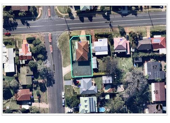
Subdivison, Lot 5 DP 226787, 70 Hill Street, Port Macquarie.............................. 46
07 DA2019
- 203.1 Demolition of Existing Buildings and Construction of Restaurant at 24
Clarence Street, Port Macquarie..................................................................................... 77
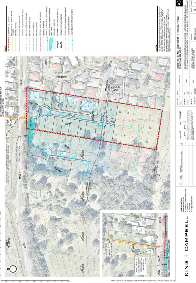
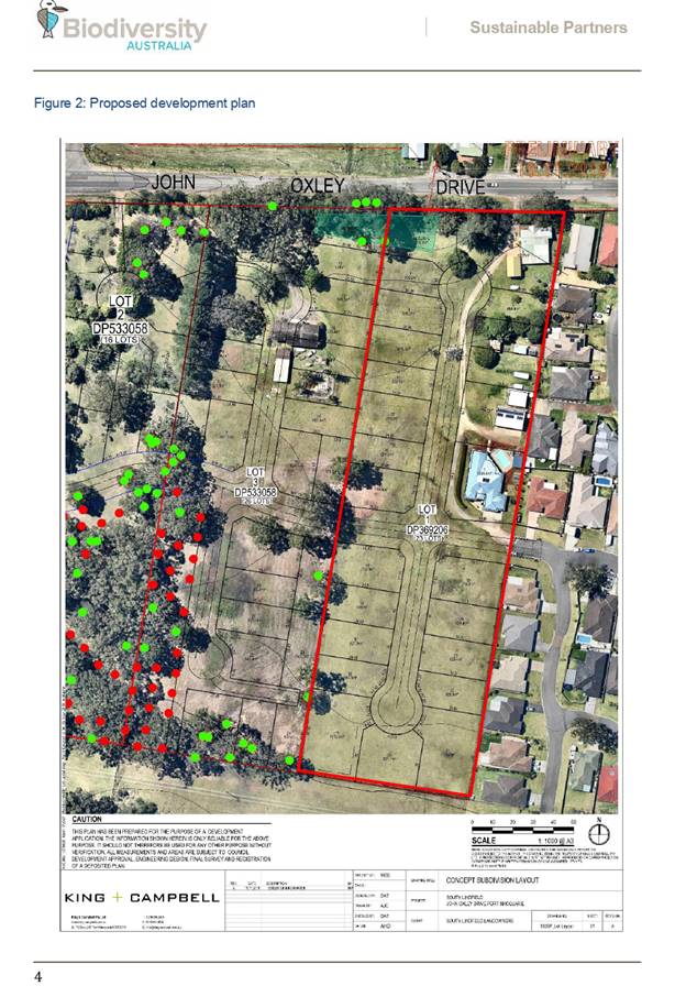
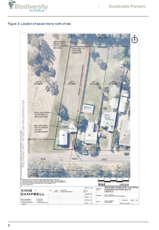
08 DA2019
- 400 Concept Proposal for Staged Residential Subdivision (25 torrens title
lots) & Staged Residential Subdivision (19 torrens title lots) - 165 John
Oxley Drive, Port Macquarie..................................................................................................................... 159
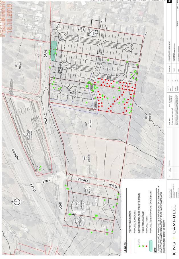
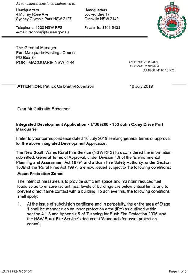
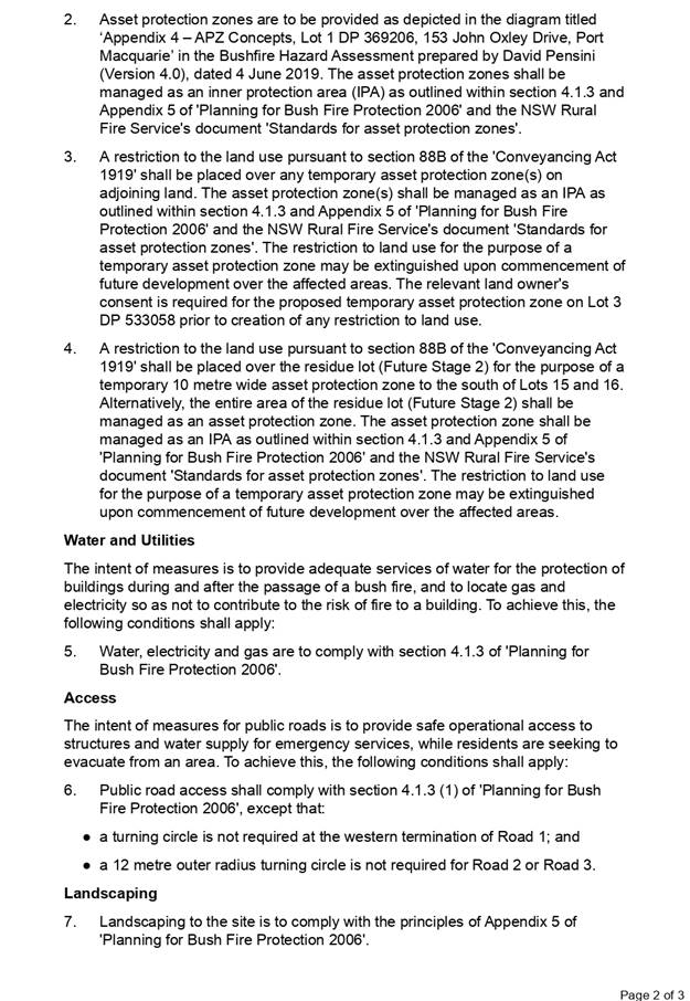
09 DA2019
- 401.1 - Concept proposal for residential subdivision (25 torrens title lots)
& staged residential subdivision (16 torrens title lots) at 153 John Oxley
Drive, Port Macquarie 471
10 General
Business
AGENDA Development Assessment Panel 23/10/2019
Subject: ACKNOWLEDGEMENT
OF COUNTRY
"I acknowledge that we are
gathered on Birpai Land. I pay respect to the Birpai Elders both past and
present. I also extend that respect to all other Aboriginal and Torres Strait
Islander people present."
RECOMMENDATION
That the apologies received be
accepted.
Subject: CONFIRMATION
OF PREVIOUS MINUTES
Recommendation
That the Minutes of the Development
Assessment Panel Meeting held on 9 October 2019 be confirmed.
MINUTES
Development Assessment Panel Meeting
09/10/2019
PRESENT
Members:
Paul
Drake
Robert Hussey
Pat Gailbraith-Robertson
Other Attendees:
Ben
Roberts
Grant Burge
|
The meeting opened at 2:06pm.
|
|
01 ACKNOWLEDGEMENT
OF COUNTRY
|
|
The
Acknowledgement of Country was delivered.
|
|
02 APOLOGIES
|
|
CONSENSUS:
That
the apology received from Dan Croft be accepted, noting that Pat
Gailbraith-Robertson is alternate for the Panel.
|
|
03 CONFIRMATION
OF MINUTES
|
|
CONSENSUS:
That
the Minutes of the Development Assessment Panel Meeting held on 25 September
2019 be confirmed.
|
|
04 DISCLOSURES
OF INTEREST
|
|
There were no disclosures of interest presented.
|
|
05 DA2018 - 988.1
Staged Torrens Title Subdivision and Multi Dwelling Housing with Strata Title
subdivision at Lot 100 DP 1009007, No. 16 Ocean Street, Port Macquarie
|
|
Speakers:
Michelle Chapman
Daniel Marzoll
Chris Bombardiere (applicants)
Bob Bailey (opposed)
CONSENSUS:
That DA 2018 - 988.1 for a staged torrens title
subdivision and multi dwelling housing with strata title subdivision at Lot
100 DP 1009007, No.16 Ocean Street, Port Macquarie be approved subject to a
Deferred Commencement Consent which is to be subject to the following:
1.
The following items be satisfied within 3 months of the issuing of the
deferred commencement consent to the satisfaction of the Director of
Development and Environment of Council:
a)
The section of public footpath proposed in John Street be removed from
the plans and relevant conditions of consent be amended to not require the
footpath.
b)
Amendments be made to the proposal to retain the existing Swamp
Mahogany tree in the John Street road reserve. Such amendments are to be made
with submission of a new Aborist report which justifies long term retention
of the tree based upon design changes.
c)
Subject to point b) being satisfactorily resolved amendments to
conditions of consent to reflect the retention of the Swamp Mahogany tree.
|
|
06 DA2019-254.1
Industrial Building and Caretaker’s Residence - Lot 2 DP 1084479, No. 3
Production Drive, Wauchope.
|
|
Speakers:
Derek Collins (applicant)
CONSENSUS:
That the determination by the Development Assessment
Panel (DAP) of DA2019 - 254 for an industrial building and caretaker’s
residence at Lot 2 DP1084479, be deferred to address the following:
1.
The Applicant give consideration to an amended layout which better
satisfies section 3.5.3.3 of Development Control Plan 2013 to require open
storage areas at the rear.
2.
The Applicant rationalise the parking layout to be a safe and minimise
potential for conflict between workers and customers.
3.
The Applicant submit a more detailed landscaping plan inclusive of
species of plantings.
4.
The Applicant relocate the parking spaces beside the storage
containers.
|
|
07 Proposed
Meeting Dates for 2020 - Development Assessment Panel
|
|
CONSENSUS:
That the Development Assessment Panel endorse the meeting
dates for 2020 as follows:
22
January
12
February
26
February
11
March
25
March
8
April
22
April
13
May
27
May
10
June
24
June
|
|
The meeting closed at 3:49pm.
|
AGENDA Development Assessment Panel 23/10/2019
Subject: DISCLOSURES
OF INTEREST
RECOMMENDATION
That Disclosures of Interest be presented
DISCLOSURE OF
INTEREST DECLARATION
|
Name of Meeting:
|
|
Meeting
Date:
|
|
Item
Number:
|
|
Subject:
|
|
I,
the undersigned, hereby declare the following interest:
Pecuniary:
 Take no part
in the consideration and voting and be out of sight of the meeting. Take no part
in the consideration and voting and be out of sight of the meeting.
Non-Pecuniary
– Significant Interest:
Take no part
in the consideration and voting and be out of sight of the meeting.
Non-Pecuniary
– Less than Significant Interest:
May
participate in consideration and voting.
|
|
For
the reason that:
|
|
Name:
Signed:
|
Date:
|
|
Please submit to the
Governance Support Officer at the Council Meeting.
|
 (Refer
to next page and the Code of Conduct)
(Refer
to next page and the Code of Conduct)
Pecuniary Interest
4.1
A pecuniary interest is an interest
that you have in a matter because of a reasonable likelihood or expectation of
appreciable financial gain or loss to you or a person referred to in clause
4.3.
4.2
You will not have a pecuniary
interest in a matter if the interest is so remote or insignificant that it
could not reasonably be regarded as likely to influence any decision you might
make in relation to the matter, or if the interest is of a kind specified in
clause 4.6.
4.3
For the purposes of this Part, you
will have a pecuniary interest in a matter if the pecuniary interest is:
(a)
your interest, or
(b)
the interest of your spouse or de
facto partner, your relative, or your partner or employer, or
(c)
a company or other body of which
you, or your nominee, partner or employer, is a shareholder or member.
4.4
For the purposes of clause 4.3:
(a)
Your “relative” is any
of the following:
(b)
“de facto partner” has
the same meaning as defined in section 21C of the Interpretation Act 1987.
4.5
You will not have a pecuniary
interest in relation to a person referred to in subclauses 4.3(b) or (c)
(a)
if you are unaware of the relevant
pecuniary interest of your spouse, de facto partner, relative, partner,
employer or company or other body, or
(b)
just because the person is a member
of, or is employed by, a council or a statutory body, or is employed by the
Crown, or
(c)
just because the person is a member
of, or a delegate of a council to, a company or other body that has a pecuniary
interest in the matter, so long as the person has no beneficial interest in any
shares of the company or body.
Non-Pecuniary
5.1
Non-pecuniary interests are private
or personal interests a council official has that do not amount to a pecuniary
interest as defined in clause 4.1 of this code. These commonly arise out of
family or personal relationships, or out of involvement in sporting, social,
religious or other cultural groups and associations, and may include an
interest of a financial nature.
5.2
A non-pecuniary conflict of
interest exists where a reasonable and informed person would perceive that you
could be influenced by a private interest when carrying out your official
functions in relation to a matter.
5.3
The personal or political views of
a council official do not constitute a private interest for the purposes of
clause 5.2.
5.4
Non-pecuniary conflicts of interest
must be identified and appropriately managed to uphold community confidence in
the probity of council decision-making. The onus is on you to identify any
non-pecuniary conflict of interest you may have in matters that you deal with,
to disclose the interest fully and in writing, and to take appropriate action
to manage the conflict in accordance with this code.
5.5
When considering whether or not you
have a non-pecuniary conflict of interest in a matter you are dealing with, it
is always important to think about how others would view your situation.
Managing non-pecuniary conflicts of interest
5.6
Where you have a non-pecuniary
conflict of interest in a matter for the purposes of clause 5.2, you must
disclose the relevant private interest you have in relation to the matter fully
and in writing as soon as practicable after becoming aware of the non-pecuniary
conflict of interest and on each occasion on which the non-pecuniary conflict
of interest arises in relation to the matter. In the case of members of council
staff other than the general manager, such a disclosure is to be made to the
staff member’s manager. In the case of the general manager, such a
disclosure is to be made to the mayor.
5.7
If a disclosure is made at a
council or committee meeting, both the disclosure and the nature of the
interest must be recorded in the minutes on each occasion on which the
non-pecuniary conflict of interest arises. This disclosure constitutes
disclosure in writing for the purposes of clause 5.6.
5.8
How you manage a non-pecuniary
conflict of interest will depend on whether or not it is significant.
5.9
As a general rule, a non-pecuniary
conflict of interest will be significant where it does not involve a pecuniary
interest for the purposes of clause 4.1, but it involves:
a)
a relationship between a council
official and another person who is affected by a decision or a matter under
consideration that is particularly close, such as a current or former spouse or
de facto partner, a relative for the purposes of clause 4.4 or another person
from the council official’s extended family that the council official has
a close personal relationship with, or another person living in the same
household
b)
other relationships with persons
who are affected by a decision or a matter under consideration that are
particularly close, such as friendships and business relationships. Closeness
is defined by the nature of the friendship or business relationship, the frequency
of contact and the duration of the friendship or relationship.
c)
an affiliation between the council
official and an organisation (such as a sporting body, club, religious,
cultural or charitable organisation, corporation or association) that is
affected by a decision or a matter under consideration that is particularly
strong. The strength of a council official’s affiliation with an
organisation is to be determined by the extent to which they actively
participate in the management, administration or other activities of the
organisation.
d)
membership, as the council’s
representative, of the board or management committee of an organisation that is
affected by a decision or a matter under consideration, in circumstances where
the interests of the council and the organisation are potentially in conflict
in relation to the particular matter
e)
a financial interest (other than an
interest of a type referred to in clause 4.6) that is not a pecuniary interest
for the purposes of clause 4.1
f)
the conferral or loss of a personal
benefit other than one conferred or lost as a member of the community or a
broader class of people affected by a decision.
5.10
Significant non-pecuniary conflicts
of interest must be managed in one of two ways:
a)
by not participating in
consideration of, or decision making in relation to, the matter in which you
have the significant non-pecuniary conflict of interest and the matter being
allocated to another person for consideration or determination, or
b)
if the significant non-pecuniary
conflict of interest arises in relation to a matter under consideration at a
council or committee meeting, by managing the conflict of interest as if you
had a pecuniary interest in the matter by complying with clauses 4.28 and 4.29.
5.11
If you determine that you have a
non-pecuniary conflict of interest in a matter that is not significant and does
not require further action, when disclosing the interest you must also explain
in writing why you consider that the non-pecuniary conflict of interest is not
significant and does not require further action in the circumstances.
5.12
If you are a member of staff of
council other than the general manager, the decision on which option should be
taken to manage a non-pecuniary conflict of interest must be made in
consultation with and at the direction of your manager. In the case of the
general manager, the decision on which option should be taken to manage a
non-pecuniary conflict of interest must be made in consultation with and at the
direction of the mayor.
5.13
Despite clause 5.10(b), a councillor
who has a significant non-pecuniary conflict of interest in a matter, may
participate in a decision to delegate consideration of the matter in question
to another body or person.
5.14 Council committee members are not required to declare
and manage a non-pecuniary conflict of interest in accordance with the
requirements of this Part where it arises from an interest they have as a
person chosen to represent the community, or as a member of a non-profit
organisation or other community or special interest group, if they have been
appointed to represent the organisation or group on the council committee.
SPECIAL
DISCLOSURE OF PECUNIARY INTEREST DECLARATION
This
form must be completed using block letters or typed.
If
there is insufficient space for all the information you are required to
disclose,
you
must attach an appendix which is to be properly identified and signed by you.
|
By
[insert full name of councillor]
|
|
|
In the
matter of
[insert name of environmental planning instrument]
|
|
|
Which is
to be considered at a meeting of the
[insert name of meeting]
|
|
|
Held on
[insert date of meeting]
|
|
|
PECUNIARY
INTEREST
|
|
Address of
the affected principal place of residence of the councillor or an associated
person, company or body (the identified land)
|
|
|
Relationship
of identified land to councillor
[Tick or cross one box.]
|
The councillor has interest in the land (e.g. is owner or has other
interest arising out of a mortgage, lease, trust, option or contract, or
otherwise).
An associated person of the councillor has an interest in the land.
An associated company or body of the councillor has interest in the land.
|
|
MATTER
GIVING RISE TO PECUNIARY INTEREST
|
|
Nature of
land that is subject to a change
in
zone/planning control by proposed
LEP (the
subject land
[Tick or cross one box]
|
The identified land.
Land that adjoins or is adjacent to or is in proximity to the identified
land.
|
|
Current
zone/planning control
[Insert name of current planning instrument and
identify relevant zone/planning control applying to the subject land]
|
|
|
Proposed
change of zone/planning control
[Insert name of proposed LEP and identify proposed
change of zone/planning control applying to the subject land]
|
|
|
Effect of
proposed change of zone/planning control on councillor or associated person
[Tick or cross one box]
|
Appreciable financial gain.
Appreciable financial loss.
|
|
|
|
[If more than one pecuniary interest is to be
declared, reprint the above box and fill in for each additional interest]
Councillor’s Signature:
……………………………….
Date: ………………..
This form is to be retained
by the council’s general manager and included in full in the minutes of
the meeting
Last Updated: 3 June 2019
Important Information
This information is being collected for the purpose of
making a special disclosure of pecuniary interests under clause 4.36(c) of the
Model Code of Conduct for Local Councils in NSW (the Model Code of Conduct).
The special disclosure must relate only to a pecuniary
interest that a councillor has in the councillor’s principal place of
residence, or an interest another person (whose interests are relevant under
clause 4.3 of the Model Code of Conduct) has in that person’s principal
place of residence.
Clause 4.3 of the Model Code of Conduct states that you
will have a pecuniary interest in a matter because of the pecuniary interest of
your spouse or your de facto partner or your relative or because your business
partner or employer has a pecuniary interest. You will also have a pecuniary
interest in a matter because you, your nominee, your business partner or your
employer is a member of a company or other body that has a pecuniary interest
in the matter.
“Relative” is defined by clause 4.4 of the Model
Code of Conduct as meaning your, your spouse’s or your de facto
partner’s parent, grandparent, brother, sister, uncle, aunt, nephew,
niece, lineal descendant or adopted child and the spouse or de facto partner of
any of those persons.
You
must not make a special disclosure that you know or ought reasonably to know is
false or misleading in a material particular. Complaints about breaches
of these requirements are to be referred to the Office of Local Government and
may result in disciplinary action by the Chief Executive of the Office of Local
Government or the NSW Civil and Administrative Tribunal.
This form must be completed by you before the commencement
of the council or council committee meeting at which the special disclosure is
being made. The completed form must be tabled at the meeting. Everyone is
entitled to inspect it. The special disclosure must be recorded in the minutes
of the meeting.
A pecuniary interest may arise by way of a change of
permissible use of land adjoining, adjacent to or in proximity to land in which
a councillor or a person, company or body referred to in clause 4.3 of the
Model Code of Conduct has a proprietary interest
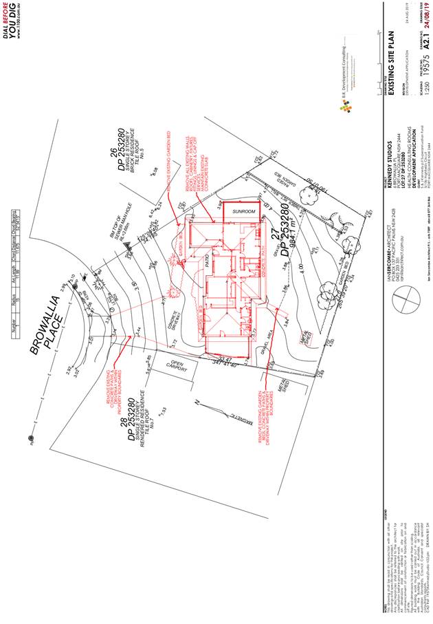
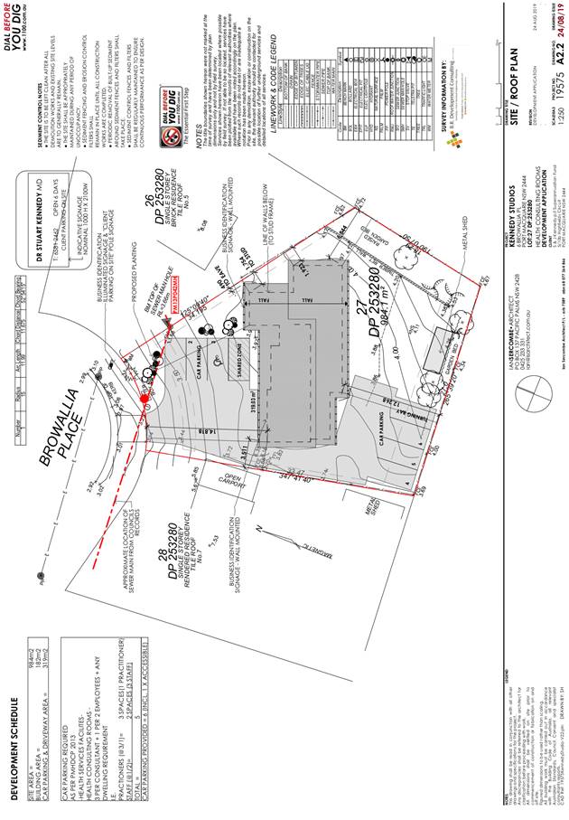
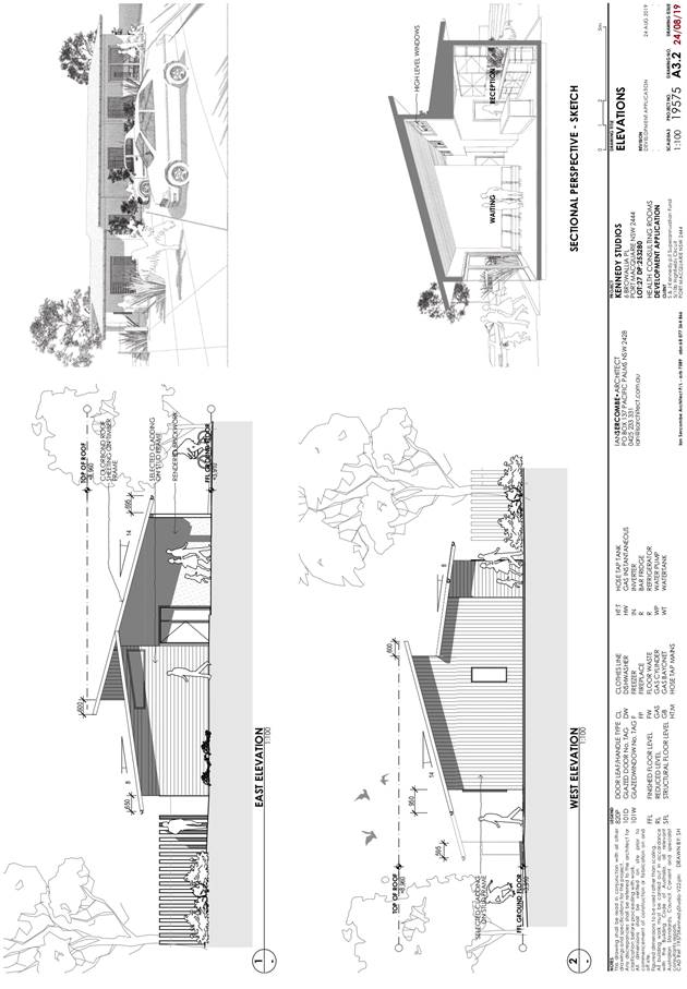
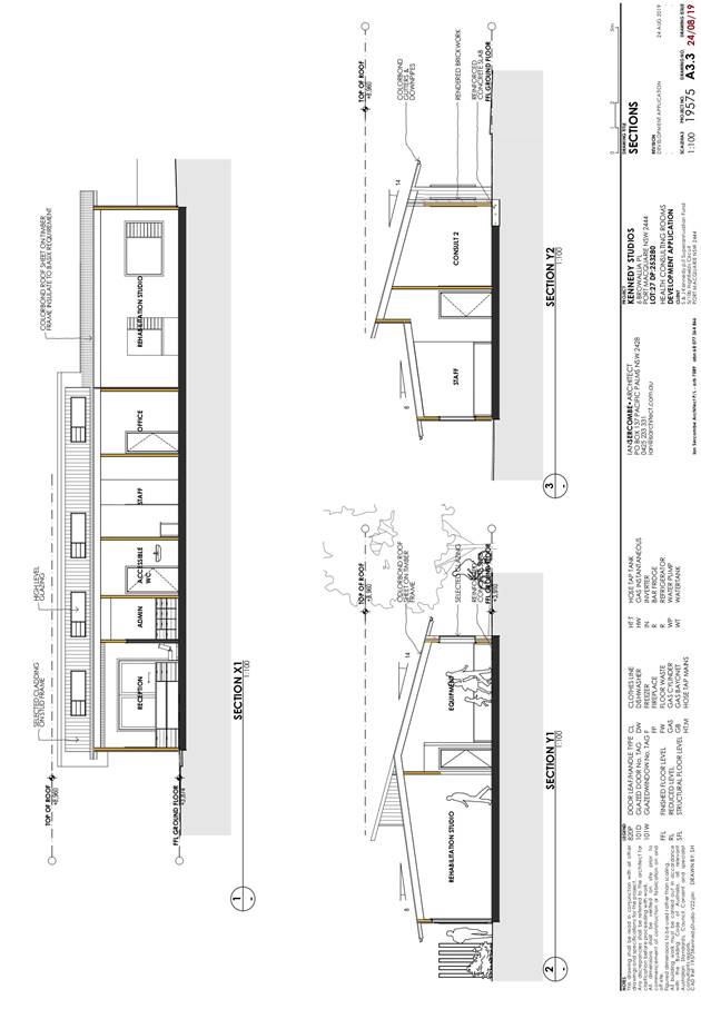
AGENDA Development Assessment Panel 23/10/2019
Item: 05
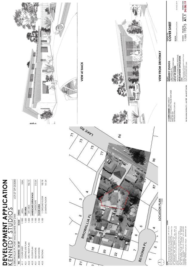
Subject: DA2019 - 621 Medical Centre - Lot 27 DP
253280, No 6 Browallia Place, Port Macquarie
Report
Author: Development Assessment Planner, Fiona Tierney
|
Applicant: Ian
Sercombe Architect
Owner: S
& J Kennedy
Estimated Cost: $353,120
Alignment with Delivery
Program
4.3.1 Undertake transparent
and efficient development assessment in accordance with relevant legislation.
|
|
RECOMMENDATION
That
DA 2019 - 621 for Medical
Centre at Lot 27, DP 253280, No. 6 Browallia Place,
Port Macquarie, be determined by
granting consent subject to the recommended conditions.
|
Executive
Summary
This
report considers a development application for a medical centre at the subject
site and provides an assessment of the application in accordance with the
Environmental Planning and Assessment Act 1979.
Following exhibition of the
application, one (1) submission was received.
The site is considered suitable
for the proposed development and the proposal adequately addresses relevant
planning controls. The development is not considered to be contrary to the
public’s interest and will not result in a significant adverse social,
environmental or economic impact.
This report recommends the
development application be approved subject to the conditions included as
Attachment 1.
1. BACKGROUND
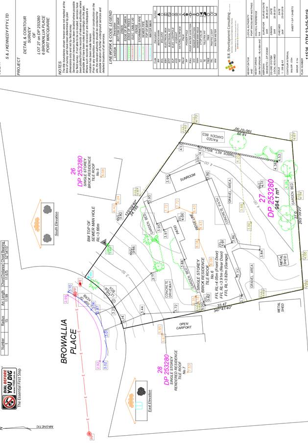
Existing Sites Features and Surrounding Development
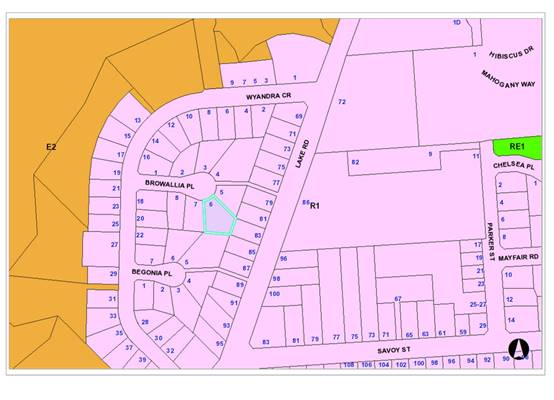
The site has an area of 984.2m2.
The site is zoned R1 General Residential in accordance with the Port Macquarie-Hastings Local
Environmental Plan 2011, as shown in the following zoning plan:
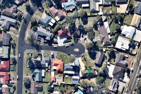
The existing subdivision pattern and location of existing
development within the locality is shown in the following aerial photograph:
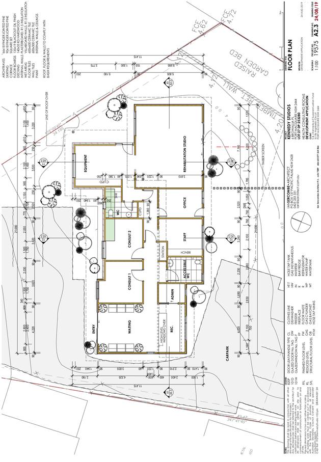
2. DESCRIPTION OF
DEVELOPMENT
Key aspects of the proposal include the following:
· Demolition
of the existing dwelling (retain existing slab)
· Construction of a medical centre and associated parking.
Refer
to Attachment 2 at the end of this report for plans of the proposed
development.
Application Chronology
· 30
August 2019 - Application lodged.
· 9
September - 23 September 2019 - Public exhibition via neighbour notification.
· 13
September - Additional information requested on staff/practitioner numbers.
· 13
September 2019 - Additional Information received.
3. STATUTORY ASSESSMENT
Section 4.15(1) Matters for Consideration
In determining the application, Council is required to take
into consideration the following matters as are relevant to the development
that apply to the land to which the development application relates:
(a) The provisions (where
applicable) of:
(i) Any Environmental
Planning Instrument
State Environmental Planning Policy 55 – Remediation
of Land
In accordance
with clause 7, following an inspection of the site and a search of Council
records, the subject land is not identified as being potentially contaminated
and is suitable for the intended use.
State Environmental Planning Policy 64 - Advertising and
Signage
The proposed
development includes proposed advertising signage in the form of a single
business/building identification sign.
In accordance
with clause 7, this SEPP prevails over the Port Macquarie-Hastings LEP 2011 in
the event of any inconsistency.
The following
assessment table provides an assessment checklist against the Schedule 1
requirements of this SEPP:
|
Applicable clauses for
consideration
|
Comments
|
Satisfactory
|
|
Clause 8(a) Consistent with objectives of the policy as
set out in Clause 3(1) (a).
|
Proposed business identification signage considered
consistent with the objectives.
|
Yes
|
Schedule 1(1) Character of
the area.
|
The proposed scale and number of signs is considered
acceptable having regard to the character of the residential area. Similar
signage exists for other medical centres in the locality.
|
Yes
|
|
Schedule 1(2) Special areas.
|
The site is not located in a special area.
|
Yes
|
|
Schedule 1(3) Views and vistas.
|
The signage would not compromise existing views or vistas
and would not project into the skyline.
|
Yes
|
|
Schedule 1(4) Streetscape, setting or landscape.
|
The proposed scale and number of signs is considered
acceptable having regard to the character of the residential area. The
signage would not require ongoing vegetation management.
|
Yes
|
|
Schedule 1(5) Site and building.
|
The proposed signage is compatible with the scale of the
building.
|
Yes
|
|
Schedule 1(6) Associated devices and logos with
advertisements and advertising structures.
|
None proposed.
|
n/a
|
|
Schedule 1(7) Illumination.
|
The signage is proposed to be illuminated. Conditions of
consent are to be applied that restrict illumination to approved hours of operation
of the business and no light overspill to adjoining properties. External
illumination only.
|
Yes
|
|
Schedule 1(7) Safety.
|
The proposal would not reduce safety on Browallia Pl or
reduce sightlines from public areas.
|
Yes
|
State Environmental Planning Policy (Infrastructure) 2007
In accordance
with clause 57(1), health services facilities (including medical centres) are
permissible with consent in the R1 General Residential zone, which is a
prescribed zone.
Port Macquarie-Hastings Local Environmental Plan 2011
· Clause 2.2 -
The subject site is zoned R1 General Residential.
· Clause
2.3(1) and the R1 zone landuse table - The proposed development for a change of
use from a single dwelling house to medical centre is a permissible landuse
with consent.
The objectives of the R1 zone are as
follows:
o To
provide for the housing needs of the community.
o To
provide for a variety of housing types and densities.
o To
enable other land uses that provide facilities or services to meet the day to
day needs of residents.
· Clause
2.3(2) - The proposal is consistent with the zone objectives having regard to
the following:
o The
proposal is a permissible landuse.
o The
development will provide a medical facility and service to meet the needs of
residents.
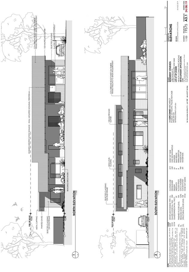
· Clause
4.3 - The maximum overall height of the building above ground level (existing)
is 5.05m which complies with the standard height limit of 8.5m applying to the
site.
· Clause
5.9 - No trees are proposed to be removed, however one tree (Melaleuca) in the
rear yard may have root systems impacted. The applicant has advised of his
desire to keep the tree and will propose a parking area adjoining the tree that
will allow root systems to be minimally impacted and water infiltration.
Council’s arborist has advised this is acceptable and Melaleuca trees are
quite tolerant of compaction over root systems as long as area around trunk is
kept well drained to prevent rotting.
· Clause
5.10 – Heritage. The site does not contain or adjoin any known heritage
items or sites of significance.
· Clause
7.13 - Satisfactory arrangements are in place for provision of essential
services including water supply, electricity supply, sewer infrastructure,
stormwater drainage and suitable road access to service the development.
(ii) Any
draft instruments that apply to the site or are on exhibition
Nil
(iii) Any
Development Control Plan in force
Port
Macquarie-Hastings Development Control Plan 2013
|
DCP 2013: General Provisions
|
|
DCP Objective
|
Development Provisions
|
Proposed
|
Complies
|
|
2.7.2.2
|
Design addresses generic principles of Crime Prevention
Through Environmental Design guideline:
· Casual surveillance
and sightlines
· Land use mix and
activity generators
· Definition of use and
ownership
· Lighting
· Way finding
· Predictable routes and
entrapment locations
|
The proposed development will be unlikely to create any
concealment/entrapment areas or crime spots that would result in any
identifiable loss of safety or reduction of security in the immediate area.
|
Yes
|
|
2.3.3.1
|
Cut and fill 1.0m max. 1m outside the perimeter of the
external building walls
|
<1m cut or fill outside the external walls of the
building.
|
Yes
|
|
2.3.3.8 onwards
|
Removal of hollow bearing trees
|
None proposed to be removed.
|
Yes
|
|
2.6.3.1
|
Tree removal (3m or higher with 100m diameter trunk and 3m
outside dwelling footprint
|
None proposed to be removed.
|
Yes
|
|
2.4.3
|
Bushfire risk, Acid sulphate soils, Flooding,
Contamination, Airspace protection, Noise and Stormwater
|
Refer to main body of report.
|
Yes
|
|
2.5.3.3
|
Off-street parking in accordance with Table 2.5.1:
· 3 per consultant
+ 1 per 2 employees. The proposal includes 1 practitioner and 2 employees,
therefore 5 spaces required.
|
It is proposed to construct 6 spaces including 1 disabled
accessible space. One additional space is available over the required
number of spaces on site for staff parking.
|
Yes
|
|
2.5.3.11
|
Section 94 A contributions
|
Refer to main body of report.
|
N/A
|
(iiia) Any
planning agreement that has been entered into under section 7.4, or any draft
planning agreement that a developer has offered to enter into under section 7.4
Nil
(iv) Any matters prescribed by the
Regulation
New South Wales Coastal Policy:
The proposed development is consistent with the objectives
and strategic actions of this policy.
Demolition
of buildings AS 2601:
Demolition of the existing building on the site is capable
of compliance with this Australian Standard and is recommended to be
conditioned.
(b) The
likely impacts of that development, including environmental impacts on both the
natural and built environments, social and economic impacts in the locality
Context and Setting
The site is
located within an existing residential area. The precinct is located in an area
in close proximity to the private hospital and several other medical centres.
This has encouraged a cluster of associated medical professionals to locate
their premises within this area.
The proposal is the second medical centre within the
cul-de-sac and is considered to be a low scale development that does not
involve external additional bulk and scale to the existing building and is not
considered to be at odds with the character of the locality. The development
adequately responds to planning controls for the area.
Access, Transport and Traffic Roads
The site has road frontage to Browallia Place, a sealed
public road under the care and control of Council, with an 8m wide carriageway
within a 16m road reserve. Upright (SA) type kerb and gutter is present in the
street, with a small section of footpath paving existing outside the medical
centre at 2 Browallia Place. Browallia Place is an Urban Access Place under the
AUSPEC standard, and is a cul-de-sac with access to Lake Road via Wyandra
Crescent.
Traffic and Transport
It is likely the existing land use as a residential dwelling
generates around 9 vehicle trips per day on average. The RMS Guide to
Traffic Generating Developments (2002) provides guidance on traffic
generation for commercial developments. Using the rate for medical centres we
can assume a lower range rate of 3.1 vehicle trips per 100 square metres of
floor area per hour during the evening peak hour. This equates to daily traffic
generation of between 20 and 40 vehicle trips per day.
Public submissions received during exhibition of the DA
mention that under existing conditions Browallia Place is congested by parked
vehicles, sometimes restricting available traffic width to one lane. Safety
concerns are highlighted by nearby residents with the visibility of pedestrian
and bicycle users under these conditions.
However, the AUSPEC ‘Access Place’ standard has
capacity for up to 30 dwellings, and the low speed, low traffic environment of
the short cul-de-sac is consistent with the standard of an ‘Access
Place’. With regard to the above factors, the increase in traffic
associated with the development is within the capacity of the existing public
road network.
Site Frontage and Access
The existing driveway access to the site is approximately
3.0m wide. This crossover will need to be removed and replaced with a
‘heavy duty’ commercial driveway to Council’s AUSPEC Standard
Drawing 202 due to the increase in traffic. The minimum width of the crossing
shall be 5.5m to allow two vehicles to pass and provide additional manoeuvring
clearance.
Council’s footpath policy specifies that for new
developments, a concrete footpath shall be provided along one side of Access
Place roads. A 1.5m wide footpath will be required along the full frontage of
the development site. This is consistent with the change in use of the site to
a medical centre, and the likely increase in pedestrian traffic using the
existing footpath directly to Lake Road is considered to warrant it.
Parking and Manoeuvring
A total of six parking spaces (including one disabled space
and adjacent shared area) have been shown on the plans. For use as a public
carpark with short term turnover (such as a medical centre), the minimum
dimensions of spaces and aisles are required to meet User Class 3 of AS2890.
The dimensions shown on the plans do not meet this standard. However, the
dimensions on Construction Certificate plans can comply and conditions have
been imposed to reflect these requirements.
Commercial developments are required to provide vehicles
with the ability to exit to the public road in a forward direction.
Additionally, if all spaces are full and another vehicle enters the carpark,
they must have the opportunity to turn around and exit. One of the parking
spaces shall be line marked with ‘No Parking’ for use as a
dedicated turning bay, unless the Construction Certificate details provide an
adequate area for turning.
A condition is recommended requiring the number of spaces to
be provided on site as set out in the DCP. Any proposed increase in the
number of consultants will require a modification application.
Water Supply Connection
Records indicate that the current development site has a
20mm metered water service from the 100mm AC water main on the same side of Browallia
Place. Final water service sizing will need to be determined by a hydraulic
consultant to suit the domestic and commercial components of the development,
as well as fire service and backflow protection requirements. Minimum
containment backflow protection for medical facilities is an RPZD at the
property boundary. Minimum water service size for commercial development is
25mm.
Sewer Connection
Sewer is available and connected to the site via a 150mm
main that traverses the adjacent properties at the rear of the lot. Council
records indicate that the existing junction is on the north western property
boundary. The existing junction can be used for the proposed development.
Stormwater
The site naturally grades towards Browallia Place street
frontage and is currently serviced via an existing kerb outlet. There are no
known issues relating to stormwater infrastructure in this location.
The legal point of discharge for the proposed development is
defined as a direct connection to Council’s kerb and gutter with the use
of an approved adaptor (one per lot only), as there is no public piped drainage
system in close proximity to the frontage of the site. Nearest public
stormwater pit is approximately 70 metres west of the site.
Due to an increase in impervious area the development will
require on-site detention (OSD) to limit site discharge to pre-development flow
rates, as per the requirements of AUSPEC D5, where pre-development conditions
suitable for this location is existing conditions.
Submitted plans do not demonstrate stormwater provisions,
including OSD, however, preliminary assessment of the development site
indicates that adequate fall towards the street frontage, and upstream
neighbouring properties having access to an interallotment system should allow
for conventional OSD design suitable for this development i.e. Rainwater re-use
tanks (for roof catchments) and / or above ground OSD in car parking areas.
Preliminary assessment of expected OSD volume required for
this development, consistent with similar sized developments, should be less
than 11m3 of storage volume, as the proposed approximate impervious
area is 60%, which is typical for residential developments.
A detailed site stormwater management plan will be required
to be submitted for assessment with the Section 68 application and prior to the
issue of a CC.
Other Utilities
Telecommunication and electricity services are available to
the site.
Soils
The proposed
development will be unlikely to have any adverse impacts on soils in terms of
quality, erosion, stability and/or productivity subject to a standard condition
requiring erosion and sediment controls to be in place prior to and during
construction.
Air and Micro-climate
The
construction of the proposed development will be unlikely to result in any
adverse impacts on the existing air quality or result in any pollution.
Flora and Fauna
Construction
of the proposed development will not require removal/clearing of any
significant vegetation.
Waste
Satisfactory
arrangements are in place for proposed storage and collection of waste and
recyclables. No adverse impacts anticipated.
Energy
No adverse
impacts. The proposal will be required to comply with the Building Code of
Australia.
Noise and Vibration
No adverse
impacts anticipated. A condition is recommended to restrict construction to
standard construction hours.
The proposed
operating hours are considered appropriate for the residential zoning
applicable to the site. The proposed operating hours are: Monday to Friday:
8.30am to 8pm.
Natural Hazards
The site is
not identified as bushfire prone.
Safety, Security and Crime Prevention
The proposed development will be unlikely to create any
concealment/entrapment areas or crime spots that would result in any
identifiable loss of safety or reduction of security in the immediate area.
Social Impact in the Locality
Given the
nature of the proposed development, the proposal is unlikely to result in any
adverse social impacts.
Economic Impact in the Locality
No adverse
impacts. Likely positive impacts can be attributed to the construction of the
development and associated flow on effects (i.e. increased expenditure in the
area).
Site Design and Internal Design
The proposed development design satisfactorily responds to
the site attributes and will fit into the locality. No adverse impacts are
likely.
Construction
No potential
adverse impacts identified to neighbouring properties with the construction of
the proposal.
Cumulative Impacts
The proposed health consulting
rooms are located in an area where there are increasing pressures in relation
to parking and traffic generation (particularly at either end of Wyandra Cr).
Given that the proposal is for a single practitioner that is located in a
cul-de-sac where there are one other health service facilities it is considered
that the proposed development is not expected to have sufficiently adverse
cumulative impacts that would justify refusal of the application.
(c) The suitability of the site for
the development
The proposal will fit into the locality and the site
attributes are conducive to the proposed development.
Site
constraints of have been adequately addressed and appropriate conditions of
consent recommended.
(d) Any submissions made in
accordance with this Act or the Regulations
One (1) written submission has been received following public
exhibition of the application. Copies of the written submission has been
provided under separate cover to members of the DAP.
Key issues raised in the submission and comments in
response are provided as follows:
|
Submission Issue/Summary
|
Planning Comment/Response
|
|
Overdevelopment in the street-
inconsistent with residential use.
|
The proposal is for a single
specialist practitioner. This is considered appropriately compatible for a
residential area. The proposed development does not include weekend opening
times.
|
|
Traffic and parking issues
|
The applicant has provided 6 spaces on site and complies
with the requirements of the Development Control Plan. (See assessment DCP
table).
It is acknowledged that the area is undergoing
significant change in character with significant demand for medical
practitioners to be close to the private hospital. One additional space has
been provided above the minimum requirements of the DCP.
|
|
Sign illuminated-unsuitable impacts
|
A condition of consent is recommended to limit
illumination only during the approved hours of operation and no flashing or
light overspill to adjoining properties is permitted. (Attachment 1)
|
|
Tree removal
|
The applicant has advised that their intention is to
remove some shrubs but that all trees in the rear yard would be retained. The
tree adjoining the fence has root systems that may be impacted and the
applicant has advised that they are proposing to use a surface around this
area that allows water infiltration rather than a solid concrete and required
minimal ground surface disturbance. A condition of consent has been recommended
to address this matter (Attachment 1).
|
(e) The Public Interest:
The proposed
development satisfies relevant planning controls and will not adversely impact
on the wider public interest.
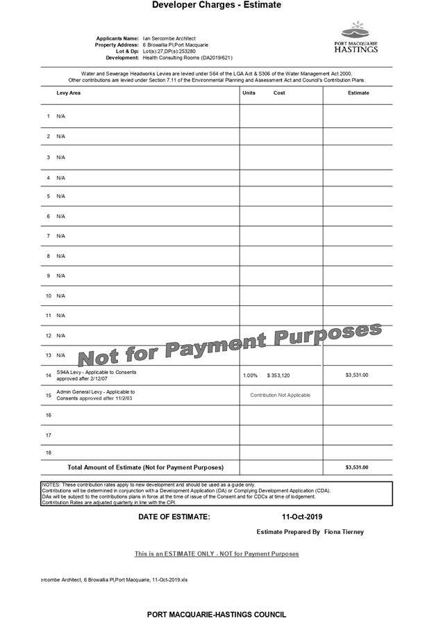
4. DEVELOPMENT
CONTRIBUTIONS APPLICABLE
· Development contributions will be required in accordance
with Section 7.12 of the Environmental Planning and Assessment Act 1979.
· A copy of the contribution estimate is included as
Attachment 3.
5. CONCLUSION AND
STATEMENT OF REASON
The application has been assessed
in accordance with Section 4.15 of the Environmental Planning and Assessment
Act 1979.
Issues raised during assessment
and public exhibition of the application have been considered in the assessment
of the application. Where relevant, conditions have been recommended to manage
the impacts attributed to these issues.
The site is considered suitable
for the proposed development and the proposal adequately addresses relevant
planning controls. The development is not considered to be contrary to the
public's interest and will not result a significant adverse social,
environmental or economic impact. It is recommended that the application be
approved, subject to the recommended conditions of consent provided in the
attachment section of this report.
|
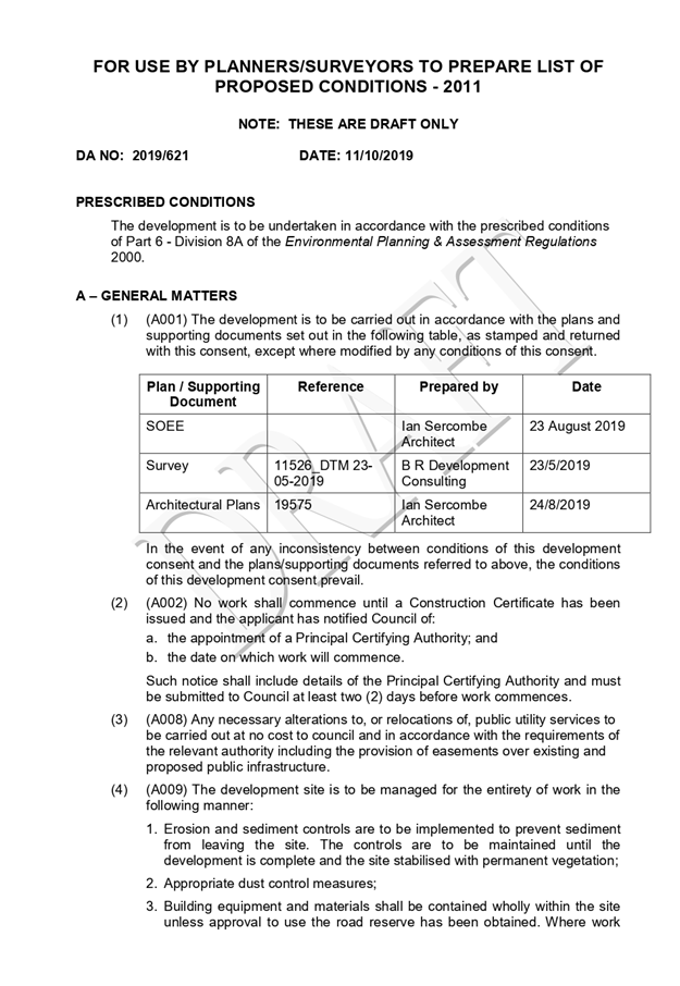
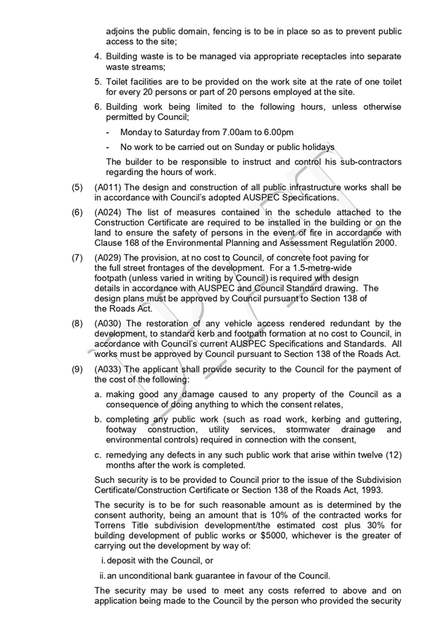
Attachments
1View. DA2019
- 621.1 Recommended Conditions
2View. DA2019
- 621.1 Plans
3View. DA2019
- 621.1 Development Contribution Estimate
|
|
ATTACHMENT
|
Development Assessment Panel
23/10/2019
|

|
ATTACHMENT
|
Development Assessment Panel
23/10/2019
|
|
ATTACHMENT
|
Development Assessment Panel
23/10/2019
|
AGENDA Development Assessment Panel 23/10/2019
Item: 06
Subject: DA2019 - 476.1 Change of Use from Medical
Centre to Dual Occupancy and Torrens Title Subdivison, Lot 5 DP 226787, 70 Hill
Street, Port Macquarie
Report
Author: Development Assessment Planner, Benjamin Roberts
|
Applicant: Rob
Beukers
Owner: J
L Hill
Estimated Cost: $250,000
Alignment with Delivery
Program
4.3.1 Undertake transparent
and efficient development assessment in accordance with relevant legislation.
|
|
RECOMMENDATION
That
DA 2019 - 476 for a change of use
from medical centre to dual occupancy and Torrens title subdivision at Lot 5, DP
226787, No. 70 Hill Street, Port
Macquarie, be determined by granting consent subject to the recommended
conditions.
|
Executive
Summary
This
report considers a development application for a change of use from medical
centre to dual occupancy and Torrens title subdivision at the subject site and
provides an assessment of the application in accordance with the Environmental
Planning and Assessment Act 1979.
Following exhibition of the
application, one (1) submission was received.
The site is considered suitable for the proposed development
and the proposal adequately addresses relevant planning controls. The
development is not considered to be contrary to the public's interest and will
not result a significant adverse social, environmental or economic impact.
This report recommends that the
development application be approved subject to the conditions included as
Attachment 1.
1. BACKGROUND
Existing Sites Features and Surrounding Development
The site has an area of
approximately 620m2.
The site is zoned R1 General Residential in accordance with the Port Macquarie-Hastings Local
Environmental Plan 2011, as shown in the following zoning plan:
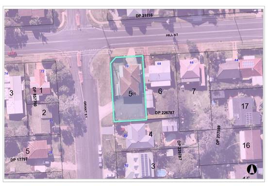
The existing subdivision pattern and location of existing
development within the locality is shown in the following aerial photograph:
2. DESCRIPTION OF
DEVELOPMENT
Key aspects of the proposal include the following:
· Conversion
of existing medical centre building to a dwelling.
· Construction
of a new dwelling.
· Torrens
title subdivision.
Refer
to Attachment 2 at the end of this report for plans of the proposed
development.
Application Chronology
· 3
July 2019 - Application lodged.
· 5
July 2019 - Additional information request.
· 9 - 22 July 2019 - Public exhibition via neighbour
notification.
· 2 September 2019 - Additional information provided.
3. STATUTORY ASSESSMENT
Section 4.15(1) Matters for Consideration
In determining the application, Council is required to take
into consideration the following matters as are relevant to the development
that apply to the land to which the development application relates:
(a) The provisions (where
applicable) of:
(i) Any Environmental
Planning Instrument
State Environmental Planning Policy No. 44 - Koala
Habitat Protection
There is no Koala Plan of Management on the site.
Additionally, the site is less than 1ha in area therefore no further
investigations are required.
State Environmental Planning Policy No. 55 –
Remediation of Land
Following an inspection of the site and a search of Council
records, the subject land is not identified as being potentially contaminated
and is suitable for the intended use.
State Environmental Planning Policy (Building
Sustainability Index: BASIX) 2004
BASIX certificates have been submitted demonstrating that
the proposal will comply with the requirements of the SEPP. It is recommended
that a condition be imposed to ensure that the commitments are incorporated
into the development and certified at Occupation Certificate stage.
Port
Macquarie-Hastings Local Environnemental Plan 2011
The proposal is consistent with the LEP having regard to the
following:
· Clause 2.2 -The subject site is zoned R1 General
Residential.
· Clause 2.3(1) and the R1 zone landuse table - dual
occupancy and subdivision is a permissible landuse with consent.
· The objectives of the R1 zone are as follows:
o To provide for the housing needs of the community.
o To provide for a variety of housing types and densities.
o To enable other land uses that provide facilities or
services to meet the day to day needs of residents.
· Clause
2.3(2) - The proposal is consistent with the zone objectives as it is a
permissible landuse and consistent with the established residential locality.
The proposal will contribute to the range of housing options available.
· Clause
4.1A - The proposal includes the construction of a new dwelling and Torrens
subdivision. The Torrens subdivision to create lots
smaller than the 450m2 minimum lot size specified on the Lot Size
Map is therefore permitted.
· Clause
4.3 - The maximum overall height of the new building above ground level
(existing) complies with the height limit of 8.5m applying to the site.
· Clause
4.4 - The floor space ratio of the proposal complies with the maximum 1:1 floor
space ratio applying to the site.
· Clause
5.10 – Heritage. The site does not contain or adjoin any known heritage
items or sites of significance.
· Clause
7.13 - Satisfactory arrangements are in place for provision of essential
services including water supply, electricity supply, sewer infrastructure,
stormwater drainage and suitable road access to service the development.
(ii) Any
draft instruments that apply to the site or are on exhibition
No draft
instruments apply.
(iii) Any
Development Control Plan in force
Port
Macquarie-Hastings Development Control Plan 2013
|
DCP 2013: Dwellings, Dual occupancies, Dwelling
houses, Multi dwelling houses & Ancillary development
|
|
|
Requirements
|
Proposed
|
Complies
|
|
3.2.2.2
|
Articulation zone:
· Min. 3m front
setback
· An entry feature
or portico
· A balcony, deck,
patio, pergola, terrace or verandah
· A window box
treatment
· A bay window or
similar feature
· An awning or
other feature over a window
· A sun shading
feature
|
The new dwelling contains an entry porch feature setback
3m to the Grant Street property boundary.
|
Yes
|
|
Front setback (Residential not R5 zone):
· Min. 4.5m local
road
· Min. 3.0m
secondary road
|
No change to setbacks of existing building. 3m setback
provided to Grant Street boundary, which is the secondary frontage.
|
Yes
|
|
3.2.2.3
|
Garage 5.5m min. and 1m behind front façade.
Garage door recessed behind building line or
eaves/overhangs provided
|
The garage to the new dwelling is setback 5.5m and greater
than 1m behind the building line to the Grant Street frontage.
There is no change to the existing setback to Hill Street
via conversion of the ground floor office to a garage. The garage doors are
recessed behind the main building lines.
|
Yes
|
|
6m max. width of garage doors and 50% max. width of
building
|
Width of garage door requirements are complied with.
|
Yes
|
|
Driveway crossovers 1/3 max. of site frontage and max.
5.0m width
|
Driveway crossing width requirements are complied with.
|
Yes
|
|
3.2.2.4
|
4m min. rear setback. Variation subject to site analysis
and provision of private open space
|
The site is a corner block. No rear setback requirement.
|
N/A
|
|
3.2.2.5
|
Side setbacks:
· Ground floor = min. 0.9m
· First floors & above = min. 3m setback or where it
can be demonstrated that overshadowing not adverse = 0.9m min.
· Building wall set in and out every 12m by 0.5m
|
New dwelling single storey.
South side setback = 1.05m.
East side setback = 1.1m.
The wall articulation is compliant
and satisfies the objectives of the development provision.
|
Yes
|
|
3.2.2.6
|
35m2 min. private open space area including a useable 4x4m
min. area which has 5% max. grade
|
Each occupancy contains minimum of 35m² open space in
one area including a useable 4m x 4m area directly off the ground floor
living area.
|
Yes
|
|
3.2.2.7
|
Front fences:
· If solid 1.2m max height and front setback 1.0m with
landscaping
· 3x3m min. splay for corner sites
· Fences >1.2m to be 1.8m max. height for 50% or 6.0m
max. length of street frontage with 25% openings
· 0.9x0.9m splays adjoining driveway entrances
|
No new fencing proposed.
|
N/A
|
|
3.2.2.8
|
Front fences and walls to have complimentary materials to
context
No chain wire, solid timber, masonry or solid steel front
fences
|
No new fencing proposed.
|
N/A
|
|
3.2.2.10
|
Privacy:
· Direct views between living areas of adjacent dwellings
screened when within 9m radius of any part of window of adjacent dwelling and
within 12m of private open space areas of adjacent dwellings. ie. 1.8m fence
or privacy screening which has 25% max. openings and is permanently fixed
· Privacy screen required if floor level > 1m height,
window side/rear setback (other than bedroom) is less than 3m and sill height
less than 1.5m
· Privacy screens provided to balconies/verandahs etc which
have <3m side/rear setback and floor level height >1m
|
The new dwelling is single
storey in construction and the primary living and open space area are
orientated north. There are no elevated living areas orientated south that
would compromise privacy to the adjacent dwelling.
|
Yes
|
|
DCP 2013: General
Provisions
|
|
|
Requirements
|
Proposed
|
Complies
|
|
2.7.2.2
|
Design addresses generic
principles of Crime Prevention Through Environmental Design guideline
|
No concealment or entrapment
areas proposed. Adequate casual surveillance available.
|
Yes
|
|
2.3.3.1
|
Cut and fill 1.0m max. 1m
outside the perimeter of the external building walls
|
No cut or fill more than 1m
proposed.
|
Yes
|
|
2.3.3.2
|
1m max. height retaining walls
along road frontage
|
No retaining walls proposed
along rod frontages.
|
N/A
|
|
Any retaining wall >1.0 in
height to be certified by structure engineer
|
No retaining walls proposed.
|
N/A
|
|
Combination of retaining wall
and front fence height max 1.8m, max length 6.0m or 30% of frontage, fence
component 25% transparent, and splay at corners and adjacent to driveway
|
No retaining wall or fencing
combination proposed.
|
N/A
|
|
2.3.3.8
|
Removal of hollow bearing trees
|
No hollow bearing trees proposed
to be removed
|
N/A
|
|
2.6.3.1
|
Tree removal (3m or higher with
100m diameter trunk at 1m above ground level and 3m from external wall of
existing dwelling)
|
No tree removal proposed.
|
N/A
|
|
2.4.3
|
Bushfire risk, Acid sulphate
soils, Flooding, Contamination, Airspace protection, Noise and Stormwater
|
Refer to main body of report.
|
Yes
|
|
2.5.3.2
|
New accesses not permitted from
arterial or distributor roads
|
No new access proposed to
arterial or distributor road.
|
N/A
|
|
Driveway crossing/s minimal in
number and width including maximising street parking
|
Driveway crossings are existing
and acceptable.
|
Yes
|
|
2.5.3.3
|
Parking in accordance with Table
2.5.1.
Dual Occupancy
1 space per dwelling/occupancy
(behind building line).
|
Proposal involves a double
garage to the new dwelling and conversion of ground floor area to provide a
single garage to the existing dwelling. Sufficient parking is proposed.
|
Yes
|
|
2.5.3.11
|
Section 94 contributions
|
Contributions apply - refer to ET calc and NOP.
|
Yes
|
|
2.5.3.12 and 2.5.3.13
|
Landscaping of parking areas
|
Suitable existing landscaping
around driveway/parking locations.
|
Yes
|
|
2.5.3.14
|
Sealed driveway surfaces unless
justified
|
Existing driveways are sealed.
|
Yes
|
|
2.5.3.15 and 2.5.3.16
|
Driveway grades first 6m or
‘parking area’ shall be 5% grade with transitions of 2m length
|
Driveways are existing.
|
Yes
|
|
2.5.3.17
|
Parking areas to be designed to
avoid concentrations of water runoff on the surface.
|
Stormwater drainage is capable
of being managed as part of plumbing construction.
|
Yes
|
(iiia) Any
planning agreement that has been entered into under section 7.4, or any draft
planning agreement that a developer has offered to enter into under section 7.4
No planning
agreement has been offered or entered into.
iv) Any matters prescribed by the
Regulations
No
matters prescribed by the regulations apply.
(b) The
likely impacts of that development, including environmental impacts on both the
natural and built environments, social and economic impacts in the locality:
Context and
setting
· The
proposal will be unlikely to have any adverse impacts to existing adjoining
properties and satisfactorily addresses the public domain.
· The proposal is sufficiently compatible with other existing
residential development in the locality and adequately addresses planning
controls for the area.
· There
are no significant adverse impacts on existing view
sharing. Specifically, the view currently enjoyed across the site from 80 Grant
Street is not special or iconic and is across the side boundary. The impacts to
this view are negligible. The proposal is single storey in nature and below the
maximum 8.5m building height control applicable to the site. The complete
retention of the existing view is unrealistic having regard to the planning
controls.
· No adverse privacy impacts would result from the proposal.
Specifically, the new dwelling is single
storey in construction and the primary living and open space area is orientated
north. There are no elevated living areas or living rooms orientated south that
would compromise privacy to the adjacent dwelling at 80 Grant Street.
· There are no identified adverse overshadowing impacts to
the adjoining property at 80 Grant Street. Specifically, the new dwelling is
single storey in nature, the adjoining property contains a side access down
this boundary and the dwelling is setback approximately 2.5m from the boundary.
The adjoining dwelling is also two storey with elevated living and deck areas.
The proposal does not prevent the adjoining property from receiving 3 hours of
sunlight to private open space and primary living areas on 21 June.
·
Roads
The site has road frontages to Grant Street and Hill Street.
Adjacent to the site, Grant Street
is a sealed public road under the care and control of Council. Grant Street is
a Local road with a 14m road width within a 30m road reserve. There is SA kerb
and gutter, a pedestrian refuge island at the intersection and on-street
parking available.
Adjacent to the site, Hill Street
is a sealed public road under the care and control of Council. Hill Street is a
Collector road with an 11m road width within a 20m road reserve. There is SA
kerb and gutter and a 1.2m wide footpath on the northern side and on-street
parking available.
Traffic and Transport
This development proposes to generate an additional 9 daily
trips. The addition in traffic associated with the development is unlikely to
have any adverse impacts to the existing road network within the immediate
locality.
Site Frontage and Access
Vehicle access to the existing and new building are proposed
through existing driveways with direct frontages to Grant and Hill Streets,
being Council-owned public roads. As these remain in good condition, no further
driveway works will be required under the subdivision application.
Parking and Manoeuvring
Parking and driveway widths comply with relevant Australian
Standards (AS 2890).
Water Supply Connection
Council records indicate that the development site has an
existing 20mm meter. The site is fronted by 150mm diameter PVC water
mains on the opposite side of Hill Street and the opposite side of Grant
Street. An additional water service is required to service the development.
Engineering plans are required to show all proposed water services to the lot.
Details will
be required to accompany the section 68 application. Refer to recommended
conditions of consent.
Sewer Connection
Council records indicate that the development site has an
existing junction from the sewer main which runs inside the eastern boundary of
the development lot. Torrens title subdivision shall require provision of a
sewer service to each lot. Engineering plans shall be required as part of the
Construction Certificate (Infrastructure) application.
Details will also be required to
accompany the section 68 application. Refer to recommended conditions of
consent.
Stormwater
The site
naturally grades towards the northeast corner of the property and is currently
serviced via an existing inter-allotment drainage system connecting to a kerb
outlet on Hill Street.
The legal
point of discharge for the proposed development is defined as a direct
connection to the existing inter-allotment drainage system servicing the site,
providing that a suitably qualified plumber inspects the line and deems it to
be in good condition. A new 600 x 600 grated surcharge pit will also need to be
installed into the line, inside the property boundary adjacent to the road
reserve.
Stormwater
from the proposed development is planned to be disposed via inter-allotment
drainage, which is consistent with the above requirements.
A detailed
site stormwater management plan will be required to be submitted for assessment
with the Section 68 application and prior to the issue of a building construction
certificate.
In accordance
with Councils AUSPEC requirements, the following must be incorporated into the
stormwater drainage plan:
· Provision
of inter-allotment drainage to allow the proposed development to drain to the
nominated point of discharge via a single suitably sized conduit. If after
inspection by a suitably qualified plumber the existing inter-allotment line is
deemed to be in an unserviceable condition, then a new inter-allotment
arrangement will need to be established, in a dedicated easement, clear of any
conflicting services.
Other Utilities
Telecommunication and electricity services are available to
the site.
Heritage
No known items of Aboriginal or European heritage
significance exist on the property. No adverse impacts anticipated. The site is
in a residential context and considered to be disturbed land.
Other land resources
The site is within an established urban context and will not
sterilise any significant mineral or agricultural resource.
Water cycle
The proposed development will be unlikely to have any
adverse impacts on water resources and the water cycle.
Soils
The proposed development will not have any significant
adverse impacts on soils in terms of quality, erosion, stability and/or
productivity subject to a standard condition requiring erosion and sediment
controls to be in place prior to and during construction.
Air and microclimate
The construction and/or operations of the proposed
development will be unlikely to result in any adverse impacts on the existing
air quality or result in any pollution. Standard precautionary site management
condition recommended.
Flora and fauna
Construction of the proposed development will not require
any removal/clearing of any native vegetation and therefore does not trigger
the biodiversity offsets scheme. Part 7 of the Biodiversity Conservation
Act 2016 is considered to be satisfied.
Waste
Satisfactory arrangements are in place for proposed storage
and collection of waste and recyclables. No adverse impacts anticipated.
Standard precautionary site management condition recommended.
Energy
The proposal includes measures to address energy efficiency
and will be required to comply with the requirements of BASIX.
Noise and vibration
No adverse impacts anticipated. Condition recommended to
restrict construction to standard construction hours.
Bushfire
The site is not identified as being bushfire prone.
Safety, security and crime prevention
The proposed development will be unlikely to create any
concealment/entrapment areas or crime spots that would result in any
identifiable loss of safety or reduction of security in the immediate area. The
increase in housing density will improve natural surveillance within the
locality and openings from each dwelling overlook common and private areas.
Social impacts in the locality
Given the nature of the proposed development and its’
location the proposal is unlikely to result in any adverse social impacts.
Economic impact in the locality
No adverse impacts. A likely positive impact is that the
development will maintain employment in the construction industry, which will
lead to flow impacts such as expenditure in the area.
Site design and internal design
The proposed development design satisfactorily responds to
the site attributes and will fit into the locality. No adverse impacts likely.
Construction
Construction impacts are considered capable of being
managed, standard construction and site management conditions have been
recommended.
Cumulative impacts
The proposed development is not expected to have any adverse
cumulative impacts on the natural or built environment or the social and
economic attributes of the locality.
(c) The suitability of the site for
the development
The proposal
will fit into the locality and the site attributes are conducive to the
proposed development.
(d) Any submissions made in
accordance with this Act or the Regulations
One (1) written submission was received following public exhibition
of the application. Copies of the written submissions have been provided under
separate cover to members of the DAP.
Key issues raised in the submission received and comments
in response to these issues are provided as follows:
|
Submission
Issue/Summary
|
Planning
Comment/Response
|
|
The new dwelling would
significantly impact on existing solar access to the north facing living room
and kitchen of the adjoining dwelling at 80 Grant Street.
|
There are no identified
adverse overshadowing impacts to the adjoining property at 80 Grant Street.
The new dwelling is single storey in nature, the adjoining property contains
a side access down the boundary and the dwelling is setback approximately
2.5m from the boundary. The adjoining dwelling is also two storey with
elevated living and deck areas. The proposal does not prevent the adjoining
property from receiving 3 hours of sunlight to private open space and primary
living areas on 21 June.
|
|
The new dwelling would block a significant view enjoyed
from the adjoining dwelling at 80 Grant Street.
|
There are no
significant adverse impacts on existing view
sharing. The view currently enjoyed across the site from 80 Grant Street is
not special or iconic and is across the side boundary. The impacts to this
view are negligible. The proposal is single storey in nature and below the
maximum 8.5m building height control applicable to the site.
|
(e) The Public Interest
The proposed
development satisfies relevant planning controls and will not adversely impact
on the wider public interest.
4. DEVELOPMENT
CONTRIBUTIONS APPLICABLE
· Development
contributions will be required towards augmentation of town water supply and
sewerage system head works under Section 64 of the Local Government Act 1993.
· Development
contributions will be required in accordance with Section 7.11 of the
Environmental Planning and Assessment Act 1979 towards roads, open space,
community cultural services, emergency services and administration buildings.
· A
copy of the contribution estimate is included as Attachment 3.
5. CONCLUSION AND
STATEMENT OF REASON
The application has been assessed
in accordance with Section 4.15 of the Environmental Planning and Assessment
Act 1979.
Issues raised during assessment
and public exhibition of the application have been considered in the assessment
of the application. Where relevant, conditions have been recommended to manage
the impacts attributed to these issues.
The site is considered suitable
for the proposed development and the proposal adequately addresses relevant
planning controls. The development is not considered to be contrary to the
public's interest and will not result a significant adverse social,
environmental or economic impact. It is recommended that the application be
approved, subject to the recommended conditions of consent provided in the
attachment section of this report.
|
Attachments
1View. DA2019
- 476.1 Recommended Conditions
2View. DA2019
- 476.1 Plans
3View. DA2019
- 476.1 Contributions Quote
|
|
ATTACHMENT
|
Development Assessment Panel
23/10/2019
|
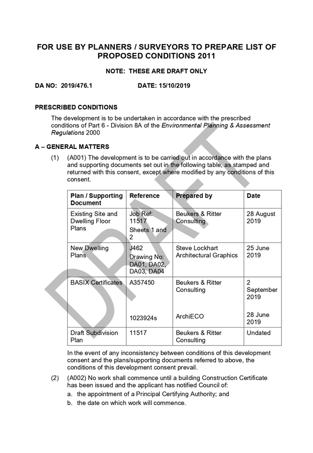
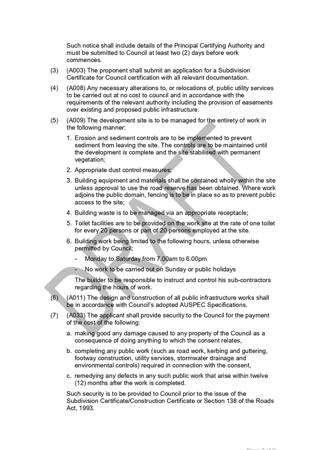

|
ATTACHMENT
|
Development Assessment Panel
23/10/2019
|
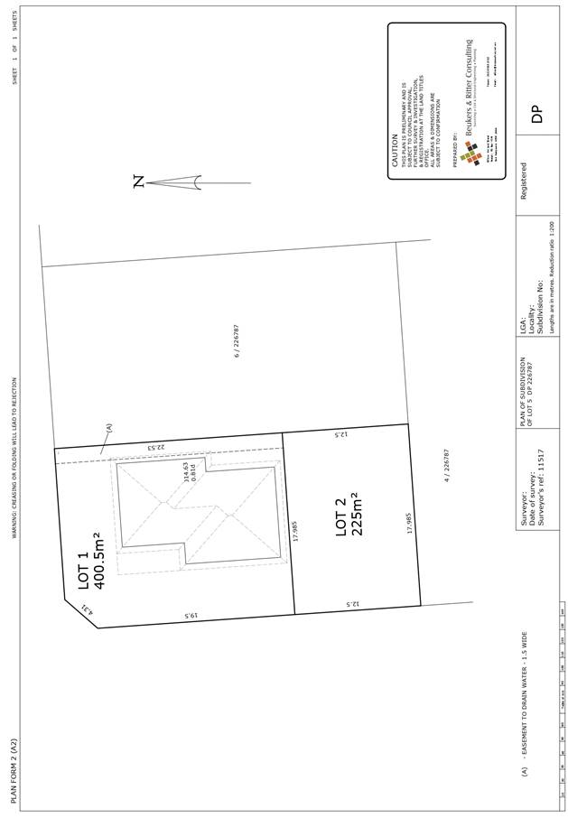
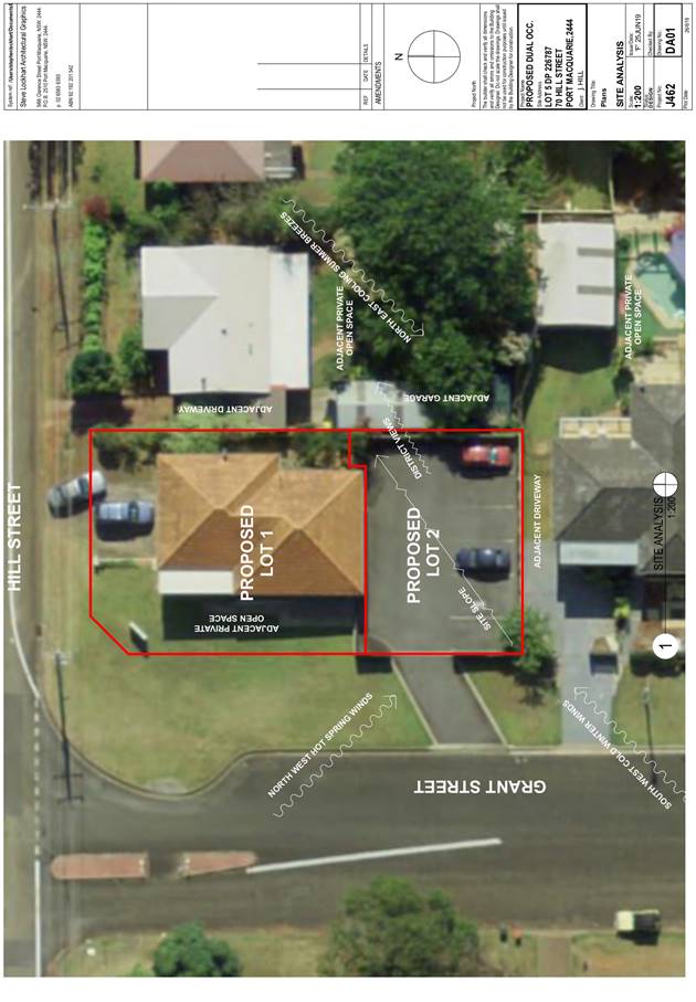
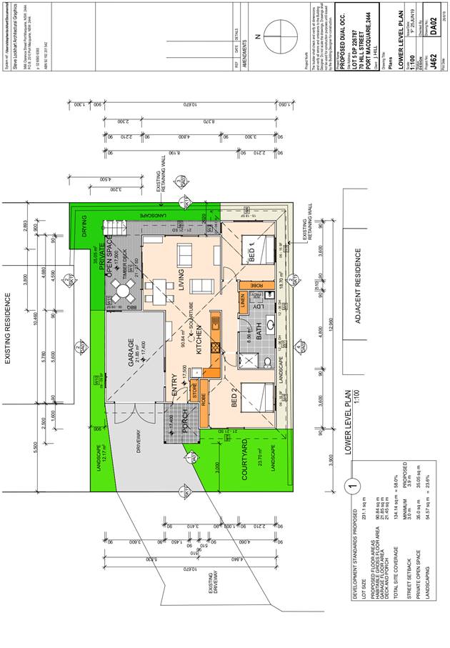
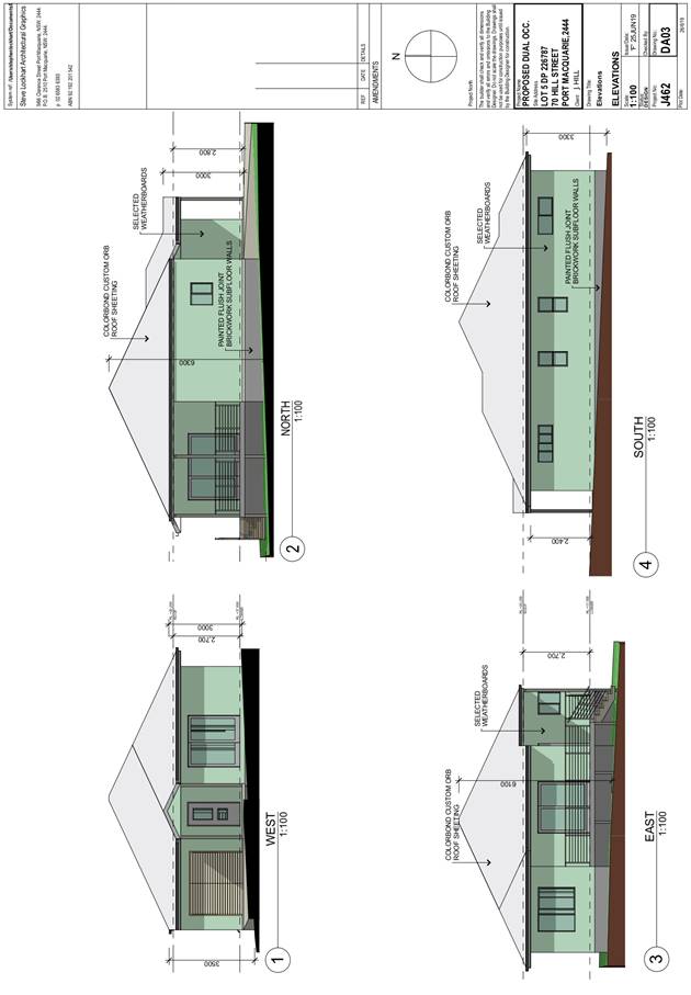
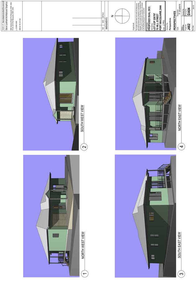
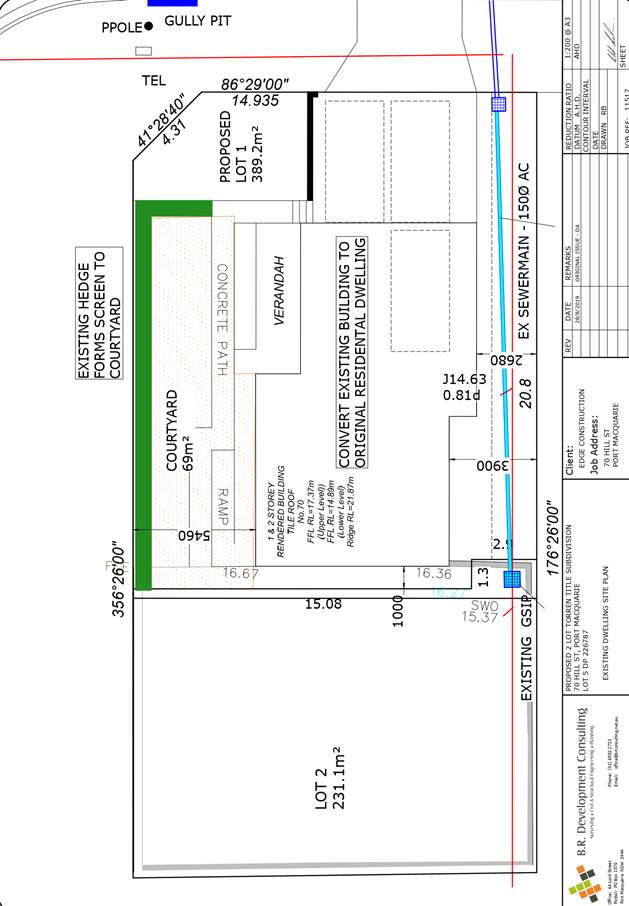
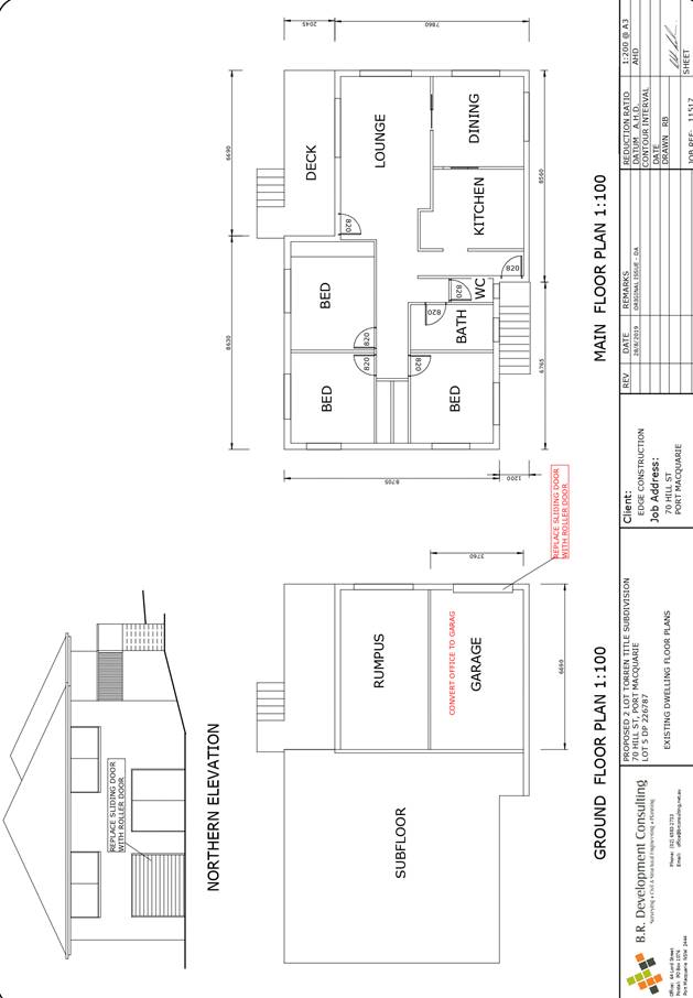
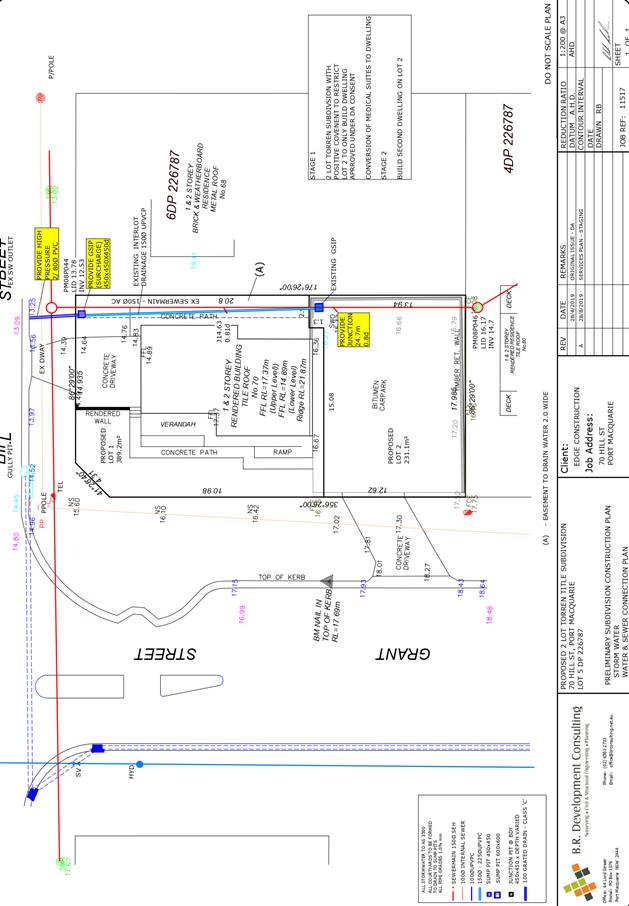
|
ATTACHMENT
|
Development Assessment Panel
23/10/2019
|
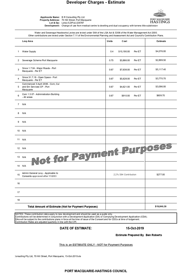
AGENDA Development Assessment Panel 23/10/2019
Item: 07
Subject: DA2019 - 203.1 Demolition of Existing
Buildings and Construction of Restaurant at 24 Clarence Street, Port Macquarie
Report
Author: Development Assessment Planning Coordinator, Patrick
Galbraith-Robertson
|
Applicant: All
About Planning
Owner: Darzi
Group Pty Ltd
Estimated Cost: $1,200,000
Alignment with Delivery
Program
4.3.1 Undertake transparent
and efficient development assessment in accordance with relevant legislation.
|
|
RECOMMENDATION
That
DA2019 - 203.1 for a demolition of existing buildings and construction
of restaurant at Lot 1, DP 713378, No. 24
Clarence Street, Port Macquarie, be determined by granting consent subject to the
recommended conditions.
|
Executive
Summary
This
report considers a Development Application for demolition of existing
buildings and construction of restaurant at the
subject site and provides an assessment of the application in accordance with
the Environmental Planning and Assessment Act 1979.
Following exhibition of the
application on two (2) occasions, five (5) submissions
were received.
The proposal has been amended during the assessment of the
application in response to assessment issues. Amendments have been made to the
design of the proposed building and removal of outdoor dining and parklet
dining.
The site is considered suitable for the proposed development
and the proposal adequately addresses relevant planning controls. The
development is not considered to be contrary to the public's interest and will
not result in a significant adverse social, environmental or economic impact.
This report recommends that
the development application be approved subject to the conditions included in
Attachment 1.
1. BACKGROUND
Existing Sites Features and Surrounding Development
The site has an area of 614m2.
The site is currently occupied by
two (2) existing commercial buildings and concrete slabs. The remainder of site
is vacant and grassed.
The site is located between and
adjoining heritage listed items being the Port Macquarie Historical Museum and
the Garrison Building and opposite the heritage listed Port Macquarie Historic
Court House.
The site is located within the
Port Macquarie Town Centre and adjoins the Port Central Shopping Centre.
The site is zoned B3 commercial core in accordance with the Port Macquarie-Hastings Local
Environmental Plan 2011, as shown in the following zoning plan:
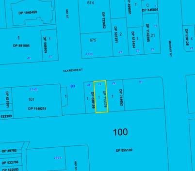
The existing subdivision pattern and location of existing
development within the locality is shown in the following aerial photograph:
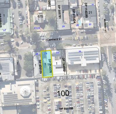
2. DESCRIPTION OF
DEVELOPMENT
Key aspects of the proposal include the following:
· Demolition
of two (2) existing single storey brick buildings;
· Construction
of a masonry single storey restaurant building.
Amended plans submitted include
the following changes to the proposed design to address assessment issues:
o Relocation of the office/ store room
from the front north eastern corner of the site towards the rear.
o Opening up of the proposed courtyard
for the length of the Historic Museum existing side wall facing the site, with
a 1m high planter bed.
o Lengthening to the rear of the
services and storeroom opposite the above on the front north western corner.
o The on street parklet outside the
site within the existing carparking spaces has been deleted.
o Revised delineation and calculation
of serviced area for the restaurant; and
o The services store rooms are now
single storey to reduce the scale from the previously (2) storey height.
Refer
to Attachment 2 at the end of this report for plans of the proposed
development.
Application Chronology
· 22
March 2019 - DA lodged with Council.
· 28
March 2019 - Referral of proposal to NSW Heritage Council for comment.
· 12 to 30 April 2019 - Neighbour notification of proposal.
· 30 April 2019 - Redacted copies of submissions forwarded to
Applicant for consideration.
· 9 April 2019 - Review of proposal by Council’s
Heritage Advisor.
· 30 April 2019 - Advice received from the NSW Heritage
Council (attached to this report).
· 2 May 2019 - Site visit by Assessing Officer.
· 2 May 2019 - Meeting with Applicant to discuss assessment
issues and request additional information.
· 3 May 2019 - Additional information requested from
Applicant in regards to stormwater management.
· 31 July 2019 - Additional information including heritage
impact statement and amended plans received from Applicant.
· 1 August 2019 - Assessment update provided to Applicant.
· 6 to 19 August 2019 - Neighbour notification of amended
proposal.
· 13 August 2019 - Review of amended proposal by
Council’s Heritage Advisor.
· 15 August 2019 - Heritage Advisor’s advice forwarded
to Applicant for consideration.
· 10 September 2019 - Amended stormwater plans received from
Applicant.
· 11 October 2019 - Applicant’s Consulting Engineer
queried on stormwater design concept.
3. STATUTORY ASSESSMENT
Section 4.15(1) Matters for Consideration
In determining the application, Council is required to take
into consideration the following matters as are relevant to the development
that apply to the land to which the development application relates:
(a) The provisions (where
applicable) of:
(i) Any Environmental
Planning Instrument
State Environmental Planning Policy No. 44 - Koala
Habitat Protection
With reference to clauses 6 and 7, the subject land is less
than 1 hectare (including any adjoining land under same ownership) and
therefore the provisions of SEPP do not require consideration.
State Environmental Planning Policy No. 55 – Remediation
of Land
Following an inspection of the site and a search of Council
records, the subject land is not identified as being potentially contaminated
and is suitable for the intended use.
State Environmental Planning Policy No. 62 –
Sustainable Aquaculture
Given the nature of the proposed development and proposed
stormwater controls (as amended) the proposal will be unlikely to have any
adverse impacts on existing aquaculture industries within the nearby Hastings
River.
State Environmental Planning
Policy No. 64 – Advertising and Signage
The proposed development includes proposed advertising
signage in the form of business identification sign. The proposed sign will be
1.8m x 0.6m, with a total area of 1.08m2 and does not protrude more than 300mm
from the wall or above the building parapet or eave.
In accordance with clause 7, this SEPP prevails over the
Port Macquarie-Hastings LEP 2011 in the event of any inconsistency.
The following assessment table
provides an assessment checklist against the Schedule 1 requirements of this
SEPP:
|
Applicable clauses for consideration
|
Comments
|
Satisfactory
|
|
Clause 8(a) Consistent with
objectives of the policy as set out in Clause 3(1)(a).
|
The proposed signage is
consistent with the objectives of this policy.
|
Yes
|
Schedule
1(1) Character of the area.
|
The proposed “The
Sicilian’ signage is considered consistent and compatible with the
existing and desire future character of the locality noting the adjoining
heritage items and advertising in the area. The signage is modest in scale.
|
Yes
|
|
Schedule 1(2) Special areas.
|
|
Schedule 1(3) Views and vistas.
|
No impacts to existing views or
vistas with the proposed signage.
|
Yes
|
|
Schedule 1(4) Streetscape,
setting or landscape.
|
The proposed sign is considered
to be integrated with the overall design, it does not obscure significant
architectural elements of the building (and other business identification
signs are not elsewhere displayed on the building elevation).
The signage is compatible with
the Clarence Street streetscape.
The proposal is compatible with
the scale, proportion and other characteristics of the building and is
rationalised and simplified in its context.
|
Yes
|
|
Schedule 1(5) Site and building.
|
|
Schedule 1(6) Associated devices
and logos with advertisements and advertising structures.
|
No logos are proposed.
|
N/A
|
|
Schedule 1(7) Illumination.
|
The sign is not proposed to be
illuminated and will not result in unacceptable glare, affect safety for
pedestrians, vehicles or aircraft and will not impact on any residences.
|
Yes
|
|
Schedule 1(7) Safety.
|
The signage does not reduce the safety for any public
road, pedestrians or cyclists or obscure sightlines from public areas.
|
Yes
|
State Environmental Planning Policy (Coastal Management)
2018
The site is located within a coastal environment area within
the Port Macquarie Town Centre.
In accordance with clause 7, this SEPP prevails over the
Port Macquarie-Hastings LEP 2011 in the event of any inconsistency.
Having regard to clauses 13 and 14 of the SEPP the proposed
development is not considered likely to result in any of the following:
a) any
adverse impact on integrity and resilience of the biophysical,
hydrological (surface and groundwater) and ecological environment;
b) any
adverse impacts coastal environmental values and natural coastal
processes;
c) any
adverse impacts on marine vegetation, native vegetation and fauna
and their habitats, undeveloped headlands and rock platforms;
d) any
adverse impact on marine vegetation, native vegetation and fauna
and their habitats, undeveloped headlands and rock platforms;
e) any
adverse impact on Aboriginal cultural heritage, practices and
places;
f) any
adverse impacts on the cultural and built environment heritage;
g) any
adverse impacts the use of the surf zone;
h) any adverse impact on the visual amenity and scenic qualities of the
coast, including coastal headlands;
i) overshadowing, wind funneling and the loss of views from public places
to foreshores;
j) any
adverse impacts on existing public open space and safe access to
and along the foreshore, beach, headland or rock platform for members of the
public, including persons with a disability;
The bulk, scale and size of the proposed development is
compatible with the surrounding coastal and built environment. The site is
located within an area zoned for commercial purposes.
State Environmental Planning Policy (Infrastructure) 2007
Under the provisions of clause
104, the proposal is not identified as a traffic generating development and
does not front a classified road.
Port Macquarie-Hastings Local
Environnemental Plan 2011
The proposal is consistent with the LEP having regard to the
following:
· Clause
2.2 - The subject site is zoned B3 commercial core.
· Clause
2.3(1) and the B3 zone landuse table - The proposed development for a
restaurant (as a form of commercial premises) is a permissible landuse with
consent.
The objectives of the B3 zone are as
follows:
• To
provide a wide range of retail, business, office, entertainment, community and
other suitable land uses that serve the needs of the local and wider community.
• To
encourage appropriate employment opportunities in accessible locations.
• To
maximise public transport patronage and encourage walking and cycling.
• To ensure
that new residential accommodation and tourist and visitor accommodation within
the zone does not conflict with the primary function of the centre for retail
and business use.
• To
provide for the retention and creation of view corridors and pedestrian links
throughout the Greater Port Macquarie city centre.
In accordance with Clause 2.3(2),
the proposal is consistent with the zone objectives having regard to the
following:
o the proposal is a permissible
landuse; and
o the proposal will provide a
suitable retail landuse to serve the community.
· Clause
2.7 - The demolition requires consent as it does not fit within the provisions
of SEPP (Exempt and Complying) 2008.
· Clause
4.3 - The maximum overall height of the building above ground level (existing)
is 4.7m which complies with the standard height limit of part 13m (north) and
part 16m (south) applying to the site.
· Clause
4.4 - The floor space ratio of the proposal is below 1:1.0 which complies with
the maximum part 2.5:1(north) and part 3:1(south) floor space ratio applying to
the site.
· Clause
5.10 – The property is not listed as a heritage item in Schedule 5 Part 1
however is listed as an archaeological site in Schedule 5 Part 3.
(a) The proposal has
been referred to the NSW Heritage Council for comment and their advice is
attached to this report. The recommendations of the advice have been
satisfactorily responded to by the Applicant inclusive of making design
amendments to the building and providing a specialist Heritage Impact Statement
prepared by John Oultram Heritage and Design. Council’s Heritage Advisor
has also reviewed the amended proposal and makes recommendation to support the
proposal. With regards to the potential for European archaeological impacts
appropriate conditions have been recommended.
· Clause
7.3 - The site is not on land within a mapped “flood planning area”
(Land subject to flood discharge of 1:100 annual recurrence interval flood
event (plus the applicable climate change allowance and relevant freeboard).
· Clause
7.13 - Satisfactory arrangements are in place for provision of essential
services including water supply, electricity supply, sewer infrastructure,
stormwater drainage and suitable road access to service the development.
(ii) Any
draft instruments that apply to the site or are on exhibition
No draft instruments apply to the site.
(iii) Any
Development Control Plan in force
The following tables provide an assessment of the proposal
against the development provisions of Port Macquarie-Hastings Development
Control Plan 2013 and Development Control Plan 2011 - Port Macquarie Greater
Town Centre.
|
Parts 2 & 3 - General and commercial provisions
|
|
DCP Objective
|
Development Provisions
|
Proposed
|
Complies
|
|
2.2.2.1
|
a) Signs identifying products
or services are not acceptable, even where relating to products or services
available on that site.
b) Signage is not permitted
outside property boundaries.
c) An on-building
‘chalkboard’ sign for the purposes of describing services to
goods for sale should not be larger than 1.5m2.
d) On-premise signs should not
project above or to the side of building facades
|
The
proposed signage is of a high quality design and finish, contributing to the
streetscape and identification of the premises. The sign does not dominate
the streetscape, do not obscure or limit motorist or pedestrian activity or
their safety.
An assessment of the proposed signage has been included
under the discussion of SEPP 64 Advertising and Signage earlier in this
report.
|
Yes
|
|
2.3.3.1
|
Development
shall not exceed a maximum cut of 1.0m and fill of 1.0m measured vertically
above the ground level (existing) at a distance of 1.0m outside the perimeter
of the external walls of the building.
|
As a relatively level site, the proposed development will
only require minimal site disturbance through cut and fill.
|
Yes
|
|
2.2.3.6
|
All
stormwater infrastructure is designed in accordance with the Council’s
Auspec Design Specification Documents.
|
All
stormwater from the proposed development will be collected and managed in
accordance with a stormwater management plan prepared by David Johnson
Engineer as submitted with the subject DA in compliance with the DCP.
Refer
to assessment comments later in this report. Appropriate consent conditions
are recommended to address this matter.
|
Yes - capable
|
|
2.5.3.3
|
Off-street
Parking is provided in accordance with Table 2.5.1
Restaurants in Commercial
Zones: 1 per 30m2 Serviced Floor Area.
|
The
site does not currently provide for any off-street carparking. The proposal
does not propose to change this arrangement.
The
proposal includes 225m2 of serviceable restaurant floor area which
requires 225/30m2 = 7.5 parking spaces.
The
site has a 5.5 parking space credit for current approved uses on the site
which equates to 165m2 of commercial/retail floor space.
|
No*
|
|
2.5.3.11
|
Parking
requirements of the community are met without imposing an additional
liability on general rating revenue.
To provide a mechanism to
offset parking shortfalls.
Contributions
will be accepted in commercial areas of Port Macquarie.
|
As
noted above, a deficiency of 2 carparking space is associated with the
subject development. Council’s Section 94 Contributions Plan and DCP
2013 makes provision for the levying of contributions for any shortfall in
onsite carparking (in the CBD) which is recommended to be used to address the
parking shortfall.
|
Yes
|
|
2.7.2.2
|
The
development is to address the generic principles of crime prevention;
•
Casual surveillance and sightlines;
•
Land use mix and activity generators;
•
Definition of use and ownership;
•
Basic exterior building design;
•
Lighting;
•
Way-finding; and
•
Predictable routes and entrapment locations;
as described in the Crime
Prevention Through Environmental Design (CPTED) principles.
|
The
site layout of the proposal achieves:
Effective
access control through the following:
1.
Providing clearly visible access from the street, and differentiating the
various areas within the restaurant/café.
2.
Minimising unintended access by intruders to the building including secure
gates locked after hours;
3.
Clear delineation of private and public areas is made;
Surveillance:
The
proposal achieves effective surveillance through the following:
1.
The proposed buildings and structures have clear and active orientations to
the sites street frontage.
2.
The building entrances on Clarence Street are open and have a wide angle of
visibility from the street.
3. There are no public areas with blind corners.
4.
Appropriate lighting (in accordance with relevant Australian Standards) will
be installed.
5.
Only suitable site landscaping that does not provide concealment
opportunities will be installed (ref submitted landscaping plan).
Territorial
Reinforcement:
The
proposal achieves effective territorial reinforcement through the following:
1.
Clear building identification.
2.
Front boundary delineation by the use of design elements, planting and other
features which clearly define public and private areas.
Space
Management:
The
proposal achieves effective space management and maintenance through the
following:
1.
Using building materials and design aspects such as avoiding blank walls, and
lighting design to minimise opportunities for vandalism.
2. Use of hard wearing materials to reduce maintenance and
provide the basis for an attractive,
|
Yes
|
|
3.4.3.1
|
A
zero metre or consistent setback to ground floor is preferred in all business
zone developments.
|
The
proposal has adopted a zero-street setback, consistent with businesses in
Clarence Street for the framed entry to the restaurant premises and the
remainder of the building setback is suitable having regard to the existing
context with adjoining heritage items.
|
Yes
|
|
3.4.3.3
|
a)
Variations in roof form including the use of skillions, gables and hips are
to be provided in the development.
b)
Variations in roof materials should be used.
c)
Parapets and flat roofs should be avoided.
d) In an established street,
roof form and materials should be consistent or complementary to those
developments in that street.
e)
Lift over-runs and service plant should be concealed within roof structures.
f)
All roof plant should be represented on plans and elevations.
g)
Outdoor recreation areas on flat roofs should be landscaped and incorporate
shade structures and wind screens to encourage use.
h) Roof design should generate
an interesting skyline and be visually interesting when viewed from adjoining
developments.
|
The
proposed high arched entrances provide a visually interesting design feature
in this location, and hides the various sections of the roof design that sits
behind.
Variations
in roof materials, and design style have been incorporated within the
building to add interest and architectural detail to the restaurant. These
details hide parts of the large domineering wall of the Port Central Plaza
which is located on its rear southern boundary.
The side elevations of the adjoining building do not
include any windows therefore avoiding any privacy, bulk and scale and
overshadowing impacts.
The proposal will provide a positive contribution to the
Clarence Street streetscape.
|
Yes
|
|
3.4.3.4
|
Colours,
construction materials and finishes should respond in a positive manner to
the existing built form, character and architectural qualities of the street.
|
The
proposed front archway entrance will be subservient in height and form to
both of the adjoining heritage items and will not physically dominate either.
Additionally,
the proposed colours and finish for the archway will be uncomplicated and
formal and will visually be complementary to the Garrison Building and less
intense than the Historical Museum. The design adds positively to the
streetscape, and does not detract from the surrounding heritage
building’s built form or character.
|
Yes
|
|
3.4.3.5
|
Building
facades should be designed to reflect the orientation of the site
incorporating environmental control devices eg. sun sheds, ventilation vents,
overhangs, building recesses, eaves as an integrated design feature of the
building.
|
The
building has been designed taking into consideration its orientation.
The
arched entranceway is a high quality architectural feature adding diversity
to the streetscape facade.
The
entry to the restaurant has alfresco open-air eating including natural
ventilation, landscaping and elements of sunshade features which will make a
positive contribution to reducing bulk of the building as the main roof
structure is setback from the street facade.
The restaurant incorporates quality architectural features
in its design adding to its contemporary, unique and vibrant appearance.
|
Yes
|
|
3.4.3.6
|
Any
security grilles should be provided inside the building, behind glazing and
designed to ensure transparency to the interior.
|
Open
decorative metal gates will provide safety being locked and secured after
hours. The transparency of the gates provide surveillance internally within
the building.
The arched entranceway also designates the public
streetscape from the restaurant or private area for diners. The internal
layout of the restaurant has been designed to provide a sense of space,
safety and openness for patrons.
|
Yes
|
|
3.4.3.7
|
a)
Infill development or alterations should respect the form, scale and massing
of existing traditional buildings.
b) Where traditional frontages
and facades set the architectural theme for parts of a Centre, infill
buildings or alterations respect and reflect the architectural qualities and
traditional materials of those buildings, but do not necessarily imitate historical
architectural styles.
|
The
building has been designed to complement the existing form, scale and massing
of the existing adjoining buildings.
The
Port Macquarie CBD has a mix of various frontages and architectural
detailing. The new restaurant frontage adds to the diversity within the
commercial centre.
Given the proximity to heritage items, the design of the
restaurant has been made distinctive so as to avoid imitating or lessen the
worth of, the adjoining historical architectural features.
|
Yes
|
|
3.4.3.9
|
a)
Active frontages should consist of a shop front, café or restaurant if
accompanied by an entry from the street.
b) A
minimum of 50% of the ground floor level front facade should be clear glazed.
c)
Active ground floor uses are to be accessible and at the same level as the
footpath.
d)
Restaurants, cafés and the like should provide openable shop fronts to
the footpath but should not encroach into footpath.
e) Colonnade structures should
not be used unless it is demonstrated that the design would not restrict
visibility into the shop or commercial premise or limit natural daylight
along footpaths and do not create opportunities for concealment.
|
The
proposed building design has incorporated an active frontage, being
accessible from the streetscape, and several open arched entries provides
direct visual contact through the building.
The
restaurant design will not impede pedestrian access along the streetscape.
Further
activation and liveliness will be provided by the proposed outdoor footpath
dining immediately adjoining the entrance archways and the parklet dining
within the roadway. Each of these are proposed under Council’s policies
for each component within the PMQ CBD.
The openness of the entry provides natural light and
ventilation, and the restaurant layout has been designed to reduce
opportunities for concealment.
|
Yes
|
|
3.4.3.11
|
Continuous
shelter from the weather is to be provided for the full extent of the active
street frontage.
|
No awning is proposed across public footpath
|
No*
|
|
3.4.3.15
|
a) A
landscaping plan to be submitted with the development application.
b) Vegetation is provided on
top of podium levels fronting the street below podium level.
|
Satisfactory landscaping proposed within the site.
|
Yes
|
|
3.4.3.22
|
a)
Any ramps are to be integrated into the overall building and landscape
design.
b) The development complies
with AS1428 - Design for Access and Mobility.
|
Due
to the flat nature of the site and its levels relative to the footpath, the
proposed development will not require access ramps and the like to provide
the required access. Nevertheless, a continuous accessible path of travel
will be provided through the development including to the uni-sex accessible/
disabled compliant toilet.
|
Yes
|
|
3.4.3.24 to 3.4.3.26
|
Waste management both
construction and operational.
|
A
waste management plan will be submitted as part of the construction
certificate.
As indicated on the submitted architectural plans, a
dedicated roofed and sealed garbage and recycling bin storage area is
provided in the front western corner of the development with direct access
off the street for servicing. Required drainage and services to this area
will be provided.
Appropriate consent conditions are recommended to reflect
these requirements.
|
Yes
|
|
Part 5 Port Macquarie Town Centre
|
|
Development Provisions
|
Proposed
|
Complies
|
|
The
future heritage and leisure focus of the town for visitors and residents,
Clarence Street will be a distinctive tree lined pedestrian dominated area
with hotels and holiday apartments above an active street frontage lined with
restaurants, heritage buildings and sidewalk cafés.
The
new buildings should respond to the heritage buildings without mimicking
them.
|
The
proposed restaurant development is complimentary to the variety of businesses
and building styles along Clarence Street.
The
building promotes its own style, and does not mimic the heritage buildings
interspersed along Clarence Street.
The proposed building is
single storey, maintaining through its design a distinctive character which
is consistent with the shops/cafes/restaurants within the locality.
Materials
and finishes will be pale in colour, and incorporate lightweight
indoor/outdoor spaces.
Smaller
roof forms are proposed, setback from the street behind the hard built form
edge established by the entrance archway without dominating the streetscape
or adjoining heritage buildings.
The proposed front archway
entrance will be subservient in height and form to both of the adjoining
heritage items
|
Yes
|
|
Façade
Enclosure
OB6 - To have the ground
floor have a high percentage of enclosures to provide a consistent edge to
the streets and an urban character.
|
The design of the proposal
has been assessed as being suitable particularly having regard to the
existing adjoining heritage items.
|
Yes/No - acceptable
|
|
Roof
Design
OB7 – To improve the
roofscapes impression of the Town Centre
|
The
architectural plans/design of this single storey restaurant building has
considered the adjoining heritage building features including roof forms.
|
Yes
|
|
Block controls B(12)
|
The design of the proposal
has been assessed as being suitable particularly having regard to the
existing adjoining heritage items.
The treatment of the
eastern section of the building in consultation with Council’s Heritage
Advisor is acceptable.
|
Yes/No
|
The proposal seeks to vary Development Provision relating to
the standard requirements for provision of calculated off-street parking. As
detailed above, the proposal has a calculated shortfall of two (2) parking
spaces.
The relevant objectives are:
· Adequate provision is made for off-street parking
commensurate with volume and turnover of traffic likely to be generated by the
development.
· To ensure no adverse impacts on traffic and road function.
The Applicant has submitted a request to support the
variation to 2 space parking requirement and also waive any the requirement for
payment of development contributions for the following reasons:
· The degree of variation is only minor and not significant;
· The proposal represents a significant investment in the
Port Macquarie CBD by the proponent who is a motivated and experienced
restauranteur who has wanted to open a premises in Port Macquarie for an
extended period of time;
· The development will be a highly prominent addition to the
hospitality sector of Port Macquarie that will be a significant enhancement to
the dining options currently available;
· As a restaurant the nature of trade will be such that much
of its operation is outside of regular daytime business hours thereby reducing
potential impacts on parking demand in the CBD.
· Much trade of the proposal as a restaurant involves
multi-purpose trips where patrons can be undertaking a number of tasks in the
one trip to the CBD including working in businesses, shopping, utilising one
form or the other of commercial, legal or real estate services, attending a
medical practice for an appointment, tourists staying in CBD accommodation,
enjoying a concert or show at The Glasshouse, or a movie at the Majestic Cinema
Complex, all in addition to enjoying a meal at the proposed restaurant. This
will reduce the actual parking demand from the proposal.
The above request has been carefully considered and
assessed. It is recommended that above request not be supported however the
parking space variation be supported subject to payment of the development
contributions in accordance with Section 2.5.3.11 of the DCP 2013.
Having regard for the development provisions and relevant
objectives, the variation is considered acceptable for the following reasons:
· The parking
variation is minor;
· A Development
Contributions Plan and DCP 2013 permits the payment of contributions in lieu of
provision of parking on-site;
· The proposal does
not reduce the amount of street parking in Clarence Street with any new
proposed driveway access noting this is the only access to the site; and
· The site does not
currently have off-street parking.
The proposal seeks to vary Development Provision relating to
not providing a street awning.
The relevant objectives are:
· To provide pedestrian amenity by the provision of weather
protection.
Having regard for the development provisions and relevant
objectives, the variation is considered acceptable for the following reasons:
· The design of the
proposal has been assessed as being suitable particularly having regard to the
existing adjoining heritage items; and
· Council’s
Heritage Advisor has recommended that a street awning not be provided given the
existing context between the existing adjoining heritage items.
Based on the above assessment, the variations proposed to
the provisions of the DCP are considered acceptable and the relevant objectives
have been satisfied.
Cumulatively, the variations do not amount to an adverse
impact or a significance that would justify refusal of the application.
(iiia) Any
planning agreement that has been entered into under section 7.4, or any draft
planning agreement that a developer has offered to enter into under section 7.4
No planning agreement has been offered or entered into
relating to the site.
(iv) Any matters prescribed by the Regulations
Demolition of buildings AS 2601 – Clause 92
Demolition of the existing buildings on the site are capable
of compliance with this Australian Standard. An appropriate standard consent
condition is recommended.
(b) The
likely impacts of that development, including environmental impacts on both the
natural and built environments, social and economic impacts in the locality
Context and setting
The proposal will be unlikely to have any adverse impacts to
existing adjoining properties and satisfactorily addresses the public domain.
The proposal is considered to be sufficient compatible with
other existing commercial development in the locality including existing
heritage buildings and adequately addresses planning controls for the area.
The proposal does not have a significant adverse impact on
existing view sharing.
The proposal does not have significant adverse lighting
impacts.
Access, Traffic and Transport
The proposal will not have any significant adverse impacts
in terms access, transport and traffic. The existing immediate road network
will satisfactorily cater for any increase in traffic generation as a result of
the development.
Water Supply Connection
Council records indicate that the development site an
existing 20mm metered water service.
Final water service sizing will need to be determined by a
hydraulic consultant to suit the domestic and commercial components of the
development, as well as fire service and backflow protection requirements.
Detailed plans will be required to be submitted for
assessment with the S.68 application.
Appropriate consent conditions have been recommended to
address water supply requirements.
Sewer Connection
Council records indicate that the development site is
connected to sewer via junction to the existing sewer line that runs along the
southern property boundary.
The development must drain sewage to an existing point of
connection to Council’s sewer system.
The proposal will require a trade waste system to be installed
and sized accordingly to meet the sewerage intakes of the development.
Detailed plans will be required to be submitted for
assessment with the Section 68 application.
Appropriate consent conditions have been recommended to
address sewer servicing requirements.
Stormwater
The site naturally grades towards the Clarence Street
frontage and is currently drained to the existing kerb inlet pit at that site
frontage. This pit will also be the legal point of discharge for the proposed
development.
A stormwater drainage plan has been submitted in support of
the development application and includes the on-site stormwater detention
facilities which have conceptually been designed to limit site stormwater
discharge to a rate less than or equal to pre-development rates.
This detention system is located beneath the floor of the
building, adjoining the Clarence Street frontage of the site and is drained
directly to the stormwater pit referred to above.
A review of the proposed detention system and associated
summary calculations indicate that the system achieves compliance with AUSPEC
requirements with regard to stormwater discharge rates pre and post
development. Furthermore, correspondence between Council’s Senior
Stormwater Engineer and the applicants Engineer confirm that the system has
been designed in accordance with the current version of Australian Rainfall and
Runoff 2019 and having regard for the likely elevated tail water levels in the
downstream drainage system.
Appropriate consent conditions have been recommended to
address stormwater servicing requirements.
Other Utilities
Telecommunication and electricity services are available to
the site.
Heritage
Refer to comments provided earlier in this report addressing
the heritage requirements of the Port Macquarie-Hastings Local Environmental
Plan 2011.
Other land resources
The site is within an established urban context and will not
sterilise any significant mineral or agricultural resource.
Water cycle
The proposed development will be unlikely to have any
adverse impacts on water resources and the water cycle.
Soils
The proposed development will be unlikely to have any
adverse impacts on soils in terms of quality, erosion, stability and/or
productivity subject to a standard condition requiring erosion and sediment
controls to be in place prior to and during construction.
Air and microclimate
The construction and/or operations of the proposed
development will be unlikely to result in any adverse impacts on the existing
air quality or result in any pollution. Standard precautionary site management
condition recommended.
Flora and fauna
Construction of the proposed development will not require
any removal/clearing of any native vegetation and therefore does not trigger
the biodiversity offsets scheme. Part 7 of the Biodiversity Conservation
Act 2016 is considered to be satisfied.
Waste
Satisfactory arrangements are in place for proposed storage
and collection of waste and recyclables. No adverse impacts anticipated.
Standard precautionary site management condition recommended.
Energy
The proposal includes measures to address energy efficiency
and will be required to comply with the requirements of Section J of the
Building Code of Australia. No adverse impacts anticipated.
Noise and vibration
No adverse impacts anticipated. Condition recommended to
restrict construction to standard construction hours.
Bushfire
The site is not identified as being bushfire prone.
Safety, security and crime prevention
The proposed development will be unlikely to create any
concealment/entrapment areas or crime spots that would result in any
identifiable loss of safety or reduction of security in the immediate
area. The design of the restaurant and orientation will improve natural
surveillance within this section of the Port Macquarie Town Centre locality.
Social impacts in the locality
Given the nature of the proposed development and its’
location the proposal is unlikely to result in any adverse social impacts.
Economic impact in the locality
No adverse impacts. A likely positive impact is that the
development will maintain employment in the construction industry, which will
lead to flow impacts such as expenditure in the area.
Site design and internal design
The proposed development design satisfactorily responds to
the site attributes and will fit into the locality. No adverse impacts likely.
Construction
No potential adverse impacts identified to neighbouring
properties with the construction of the proposal.
Cumulative impacts
The proposed development is not expected to have any adverse
cumulative impacts on the natural or built environment or the social and
economic attributes of the locality.
(c) The suitability of the site for
the development
The proposal will fit into the locality and the site
attributes are conducive to the proposed development.
Site constraints of existing European heritage and adjoining
and adjacent heritage has been adequately addressed and appropriate conditions
of consent recommended.
(d) Any submissions made in accordance
with this Act or the Regulations
Five (5) written submissions were received following public
exhibition of the application on two (2) occasions. Copies of the written
submissions have been provided separately to members of the DAP.
Key issues raised in the submissions received and comments
are provided as follows:
|
Submission
Issue/Summary
|
Planning
Comment/Response
|
|
Concern with removal of 4
parking spaces in Clarence Street with parklet.
|
Proposal has been amended to
remove parklets in Clarence Street.
|
|
The sewer mains within the locality are at capacity.
|
Council’s Water & Sewer section have reviewed
the proposal and raised no objections to the proposal subject to conditions.
Refer to comments earlier in this report.
|
|
The
demolition and construction processes at 24 Clarence Street has the potential
to highly impact the businesses and their customers at 26 Clarence Street. To
minimise any disruption to these businesses trading capacity, it would be
strongly preferred that works could be undertaken outside of normal trading
hours.
|
Appropriate standard conditions are recommended with
flexibility for Council to approve variations to construction hours in
certain circumstances.
|
|
The proposal fails to appropriately acknowledge or
respect the cultural precinct in which the development will be taking place,
nor the architectural features of the nearby State significant buildings.
|
The proposal has been amended to address compatibility of
the proposal within the existing context. Council’s Heritage Advisor
supports the proposal as amended.
|
|
Proximity of proposed structures to the external western
wall of the adjoining Museum building which are too close and jeopardise any
conservation work and place it at permanent risk of future damage both during
the construction phase and afterwards given we will have restricted external
access to it.
|
A revised
proposal has been submitted. Changes have been incorporated in the principal
areas of assessment and submissions concern including:
• Removal of potential abutments to the Port Macquarie Museum
building, setting the Office back to the
south of the building.
• Setting the street front façade back from the principal
street alignment.
• Providing clearance between the built elements of the proposal
to any built element on the adjacent
eastern site.
• Adjustment of the colonnaded façade elemental heights
and relating the components to the adjacent
buildings.
• The provision of a street elevation demonstrating the fit of
the intervention.
• Provision of a Statement of Heritage Impact prepared by John
Oultram Heritage and Design. Council’s
Heritage Advisor supports the proposal as amended.
|
|
Suggest that the development be set back to enable not
only access to our building but that it could form an interesting feature of
the new development.
|
|
The proposal has failed to adequately assess the heritage
impacts of the development on both the streetscape and the heritage buildings
in the precinct, nor does it adequately address the requirements of its
Archaeological Management Zoning.
|
A heritage impact statement has been submitted during the
assessment of the DA. This has been reviewed as being acceptable together
with the amendments made to the proposal.
|
|
The idea of a ‘screen’ type street-edge
structure at the front boundary is broadly supported. However, the proposed
faux- “Roman” detail and proportions of the masonry rendered and
arched wall are not appropriate in this case. This element does not reference
the proportions, form and fenestration pattern of the Museum
or Garrison buildings nor is it an appropriate use of
this architectural language in an Australian colonial
context.
|
The proposal has been amended to address compatibility of
the proposal within the existing context. Council’s Heritage Advisor
supports the proposal as amended.
|
(e) The Public Interest
The proposed
development satisfies relevant planning controls including justified variations
to standard planning controls and will not adversely impact on the wider public
interest.
4. DEVELOPMENT
CONTRIBUTIONS APPLICABLE
· Development contributions will be required towards
augmentation of town water supply and sewerage system head works under Section
64 of the Local Government Act 1993.
· Development contributions will be required in accordance
with Section 7.11 of the Environmental Planning and Assessment Act 1979 towards
public parking.
(b)
· A copy of the contributions estimate is included as
Attachment 3.
5. CONCLUSION AND
STATEMENT OF REASON
The application has been assessed
in accordance with Section 4.15 of the Environmental Planning and Assessment
Act 1979.
Issues raised during assessment
and public exhibition of the application have been considered in the assessment
of the application. Where relevant, conditions have been recommended to manage
the impacts attributed to these issues.
The site is considered suitable
for the proposed development and the proposal adequately addresses relevant
planning controls. The development is not considered to be contrary to the
public's interest and will not result a significant adverse social,
environmental or economic impact. It is recommended that the application be
approved, subject to the recommended conditions of consent provided in the
attachment section of this report.
|
Attachments
1View. DA2019
- 203.1 Recommended Conditions
2View. DA2019
- 203.1 Plans and Supporting Documents
3View. DA2019
- 203.1 Contribution Estimate
|
|
ATTACHMENT
|
Development Assessment Panel
23/10/2019
|
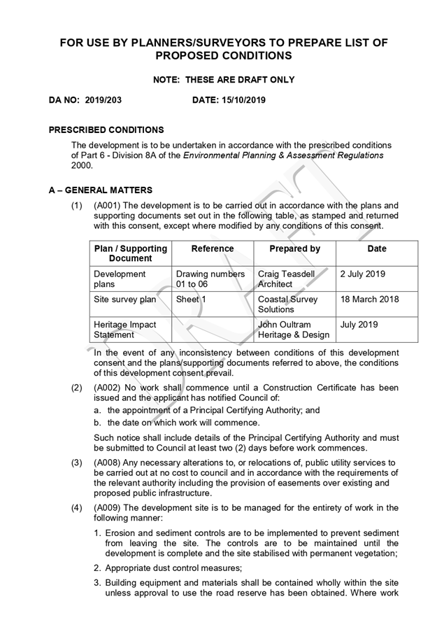
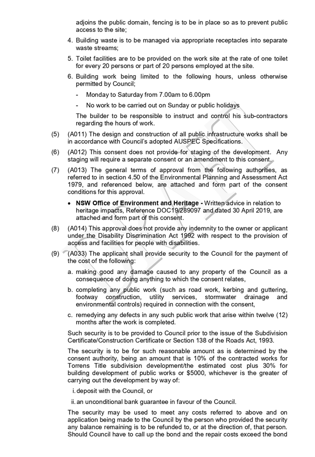
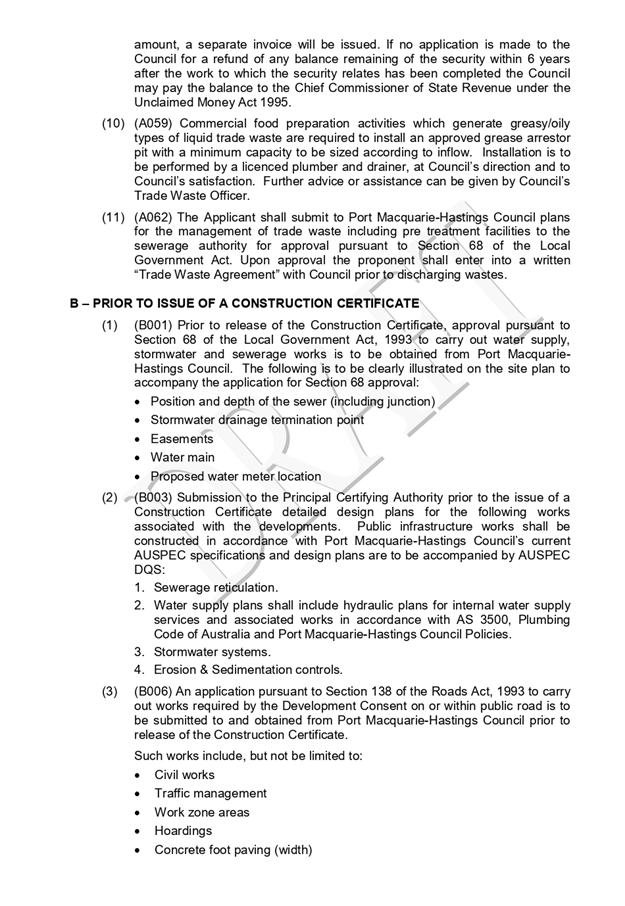
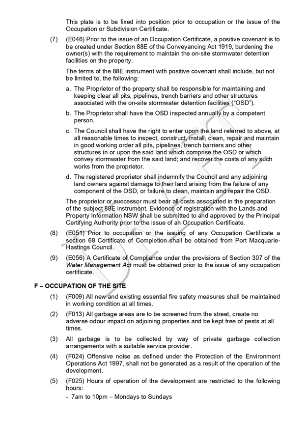
|
ATTACHMENT
|
Development Assessment Panel
23/10/2019
|
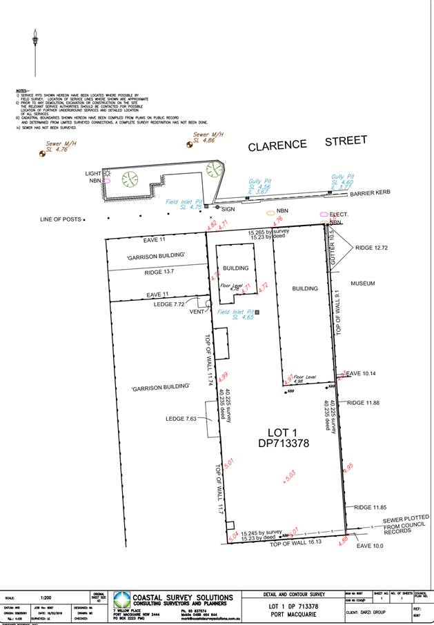
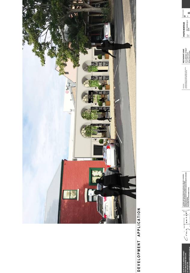
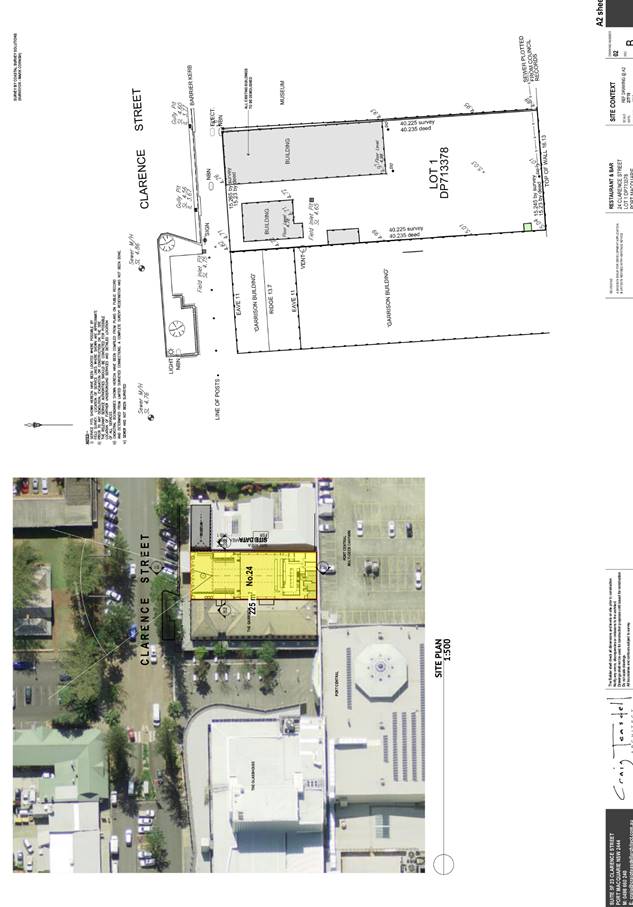
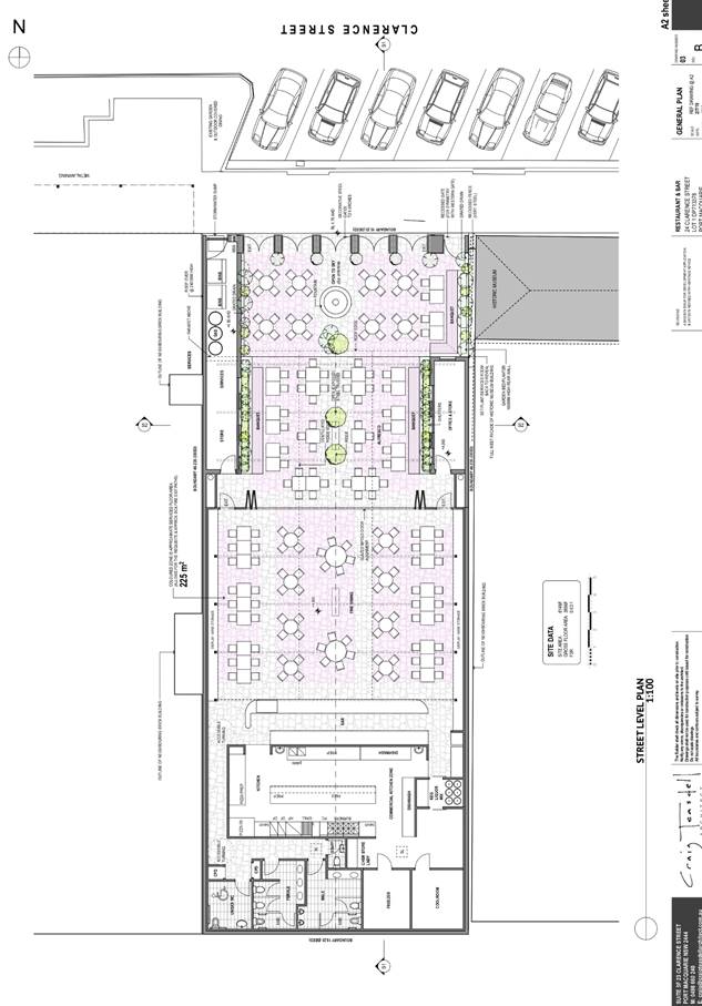
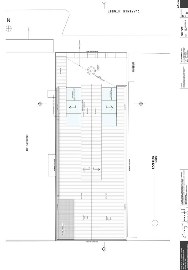
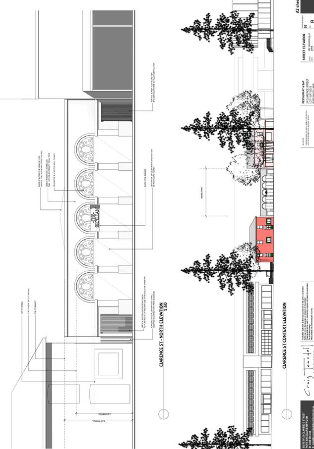
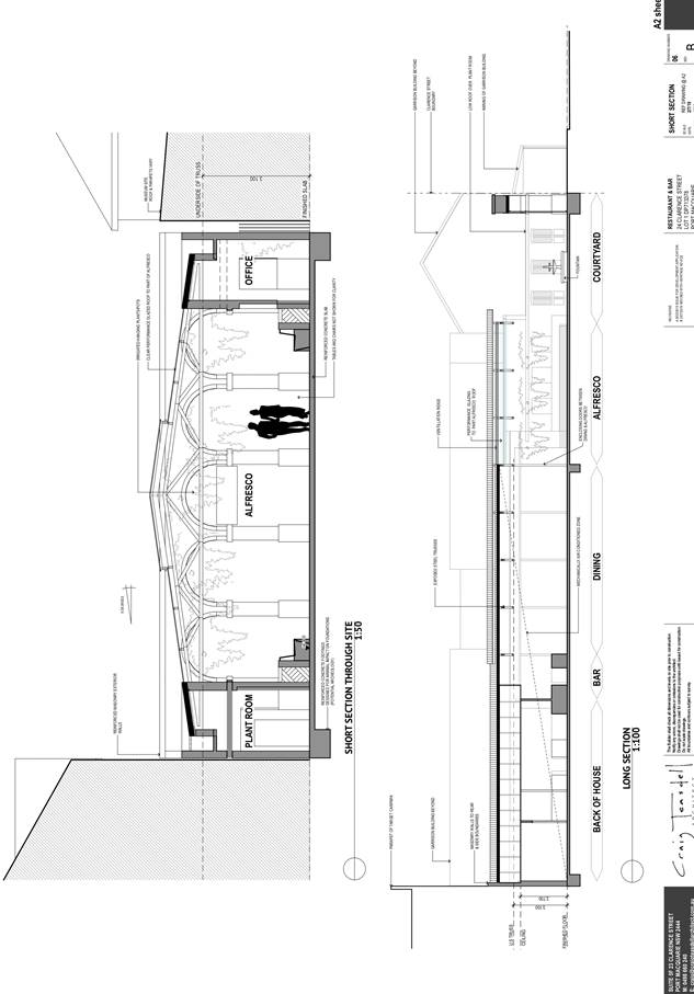
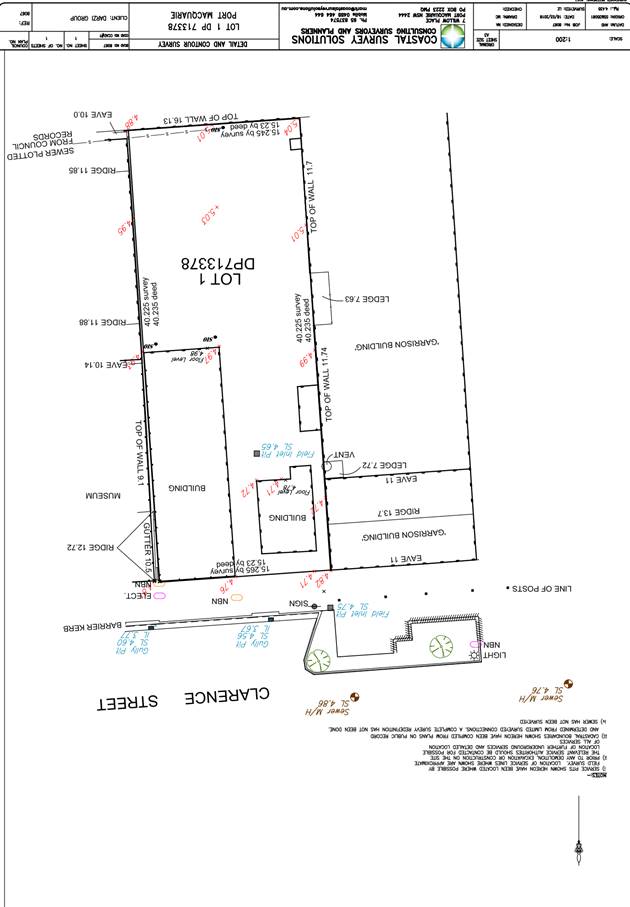
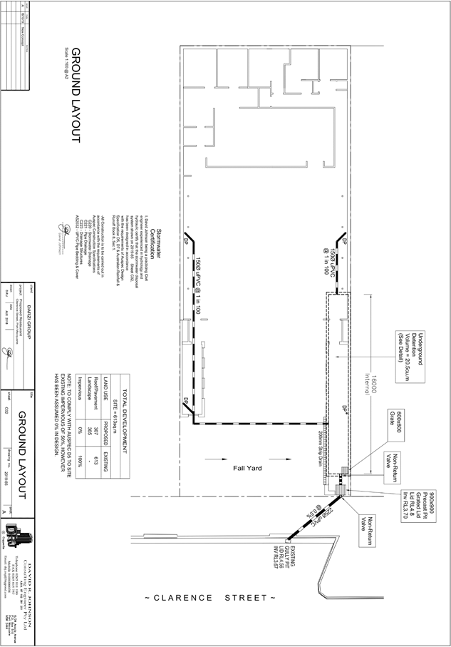
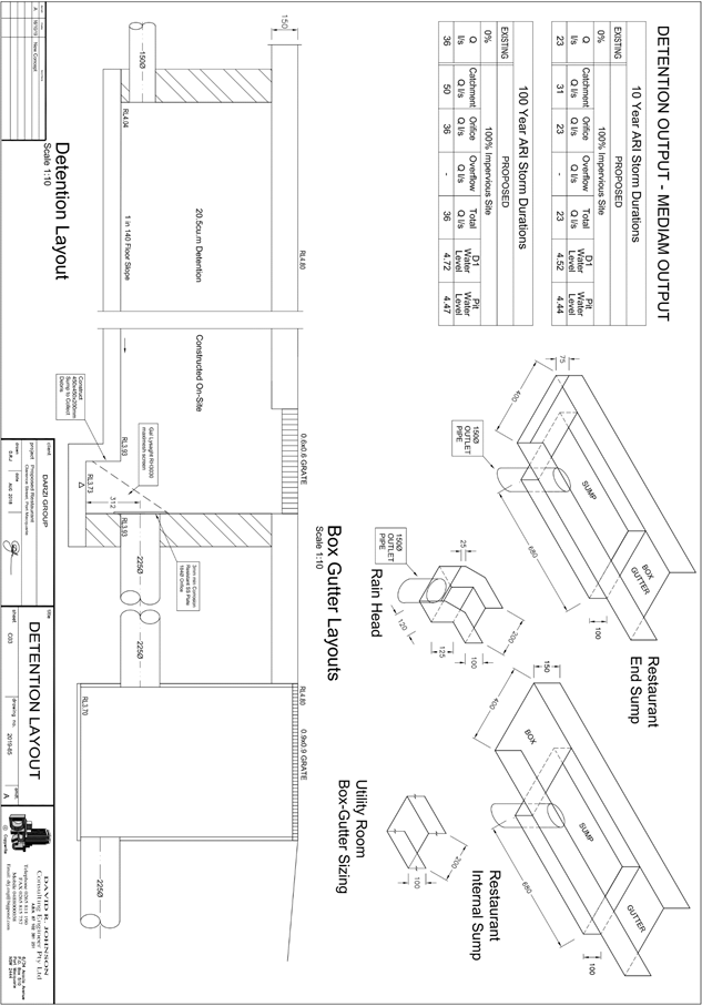
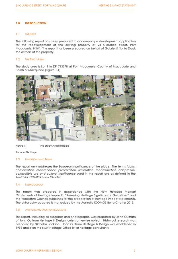
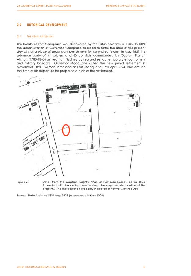
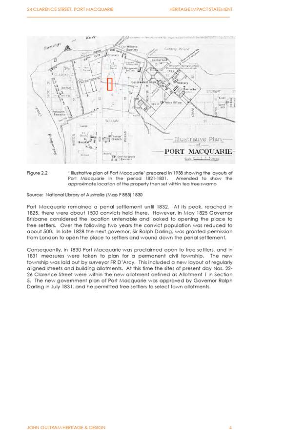
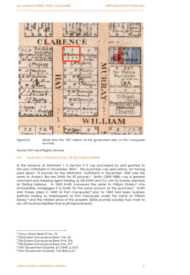
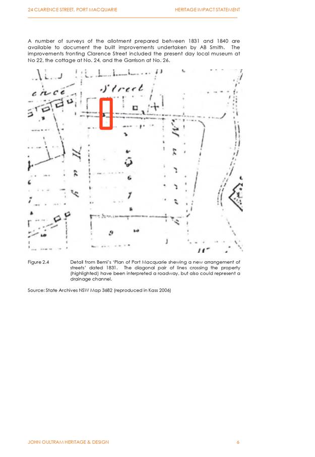
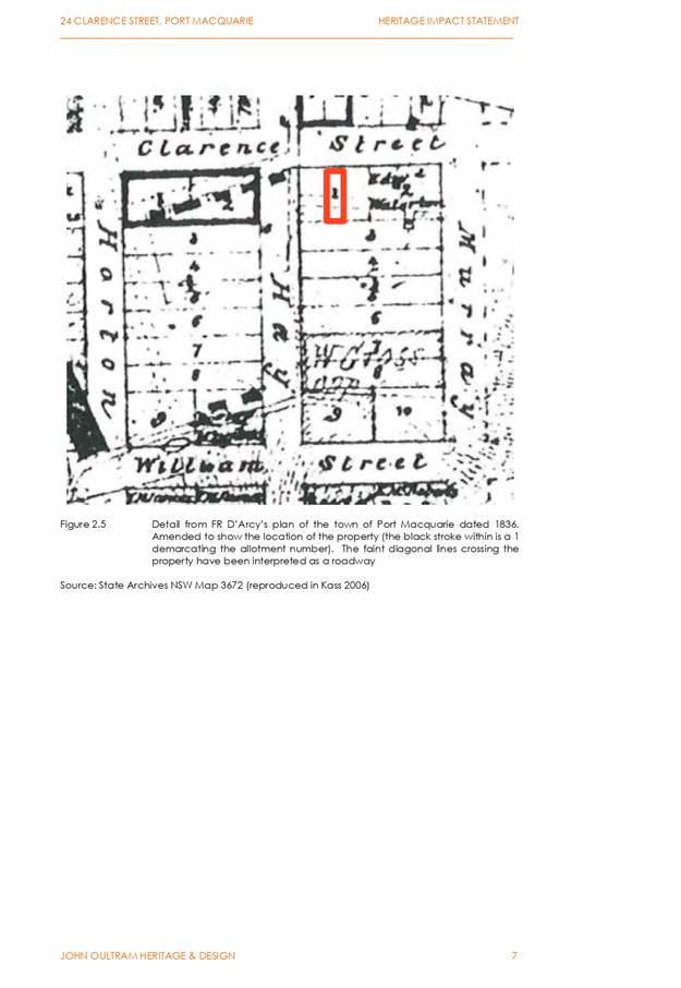
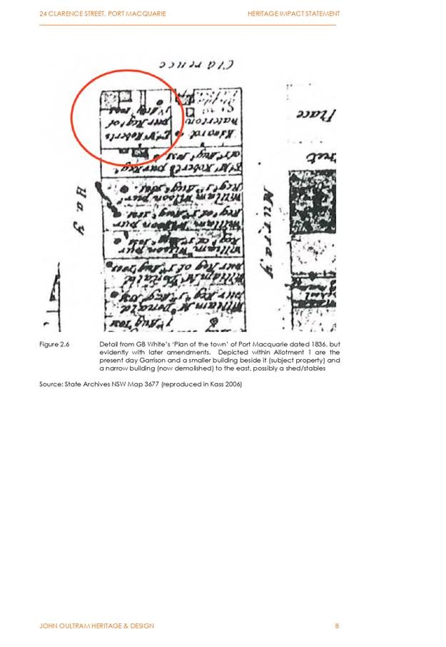
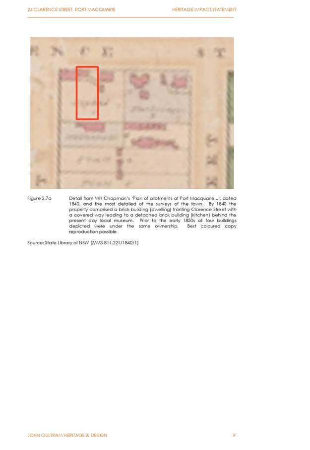
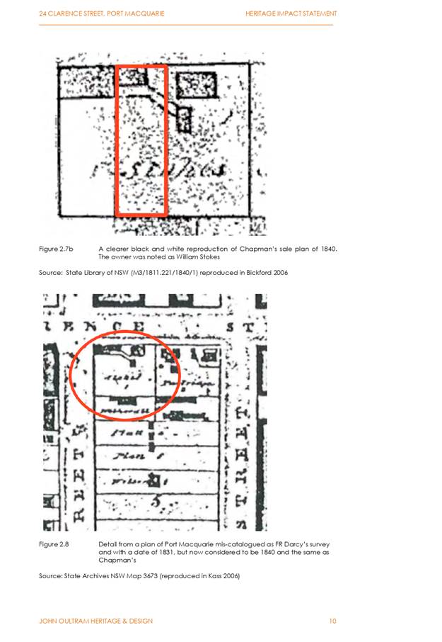
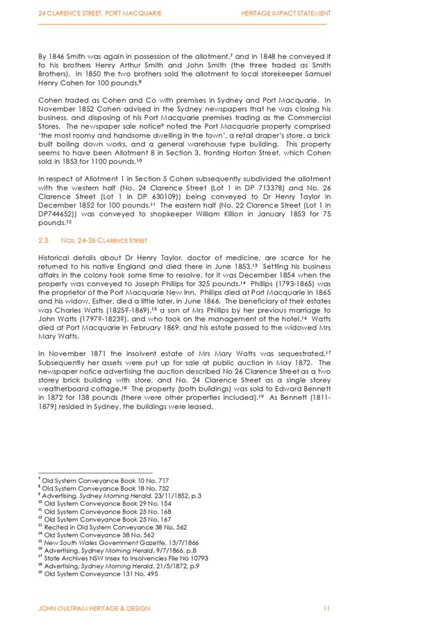
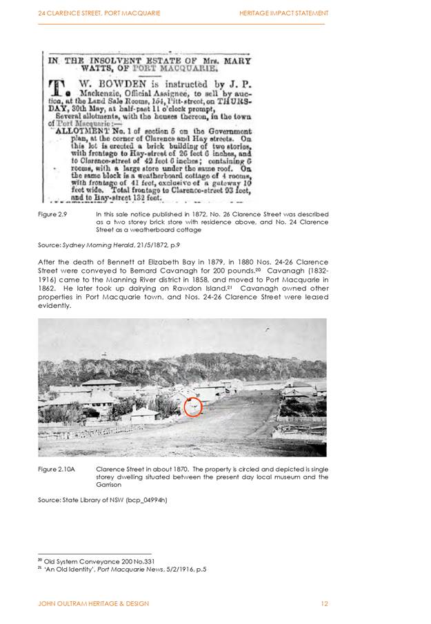
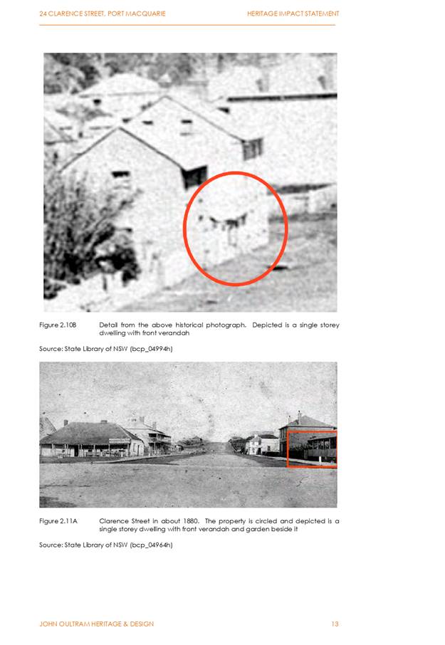
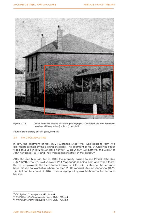
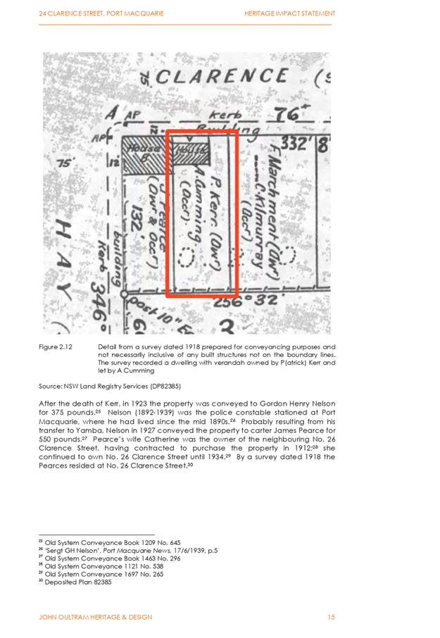
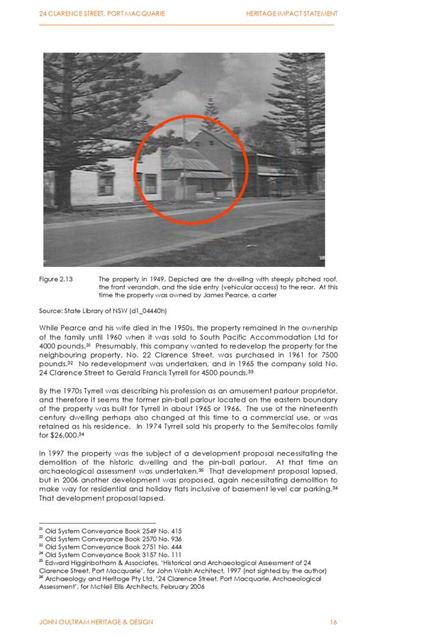
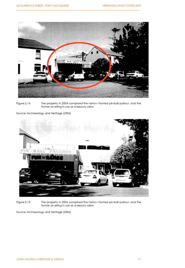
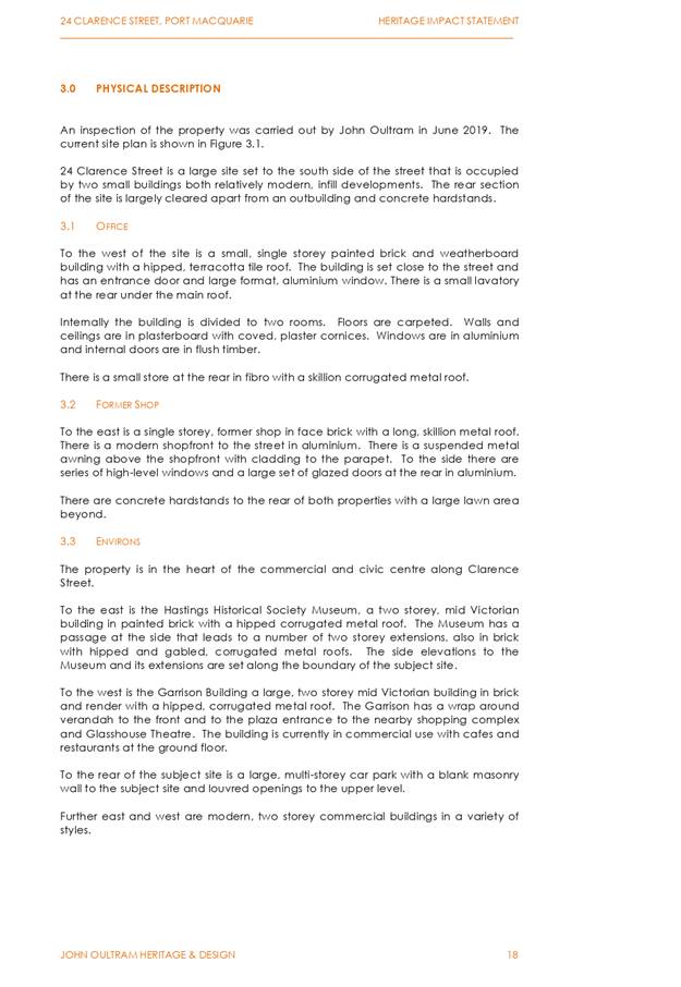
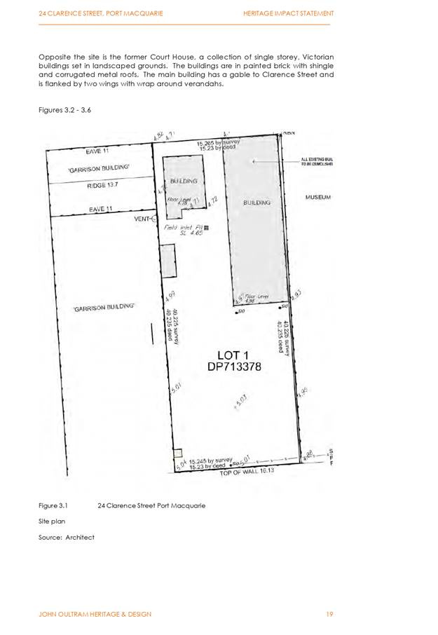
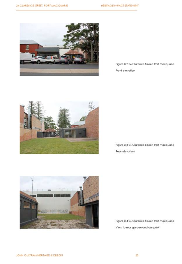
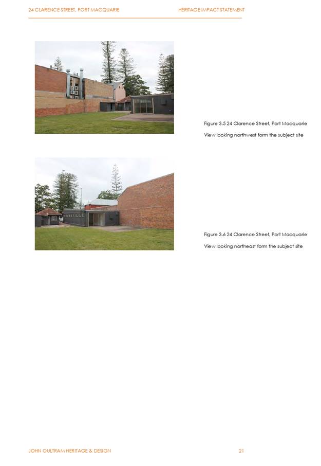
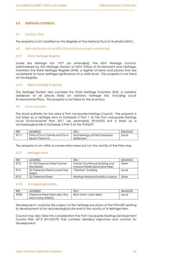
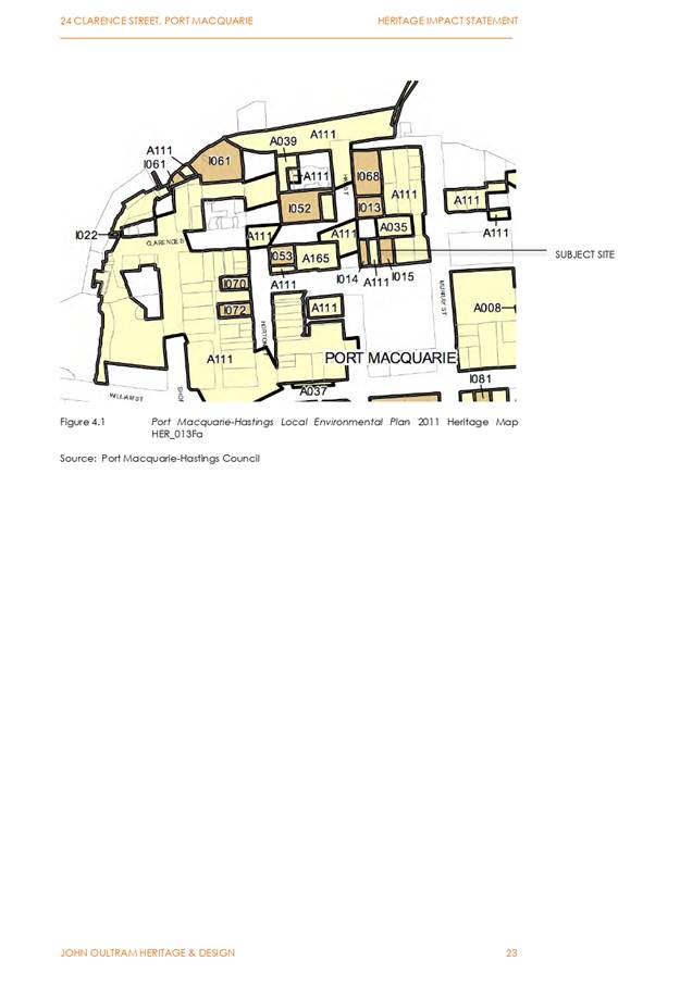
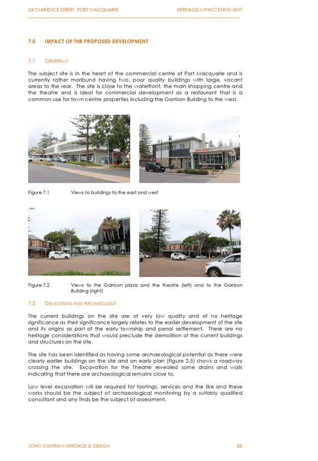
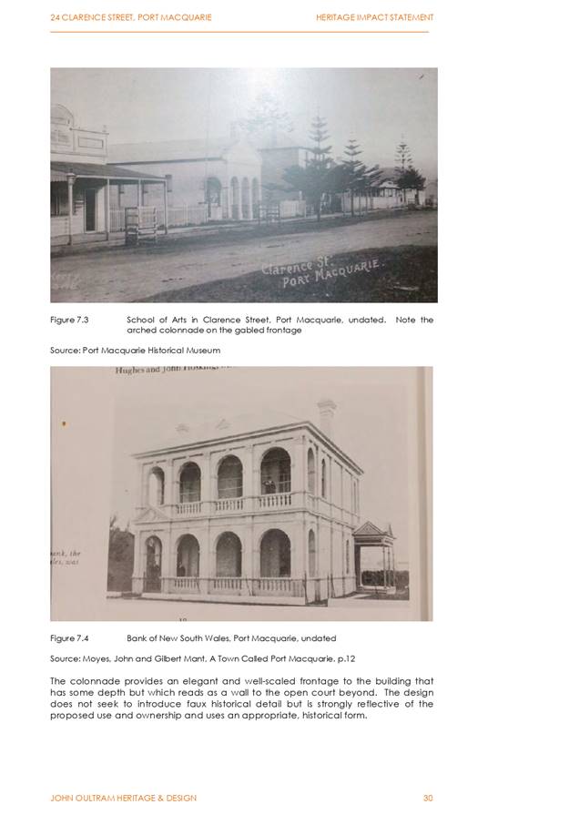
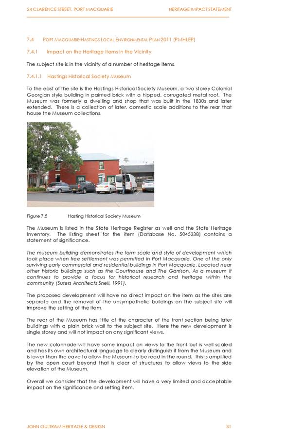
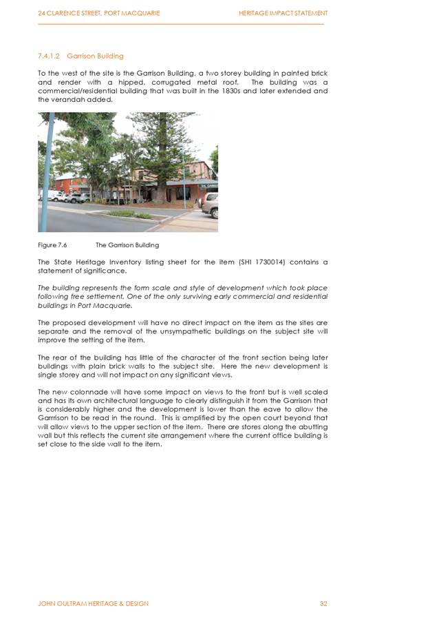
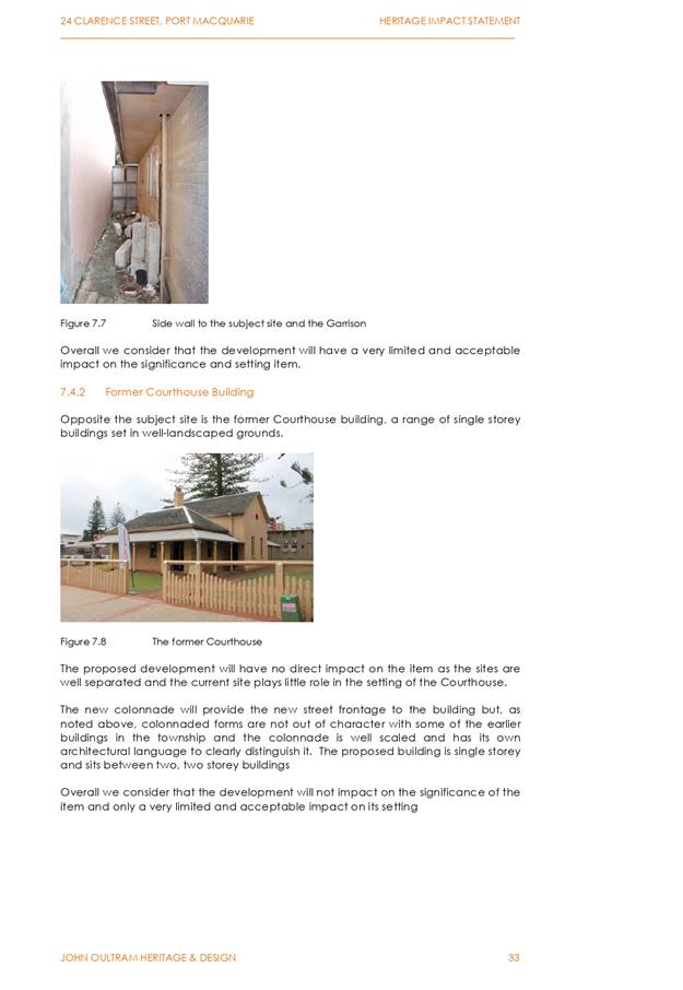
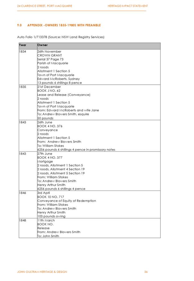
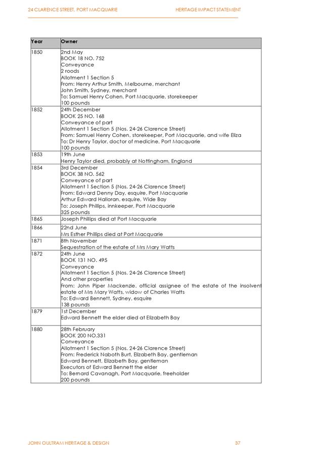
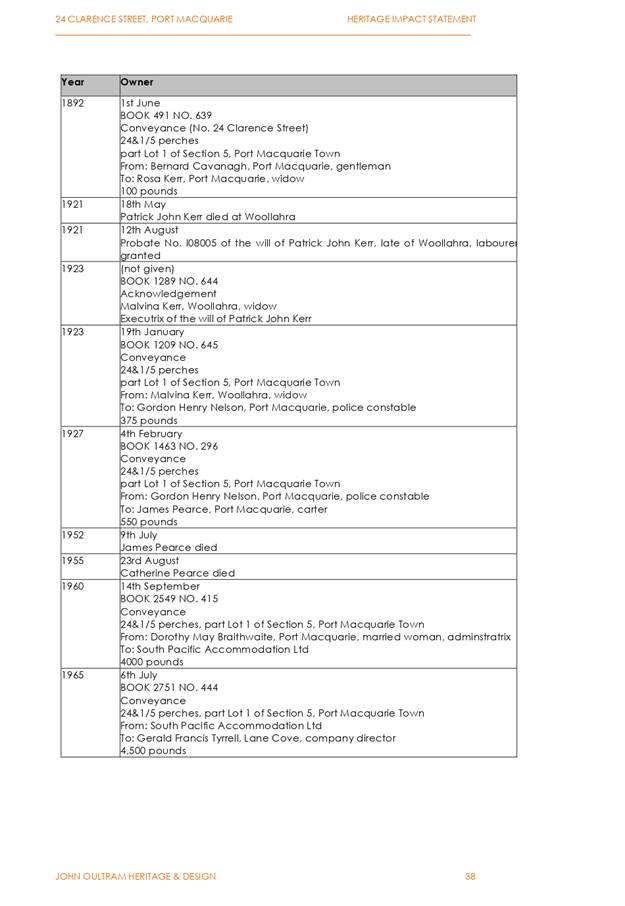
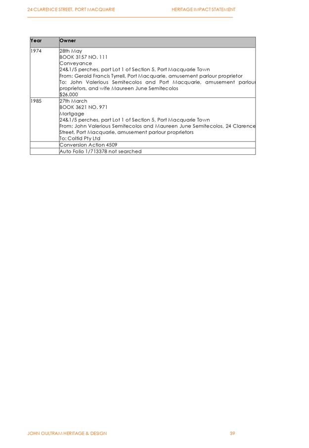
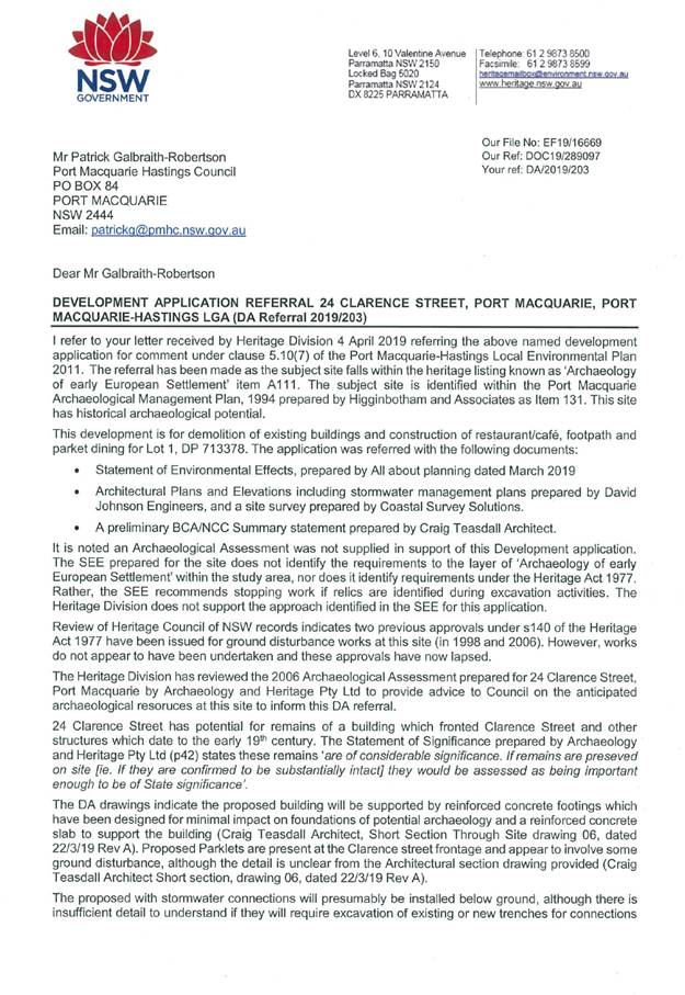
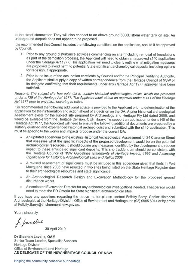
|
ATTACHMENT
|
Development Assessment Panel
23/10/2019
|
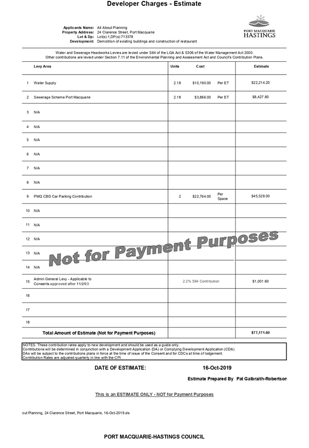
AGENDA Development Assessment Panel 23/10/2019
Item: 08
Subject: DA2019 - 400 Concept Proposal for Staged
Residential Subdivision (25 torrens title lots) & Staged Residential
Subdivision (19 torrens title lots) - 165 John Oxley Drive, Port Macquarie
Report
Author: Development Assessment Planning Coordinator, Patrick
Galbraith-Robertson
|
Applicant: N
& P Mann, P & J Mann, P & B Pye CARE King & Campbell Pty Ltd
Owner: N
& P Mann, P & J Mann, P & B Pye
Estimated Cost: $750,000
Alignment with Delivery
Program
4.3.1 Undertake transparent
and efficient development assessment in accordance with relevant legislation.
|
|
RECOMMENDATION
That
DA2019 - 400 for a concept proposal for staged residential subdivision
(25 Torrens title lots) & staged residential subdivision (19 Torrens
title lots) at Lot 3 DP 533058, No. 165
John Oxley Drive, Port Macquarie, be
determined by granting consent subject to the recommended conditions.
|
Executive
Summary
This
report considers a development application for a concept proposal for
staged residential subdivision & staged residential subdivision at the subject site and provides an assessment of the
application in accordance with the Environmental Planning and Assessment Act
1979.
Following exhibition of the
application, three (3) submissions were
received.
The proposal has been amended
during the assessment of the application in response to assessment issues.
The site is considered suitable for the proposed development
and the proposal adequately addresses relevant planning controls. The
development is not considered to be contrary to the public's interest and will
not result a significant adverse social, environmental or economic impact.
This report recommends that the development application be
approved subject to the attached conditions.
1. BACKGROUND
Existing Sites Features and Surrounding Development
The site has an area of 2.4132
hectares.
The site has recently been
rezoned to part R1 General Residential and part E2 Environmental Conservation
with the gazettal of Amendment No.39 to the Port Macquarie Hastings LEP 2011.
The site is subject to an
existing Planning Agreement known as the South Lindfield Urban Release Area
Planning Agreement (Mann VPA).
The site is zoned part R1 general residential and
part E2 Environmental Conservation in accordance with
the Port Macquarie-Hastings Local Environmental Plan 2011, as shown in the
following zoning plan.
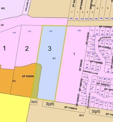
The existing subdivision pattern and location of existing
development within the locality is shown in the following aerial photograph:
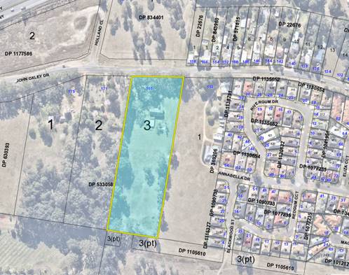
2. DESCRIPTION OF
DEVELOPMENT
Key aspects of the proposal include the following:
· Concept
proposal for a Torrens title subdivision of the site into 25 lots; and
· A Stage 1 works development which includes:
- Vegetation clearing within the development footprint (R1
zone);
- Confirmation of the bushfire asset
protection (APZs) for the concept proposal;
- Demolition of existing dwelling and sheds;
- Construction of the northern sewer
route within the John Oxley Drive road reserve and Lot 1 DP 22676 to the
existing sewerage reticulation infrastructure; and
- The subdivision of the northern
catchment, including road no.1, road no.2, part road no.3 and residential
subdivision to provide 19 lots, which will be released in 3 sub-stages.
· The subsequent Stage 2 Works DA will provide for the
residential subdivision of the southern catchment to provide 6 Torrens title
lots:
- The
Stage 2 Works DA will include details of the downstream connections to the
existing pump station and stormwater treatment via a bio-retention swale within
the adjoining property to the south (Lot 399 DP 1241278), which is held in
separate ownership.
- The
proposed subdivision has been concurrently lodged with a Concept DA and Stage 1
Works DA on the adjoining property to the west, described as Lot 3 DP 533058.
The required servicing (sewer and stormwater) for the northern catchments of
both the subject site and adjoining Lot 1 will be provided on a shared
arrangement.
· The concept proposal has been made pursuant to Part 4
Division 4.4 of the
Environmental Planning and Assessment Act 1979
(the Act) and relates to land identified within the South Lindfield Urban
Release Area.
· The Act establishes at clause 4.22 (5) that Council’s
assessment of a Concept DA need only consider the likely impact of the concept
proposal, including any first stage and does not need to consider the likely
impact of the carrying out of development (the works) that may be the subject
of subsequent Development Applications.
· The proposal is also an Integrated Development requiring
Bushfire Safety Authority under the Rural Fires Act 1997.
Refer
to Attachment 2 at the end of this report for plans of the proposed
development.
Application Chronology
· 5
June 2019 - DA lodged with Council.
· 6 June 2019 - Referral of proposal to NSW Rural Fire
Service to obtain Bushfire Safety Authority.
· 12 to 25 June 2019 - Neighbour notification of proposal.
· 24 June 2019 - Referral of Biodiversity Assessment Report
(BDAR) to the Department of Planning, Industry and Environment.
· 1 July 2019 - Site inspection by Assessing Officer with
Applicant and request for additional information - approach to noise assessment
and Vegetation Management Plan (VMP).
· 3 July 2019 - Copy of submissions forwarded to Applicant
for consideration.
· 18 July 2019 - Bushfire Safety Authority issued by the NSW
Rural Fire Service.
· 28 August 2019 - Meeting with Applicant to discuss assessment
issues.
· 4 September 2019 - Copy of correspondence received from
Applicant of additional information sent to the Department of Planning,
Industry and Environment (DPIE) in regards to an exemption request to the
Biodiversity Conservation Act 2016.
· 5 September 2019 - Amended VMP received from Applicant.
· 17 September 2019 - DPIE provided advice on BDAR received.
· 19 September 2019 - Additional information requested from
Applicant - arborist report queries, VMP suggestions, copy of BDAR issues raised
by DPIE and bushfire risk queries.
· 9 October 2019 - Additional information received from
Applicant - response to all assessment queries and updated BDAR.
3. STATUTORY ASSESSMENT
Section 4.15(1) Matters for Consideration
In determining the application, Council is required to take
into consideration the following matters as are relevant to the development
that apply to the land to which the development application relates:
(a) The provisions (where
applicable) of:
(i) Any Environmental Planning
Instrument
State Environmental Planning Policy No. 44 - Koala
Habitat Protection
The site is identified within
Council’s Koala Plan of Management for South Lindfield Stage 3 (KPoM) dated
November 2018.
An extract of KPoM is provided
below and it confirms the proposed approach to trees being removed within the
development footprint and those trees that are to be retained on the northern
and southern property boundary and within the E2 zoned lands.
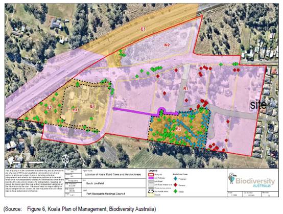
The Applicant has submitted a Vegetation Management Plan
(VMP) (as required by the Planning Agreement applying to the site) which
satisfactorily addresses the requirements of this KPoM. The VMP is recommended
to be supported and an appropriate consent condition is recommended.
State Environmental Planning Policy No. 55 –
Remediation of Land
Following an inspection of the site and a search of Council
records, the subject land is not identified as being potentially contaminated
and is suitable for the intended use.
State Environmental Planning Policy (Coastal Management)
2018
The site is not located within a coastal use area or coastal
environment area.
State Environmental Planning Policy (Infrastructure) 2007
The site does not have frontage
to a classified road. John Oxley Drive has been declassified from previously
being the Oxley Highway.
On the basis that the site is
not adjacent to the road corridor for a freeway, a tollway or a transit way or
any other road with an annual average daily traffic volume of more than 40,000
vehicles, clause 102 does not apply.
Under the provisions of clause
104, the proposed subdivision is not identified as a traffic generating
development.
Under the provisions of clause 106, the proposed northern
sewer route is a permissible landuse outside the development site in the RU1
primary production zone to the north of the site.
Based on the above, the proposed development addresses
relevant clauses in the SEPP and will not to create any significant adverse
conflict in terms of traffic or noise.
Port Macquarie-Hastings Local
Environnemental Plan 2011
The proposal is consistent with the LEP having regard to the
following:
· Clause
2.2 - The subject site is zoned part R1 general residential and part E2
environmental conservation.
The objectives of the R1 zone are as
follows:
• To provide for the housing needs of the
community.
• To provide for a variety of housing
types and densities.
• To enable other land uses that provide
facilities or services to meet the day to day needs of residents.
The objectives of the E2 zone are as follows:
• To protect, manage and restore areas of
high ecological, scientific, cultural or aesthetic values.
• To prevent development that could
destroy, damage or otherwise have an adverse effect on those values.
• To protect coastal wetlands and littoral
rainforests.
• To protect land affected by coastal
processes and environmentally sensitive land.
• To prevent development that adversely
affects, or would be adversely affected by, coastal processes.
• To enable development of public works
and environmental facilities where such development would not have an overall
detrimental impact on ecological, scientific, cultural or aesthetic values.
In accordance with Clause 2.3(2),
the proposal is consistent with the objectives of both zones having regard to
the following:
o The proposal will ensure the
protection of the section of the site which is zoned E2 which has high
ecological value.
o The proposal will increase the
ecological value of the E2 zoned section of the site with the proposed VMP
works and koala offset plantings;
o The subdivision is a
permissible landuse; and
o The subdivision will provide
for new housing needs of the community.
· Clause
2.7 - The demolition of the existing dwelling requires consent as it does not
fit within the provisions of SEPP (Exempt and Complying) 2008.
· Clause
4.1 - The lot sizes within the proposed Stage 1 subdivision development area
range from 497.6m2 to 819.5m2. All proposed lots comply with the minimum 450m2
lot size standard identified in the Lot Size Map relating to the site.
· Clause
5.10 – Heritage. The site does not contain or adjoin any known heritage
items or sites of significance. A standard precautionary condition is
recommended to stop works should any aboriginal archaeological items be
discovered during any works.
· Clause
7.5 – Koala Habitat. This clause applies to land that is shown as
“Koala Habitat area” on the Koala Habitat Map. The site is
identified within Council’s Koala Plan of Management for South
Lindfield Stage 3. Koala trees are proposed to be removed as detailed in
the submitted plans and offset plantings of trees are proposed within the
planned location within the E2 environmental conservation zone. The E2 zoned
section of the site is intended to be dedicated to Council under the Mann VPA.
· Clause
7.8 - The site is not subject to any identifiable adverse aircraft noise
associated with the operations of the Port Macquarie Airport.
· Clause
7.9 - The site is subject to acoustic controls as shown on the ‘acoustic
controls map’. A specialist site specific Road Noise Assessment has been
submitted to address any potential amenity impacts to future residential uses
on the site. This report recommends that a continuous 1.8m fence (either
standard colorbond or timber lapped), to the northern property boundary will
ensure that the relevant requirements for road traffic noise intrusion will be
achieved for all future dwellings that are constructed to normal residential
standards.
· Clause
7.13 - Satisfactory arrangements are in place for provision of essential
services including water supply, electricity supply, sewer infrastructure,
stormwater drainage and suitable road access to service the development.
Provision of electricity will be subject to obtaining satisfactory arrangements
certification prior to the issue of a Subdivision Certificate as recommended by
a condition of consent.
(ii) Any
draft instruments that apply to the site or are on exhibition
No draft instruments apply to the site.
(iii) Any
Development Control Plan in force
The relevant provisions
of the Development Control Plan 2013 include:
· Part 4 – Chapter 4.4.3 - South Lindfield precinct;
· Part 3 – Chapter 3.6 Subdivision; and
· Part 2 - General Provisions.
The South Lindfield
Precinct is identified in the below image:
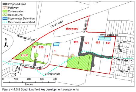
|
Part 4 - Chapter 4.4.3 South Lindfield Precinct
|
|
DCP Objective
|
Development Provisions
|
Proposed
|
Complies
|
|
4.4.3.1 & 4.4.3.2
|
Subdivision layouts to provide a road network that
conforms with the connectivity shown in Figure 4.4.3-2 - (refer above Figure
extract).
New development within the
western sub precinct has access via a single access from Philip Charley Drive
from the south.
|
The proposed internal road
network is consistent with Figure 4.4.3-2, which
provides for an extension to Anabella Drive.
All proposed lots will only be accessible from the new
internal road network.
|
Yes
|
|
4.4.3.3 & 4.4.3.4
|
All stormwater infrastructure is
consistent with the outcomes of the stormwater management strategy
summarised in Figure 4.4.3-2.
All stormwater infrastructure (including access) is to be
dedicated to Council.
|
The location of the proposed
stormwater basin to serve the northern catchment of the site (Lot 3) and the
adjoining property at Lot 1, is consistent with Figure 4.4.3-2.
It is proposed to dedicate the
stormwater infrastructure which will serve a number of properties, to
Council.
|
Yes
|
|
4.4.3.5
|
Development is to provide an integrated solution for
sewerage services with adjoining properties.
Development will require
approval from relevant landowners for gravity sewerage mains connecting to
the
existing sewerage network.
In the northern catchment:
• the sewer mains are to
connect to an existing gravity main connecting to Sewer Pump Station 54,
until a sewer
pumping station on Lindfield
Park Road is operational
• the alignment should
cater for possible extension to serve the bulk of the 4 lots west of Philip
Charley Drive
• development yields of
the land zoned Residential are not to exceed 16 et/ha prior to provision of
upgraded local
sewerage main capacity.
In the southern catchment the sewer mains are to connect
to Sewer Pump Station 80 to the south.
|
The proposed sewer strategy for the Concept DA is
illustrated on the plans submitted.
The northern catchment, the
subject of the Stage 1 Works DA, will ultimately drain to Pump Station 54 via
a connection through Lot 1 DP 22675 to PM54P010MH. The owner’s consent
from the landowner of Lot 1 DP 22675 has been submitted.
The development of the
southern catchment, the subject of the future Stage
2 Works DA, will drain to Pump
Station 80 through Lot 399 DP1241278 to
PM80P001MH. The point of the
future connection within the site is shown on the plans submitted.
|
Yes
|
|
4.4.3.6
|
Compliance with requirements of the South Lindfield Koala
Plan of Management.
The areas shown on Figure
4.4.3-2 for Conservation are to be dedicated to Council
for long term management,
following embellishment planting of koala food trees:
• in forested areas -
within available canopy spaces where the space has a radius of at least 5 m,
or
• in cleared areas - at 10 m centres.
Alternatively, with Council
approval planting in cleared areas can be provided elsewhere in the vicinity
at an offset ratio of 4 trees for each koala food tree removed, with trees at
10 m centres.
Where land zoned E2 or land
containing offset planning is held in private ownership, satisfactory
arrangements will be required for ongoing maintenance in perpetuity.
Development adjoining the land
zoned E2 Environmental Conservation must ensure that the long-term habitat
integrity of that E2 land is
not compromised by the development activities.
|
Figure 6 of the South
Lindfield KPoM confirms that will the proposed removal of the existing koala
food trees these will be required to be offset within the E2 environmental
conservation area which is to be dedicated to Council. The VMP submitted sets
out a satisfactory approach to addressing these requirements.
|
Yes
|
|
4.4.3.8
|
Applications for subdivisions
should provide site-specific updated traffic noise assessments, with adequate
information to simplify subsequent assessment of building
proposals.
Acoustic mitigation measures should not use high visual
barriers.
|
A specialist Road Noise
Assessment has been submitted. This report confirms that a continuous 1.8m
fence (either standard colorbond or timber lapped), to the northern property
boundary will ensure that the relevant requirements for road traffic noise
intrusion will be
achieved for all future
dwellings that are constructed to conventional residential development
standards.
|
Yes
|
|
DCP 2013: Chapter 3.6 - Subdivision
|
|
DCP Objective
|
Development Provisions
|
Proposed
|
Complies
|
|
3.6.3.1
|
A site analysis is required for all development and shall
illustrate:
· microclimate;
· lot dimensions;
· north point;
· existing
contours and levels to AHD;
· flood affected
areas;
· overland flow
patterns, drainage and services;
· any contaminated
soils or filled areas, or areas of unstable land;
· easements and/or
connections for drainage and utility services;
· identification
of any existing trees and other significant vegetation;
· any existing
buildings and other structures, including their setback distances;
· heritage and
archaeological features;
· fences;
· existing and
proposed road network, including connectivity and access for all adjoining
land parcels;
· pedestrian and
vehicle access;
· views to and
from the site;
· overshadowing by
neighbouring structures; and
· any other
notable features or characteristics of the site.
|
A satisfactory site analysis plan has been submitted.
|
Yes
|
|
3.6.3.2
|
Torrens title lots minimum width of 15m when measured at a
distance of 5.5m from front property boundary.
|
All lots have a minimum or greater width of 15m when
measured at a distance of 5.5m from front property boundary.
|
Yes
|
|
Minimum width of 7m when boundaries are extended to kerb
line.
|
All lots have a width greater than 7m for lots which have
boundaries extended to the kerb line.
|
Yes
|
|
Minimum depth of 25m.
|
All lots have a depth greater than 25m.
|
Yes
|
|
For lots where average slope of the site is equal to, or
exceeds 16%, indicative road and driveway grades are required demonstrating satisfactory
access.
|
No indicative driveway grades are required for individual
lots as the slope grades are less than 16%.
|
N/A
|
|
3.6.3.3
|
Battle-axe lots discouraged in greenfield development.
|
No battle-axe lots are proposed.
|
Yes
|
|
3.6.3.4
|
Lots are to be designed to allow the construction of a
dwelling, which does not involve more than 1m cut, or fill, measured from
natural ground level, outside the dwellings external walls.
|
All proposed lots are designed to allow for future
construction of dwellings, which will be unlikely to require more than 1m cut
or fill.
|
Yes
|
|
Additional information provided for slope categories in
accordance with Table 3.6.2.
|
All proposed lots will meet the criteria for Slope A
standards with no special lot designs required.
|
Yes
|
|
3.6.3.5
|
Wherever possible orientate streets to maximise the number
of east, west and south facing lots and to minimise the number of narrow
north facing lots.
Residential street blocks should preferably be orientated
north-south with dimensions generally
limited to 60-80m by 120-150m as illustrated in Figure
3.6-2.
|
The orientation of the
proposed lots has been determined primarily having regard to the position of
the east-west extension of Annabella Drive and planned road corridors.
|
Yes
|
|
Lot size and shape are to reflect orientation to ensure
future dwelling construction has optimal opportunity for passive solar
design.
|
|
3.6.3.6
|
Kerb and guttering, associated street drainage, pavement
construction and foot paving across the
street frontages should be constructed as part of the
subdivision works where these do not exist (may be varied subject to criteria
in this clause)
|
The proposed street pattern
has been determined having regard to the
position of the east-west
extension of Annabella Drive and includes a
pathway network and
consideration of the future external connections in the
South Lindfield neighbourhood.
|
Yes + appropriate consent conditions recommended.
|
|
3.6.3.7
|
Subdivisions close to urban centres or along arterial
roads serviced by public transport achieve yield of >35 dwellings per
hectare.
|
The proposal will achieve a
yield of approximately 10-11 dwelling per hectare.
Satisfactory density achieved
particularly having regard to general residential zoning of land and noting
there is no minimum floor space ratio controls. There is also potential for
more than 1 dwelling on some of the proposed lots.
|
Satisfactory
|
|
3.6.3.8
|
All new roads are to be dedicated to Council designed in
accordance the Council’s adopted AUSPEC
design specification documents.
All applications to subdivide land should include a road
layout plan that meets the Council’s design requirements including
providing connectivity and access for all land parcels consistent with
Council’s road hierarchy.
|
All proposed roads meet
Councils current Aus-Spec requirements and provides for connectivity within
the South Lindfield neighbourhood.
|
Yes
|
|
3.6.3.9
|
The design of roads identified for bus routes should
comply with the AUSTROADS standards, including the design of bus bays and
stops.
|
The site is adjacent John
Oxley Drive and it is anticipated that all future bus stops will be provided
for in this existing road reserve.
No bus stops are proposed
within the subdivision.
|
Yes
|
|
Development should provide the bus stops, including bus
bays and shelters not more than 600m apart.
|
|
3.6.3.10
|
The design of roads should aspire to achieve standards
illustrated in Figure 3.6-3 to Figure 3.6-11.
|
The proposed road network
provides for the following:
- Street trees on the opposite
side of the roads are proposed to allow for the water services/ footpaths;
- Underground utilities;
- Formed kerb and guttering;
and
- 1.5m wide footpaths.
|
Yes
|
|
At a minimum all new roads should include:
•
street trees at a rate of 1 per 20m along the street frontage and in accordance
with Council’s Indigenous Street and Open Space Planting List;
•
underground utilities;
•
formed kerb and guttering;
•
1.2metres pedestrian path.
|
|
3.6.3.11
|
Perimeter roads adjoining bushland should be designed in
accordance with Figure 3.6-8 and may be considered part of the APZ
requirements for the adjoining land.
|
The positioning of the
Annabella Drive extension, as required by the DCP provisions for South
Lindfield, has generally determined the road layout within each property. An
edge road to the southern boundary is acceptable and accordingly the lots
that front this boundary will include 10m wide APZ’s.
|
Yes
|
|
3.6.3.12
|
Perimeter roads should be designed in accordance with
Figure 3.6-8
|
|
3.6.3.13
|
Development for the subdivision for land or major
residential development should provide footpaths on both sides of all
collector and arterial roads.
|
All proposed footpaths have
been designed to one street frontage, ensuring street tree planting can be
undertaken on the opposite side of each street.
All proposed lots have
frontage to a public road ensuring future casual
surveillance.
|
Yes
|
|
Footpaths should be provided on one side of the street for
access places and local streets in accordance with Council’s adopted
AUSPEC design specification documents.
|
|
Off street share-ways and on road cycle ways should be
provided.
|
|
Footpaths and cycleway are to have regard for Crime
Prevention Through Environmental Design
(CPTED) principles.
|
|
The choice of direction and possible routes should be
maximised, with streets and footpaths
substantially capable of surveillance by residents.
|
|
3.6.3.14
|
Local roads are to be designed for a maximum vehicle speed
of 50kph.
|
The road network has been
designed to restrict vehicle speeds to 50km/hr.
This also supported in the
KPoM that applies to the South Lindfield
neighbourhood.
|
Yes
|
|
Traffic management schemes may be appropriate to
discourage speeding in long stretches of local roads or to discourage ‘rat-running’.
|
|
On street parking should be discouraged along local roads.
|
|
3.6.3.15
|
Cycling infrastructure should be provided in accordance
with the Council’s Cycling Plan.
|
N/A
|
N/A
|
|
Where physical infrastructure or land dedication cannot be
provided or is not identified, a contribution in accordance with the
Councils’ contribution plan/s.
|
Development contributions recommended for contribution to
recreation facilities in accordance with Council’s adopted Development
Contributions Plans.
|
Yes
|
|
3.6.3.16
|
An application for subdivision should be accompanied by an
a Integrated Water Cycle Management Strategy prepared by a certified
practicing engineer and in accordance with Council’s adopted design
specification documents.
|
A satisfactory Stormwater and Servicing Strategy has been
submitted.
This Plan includes the
stormwater management provisions for the development of the northern
catchments for the site (Lot 3) and the adjoining property at Lot 1 DP
369206.
The plans submitted illustrate
the extent of the stormwater management provisions within the northern
catchment of both Lot 3 (the site) and adjoining Lot 1.
Note: The proposed works for
the stormwater infrastructure and bio-retention swale within the adjoining
property to the south (Lot 399 DP
1241278), will be undertaken
as part of the Stage 2 DA to this Concept DA.
In relation to the proposed
stormwater management provisions, the impact
of the proposed development on
stormwater quantity and stormwater
quality was modelled in the
12d and MUSIC programs respectively, comparing existing pre-development
conditions to proposed post-development
conditions, and the change to
water quality from source to outlet. The modelling has demonstrated that the
subject land has the
capability to provide the
necessary mitigation measures to ensure
protection of the downstream environment and hydrology.
|
Yes
|
|
3.6.3.17 - 3.6.3.19
|
An application for subdivision should be accompanied by a
Stormwater Management Strategy prepared by a certified practicing engineer
and in accordance with Council’s adopted Aus-Spec design specification
documents.
The finished floor level of buildings should be above the
100 year ARI flood level (plus freeboard) and in accordance with the
council’s current flood policy.
|
|
3.6.3.20
|
Water supply to meet Council’s design
specifications.
|
It is proposed to connect to
the existing 200mm water main in Annabella Drive and run reticulated water
through the development as shown on the Stormwater and Servicing Strategy.
The future Stage 2 DA for the
development of the southern catchment will provide a connection to either the
450mm DICL or 525mm AC main to the south of the property and will be subject
of further consultation with the
PMHC Water and Sewer Section.
|
Yes
|
|
3.6.3.21 - 3.6.3.22
|
All lots connected to reclaimed water if available.
|
|
3.6.3.24
|
Separate sewer junction provided for each lot.
|
The northern catchment, the
subject of the Stage 1 Works DA will ultimately
drain to Pump Station 54 via a
connection through Lot 1 DP 22675 to
PM54P010MH, as shown in the
submitted plans. The owner’s consent from the landowner of Lot 1 DP
22675 accompanies this submission.
The development of the southern
catchment, the subject of the future Stage 2 Works DA, will drain to Pump
Station 80 through Lot 399 DP1241278 to PM80P001MH. The point of connection
within the site is shown in the submitted plans.
|
Yes
|
|
3.6.3.25
|
Extension of sewer infrastructure at cost of developer.
|
|
3.6.3.26 - 3.6.3.27
|
Erosion and sediment control plan to be provided.
|
A silt and sediment control
plan will be provided with the Construction Certificate for the subdivision
works.
|
Yes - capable with consent condition recommender.
|
|
3.6.3.28
|
Saving and re-using top soil and the incorporation of
additives to improve existing soils is preferred to the importation of soils
for landscaping.
|
Construction details will be required to be provided with
the Construction Certificate for the subdivision works.
|
Yes
|
|
3.6.3.29
|
Neighbourhood parks area to be provided so that all
residential areas are generally within 500m of the nearest park.
|
The subject site is not
identified to make provision for public open space for recreational purposes.
|
N/A
|
|
The location of neighbourhood parks is to be optimised so
that a minimal number of parks are required.
|
|
Neighbourhood parks and playing fields should be connected
to the cycleway and pedestrian path networks.
|
|
Neighbourhood parks should provide a range of facilities.
|
|
Sports fields should be located close to school
facilities.
|
|
As a minimum 1.5 hectares active open space (sports
fields); 5000m2 neighbourhood park; 1 hectare of linkage/amenity space (total
3 hectares open space) to be provided per 1,000 people.
|
|
3.6.3.30
|
Neighbourhood parks are to be dedicated as development
occurs, and are to include the following:
• Minimum size of 5,000m2.
• At least 2000m2 should be level to gently sloping
land.
• Street frontage to the same standard as adjoining
residential areas (i.e. kerb and gutter, or drainage swales where
appropriate).
• Any landform grooming to ensure the park is to a
standard to suit Council’s maintenance regime.
• Any drainage works to ensure the functionality of
the park.
• Access via more than one street.
• Integration with other community facilities.
• Should be located to cause minimal disruption to
traffic.
|
|
Neighbourhood park embellishment is to incorporate:
• Park furniture including seats with shelters,
barriers and any appropriate path and cycleway linkages along desire lines or
linking to the cycleway network.
• Any boardwalks necessary to achieve the required
functionality of the park.
• Works should generally be required to be
undertaken prior to dedication to Council.
|
|
3.6.3.31
|
An open space management strategy should accompany any
subdivision application where open space that connects to natural linkages,
drainage and wildlife corridors.
|
N/A
|
N/A
|
|
3.6.3.32
|
All street plantings are to be selected from Council's Indigenous
Street and Open Space Planting List from the relevant vegetation
community adjacent to the Development.
|
The proposed street planting
will be consistent with Council’s Indigenous
Street and Open Space Planting List.
|
Yes
|
|
3.6.3.33
|
Lot layout should address areas of open space or public
environmental management areas.
|
The positioning of the
Annabella Drive extension, as required by the DCP provisions for South
Lindfield, has generally determined the road layout within each property. Not
providing an edge road to the southern boundary is acceptable and accordingly
the lots that front this boundary will included
10m wide APZ’s.
|
Yes
|
|
Perimeter roads should border any area of open space or
public environmental management areas.
|
|
An assessment against the generic elements of crime
prevention through environmental design
described in the Crime Prevention Through Environmental
Design (CPTED) principles is provided with the subdivision application.
|
No battle axe lots are proposed. All lots have street
frontage connection to provide for casual observation of street.
|
Yes
|
|
3.6.3.34
|
All service infrastructure should be underground unless
otherwise approved by Council.
|
All services will be provided
underground, in accordance with the relevant construction codes.
|
Yes
|
|
All service infrastructure should be installed in a common
trench.
|
|
Conduits for the main technology network system should be
provided in all streets.
|
|
Conduits are to be installed in accordance with the
National Broadband Network Company Limited’s
‘Guidelines for Fibre to the Premises Underground
Deployment’.
|
|
Access pits are to be installed at appropriate intervals
along all streets.
|
|
3.6.3.35
|
All new roads are to be designed in accordance the
Council’s Aus-Spec design specification documents.
All applications to subdivide land should include a road
layout plan that meets the Council’s design requirements.
|
All proposed roads are
compliant with Council’s Aus-Spec design
specification documents.
|
Yes
|
|
3.6.3.45
|
Street lighting should be provided in accordance with
Australian Standards
|
Street lighting should be provided in accordance with
Australian Standards.
|
Yes
|
|
3.6.3.46
|
All new development should use energy efficient street lighting.
|
|
3.6.3.47
|
Lighting should be provided along pathways, cycle ways and
in public places.
|
|
3.6.3.51
|
Street trees should be provided along all road frontages
generally at a rate of 1 per 20m interval.
|
Street trees are provided to
one side of every street, enabling footpaths and water services to be
provided on the alternate side.
The proposed street planting
will be consistent with Councils’ Indigenous
Street and Open Space Planting
List.
|
Yes
|
|
Street trees should not affect solar access.
|
|
3.6.3.52
|
Street trees from Council’s list.
|
|
3.6.3.53 - 3.6.3.54
|
CPTED assessment required
|
All proposed lots have
frontage to a public road, allowing for casual
surveillance.
|
Yes
|
|
DCP 2013: General Provisions
|
|
DCP Objective
|
Development Provisions
|
Proposed
|
Complies
|
|
2.3.3.8 onwards
|
Removal of hollow bearing trees
|
A specialist site specific
ecological assessment has been submitted. This assessment confirms that
Hollow bearing trees are not present within the site.
|
N/A
|
|
2.6.3.1
|
Tree removal (3m or higher with 100mm diameter trunk and
3m outside dwelling footprint
|
Tree removal is proposed which has been satisfactorily
addressed with the submitted ecological Biodiversity Assessment Report.
|
Yes
|
|
2.4.3
|
Bushfire risk, Acid sulphate soils, Flooding,
Contamination, Airspace protection, Noise and Stormwater
|
Refer to main body of report.
|
Yes
|
|
2.5.3.11
|
Section 94 contributions
|
Refer to main body of report.
|
Yes
|
(iiia) any
planning agreement that has been entered into under section 7.4, or any draft
planning agreement that a developer has offered to enter into under section 7.4
There is an existing planning agreement in place between the
landowner’s and Council known as the South Lindfield Planning
Agreement (Mann VPA) which has been entered into relating to the site. The
Ramm VPA sets out the following provisions:
· Roads Contribution
- requires payment of the current Roads Contribution or the Roads Contribution
determined by the next review of the Roads Contribution Plan (Clause 8)
· Clause 9 -
provides the landowner of the adjoining western property with the opportunity
to construct and dedicate the Link Road across the subject property in order to
connect to Annabella Drive.
· Clause 10 -
includes provisions facilitating payment of compensation by the subject
landowner to the adjoining western landowner in the event that the adjoining
landowner has constructed and dedicated the Link Road across the subject
property.
· Clauses 13 –
15 - includes provisions that provide for the construction of Stormwater
Catchment Work and where appropriate reimbursement of the cost of those works
on a catchment share basis.
· Clause 16 -
provides for the payment of the Sewerage Services Contribution and Sewerage
Services Contribution Local.
· Clause 17 -
provides for the payment of the current Open Space Contribution or the Open
Space Contribution determined by the next review of the Open Space Contribution
Plan.
· Clauses 18 to 23 -
includes provisions relating to the Environmental Management Land within the
subject property. These clauses require the establishment, management and
dedication of the Environmental Management Land (EML) in conjunction with the
subdivision of the subject land. It is proposed to undertake the establishment,
management and dedication of the EML, as detailed in the attached VMP and the
South Lindfield KPOM, as part of the Stage 1 Works DA.
The proposed subdivision is consistent with this VPA and
appropriate conditions are recommended to require the VPA to be performed.
(iv) Any matters prescribed by the
Regulations
Demolition of buildings AS 2601 – Clause 92
The submitted plan of
subdivision includes demolition of the existing dwelling and sheds.
Demolition of the existing buildings on the site are capable
of compliance with this Australian Standard and an appropriate standard
condition is recommended.
(b) The
likely impacts of that development, including environmental impacts on both the
natural and built environments, social and economic impacts in the locality:
Context and setting
The proposal will not have any significant adverse impacts
to existing adjoining properties or the public domain.
The proposal is considered to be sufficiently compatible
with other residential development in the locality and adequately addresses
planning controls for the area.
The concept Development Application component of the
proposal provides for the following:
· The identification
of the future vegetation clearing within the site and tree removal within the
John Oxley Drive road reserve;
· The indicative
future residential lot layout that will provide for 25 Torrens title lots to
satisfy the minimum lot size requirements set out in the PMH LEP 2011;
· The location of
the future internal road network and the locations for connections to the
existing road network to the east and the proposed adjacent network to the
west;
· The identification
of the location for a future stormwater basin, to be provided within a public
reserve and straddle the boundaries of the subject site and adjoining Lot 1 DP
369206;
· The identification
of the connection locations for the future upstream and downstream servicing
through adjoining properties; and
· The identification
of the location for future Asset Protection Zones.
Pursuant to Section 4.22(2) of
the Act the DA also provides for the first stages of subdivision development,
being the Staged Works DA within the northern section of the site. The
environmental, social and economic impacts of the concept DA have been assessed
as being acceptable under Section 4.22(5) of the Act. In particular, the
justification details submitted for the southern section/catchment of the site
are considered acceptable.
An appropriate condition is
recommended to restrict development of the southern section/catchment which
will need to be the subject of a separate DA and development consent.
Roads
The site has road frontage to John Oxley Drive and Annabella
Drive via an adjoining proposed subdivision under DA2019 - 401, also reported
to this DAP meeting.
John Oxley Drive is classified as a Sub-Arterial road which
is in the care and control of Council. It is a sealed road with a pavement
formation of 6m, with shoulders to both sides of the pavement. The road reserve
is approximately 24m wide.
Annabella Drive is classified as a local road with a
pavement formation of 9m wide in a 20m road reserve. The pavement has layback
kerb.
Annabella drive is connected to the Ruins Way (which is a
collector road) via a single lane roundabout.
Traffic and Transport
Anabella Drive is classified as a Local Road with a 9m
pavement width. Based on the number of existing dwellings and the proposed
lots, the calculated daily vehicle trips along Anabella Drive will be
approximately 1806vpd (using RMS guidelines of 7 daily vehicles trips per day,
over approx. 258 lots (existing and proposed DA2019 - 400.1 and DA2019 -
401.1)). In accordance with Aus-Spec, the design criteria of a local road is
100 - 2000vpd. In this regard, the development is unlikely to have any adverse
impacts to the existing road network within the immediate locality. The
immediate existing road network has capacity for the anticipated additional
traffic.
Site Frontage & Access
This development has proposed an internal road network in
accordance with our current DCP for the Lindfield Area development. The
Development Control Plan 2013 refers to this precinct the “South
Lindfield precinct” and has defined the future road layout to minimise
road connections to John Oxley Drive, noting that it is a sub-arterial road.
This application does not include the lot required to make the second
connection to John Oxley Drive (refer to image below and circled). This future
access will be subject to a future DA on Lot 2 DP 533058 (i.e. lot 171, refer
to image extracted from DCP2013 below). This will ultimately require all
vehicles movements associated with this development to use the existing
Annabella Drive exit via the Ruins Way until Lot 2 DP533058 develops further.
The plans provided are generally in accordance with this
strategic plan.


The development proposal is for vehicle access to the
development via Annabella Drive, which is a 9m wide road running east west
through the development site. Annabella Drive is classified as a local road
with a 9m wide pavement formation.
This DA application proposes to extend Annabella Drive to
the west, (Road 1, east-west) providing access to the Ruins Way and ultimately
John Oxley drive. Additional local roads in the development are proposed in a
north-south direction (off Road 1) providing access to all residential lots.
It should be noted that once the development lot to the west
of the development site (Lot 171 in the above image) develops, a further
extension of Annabella Drive and connection to John Oxley Drive shall be
required in accordance with DCP2013. This will provide an additional entry/exit
to this residential area, which will ultimately alleviate traffic movements to
the east along Annabella Drive/The Ruins Way. The construction of this
connection to John Oxley Drive is a requirement of the Voluntary Planning
Agreement for the South Linfield Urban Release Area and will be a development
requirement once the applicable stage generates a demand for the link road.
The internal roads shall be classified as follows:
|
Road Name
|
Pavement width
|
|
Road 1
|
9m - Local
Anabella Drive is a local road with a 9m wide formation.
Road 1 is an extension of Anabella drive and would require a similar 9m wide
pavement width.
|
|
Road 2
|
8m - Local with min. 9m radius turning head (northern side
only)
|
|
Road 3
|
8m - Local with a 12m radius turning head (subject to
future DA)
|
All internal roads shall comply with Council AUSPEC and
Australian Standards, and conditions have been imposed to reflect these
requirements.
Due to the type and size of development, additional works
are required to include:
· Concrete
footpath paving along on one side of all local roads
· Concrete
footpath connecting the development site to the bus-stops on John Oxley Drive
· A
temporary construction access from John Oxley Drive. No construction traffic is
recommended via Annabella Drive on the basis that the construction of the
development will have significant impacts to Council’s existing road network.
Appropriate consent conditions are
recommended to address new road and impact to existing road requirements.
Parking and Manoeuvring
N/A
Water Supply Connection
Council records indicate that the development site has an
existing 20mm metered water service from the 200 PVC water main on the opposite
side of John Oxley Drive. Upon development of the adjoining western property
(Lot 2 DP 533058) an extension of Council’s 200mm water main in Annabella
Drive and connection made to the existing water main in John Oxley Drive, at no
cost to Council, can service the proposed development.
Pipe sizes shall be confirmed by PMHC’s Water and
Sewer Section with application for the Construction Certificate.
Each proposed lot is to have an
individual service connection.
Appropriate consent conditions are recommended to address
water supply requirements.
Sewer Connection
Council records indicate that the proposed development site does
not currently have a connection to sewer. Council’s sewer infrastructure
is to be extended at no cost to Council to provide each lot with an individual
connection. In accordance with Council’s adopted specifications, sewer
shall be provided to enable 100% of building areas within lots to drain to
sewer
The proposed development is to provide an integrated
solution for sewerage services with adjoining properties. Any proposed gravity
sewerage mains connections to the existing sewerage network requires approval
from relevant landowners.
In the northern catchment:
· the sewer mains
are to connect to an existing gravity main connecting to Sewer Pump Station 54
· the alignment is
to consider a possible extension to serve the bulk of the following lots west
of Philip Charley Drive; Lot 2 DP1186806, Lot 21 DP1089272, Lot 2 DP578793, Lot
4 DP 630393.
In the southern catchment, the sewer mains are to connect to
Sewer Pump Station 80 to the south of the proposed development lot.
PMHC’s Water and Sewer Section shall
confirm proposed pipe locations with application for the Construction
Certificate.
Appropriate consent conditions are recommended to address
sewer servicing requirements.
Stormwater
The site contains two catchments
separated by a ridge line in the East –West direction and draining to the
northern & southern boundary respectively. Drainage is primarily directed
by overland means to the proposed pit and pipe stormwater network for both
catchments.
The overall site catchment is
composed of two catchments, with both being of a roughly rectangular shape. The
northern catchment drains northwards, crossing the John Oxley Drive & Oxley
Highway via existing stormwater culverts and drainage swales to the Hastings
River Floodplain and ultimately the Hastings River itself. The southern
catchment drains southwards over land and via a series of small creeks and
swales to enter the Lake Innes Floodplain and ultimately Lake Innes itself.
The legal point of discharge for the proposed development is
defined as a direct connection to Council’s stormwater pit/pipeline.
A detailed site stormwater management plan will be required
to be submitted for assessment with the Section 68 application and prior to the
issue of a Construction Certificate.
In accordance with Councils AUSPEC requirements, the
following must be incorporated into the stormwater drainage plan:
· On
site stormwater detention facilities
· Water
quality
· Provision
of interallotment drainage to allow the proposed development to drain to the
nominated point of discharge via a single suitably sized conduit
Appropriate consent conditions are recommended to address
stormwater servicing requirements.
Other Utilities
Telecommunication and electricity services are available to
the site.
Evidence of satisfactory arrangements with the relevant
utility authorities for provision to each proposed lot will be required prior
to Subdivision Certificate approval.
Appropriate consent conditions are recommended to address
utility servicing requirements.
Heritage
Following a site inspection (and a search of Council
records), no known items of Aboriginal or European heritage significance exist
on the property. No adverse impacts anticipated. The site is considered to be
disturbed land.
As a precaution, a condition of consent has been recommended
that works are to cease in the unexpected event heritage items are found. Works
can only recommence when appropriate approvals are obtained for management
and/or removal of the heritage item.
Other land resources
The site is within a planned
urban release context and will not sterilise any significant mineral or
agricultural resource.
Water cycle
The proposed development will not have any significant
adverse impacts on water resources and the water cycle.
Soils
The proposed development will not have any significant
adverse impacts on soils in terms of quality, erosion, stability and/or
productivity subject to a standard condition requiring erosion and sediment
controls to be in place prior to and during construction.
Air and microclimate
The construction and/or operations of the proposed
development will not result in any significant adverse impacts on the existing
air quality or result in any pollution. Standard precautionary site management
condition recommended.
Flora and fauna
The proposed development includes clearing of approximately
0.45 hectares of native vegetation. Under the Biodiversity Conservation Act
2016, the Biodiversity Offset Scheme (BoS) applies for the following reasons:
· The extent of clearing
is above the thresholds in Clause 7.2 of the Biodiversity Conservation
Regulation 2017;
|
Minimum lot size of land (LEP Lot Size Map)
|
Area of Clearing
|
|
Less than 1 hectare
|
0.25 hectare or more
|
The Applicant has submitted a Biodiversity Development
Assessment Report (BDAR as amended) prepared by an authorised person -
Biodiversity Australia. The report has been reviewed and it is considered that
adequate measures have been taken to avoid or minimise impacts, and the
development would not result in serious and irreversible impacts on
biodiversity.
The offset area specified in section 7.2 of the submitted
Biodiversity Development Assessment Report | Lot 3 John Oxley Drive | October
2019 to reduce ecosystem and species credit requirements is recommended to not
supported. The BAM calculated credits are to be used for this development. The
development will require the retirement of the following ecosystem credits
and/or species credits to offset the impacts of the development: No 690:
Blackbutt - Tallowwood moist ferny open forest of the coastal ranges of the NSW
North Coast Bioregion 8 Credits and Koala (Phascolarctos cinereus) 9 Credits:
|
Impacted plant community type
|
Number of ecosystem credits
|
IBRA sub-region
|
Plant community type(s) that can be used to offset the
impacts from development
|
|
No 690: Blackbutt - Tallowwood
moist
ferny open forest of the
coastal ranges of
the NSW North Coast Bioregion
|
8
|
|
|
|
Impacted species
|
Number of species credits
|
IBRA sub-region
|
|
Koala (Phascolarctos cinereus)
|
9
|
Anywhere in NSW
|
Conditions have been recommended requiring evidence of
retirement of the relevant credits prior to the commencement of any clearing on
the land.
The Applicant has also submitted a Vegetation Management
Plan (VMP as amended) which has been reviewed as being acceptable and
recommended to be approved. An appropriate standard condition is recommended to
approve the VMP.
Waste
Satisfactory arrangements are in place for proposed storage
and collection of waste and recyclables. No adverse impacts anticipated.
Standard precautionary site management condition recommended.
Energy
No adverse energy impacts are anticipated.
Noise and vibration
The construction and/or operations of the proposed
development will not result in any significant adverse impacts on the existing
air quality or result in any pollution. Standard precautionary site management
condition recommended.
Bushfire
The site is identified as being bushfire prone.
In accordance with Section 100B - Rural Fires Act 1997 - the
application proposes subdivision of bush fire prone land that could lawfully be
used for residential purposes. As a result, the applicant has submitted a
bushfire report prepared by a Certified Consultant. The report was forwarded to
the NSW Rural Fire Service who have since issued a Bushfire Safety Authority,
which will be incorporated into the consent.
Safety, security and crime prevention
The proposed development will be unlikely to create any
concealment/entrapment areas or crime spots that would result in any
identifiable loss of safety or reduction of security in the immediate
area. The increase in housing density will improve natural surveillance
within the locality.
Social impacts in the locality
Given the nature of the proposed development and its
location the proposal is not considered to have any significant adverse social
impacts.
Economic impact in the locality
The proposal is not considered to have any significant
adverse economic impacts on the locality. A likely positive impact is that the
development will maintain employment in the construction industry, which will
lead to flow impacts such as expenditure in the area.
Site design and internal design
The proposed development design satisfactorily responds to
the site attributes and will fit into the locality.
Construction
Construction impacts are considered capable of being
managed, standard construction and site management conditions have been
recommended.
Cumulative impacts
The proposed development is not considered to have any
significant adverse cumulative impacts on the natural or built environment or
the social and economic attributes of the locality.
(c) The suitability of the site for
the development
The proposal will fit into the locality and the site
attributes are conducive to the proposed development.
Site constraints of bushfire risk have been adequately
addressed and appropriate conditions of consent recommended.
(d) Any submissions made in
accordance with this Act or the Regulations
Three (3) written submissions were received following public
exhibition of the application. Copies of the written submissions have been
provided separately to members of the Development Assessment Panel.
Key issues raised in the submissions received and comments
in response are provided as follows:
|
Submission
Issue/Summary
|
Planning
Comment/Response
|
|
Footpaths do not show kerb ramps and
are on one side of the road
|
The proposed
footpath locations are illustrated diagrammatically on the
subdivision
plans that accompany the DA submission. The detail design
will be
provided with the Construction Certificate submission for the civil
works and
will be consistent with D1.16 of Councils AUSPEC, which
includes the
requirement for pram ramps.
The proposed
footpath locations are consistent with chapter 3.6 of the
PMH DCP 2013
and Council’s adopted AUSPEC design specification documents, including
1.2m wide footpath provision to one side of the local street network. This
provision will also provide for street tree plantings on the opposite of each
street.
|
|
Construction
noise
|
Any consent
issued by Council will include hours of operation for
construction,
which will limit potential disturbance to existing adjoining
residential
premises. Additionally, construction for both subdivision works and future
dwellings will be limited in overall duration, i.e.; construction noise will
cease when development is completed.
It is noted
that safety reversing alarms will need to comply with the relevant Australian
Standards and as such, cannot be conditioned Council.
It is
proposed that the future Construction Certificate documentation for the
subdivision civil works will be required to make provision for a temporary construction
access directly from John Oxley Drive. The intention of this temporary
construction access arrangement is to minimise potential amenity impacts on
the existing adjoining residential areas. An appropriate condition is
recommended in this regard.
|
|
Traffic
impact
|
The matters
raised with respect to overall traffic congestion and general cumulative
impacts are outside the scope of the subject Development Applications. These
matters should be dealt with in Council’s
Regional
Traffic Plan and review of the Major Roads Contribution Plan.
The proposed
subdivision as presented is consistent with Chapter 4.4.3 of Councils DCP
2013 for the South Lindfield Precinct. The proposed internal road network is
consistent with Figure 4.4.3-2, which provides for an extension to Anabella
Drive, an edge road to the E2 zoned land and a footpath connection to the
south. In accordance with the DCP, Annabella Drive will extend further to the
west to facilitate an intersection connection onto John Oxley Drive. This
future intersection connection will provide a secondary means of access for
the subject properties and the locality generally.
Annabella
Drive is currently constructed to a collector road standard (9m carriageway)
and that pursuant to Table D1.5 of
Councils
AUSPEC, and sufficient capacity for the likely additional traffic.
Until such
time as the new intersection is provided onto John Oxley Drive (as per the
DCP), all 200 lots (includes existing and subject
properties)
will be required to enter/exit The Ruins Way via Annabella Drive.
The proposed
extension to Annabella Drive is therefore an efficient use of the existing
road infrastructure.
When a new
intersection is available onto John Oxley Drive to the west, in
accordance
with Councils DCP, the existing 200 lots will have a choice of
access onto
John Oxley Drive, either to the west or to the east.
|
|
Cumulative
impacts
|
The subject
properties are part of the South Lindfield Urban Release Area
where
cumulative impacts and servicing were considered as part of the
Planning
Proposal process. The area has been included in Council’s Urban
Growth
Strategies since 1998.
The proposed
subdivision is
consistent
with Chapter 4.4.3 of the DCP, including an extension to
Anabella
Drive, an edge road to the E2 zoned land and a footpath
connection
to the south.
In addition
as noted above, Annabella Drive will continue to operate within its capacity
as a collector road and its extension to the west has been consistently
included in the planning process to date.
|
|
SEPP 55 Remediation of Land
|
The Planning
Proposal to support the rezoning the site included assessment of the site
consistent with the provisions of this Policy. Geotechnical assessment was
undertaken at areas with a previous land use history of potential
contamination (nursery).
The subject
properties do not have a landuse history that would indicate
potential
contamination.
The Planning
Proposal noted that there was a presumption that asbestos could be found in
the older dwellings. Suitable conditions can be included in the consent to
ensure consideration of this matter when demolition of the existing
structures are undertaken.
The site may
contain rock that contains Naturally Occurring
Asbestos
(NOA). A standard condition is recommended to ensure preparation of a NOA
management plan and to ensure compliance with WorkCover.
Potential
general dust nuisance can be addressed with a recommended standard condition
for management of the site for the entirety of the
works.
|
|
Additional access to
John Oxley Drive
|
The subject
Development Applications do not include a secondary access onto John Oxley
Drive, however a temporary construction access for the
civil works
is proposed. The road network presented in the subject
Development
Application is consistent with Council’s DCP and will enable a future
connection to the west that will provide a secondary access to John Oxley
Drive.
Annabella
Drive is constructed to a collector road standard (9m carriageway) and that
pursuant to Table D1.5 of Councils
AUSPEC.
|
|
Public Open
Space
|
Council’s
DCP does not require the provision of additional areas of open space however
development contributions are required to the provision of recreation
facilities in accordance with Council’s adopted Development
Contribution Plan.
|
(e) The Public Interest
The proposed development will be in the wider public
interest with provision of appropriate additional housing opportunities.
The proposed
development satisfies relevant planning controls and will not adversely impact
on the wider public interest.
Ecologically Sustainable Development and Precautionary
Principle
Ecologically sustainable development requires the effective
integration of economic and environmental considerations in decision-making
processes.
The four principles of ecologically sustainable development
are:
· the
precautionary principle,
· intergenerational
equity,
· conservation
of biological diversity and ecological integrity,
· improved
valuation, pricing and incentive mechanisms.
The principles of ESD require that a balance needs to be
struck between the man-made development and the need to retain the natural vegetation.
Based on the assessment provided in the report and with recommended conditions
of consent, it is considered an appropriate balance has been struck.
Climate change
The proposal is not considered to be vulnerable to any risks
associated with climate change.
4. DEVELOPMENT
CONTRIBUTIONS APPLICABLE
· Development contributions will be required towards
augmentation of town water supply and sewerage system head works under Section
64 of the Local Government Act 1993.
· Development contributions will be required in accordance
with Section 7.11 of the Environmental Planning and Assessment Act 1979 towards
roads, open space, community cultural services, emergency services and
administration buildings.
· A copy of the contributions estimate will be tabled at the
DAP meeting.
5. CONCLUSION AND
STATEMENT OF REASON
The application has been assessed in accordance with Section
4.15 of the Environmental Planning and Assessment Act 1979.
Issues raised during assessment and public exhibition of the
application have been considered in the assessment of the application. Where
relevant, conditions have been recommended to manage the impacts attributed to
these issues.
The site is considered suitable for the proposed development
and the proposal adequately addresses relevant planning controls. The
development is not considered to be contrary to the public's interest and will
not result a significant adverse social, environmental or economic impact. It
is recommended that the application be approved, subject to the recommended
conditions of consent provided in the attachment section of this report.
|
Attachments
1View. DA2019
- 400.1 Recommended Conditions
2View. DA2019
- 400.1 Plans and Supporting Documents
|
|
ATTACHMENT
|
Development Assessment Panel
23/10/2019
|
|
ATTACHMENT
|
Development Assessment Panel
23/10/2019
|
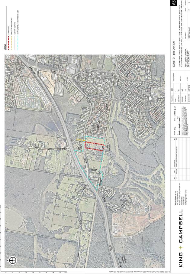
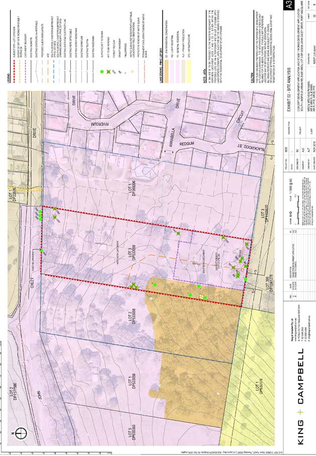
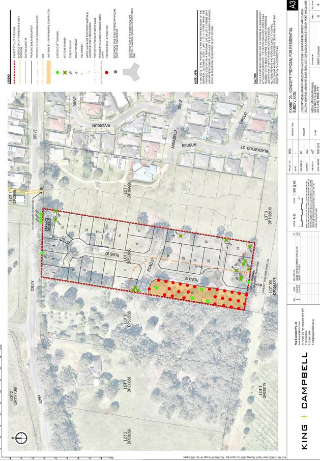
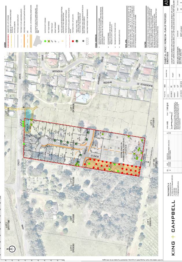
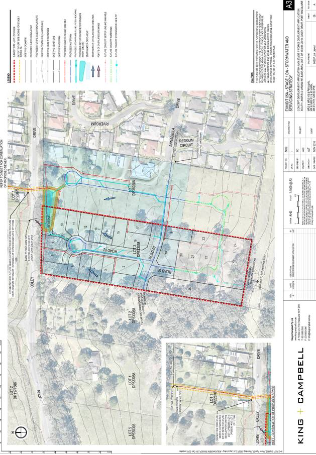
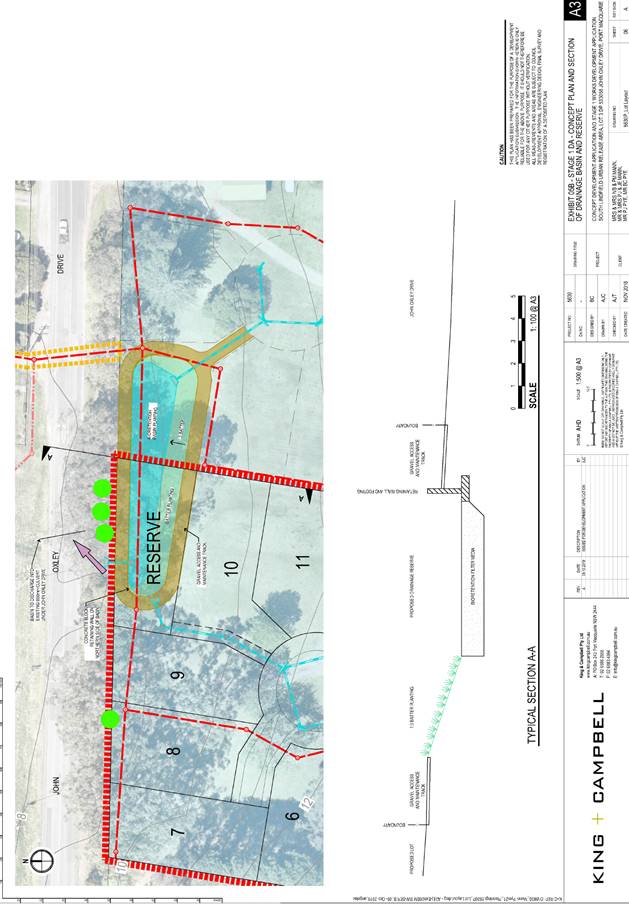

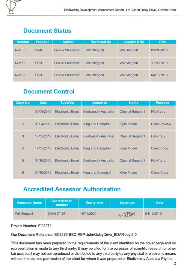

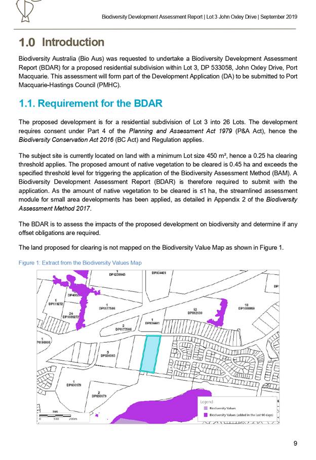
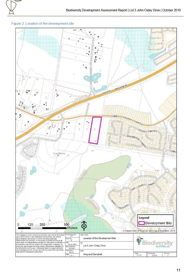

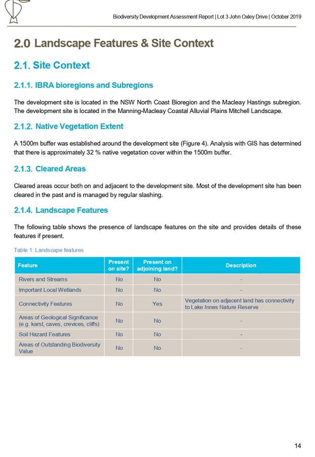
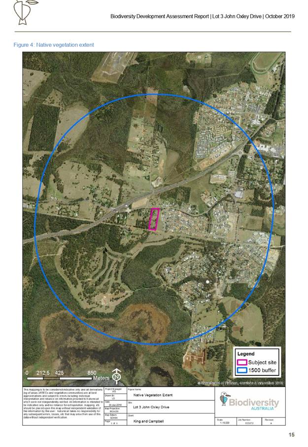


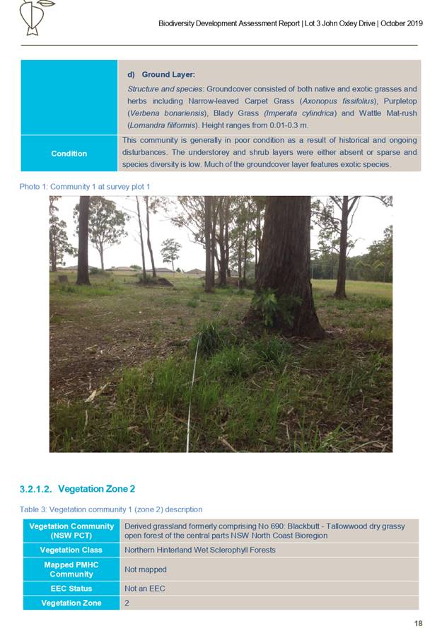
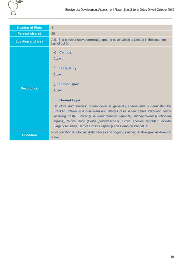

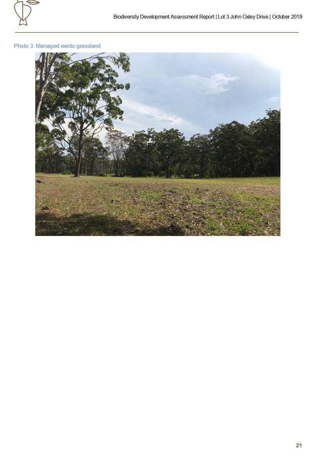

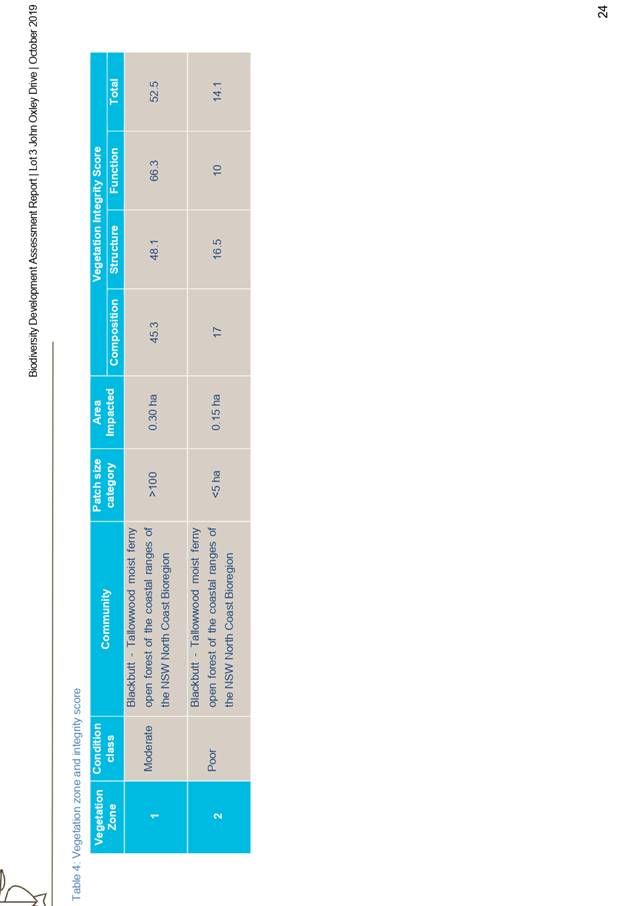
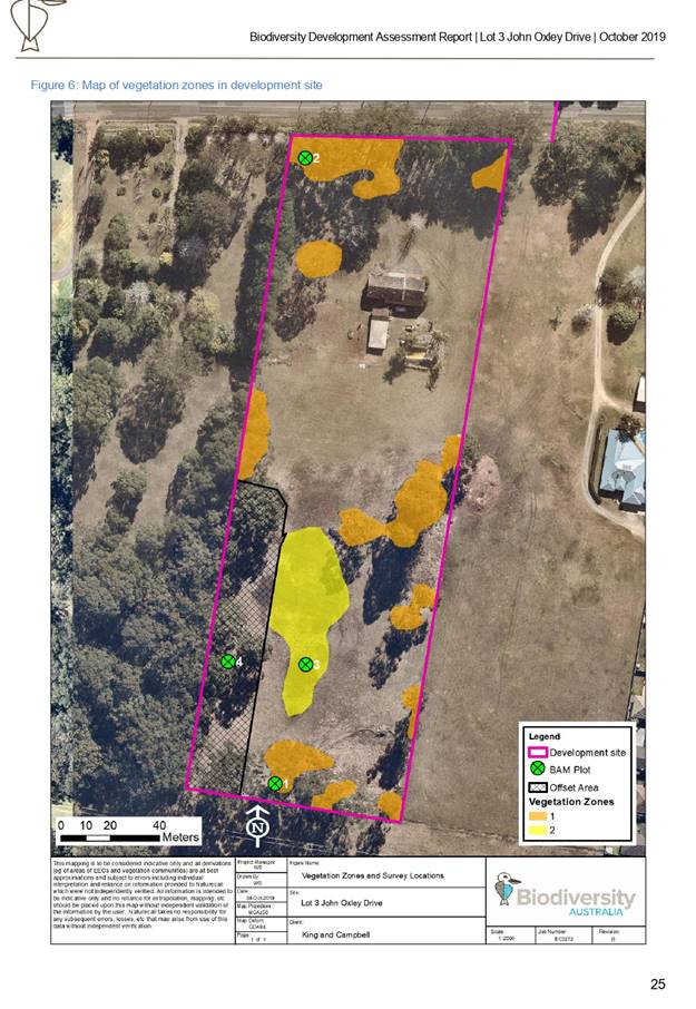
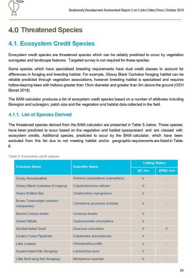
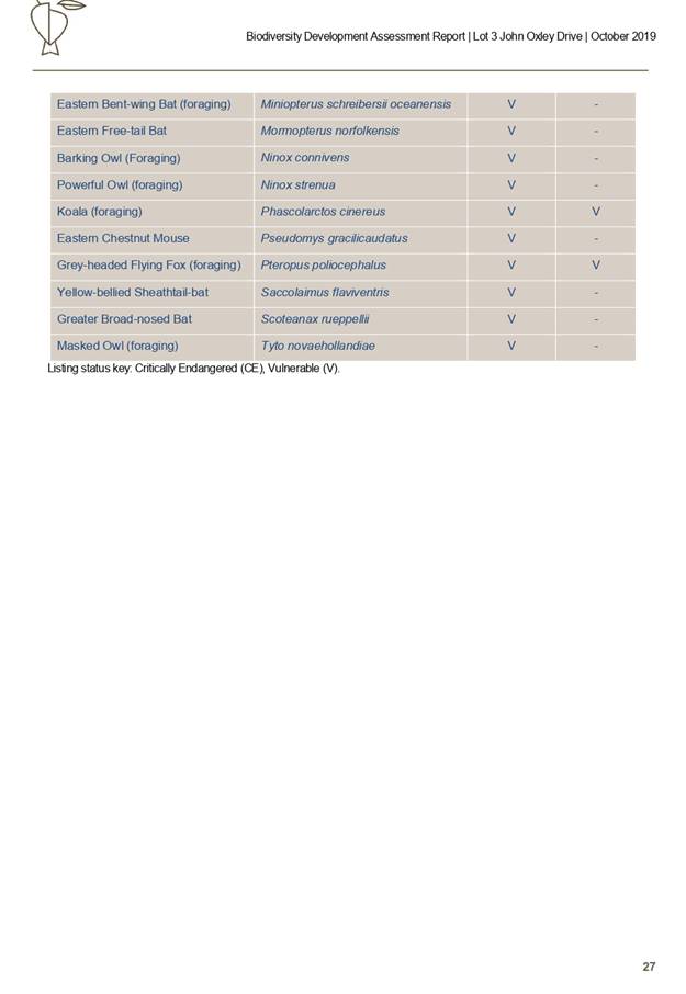
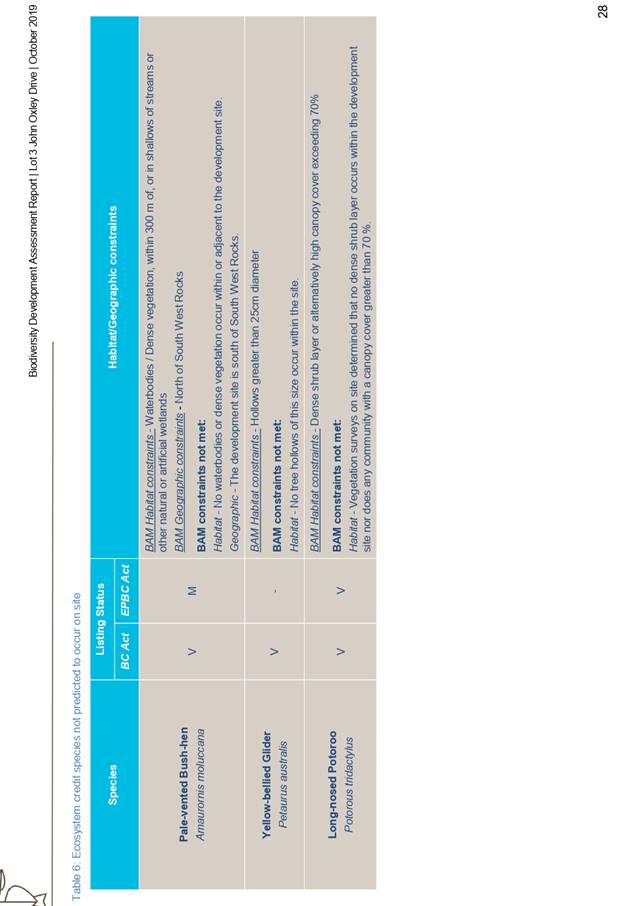

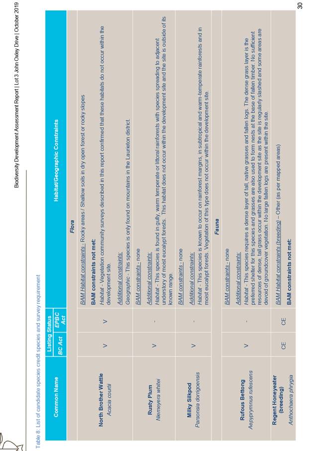
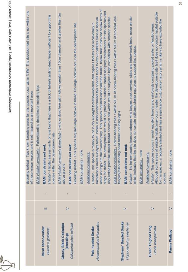
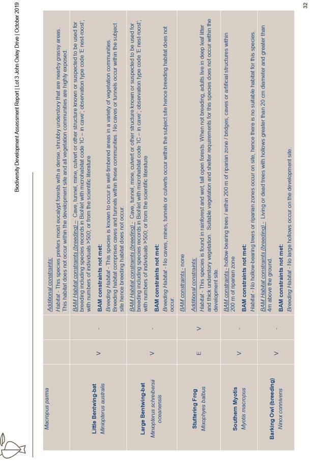


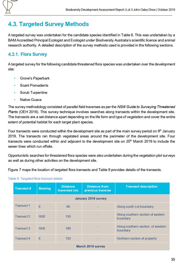


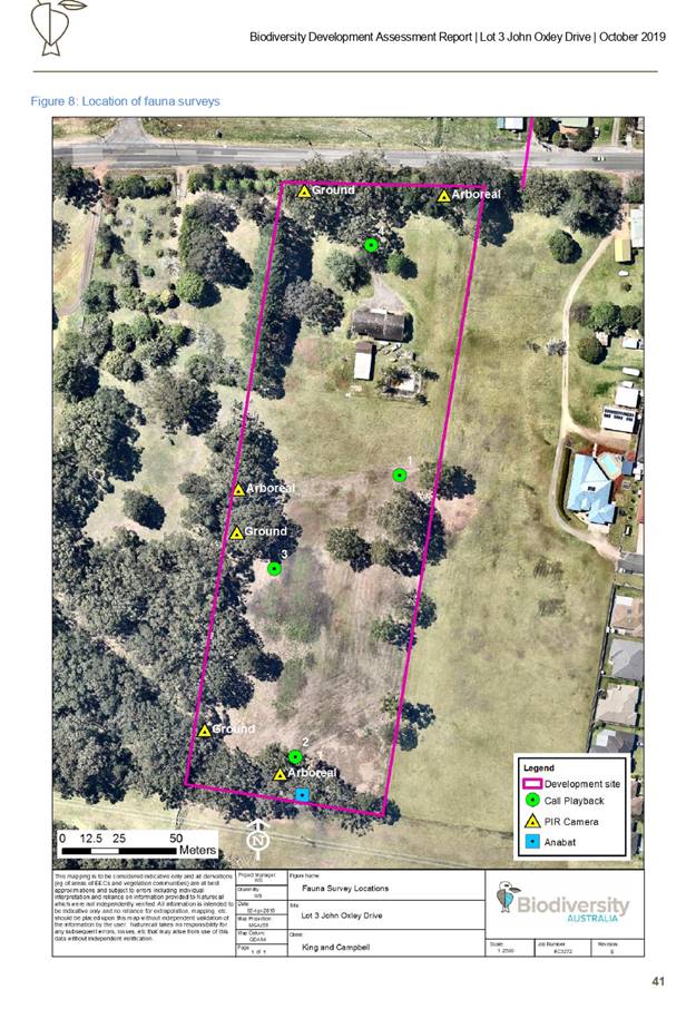
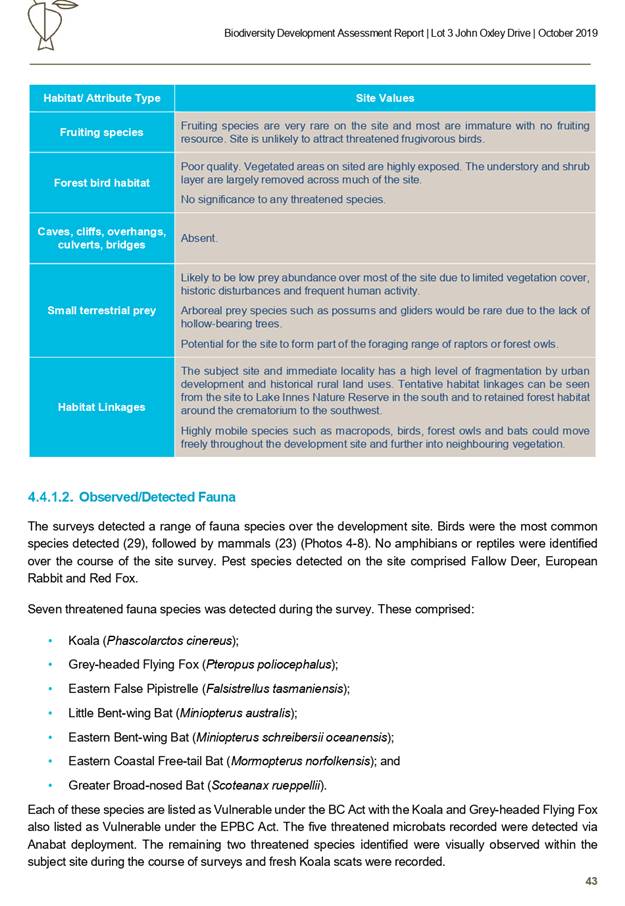


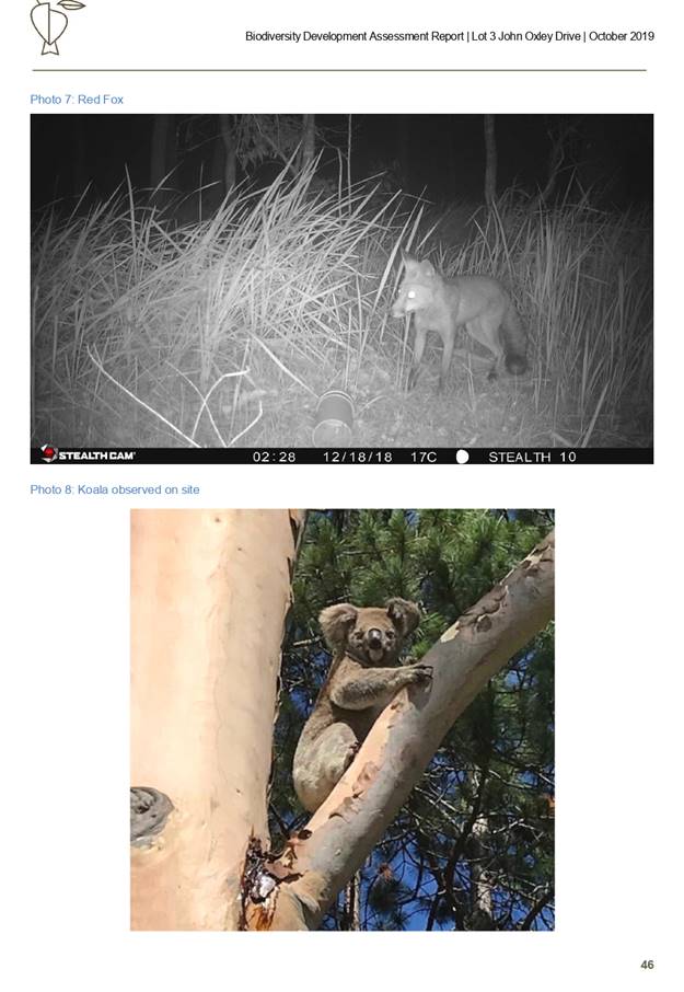
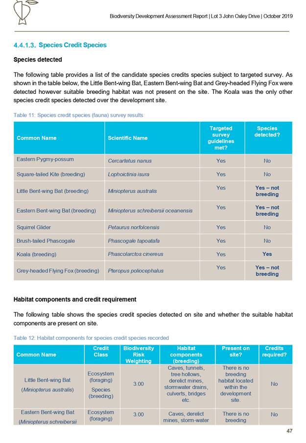
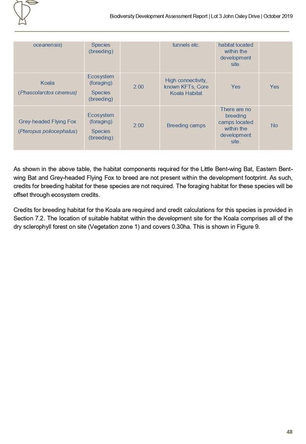


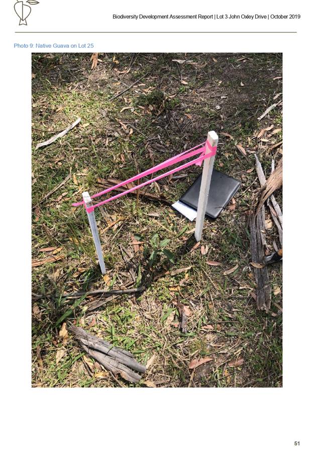


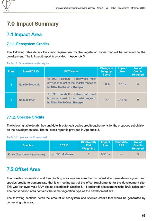
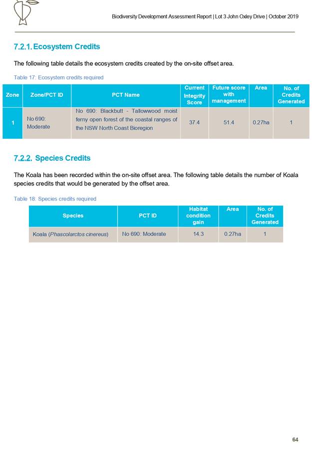

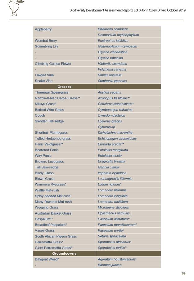
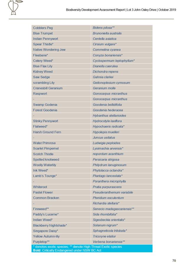
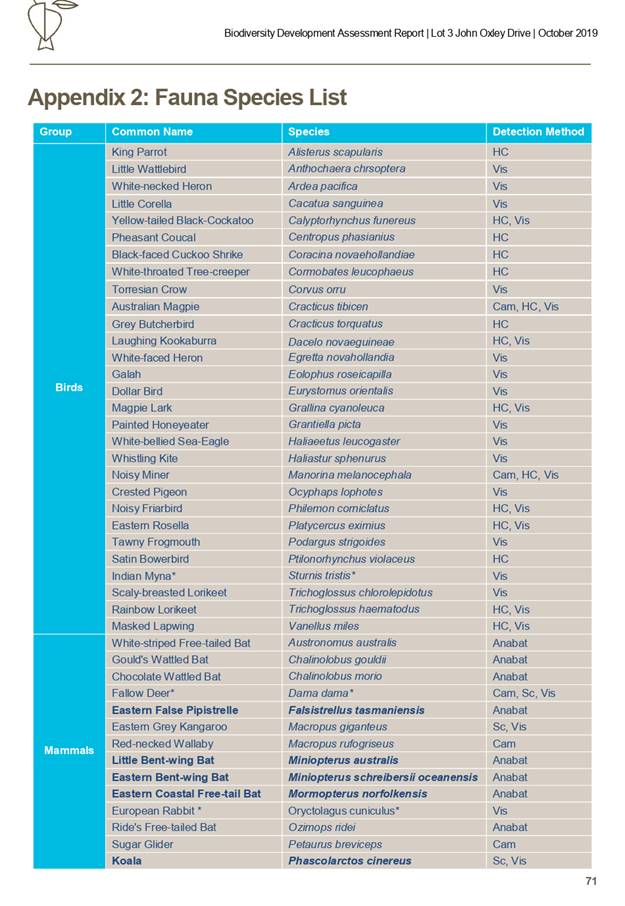
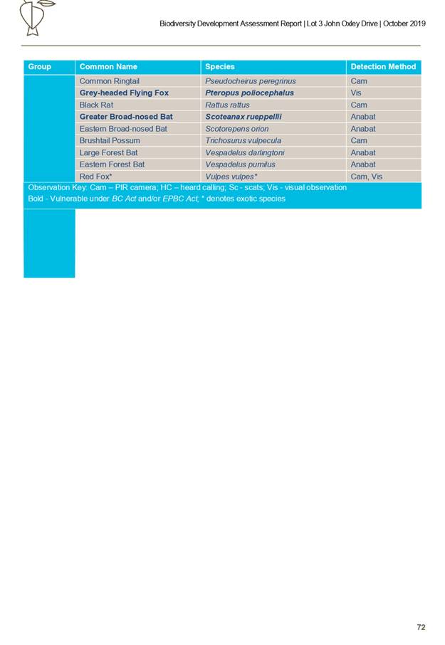

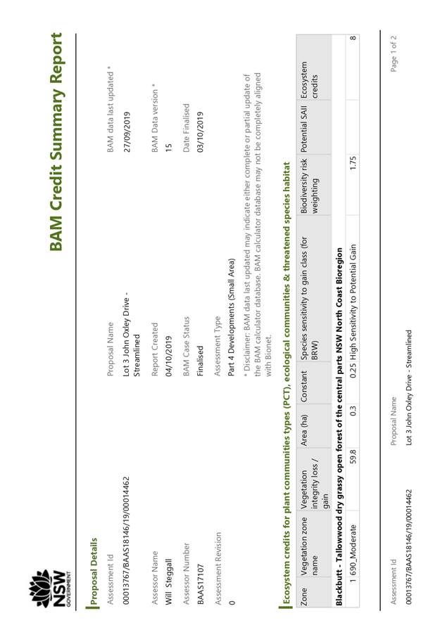


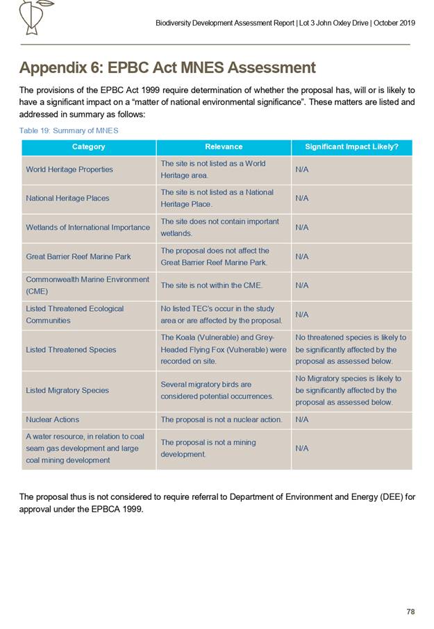
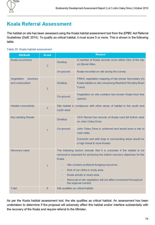
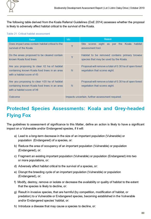

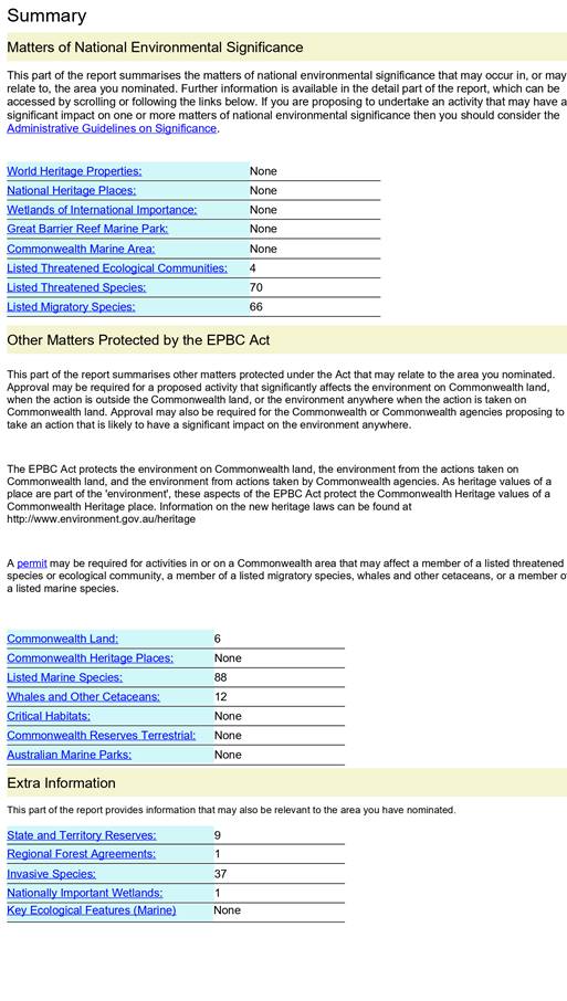
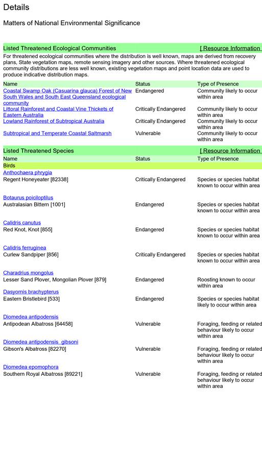
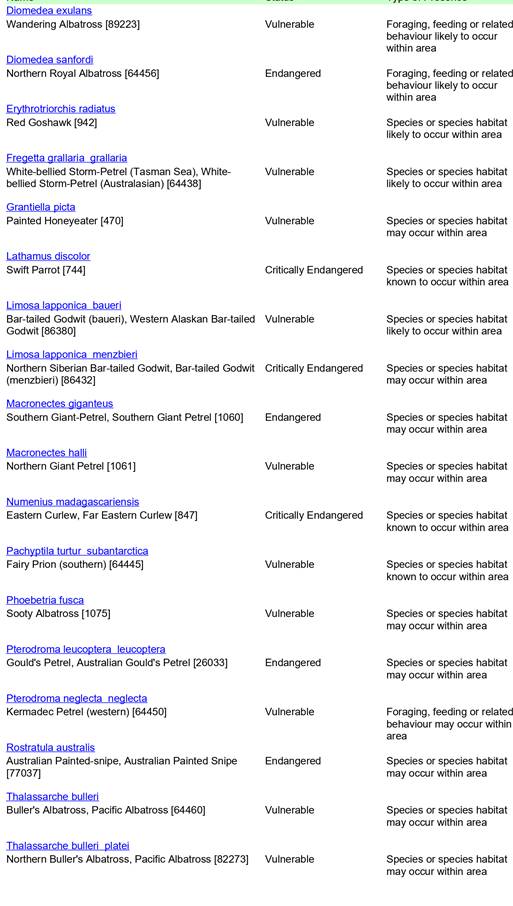
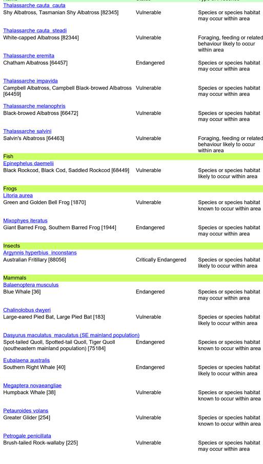
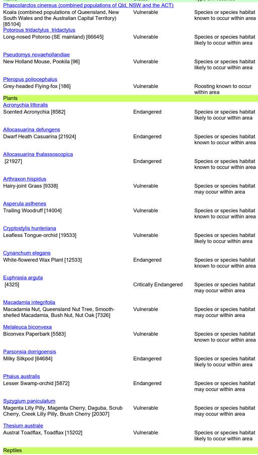
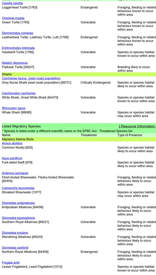
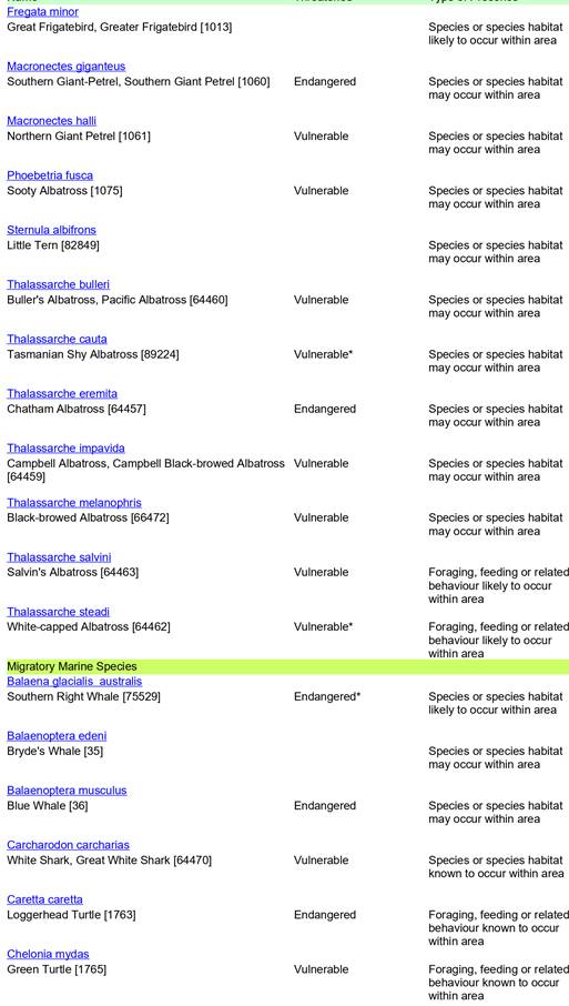
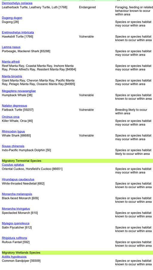
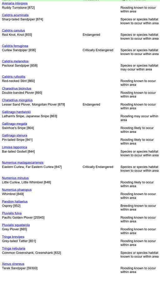
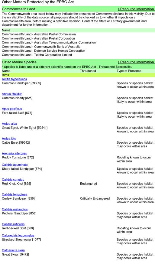
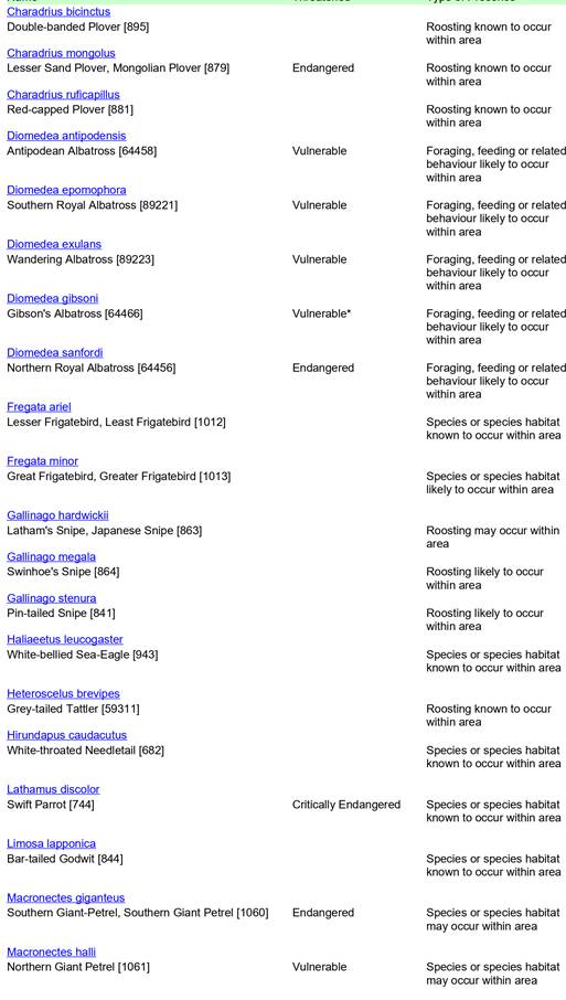


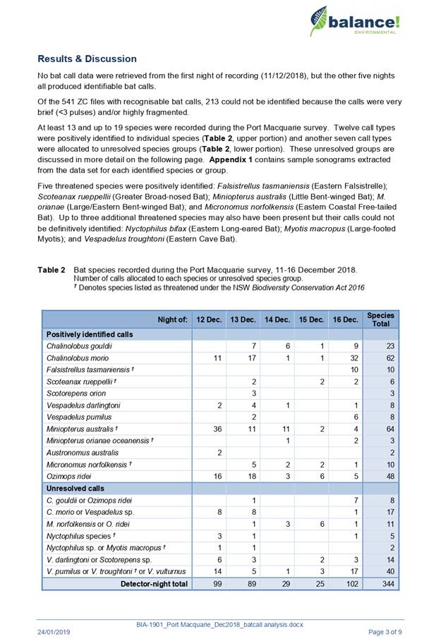
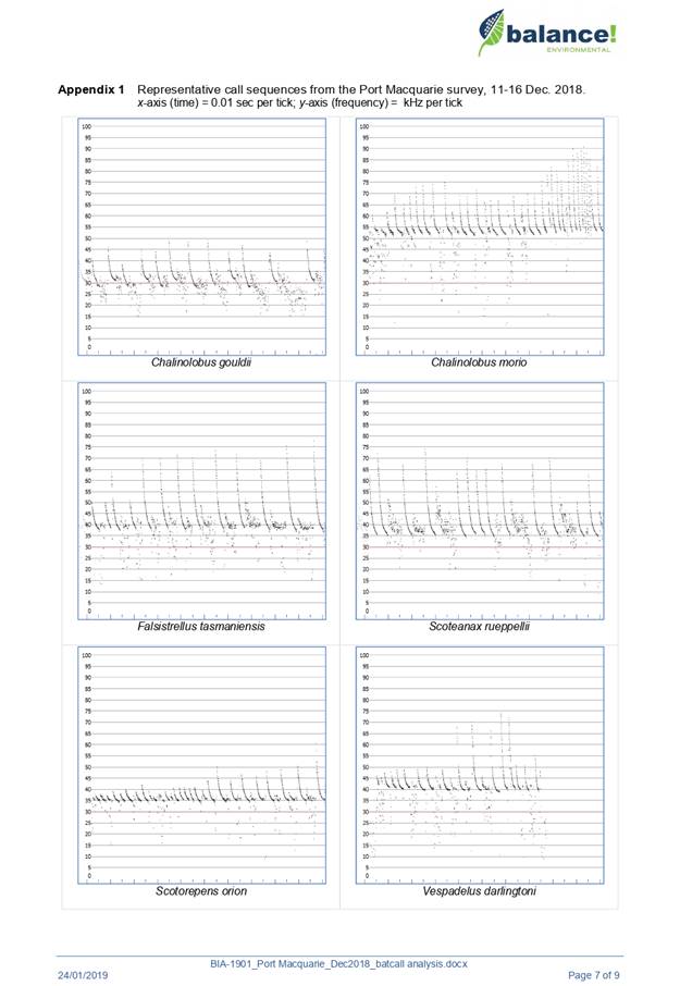
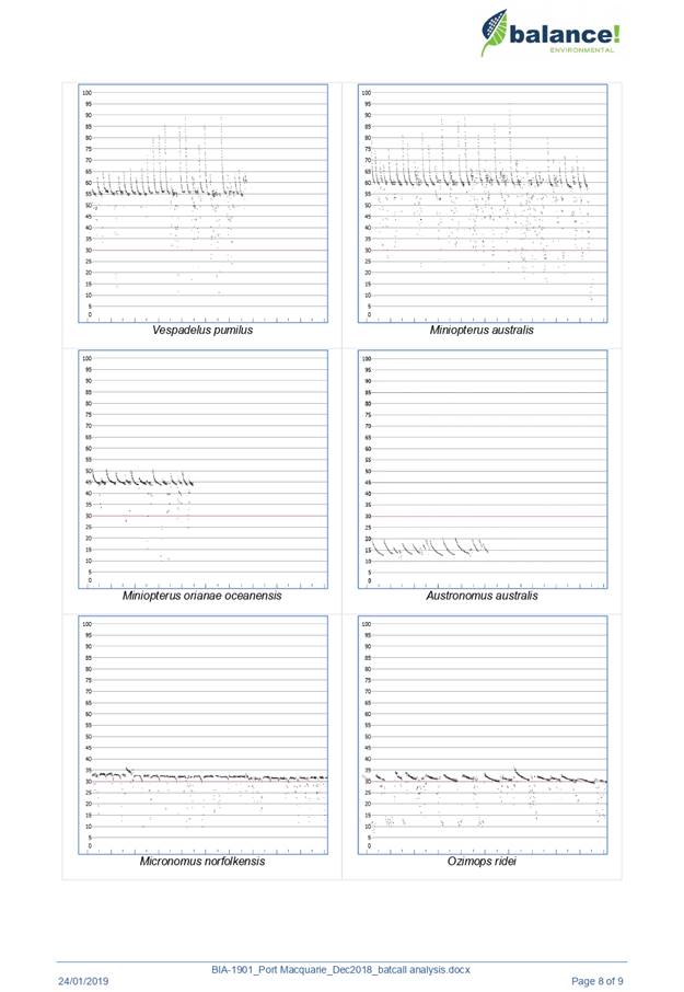
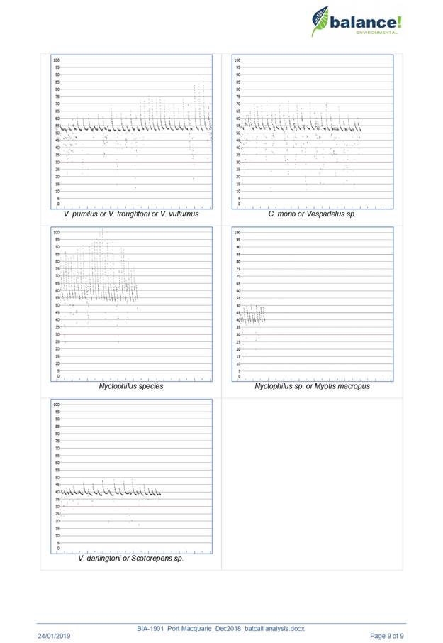
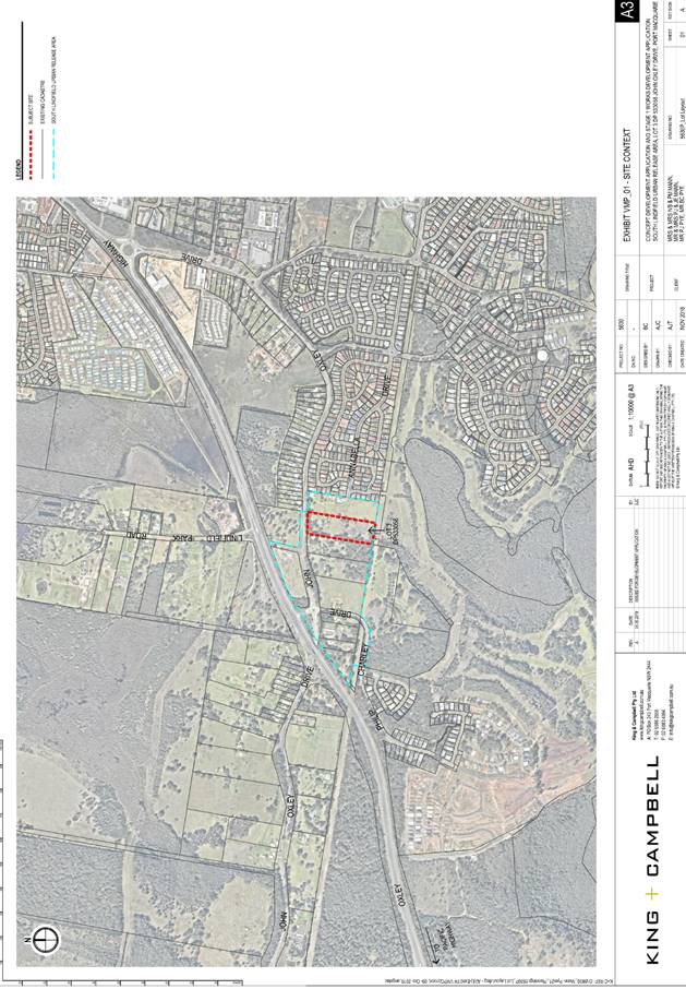
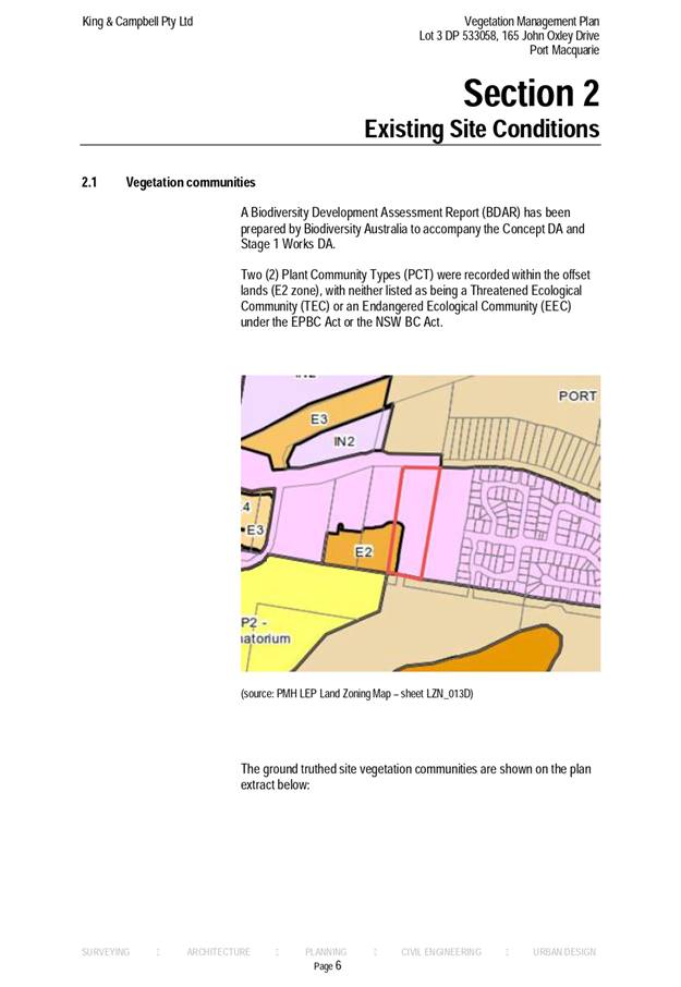
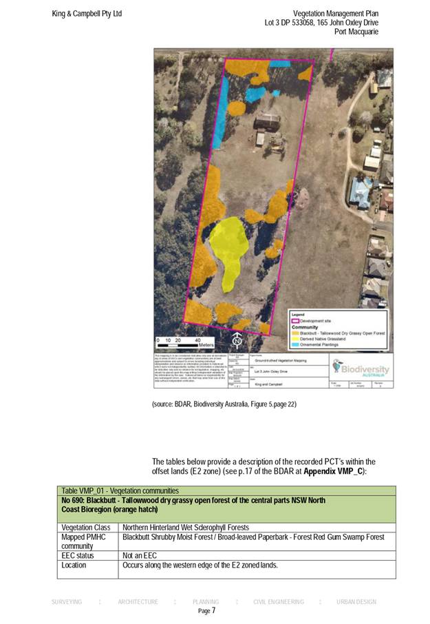
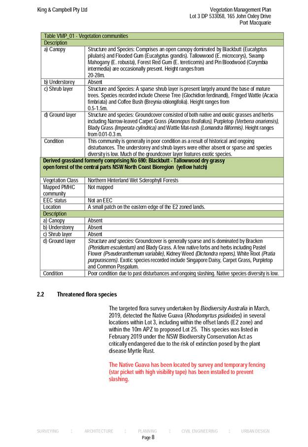
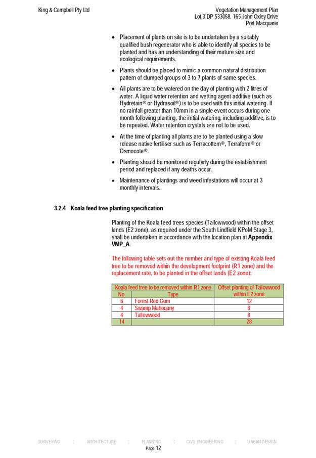
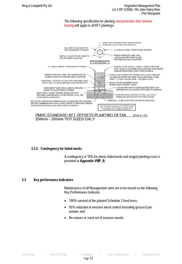
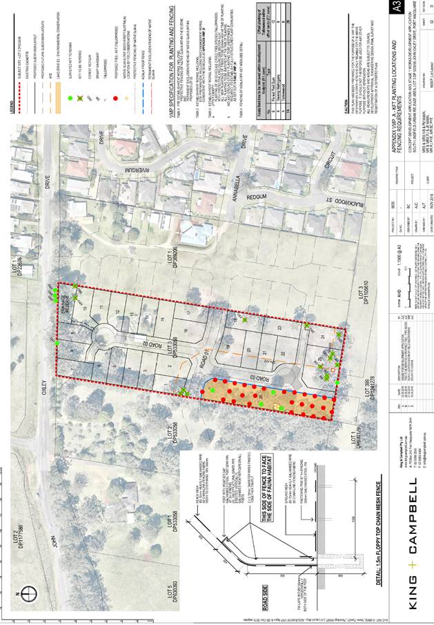
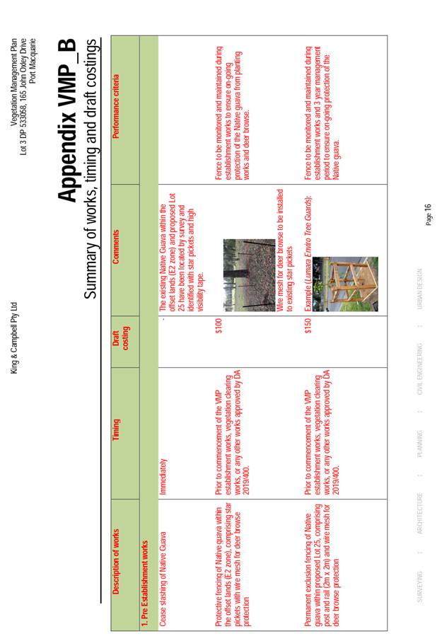
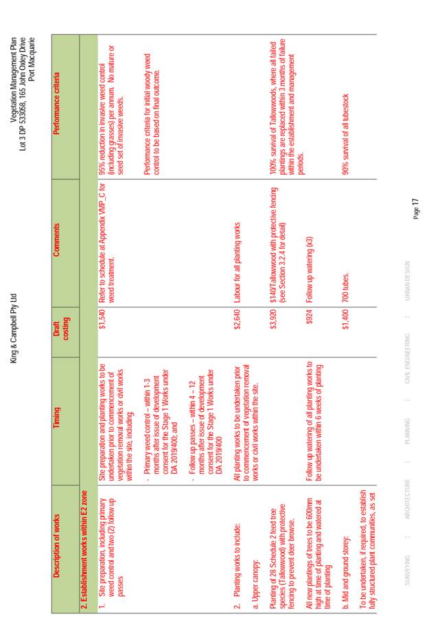
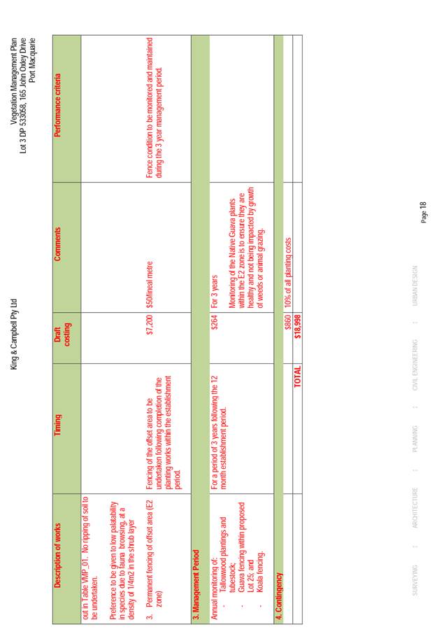
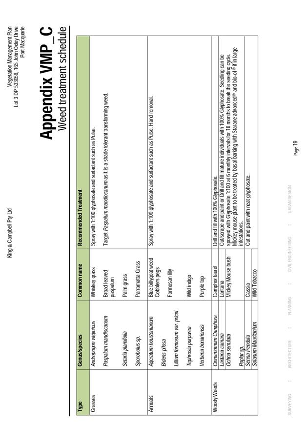


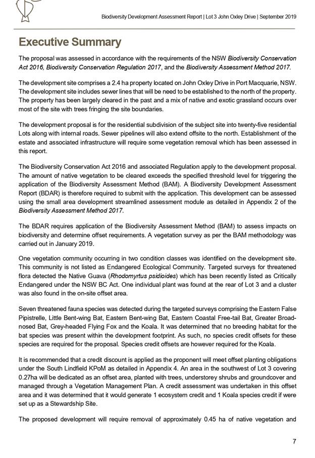


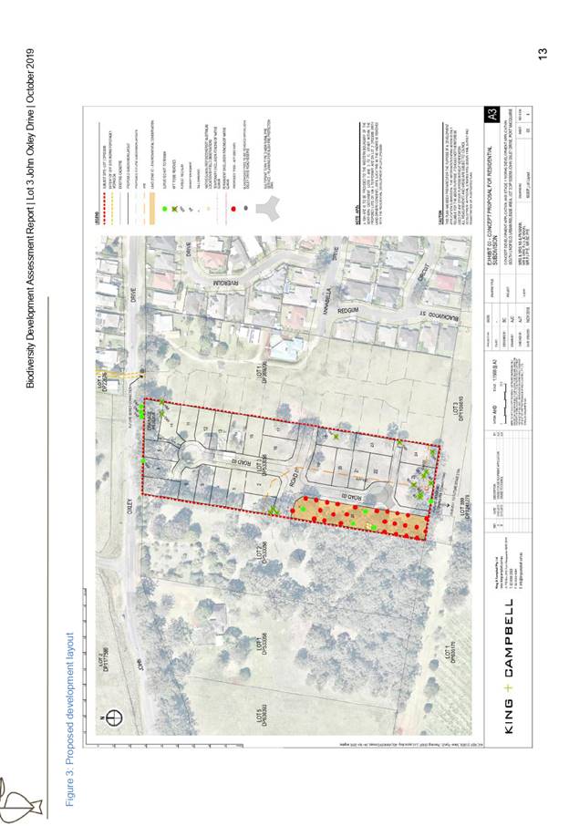

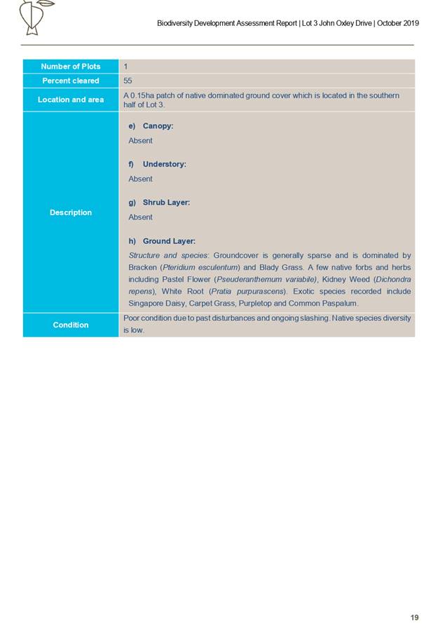
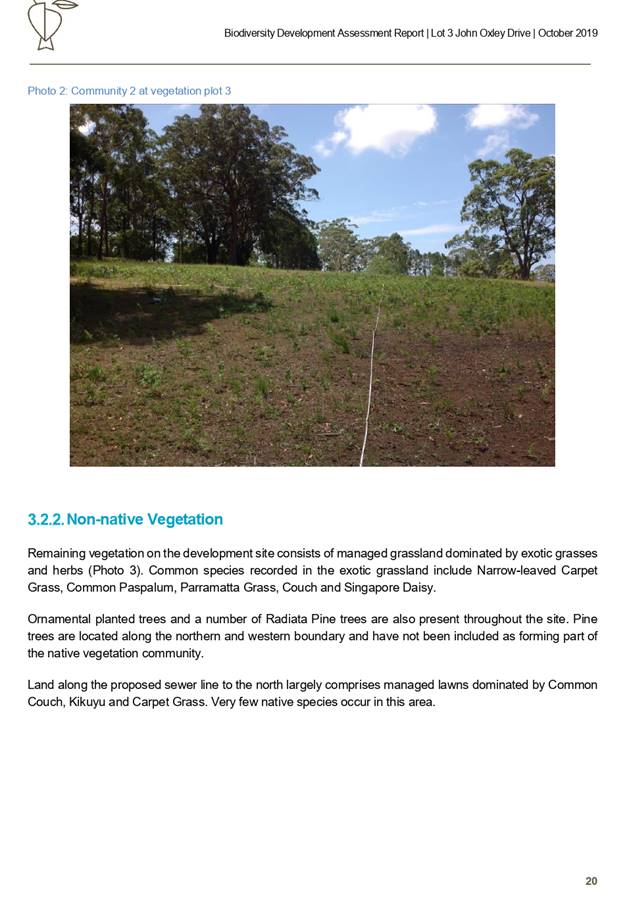

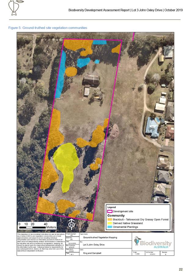


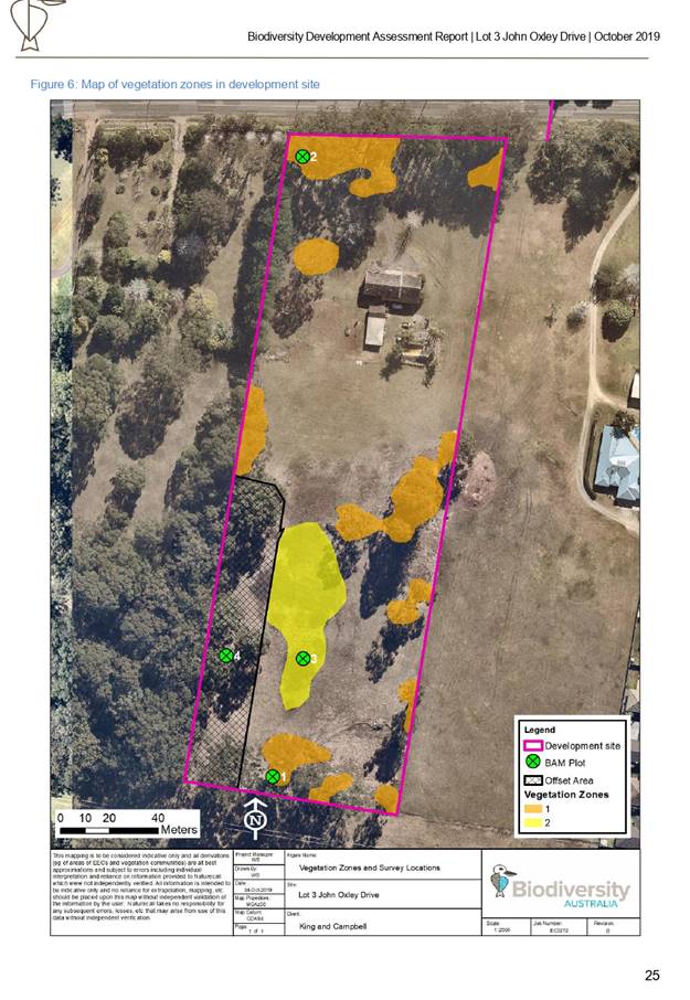
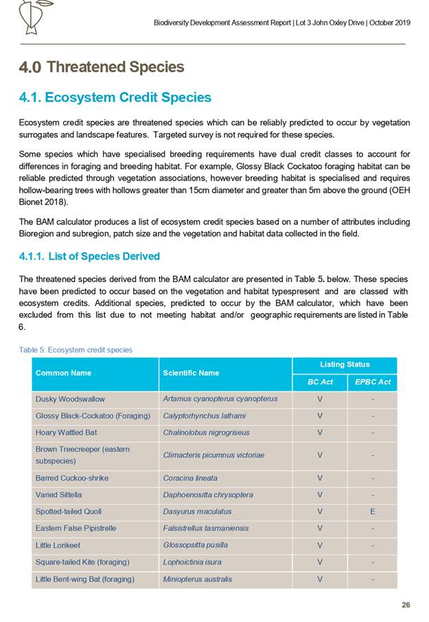
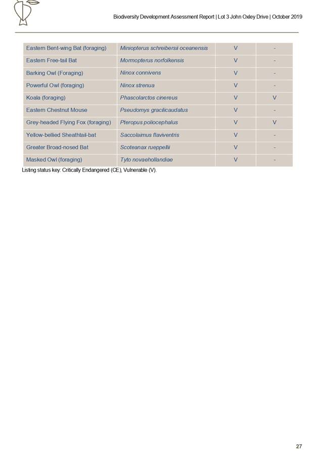
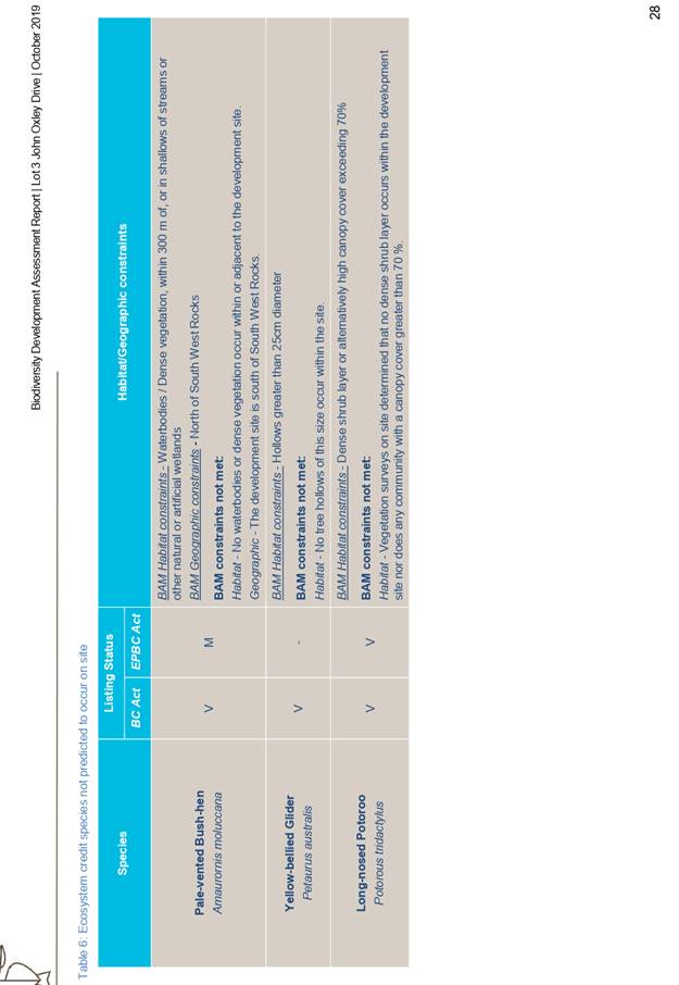
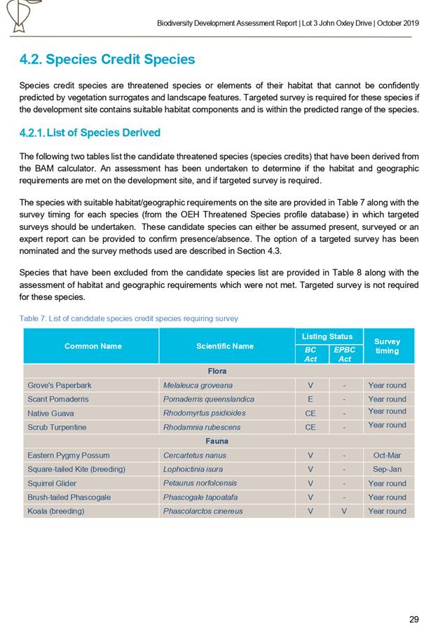

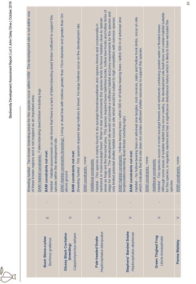
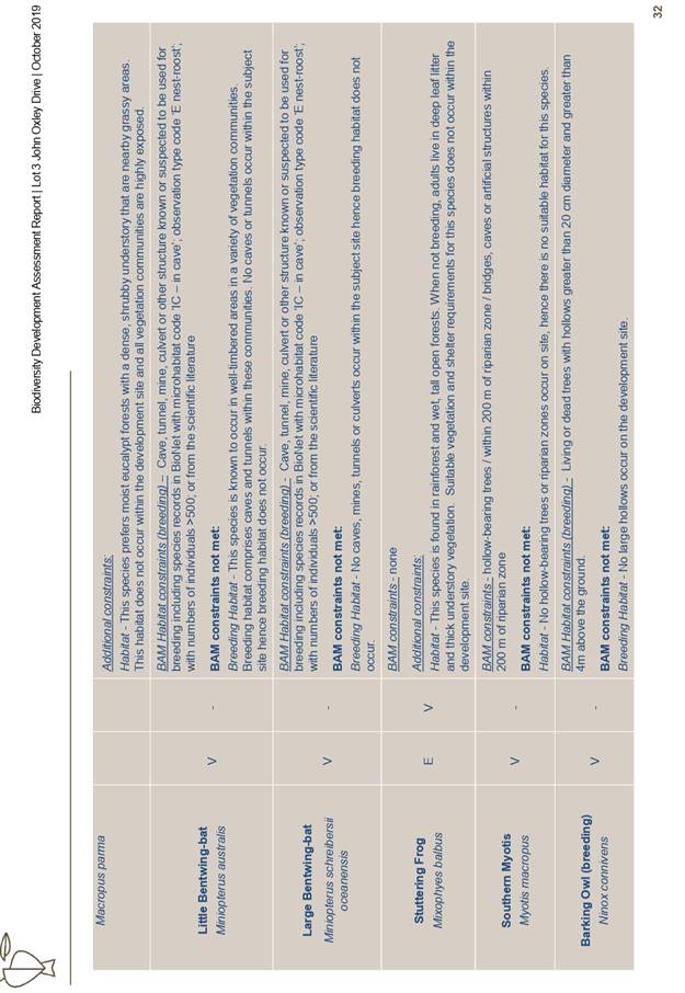
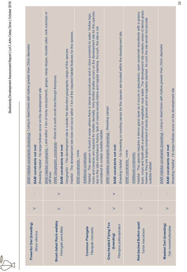
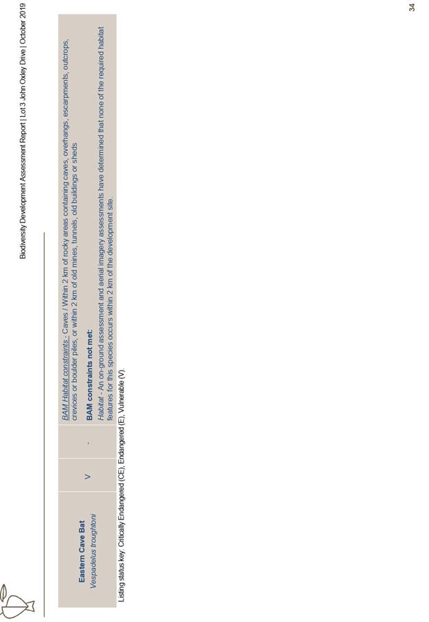


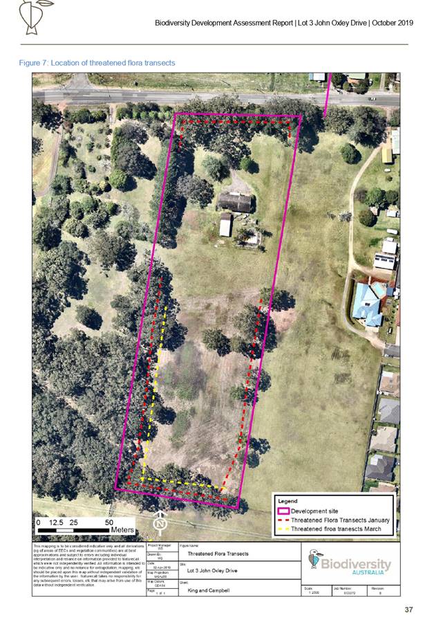


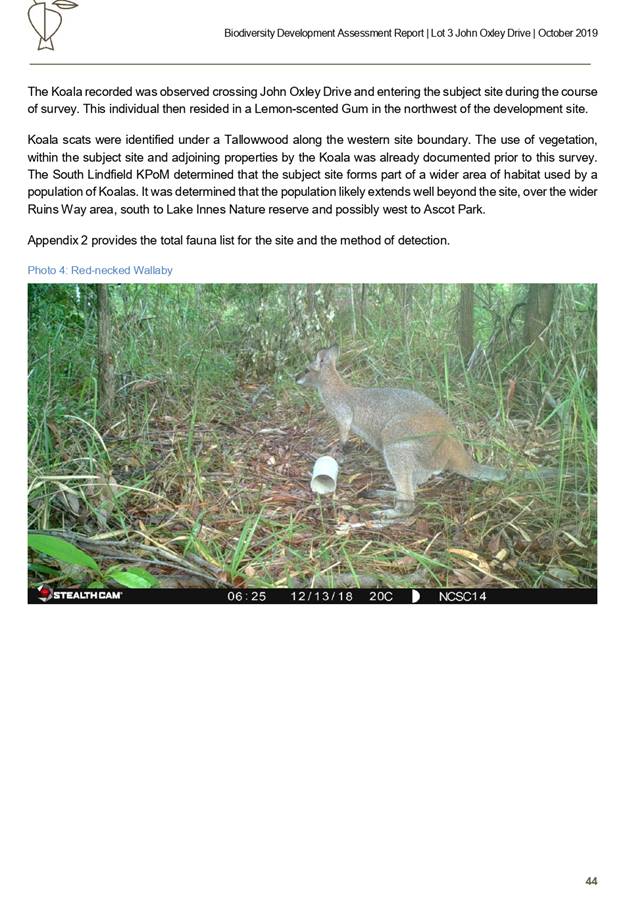
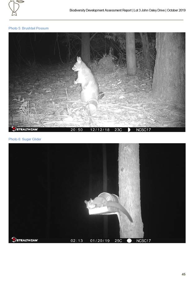


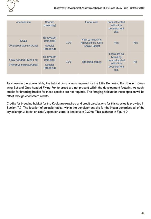
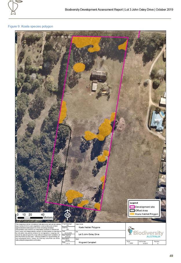
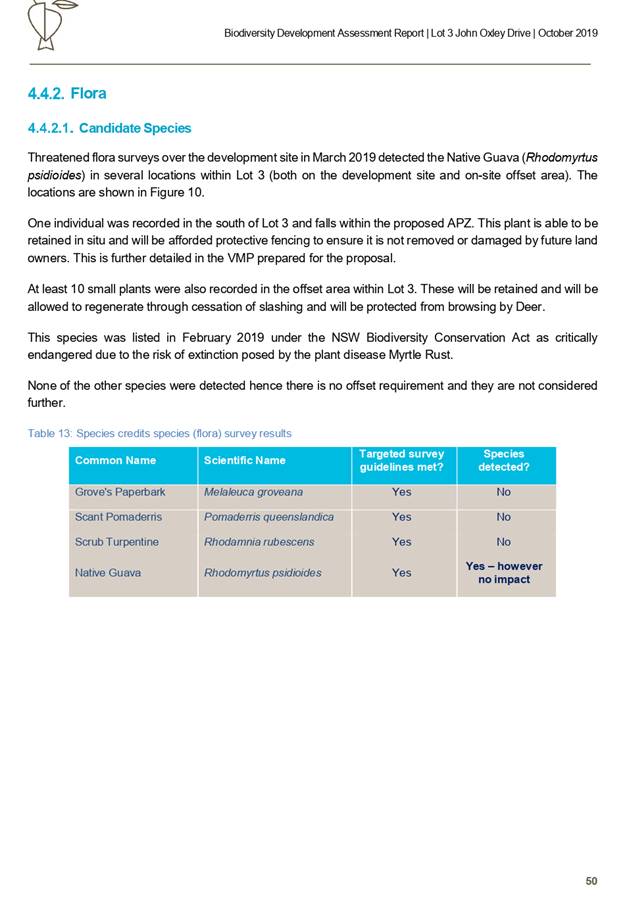
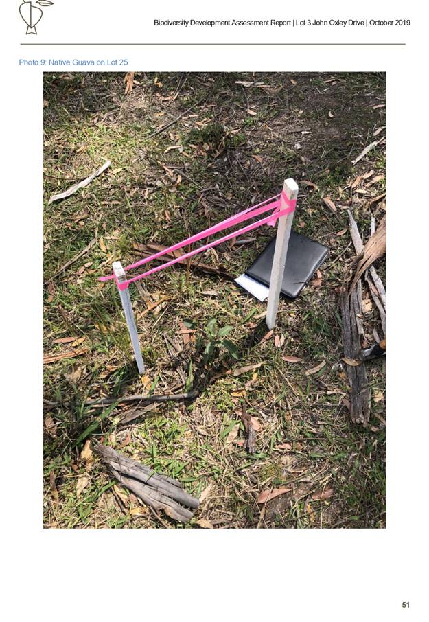
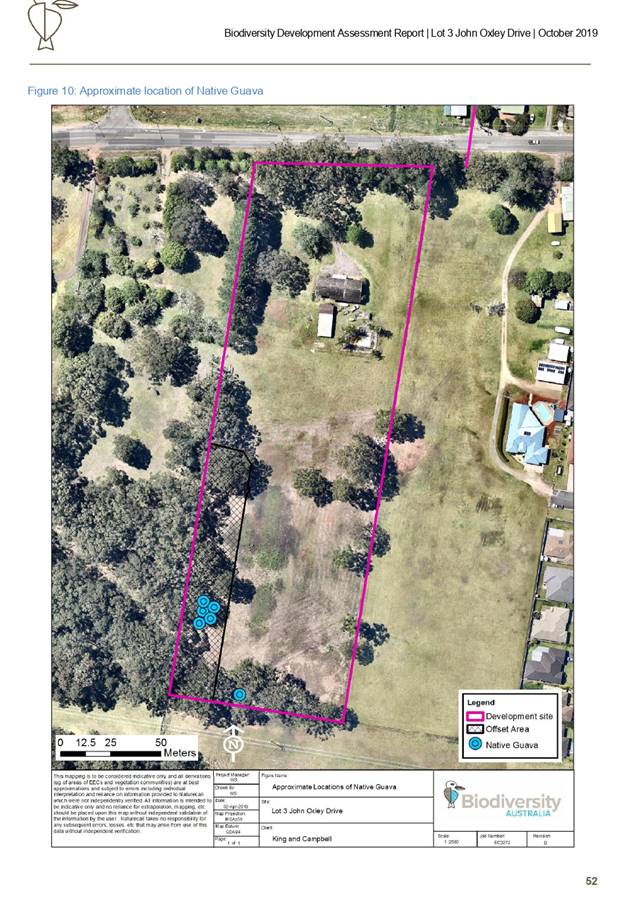


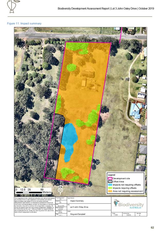


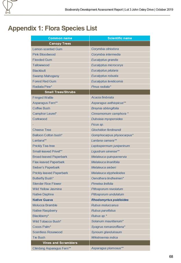
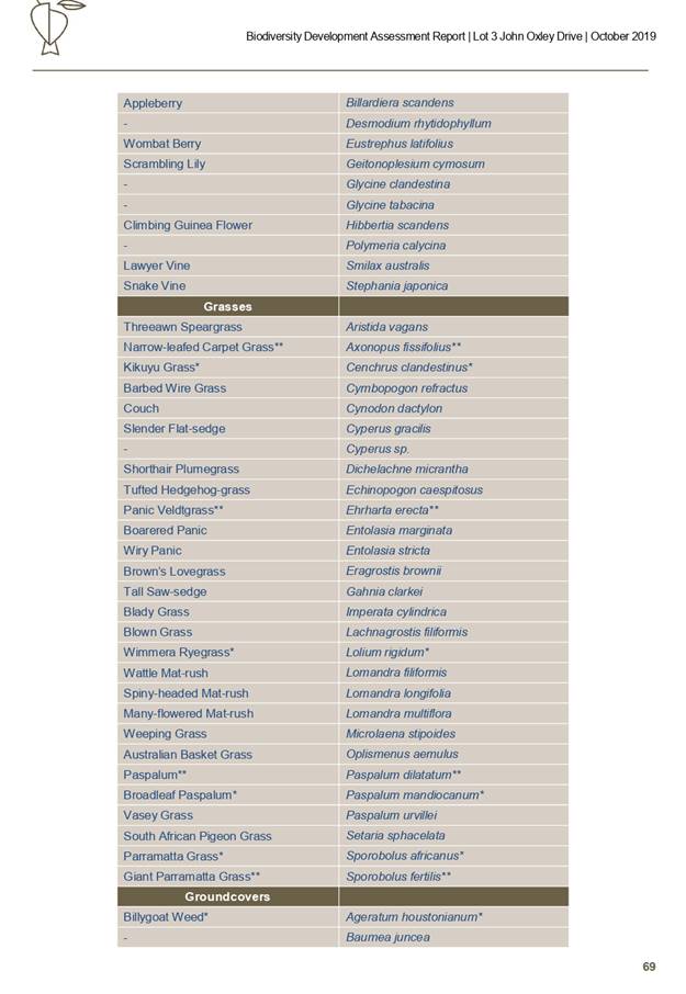
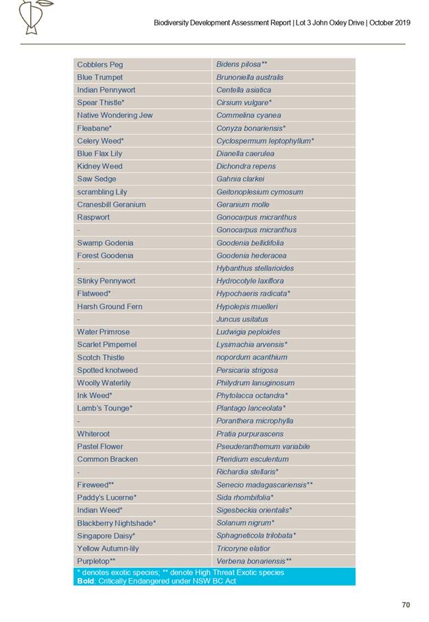
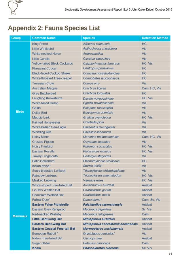


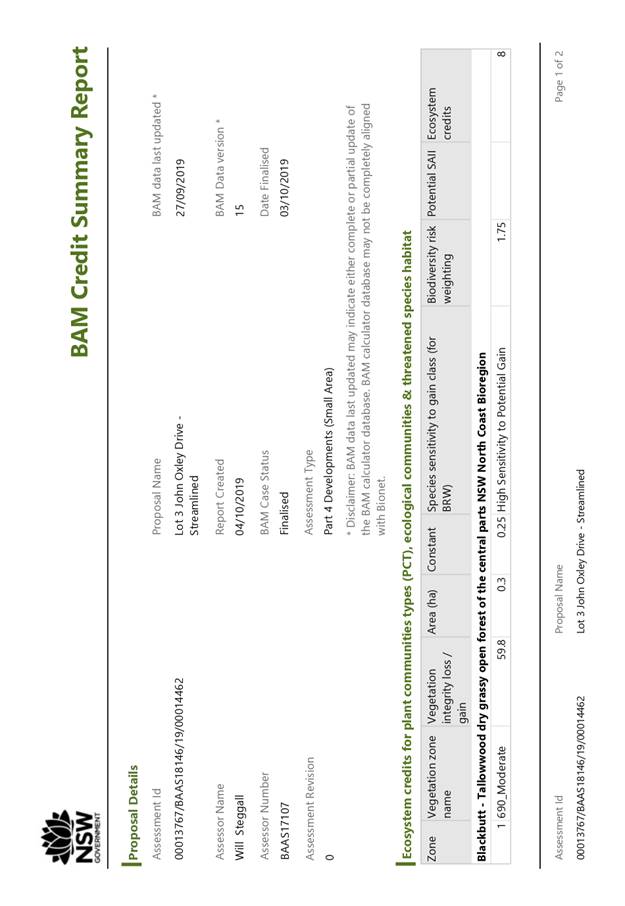
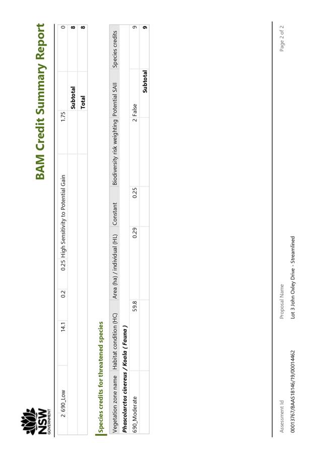


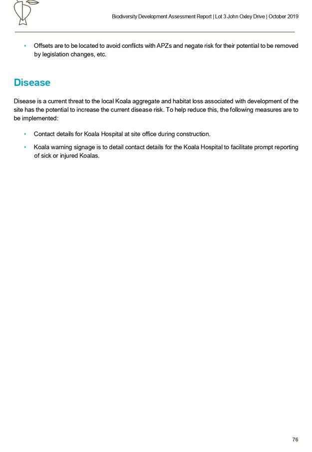


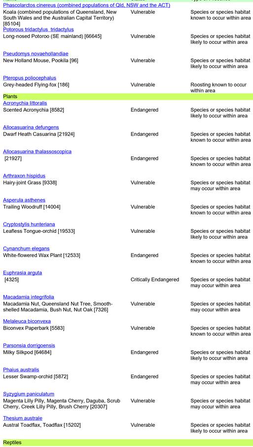
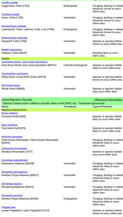

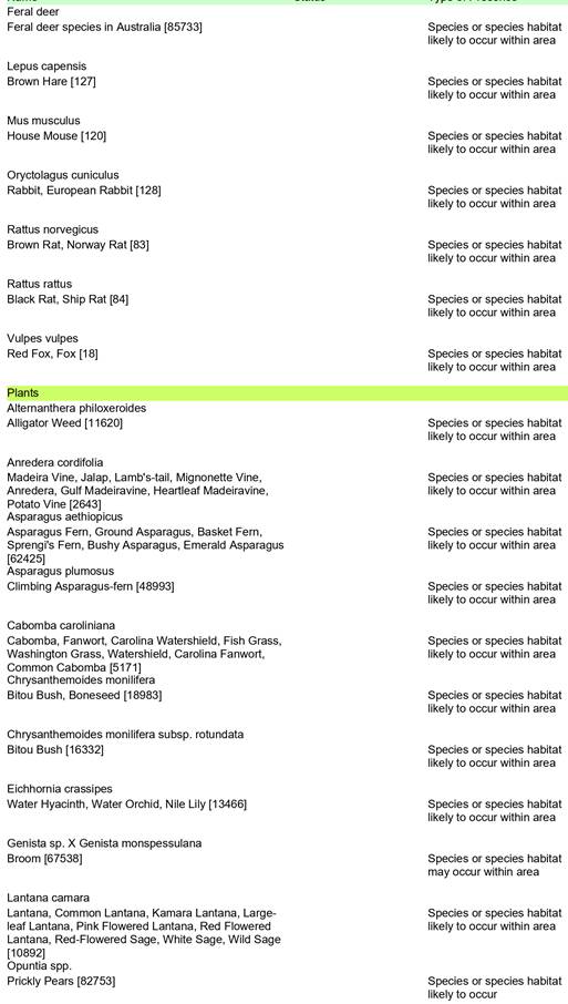
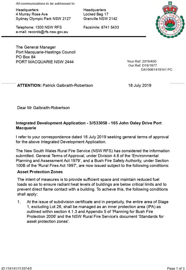
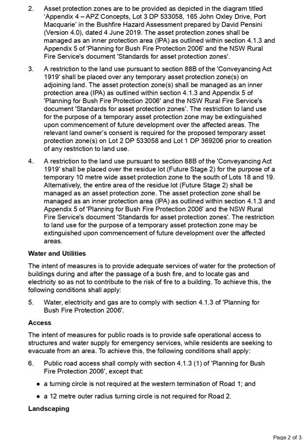
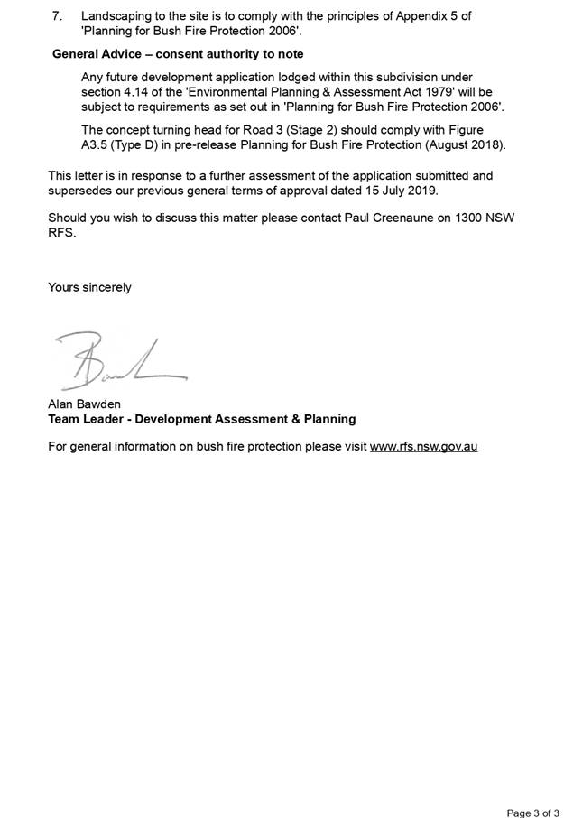
AGENDA Development Assessment Panel 23/10/2019
Item: 09
Subject: DA2019 - 401.1 - Concept proposal for
residential subdivision (25 torrens title lots) & staged residential
subdivision (16 torrens title lots) at 153 John Oxley Drive, Port Macquarie
Report
Author: Development Assessment Planning Coordinator, Patrick
Galbraith-Robertson
|
Applicant: Lifestyle
Design Homes CARE King & Campbell Pty Ltd
Owner: RW
& JM Ramm
Estimated Cost: $750,000
Alignment with Delivery
Program
4.3.1 Undertake transparent
and efficient development assessment in accordance with relevant legislation.
|
|
RECOMMENDATION
That
DA2019 - 401.1 for a concept proposal
for residential subdivision (25 Torrens title lots) & staged residential
subdivision (16 Torrens title lots) at Lot 1 DP 369206, No. 153 John Oxley Drive,
Port Macquarie, be determined by
granting consent subject to the recommended conditions.
|
Executive
Summary
This
report considers a Development Application for a concept proposal for
residential subdivision and staged residential subdivision at the subject site and provides an assessment of the
application in accordance with the Environmental Planning and Assessment Act
1979.
Following exhibition of the
application, four (4) submissions were received.
The proposal has been amended
during the assessment of the application in response to assessment issues.
The site is considered suitable for the proposed development
and the proposal adequately addresses relevant planning controls. The
development is not considered to be contrary to the public's interest and will
not result a significant adverse social, environmental or economic impact.
This report recommends that the Development Application be
approved subject to the attached conditions.
1. BACKGROUND
Existing Sites Features and Surrounding Development
The site has an area of 2.4225
hectares.
The site has recently been
rezoned to R1 General Residential with the gazettal of Amendment No.39 to the
Port Macquarie Hastings LEP 2011.
The site is subject to an
existing Planning Agreement known as the South Lindfield Urban Release Area
Planning Agreement (Ramm VPA).
The site is zoned R1 General Residential in accordance with the Port Macquarie-Hastings Local
Environmental Plan 2011, as shown in the following zoning plan.
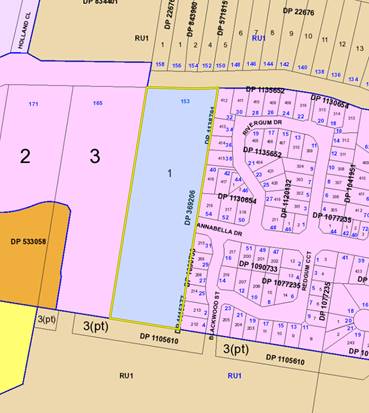
The existing subdivision pattern and location of existing
development within the locality is shown in the following aerial photograph:
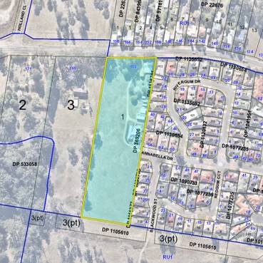
2. DESCRIPTION OF
DEVELOPMENT
Key aspects of the proposal include the following:
· Concept
proposal for a Torrens title subdivision of the site into 25 lots; and
· A Stage 1 works development which includes:
- Vegetation clearing within the development footprint (R1
zone) and removal of two (2) trees in the John Oxley Drive road reserve;
- Confirmation of the bushfire asset
protection (APZs) for the concept proposal;
- Demolition of existing dwelling on proposed Lot 6 and sheds
on proposed Lots 4 and 5;
- Construction of the northern sewer
route within the John Oxley Drive road reserve and Lot 1 DP 22676 to the
existing sewerage reticulation infrastructure; and
- The subdivision of the northern
catchment, including road no.1, road no.2, part road no.3 and residential
subdivision to provide 16 lots, which will be released in 3 sub-stages.
· The subsequent Stage 2 Works DA will provide for the
residential subdivision of the southern catchment to provide 9 Torrens title
lots:
- The
Stage 2 Works DA will include details of the downstream connections to the
existing pump station and stormwater treatment via a bio-retention swale within
the adjoining property to the south (Lot 399 DP 1241278), which is held in
separate ownership.
- The
proposed subdivision has been concurrently lodged with a Concept DA and Stage 1
Works DA on the adjoining property to the west, described as Lot 3 DP 533058.
The required servicing (sewer and stormwater) for the northern catchments of
both the subject site and adjoining Lot 3 will be provided on a shared
arrangement.
· The concept proposal has been made pursuant to Part 4
Division 4.4 of the
Environmental Planning and Assessment Act 1979
(the Act) and relates to land identified within the South Lindfield Urban
Release Area.
· The Act establishes at clause 4.22 (5) that Council’s
assessment of a Concept DA need only consider the likely impact of the concept
proposal, including any first stage and does not need to consider the likely
impact of the carrying out of development (the works) that may be the subject
of subsequent Development Applications.
· The proposal is also an Integrated Development requiring
Bushfire Safety Authority under the Rural Fires Act 1997.
Refer
to Attachment 2 at the end of this report for plans of the proposed
development.
Application Chronology
· 4
June 2019 - DA lodged with Council.
· 6 June 2019 - Confirmation of estimated cost of works.
· 6 June 2019 - Referral of proposal to the NSW Rural Fire
Service to seek Bushfire Safety Authority.
· 11 June to 24 June 2019 - Neighbour notification of
proposal.
· 1 July 2019 - Assessing Officer site meeting with Applicant
and request for additional information: confirmation of zoning boundaries,
queries relating to approach of road noise assessment and queries in relation
to demolition of existing sheds.
· 3 July 2019 - Redacted copies of submissions forwarded to
Applicant for consideration.
· 18 July 2019 - Bushfire Safety Authority granted by the NSW
Rural Fire Service.
· 5 September 2019 - Additional information received from the
Applicant: confirmation of zoning boundaries, additional noise assessment
justification details and queries in relation to demolition of existing sheds.
3. STATUTORY ASSESSMENT
Section 4.15(1) Matters for Consideration
In determining the application, Council is required to take
into consideration the following matters as are relevant to the development
that apply to the land to which the development application relates:
(a) The provisions (where
applicable) of:
(i) Any Environmental
Planning Instrument
State Environmental Planning Policy No. 44 - Koala
Habitat Protection
The site is identified within
Council’s Koala Plan of Management for South Lindfield Stage 3 (KPoM) dated
November 2018.
The Plan confirms that no
existing Koala feed trees are mapped within the site and that no specific
offset works are required to be provided as part of this development.
No further considerations under
this SEPP are therefore required.
State Environmental Planning Policy No. 55 –
Remediation of Land
Following an inspection of the site and a search of Council
records, the subject land is not identified as being potentially contaminated
and is suitable for the intended residential use.
State Environmental Planning Policy (Coastal Management)
2018
The site is not located within a coastal use area or coastal
environment area.
State Environmental Planning Policy (Infrastructure) 2007
The site does not have frontage
to a classified road. John Oxley Drive has been declassified from previously
being the Oxley Highway.
On the basis that the site is
not adjacent to the road corridor for a freeway, a tollway or a transit way or
any other road with an annual average daily traffic volume of more than 40,000
vehicles, clause 102 does not apply.
Under the provisions of clause
104, the proposed subdivision is not identified as a traffic generating
development.
Under the provisions of clause 106, the proposed northern
sewer route is a permissible landuse outside the development site in the RU1
primary production zone to the north of the site.
Based on the above, the proposed development addresses
relevant clauses in the SEPP and will not to create any significant adverse
conflict in terms of traffic or noise.
Port Macquarie-Hastings Local
Environnemental Plan 2011
The proposal is consistent with the LEP having regard to the
following:
· Clause
2.2 - The subject site is zoned R1 general residential.
The objectives of the R1 zone are as
follows:
o To provide for the housing needs of the community.
o To provide for a variety of housing types and
densities.
o To enable other land uses that provide facilities
or services to meet the day to day needs of residents.
· Clause
2.3(2) - The proposal is consistent with the zone objectives having regard to
the following:
o the subdivision is a permissible
landuse; and
o the subdivision will provide for new
housing needs of the community.
· Clause
2.7 - The demolition of the existing sheds and dwelling on proposed Lot 6
requires consent as it does not fit within the provisions of SEPP (Exempt and
Complying) 2008.
· Clause
4.1 - The lot sizes within the proposed Stage 1 subdivision development area
range from 466.4m2 to 1274.4m2. All proposed lots comply with the minimum 450m2
lot size standard identified in the Lot Size Map relating to the site.
· Clause
5.10 – Heritage. The site does not contain or adjoin any known heritage
items or sites of significance. A standard precautionary condition is
recommended to stop works should any aboriginal archaeological items be
discovered during any works.
· Clause
7.5 – Koala Habitat. This clause applies to land that is shown as
“Koala Habitat area” on the Koala Habitat Map. The site is
identified within Council’s Koala Plan of Management for South
Lindfield Stage 3. In this regard, no removal of koala food trees is
proposed and therefore no further considerations of this clause is required.
· Clause
7.8 - The site is not subject to any identifiable adverse aircraft noise
associated with the operations of the Port Macquarie Airport.
· Clause
7.9 - The site is subject to acoustic controls as shown on the ‘acoustic
controls map’. A specialist site specific Road Noise Assessment has been
submitted to address any potential amenity impacts to future residential uses
on the site. This report recommends that a continuous 1.8m fence (either
standard colorbond or timber lapped), to the northern property boundary will
ensure that the relevant requirements for road traffic noise intrusion will be
achieved for all future dwellings that are constructed to normal residential
standards.
· Clause
7.13 - Satisfactory arrangements are in place for provision of essential
services including water supply, electricity supply, sewer infrastructure,
stormwater drainage and suitable road access to service the development.
Provision of electricity will be subject to obtaining satisfactory arrangements
certification prior to the issue of a Subdivision Certificate as recommended by
a condition of consent.
(ii) Any
draft instruments that apply to the site or are on exhibition
No draft instruments apply to the site.
(iii) Any
Development Control Plan in force
The relevant provisions
of the Development Control Plan 2013 include:
· Part 4 – Chapter 4.4.3 - South Lindfield precinct;
· Part 3 – Chapter 3.6 Subdivision; and
· Part 2 - General Provisions.
The South Lindfield
Precinct is identified in the below image:

|
Part 4 - Chapter 4.4.3 South Lindfield Precinct
|
|
DCP Objective
|
Development Provisions
|
Proposed
|
Complies
|
|
4.4.3.1 & 4.4.3.2
|
Subdivision layouts to provide a road network that
conforms with the connectivity shown in Figure 4.4.3-2 - (refer above Figure
extract).
New development within the
western sub precinct has access via a single access from Philip Charley Drive
from the south.
|
The proposed internal road
network is consistent with Figure 4.4.3-2, which
provides for an extension to Anabella Drive.
All proposed lots will only be accessible from the new
internal road network.
|
Yes
|
|
4.4.3.3 & 4.4.3.4
|
All stormwater infrastructure
is consistent with the outcomes of the stormwater management strategy
summarised in Figure 4.4.3-2.
All stormwater infrastructure (including access) is to be
dedicated to Council.
|
The location of the proposed
stormwater basin to serve the northern catchment of the site (Lot 1) and the
adjoining property at Lot 3, is consistent with Figure 4.4.3-2.
It is proposed to dedicate the
stormwater infrastructure which will serve a number of properties, to
Council.
|
Yes
|
|
4.4.3.5
|
Development is to provide an integrated solution for
sewerage services with adjoining properties.
Development will require
approval from relevant landowners for gravity sewerage mains connecting to
the
existing sewerage network.
In the northern catchment:
• the sewer mains are to
connect to an existing gravity main connecting to Sewer Pump Station 54,
until a sewer
pumping station on Lindfield
Park Road is operational
• the alignment should
cater for possible extension to serve the bulk of the 4 lots west of Philip
Charley Drive
• development yields of
the land zoned Residential are not to exceed 16 et/ha prior to provision of
upgraded local
sewerage main capacity.
In the southern catchment the sewer mains are to connect
to Sewer Pump Station 80 to the south.
|
The proposed sewer strategy for the Concept DA is
illustrated on the plans submitted.
The northern catchment, the
subject of the Stage 1 Works DA, will ultimately drain to Pump Station 54 via
a connection through Lot 1 DP 22675 to PM54P010MH. The owner’s consent
from the landowner of Lot 1 DP 22675 has been submitted.
The development of the
southern catchment, the subject of the future Stage
2 Works DA, will drain to Pump
Station 80 through Lot 399 DP1241278 to
PM80P001MH. The point of the
future connection within the site is shown on the plans submitted.
|
Yes
|
|
4.4.3.6
|
Compliance with requirements of the South Lindfield Koala
Plan of Management.
The areas shown on Figure
4.4.3-2 for Conservation are to be dedicated to Council
for long term management,
following embellishment planting of koala food trees:
• in forested areas -
within available canopy spaces where the space has a radius of at least 5 m,
or
• in cleared areas - at 10 m centres.
Alternatively, with Council
approval planting in cleared areas can be provided elsewhere in the vicinity
at an offset ratio of 4 trees for each koala food tree removed, with trees at
10 m centres.
Where land zoned E2 or land
containing offset planning is held in private ownership, satisfactory
arrangements will be required for ongoing maintenance in perpetuity.
Development adjoining the land
zoned E2 Environmental Conservation must ensure that the long-term habitat
integrity of that E2 land is
not compromised by the development activities.
|
Figure 6 of the South
Lindfield KPOM confirms that no existing Koala feed
trees are mapped within the
site and that no offset works are required to be provided.
|
Yes
|
|
4.4.3.8
|
Applications for subdivisions
should provide site-specific updated traffic noise assessments, with adequate
information to simplify subsequent assessment of building
proposals.
Acoustic mitigation measures should not use high visual
barriers.
|
A specialist site specific
Road Noise Assessment has been submitted. This report confirms that a
continuous 1.8m fence (either standard colorbond or timber lapped), to the
northern property boundary will ensure that the relevant requirements for
road traffic noise intrusion will be
achieved for all future
dwellings that are constructed to normal residential development standards.
|
Yes
|
|
DCP 2013: Chapter 3.6 - Subdivision
|
|
DCP Objective
|
Development Provisions
|
Proposed
|
Complies
|
|
3.6.3.1
|
A site analysis is required for all development and shall
illustrate:
· microclimate;
· lot dimensions;
· north point;
· existing
contours and levels to AHD;
· flood affected
areas;
· overland flow
patterns, drainage and services;
· any contaminated
soils or filled areas, or areas of unstable land;
· easements and/or
connections for drainage and utility services;
· identification
of any existing trees and other significant vegetation;
· any existing
buildings and other structures, including their setback distances;
· heritage and
archaeological features;
· fences;
· existing and
proposed road network, including connectivity and access for all adjoining
land parcels;
· pedestrian and
vehicle access;
· views to and
from the site;
· overshadowing by
neighbouring structures; and
· any other
notable features or characteristics of the site.
|
A satisfactory site analysis plan has been submitted.
|
Yes
|
|
3.6.3.2
|
Torrens title lots minimum width of 15m when measured at a
distance of 5.5m from front property boundary.
|
All lots have a minimum or greater width of 15m when
measured at a distance of 5.5m from front property boundary.
|
Yes
|
|
Minimum width of 7m when boundaries are extended to kerb
line.
|
All lots have a width greater than 7m for lots which have
boundaries extended to the kerb line.
|
Yes
|
|
Minimum depth of 25m.
|
All lots have a depth greater than 25m.
|
Yes
|
|
For lots where average slope of the site is equal to, or
exceeds 16%, indicative road and driveway grades are required demonstrating
satisfactory access.
|
No indicative driveway grades are required for individual
lots as the slope grades are less than 16%.
|
N/A
|
|
3.6.3.3
|
Battle-axe lots discouraged in greenfield development.
|
No battle-axe lots are proposed.
|
Yes
|
|
3.6.3.4
|
Lots are to be designed to allow the construction of a
dwelling, which does not involve more than 1m cut, or fill, measured from
natural ground level, outside the dwellings external walls.
|
All proposed lots are designed to allow for future
construction of dwellings, which will be unlikely to require more than 1m cut
or fill.
|
Yes
|
|
Additional information provided for slope categories in
accordance with Table 3.6.2.
|
All proposed lots will meet the criteria for Slope A
standards with no special lot designs required.
|
Yes
|
|
3.6.3.5
|
Wherever possible orientate streets to maximise the number
of east, west and south facing lots and to minimise the number of narrow
north facing lots.
Residential street blocks should preferably be orientated
north-south with dimensions generally
limited to 60-80m by 120-150m as illustrated in Figure
3.6-2.
|
The orientation of the
proposed lots has been determined primarily having regard to the position of
the east-west extension of Annabella Drive and planned road corridors.
|
Yes
|
|
Lot size and shape are to reflect orientation to ensure
future dwelling construction has optimal opportunity for passive solar
design.
|
|
3.6.3.6
|
Kerb and guttering, associated street drainage, pavement
construction and foot paving across the
street frontages should be constructed as part of the
subdivision works where these do not exist (may be varied subject to criteria
in this clause)
|
The proposed street pattern
has been determined having regard to the
position of the east-west
extension of Annabella Drive and includes a
pathway network and
consideration of the future external connections in the
South Lindfield neighbourhood.
|
Yes + appropriate consent conditions recommended.
|
|
3.6.3.7
|
Subdivisions close to urban centres or along arterial
roads serviced by public transport achieve yield of >35 dwellings per
hectare.
|
The proposal will achieve a
yield of approximately 10-11 dwelling per hectare.
Satisfactory density achieved
particularly having regard to general residential zoning of land and noting
there is no minimum floor space ratio controls. There is also potential for
more than 1 dwelling on some of the proposed lots.
|
Satisfactory
|
|
3.6.3.8
|
All new roads are to be dedicated to Council designed in
accordance the Council’s adopted AUSPEC
design specification documents.
All applications to subdivide land should include a road
layout plan that meets the Council’s design requirements including
providing connectivity and access for all land parcels consistent with
Council’s road hierarchy.
|
All proposed roads meet
Councils current Aus-Spec requirements and provides for connectivity within
the South Lindfield neighbourhood.
|
Yes
|
|
3.6.3.9
|
The design of roads identified for bus routes should
comply with the AUSTROADS standards, including the design of bus bays and
stops.
|
The site is adjacent John
Oxley Drive and it is anticipated that all future bus stops will be provided
for in this existing road reserve.
No bus stops are proposed
within the subdivision.
|
Yes
|
|
Development should provide the bus stops, including bus
bays and shelters not more than 600m apart.
|
|
3.6.3.10
|
The design of roads should aspire to achieve standards
illustrated in Figure 3.6-3 to Figure 3.6-11.
|
The proposed road network
provides for the following:
- Street trees on the opposite
side of the roads are proposed to allow for the water services/ footpaths;
- Underground utilities;
- Formed kerb and guttering;
and
- 1.5m wide footpaths.
|
Yes
|
|
At a minimum all new roads should include:
•
street trees at a rate of 1 per 20m along the street frontage and in
accordance with Council’s Indigenous Street and Open Space Planting
List;
•
underground utilities;
•
formed kerb and guttering;
•
1.2metres pedestrian path.
|
|
3.6.3.11
|
Perimeter roads adjoining bushland should be designed in
accordance with Figure 3.6-8 and may be considered part of the APZ
requirements for the adjoining land.
|
The positioning of the
Annabella Drive extension, as required by the DCP provisions for South
Lindfield, has generally determined the road layout within each property. An
edge road to the southern boundary is acceptable and accordingly the lots
that front this boundary will include 10m wide APZ’s.
|
Yes
|
|
3.6.3.12
|
Perimeter roads should be designed in accordance with
Figure 3.6-8
|
|
3.6.3.13
|
Development for the subdivision for land or major
residential development should provide footpaths on both sides of all
collector and arterial roads.
|
All proposed footpaths have
been designed to one street frontage, ensuring street tree planting can be
undertaken on the opposite side of each street.
All proposed lots have
frontage to a public road ensuring future casual surveillance.
|
Yes
|
|
Footpaths should be provided on one side of the street for
access places and local streets in accordance with Council’s adopted
AUSPEC design specification documents.
|
|
Off street share-ways and on road cycle ways should be
provided.
|
|
Footpaths and cycleway are to have regard for Crime
Prevention Through Environmental Design
(CPTED) principles.
|
|
The choice of direction and possible routes should be
maximised, with streets and footpaths
substantially capable of surveillance by residents.
|
|
3.6.3.14
|
Local roads are to be designed for a maximum vehicle speed
of 50kph.
|
The road network has been
designed to restrict vehicle speeds to 50km/hr.
This also supported in the
KPoM that applies to the South Lindfield neighbourhood.
|
Yes
|
|
Traffic management schemes may be appropriate to
discourage speeding in long stretches of local roads or to discourage ‘rat-running’.
|
|
On street parking should be discouraged along local roads.
|
|
3.6.3.15
|
Cycling infrastructure should be provided in accordance
with the Council’s Cycling Plan.
|
N/A
|
N/A
|
|
Where physical infrastructure or land dedication cannot be
provided or is not identified, a contribution in accordance with the
Councils’ contribution plan/s.
|
Development contributions recommended for contribution to
recreation facilities in accordance with Council’s adopted Development
Contributions Plans.
|
Yes
|
|
3.6.3.16
|
An application for subdivision should be accompanied by an
a Integrated Water Cycle Management Strategy prepared by a certified
practicing engineer and in accordance with Council’s adopted design
specification documents.
|
A satisfactory Stormwater and Servicing Strategy has been
submitted.
This Plan includes the
stormwater management provisions for the development of the northern
catchments for the site (Lot 1) and the adjoining property at Lot 3 DP
533058.
The plans submitted illustrate
the extent of the stormwater management provisions within the northern
catchment of both Lot 1 (the site) and adjoining Lot 3.
Note: The proposed works for
the stormwater infrastructure and bio-retention swale within the adjoining
property to the south (Lot 399 DP
1241278), will be undertaken
as part of the Stage 2 DA to this Concept DA.
In relation to the proposed
stormwater management provisions, the impact
of the proposed development on
stormwater quantity and stormwater quality was modelled in the 12d and MUSIC
programs respectively, comparing existing pre-development conditions to
proposed post-development conditions, and the change to water quality from
source to outlet. The modelling has demonstrated that the subject land has
the capability to provide the necessary mitigation measures to ensure
protection of the downstream environment and hydrology.
|
Yes
|
|
3.6.3.17 - 3.6.3.19
|
An application for subdivision should be accompanied by a
Stormwater Management Strategy prepared by a certified practicing engineer
and in accordance with Council’s adopted Aus-Spec design specification
documents.
The finished floor level of buildings should be above the
100 year ARI flood level (plus freeboard) and in accordance with the
council’s current flood policy.
|
|
3.6.3.20
|
Water supply to meet Council’s design
specifications.
|
It is proposed to connect to
the existing 200mm watermain in Annabella Drive and run reticulated water
through the development as shown on the Stormwater and Servicing Strategy.
The future Stage 2 DA for the
development of the southern catchment will provide a connection to either the
450mm DICL or 525mm AC main to the south of the property and will be subject
of further consultation with the
PMHC Water and Sewer Section.
|
Yes
|
|
3.6.3.21 - 3.6.3.22
|
All lots connected to reclaimed water if available.
|
|
3.6.3.24
|
Separate sewer junction provided for each lot.
|
The northern catchment, the
subject of the Stage 1 Works DA will ultimately
drain to Pump Station 54 via a
connection through Lot 1 DP 22675 to
PM54P010MH, as shown in the
submitted plans. The owner’s consent from the landowner of Lot 1 DP
22675 accompanies this submission.
The development of the
southern catchment, the subject of the future Stage 2 Works DA, will drain to
Pump Station 80 through Lot 399 DP1241278 to PM80P001MH. The point of
connection within the site is shown in the submitted plans.
|
Yes
|
|
3.6.3.25
|
Extension of sewer infrastructure at cost of developer.
|
|
3.6.3.26 - 3.6.3.27
|
Erosion and sediment control plan to be provided.
|
A silt and sediment control
plan will be provided with the Construction Certificate for the subdivision
works.
|
Yes - capable with consent condition recommender.
|
|
3.6.3.28
|
Saving and re-using top soil and the incorporation of
additives to improve existing soils is preferred to the importation of soils
for landscaping.
|
Construction details will be required to be provided with
the Construction Certificate for the subdivision works.
|
Yes
|
|
3.6.3.29
|
Neighbourhood parks area to be provided so that all
residential areas are generally within 500m of the nearest park.
|
The subject site is not
identified to make provision for public open space for recreational purposes.
|
N/A
|
|
The location of neighbourhood parks is to be optimised so
that a minimal number of parks are required.
|
|
Neighbourhood parks and playing fields should be connected
to the cycleway and pedestrian path networks.
|
|
Neighbourhood parks should provide a range of facilities.
|
|
Sports fields should be located close to school
facilities.
|
|
As a minimum 1.5 hectares active open space (sports
fields); 5000m2 neighbourhood park; 1 hectare of linkage/amenity space (total
3 hectares open space) to be provided per 1,000 people.
|
|
3.6.3.30
|
Neighbourhood parks are to be dedicated as development
occurs, and are to include the following:
• Minimum size of 5,000m2.
• At least 2000m2 should be level to gently sloping
land.
• Street frontage to the same standard as adjoining
residential areas (i.e. kerb and gutter, or drainage swales where
appropriate).
• Any landform grooming to ensure the park is to a
standard to suit Council’s maintenance regime.
• Any drainage works to ensure the functionality of
the park.
• Access via more than one street.
• Integration with other community facilities.
• Should be located to cause minimal disruption to
traffic.
|
|
Neighbourhood park embellishment is to incorporate:
• Park furniture including seats with shelters,
barriers and any appropriate path and cycleway linkages along desire lines or
linking to the cycleway network.
• Any boardwalks necessary to achieve the required
functionality of the park.
• Works should generally be required to be
undertaken prior to dedication to Council.
|
|
3.6.3.31
|
An open space management strategy should accompany any
subdivision application where open space that connects to natural linkages,
drainage and wildlife corridors.
|
N/A
|
N/A
|
|
3.6.3.32
|
All street plantings are to be selected from Council's Indigenous
Street and Open Space Planting List from the relevant vegetation
community adjacent to the Development.
|
The proposed street planting
will be consistent with Council’s Indigenous
Street and Open Space Planting List.
|
Yes
|
|
3.6.3.33
|
Lot layout should address areas of open space or public
environmental management areas.
|
The positioning of the
Annabella Drive extension, as required by the DCP provisions for South
Lindfield, has generally determined the road layout within each property. Not
providing an edge road to the southern boundary is acceptable and accordingly
the lots that front this boundary will included
10m wide APZ’s.
|
Yes
|
|
Perimeter roads should border any area of open space or
public environmental management areas.
|
|
An assessment against the generic elements of crime
prevention through environmental design
described in the Crime Prevention Through Environmental
Design (CPTED) principles is provided with the subdivision application.
|
No battle axe lots are proposed. All lots have street
frontage connection to provide for casual observation of street.
|
Yes
|
|
3.6.3.34
|
All service infrastructure should be underground unless
otherwise approved by Council.
|
All services will be provided
underground, in accordance with the relevant construction codes.
|
Yes
|
|
All service infrastructure should be installed in a common
trench.
|
|
Conduits for the main technology network system should be
provided in all streets.
|
|
Conduits are to be installed in accordance with the
National Broadband Network Company Limited’s
‘Guidelines for Fibre to the Premises Underground
Deployment’.
|
|
Access pits are to be installed at appropriate intervals
along all streets.
|
|
3.6.3.35
|
All new roads are to be designed in accordance the
Council’s Aus-Spec design specification documents.
All applications to subdivide land should include a road
layout plan that meets the Council’s design requirements.
|
All proposed roads are
compliant with Council’s Aus-Spec design specification documents.
|
Yes
|
|
3.6.3.45
|
Street lighting should be provided in accordance with
Australian Standards
|
Street lighting should be provided in accordance with
Australian Standards.
|
Yes
|
|
3.6.3.46
|
All new development should use energy efficient street
lighting.
|
|
3.6.3.47
|
Lighting should be provided along pathways, cycleways and
in public places.
|
|
3.6.3.51
|
Street trees should be provided along all road frontages
generally at a rate of 1 per 20m interval.
|
Street trees are provided to
one side of every street, enabling footpaths and water services to be
provided on the alternate side.
The proposed street planting
will be consistent with Councils’ Indigenous
Street and Open Space Planting
List.
|
Yes
|
|
Street trees should not affect solar access.
|
|
3.6.3.52
|
Street trees from Council’s list.
|
|
3.6.3.53 - 3.6.3.54
|
CPTED assessment required
|
All proposed lots have frontage
to a public road, allowing for casual
surveillance.
|
Yes
|
|
DCP 2013: General Provisions
|
|
DCP Objective
|
Development Provisions
|
Proposed
|
Complies
|
|
2.3.3.8 onwards
|
Removal of hollow bearing trees
|
A specialist site specific
ecological assessment has been submitted. This assessment confirms that
Hollow bearing trees are not present within the site.
|
N/A
|
|
2.6.3.1
|
Tree removal (3m or higher with 100mm diameter trunk and
3m outside dwelling footprint
|
Tree removal is proposed which has been satisfactorily
addressed with the submitted ecological assessment.
|
Yes
|
|
2.4.3
|
Bushfire risk, Acid sulphate soils, Flooding,
Contamination, Airspace protection, Noise and Stormwater
|
Refer to main body of report.
|
Yes
|
|
2.5.3.11
|
Section 94 contributions
|
Refer to main body of report.
|
Yes
|
(iiia) Any
planning agreement that has been entered into under section 7.4, or any draft
planning agreement that a developer has offered to enter into under section 7.4
There is an existing planning agreement in place between the
landowner’s and Council known as the South Lindfield Planning
Agreement (Ramm VPA) which has been entered into relating to the site. The
Ramm VPA sets out the following provisions:
· Clause 8 - requires
payment of the current Roads Contribution or the Roads Contribution determined
by the next review of the Roads Contribution Plan.
· Clause 9 -
provides the landowner of the adjoining western property with the opportunity
to construct and dedicate the Link Road across the subject property in order to
connect to Annabella Drive.
· Clause 10 -
includes provisions facilitating payment of compensation by the subject
landowner to the adjoining western landowner in the event that the adjoining
landowner has constructed and dedicated the Link Road across the subject
property.
· Clauses 13 –
15 - includes provisions that provide for the construction of Stormwater
Catchment Work and where appropriate reimbursement of the cost of those works
on a catchment share basis.
· Clause 16 -
provides for the payment of the Sewerage Services Contribution and Sewerage
Services Contribution Local.
· Clause 17 -
provides for the payment of the current Open Space Contribution or the Open
Space Contribution determined by the next review of the Open Space Contribution
Plan.
The proposed subdivision is consistent with this VPA and
appropriate conditions are recommended to require the VPA to be performed.
(iv) Any matters prescribed by the
Regulations
Demolition of buildings AS 2601 – Clause 92
Existing Lot 1 includes a number
of existing sheds/outbuildings (note that the aerial image includes an existing
caravan on proposed Lot 3). The submitted plan of subdivision includes
demolition of the existing sheds on proposed Lots 4 and 6. In relation to
proposed Lot 2, it is proposed that this lot will not be released until such
time as the sheds are removed. An appropriate condition of consent is
recommended in this regard.
Demolition of the existing buildings on the site are capable
of compliance with this Australian Standard and an appropriate standard
condition is recommended.
(b) The
likely impacts of that development, including environmental impacts on both the
natural and built environments, social and economic impacts in the locality:
Context and Setting
The proposal will not have any identifiable significant
adverse impacts to existing adjoining properties or the public domain.
The proposal is considered to be sufficiently compatible
with other residential development in the locality and adequately addresses
planning controls for the area.
Concept proposal for residential subdivision
The concept Development Application component of the
proposal provides for the following:
· The identification
of the future vegetation clearing within the site and tree removal within the
John Oxley Drive road reserve;
· The indicative
future residential lot layout that will provide for 25 Torrens title lots to
satisfy the minimum lot size requirements set out in the PMH LEP 2011;
· The location of
the future internal road network and the locations for connections to the
existing road network to the east and the proposed adjacent network to the
west;
· The identification
of the location for a future stormwater basin, to be provided within a public
reserve and straddle the boundaries of the subject site and adjoining Lot 3 DP
533058;
· The identification
of the connection locations for the future upstream and downstream servicing
through adjoining properties; and
· The identification
of the location for future Asset Protection Zones.
Pursuant to Section 4.22(2) of
the Act the DA also provides for the first stages of subdivision development,
being the Staged Works DA within the northern section of the site. The
environmental, social and economic impacts of the concept DA have been assessed
as being acceptable under Section 4.22(5) of the Act. The justification details
submitted for the southern section/catchment of the site are considered
acceptable.
An appropriate condition is
recommended to restrict development of the southern section/catchment which
will need to be the subject of a separate DA and development consent.
Roads
The site has road frontage to John Oxley Drive and Annabella
Drive.
John Oxley Drive is classified as a Sub-Arterial road, which
is in the care and control of Council. It is a sealed road with a pavement
formation of 6m, with shoulders to both sides of the pavement. The road reserve
is approximately 24m wide.
Annabella Drive is classified as a local road with a
pavement formation of 9m wide in a 20m road reserve. The pavement has layback
kerb.
Annabella drive is connected to the Ruins Way (which is a
collector road) via a single lane roundabout.
Traffic and Transport
Anabella Drive is classified as a Local Road with a 9m
pavement width. Based on the number of existing dwellings and the proposed
lots, the calculated daily vehicle trips along Anabella Drive will be
approximately 1806vpd (using RMS guidelines of 7 daily vehicles trips per day,
over approx. 258 lots (existing and proposed DA2019 - 400.1 and DA2019 -
401.1)). In accordance with Aus-Spec, the design criteria of a local road is
100 - 2000vpd. In this regard, the development is unlikely to have any adverse
impacts to the existing road network within the immediate locality. The
immediate existing road network has capacity for the anticipated additional
traffic.
Site Frontage and Access
This development has proposed an internal road network in
accordance with our current DCP for the Lindfield Area development. The
Development Control Plan 2013 refers to this precinct the “South
Lindfield precinct” and has defined the future road layout to minimise
road connections to John Oxley Drive, noting that it is a sub-arterial road.
This application does not include the lot required to make the second
connection to John Oxley Drive (refer to image below and circled). This future
access will be subject to a future DA on Lot 2 DP 533058 (i.e. lot 171, refer
to image extracted from DCP2013 below). This will ultimately require all
vehicles movements associated with this development to use the existing
Annabella Drive exit via the Ruins Way until Lot 2 DP533058 develops further.
The plans provided are generally in accordance with this
strategic plan and are supported.
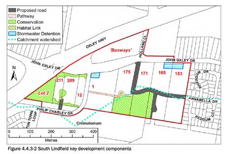
The development proposal is for vehicle access to the
development via Annabella Drive, which is a 9m wide road running east west through
the development site. Annabella Drive is classified as a local road with a 9m
wide pavement formation.
This proposal includes the extension to Annabella Drive to
the west, (Road 1, east-west) providing access to the Ruins Way and ultimately
John Oxley drive. Additional local roads in the development are proposed in a
north-south direction (off Road 1) providing access to all residential lots.
It should be noted that once the development lot to the west
of the development site (Lot 171 in the above image) develops, a further
extension of Annabella Drive and connection to John Oxley Drive shall be
required in accordance with DCP2013. This will provide an additional entry/exit
to this residential area, which will ultimately alleviate traffic movements to
the east along Annabella Drive/The Ruins Way. The construction of this
connection to John Oxley Drive is a requirement of the Voluntary Planning
Agreement/s for the South Linfield Urban Release Area and will be a development
requirement once the applicable stage generates a demand for the link road.
The internal roads shall be classified as follows:
|
Road Name
|
Pavement width
|
|
Road 1
|
9m - Local
Anabella Drive is a local road with a 9m wide formation.
Road 1 is an extension of Anabella drive and would require a similar 9m wide
pavement width.
|
|
Road 2
|
8m - Local with min. 9m radius turning head (northern side
only)
|
|
Road 3
|
8m - Local with a 12m radius turning head (subject to
future DA)
|
All internal roads shall comply with Council AUSPEC and
Australian Standards, and conditions have been imposed to reflect these
requirements.
Due to the type and size of development, additional works
are required to include:
· Concrete
footpath paving along on one side of all local roads
· Concrete
footpath connecting the development site to the bus-stops on John Oxley Drive
· A
temporary construction access from John Oxley Drive. No construction traffic is
recommended via Annabella Drive on the basis that the construction of the
development will have significant impacts to Council’s existing road
network.
Appropriate consent conditions are
recommended to address the new road and impact to existing road requirements.
Parking and Manoeuvring
N/A
Water Supply Connection
Council records indicate that the development site has an
existing 20mm metered water service from the 200 PVC water main on the opposite
side of John Oxley Drive. An extension of Council’s 200mm water main in
Annabella Drive, at no cost to Council, can service the proposed development.
Pipe sizes shall be confirmed by PMHC’s Water and
Sewer Section with application for the Construction Certificate.
Each proposed lot is to have an individual service
connection.
Appropriate consent conditions are recommended to address
water supply requirements.
Sewer Connection
Council records indicate that the proposed development site
does not currently have a connection to sewer. Council’s sewer
infrastructure is to be extended at no cost to Council to provide each lot with
an individual connection. In accordance with Council’s adopted
specifications, sewer shall be provided to enable 100% of building areas within
lots to drain to sewer.
The proposed development is to provide an integrated
solution for sewerage services with adjoining properties. Any proposed gravity
sewerage mains connections to the existing sewerage network requires approval
from relevant landowners.
In the northern catchment:
· the sewer mains
are to connect to an existing gravity main connecting to Sewer Pump Station 54
· the alignment is
to consider a possible extension to serve the bulk of the following lots west
of Philip Charley Drive; Lot 2 DP1186806, Lot 21 DP1089272, Lot 2 DP578793, Lot
4 DP 630393.
In the southern catchment, the sewer mains are to connect to
Sewer Pump Station 80 to the south of the proposed development lot.
PMHC’s Water and Sewer Section shall confirm proposed
pipe locations with application for the Construction Certificate.
Appropriate consent conditions are recommended to address
sewer servicing requirements.
Stormwater
The site contains two catchments
separated by a ridge line in the East –West direction and draining to the
northern and southern boundary respectively. Drainage is primarily directed by
overland means to the proposed pit and pipe stormwater network for both
catchments.
The overall site catchment is
composed of two catchments, with both being of a roughly rectangular shape. The
northern catchment drains northwards, crossing the John Oxley Drive and Oxley
Highway via existing stormwater culverts and drainage swales to the Hastings
River Floodplain and ultimately the Hastings River itself. The southern
catchment drains southwards over land and via a series of small creeks and
swales to enter the Lake Innes Floodplain and ultimately Lake Innes itself.
The legal point of discharge for the proposed development is
defined as a direct connection to Council’s stormwater pit/pipeline.
A detailed site stormwater management plan will be required
to be submitted for assessment with the Section 68 application and prior to the
issue of a Construction Certificate.
In accordance with Councils AUSPEC requirements, the
following must be incorporated into the stormwater drainage plan:
· On
site stormwater detention facilities
· Water
quality
· Provision
of interallotment drainage to allow the proposed development to drain to the
nominated point of discharge via a single suitably sized conduit
Appropriate consent conditions are recommended to address
stormwater servicing requirements.
Other Utilities
Telecommunication and electricity services are available to
the site.
Evidence of satisfactory arrangements with the relevant
utility authorities for provision to each proposed lot will be required prior
to Subdivision Certificate approval.
Appropriate consent conditions are recommended to address
utility servicing requirements.
Heritage
Following a site inspection (and a search of Council
records), no known items of Aboriginal or European heritage significance exist
on the property. No adverse impacts anticipated. The site is considered to be
disturbed land.
As a precaution, a condition of consent has been recommended
that works are to cease in the unexpected event heritage items are found. Works
can only recommence when appropriate approvals are obtained for management
and/or removal of the heritage item.
Other land resources
The site is within a planned urban release context and will
not sterilise any significant mineral or agricultural resource.
Water cycle
The proposed development will not have any significant
adverse impacts on water resources and the water cycle.
Soils
The proposed development will not have any significant
adverse impacts on soils in terms of quality, erosion, stability and/or
productivity subject to a standard condition requiring erosion and sediment
controls to be in place prior to and during construction.
Air and microclimate
The construction and/or operations of the proposed
development will not result in any significant adverse impacts on the existing
air quality or result in any pollution. Standard precautionary site management
condition recommended.
Flora and fauna
A specialist ecological assessment prepared by Biodiversity
Australia has been submitted to support the proposal.
In summary the Biodiversity report states that:
· A bloodwood tree in the John Oxley Drive road reserve will
require removal to establish the proposed sewer line running to the north of
the site.
· A large Blackbutt also in the road reserve has been
assessed by an Arborist who has found it to be unsound and recommended its
removal.
· No preferred Koala food trees or hollow-bearing trees are
present within the subject site. The proposal will require the removal of
garden ornamentals and exotic trees only as well as a Bloodwood tree in the
John Oxley Drive road reserve which will be impacted by a sewer line.
· No threatened flora species or Endangered Ecological
Communities were found on the site during the survey.
· No threatened fauna species were detected during the
survey. Eight threatened fauna species are considered to potentially occur.
· The site does not contain Core Koala habitat and no
evidence of the Koala was found on the subject site. The Koala has been
recorded on adjacent land however and has been assessed for potential impacts
from the proposed development.
Construction of the proposed development will not require
any removal/clearing of any significant native vegetation and therefore does
not trigger the biodiversity offsets scheme. Part 7 of the Biodiversity
Conservation Act 2016 is considered to be satisfied.
Waste
Satisfactory arrangements are in place for proposed storage
and collection of waste and recyclables. No adverse impacts anticipated.
Standard precautionary site management condition recommended.
Energy
No adverse energy impacts are anticipated.
Noise and vibration
The construction and/or operations of the proposed
development will not result in any significant adverse impacts on the existing
air quality or result in any pollution. Standard precautionary site management
condition recommended.
Bushfire
The site is identified as being bushfire prone.
In accordance with Section 100B - Rural Fires Act 1997 - the
application proposes subdivision of bush fire prone land that could lawfully be
used for residential purposes. As a result, the applicant has submitted a
bushfire report prepared by a Certified Consultant. The report was forwarded to
the NSW Rural Fire Service who have since issued a Bushfire Safety Authority
subject to conditions. The conditions are recommended to be incorporated into
the consent.
Safety, security and crime prevention
The proposed development will be unlikely to create any
concealment/entrapment areas or crime spots that would result in any
identifiable loss of safety or reduction of security in the immediate
area. The increase in housing density will improve natural surveillance
within the locality.
Social impacts in the locality
Given the nature of the proposed development and its
location the proposal is not considered to have any significant adverse social
impacts.
Economic impact in the locality
The proposal is not considered to have any significant
adverse economic impacts on the locality. A likely positive impact is that the
development will maintain employment in the construction industry, which will
lead to flow impacts such as expenditure in the area.
Site design and internal design
The proposed development design satisfactorily responds to
the site attributes and will fit into the locality.
Construction
Construction impacts are considered capable of being
managed, standard construction and site management conditions have been
recommended.
Cumulative impacts
The proposed development is not considered to have any
significant adverse cumulative impacts on the natural or built environment or
the social and economic attributes of the locality.
(c) The suitability of the site for
the development
The proposal will fit into the locality and the site
attributes are conducive to the proposed development.
Site constraints of bushfire risk have been adequately addressed
and appropriate conditions of consent recommended.
(d) Any submissions made in
accordance with this Act or the Regulations
Four (4) written submissions were received following public
exhibition of the application. Copies of the written submissions have been
provided separately to members of the Development Assessment Panel.
Key issues raised in the submissions received and comments
in response are provided as follows:
|
Submission
Issue/Summary
|
Planning
Comment/Response
|
|
Rear boundary fence between
proposed Lots 3, 4 and 5 in existing Lot 1 DP 369206 and no. 36 Rivergum
Drive.
|
An existing well maintained
boundary fence currently divides existing Lot 1
DP 369206 and no.36 Rivergum
Drive. Any future negotiations between the future residents of proposed lots
3, 4 and 5 within existing Lot 1 DP 369206 and no.36 Rivergum Drive will need
to be consistent with the Dividing Fences Act, which is not administered by
Council.
On the basis that proposed
lots 4 and 5 have minimum widths of 15m, an amendment to the subdivision
layout is not proposed.
|
|
Footpaths do not show kerb ramps and
are on one side of the road
|
The proposed
footpath locations are illustrated diagrammatically on the subdivision plans
that accompany the DA submission. The detail design
will be
provided with the Construction Certificate submission for the civil works and
will be consistent with D1.16 of Councils AUSPEC, which includes the requirement
for pram ramps.
The proposed
footpath locations are consistent with chapter 3.6 of the
PMH DCP 2013
and Council’s adopted AUSPEC design specification documents, including
1.2m wide footpath provision to one side of the local street network. This
provision will also provide for street tree plantings on the opposite of each
street.
|
|
Construction
noise
|
Any consent
issued by Council will include hours of operation for construction, which
will limit potential disturbance to existing adjoining residential premises.
Additionally, construction for both subdivision works and future dwellings
will be limited in overall duration, i.e.; construction noise will cease when
development is completed.
It is noted
that safety reversing alarms will need to comply with the relevant Australian
Standards and as such, cannot be conditioned Council.
It is
proposed that the future Construction Certificate documentation for the
subdivision civil works will be required to make provision for a temporary
construction access directly from John Oxley Drive. The intention of this
temporary construction access arrangement is to minimise potential amenity
impacts on the existing adjoining residential areas. An appropriate condition
is recommended in this regard.
|
|
Traffic
impact
|
The matters
raised with respect to overall traffic congestion and general cumulative
impacts are outside the scope of the subject Development Applications. These
matters should be dealt with in Council’s
Regional
Traffic Plan and review of the Major Roads Contribution Plan.
The proposed
subdivision as presented is consistent with Chapter 4.4.3 of Councils DCP
2013 for the South Lindfield Precinct. The proposed internal road network is
consistent with Figure 4.4.3-2, which provides for an extension to Anabella Drive,
an edge road to the E2 zoned land and a footpath connection to the south. In
accordance with the DCP, Annabella Drive will extend further to the west to
facilitate an intersection connection onto John Oxley Drive. This future
intersection connection will provide a secondary means of access for the
subject properties and the locality generally.
Annabella
Drive is currently constructed to a collector road standard (9m carriageway)
and that pursuant to Table D1.5 of
Councils
AUSPEC, and sufficient capacity for the likely additional traffic.
Until such time as the new intersection is provided onto John Oxley Drive (as
per the DCP), all 200 lots (includes existing and subject properties) will be
required to enter/exit The Ruins Way via Annabella Drive.
The proposed
extension to Annabella Drive is therefore an efficient use of the existing
road infrastructure.
When a new
intersection is available onto John Oxley Drive to the west, in accordance
with Councils DCP, the existing 200 lots will have a choice of access onto
John Oxley Drive, either to the west or to the east.
|
|
Cumulative
impacts
|
The subject
properties are part of the South Lindfield Urban Release Area where
cumulative impacts and servicing were considered as part of the Planning
Proposal process. The area has been included in Council’s Urban Growth
Strategies since 1998.
The proposed
subdivision is
consistent
with Chapter 4.4.3 of the DCP, including an extension to
Anabella
Drive, an edge road to the E2 zoned land and a footpath connection to the
south.
In addition
as noted above, Annabella Drive will continue to operate within its capacity
as a collector road and its extension to the west has been consistently
included in the planning process to date.
|
|
SEPP 55 Remediation of
Land
|
The Planning
Proposal to support the rezoning of the site included assessment of the site
consistent with the provisions of this Policy.
Geotechnical
assessment was undertaken at areas with a previous land use history of
potential contamination (nursery).
The subject
properties do not have a landuse history that would indicate potential
contamination.
The Planning
Proposal noted that there was a presumption that asbestos could be found in
the older dwellings. Suitable conditions can be included in the consent to
ensure consideration of this matter when demolition of the existing
structures are undertaken.
The site may
contain rock that contains Naturally Occurring Asbestos (NOA). A standard
condition is recommended to ensure preparation of a NOA management plan and
to ensure compliance with WorkCover.
Potential
general dust nuisance can be addressed with a recommended standard condition
for management of the site for the entirety of the works.
|
|
Additional access to
John Oxley Drive
|
The subject
Development Applications do not include a secondary access onto John Oxley
Drive, however a temporary construction access for the civil works is
proposed. The road network presented in the subject
Development
Application is consistent with Council’s DCP and will enable a future
connection to the west that will provide a secondary access to John Oxley
Drive.
Annabella
Drive is constructed to a collector road standard (9m carriageway) and that
pursuant to Table D1.5 of Councils
AUSPEC.
|
|
Public Open
Space
|
Council’s
DCP does not require the provision of additional areas of open space however
development contributions are required to the provision of recreation
facilities in accordance with Council’s adopted Development
Contribution Plan.
|
(e) The Public Interest
The proposed development will be in the wider public
interest with provision of appropriate additional housing opportunities.
The proposed development satisfies relevant planning
controls and will not have any significant adverse impacts on the wider public interest.
Ecologically Sustainable Development and Precautionary
Principle
Ecologically sustainable development requires the effective
integration of economic and environmental considerations in decision-making
processes.
The four principles of ecologically sustainable development
are:
· the
precautionary principle,
· intergenerational
equity,
· conservation
of biological diversity and ecological integrity,
· improved
valuation, pricing and incentive mechanisms.
The principles of ESD require that a balance needs to be
struck between the man-made development and the need to retain the natural
vegetation. Based on the assessment provided in the report and with recommended
conditions of consent, it is considered an appropriate balance has been struck.
Climate change
The proposal is not considered to be vulnerable to any risks
associated with climate change.
4. DEVELOPMENT
CONTRIBUTIONS APPLICABLE
· Development contributions will be required towards
augmentation of town water supply and sewerage system head works under Section
64 of the Local Government Act 1993.
· Development contributions will be required in accordance
with Section 7.11 of the Environmental Planning and Assessment Act 1979 towards
roads, open space, community cultural services, emergency services and
administration buildings.
· A copy of the contributions estimate will be tabled at the
DAP meeting.
a
5. CONCLUSION AND
STATEMENT OF REASON
The application has been assessed
in accordance with Section 4.15 of the Environmental Planning and Assessment
Act 1979.
Issues raised during assessment
and public exhibition of the application have been considered in the assessment
of the application. Where relevant, conditions have been recommended to manage
the impacts attributed to these issues.
The site is considered suitable
for the proposed development and the proposal adequately addresses relevant
planning controls. The development is not considered to be contrary to the
public's interest and will not result a significant adverse social,
environmental or economic impact. It is recommended that the application be
approved, subject to the recommended conditions of consent provided in the
attachment section of this report.
|
Attachments
1View. DA2019
- 401.1 Recommended Conditions
2View. DA2019
- 401.1 Plans and Supporting Documents
|
|
ATTACHMENT
|
Development Assessment Panel
23/10/2019
|
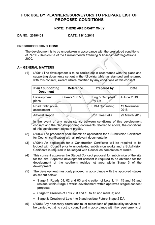
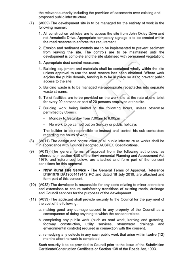
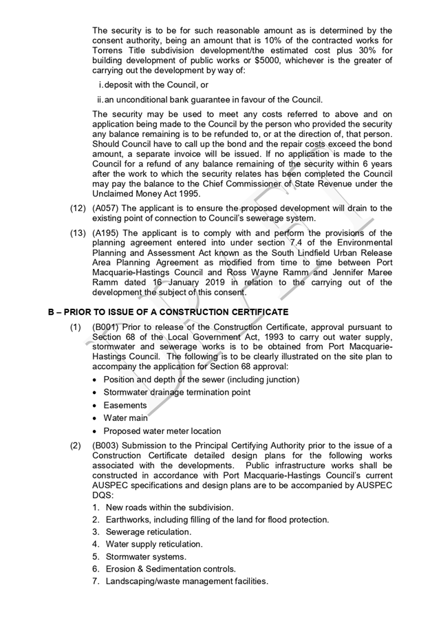
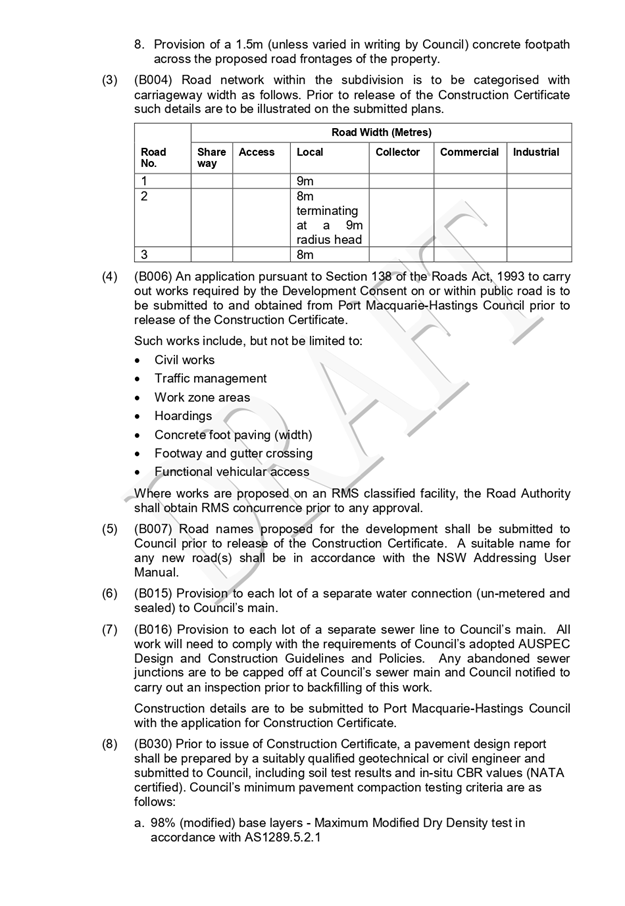

|
ATTACHMENT
|
Development Assessment Panel
23/10/2019
|